Howe is a town in Grayson County, Texas, United States. The population was 3,451 in the 2020 U.S. Census. It is part of the Sherman–Denison metropolitan statistical area.
| Name: | Howe town |
|---|---|
| LSAD Code: | 43 |
| LSAD Description: | town (suffix) |
| State: | Texas |
| County: | Grayson County |
| Elevation: | 840 ft (256 m) |
| Total Area: | 5.10 sq mi (13.22 km²) |
| Land Area: | 5.10 sq mi (13.22 km²) |
| Water Area: | 0.00 sq mi (0.00 km²) |
| Total Population: | 2,600 |
| Population Density: | 655.69/sq mi (253.19/km²) |
| ZIP code: | 75459 |
| Area code: | 903 |
| FIPS code: | 4835084 |
| GNISfeature ID: | 1359742 |
| Website: | cityofhowe.org |
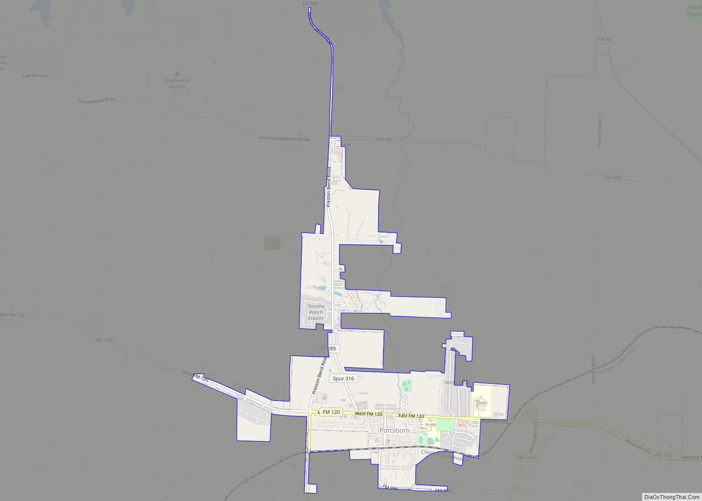
Online Interactive Map
Click on ![]() to view map in "full screen" mode.
to view map in "full screen" mode.
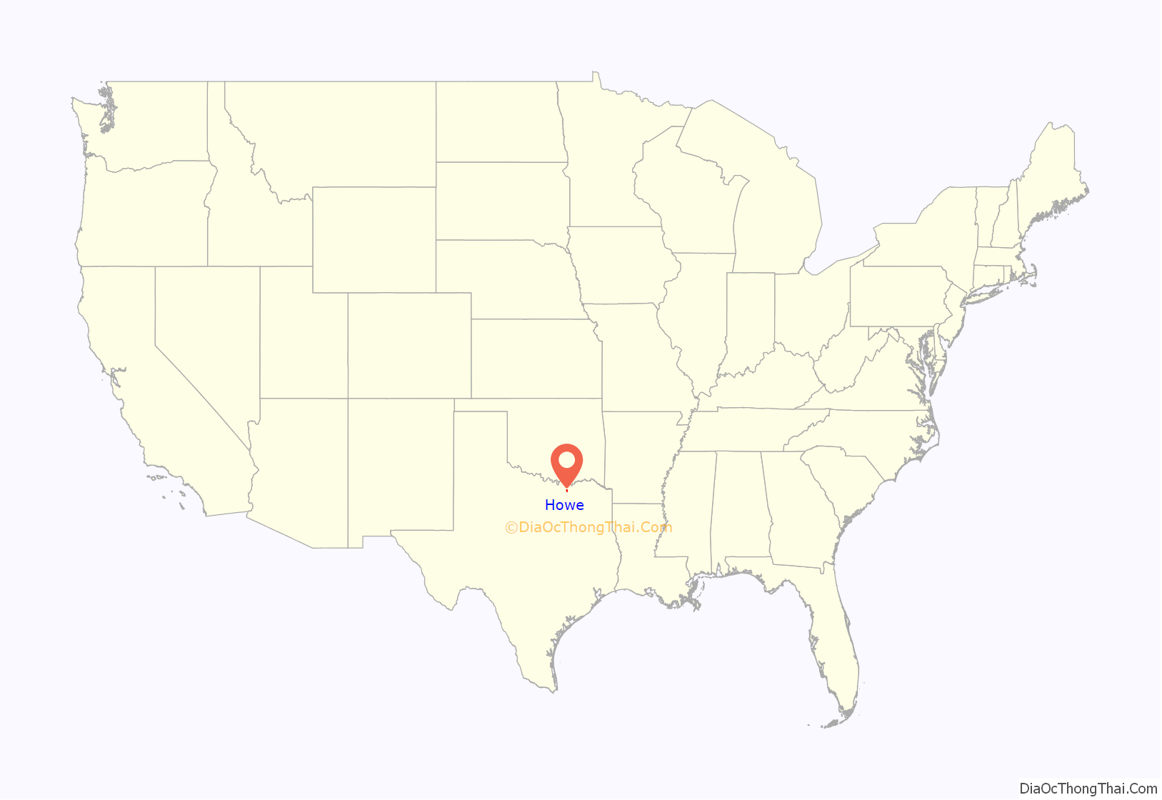
Howe location map. Where is Howe town?
History
The first settlers in the area arrived around the time of the Texas Revolution in 1836. In 1843, the last Indian battle in Grayson County was said to have been fought in the area. The first settlers of Howe were Jabez and Harriet Haning, and Jabez’s brother John. They received land through the Peters colony after their arrival from Pennsylvania before 1850. The Houston and Texas Central Railway built through the area in 1873, and a railroad switch was located in the community. It was called “Summit” because at 810 feet (250 m) above sea level, it was supposed to be the highest point between the Red River and the Gulf of Mexico. In 1873, when Summit received a post office, two businesses were located at the switch—a general store and a saloon. Several houses were built to the east of the switch. Jabez Haning persuaded the railroad to establish a depot on his land by donating every second lot in his newly platted town to the railroad. The names of the depot, the store, and the post office were changed in 1876 to “Howe”, after F. M. Howe, who worked for the Houston and Texas Central. Howe had three saloons until around 1900, when the town voted to go dry. Its first one-room school building opened in 1877 and was replaced by a two-story building in 1884.
In 1884, Howe was incorporated, with George M. McCrary as mayor. By the late 1880s, the town had become a major grain shipping center and was the home of red rust-proof oats. A number of seed companies had their beginnings there in that decade. Howe became home to a Farmers’ Alliance Cooperative Association, which was absorbed by the Howe Grain and Mercantile Company in 1894. In 1890, Howe had a population of 450, a steam gristmill, a Farmers’ Alliance Cooperative, and Baptist and Methodist churches, as well as a number of hotels, doctors, druggists, and barbers. Several newspapers were published in Howe, such as the Howe Herald from 1890 to the 1910s and the Howe Messenger in the late 1930s and early ’40s. During the 1930s, the Howe Chronicle was published by former Governor James E. Ferguson and his brother A. M. Ferguson. The Howe Enterprise was established in 1963 by A.P. “Pop” Sloan.
On May 15, 1896, an F5 category tornado passed through the west side of Howe and the Farmington community, sweeping away around 17 homes. On October 6, 1904, The Arlington Journal reported a fire through Howe’s business district and named four stores it destroyed.
By 1914, the Texas Traction Company, better known as the Interurban, was providing service to Howe. This electric train ran between Denison and Dallas with a stop in Howe. By 1914, Howe also had the Farmers National Bank, the Howe Herald, three grain elevators, and an ice plant. The community’s population had grown from 521 in 1904 to 680 in the early 1960s. After then, it rose rapidly through the early 1980s, reaching 2,173 by 1990. By 2000, the population was 2,478. Throughout most of its history, Howe remained primarily an agricultural center, but some oil has been produced in the area. During the early 1980s, Howe reported some 30 businesses. In 1981, local industries included a shirt manufacturer and a hydraulics company, and by 1991, the number of manufacturers in Howe had risen to five, including makers of plastics, electronics, and agricultural equipment.
On April 26, 2016, an F1 category tornado struck Howe around 10:00 pm, injuring three people and damaging over 20 homes. It started in a field behind the Summit Hill housing division, where a home was destroyed off Smith Road, then it proceeded northeast and crossed US Hwy 75, where trucker Gene Marshall was filming it; the storm tossed his truck and semitrailer to the other side of the road along with three cars. It then hit the north side of the high school before going directly through Stark Lane. It then proceeded to the Luella/Ida area before it dissipated.
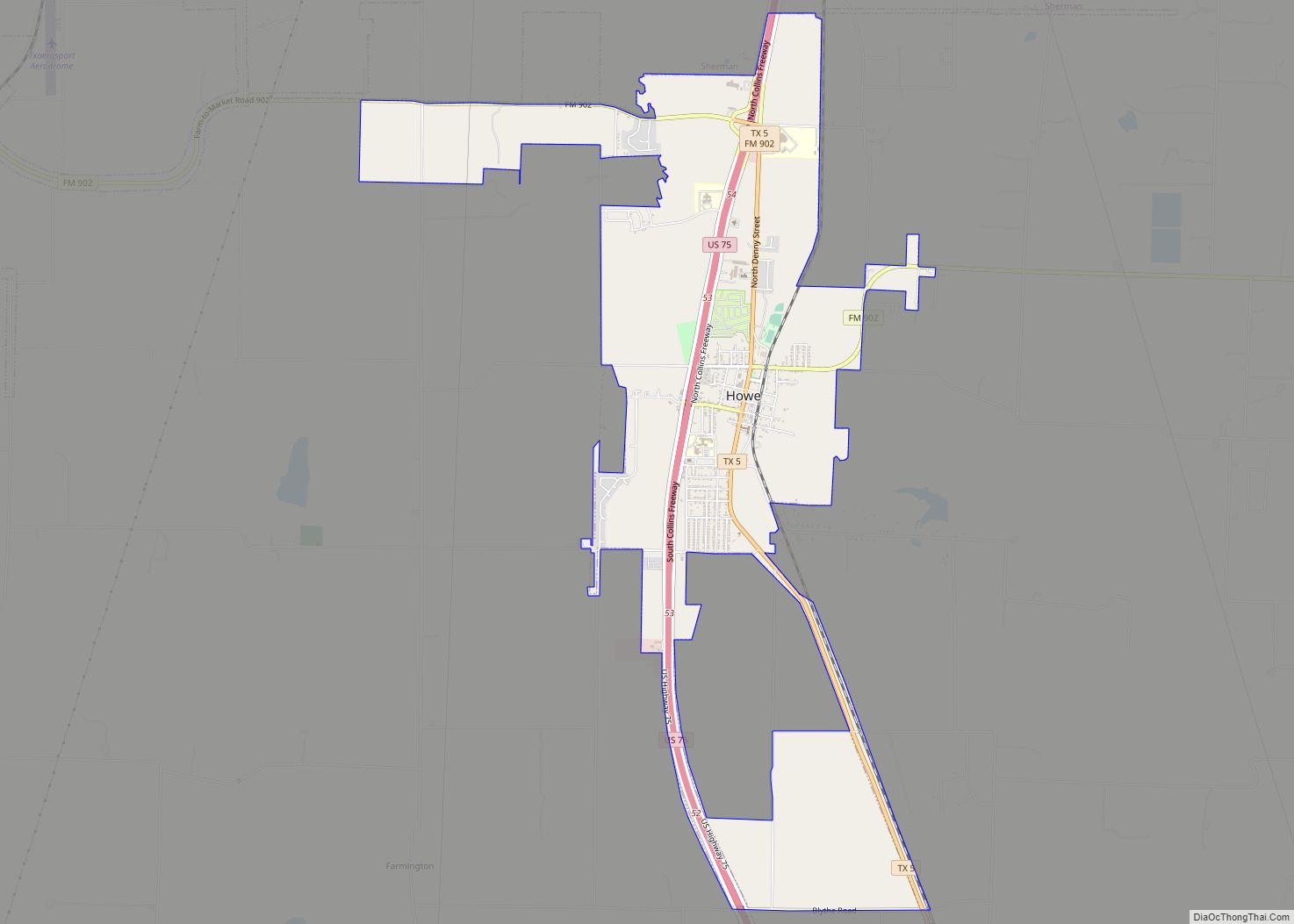
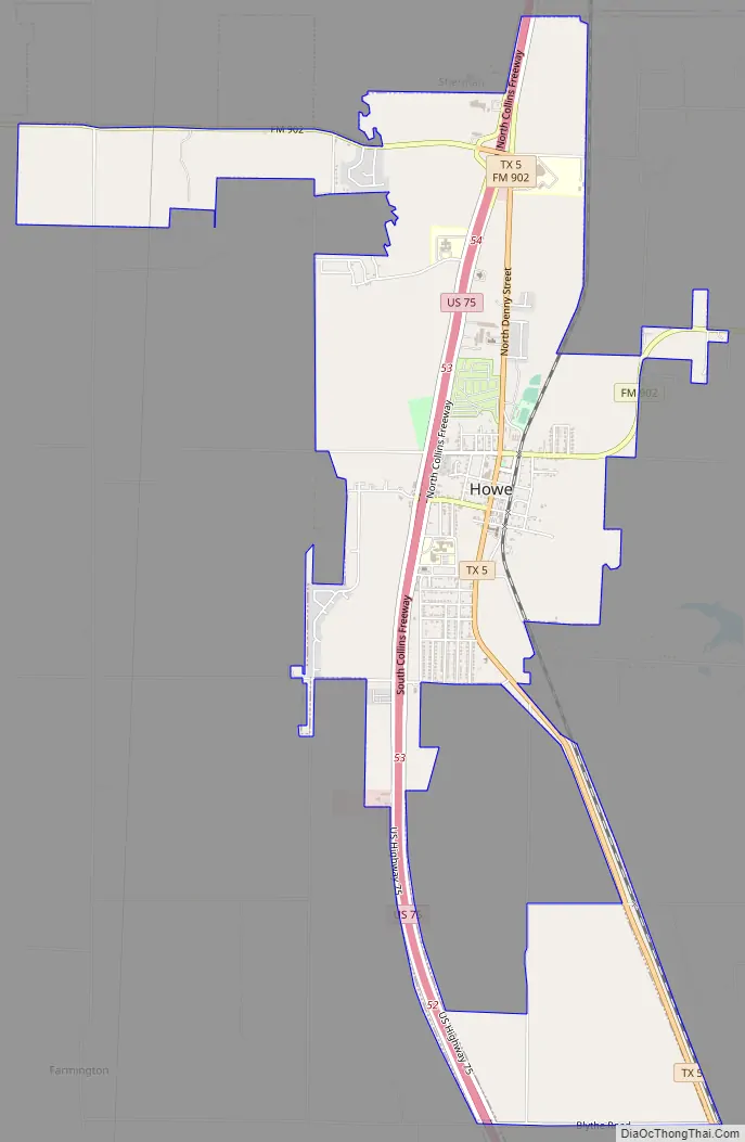
Howe Road Map
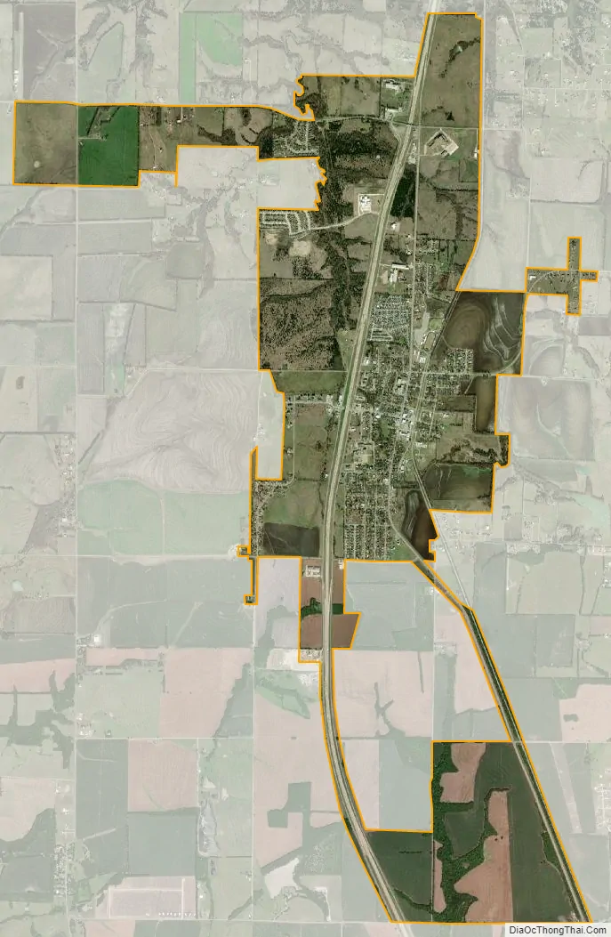
Howe city Satellite Map
Geography
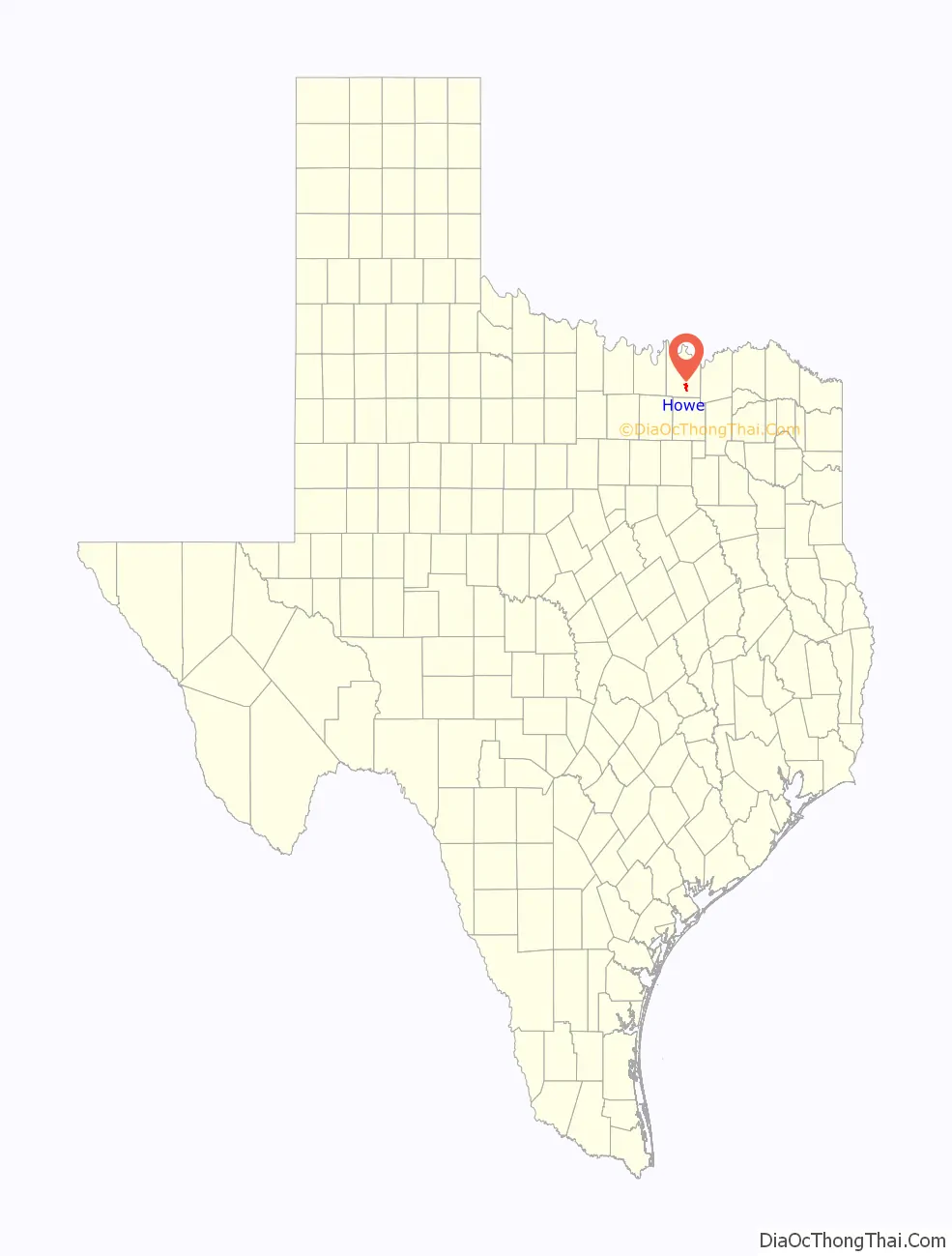
Howe is located in southern Grayson County at 33°30′18″N 96°36′51″W / 33.50500°N 96.61417°W / 33.50500; -96.61417 (33.505089, –96.614239). It is at the intersection of U.S. Highway 75, Texas State Highway 5, and Farm Road 902, and it is bordered to the north by Sherman, the county seat.
According to the United States Census Bureau, the town has a total area of 4.2 square miles (11.0 km), all of it land.
Howe’s elevation of 860 feet (260 m) is the highest point along US 75 between the Red River and the Gulf of Mexico.
See also
Map of Texas State and its subdivision:- Anderson
- Andrews
- Angelina
- Aransas
- Archer
- Armstrong
- Atascosa
- Austin
- Bailey
- Bandera
- Bastrop
- Baylor
- Bee
- Bell
- Bexar
- Blanco
- Borden
- Bosque
- Bowie
- Brazoria
- Brazos
- Brewster
- Briscoe
- Brooks
- Brown
- Burleson
- Burnet
- Caldwell
- Calhoun
- Callahan
- Cameron
- Camp
- Carson
- Cass
- Castro
- Chambers
- Cherokee
- Childress
- Clay
- Cochran
- Coke
- Coleman
- Collin
- Collingsworth
- Colorado
- Comal
- Comanche
- Concho
- Cooke
- Coryell
- Cottle
- Crane
- Crockett
- Crosby
- Culberson
- Dallam
- Dallas
- Dawson
- Deaf Smith
- Delta
- Denton
- Dewitt
- Dickens
- Dimmit
- Donley
- Duval
- Eastland
- Ector
- Edwards
- El Paso
- Ellis
- Erath
- Falls
- Fannin
- Fayette
- Fisher
- Floyd
- Foard
- Fort Bend
- Franklin
- Freestone
- Frio
- Gaines
- Galveston
- Garza
- Gillespie
- Glasscock
- Goliad
- Gonzales
- Gray
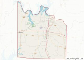
- Grayson
- Gregg
- Grimes
- Guadalupe
- Hale
- Hall
- Hamilton
- Hansford
- Hardeman
- Hardin
- Harris
- Harrison
- Hartley
- Haskell
- Hays
- Hemphill
- Henderson
- Hidalgo
- Hill
- Hockley
- Hood
- Hopkins
- Houston
- Howard
- Hudspeth
- Hunt
- Hutchinson
- Irion
- Jack
- Jackson
- Jasper
- Jeff Davis
- Jefferson
- Jim Hogg
- Jim Wells
- Johnson
- Jones
- Karnes
- Kaufman
- Kendall
- Kenedy
- Kent
- Kerr
- Kimble
- King
- Kinney
- Kleberg
- Knox
- La Salle
- Lamar
- Lamb
- Lampasas
- Lavaca
- Lee
- Leon
- Liberty
- Limestone
- Lipscomb
- Live Oak
- Llano
- Loving
- Lubbock
- Lynn
- Madison
- Marion
- Martin
- Mason
- Matagorda
- Maverick
- McCulloch
- McLennan
- McMullen
- Medina
- Menard
- Midland
- Milam
- Mills
- Mitchell
- Montague
- Montgomery
- Moore
- Morris
- Motley
- Nacogdoches
- Navarro
- Newton
- Nolan
- Nueces
- Ochiltree
- Oldham
- Orange
- Palo Pinto
- Panola
- Parker
- Parmer
- Pecos
- Polk
- Potter
- Presidio
- Rains
- Randall
- Reagan
- Real
- Red River
- Reeves
- Refugio
- Roberts
- Robertson
- Rockwall
- Runnels
- Rusk
- Sabine
- San Augustine
- San Jacinto
- San Patricio
- San Saba
- Schleicher
- Scurry
- Shackelford
- Shelby
- Sherman
- Smith
- Somervell
- Starr
- Stephens
- Sterling
- Stonewall
- Sutton
- Swisher
- Tarrant
- Taylor
- Terrell
- Terry
- Throckmorton
- Titus
- Tom Green
- Travis
- Trinity
- Tyler
- Upshur
- Upton
- Uvalde
- Val Verde
- Van Zandt
- Victoria
- Walker
- Waller
- Ward
- Washington
- Webb
- Wharton
- Wheeler
- Wichita
- Wilbarger
- Willacy
- Williamson
- Wilson
- Winkler
- Wise
- Wood
- Yoakum
- Young
- Zapata
- Zavala
- Alabama
- Alaska
- Arizona
- Arkansas
- California
- Colorado
- Connecticut
- Delaware
- District of Columbia
- Florida
- Georgia
- Hawaii
- Idaho
- Illinois
- Indiana
- Iowa
- Kansas
- Kentucky
- Louisiana
- Maine
- Maryland
- Massachusetts
- Michigan
- Minnesota
- Mississippi
- Missouri
- Montana
- Nebraska
- Nevada
- New Hampshire
- New Jersey
- New Mexico
- New York
- North Carolina
- North Dakota
- Ohio
- Oklahoma
- Oregon
- Pennsylvania
- Rhode Island
- South Carolina
- South Dakota
- Tennessee
- Texas
- Utah
- Vermont
- Virginia
- Washington
- West Virginia
- Wisconsin
- Wyoming