Iowa Colony is an incorporated Home Rule City in Brazoria County, Texas, United States, in the Houston metropolitan area. As of the 2010 census the city has a population of 1,170.
| Name: | Iowa Colony village |
|---|---|
| LSAD Code: | 47 |
| LSAD Description: | village (suffix) |
| State: | Texas |
| County: | Brazoria County |
| Founded: | 1908 |
| Incorporated: | 1973 |
| Elevation: | 59 ft (18 m) |
| Total Area: | 9.45 sq mi (24.48 km²) |
| Land Area: | 9.44 sq mi (24.44 km²) |
| Water Area: | 0.01 sq mi (0.04 km²) |
| Total Population: | 1,170 |
| Population Density: | 342.66/sq mi (132.30/km²) |
| ZIP code: | 77583 |
| Area code: | 281 |
| FIPS code: | 4836092 |
| GNISfeature ID: | 1378484 |
| Website: | www.iowacolonytx.gov |
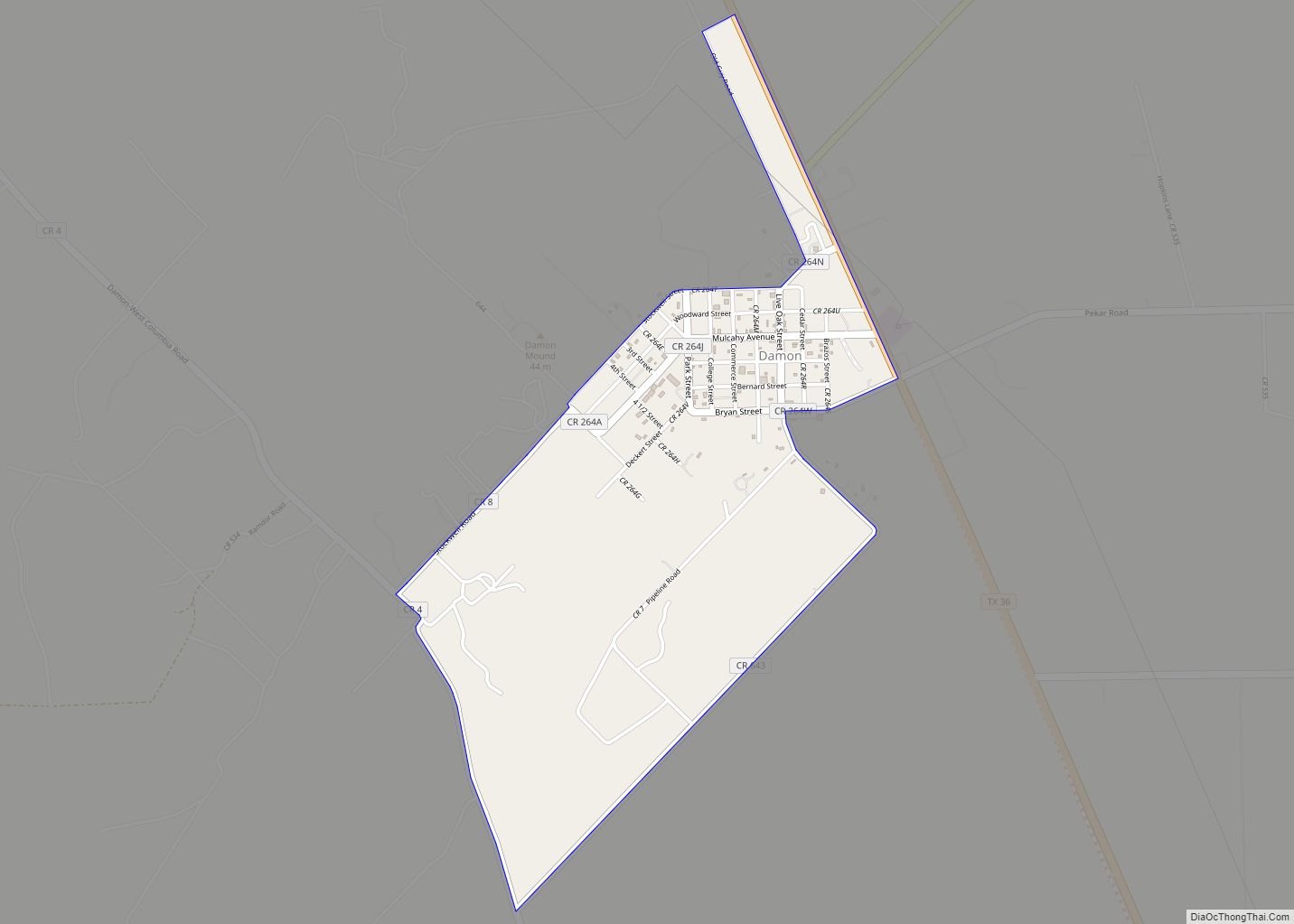
Online Interactive Map
Click on ![]() to view map in "full screen" mode.
to view map in "full screen" mode.
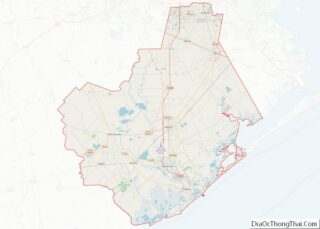
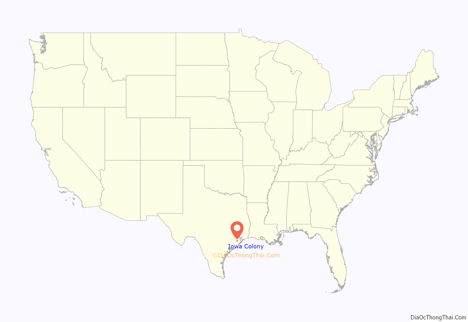
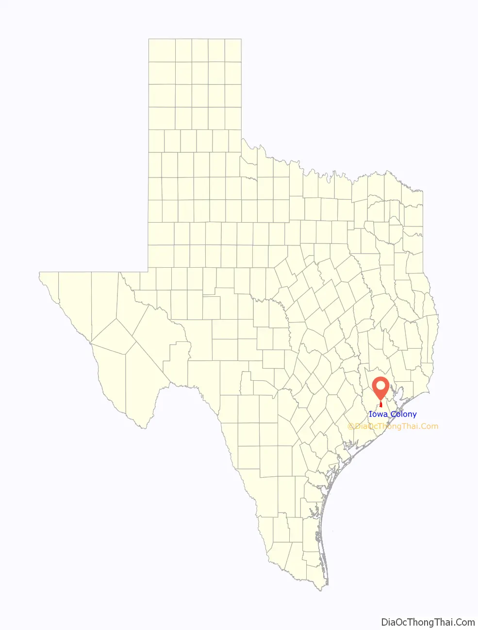
Iowa Colony location map. Where is Iowa Colony village?
History
Iowa Colony was founded in 1908 by the Immigration Land Company of Des Moines, Iowa, and received its name from Iowans G. I. Hoffmann and Robert Beard. The community received a post office in 1919, and rice farming was introduced there in 1920. Although not directly on a railroad line, Iowa Colony was served by the Gulf, Colorado and Santa Fe line through nearby Manvel. The population grew slowly to twenty-seven and remained at that level until the mid-1960s. The discovery of oil in 1948 brought regional employment to the area. By 1961 the Iowa Colony post office had closed, yet during the 1960s the settlement began to grow vigorously as part of the greater Houston area. By 1973 Iowa Colony had been incorporated, and by 1989 the town listed a population of 661. The city hall, community center, and municipal court are all housed in the same building, next to the fire department. In 1990 the population was 675. The population was 1,170 in 2010. Iowa Colony showed unprecedented growth, with an estimated 2019 population of 3,233. In 2020, they surpassed the 5,000 population requirement to seek home rule status, and subsequently voted to pass the city’s Home Rule Charter on November 3, 2020. The city website further states in 2021 that the population has exceeded 8000, growing at a rate of 400%.
Iowa Colony gained notoriety in the early 1990s as a major speed trap and was an inspiration for a Texas statute limiting municipal profits from speed traps.
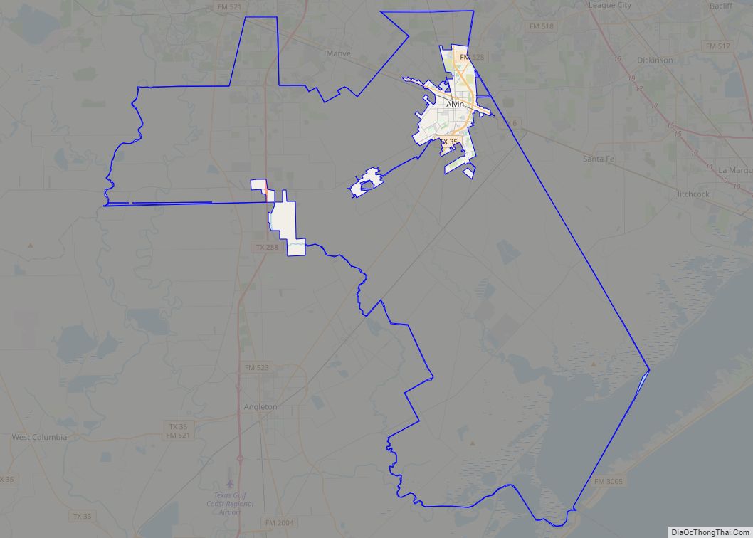
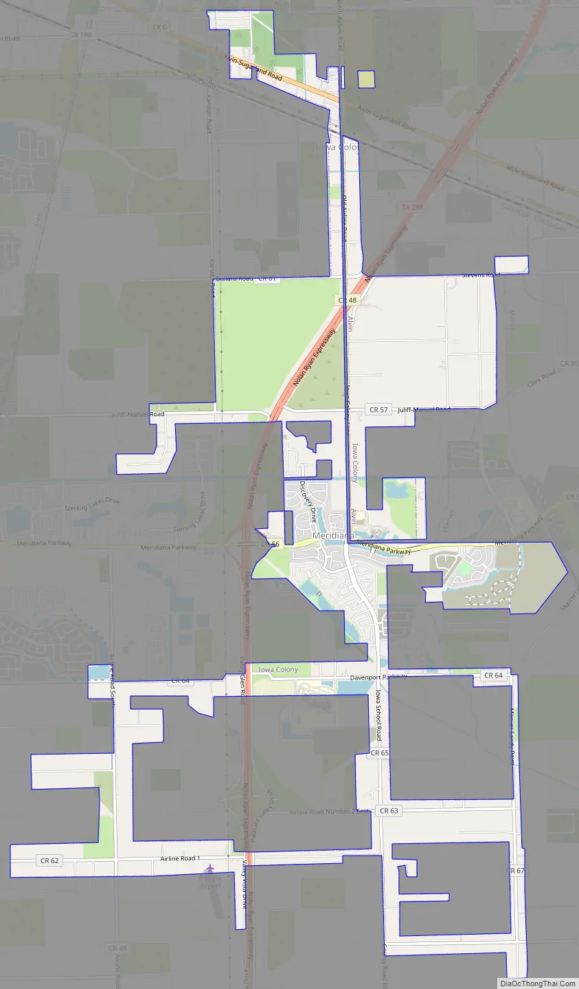
Iowa Colony Road Map
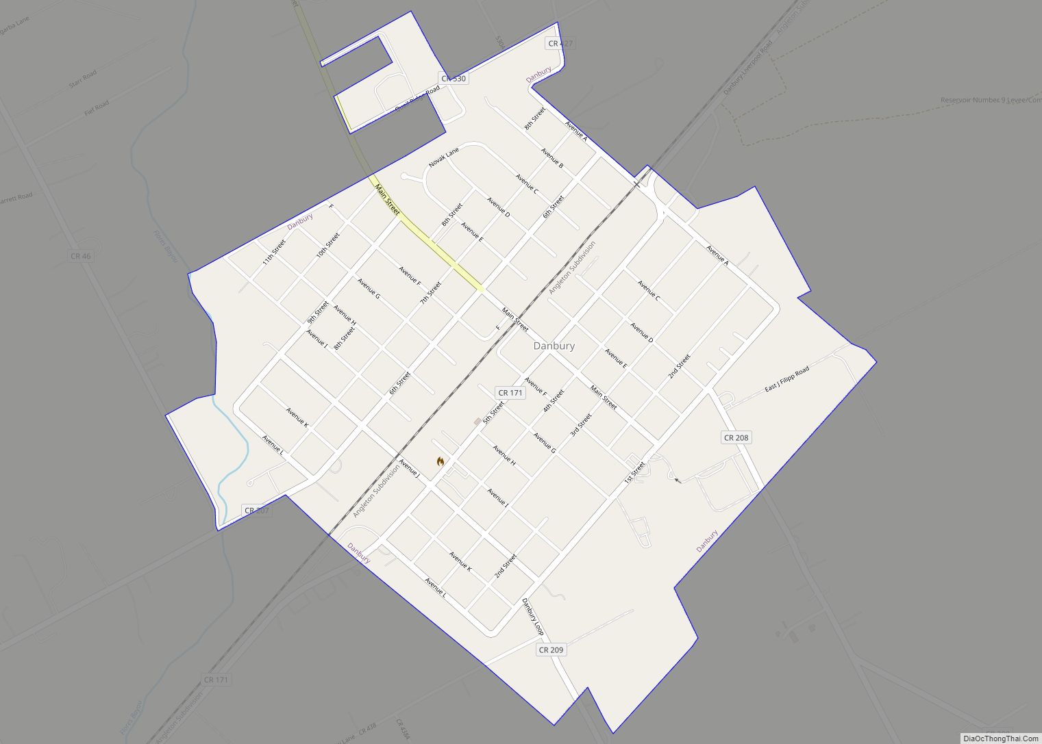
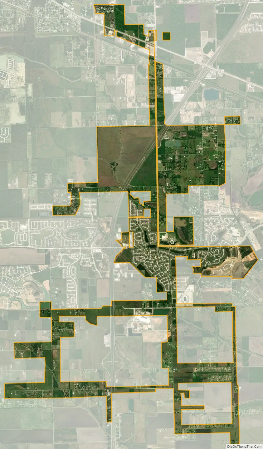
Iowa Colony city Satellite Map
Geography
Iowa Colony is located in northern Brazoria County at 29°26′35″N 95°24′56″W / 29.44306°N 95.41556°W / 29.44306; -95.41556 (29.442963, –95.415607). It is on Texas State Highway 288 south of Pearland city limits. Downtown Houston is 22 miles (35 km) to the north.
According to the United States Census Bureau, the city has a total area of 7.3 square miles (19.0 km), of which 0.015 square miles (0.04 km), or 0.21%, is water.
See also
Map of Texas State and its subdivision:- Anderson
- Andrews
- Angelina
- Aransas
- Archer
- Armstrong
- Atascosa
- Austin
- Bailey
- Bandera
- Bastrop
- Baylor
- Bee
- Bell
- Bexar
- Blanco
- Borden
- Bosque
- Bowie
- Brazoria
- Brazos
- Brewster
- Briscoe
- Brooks
- Brown
- Burleson
- Burnet
- Caldwell
- Calhoun
- Callahan
- Cameron
- Camp
- Carson
- Cass
- Castro
- Chambers
- Cherokee
- Childress
- Clay
- Cochran
- Coke
- Coleman
- Collin
- Collingsworth
- Colorado
- Comal
- Comanche
- Concho
- Cooke
- Coryell
- Cottle
- Crane
- Crockett
- Crosby
- Culberson
- Dallam
- Dallas
- Dawson
- Deaf Smith
- Delta
- Denton
- Dewitt
- Dickens
- Dimmit
- Donley
- Duval
- Eastland
- Ector
- Edwards
- El Paso
- Ellis
- Erath
- Falls
- Fannin
- Fayette
- Fisher
- Floyd
- Foard
- Fort Bend
- Franklin
- Freestone
- Frio
- Gaines
- Galveston
- Garza
- Gillespie
- Glasscock
- Goliad
- Gonzales
- Gray
- Grayson
- Gregg
- Grimes
- Guadalupe
- Hale
- Hall
- Hamilton
- Hansford
- Hardeman
- Hardin
- Harris
- Harrison
- Hartley
- Haskell
- Hays
- Hemphill
- Henderson
- Hidalgo
- Hill
- Hockley
- Hood
- Hopkins
- Houston
- Howard
- Hudspeth
- Hunt
- Hutchinson
- Irion
- Jack
- Jackson
- Jasper
- Jeff Davis
- Jefferson
- Jim Hogg
- Jim Wells
- Johnson
- Jones
- Karnes
- Kaufman
- Kendall
- Kenedy
- Kent
- Kerr
- Kimble
- King
- Kinney
- Kleberg
- Knox
- La Salle
- Lamar
- Lamb
- Lampasas
- Lavaca
- Lee
- Leon
- Liberty
- Limestone
- Lipscomb
- Live Oak
- Llano
- Loving
- Lubbock
- Lynn
- Madison
- Marion
- Martin
- Mason
- Matagorda
- Maverick
- McCulloch
- McLennan
- McMullen
- Medina
- Menard
- Midland
- Milam
- Mills
- Mitchell
- Montague
- Montgomery
- Moore
- Morris
- Motley
- Nacogdoches
- Navarro
- Newton
- Nolan
- Nueces
- Ochiltree
- Oldham
- Orange
- Palo Pinto
- Panola
- Parker
- Parmer
- Pecos
- Polk
- Potter
- Presidio
- Rains
- Randall
- Reagan
- Real
- Red River
- Reeves
- Refugio
- Roberts
- Robertson
- Rockwall
- Runnels
- Rusk
- Sabine
- San Augustine
- San Jacinto
- San Patricio
- San Saba
- Schleicher
- Scurry
- Shackelford
- Shelby
- Sherman
- Smith
- Somervell
- Starr
- Stephens
- Sterling
- Stonewall
- Sutton
- Swisher
- Tarrant
- Taylor
- Terrell
- Terry
- Throckmorton
- Titus
- Tom Green
- Travis
- Trinity
- Tyler
- Upshur
- Upton
- Uvalde
- Val Verde
- Van Zandt
- Victoria
- Walker
- Waller
- Ward
- Washington
- Webb
- Wharton
- Wheeler
- Wichita
- Wilbarger
- Willacy
- Williamson
- Wilson
- Winkler
- Wise
- Wood
- Yoakum
- Young
- Zapata
- Zavala
- Alabama
- Alaska
- Arizona
- Arkansas
- California
- Colorado
- Connecticut
- Delaware
- District of Columbia
- Florida
- Georgia
- Hawaii
- Idaho
- Illinois
- Indiana
- Iowa
- Kansas
- Kentucky
- Louisiana
- Maine
- Maryland
- Massachusetts
- Michigan
- Minnesota
- Mississippi
- Missouri
- Montana
- Nebraska
- Nevada
- New Hampshire
- New Jersey
- New Mexico
- New York
- North Carolina
- North Dakota
- Ohio
- Oklahoma
- Oregon
- Pennsylvania
- Rhode Island
- South Carolina
- South Dakota
- Tennessee
- Texas
- Utah
- Vermont
- Virginia
- Washington
- West Virginia
- Wisconsin
- Wyoming