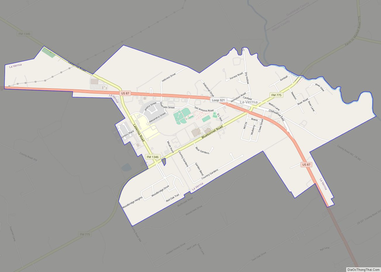
La Vernia is a city in Wilson County, Texas, United States. La Vernia is on the south bank of Cibolo Creek at the junction of U.S. Highway 87 and Texas Farm to Market Road 775, about 25 miles east of downtown San Antonio. The population was 1,077 at the 2020 census. La Vernia is part of the San Antonio Metropolitan Statistical Area.
| Name: | La Vernia city |
|---|---|
| LSAD Code: | 25 |
| LSAD Description: | city (suffix) |
| State: | Texas |
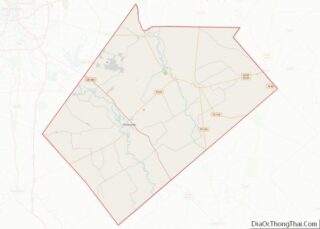
| County: | Wilson County |
| Elevation: | 489 ft (149 m) |
| Total Area: | 2.39 sq mi (6.20 km²) |
| Land Area: | 2.39 sq mi (6.19 km²) |
| Water Area: | 0.00 sq mi (0.01 km²) |
| Total Population: | 1,077 |
| Population Density: | 597.74/sq mi (230.77/km²) |
| ZIP code: | 78121 |
| Area code: | 830 |
| FIPS code: | 4841764 |
| GNISfeature ID: | 1360813 |
| Website: | lavernia-tx.gov |
Online Interactive Map
Click on ![]() to view map in "full screen" mode.
to view map in "full screen" mode.
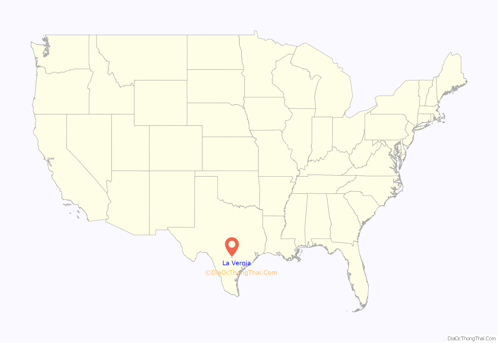
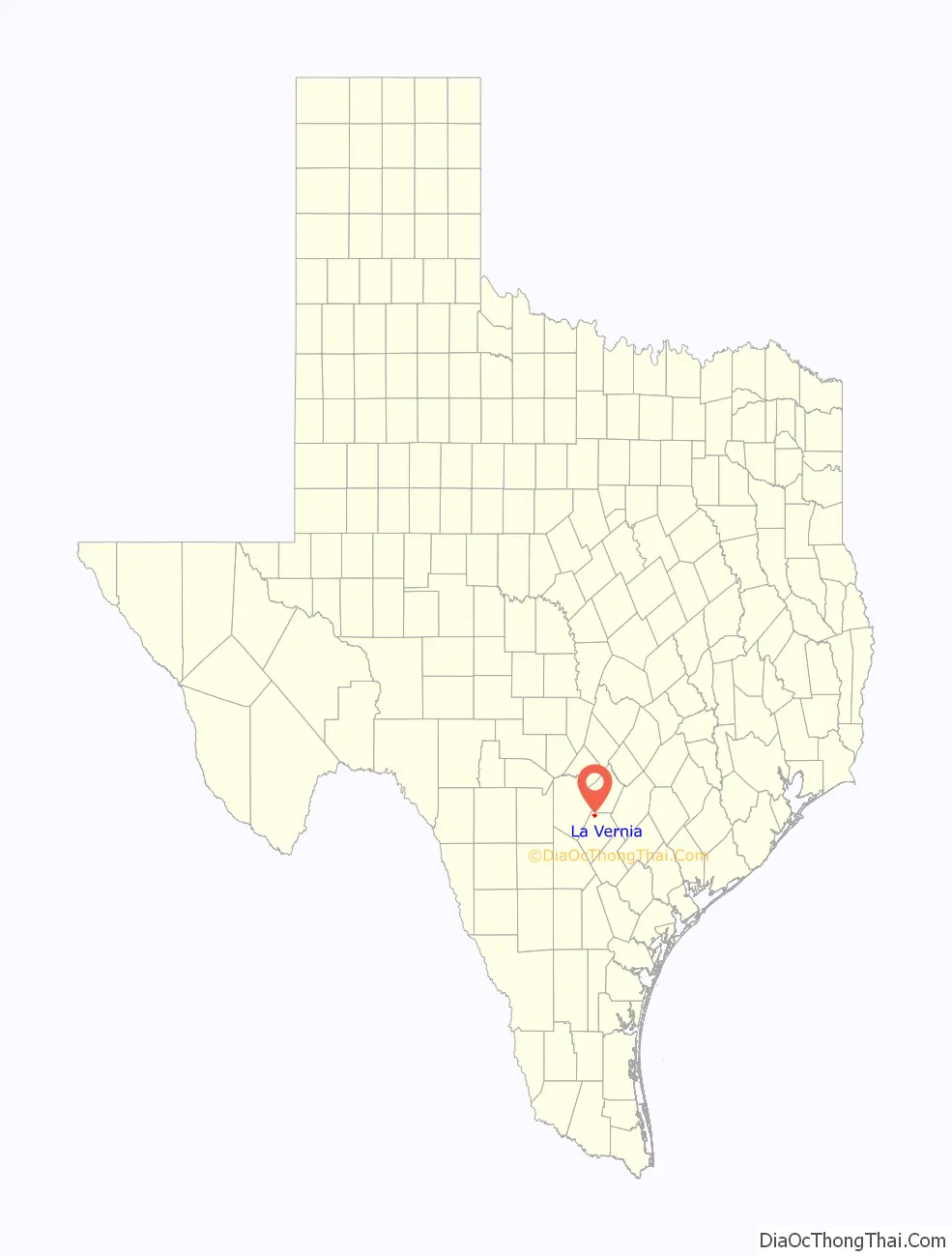
La Vernia location map. Where is La Vernia city?
History
The La Vernia area was first inhabited by the Coahuiltecan speaking peoples of Texas and subsequently by nomadic bands of Apache and Comanche who migrated to Texas in the 17th century. One of the earliest land grants made was to Erastus “Deaf” Smith. Smith married Guadalupe Ruiz Durán, a Mexican citizen, who was descended from one of the original Tejano or Spanish Texas families; and as such, received a land grant from the Mexican government on Cibolo Creek, north of present-day La Vernia in 1825. This area remained primarily unsettled by Europeans until 1837, when veterans from the Texas Revolution began to arrive.
La Vernia was first settled in earnest around 1850. W. R. Wiseman of Mississippi, who organized a Presbyterian church at the site around 1851, is said to have named the place Live Oak Grove, for a grove of trees nearby.
In 1853 a post office was established under the name Post Oak. The town’s name was changed to La Vernia in 1859. The name came from the local Spanish vernacular for green oaks (Lavernia is not Spanish for green oaks). Hence, The Brahan Masonic lodge was established in 1859. The building also served as a school and church.
German and Polish immigration brought the population to 110 by 1885. The community was now served by three churches, a steam gristmill, and a cotton gin. During this time, the major crops grown were corn and cotton, which are still major crops in the area today.
In 1890, La Vernia had a population of 200. Construction of the San Antonio and Gulf Railroad across the area in 1893 brought the population to 343 by 1900. A two-teacher school was in operation by 1896. Classes grew to be so large, that they had to move out of the Masonic lodge. The enrollment had grown to sixty-six children.
By 1915, the town operated two cotton gins, a bank, four churches, a pottery plant, a brick works, and supported a population of 500. In 1947, there were seventeen businesses recorded. In 1965, population had increased to 700 residents and twenty-five businesses.
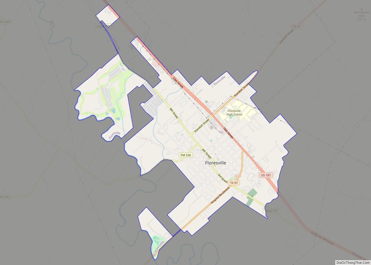
The community incorporated around 1966, and in 1990, had a population of 639 and thirty-six businesses. La Vernia experienced a population drop as people began to migrate to the larger job markets available in neighboring San Antonio, Floresville and Canyon Lake.
In 2000, La Vernia had 136 businesses and a population of 931. The census of 2005 La Vernia had a population of 1,087 of people. In 2010 a new shopping area was built just west of town on Highway 87, including a new H-E-B grocery store and gas station. A longtime grocer, Baumann’s Grocery store, closed at the time H-E-B opened.
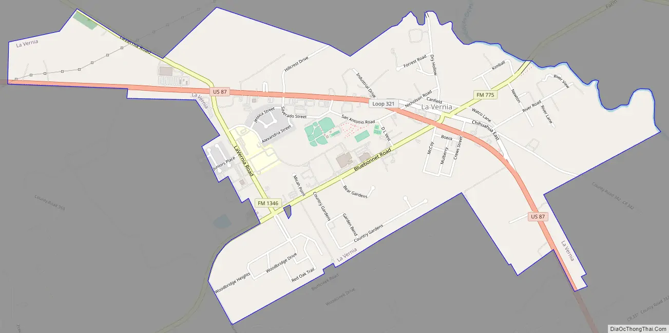
La Vernia Road Map
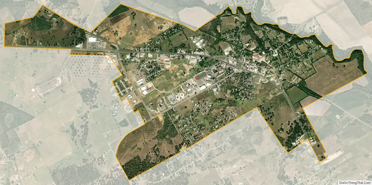
La Vernia city Satellite Map
Geography
La Vernia is located at 29°21′11″N 98°7′33″W / 29.35306°N 98.12583°W / 29.35306; -98.12583 (29.353106, –98.125777). According to the United States Census Bureau, the city has a total area of 2.4 square miles (6.2 km), all land. La Vernia is 489 feet (149 m) above sea level.
See also
Map of Texas State and its subdivision:- Anderson
- Andrews
- Angelina
- Aransas
- Archer
- Armstrong
- Atascosa
- Austin
- Bailey
- Bandera
- Bastrop
- Baylor
- Bee
- Bell
- Bexar
- Blanco
- Borden
- Bosque
- Bowie
- Brazoria
- Brazos
- Brewster
- Briscoe
- Brooks
- Brown
- Burleson
- Burnet
- Caldwell
- Calhoun
- Callahan
- Cameron
- Camp
- Carson
- Cass
- Castro
- Chambers
- Cherokee
- Childress
- Clay
- Cochran
- Coke
- Coleman
- Collin
- Collingsworth
- Colorado
- Comal
- Comanche
- Concho
- Cooke
- Coryell
- Cottle
- Crane
- Crockett
- Crosby
- Culberson
- Dallam
- Dallas
- Dawson
- Deaf Smith
- Delta
- Denton
- Dewitt
- Dickens
- Dimmit
- Donley
- Duval
- Eastland
- Ector
- Edwards
- El Paso
- Ellis
- Erath
- Falls
- Fannin
- Fayette
- Fisher
- Floyd
- Foard
- Fort Bend
- Franklin
- Freestone
- Frio
- Gaines
- Galveston
- Garza
- Gillespie
- Glasscock
- Goliad
- Gonzales
- Gray
- Grayson
- Gregg
- Grimes
- Guadalupe
- Hale
- Hall
- Hamilton
- Hansford
- Hardeman
- Hardin
- Harris
- Harrison
- Hartley
- Haskell
- Hays
- Hemphill
- Henderson
- Hidalgo
- Hill
- Hockley
- Hood
- Hopkins
- Houston
- Howard
- Hudspeth
- Hunt
- Hutchinson
- Irion
- Jack
- Jackson
- Jasper
- Jeff Davis
- Jefferson
- Jim Hogg
- Jim Wells
- Johnson
- Jones
- Karnes
- Kaufman
- Kendall
- Kenedy
- Kent
- Kerr
- Kimble
- King
- Kinney
- Kleberg
- Knox
- La Salle
- Lamar
- Lamb
- Lampasas
- Lavaca
- Lee
- Leon
- Liberty
- Limestone
- Lipscomb
- Live Oak
- Llano
- Loving
- Lubbock
- Lynn
- Madison
- Marion
- Martin
- Mason
- Matagorda
- Maverick
- McCulloch
- McLennan
- McMullen
- Medina
- Menard
- Midland
- Milam
- Mills
- Mitchell
- Montague
- Montgomery
- Moore
- Morris
- Motley
- Nacogdoches
- Navarro
- Newton
- Nolan
- Nueces
- Ochiltree
- Oldham
- Orange
- Palo Pinto
- Panola
- Parker
- Parmer
- Pecos
- Polk
- Potter
- Presidio
- Rains
- Randall
- Reagan
- Real
- Red River
- Reeves
- Refugio
- Roberts
- Robertson
- Rockwall
- Runnels
- Rusk
- Sabine
- San Augustine
- San Jacinto
- San Patricio
- San Saba
- Schleicher
- Scurry
- Shackelford
- Shelby
- Sherman
- Smith
- Somervell
- Starr
- Stephens
- Sterling
- Stonewall
- Sutton
- Swisher
- Tarrant
- Taylor
- Terrell
- Terry
- Throckmorton
- Titus
- Tom Green
- Travis
- Trinity
- Tyler
- Upshur
- Upton
- Uvalde
- Val Verde
- Van Zandt
- Victoria
- Walker
- Waller
- Ward
- Washington
- Webb
- Wharton
- Wheeler
- Wichita
- Wilbarger
- Willacy
- Williamson
- Wilson
- Winkler
- Wise
- Wood
- Yoakum
- Young
- Zapata
- Zavala
- Alabama
- Alaska
- Arizona
- Arkansas
- California
- Colorado
- Connecticut
- Delaware
- District of Columbia
- Florida
- Georgia
- Hawaii
- Idaho
- Illinois
- Indiana
- Iowa
- Kansas
- Kentucky
- Louisiana
- Maine
- Maryland
- Massachusetts
- Michigan
- Minnesota
- Mississippi
- Missouri
- Montana
- Nebraska
- Nevada
- New Hampshire
- New Jersey
- New Mexico
- New York
- North Carolina
- North Dakota
- Ohio
- Oklahoma
- Oregon
- Pennsylvania
- Rhode Island
- South Carolina
- South Dakota
- Tennessee
- Texas
- Utah
- Vermont
- Virginia
- Washington
- West Virginia
- Wisconsin
- Wyoming