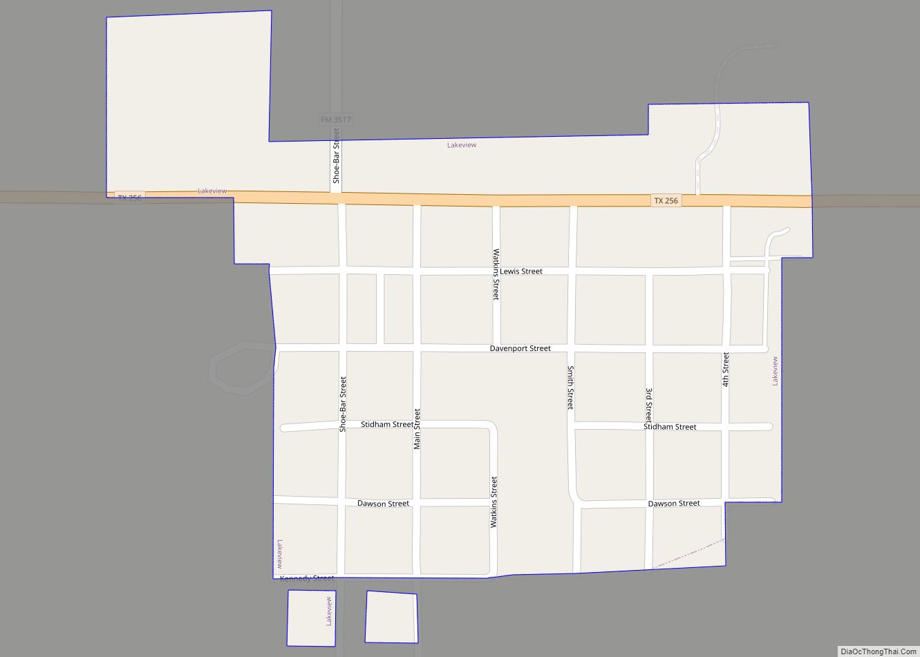
Lakeview is a town in Hall County, Texas, United States. The population was 107 at the 2010 census, down from 152 at the 2000 census.
| Name: | Lakeview town |
|---|---|
| LSAD Code: | 43 |
| LSAD Description: | town (suffix) |
| State: | Texas |
| County: | Hall County |
| Elevation: | 2,129 ft (649 m) |
| Total Area: | 0.21 sq mi (0.53 km²) |
| Land Area: | 0.21 sq mi (0.53 km²) |
| Water Area: | 0.00 sq mi (0.00 km²) |
| Total Population: | 107 |
| Population Density: | 461.17/sq mi (177.64/km²) |
| ZIP code: | 79239 |
| Area code: | 806 |
| FIPS code: | 4840888 |
| GNISfeature ID: | 1360879 |
Online Interactive Map
Click on ![]() to view map in "full screen" mode.
to view map in "full screen" mode.
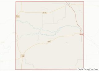
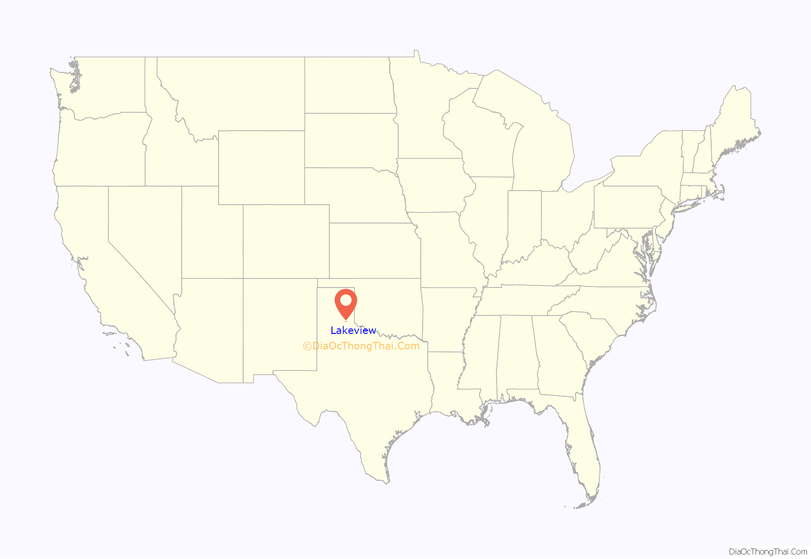
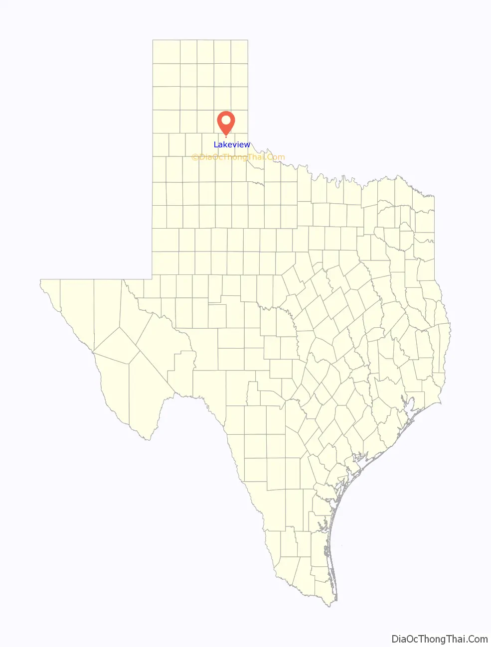
Lakeview location map. Where is Lakeview town?
History
Lakeview’s beginnings are unique as it has occupied two different sites in Hall County. The first site was located near the geographic center of the county on a section of the Southern Pacific Railroad survey in May 1890. A post office and several businesses sprang up at the site. After a failed attempt to become the county seat, most of the homes were sold to farmers and the land reverted to the family of S.L. Lindley. The post office was eventually relocated to the homestead of David H. Davenport, who operated a general store in 1902.
Three years later, Davenport purchased land north of his farm that had a supply of soft water, making it a suitable site to develop a community. On June 11, 1908, he moved his store and post office and platted the second Lakeview site at its present-day location. Prospects for a new railroad grew in 1910, when the Altus, Roswell, and El Paso Company constructed a roadbed through Lakeview, but prevailing conditions forced them to abandon the project. Despite this and two disastrous fires in 1918 and 1919, the community survived. Lakeview was incorporated in 1921. By the late 1920s, the town had several stores and a population exceeding 1,000.
A third fire in 1930 destroyed the business district, and the impact of the Great Depression contributed to Lakeview’s decline. A short-lived boom in the late 1940s occurred, but it wasn’t enough to revive the town. The First State Bank of Lakeview, in operation since 1908, merged with the First National Bank of Memphis in 1953. By 1980, the population had fallen to 244. That figure declined to 202 in 1990 and 152 in 2000.
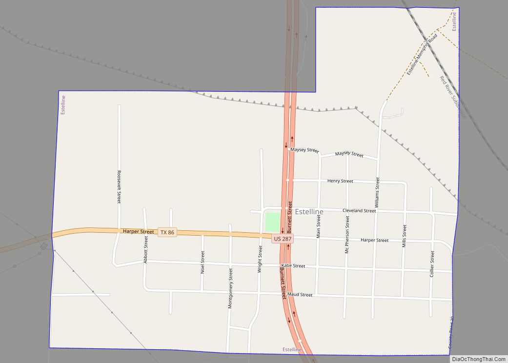
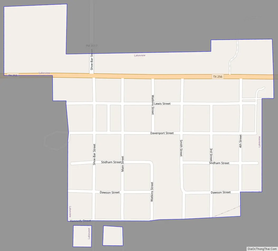
Lakeview Road Map
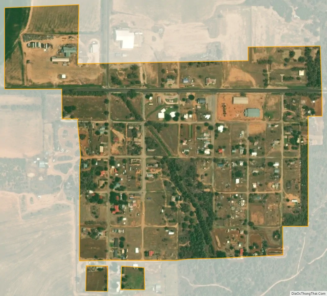
Lakeview city Satellite Map
Geography
Lakeview is located at 34°40′22″N 100°41′51″W / 34.67278°N 100.69750°W / 34.67278; -100.69750 (34.672880, –100.697637). It is situated along State Highway 256 in north-central Hall County, 10 miles (16 km) southwest of Memphis, the county seat, and 30 miles (48 km) by road southeast of Clarendon.
According to the United States Census Bureau, the town has a total area of 0.2 square miles (0.5 km), all land.
See also
Map of Texas State and its subdivision:- Anderson
- Andrews
- Angelina
- Aransas
- Archer
- Armstrong
- Atascosa
- Austin
- Bailey
- Bandera
- Bastrop
- Baylor
- Bee
- Bell
- Bexar
- Blanco
- Borden
- Bosque
- Bowie
- Brazoria
- Brazos
- Brewster
- Briscoe
- Brooks
- Brown
- Burleson
- Burnet
- Caldwell
- Calhoun
- Callahan
- Cameron
- Camp
- Carson
- Cass
- Castro
- Chambers
- Cherokee
- Childress
- Clay
- Cochran
- Coke
- Coleman
- Collin
- Collingsworth
- Colorado
- Comal
- Comanche
- Concho
- Cooke
- Coryell
- Cottle
- Crane
- Crockett
- Crosby
- Culberson
- Dallam
- Dallas
- Dawson
- Deaf Smith
- Delta
- Denton
- Dewitt
- Dickens
- Dimmit
- Donley
- Duval
- Eastland
- Ector
- Edwards
- El Paso
- Ellis
- Erath
- Falls
- Fannin
- Fayette
- Fisher
- Floyd
- Foard
- Fort Bend
- Franklin
- Freestone
- Frio
- Gaines
- Galveston
- Garza
- Gillespie
- Glasscock
- Goliad
- Gonzales
- Gray
- Grayson
- Gregg
- Grimes
- Guadalupe
- Hale
- Hall
- Hamilton
- Hansford
- Hardeman
- Hardin
- Harris
- Harrison
- Hartley
- Haskell
- Hays
- Hemphill
- Henderson
- Hidalgo
- Hill
- Hockley
- Hood
- Hopkins
- Houston
- Howard
- Hudspeth
- Hunt
- Hutchinson
- Irion
- Jack
- Jackson
- Jasper
- Jeff Davis
- Jefferson
- Jim Hogg
- Jim Wells
- Johnson
- Jones
- Karnes
- Kaufman
- Kendall
- Kenedy
- Kent
- Kerr
- Kimble
- King
- Kinney
- Kleberg
- Knox
- La Salle
- Lamar
- Lamb
- Lampasas
- Lavaca
- Lee
- Leon
- Liberty
- Limestone
- Lipscomb
- Live Oak
- Llano
- Loving
- Lubbock
- Lynn
- Madison
- Marion
- Martin
- Mason
- Matagorda
- Maverick
- McCulloch
- McLennan
- McMullen
- Medina
- Menard
- Midland
- Milam
- Mills
- Mitchell
- Montague
- Montgomery
- Moore
- Morris
- Motley
- Nacogdoches
- Navarro
- Newton
- Nolan
- Nueces
- Ochiltree
- Oldham
- Orange
- Palo Pinto
- Panola
- Parker
- Parmer
- Pecos
- Polk
- Potter
- Presidio
- Rains
- Randall
- Reagan
- Real
- Red River
- Reeves
- Refugio
- Roberts
- Robertson
- Rockwall
- Runnels
- Rusk
- Sabine
- San Augustine
- San Jacinto
- San Patricio
- San Saba
- Schleicher
- Scurry
- Shackelford
- Shelby
- Sherman
- Smith
- Somervell
- Starr
- Stephens
- Sterling
- Stonewall
- Sutton
- Swisher
- Tarrant
- Taylor
- Terrell
- Terry
- Throckmorton
- Titus
- Tom Green
- Travis
- Trinity
- Tyler
- Upshur
- Upton
- Uvalde
- Val Verde
- Van Zandt
- Victoria
- Walker
- Waller
- Ward
- Washington
- Webb
- Wharton
- Wheeler
- Wichita
- Wilbarger
- Willacy
- Williamson
- Wilson
- Winkler
- Wise
- Wood
- Yoakum
- Young
- Zapata
- Zavala
- Alabama
- Alaska
- Arizona
- Arkansas
- California
- Colorado
- Connecticut
- Delaware
- District of Columbia
- Florida
- Georgia
- Hawaii
- Idaho
- Illinois
- Indiana
- Iowa
- Kansas
- Kentucky
- Louisiana
- Maine
- Maryland
- Massachusetts
- Michigan
- Minnesota
- Mississippi
- Missouri
- Montana
- Nebraska
- Nevada
- New Hampshire
- New Jersey
- New Mexico
- New York
- North Carolina
- North Dakota
- Ohio
- Oklahoma
- Oregon
- Pennsylvania
- Rhode Island
- South Carolina
- South Dakota
- Tennessee
- Texas
- Utah
- Vermont
- Virginia
- Washington
- West Virginia
- Wisconsin
- Wyoming