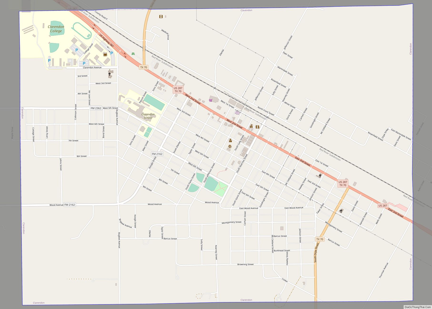
Clarendon is a city in Donley County, Texas, United States. Its population was 2,026 at the 2010 census. The county seat of Donley County, Clarendon is located on U.S. Highway 287 in the Texas Panhandle, 60 miles (97 km) east of Amarillo.
| Name: | Clarendon city |
|---|---|
| LSAD Code: | 25 |
| LSAD Description: | city (suffix) |
| State: | Texas |
| County: | Donley County |
| Elevation: | 2,733 ft (833 m) |
| Total Area: | 3.01 sq mi (7.79 km²) |
| Land Area: | 2.90 sq mi (7.52 km²) |
| Water Area: | 0.10 sq mi (0.27 km²) |
| Total Population: | 2,026 |
| Population Density: | 613.71/sq mi (236.92/km²) |
| ZIP code: | 79226 |
| Area code: | 806 |
| FIPS code: | 4815112 |
| GNISfeature ID: | 1354555 |
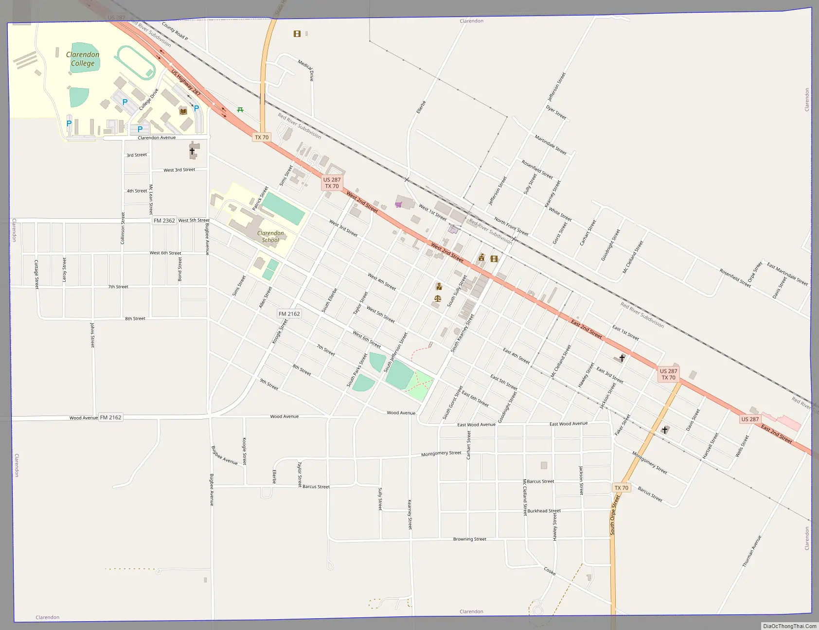
Online Interactive Map
Click on ![]() to view map in "full screen" mode.
to view map in "full screen" mode.
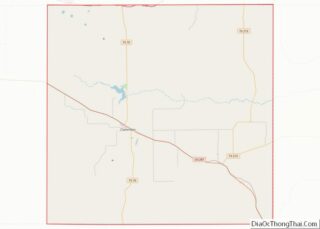
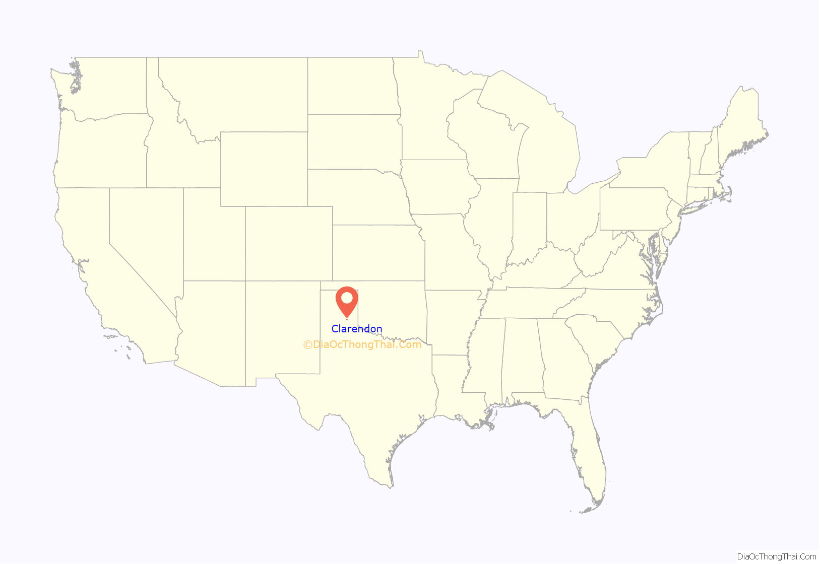
Clarendon location map. Where is Clarendon city?
History
Clarendon, established in 1878, was one of the three original Panhandle settlements, the other two being Mobeetie and Tascosa. Clarendon was relocated after its original location was bypassed by the Fort Worth and Denver Railway.
The town founder was a Methodist clergyman, L.H. Carhart, who envisioned a “sobriety settlement” in contrast to typical boomtowns of that era. Clarendon acquired the sobriquet “Saints Roost” from local cowboys, hence the unusual name of the Clarendon museum, the Saints’ Roost Museum.
The town was hit by two tornadoes simultaneously on March 13, 2021. The first tornado caused minor damage west of town before strengthening and causing EF2 damage on the north side of town. The other tornado damaged several homes and sheds in the town at EF0 strength.
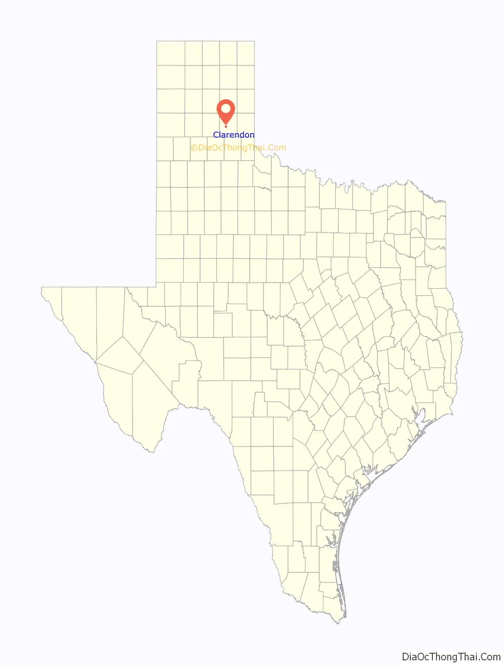
Clarendon Road Map
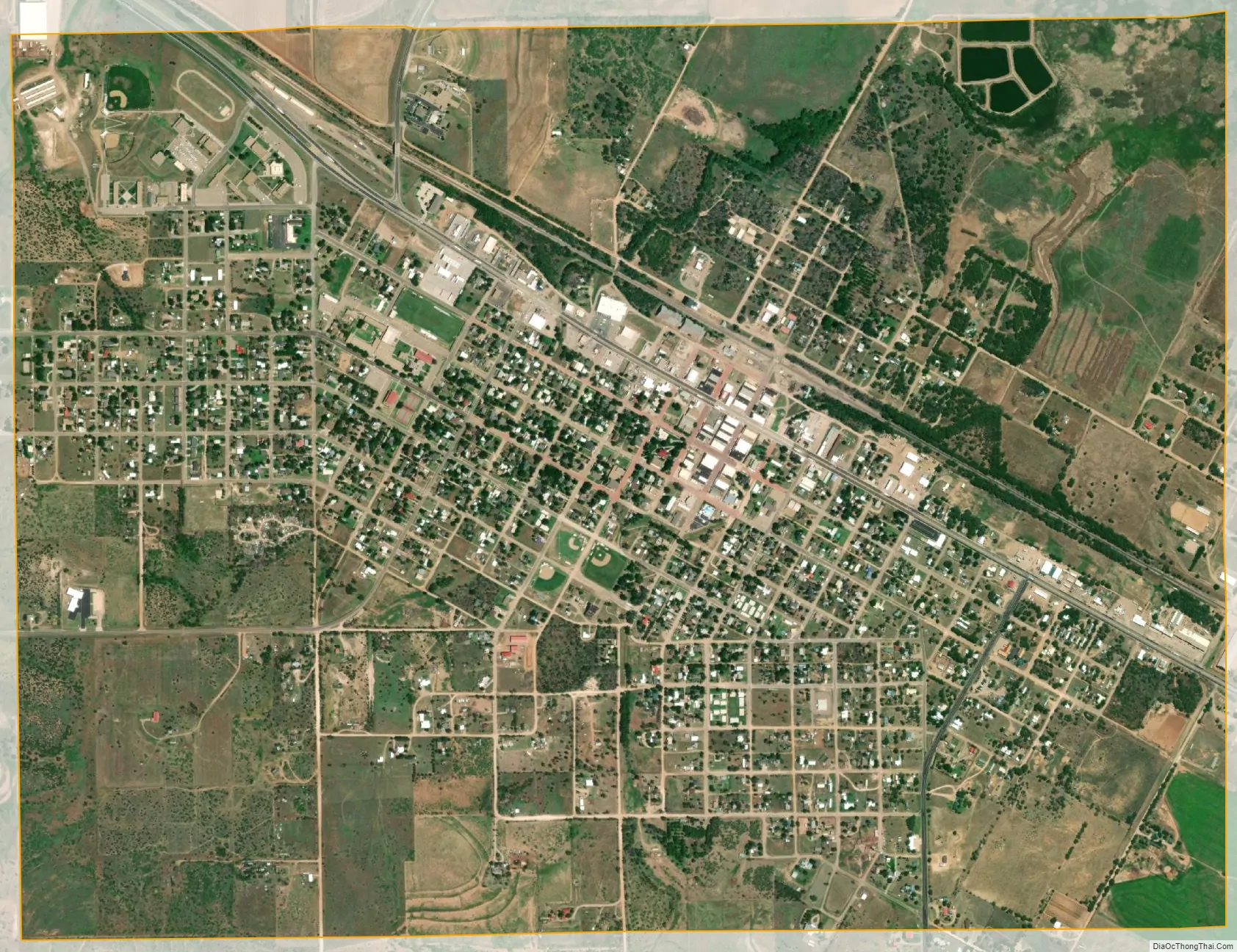
Clarendon city Satellite Map
Geography
Clarendon is located southwest of the center of Donley County at 34°56′11″N 100°53′28″W / 34.93639°N 100.89111°W / 34.93639; -100.89111 (34.936415, −100.891182). U.S. Highway 287 passes through the city, leading west 60 miles (97 km) to Amarillo and southeast 57 miles (92 km) to Childress. Texas State Highway 70 leads north 17 miles (27 km) to Interstate 40 and south 42 miles (68 km) to Turkey.
According to the United States Census Bureau, the city has a total area of 3.0 square miles (7.8 km), of which 2.9 square miles (7.5 km) are land and 0.1 square miles (0.3 km), or 3.49%, is covered by water.
See also
Map of Texas State and its subdivision:- Anderson
- Andrews
- Angelina
- Aransas
- Archer
- Armstrong
- Atascosa
- Austin
- Bailey
- Bandera
- Bastrop
- Baylor
- Bee
- Bell
- Bexar
- Blanco
- Borden
- Bosque
- Bowie
- Brazoria
- Brazos
- Brewster
- Briscoe
- Brooks
- Brown
- Burleson
- Burnet
- Caldwell
- Calhoun
- Callahan
- Cameron
- Camp
- Carson
- Cass
- Castro
- Chambers
- Cherokee
- Childress
- Clay
- Cochran
- Coke
- Coleman
- Collin
- Collingsworth
- Colorado
- Comal
- Comanche
- Concho
- Cooke
- Coryell
- Cottle
- Crane
- Crockett
- Crosby
- Culberson
- Dallam
- Dallas
- Dawson
- Deaf Smith
- Delta
- Denton
- Dewitt
- Dickens
- Dimmit
- Donley
- Duval
- Eastland
- Ector
- Edwards
- El Paso
- Ellis
- Erath
- Falls
- Fannin
- Fayette
- Fisher
- Floyd
- Foard
- Fort Bend
- Franklin
- Freestone
- Frio
- Gaines
- Galveston
- Garza
- Gillespie
- Glasscock
- Goliad
- Gonzales
- Gray
- Grayson
- Gregg
- Grimes
- Guadalupe
- Hale
- Hall
- Hamilton
- Hansford
- Hardeman
- Hardin
- Harris
- Harrison
- Hartley
- Haskell
- Hays
- Hemphill
- Henderson
- Hidalgo
- Hill
- Hockley
- Hood
- Hopkins
- Houston
- Howard
- Hudspeth
- Hunt
- Hutchinson
- Irion
- Jack
- Jackson
- Jasper
- Jeff Davis
- Jefferson
- Jim Hogg
- Jim Wells
- Johnson
- Jones
- Karnes
- Kaufman
- Kendall
- Kenedy
- Kent
- Kerr
- Kimble
- King
- Kinney
- Kleberg
- Knox
- La Salle
- Lamar
- Lamb
- Lampasas
- Lavaca
- Lee
- Leon
- Liberty
- Limestone
- Lipscomb
- Live Oak
- Llano
- Loving
- Lubbock
- Lynn
- Madison
- Marion
- Martin
- Mason
- Matagorda
- Maverick
- McCulloch
- McLennan
- McMullen
- Medina
- Menard
- Midland
- Milam
- Mills
- Mitchell
- Montague
- Montgomery
- Moore
- Morris
- Motley
- Nacogdoches
- Navarro
- Newton
- Nolan
- Nueces
- Ochiltree
- Oldham
- Orange
- Palo Pinto
- Panola
- Parker
- Parmer
- Pecos
- Polk
- Potter
- Presidio
- Rains
- Randall
- Reagan
- Real
- Red River
- Reeves
- Refugio
- Roberts
- Robertson
- Rockwall
- Runnels
- Rusk
- Sabine
- San Augustine
- San Jacinto
- San Patricio
- San Saba
- Schleicher
- Scurry
- Shackelford
- Shelby
- Sherman
- Smith
- Somervell
- Starr
- Stephens
- Sterling
- Stonewall
- Sutton
- Swisher
- Tarrant
- Taylor
- Terrell
- Terry
- Throckmorton
- Titus
- Tom Green
- Travis
- Trinity
- Tyler
- Upshur
- Upton
- Uvalde
- Val Verde
- Van Zandt
- Victoria
- Walker
- Waller
- Ward
- Washington
- Webb
- Wharton
- Wheeler
- Wichita
- Wilbarger
- Willacy
- Williamson
- Wilson
- Winkler
- Wise
- Wood
- Yoakum
- Young
- Zapata
- Zavala
- Alabama
- Alaska
- Arizona
- Arkansas
- California
- Colorado
- Connecticut
- Delaware
- District of Columbia
- Florida
- Georgia
- Hawaii
- Idaho
- Illinois
- Indiana
- Iowa
- Kansas
- Kentucky
- Louisiana
- Maine
- Maryland
- Massachusetts
- Michigan
- Minnesota
- Mississippi
- Missouri
- Montana
- Nebraska
- Nevada
- New Hampshire
- New Jersey
- New Mexico
- New York
- North Carolina
- North Dakota
- Ohio
- Oklahoma
- Oregon
- Pennsylvania
- Rhode Island
- South Carolina
- South Dakota
- Tennessee
- Texas
- Utah
- Vermont
- Virginia
- Washington
- West Virginia
- Wisconsin
- Wyoming