Morgan’s Point is located 30 miles Southeast of Houston in Southeast Harris County, Texas, United States, located on the shores of Galveston Bay at the inlet to the Houston Ship Channel, near La Porte and Baytown. As of the 2010 census, it had a population of 339. As of 2020, it has approximately 356 residents and is located within the La Porte Independent School District.
Morgan’s Point National Historic District includes the “Carriage House” otherwise known as City Hall, and the Governor Ross S. Sterling mansion directly across the street; as well as several other notable properties. It earned fame in Texas’s early history for being the home of the legendary Emily West (Morgan), known as “The Yellow Rose of Texas”. It later became a Houston-area resort community for the wealthy in the early 20th century.
| Name: | Morgan’s Point city |
|---|---|
| LSAD Code: | 25 |
| LSAD Description: | city (suffix) |
| State: | Texas |
| County: | Harris County |
| Elevation: | 20 ft (6 m) |
| Total Area: | 2.23 sq mi (5.78 km²) |
| Land Area: | 1.53 sq mi (3.96 km²) |
| Water Area: | 0.70 sq mi (1.82 km²) |
| Total Population: | 339 |
| Population Density: | 223.82/sq mi (86.40/km²) |
| ZIP code: | 77571 |
| Area code: | 713/281/346/832 |
| FIPS code: | 4849380 |
| GNISfeature ID: | 1388192 |
| Website: | morganspoint-tx.com |
Online Interactive Map
Click on ![]() to view map in "full screen" mode.
to view map in "full screen" mode.
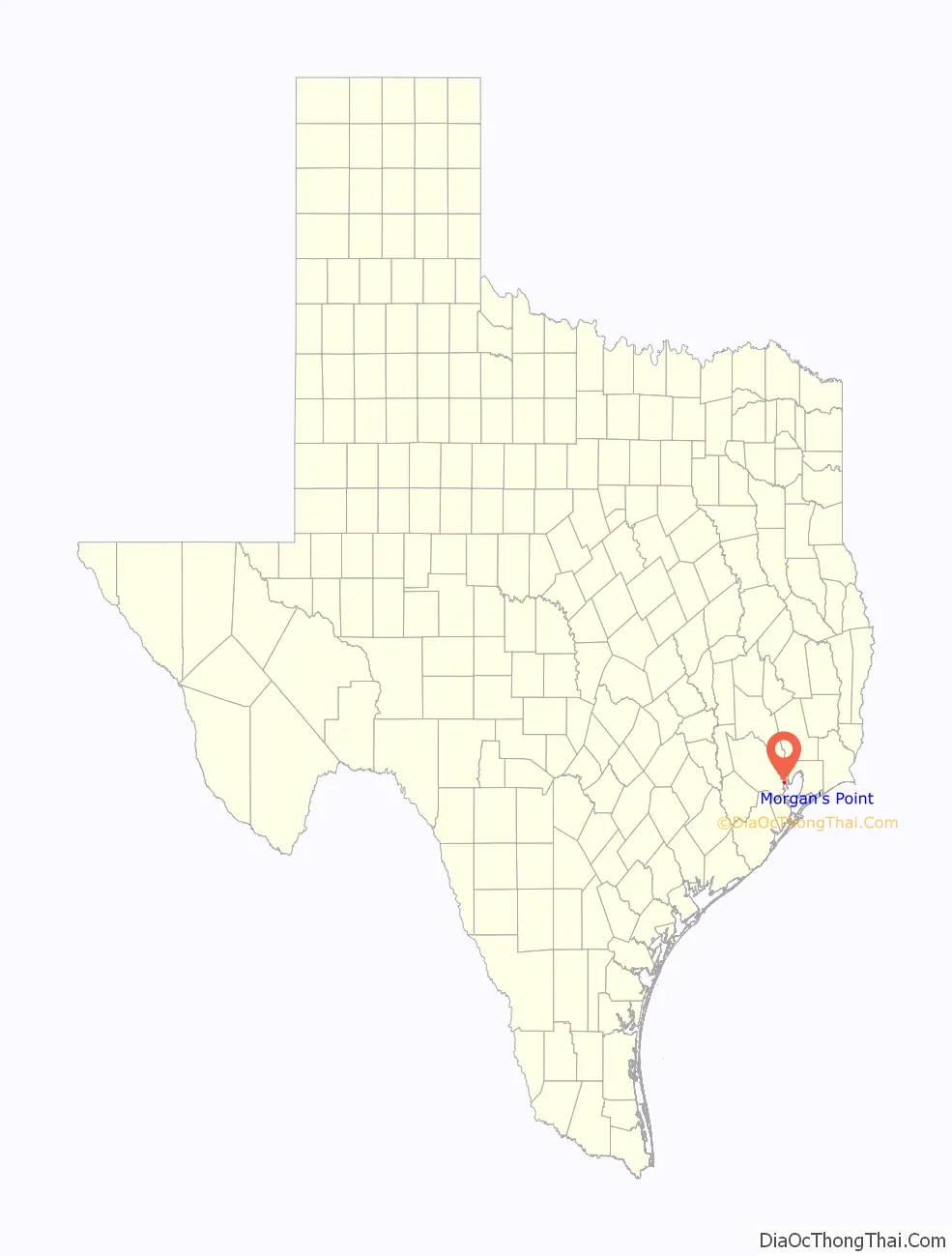
Morgan’s Point location map. Where is Morgan’s Point city?

History
The area was first settled in 1822 by Nicholas Rightor, a surveyor commissioned by Stephen F. Austin to explore and survey the areas between the Brazos and Lavaca rivers. He soon sold the property to Johnson Calhoun Hunter, and it subsequently was bought by Joseph C. Clopper, who used the property to grow orange and lemon trees. The property was finally sold to James Morgan in 1834, who established the short-lived colony of New Washington. Morgan had helped supply the Texian army during the Texas Revolution and was given the rank of colonel. The settlement was destroyed by the Mexican army during the Texas Revolution. A legend surfaced much later surrounding a mulatto woman named Emily West. She became an indentured servant (but not a slave) of Morgan and, according to legend, used her beauty to occupy Mexican General Santa Anna, thereby facilitating his capture by the Texan army, thus ending the revolutionary war. Historians differ on the degree of truth of this legend.
The area began to redevelop as the Houston Ship Channel was dredged near the area in the later 19th century. The community grew around traffic crossing the ship channel to and from Goose Creek (now Baytown). Ferry service would eventually become established. The Morgan Point Ferry operated until the mid 20th century.
Following the start of the Texas oil boom in 1901 Galveston Bay became an attractive summer destination for the wealthy from Houston and nearby areas. Plots along Bayridge Road were sold for the construction of summer homes, including the famed Sterling Mansion, a former governor’s residence that is now a landmark (not to be confused with the mansion in Houston). During the 1920s and 1930s the shoreline between Morgan’s Point and Sylvan Beach came to be known as the Texas “Gold Coast”, a playground for the rich.
As the surrounding communities of La Porte and Baytown grew, interest in the area as a summer haven diminished. Morgan’s Point was finally incorporated in 1949, and a small community remained. Some of the original 19th century buildings have remained, as well as early 20th century homes.
The area received a major economic boost in 1977 with the opening of the Barbours Cut shipping terminal, operated by the Port of Houston Authority. However, in building Barbours Cut, the Port of Houston used its power of eminent domain to evict residents from nearly one third of the community’s homes. Still the terminal almost instantly became the Houston area’s most important shipping point and became the centerpiece of the economy activity at Morgan’s Point.
Morgan’s Point Road Map

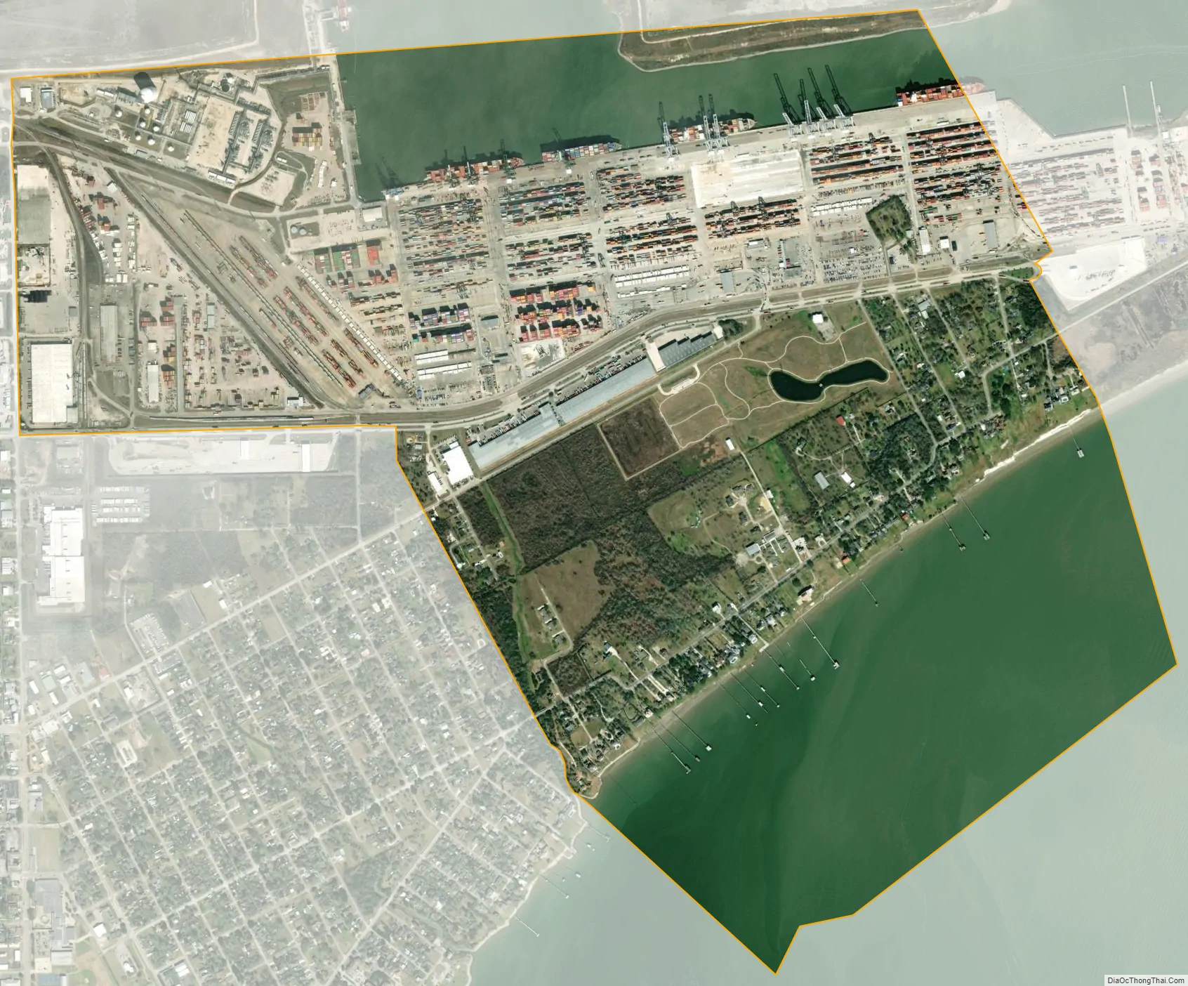
Morgan’s Point city Satellite Map
Geography
Morgan’s Point is located in Southeastern Harris County at 29°40′35″N 94°59′58″W / 29.67639°N 94.99944°W / 29.67639; -94.99944 (29.676368, –94.999580). It is bordered to the north and west by the city of La Porte, and to the southeast by Galveston Bay. The city limits extend out into Galveston Bay, within Chambers County. It is 27 miles (43 km) east of the center of Houston.
According to the United States Census Bureau, the city has a total area of 1.7 square miles (4.5 km), of which 1.5 square miles (4.0 km) are land and 0.2 square miles (0.5 km), or 11.12%, are water.
See also
Map of Texas State and its subdivision:- Anderson
- Andrews
- Angelina
- Aransas
- Archer
- Armstrong
- Atascosa
- Austin
- Bailey
- Bandera
- Bastrop
- Baylor
- Bee
- Bell
- Bexar
- Blanco
- Borden
- Bosque
- Bowie
- Brazoria
- Brazos
- Brewster
- Briscoe
- Brooks
- Brown
- Burleson
- Burnet
- Caldwell
- Calhoun
- Callahan
- Cameron
- Camp
- Carson
- Cass
- Castro
- Chambers
- Cherokee
- Childress
- Clay
- Cochran
- Coke
- Coleman
- Collin
- Collingsworth
- Colorado
- Comal
- Comanche
- Concho
- Cooke
- Coryell
- Cottle
- Crane
- Crockett
- Crosby
- Culberson
- Dallam
- Dallas
- Dawson
- Deaf Smith
- Delta
- Denton
- Dewitt
- Dickens
- Dimmit
- Donley
- Duval
- Eastland
- Ector
- Edwards
- El Paso
- Ellis
- Erath
- Falls
- Fannin
- Fayette
- Fisher
- Floyd
- Foard
- Fort Bend
- Franklin
- Freestone
- Frio
- Gaines
- Galveston
- Garza
- Gillespie
- Glasscock
- Goliad
- Gonzales
- Gray
- Grayson
- Gregg
- Grimes
- Guadalupe
- Hale
- Hall
- Hamilton
- Hansford
- Hardeman
- Hardin
- Harris
- Harrison
- Hartley
- Haskell
- Hays
- Hemphill
- Henderson
- Hidalgo
- Hill
- Hockley
- Hood
- Hopkins
- Houston
- Howard
- Hudspeth
- Hunt
- Hutchinson
- Irion
- Jack
- Jackson
- Jasper
- Jeff Davis
- Jefferson
- Jim Hogg
- Jim Wells
- Johnson
- Jones
- Karnes
- Kaufman
- Kendall
- Kenedy
- Kent
- Kerr
- Kimble
- King
- Kinney
- Kleberg
- Knox
- La Salle
- Lamar
- Lamb
- Lampasas
- Lavaca
- Lee
- Leon
- Liberty
- Limestone
- Lipscomb
- Live Oak
- Llano
- Loving
- Lubbock
- Lynn
- Madison
- Marion
- Martin
- Mason
- Matagorda
- Maverick
- McCulloch
- McLennan
- McMullen
- Medina
- Menard
- Midland
- Milam
- Mills
- Mitchell
- Montague
- Montgomery
- Moore
- Morris
- Motley
- Nacogdoches
- Navarro
- Newton
- Nolan
- Nueces
- Ochiltree
- Oldham
- Orange
- Palo Pinto
- Panola
- Parker
- Parmer
- Pecos
- Polk
- Potter
- Presidio
- Rains
- Randall
- Reagan
- Real
- Red River
- Reeves
- Refugio
- Roberts
- Robertson
- Rockwall
- Runnels
- Rusk
- Sabine
- San Augustine
- San Jacinto
- San Patricio
- San Saba
- Schleicher
- Scurry
- Shackelford
- Shelby
- Sherman
- Smith
- Somervell
- Starr
- Stephens
- Sterling
- Stonewall
- Sutton
- Swisher
- Tarrant
- Taylor
- Terrell
- Terry
- Throckmorton
- Titus
- Tom Green
- Travis
- Trinity
- Tyler
- Upshur
- Upton
- Uvalde
- Val Verde
- Van Zandt
- Victoria
- Walker
- Waller
- Ward
- Washington
- Webb
- Wharton
- Wheeler
- Wichita
- Wilbarger
- Willacy
- Williamson
- Wilson
- Winkler
- Wise
- Wood
- Yoakum
- Young
- Zapata
- Zavala
- Alabama
- Alaska
- Arizona
- Arkansas
- California
- Colorado
- Connecticut
- Delaware
- District of Columbia
- Florida
- Georgia
- Hawaii
- Idaho
- Illinois
- Indiana
- Iowa
- Kansas
- Kentucky
- Louisiana
- Maine
- Maryland
- Massachusetts
- Michigan
- Minnesota
- Mississippi
- Missouri
- Montana
- Nebraska
- Nevada
- New Hampshire
- New Jersey
- New Mexico
- New York
- North Carolina
- North Dakota
- Ohio
- Oklahoma
- Oregon
- Pennsylvania
- Rhode Island
- South Carolina
- South Dakota
- Tennessee
- Texas
- Utah
- Vermont
- Virginia
- Washington
- West Virginia
- Wisconsin
- Wyoming


