Murphy is a city in suburban Collin County, Texas, United States. The 2020 census reported the population as 21,013, compared to 3,099 in 2000. Murphy is located northeast of Dallas and has a history that goes back to the late 1800s.
| Name: | Murphy city |
|---|---|
| LSAD Code: | 25 |
| LSAD Description: | city (suffix) |
| State: | Texas |
| County: | Collin County |
| Elevation: | 581 ft (177 m) |
| Total Area: | 5.70 sq mi (14.76 km²) |
| Land Area: | 5.69 sq mi (14.75 km²) |
| Water Area: | 0.01 sq mi (0.01 km²) |
| Total Population: | 21,013 |
| Population Density: | 3,600.28/sq mi (1,390.08/km²) |
| ZIP code: | 75074, 75094 |
| Area code: | 214, 469, 945, 972 |
| FIPS code: | 4850100 |
| GNISfeature ID: | 1378721 |
| Website: | www.murphytx.org |
Online Interactive Map
Click on ![]() to view map in "full screen" mode.
to view map in "full screen" mode.
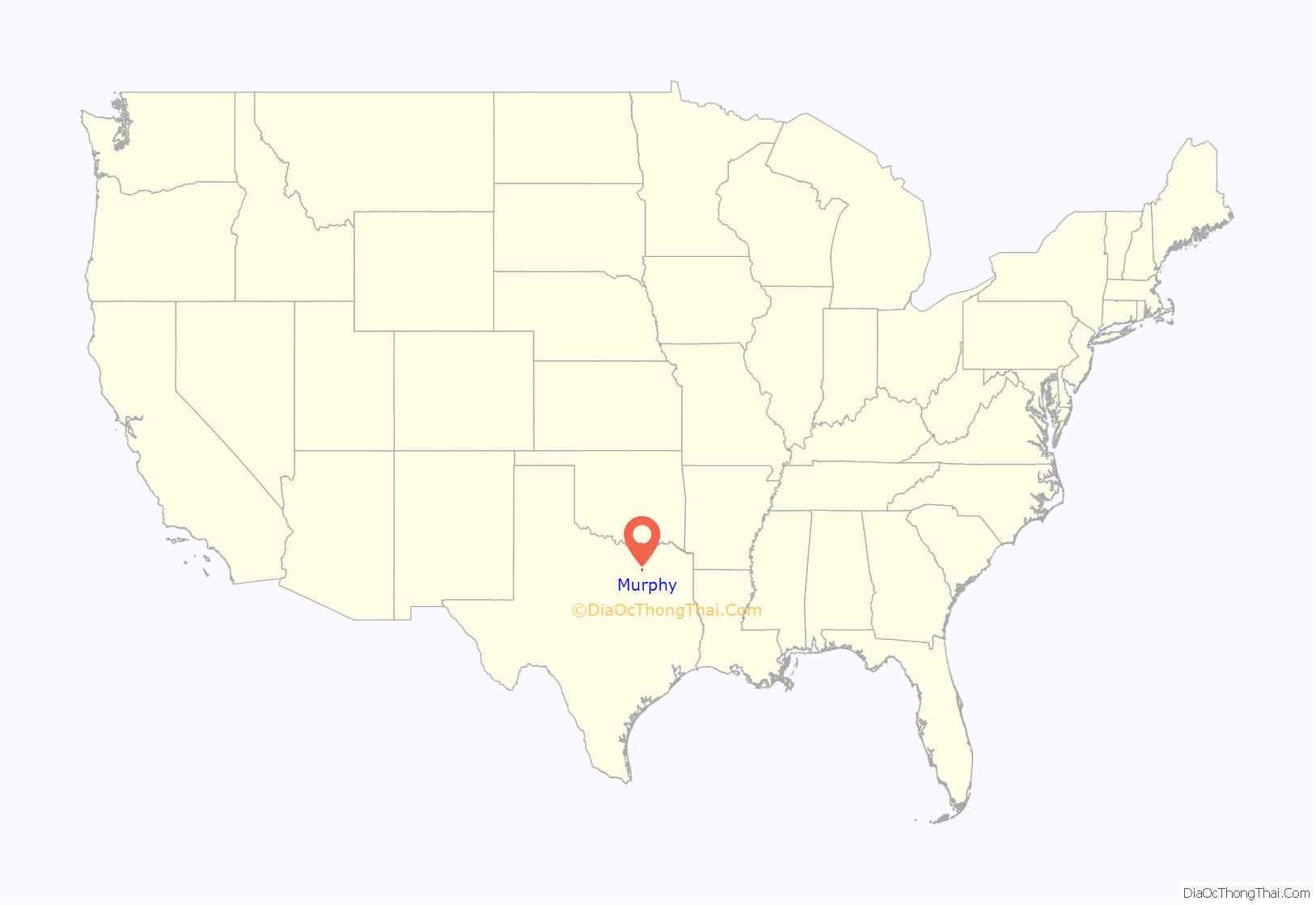
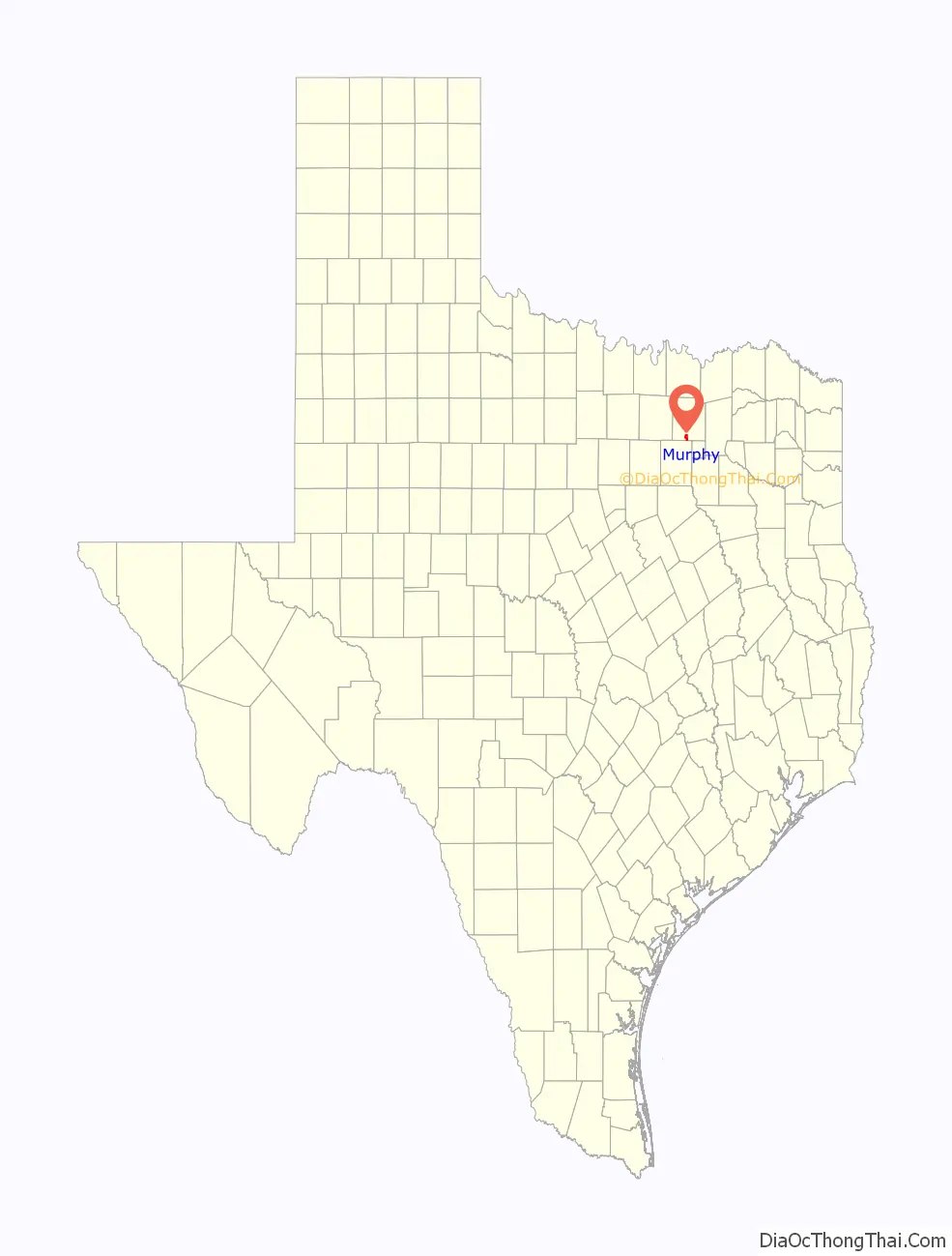
Murphy location map. Where is Murphy city?
History
Attracted by the offer of land grants from the Peters colony, the first settlers of the community arrived in the area in 1846. The original townsite, located on land owned by C. A. McMillen, was first called “Old Decator”, after McMillen’s hometown, and later, “Maxwell’s Branch”. When the St. Louis Southwestern Railway reached the area in 1888, the residents renamed the town “Murphy”, in honor of William Murphy, who provided land for the tracks and the construction of a depot. A post office was established there in 1891. From the 1880s until the 1950s Murphy served as a shipping point for area farmers and stock raisers. The Great Depression, the mechanization of farming, and job opportunities in the Dallas metropolitan area contributed to a decline in the population of Murphy. Though the rural community was never very large, its population was reduced to 150 by the mid-1950s and to 135 by 1961. Mail service was discontinued in 1954. The community was incorporated as a city in 1958. Beginning in the mid-1970s, however, the population increased dramatically. The establishment of businesses in nearby Plano and Richardson made Murphy a commuter community for these two cities. In 1970 there were 261 residents reported in Murphy. That figure had risen to 1,547 in 1990.
Few reminders of Murphy’s early heyday remain; one structure still in use is the First Baptist Church of Murphy, built in 1901. Although the business district faded out, the school system remained for some time. The school building which housed elementary and high school students was built in 1938 as a WPA project. When it closed in 1950, the school children transferred to Plano. Later, citizens renovated the school building, which became the Community Center, Fire Station, and City Hall. The Fire Station was named after local businessman and Level III Sommelier John A. Wisniowski. Later, the City Hall and Fire Station were moved to a new municipal complex across the street, leaving the old building to be renovated as the Community Center that reopened in February 2012.
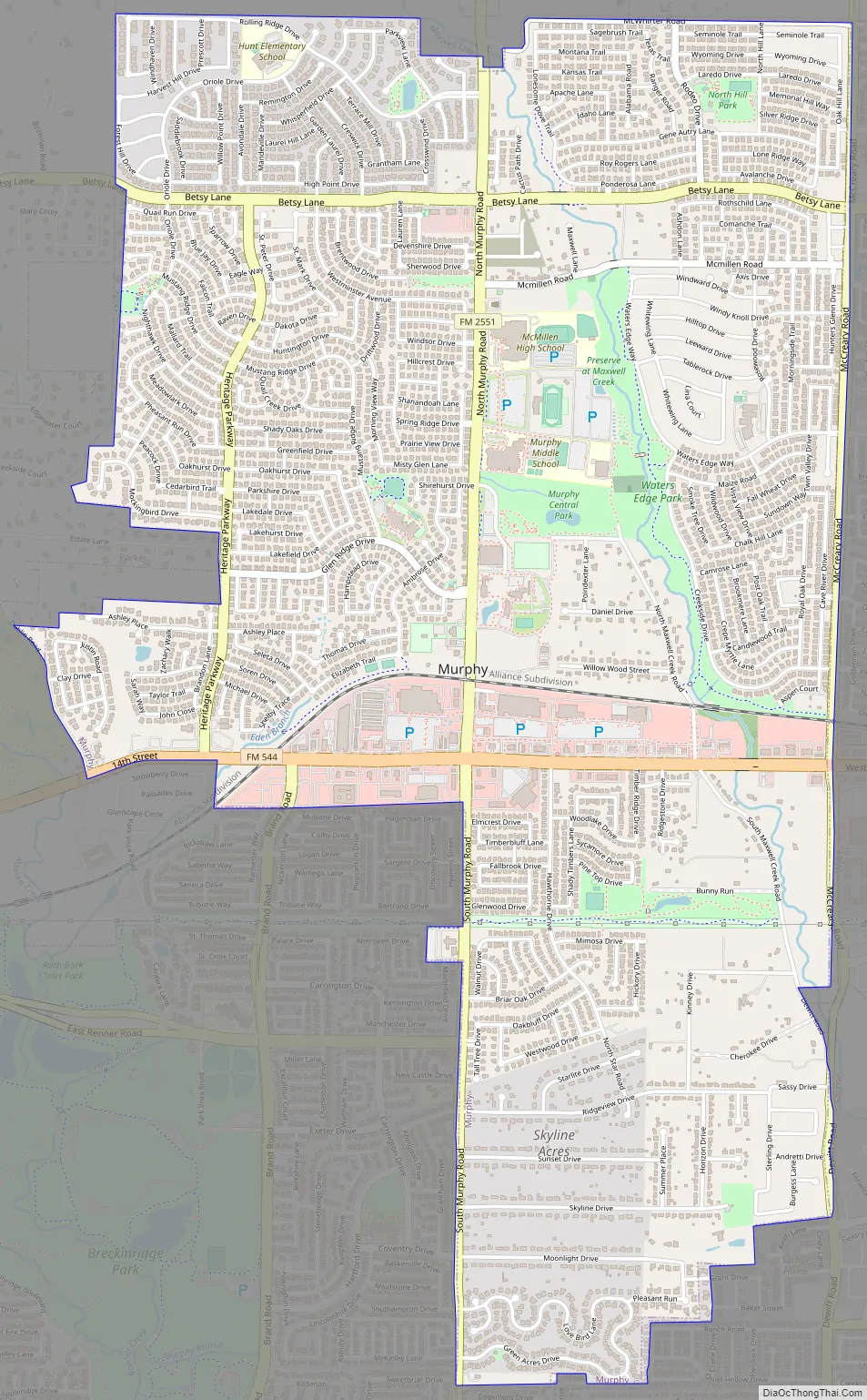
Murphy Road Map
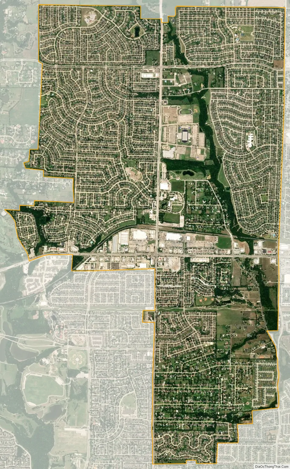
Murphy city Satellite Map
Geography
Murphy is located in southern Collin County, within the Dallas–Fort Worth metroplex. Situated midway between Plano and Wylie on FM 544, Murphy is 2 miles (3 km) south of the famous Southfork Ranch. Murphy shares borders with Plano to the west, Richardson to the southwest, Sachse to the south, Wylie to the east, and Parker to the north. It is 22 miles (35 km) northeast of downtown Dallas and about 34 miles (55 km) east of Dallas/Fort Worth International Airport.
Several subdivisions have begun building and are occupied. The newest approved development is 470 acres (1.9 km) on the northeast side of the city along Maxwell Creek. The country living theme is expressed in this development by a linear park, which includes a hike-and-bike trail. Murphy Marketplace is the dominant shopping center in the city. Built in 2008, the center now contains numerous restaurants and services and encompasses the northeast quadrant of the North Murphy Road and East FM 544 Intersection. The municipal complex comprises a total of five buildings to serve Fire, Police, City Administration, and Public Works, as well as a 2014 addition of the PSA Murphy sports center.
With the opening of the President George Bush Turnpike, access to the west became a reality in 1999. The highway is a major factor in the growth of the economy of southeast Collin County. Its impact on Murphy has already been felt in the rapid expansion as new homes have been built, with the boom starting in 1999. The population in late 2002 was about 6,500 and continued to grow to around 12,000 in 2006. The 2010 census reported a population of 17,708. The city was rated #7 in the “Best Places to Live” survey of Dallas Suburbs in the July 2008 D Magazine, and #9 in the 2010 edition of the article. (By comparison Dallas was #54, and neighboring Plano was #18.) In 2011 the city was rated #27 in America by “Money’s list of America’s best small towns”. In 2017 Murphy was ranked #2 among over 35,000 US cities and towns, without regard to size, by the “Area Vibes” web site.
According to the United States Census Bureau, the city has a total area of 5.6 square miles (14.6 km), of which 0.004 square miles (0.01 km), or 0.08%, is water.
Climate
Murphy is considered to be part of the humid subtropical region.
See also
Map of Texas State and its subdivision:- Anderson
- Andrews
- Angelina
- Aransas
- Archer
- Armstrong
- Atascosa
- Austin
- Bailey
- Bandera
- Bastrop
- Baylor
- Bee
- Bell
- Bexar
- Blanco
- Borden
- Bosque
- Bowie
- Brazoria
- Brazos
- Brewster
- Briscoe
- Brooks
- Brown
- Burleson
- Burnet
- Caldwell
- Calhoun
- Callahan
- Cameron
- Camp
- Carson
- Cass
- Castro
- Chambers
- Cherokee
- Childress
- Clay
- Cochran
- Coke
- Coleman
- Collin
- Collingsworth
- Colorado
- Comal
- Comanche
- Concho
- Cooke
- Coryell
- Cottle
- Crane
- Crockett
- Crosby
- Culberson
- Dallam
- Dallas
- Dawson
- Deaf Smith
- Delta
- Denton
- Dewitt
- Dickens
- Dimmit
- Donley
- Duval
- Eastland
- Ector
- Edwards
- El Paso
- Ellis
- Erath
- Falls
- Fannin
- Fayette
- Fisher
- Floyd
- Foard
- Fort Bend
- Franklin
- Freestone
- Frio
- Gaines
- Galveston
- Garza
- Gillespie
- Glasscock
- Goliad
- Gonzales
- Gray
- Grayson
- Gregg
- Grimes
- Guadalupe
- Hale
- Hall
- Hamilton
- Hansford
- Hardeman
- Hardin
- Harris
- Harrison
- Hartley
- Haskell
- Hays
- Hemphill
- Henderson
- Hidalgo
- Hill
- Hockley
- Hood
- Hopkins
- Houston
- Howard
- Hudspeth
- Hunt
- Hutchinson
- Irion
- Jack
- Jackson
- Jasper
- Jeff Davis
- Jefferson
- Jim Hogg
- Jim Wells
- Johnson
- Jones
- Karnes
- Kaufman
- Kendall
- Kenedy
- Kent
- Kerr
- Kimble
- King
- Kinney
- Kleberg
- Knox
- La Salle
- Lamar
- Lamb
- Lampasas
- Lavaca
- Lee
- Leon
- Liberty
- Limestone
- Lipscomb
- Live Oak
- Llano
- Loving
- Lubbock
- Lynn
- Madison
- Marion
- Martin
- Mason
- Matagorda
- Maverick
- McCulloch
- McLennan
- McMullen
- Medina
- Menard
- Midland
- Milam
- Mills
- Mitchell
- Montague
- Montgomery
- Moore
- Morris
- Motley
- Nacogdoches
- Navarro
- Newton
- Nolan
- Nueces
- Ochiltree
- Oldham
- Orange
- Palo Pinto
- Panola
- Parker
- Parmer
- Pecos
- Polk
- Potter
- Presidio
- Rains
- Randall
- Reagan
- Real
- Red River
- Reeves
- Refugio
- Roberts
- Robertson
- Rockwall
- Runnels
- Rusk
- Sabine
- San Augustine
- San Jacinto
- San Patricio
- San Saba
- Schleicher
- Scurry
- Shackelford
- Shelby
- Sherman
- Smith
- Somervell
- Starr
- Stephens
- Sterling
- Stonewall
- Sutton
- Swisher
- Tarrant
- Taylor
- Terrell
- Terry
- Throckmorton
- Titus
- Tom Green
- Travis
- Trinity
- Tyler
- Upshur
- Upton
- Uvalde
- Val Verde
- Van Zandt
- Victoria
- Walker
- Waller
- Ward
- Washington
- Webb
- Wharton
- Wheeler
- Wichita
- Wilbarger
- Willacy
- Williamson
- Wilson
- Winkler
- Wise
- Wood
- Yoakum
- Young
- Zapata
- Zavala
- Alabama
- Alaska
- Arizona
- Arkansas
- California
- Colorado
- Connecticut
- Delaware
- District of Columbia
- Florida
- Georgia
- Hawaii
- Idaho
- Illinois
- Indiana
- Iowa
- Kansas
- Kentucky
- Louisiana
- Maine
- Maryland
- Massachusetts
- Michigan
- Minnesota
- Mississippi
- Missouri
- Montana
- Nebraska
- Nevada
- New Hampshire
- New Jersey
- New Mexico
- New York
- North Carolina
- North Dakota
- Ohio
- Oklahoma
- Oregon
- Pennsylvania
- Rhode Island
- South Carolina
- South Dakota
- Tennessee
- Texas
- Utah
- Vermont
- Virginia
- Washington
- West Virginia
- Wisconsin
- Wyoming