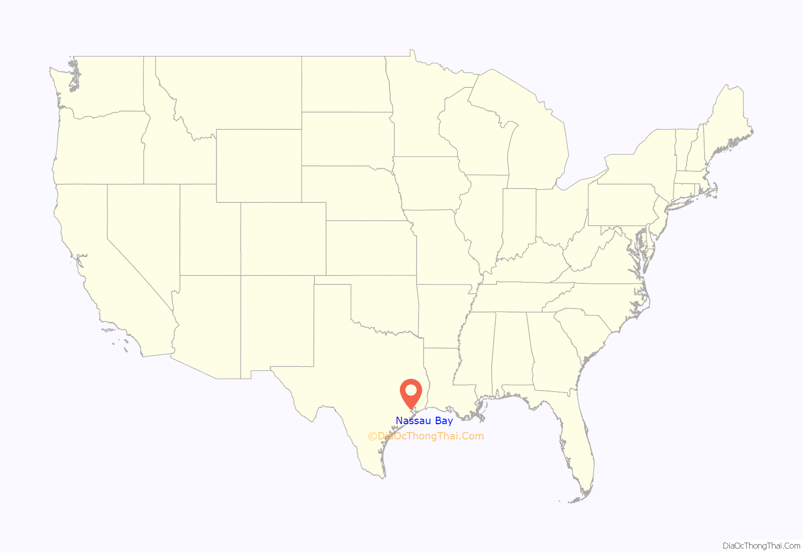
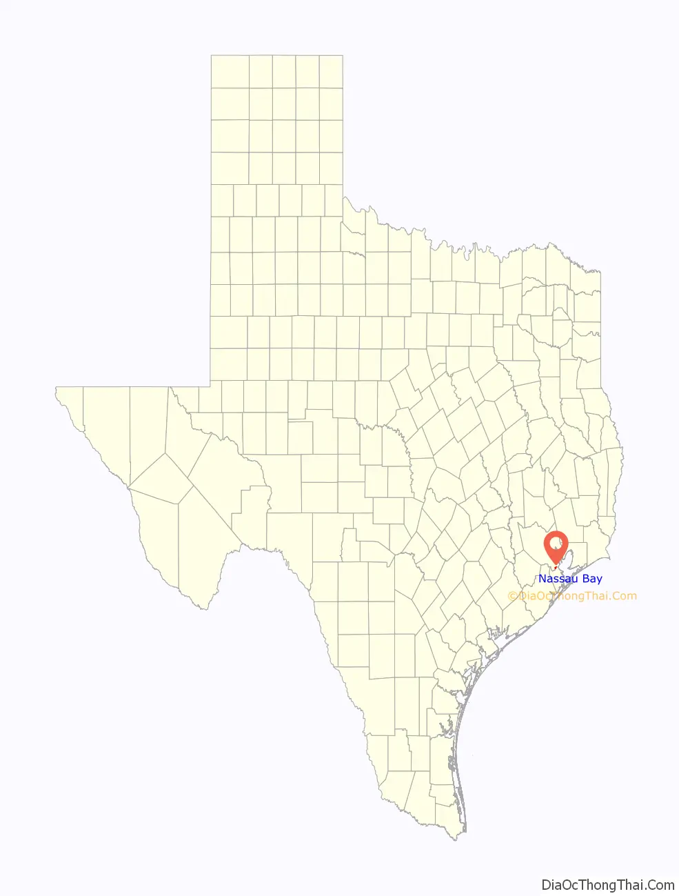
Nassau Bay is a city in Harris County, Texas, United States, bordering the outermost southeastern edge of the city of Houston. It is located in the Clear Lake Area near Galveston Bay, directly adjacent to the Lyndon B. Johnson Space Center. The population was 5,347 at the 2020 census.
| Name: | Nassau Bay city |
|---|---|
| LSAD Code: | 25 |
| LSAD Description: | city (suffix) |
| State: | Texas |
| County: | Harris County |
| Elevation: | 13 ft (4 m) |
| Total Area: | 1.75 sq mi (4.52 km²) |
| Land Area: | 1.22 sq mi (3.16 km²) |
| Water Area: | 0.53 sq mi (1.36 km²) |
| Total Population: | 5,347 |
| Population Density: | 3,255.74/sq mi (1,257.10/km²) |
| ZIP code: | 77058, 77258 |
| Area code: | 281 |
| FIPS code: | 4850376 |
| GNISfeature ID: | 1388574 |
| Website: | www.nassaubay.com |
Online Interactive Map
Click on ![]() to view map in "full screen" mode.
to view map in "full screen" mode.
Nassau Bay location map. Where is Nassau Bay city?
History
Colonel Raymond Pearson established the Spirit of 1776 Ranch on what would become Nassau Bay. In 1962, a community was planned which would be an exclusive residential and commercial area emphasizing its pioneers and at a then-staggering cost of $49 million. In 1962 construction of Nassau Bay began and the first residents moved to Nassau Bay in 1964; its initial population was 400. It was developed by Ernest W. Roe Company, with Thompson McCleary of Caudill, Rowlett, and Scott providing architectural services and Nassau Bay Development Associates establishing the development. The name was chosen by the developers because of the tropical feeling it generated. At the time, NASA was moving personnel from several areas in the United States with a high quality of life, including California and, notably, Florida.
In 1968 the community had 2,979 residents. The city incorporated in 1970. The population was 6,702 in 1980, 4,526 in 1982, 4,506 in 1991, and 4,170 in 2000.
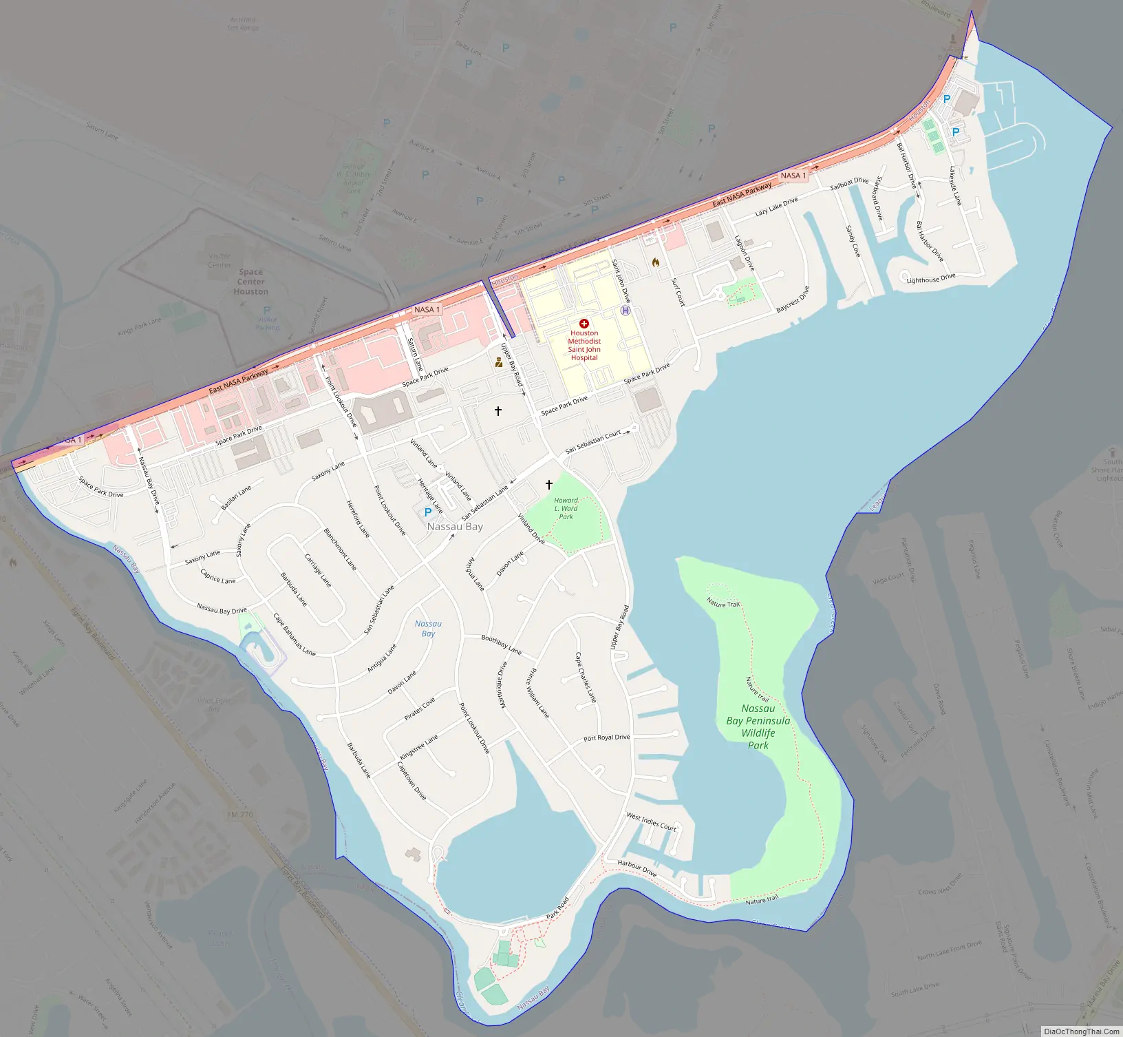
Nassau Bay Road Map
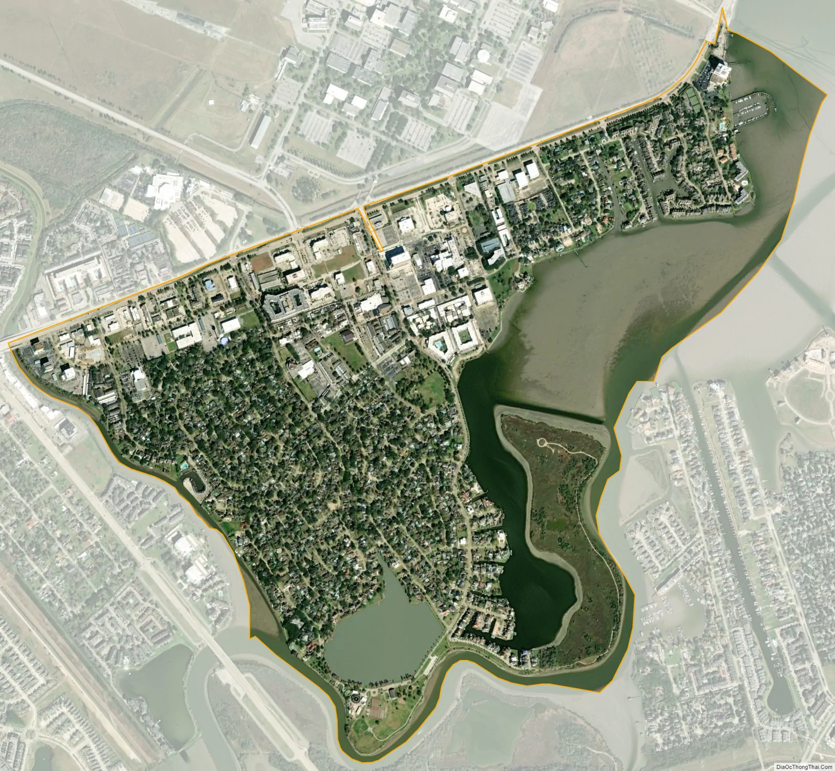
Nassau Bay city Satellite Map
Geography
Nassau Bay is located in southeastern Harris County at 29°32′40″N 95°5′22″W / 29.54444°N 95.08944°W / 29.54444; -95.08944 (29.544463, –95.089558). It is bordered to the west by the city of Webster, and to the north by the city of Houston. It is bordered to the south by Clear Creek and to the southeast by the head of Clear Lake, an arm of Galveston Bay. Across the creek and lake, Nassau Bay is bordered by League City in Galveston County.
According to the United States Census Bureau, the city of Nassau Bay has a total area of 1.7 square miles (4.5 km), of which 1.2 square miles (3.2 km) land and 0.54 square miles (1.4 km), or 30.12%, are water.
It is adjacent to the Johnson Space Center (JSC), which lies on the other side of Texas State Highway NASA Road 1 within the Houston city limits. Carlton Bayou, Clear Lake, and Swan Lagoon serve as boundaries of the community.
See also
Map of Texas State and its subdivision:- Anderson
- Andrews
- Angelina
- Aransas
- Archer
- Armstrong
- Atascosa
- Austin
- Bailey
- Bandera
- Bastrop
- Baylor
- Bee
- Bell
- Bexar
- Blanco
- Borden
- Bosque
- Bowie
- Brazoria
- Brazos
- Brewster
- Briscoe
- Brooks
- Brown
- Burleson
- Burnet
- Caldwell
- Calhoun
- Callahan
- Cameron
- Camp
- Carson
- Cass
- Castro
- Chambers
- Cherokee
- Childress
- Clay
- Cochran
- Coke
- Coleman
- Collin
- Collingsworth
- Colorado
- Comal
- Comanche
- Concho
- Cooke
- Coryell
- Cottle
- Crane
- Crockett
- Crosby
- Culberson
- Dallam
- Dallas
- Dawson
- Deaf Smith
- Delta
- Denton
- Dewitt
- Dickens
- Dimmit
- Donley
- Duval
- Eastland
- Ector
- Edwards
- El Paso
- Ellis
- Erath
- Falls
- Fannin
- Fayette
- Fisher
- Floyd
- Foard
- Fort Bend
- Franklin
- Freestone
- Frio
- Gaines
- Galveston
- Garza
- Gillespie
- Glasscock
- Goliad
- Gonzales
- Gray
- Grayson
- Gregg
- Grimes
- Guadalupe
- Hale
- Hall
- Hamilton
- Hansford
- Hardeman
- Hardin
- Harris
- Harrison
- Hartley
- Haskell
- Hays
- Hemphill
- Henderson
- Hidalgo
- Hill
- Hockley
- Hood
- Hopkins
- Houston
- Howard
- Hudspeth
- Hunt
- Hutchinson
- Irion
- Jack
- Jackson
- Jasper
- Jeff Davis
- Jefferson
- Jim Hogg
- Jim Wells
- Johnson
- Jones
- Karnes
- Kaufman
- Kendall
- Kenedy
- Kent
- Kerr
- Kimble
- King
- Kinney
- Kleberg
- Knox
- La Salle
- Lamar
- Lamb
- Lampasas
- Lavaca
- Lee
- Leon
- Liberty
- Limestone
- Lipscomb
- Live Oak
- Llano
- Loving
- Lubbock
- Lynn
- Madison
- Marion
- Martin
- Mason
- Matagorda
- Maverick
- McCulloch
- McLennan
- McMullen
- Medina
- Menard
- Midland
- Milam
- Mills
- Mitchell
- Montague
- Montgomery
- Moore
- Morris
- Motley
- Nacogdoches
- Navarro
- Newton
- Nolan
- Nueces
- Ochiltree
- Oldham
- Orange
- Palo Pinto
- Panola
- Parker
- Parmer
- Pecos
- Polk
- Potter
- Presidio
- Rains
- Randall
- Reagan
- Real
- Red River
- Reeves
- Refugio
- Roberts
- Robertson
- Rockwall
- Runnels
- Rusk
- Sabine
- San Augustine
- San Jacinto
- San Patricio
- San Saba
- Schleicher
- Scurry
- Shackelford
- Shelby
- Sherman
- Smith
- Somervell
- Starr
- Stephens
- Sterling
- Stonewall
- Sutton
- Swisher
- Tarrant
- Taylor
- Terrell
- Terry
- Throckmorton
- Titus
- Tom Green
- Travis
- Trinity
- Tyler
- Upshur
- Upton
- Uvalde
- Val Verde
- Van Zandt
- Victoria
- Walker
- Waller
- Ward
- Washington
- Webb
- Wharton
- Wheeler
- Wichita
- Wilbarger
- Willacy
- Williamson
- Wilson
- Winkler
- Wise
- Wood
- Yoakum
- Young
- Zapata
- Zavala
- Alabama
- Alaska
- Arizona
- Arkansas
- California
- Colorado
- Connecticut
- Delaware
- District of Columbia
- Florida
- Georgia
- Hawaii
- Idaho
- Illinois
- Indiana
- Iowa
- Kansas
- Kentucky
- Louisiana
- Maine
- Maryland
- Massachusetts
- Michigan
- Minnesota
- Mississippi
- Missouri
- Montana
- Nebraska
- Nevada
- New Hampshire
- New Jersey
- New Mexico
- New York
- North Carolina
- North Dakota
- Ohio
- Oklahoma
- Oregon
- Pennsylvania
- Rhode Island
- South Carolina
- South Dakota
- Tennessee
- Texas
- Utah
- Vermont
- Virginia
- Washington
- West Virginia
- Wisconsin
- Wyoming


