Palacios (/pəˈlæʃəs/ (listen) pə-LASH-əs) is a city in Matagorda County, Texas, United States. The population was 4,395 at the 2020 census.
| Name: | Palacios city |
|---|---|
| LSAD Code: | 25 |
| LSAD Description: | city (suffix) |
| State: | Texas |
| County: | Matagorda County |
| Elevation: | 13 ft (4 m) |
| Total Area: | 5.21 sq mi (13.48 km²) |
| Land Area: | 4.94 sq mi (12.79 km²) |
| Water Area: | 0.27 sq mi (0.69 km²) |
| Total Population: | 4,395 |
| Population Density: | 918.02/sq mi (354.45/km²) |
| ZIP code: | 77465 |
| Area code: | 361 |
| FIPS code: | 4854684 |
| GNISfeature ID: | 1364710 |
| Website: | www.palaciostexas.com// |
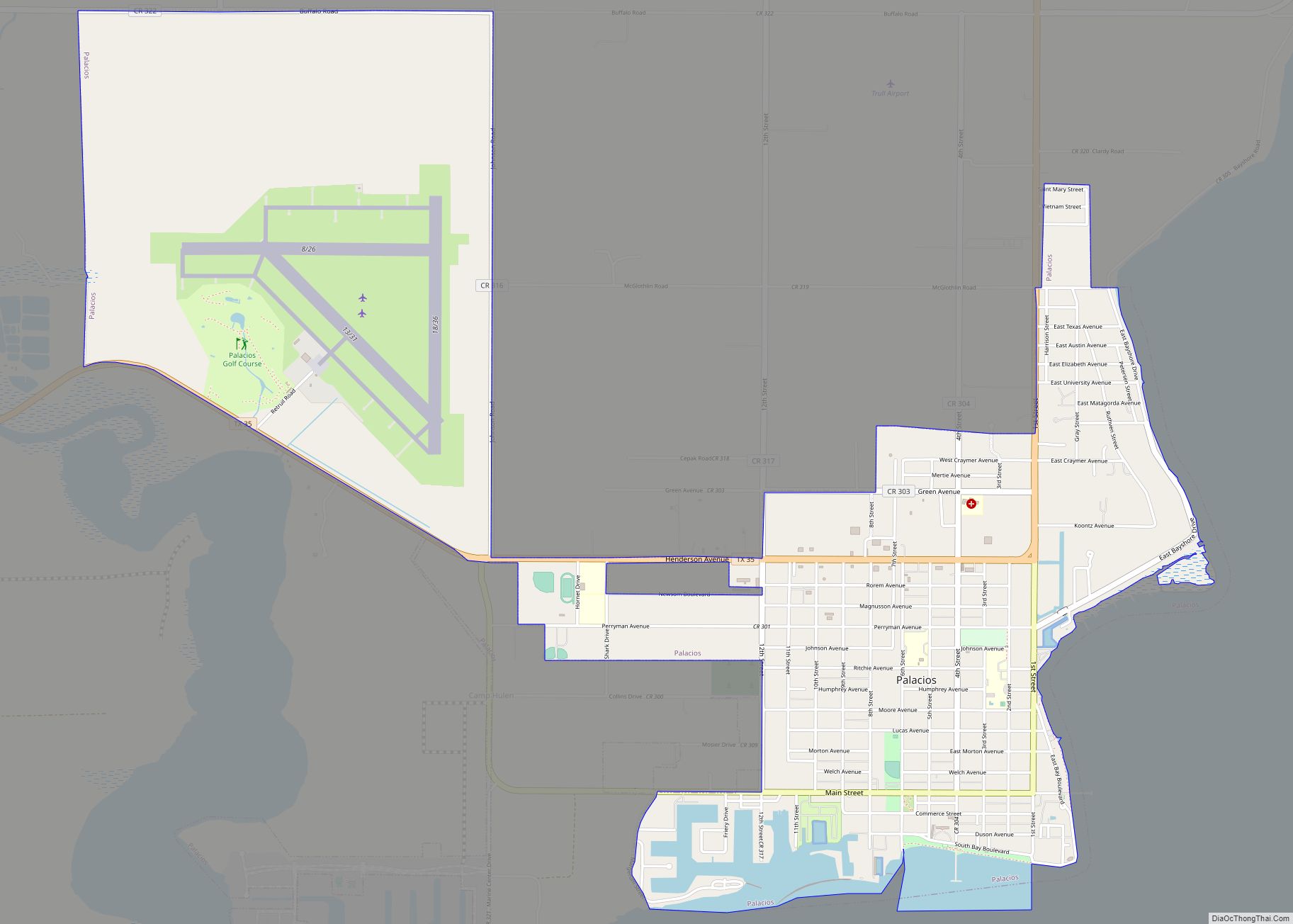
Online Interactive Map
Click on ![]() to view map in "full screen" mode.
to view map in "full screen" mode.
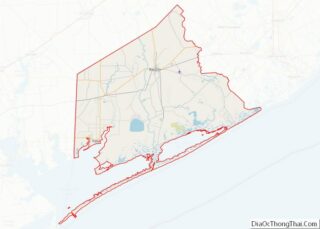
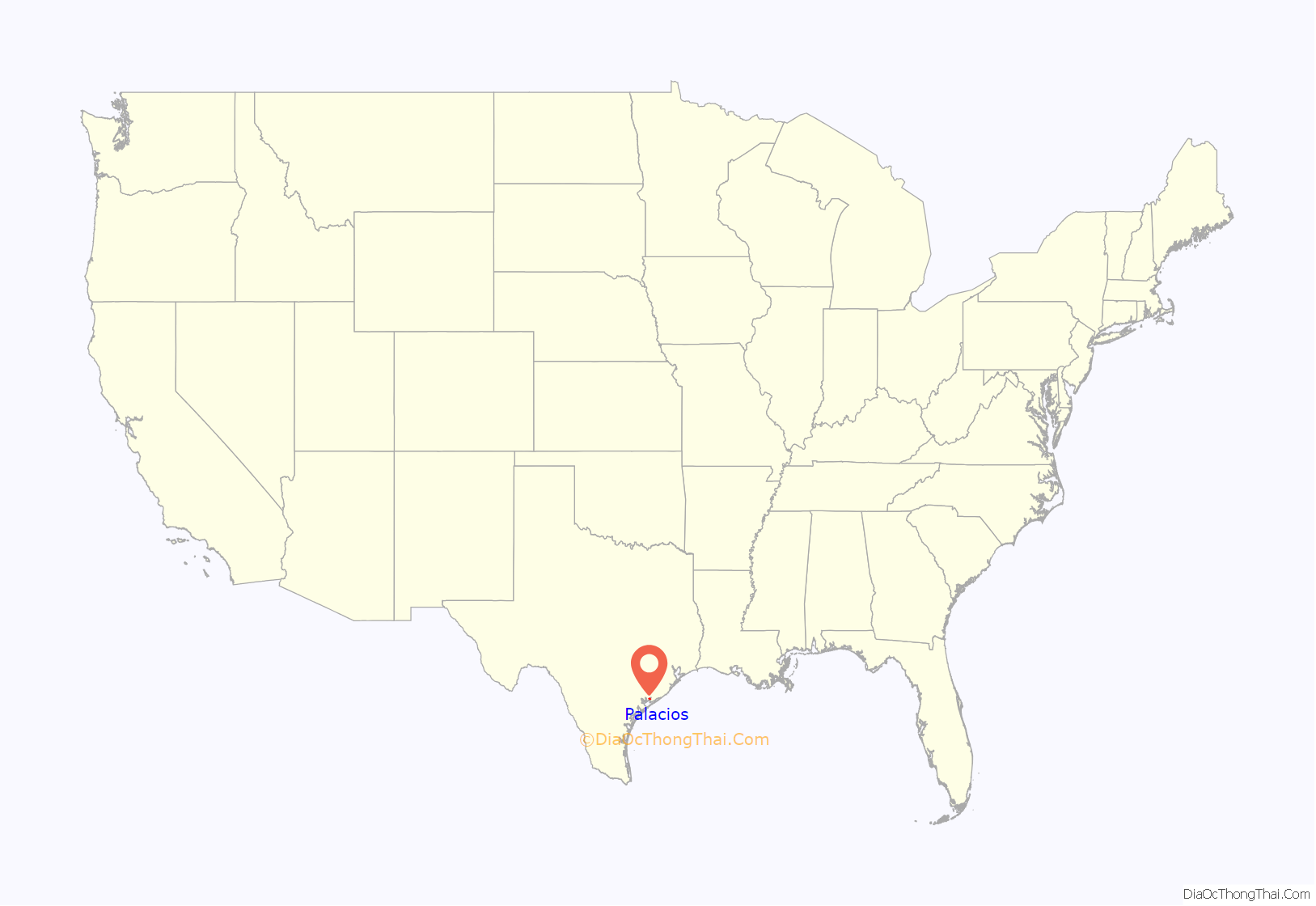
Palacios location map. Where is Palacios city?

History
The native inhabitants of the region were the Karankawa people, whose initial contact with Europeans came in the 16th century when Spanish expeditions first traversed their territory. In 1685, the area was explored by René-Robert Cavelier, Sieur de La Salle, the leader of an ill-fated French settlement attempt whose flagship La Belle was wrecked in the bay the following year. In the 1820s, English-speaking settlers arrived and came into frequent conflict with the Karankawa, who were eventually driven out of the area.
Popular local legend states that the area was named Tres Palacios (“Three Palaces”) several centuries ago by shipwrecked Spanish sailors who claimed they saw a vision of three palaces on the bay. Historians believe it was more likely named for José Félix Trespalacios, an early Mexican governor of Texas. The town was originally called Trespalacios, but shortened its name due to a nearby post office already using the longer version.
The future site of Palacios was ranch land until 1901, when it was put up for sale by the estate of the former owner, Abel “Shanghai” Pierce. The land was purchased by a development company, surveyed into lots, and with the arrival of the Southern Pacific Railroad and the establishment of the Texas Baptist Encampment, it rapidly grew into a seaside resort town. It was first settled as a community in 1903. City government was established in 1909, and by 1915, Palacios was home to more than 100 businesses, with a post office, library, weekly newspaper, numerous hotels, and churches, as well as a large entertainment pavilion built on a pier in the bay.
In 1926, Camp Hulen (originally “Camp Palacios”) was opened as a training center for the 36th Infantry of the Texas National Guard. The camp was leased by the War Department during World War II, when it was developed into a major antiaircraft training facility with a peak troop capacity of 14,560, and also served as a detention center for German prisoners of war. The population of Palacios boomed during this period, and the city hosted visiting stars such as Rita Hayworth and Glenn Miller.
After the war, Camp Hulen was closed and the local population declined. The town was hit by Hurricane Carla in 1961, causing major damage. Since then, the population has grown again, with the settlement of Vietnamese immigrants and other newcomers from all over the United States. In 1973, acknowledging the rash of UFO sightings in the area and the state, then Mayor W.C. “Bill” Jackson declared October 24 Palacios’ “First Annual UFO Fly-In Day” and called on President Richard Nixon to declare the community the “Interplanetary Capital of the Universe.” In 1991, a pavilion was rebuilt on the waterfront, and in 1995 the La Belle shipwreck was rediscovered at the bottom of the bay, becoming the focus of a major archeological excavation. In 2009, the city marked its centennial with celebrations and other events.
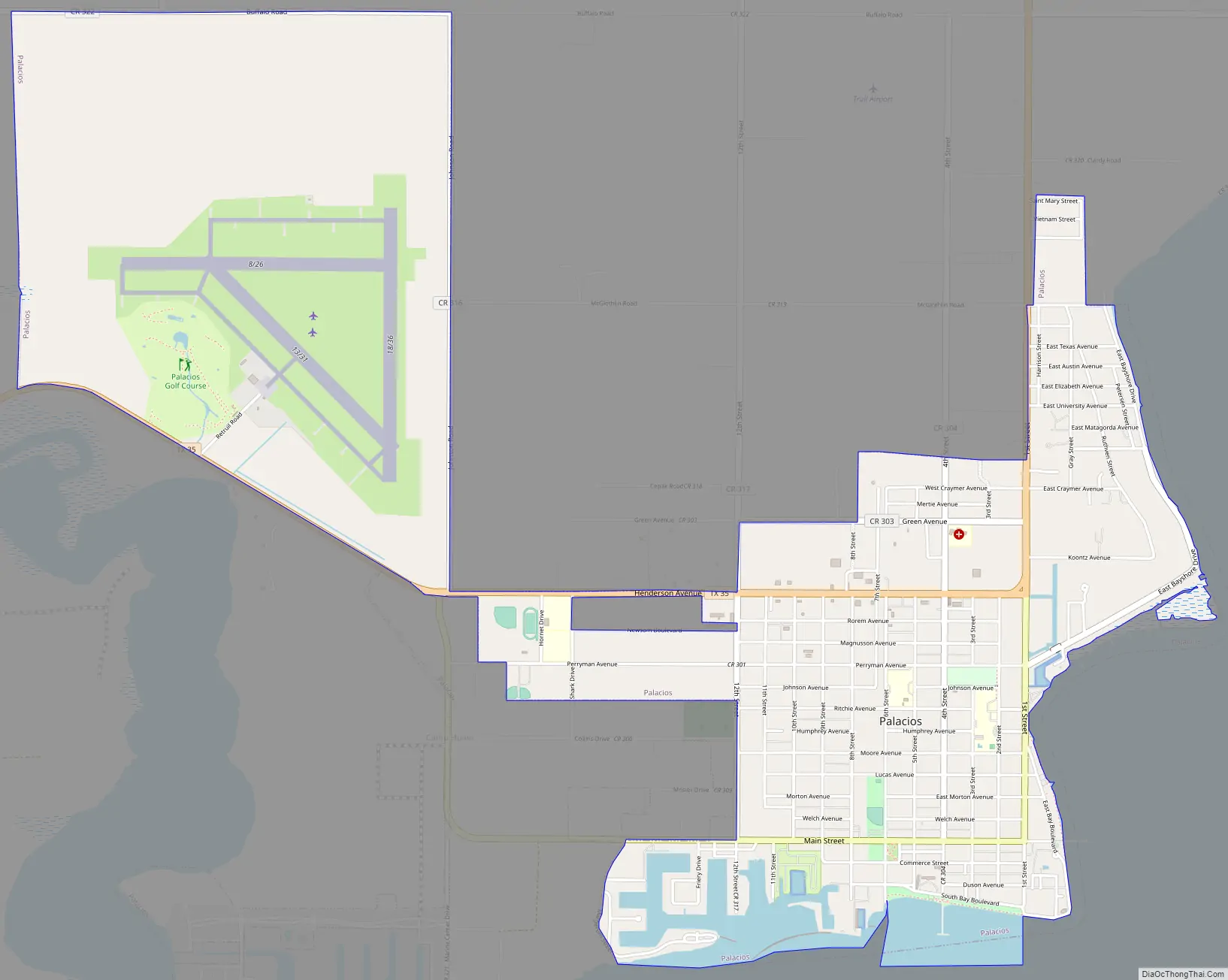
Palacios Road Map
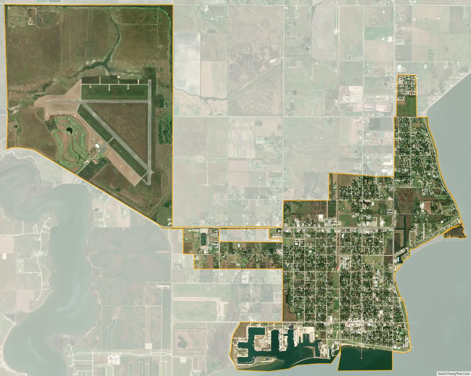
Palacios city Satellite Map
Geography
Palacios is located on the Gulf Coast about halfway between Houston and Corpus Christi. It is connected to both cities by State Highway 35.
According to the United States Census Bureau, the city has a total area of 5.3 square miles (14 km), of which, 5.0 square miles (13 km) of it is land and 0.2 square miles (0.52 km) of it (4.36%) is covered by water. It is located on the shores of Tres Palacios Bay, an arm of Matagorda Bay.
The Palacios area is known among birders for its wide diversity of bird life. Since 1997, as part of the 15-mile-diameter Matagorda County-Mad Island Marsh count circle of the National Audubon Society Christmas Bird Count, it has consistently reported more bird species than anywhere else in the United States. On December 19, 2005, a record 250 species were observed.
Climate
Palacios experiences a humid subtropical climate. Average daytime high temperatures range from 62 °F (17 °C) in January to 90 °F (32 °C) in August. Average nighttime lows range from 44 °F (7 °C) in winter to 77 °F (25 °C) in summer.
See also
Map of Texas State and its subdivision:- Anderson
- Andrews
- Angelina
- Aransas
- Archer
- Armstrong
- Atascosa
- Austin
- Bailey
- Bandera
- Bastrop
- Baylor
- Bee
- Bell
- Bexar
- Blanco
- Borden
- Bosque
- Bowie
- Brazoria
- Brazos
- Brewster
- Briscoe
- Brooks
- Brown
- Burleson
- Burnet
- Caldwell
- Calhoun
- Callahan
- Cameron
- Camp
- Carson
- Cass
- Castro
- Chambers
- Cherokee
- Childress
- Clay
- Cochran
- Coke
- Coleman
- Collin
- Collingsworth
- Colorado
- Comal
- Comanche
- Concho
- Cooke
- Coryell
- Cottle
- Crane
- Crockett
- Crosby
- Culberson
- Dallam
- Dallas
- Dawson
- Deaf Smith
- Delta
- Denton
- Dewitt
- Dickens
- Dimmit
- Donley
- Duval
- Eastland
- Ector
- Edwards
- El Paso
- Ellis
- Erath
- Falls
- Fannin
- Fayette
- Fisher
- Floyd
- Foard
- Fort Bend
- Franklin
- Freestone
- Frio
- Gaines
- Galveston
- Garza
- Gillespie
- Glasscock
- Goliad
- Gonzales
- Gray
- Grayson
- Gregg
- Grimes
- Guadalupe
- Hale
- Hall
- Hamilton
- Hansford
- Hardeman
- Hardin
- Harris
- Harrison
- Hartley
- Haskell
- Hays
- Hemphill
- Henderson
- Hidalgo
- Hill
- Hockley
- Hood
- Hopkins
- Houston
- Howard
- Hudspeth
- Hunt
- Hutchinson
- Irion
- Jack
- Jackson
- Jasper
- Jeff Davis
- Jefferson
- Jim Hogg
- Jim Wells
- Johnson
- Jones
- Karnes
- Kaufman
- Kendall
- Kenedy
- Kent
- Kerr
- Kimble
- King
- Kinney
- Kleberg
- Knox
- La Salle
- Lamar
- Lamb
- Lampasas
- Lavaca
- Lee
- Leon
- Liberty
- Limestone
- Lipscomb
- Live Oak
- Llano
- Loving
- Lubbock
- Lynn
- Madison
- Marion
- Martin
- Mason
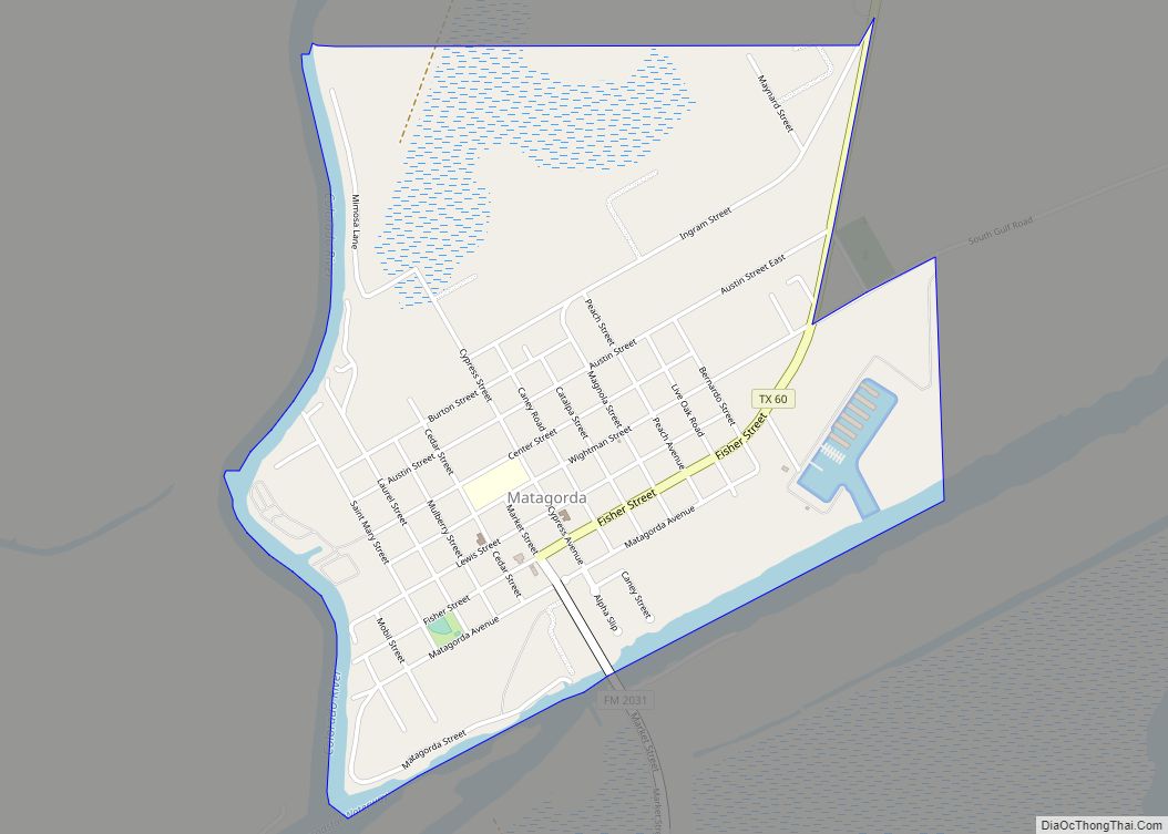
- Matagorda
- Maverick
- McCulloch
- McLennan
- McMullen
- Medina
- Menard
- Midland
- Milam
- Mills
- Mitchell
- Montague
- Montgomery
- Moore
- Morris
- Motley
- Nacogdoches
- Navarro
- Newton
- Nolan
- Nueces
- Ochiltree
- Oldham
- Orange
- Palo Pinto
- Panola
- Parker
- Parmer
- Pecos
- Polk
- Potter
- Presidio
- Rains
- Randall
- Reagan
- Real
- Red River
- Reeves
- Refugio
- Roberts
- Robertson
- Rockwall
- Runnels
- Rusk
- Sabine
- San Augustine
- San Jacinto
- San Patricio
- San Saba
- Schleicher
- Scurry
- Shackelford
- Shelby
- Sherman
- Smith
- Somervell
- Starr
- Stephens
- Sterling
- Stonewall
- Sutton
- Swisher
- Tarrant
- Taylor
- Terrell
- Terry
- Throckmorton
- Titus
- Tom Green
- Travis
- Trinity
- Tyler
- Upshur
- Upton
- Uvalde
- Val Verde
- Van Zandt
- Victoria
- Walker
- Waller
- Ward
- Washington
- Webb
- Wharton
- Wheeler
- Wichita
- Wilbarger
- Willacy
- Williamson
- Wilson
- Winkler
- Wise
- Wood
- Yoakum
- Young
- Zapata
- Zavala
- Alabama
- Alaska
- Arizona
- Arkansas
- California
- Colorado
- Connecticut
- Delaware
- District of Columbia
- Florida
- Georgia
- Hawaii
- Idaho
- Illinois
- Indiana
- Iowa
- Kansas
- Kentucky
- Louisiana
- Maine
- Maryland
- Massachusetts
- Michigan
- Minnesota
- Mississippi
- Missouri
- Montana
- Nebraska
- Nevada
- New Hampshire
- New Jersey
- New Mexico
- New York
- North Carolina
- North Dakota
- Ohio
- Oklahoma
- Oregon
- Pennsylvania
- Rhode Island
- South Carolina
- South Dakota
- Tennessee
- Texas
- Utah
- Vermont
- Virginia
- Washington
- West Virginia
- Wisconsin
- Wyoming