Pecan Gap is a city in Delta and Fannin counties within the U.S. state of Texas. It is sometimes informally referred to as “The Gap” by area residents. The population was 178 at the time of the 2020 census. It is named for the gap between two pecan trees, but unfortunately one of the two pecan trees was destroyed by a tornado in 1963.
| Name: | Pecan Gap city |
|---|---|
| LSAD Code: | 25 |
| LSAD Description: | city (suffix) |
| State: | Texas |
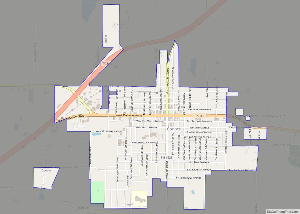
| County: | Delta County, Fannin County |
| Elevation: | 571 ft (174 m) |
| Total Area: | 0.63 sq mi (1.64 km²) |
| Land Area: | 0.63 sq mi (1.62 km²) |
| Water Area: | 0.01 sq mi (0.02 km²) |
| Total Population: | 178 |
| Population Density: | 314.19/sq mi (121.31/km²) |
| ZIP code: | 75469 |
| Area code: | 903 |
| FIPS code: | 4856468 |
| GNISfeature ID: | 1364973 |
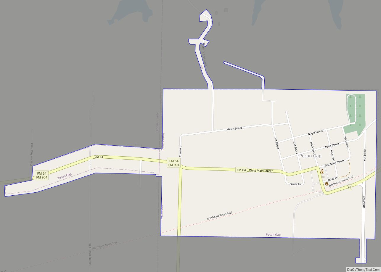
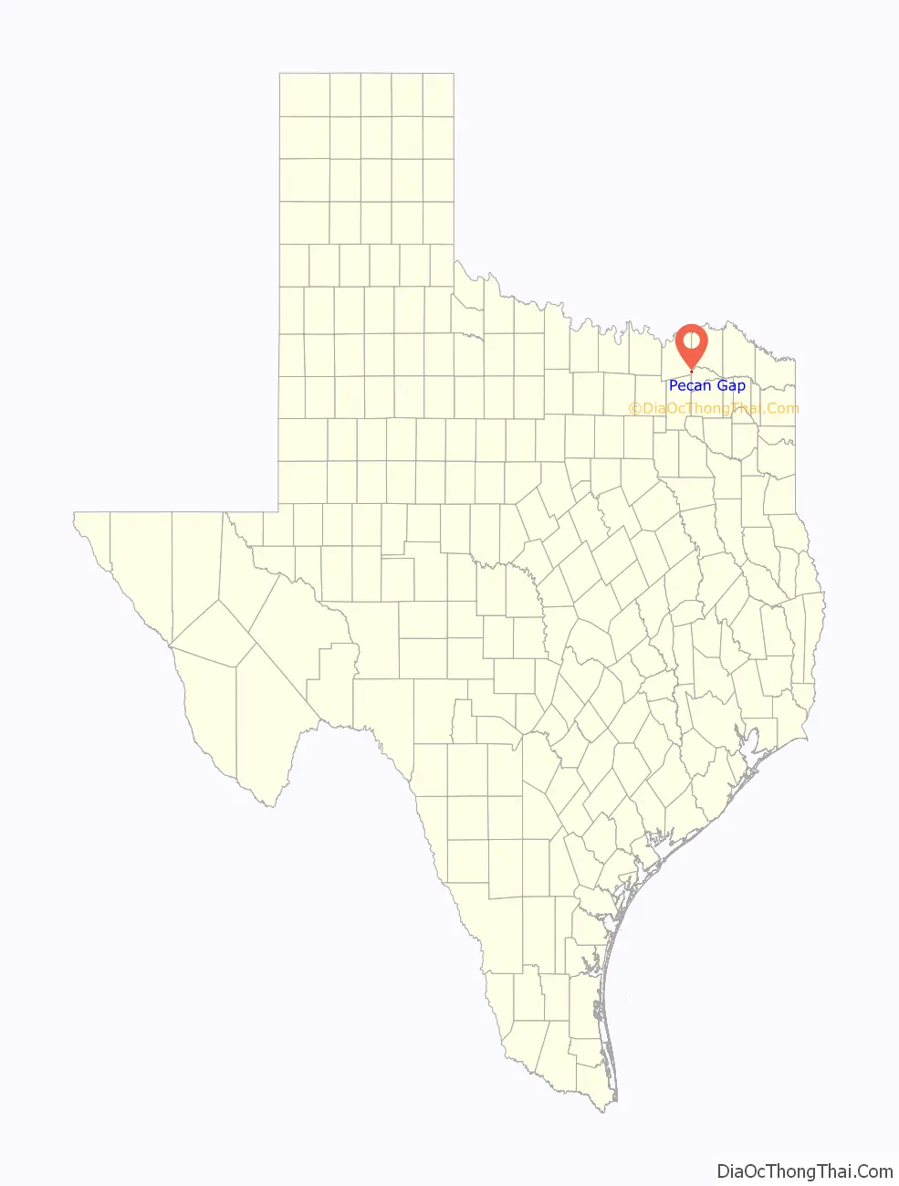
Online Interactive Map
Click on ![]() to view map in "full screen" mode.
to view map in "full screen" mode.
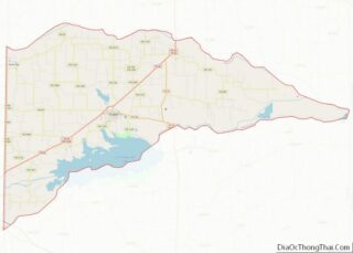
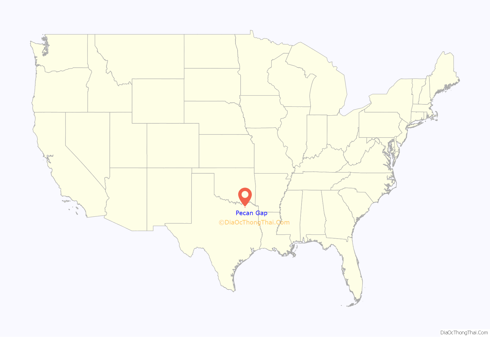
Pecan Gap location map. Where is Pecan Gap city?
History
The first inhabitants of the area that is now Pecan Gap were the Caddo people, who settled large portions of eastern Texas as early as 800 CE. The Caddo were highly advanced, living in large wooden structures, and were skilled farmers. The first European to visit the area was French explorer François Hervey, around 1750. A few decades afterwards, European disease and attacks from neighboring tribes as well as attacks from European settlers forced the Caddo out of the area around Pecan Gap. Around 1820, Delaware, Quapaw, and Seminole tribes began settling in the area. In 1836, the Republic of Texas officially recognized the region around Pecan Gap as part of Red River County. In 1840, Lamar County was formed, which absorbed much of the area just south of Pecan Gap. However, just six years later, the region was designated as part of the newly formed Hopkins County. In 1870 Delta County was created. As Pecan Gap grew it expanded west into Fannin County.
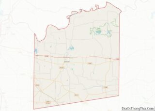
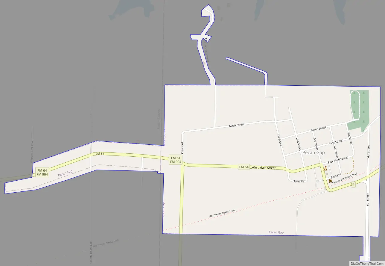
Pecan Gap Road Map
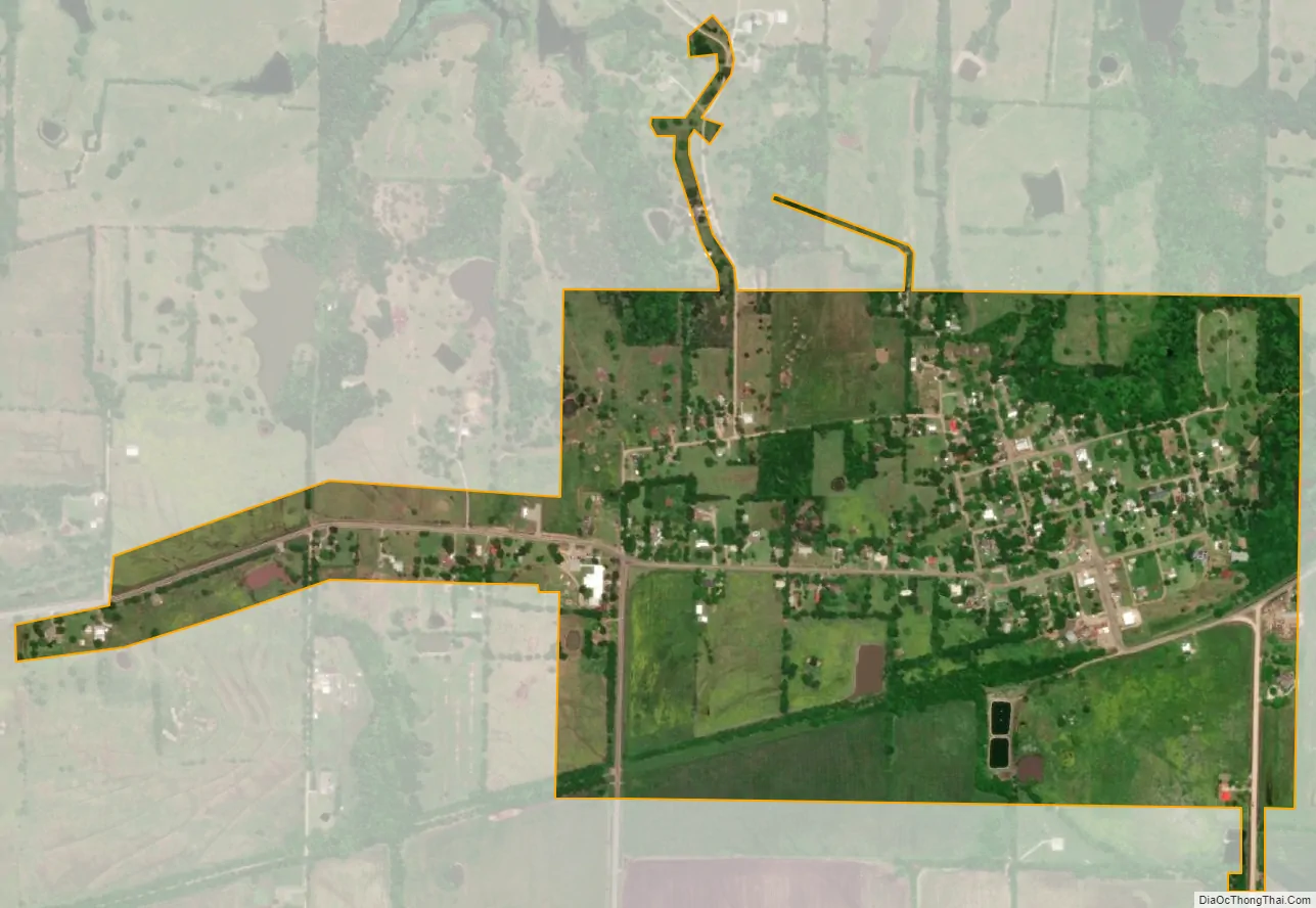
Pecan Gap city Satellite Map
Geography
Pecan Gap is one of just two incorporated communities in Delta County. The city is the second largest in the county, population-wise, behind Cooper. According to statistics from the Census Bureau, the city covers a total area of 0.63 square miles (1.64 km), of which 0.01 square miles (0.02 km), or 1.13%, is water.
Pecan Gap, as well as most of Delta County, is located in the Texas blackland prairies region, a flat, tallgrass prairie ecosystem that covers a large portion of north-central Texas. The region’s elevation rarely varies from around 400 to 500 feet (120 to 150 m). The area’s geology consists mainly of deep clay, or clay mixed with a dark-colored loam. However, the county is also known to have high-quality topsoil, ideal for crop growing. A specific layer of the soil in the region is known as Pecan Gap Chalk, named for the city when it was discovered nearby in 1918. The layer is a blue-gray, sandy chalk substance, which is fossil-rich and is located in much of the Pecan Gap vicinity.
Under the Köppen climate classification, Pecan Gap is located in zone Cfa, which experiences warm, wet summers and a humid subtropical climate. Temperatures in Pecan Gap are generally high, with the average in January being 42 °F (6 °C) and in July being 82 °F (28 °C). The highest recorded temperature for Pecan Gap was 115 °F (46 °C) in July 1936, while the lowest recorded temperature was −5 °F (−21 °C) in January 1930. On average, the hottest month of the year is August, when temperatures stay around an average of 82 °F (28 °C). January is generally the coolest month, when the average temperature is around 42 °F (6 °C). The community receives low precipitation, with the average monthly high being around 5.5 inches (140 mm) in May and June. August is the driest month for the city, when it receives an average of just 2 inches (51 mm) of rain.
See also
Map of Texas State and its subdivision:- Anderson
- Andrews
- Angelina
- Aransas
- Archer
- Armstrong
- Atascosa
- Austin
- Bailey
- Bandera
- Bastrop
- Baylor
- Bee
- Bell
- Bexar
- Blanco
- Borden
- Bosque
- Bowie
- Brazoria
- Brazos
- Brewster
- Briscoe
- Brooks
- Brown
- Burleson
- Burnet
- Caldwell
- Calhoun
- Callahan
- Cameron
- Camp
- Carson
- Cass
- Castro
- Chambers
- Cherokee
- Childress
- Clay
- Cochran
- Coke
- Coleman
- Collin
- Collingsworth
- Colorado
- Comal
- Comanche
- Concho
- Cooke
- Coryell
- Cottle
- Crane
- Crockett
- Crosby
- Culberson
- Dallam
- Dallas
- Dawson
- Deaf Smith
- Delta
- Denton
- Dewitt
- Dickens
- Dimmit
- Donley
- Duval
- Eastland
- Ector
- Edwards
- El Paso
- Ellis
- Erath
- Falls
- Fannin
- Fayette
- Fisher
- Floyd
- Foard
- Fort Bend
- Franklin
- Freestone
- Frio
- Gaines
- Galveston
- Garza
- Gillespie
- Glasscock
- Goliad
- Gonzales
- Gray
- Grayson
- Gregg
- Grimes
- Guadalupe
- Hale
- Hall
- Hamilton
- Hansford
- Hardeman
- Hardin
- Harris
- Harrison
- Hartley
- Haskell
- Hays
- Hemphill
- Henderson
- Hidalgo
- Hill
- Hockley
- Hood
- Hopkins
- Houston
- Howard
- Hudspeth
- Hunt
- Hutchinson
- Irion
- Jack
- Jackson
- Jasper
- Jeff Davis
- Jefferson
- Jim Hogg
- Jim Wells
- Johnson
- Jones
- Karnes
- Kaufman
- Kendall
- Kenedy
- Kent
- Kerr
- Kimble
- King
- Kinney
- Kleberg
- Knox
- La Salle
- Lamar
- Lamb
- Lampasas
- Lavaca
- Lee
- Leon
- Liberty
- Limestone
- Lipscomb
- Live Oak
- Llano
- Loving
- Lubbock
- Lynn
- Madison
- Marion
- Martin
- Mason
- Matagorda
- Maverick
- McCulloch
- McLennan
- McMullen
- Medina
- Menard
- Midland
- Milam
- Mills
- Mitchell
- Montague
- Montgomery
- Moore
- Morris
- Motley
- Nacogdoches
- Navarro
- Newton
- Nolan
- Nueces
- Ochiltree
- Oldham
- Orange
- Palo Pinto
- Panola
- Parker
- Parmer
- Pecos
- Polk
- Potter
- Presidio
- Rains
- Randall
- Reagan
- Real
- Red River
- Reeves
- Refugio
- Roberts
- Robertson
- Rockwall
- Runnels
- Rusk
- Sabine
- San Augustine
- San Jacinto
- San Patricio
- San Saba
- Schleicher
- Scurry
- Shackelford
- Shelby
- Sherman
- Smith
- Somervell
- Starr
- Stephens
- Sterling
- Stonewall
- Sutton
- Swisher
- Tarrant
- Taylor
- Terrell
- Terry
- Throckmorton
- Titus
- Tom Green
- Travis
- Trinity
- Tyler
- Upshur
- Upton
- Uvalde
- Val Verde
- Van Zandt
- Victoria
- Walker
- Waller
- Ward
- Washington
- Webb
- Wharton
- Wheeler
- Wichita
- Wilbarger
- Willacy
- Williamson
- Wilson
- Winkler
- Wise
- Wood
- Yoakum
- Young
- Zapata
- Zavala
- Alabama
- Alaska
- Arizona
- Arkansas
- California
- Colorado
- Connecticut
- Delaware
- District of Columbia
- Florida
- Georgia
- Hawaii
- Idaho
- Illinois
- Indiana
- Iowa
- Kansas
- Kentucky
- Louisiana
- Maine
- Maryland
- Massachusetts
- Michigan
- Minnesota
- Mississippi
- Missouri
- Montana
- Nebraska
- Nevada
- New Hampshire
- New Jersey
- New Mexico
- New York
- North Carolina
- North Dakota
- Ohio
- Oklahoma
- Oregon
- Pennsylvania
- Rhode Island
- South Carolina
- South Dakota
- Tennessee
- Texas
- Utah
- Vermont
- Virginia
- Washington
- West Virginia
- Wisconsin
- Wyoming