Port Neches is a city in Jefferson County, Texas, United States. The population was 13,692 at the 2020 census, up from 13,040 at the 2010 census. It is part of the Beaumont–Port Arthur metropolitan area.
| Name: | Port Neches city |
|---|---|
| LSAD Code: | 25 |
| LSAD Description: | city (suffix) |
| State: | Texas |
| County: | Jefferson County |
| Elevation: | 16 ft (5 m) |
| Total Area: | 9.12 sq mi (23.62 km²) |
| Land Area: | 8.65 sq mi (22.41 km²) |
| Water Area: | 0.47 sq mi (1.21 km²) |
| Total Population: | 13,692 |
| Population Density: | 1,462.50/sq mi (564.68/km²) |
| ZIP code: | 77651 |
| Area code: | 409 |
| FIPS code: | 4858940 |
| GNISfeature ID: | 1375534 |
| Website: | ci.port-neches.tx.us |
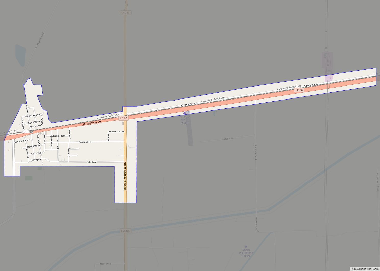
Online Interactive Map
Click on ![]() to view map in "full screen" mode.
to view map in "full screen" mode.
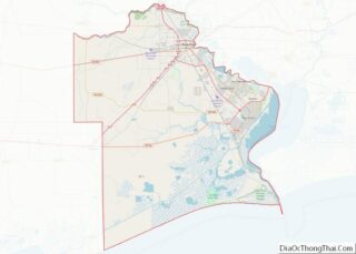
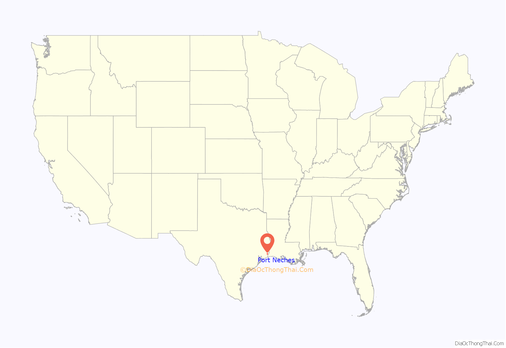
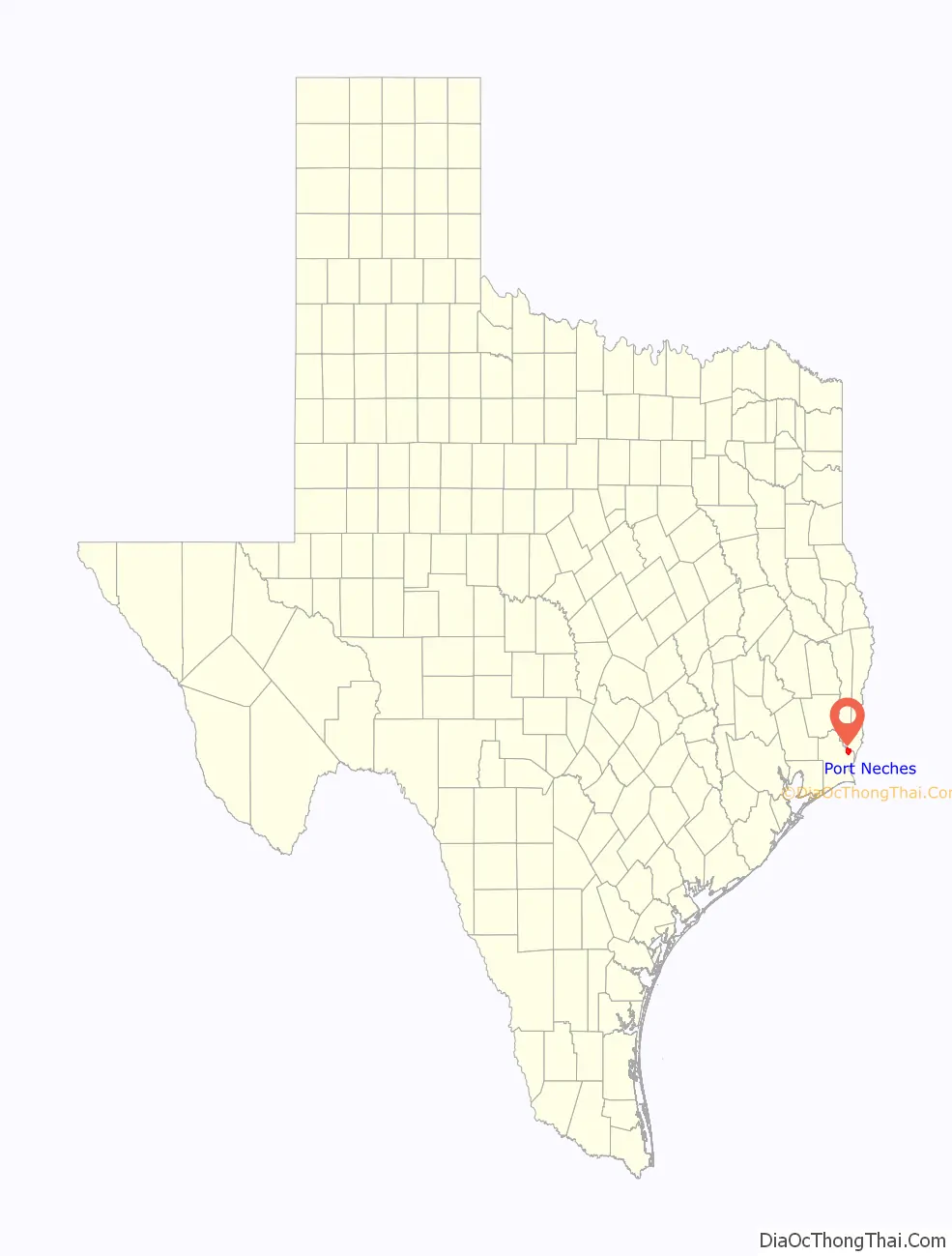
Port Neches location map. Where is Port Neches city?
History
The area known as Port Neches was once inhabited by tribes of the coastal-dwelling Karankawa and Atakapa Native Americans. Smith’s Bluff (the future site of Sun Oil and Union Oil of California riverside property) and Grigsby’s Bluff (now Port Neches) were the only two high land bluffs on the Neches River south of Beaumont, whose name is believed to have been derived from the Caddo word “Nachawi”, meaning “wood of the bow”, after Spanish settlers called it Río Neches. Before 1780, Grigsby’s Bluff, specifically that part of Port Neches immediately east of Port Neches Park, had been a Native American town for at least 1,500 years, at first of the Karankawa tribe, whose 7-foot (210 cm) skeletons were often found in the burial mounds there; and after 1650 of the Nacazils, a sub-tribe of the Attakapas, who were a short and stocky people before their extinction about 1780. As of 1841, there were six large burial mounds at Grigsby’s Bluff, size about 60 feet (18 m) wide, 20 feet (6.1 m) tall, and 100 yards (91 m) long, consisting entirely of clam and sea shells, skeletons, pottery shards, and other Native American artifacts. Between 1841 and 1901, all six of the mounds disappeared, a result of human actions. Grigsby’s Bluff became a post office in 1859 (there was also a store and sawmill there), but the office was discontinued in 1893.
Port Neches was the site of Fort Grigsby, a set of Civil War-era defenses intended to stop a Union advance up the Neches River. The fort was constructed in October 1862 and abandoned sometime after July 1863. Its guns, munitions, and stores were moved to the then-unfinished Fort Griffin, the site of the Second Battle of Sabine Pass, often credited as the most one-sided Confederate victory of the American Civil War.
A pioneer of Port Neches was Will Block Sr., born on August 2, 1870. In 2003, his son, W. T. Block Jr., was appointed a Knight of the Royal Order of Orange-Nassau for his work in reconstructing the history of Dutch settlers in the area.
The city of Port Neches was incorporated in 1902.
The greater Neches River Basin is an attraction for fishing, hunting, birding, and boating.
TPC Group’s Port Arthur Refinery, a chemical processing facility, was opened in 1944 by Neches Butane Products Co. On November 27, 2019, two explosions occurred at the plant injuring at least eight people, three of them plant workers who were treated in hospital. Several buildings, including homes, were damaged in Port Neches and the surrounding area. The blasts started a chemical fire that prompted a mandatory evacuation of approximately 60,000 residents from several nearby cities. The fire was finally put out on December 3 after burning for six days. The next day air monitors posted elevated levels of butadiene, prompting a second evacuation. The explosions occurred just days after the U.S. United States Environmental Protection Agency eased chemical plant safety regulations.
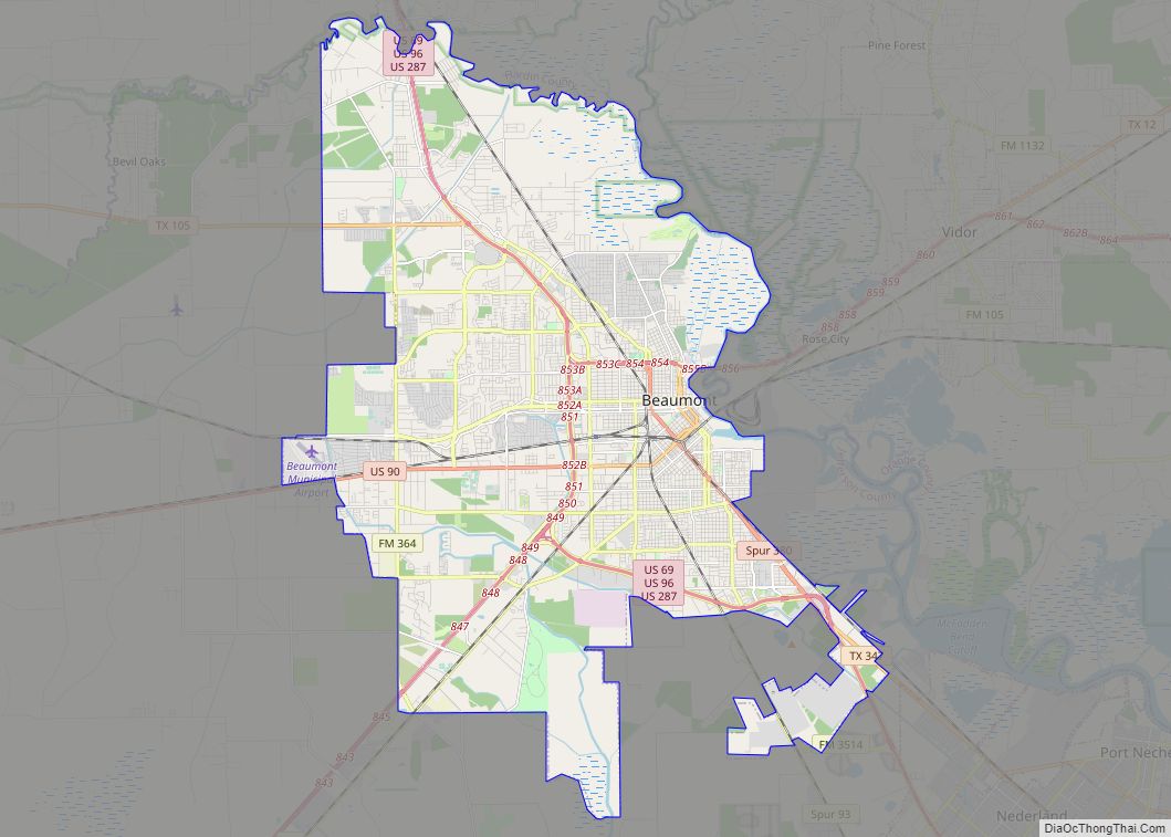
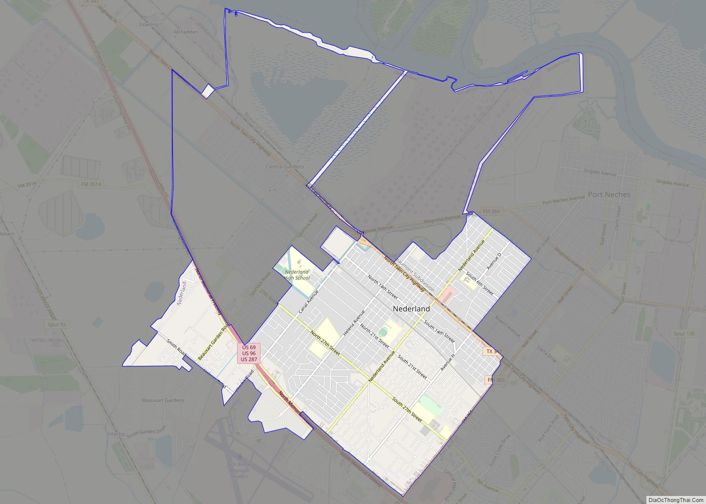
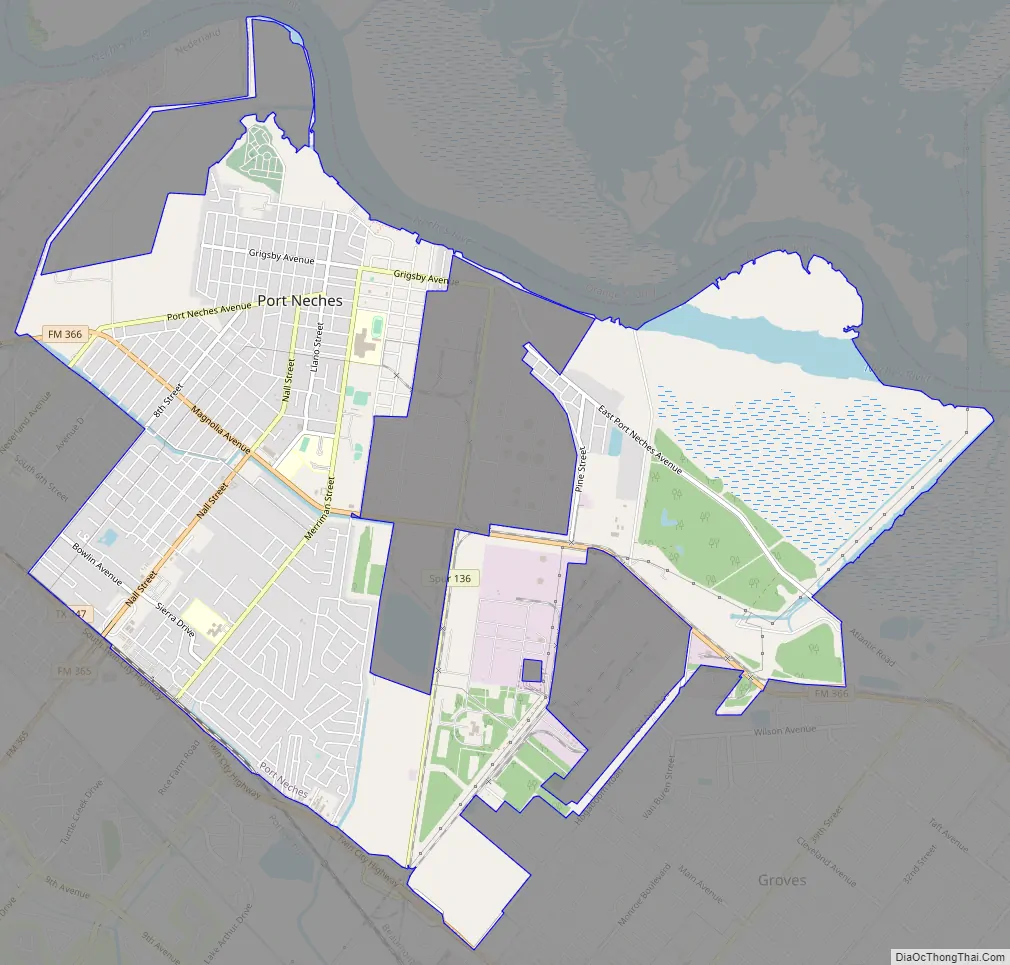
Port Neches Road Map
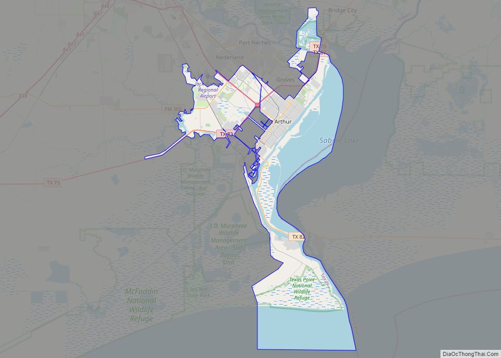
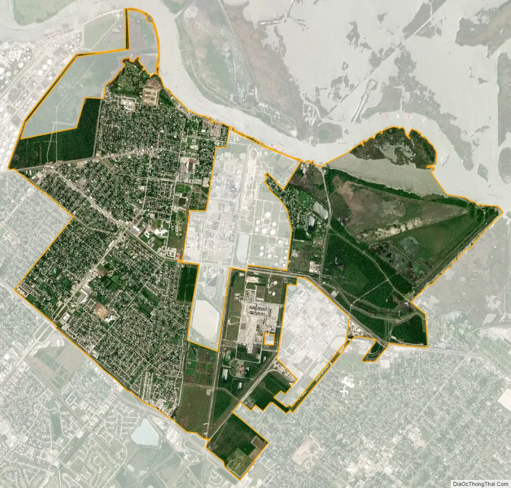
Port Neches city Satellite Map
Geography
Port Neches is located 20 miles (32 km) inland from the Gulf of Mexico at 29°58′51″N 93°57′37″W / 29.98083°N 93.96028°W / 29.98083; -93.96028 (29.980863, –93.960382).
According to the United States Census Bureau, the city has a total area of 9.1 square miles (23.6 km), of which 8.6 square miles (22.4 km) are land and 0.50 square miles (1.3 km), or 5.39%, are water.
See also
Map of Texas State and its subdivision:- Anderson
- Andrews
- Angelina
- Aransas
- Archer
- Armstrong
- Atascosa
- Austin
- Bailey
- Bandera
- Bastrop
- Baylor
- Bee
- Bell
- Bexar
- Blanco
- Borden
- Bosque
- Bowie
- Brazoria
- Brazos
- Brewster
- Briscoe
- Brooks
- Brown
- Burleson
- Burnet
- Caldwell
- Calhoun
- Callahan
- Cameron
- Camp
- Carson
- Cass
- Castro
- Chambers
- Cherokee
- Childress
- Clay
- Cochran
- Coke
- Coleman
- Collin
- Collingsworth
- Colorado
- Comal
- Comanche
- Concho
- Cooke
- Coryell
- Cottle
- Crane
- Crockett
- Crosby
- Culberson
- Dallam
- Dallas
- Dawson
- Deaf Smith
- Delta
- Denton
- Dewitt
- Dickens
- Dimmit
- Donley
- Duval
- Eastland
- Ector
- Edwards
- El Paso
- Ellis
- Erath
- Falls
- Fannin
- Fayette
- Fisher
- Floyd
- Foard
- Fort Bend
- Franklin
- Freestone
- Frio
- Gaines
- Galveston
- Garza
- Gillespie
- Glasscock
- Goliad
- Gonzales
- Gray
- Grayson
- Gregg
- Grimes
- Guadalupe
- Hale
- Hall
- Hamilton
- Hansford
- Hardeman
- Hardin
- Harris
- Harrison
- Hartley
- Haskell
- Hays
- Hemphill
- Henderson
- Hidalgo
- Hill
- Hockley
- Hood
- Hopkins
- Houston
- Howard
- Hudspeth
- Hunt
- Hutchinson
- Irion
- Jack
- Jackson
- Jasper
- Jeff Davis
- Jefferson
- Jim Hogg
- Jim Wells
- Johnson
- Jones
- Karnes
- Kaufman
- Kendall
- Kenedy
- Kent
- Kerr
- Kimble
- King
- Kinney
- Kleberg
- Knox
- La Salle
- Lamar
- Lamb
- Lampasas
- Lavaca
- Lee
- Leon
- Liberty
- Limestone
- Lipscomb
- Live Oak
- Llano
- Loving
- Lubbock
- Lynn
- Madison
- Marion
- Martin
- Mason
- Matagorda
- Maverick
- McCulloch
- McLennan
- McMullen
- Medina
- Menard
- Midland
- Milam
- Mills
- Mitchell
- Montague
- Montgomery
- Moore
- Morris
- Motley
- Nacogdoches
- Navarro
- Newton
- Nolan
- Nueces
- Ochiltree
- Oldham
- Orange
- Palo Pinto
- Panola
- Parker
- Parmer
- Pecos
- Polk
- Potter
- Presidio
- Rains
- Randall
- Reagan
- Real
- Red River
- Reeves
- Refugio
- Roberts
- Robertson
- Rockwall
- Runnels
- Rusk
- Sabine
- San Augustine
- San Jacinto
- San Patricio
- San Saba
- Schleicher
- Scurry
- Shackelford
- Shelby
- Sherman
- Smith
- Somervell
- Starr
- Stephens
- Sterling
- Stonewall
- Sutton
- Swisher
- Tarrant
- Taylor
- Terrell
- Terry
- Throckmorton
- Titus
- Tom Green
- Travis
- Trinity
- Tyler
- Upshur
- Upton
- Uvalde
- Val Verde
- Van Zandt
- Victoria
- Walker
- Waller
- Ward
- Washington
- Webb
- Wharton
- Wheeler
- Wichita
- Wilbarger
- Willacy
- Williamson
- Wilson
- Winkler
- Wise
- Wood
- Yoakum
- Young
- Zapata
- Zavala
- Alabama
- Alaska
- Arizona
- Arkansas
- California
- Colorado
- Connecticut
- Delaware
- District of Columbia
- Florida
- Georgia
- Hawaii
- Idaho
- Illinois
- Indiana
- Iowa
- Kansas
- Kentucky
- Louisiana
- Maine
- Maryland
- Massachusetts
- Michigan
- Minnesota
- Mississippi
- Missouri
- Montana
- Nebraska
- Nevada
- New Hampshire
- New Jersey
- New Mexico
- New York
- North Carolina
- North Dakota
- Ohio
- Oklahoma
- Oregon
- Pennsylvania
- Rhode Island
- South Carolina
- South Dakota
- Tennessee
- Texas
- Utah
- Vermont
- Virginia
- Washington
- West Virginia
- Wisconsin
- Wyoming