Potosi is a census-designated place (CDP) in Taylor County, Texas, United States. Its population was 2,991 at the 2010 census. It is part of the Abilene, Texas metropolitan statistical area.
| Name: | Potosi CDP |
|---|---|
| LSAD Code: | 57 |
| LSAD Description: | CDP (suffix) |
| State: | Texas |
| County: | Taylor County |
| Elevation: | 1,821 ft (555 m) |
| Total Area: | 18.5 sq mi (47.8 km²) |
| Land Area: | 18.5 sq mi (47.8 km²) |
| Water Area: | 0.0 sq mi (0.0 km²) |
| Total Population: | 2,991 |
| Population Density: | 160/sq mi (63/km²) |
| ZIP code: | 79602 |
| Area code: | 325 |
| FIPS code: | 4859108 |
| GNISfeature ID: | 1344423 |
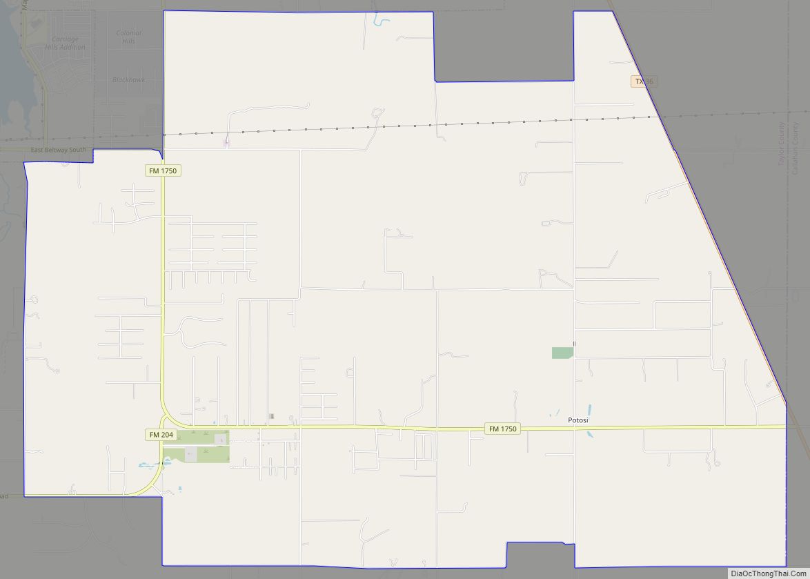
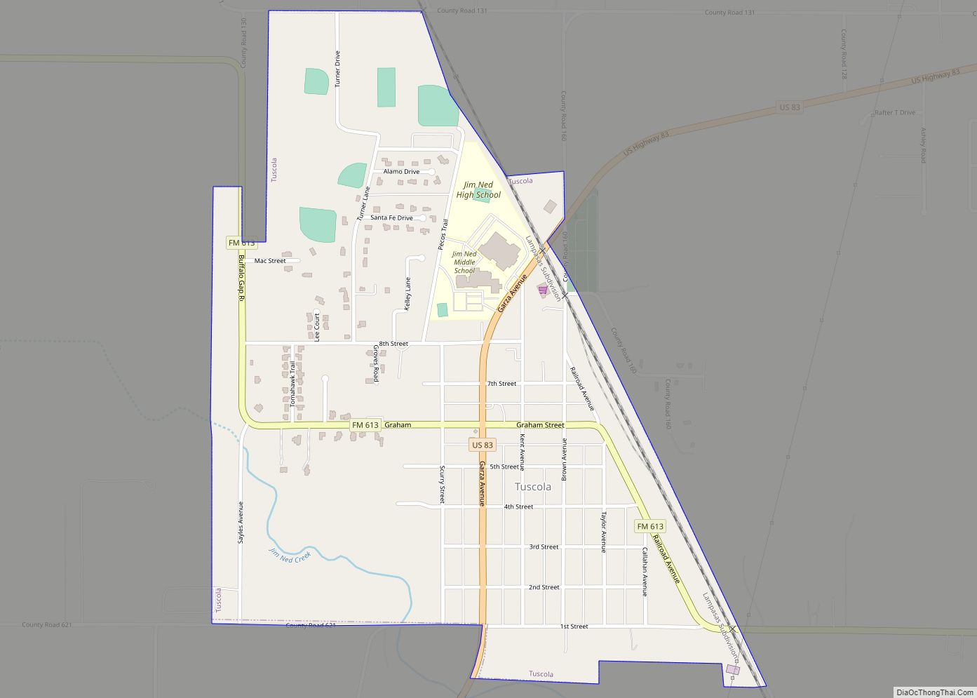
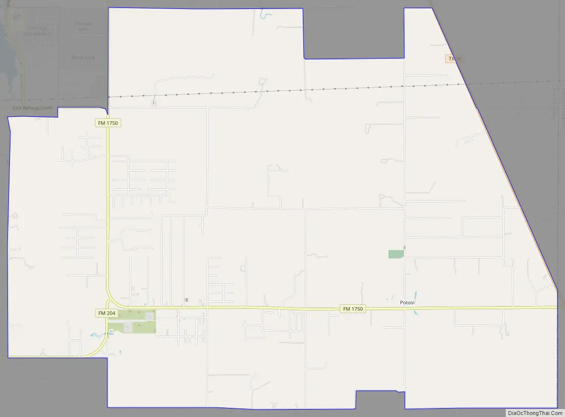
Online Interactive Map
Click on ![]() to view map in "full screen" mode.
to view map in "full screen" mode.
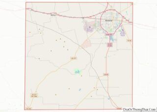
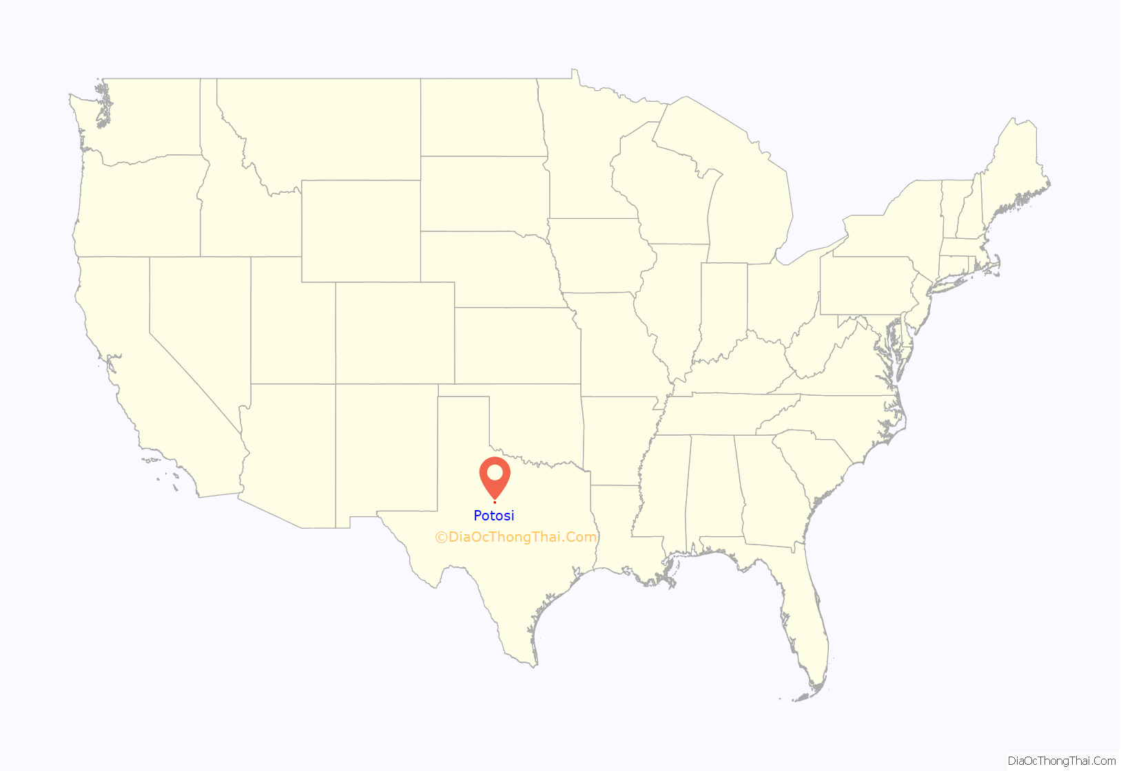
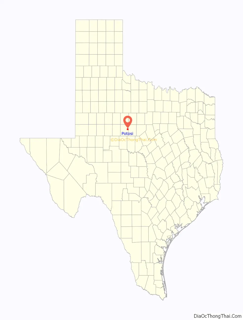
Potosi location map. Where is Potosi CDP?
History
The first settlers in the area were the Pollard family in the 1870s. In 1893, R.A. Pollard applied for a post office and chose the name Potosi after the Mexican city of San Luis Potosí. An estimated 100 inhabitants were living in the community in 1896. By 1940, 80 residents, a school, a church, four businesses, and a number of dwellings were there. In 1949, Potosi’s school consolidated with the Wylie Independent School District.
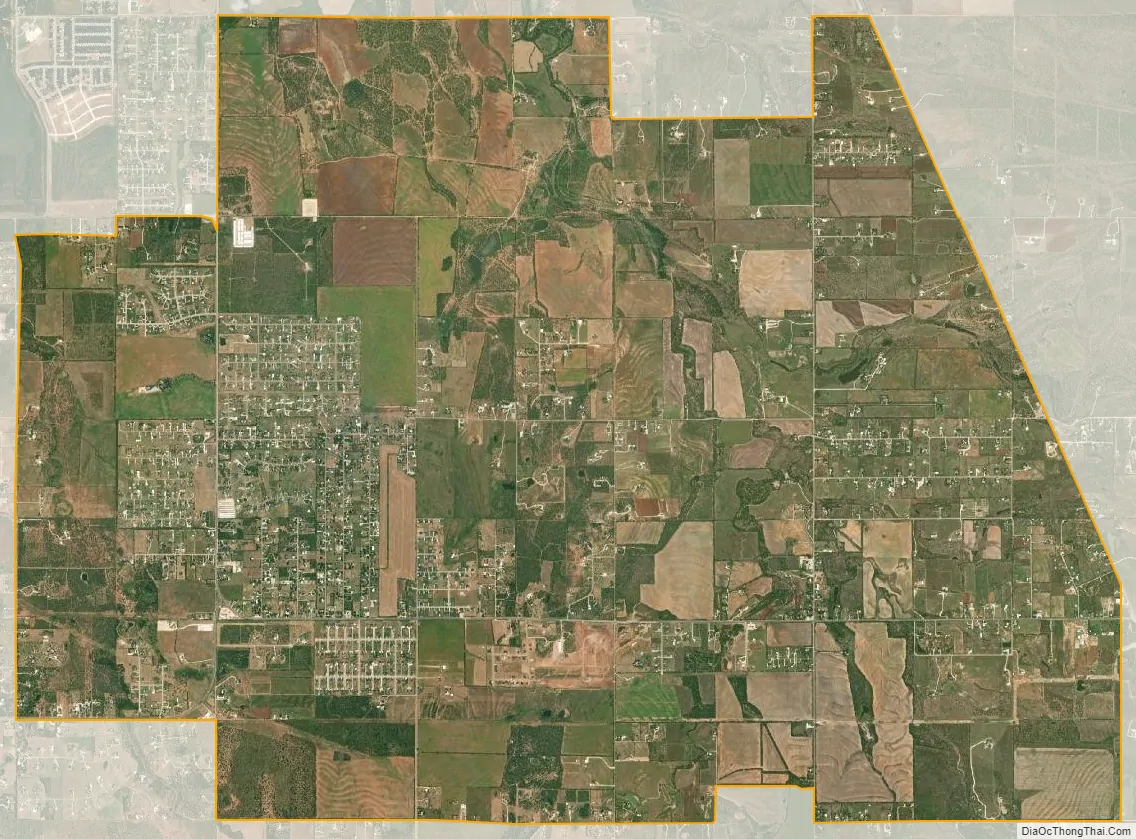
The population declined to 20 during the 1950s, and rose to 149 in 1968. Significant growth in the area, aided by its proximity to Abilene, began to occur in the late 1980s, and by 1992, 1,441 people were living in Potosi. That growth has continued to date, as new subdivisions are being constructed and expanded along FM 1750, the main route through Potosi. They include Deerwood, Pack Saddle Prairie, Blackhawk Estates, Pack Saddle Farms, Seven Winds, and Pack Saddle Meadows.
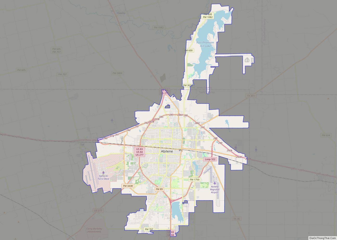
Potosi Road Map
Potosi city Satellite Map
Geography
Potosi is located at 32°20′8″N 99°39′57″W / 32.33556°N 99.66583°W / 32.33556; -99.66583 (32.335615, -99.665777). It is situated along FM 1750, about 9 miles south of Abilene in east-central Taylor County.
According to the United States Census Bureau, the CDP has a total area of 18.5 sq mi (47.8 km), all of it land.
Climate
According to the Köppen climate classification, Potosi has a humid subtropical climate, Cfa on climate maps, typically characterized by hot, humid summers and generally mild to cool winters. Potosi also borders the neighboring semiarid climate (Köppen BSh or BSk) of the west-central Texas region, which has characteristically long, hot summers and short, moderate winters.
See also
Map of Texas State and its subdivision:- Anderson
- Andrews
- Angelina
- Aransas
- Archer
- Armstrong
- Atascosa
- Austin
- Bailey
- Bandera
- Bastrop
- Baylor
- Bee
- Bell
- Bexar
- Blanco
- Borden
- Bosque
- Bowie
- Brazoria
- Brazos
- Brewster
- Briscoe
- Brooks
- Brown
- Burleson
- Burnet
- Caldwell
- Calhoun
- Callahan
- Cameron
- Camp
- Carson
- Cass
- Castro
- Chambers
- Cherokee
- Childress
- Clay
- Cochran
- Coke
- Coleman
- Collin
- Collingsworth
- Colorado
- Comal
- Comanche
- Concho
- Cooke
- Coryell
- Cottle
- Crane
- Crockett
- Crosby
- Culberson
- Dallam
- Dallas
- Dawson
- Deaf Smith
- Delta
- Denton
- Dewitt
- Dickens
- Dimmit
- Donley
- Duval
- Eastland
- Ector
- Edwards
- El Paso
- Ellis
- Erath
- Falls
- Fannin
- Fayette
- Fisher
- Floyd
- Foard
- Fort Bend
- Franklin
- Freestone
- Frio
- Gaines
- Galveston
- Garza
- Gillespie
- Glasscock
- Goliad
- Gonzales
- Gray
- Grayson
- Gregg
- Grimes
- Guadalupe
- Hale
- Hall
- Hamilton
- Hansford
- Hardeman
- Hardin
- Harris
- Harrison
- Hartley
- Haskell
- Hays
- Hemphill
- Henderson
- Hidalgo
- Hill
- Hockley
- Hood
- Hopkins
- Houston
- Howard
- Hudspeth
- Hunt
- Hutchinson
- Irion
- Jack
- Jackson
- Jasper
- Jeff Davis
- Jefferson
- Jim Hogg
- Jim Wells
- Johnson
- Jones
- Karnes
- Kaufman
- Kendall
- Kenedy
- Kent
- Kerr
- Kimble
- King
- Kinney
- Kleberg
- Knox
- La Salle
- Lamar
- Lamb
- Lampasas
- Lavaca
- Lee
- Leon
- Liberty
- Limestone
- Lipscomb
- Live Oak
- Llano
- Loving
- Lubbock
- Lynn
- Madison
- Marion
- Martin
- Mason
- Matagorda
- Maverick
- McCulloch
- McLennan
- McMullen
- Medina
- Menard
- Midland
- Milam
- Mills
- Mitchell
- Montague
- Montgomery
- Moore
- Morris
- Motley
- Nacogdoches
- Navarro
- Newton
- Nolan
- Nueces
- Ochiltree
- Oldham
- Orange
- Palo Pinto
- Panola
- Parker
- Parmer
- Pecos
- Polk
- Potter
- Presidio
- Rains
- Randall
- Reagan
- Real
- Red River
- Reeves
- Refugio
- Roberts
- Robertson
- Rockwall
- Runnels
- Rusk
- Sabine
- San Augustine
- San Jacinto
- San Patricio
- San Saba
- Schleicher
- Scurry
- Shackelford
- Shelby
- Sherman
- Smith
- Somervell
- Starr
- Stephens
- Sterling
- Stonewall
- Sutton
- Swisher
- Tarrant
- Taylor
- Terrell
- Terry
- Throckmorton
- Titus
- Tom Green
- Travis
- Trinity
- Tyler
- Upshur
- Upton
- Uvalde
- Val Verde
- Van Zandt
- Victoria
- Walker
- Waller
- Ward
- Washington
- Webb
- Wharton
- Wheeler
- Wichita
- Wilbarger
- Willacy
- Williamson
- Wilson
- Winkler
- Wise
- Wood
- Yoakum
- Young
- Zapata
- Zavala
- Alabama
- Alaska
- Arizona
- Arkansas
- California
- Colorado
- Connecticut
- Delaware
- District of Columbia
- Florida
- Georgia
- Hawaii
- Idaho
- Illinois
- Indiana
- Iowa
- Kansas
- Kentucky
- Louisiana
- Maine
- Maryland
- Massachusetts
- Michigan
- Minnesota
- Mississippi
- Missouri
- Montana
- Nebraska
- Nevada
- New Hampshire
- New Jersey
- New Mexico
- New York
- North Carolina
- North Dakota
- Ohio
- Oklahoma
- Oregon
- Pennsylvania
- Rhode Island
- South Carolina
- South Dakota
- Tennessee
- Texas
- Utah
- Vermont
- Virginia
- Washington
- West Virginia
- Wisconsin
- Wyoming