Rising Star is a town in Eastland County, Texas, United States. Its population as of the 2010 census was 835.
| Name: | Rising Star town |
|---|---|
| LSAD Code: | 43 |
| LSAD Description: | town (suffix) |
| State: | Texas |
| County: | Eastland County |
| Elevation: | 1,624 ft (495 m) |
| Total Area: | 1.73 sq mi (4.47 km²) |
| Land Area: | 1.73 sq mi (4.47 km²) |
| Water Area: | 0.00 sq mi (0.00 km²) |
| Total Population: | 835 |
| Population Density: | 475.39/sq mi (183.54/km²) |
| ZIP code: | 76471 |
| Area code: | 254 |
| FIPS code: | 4862252 |
| GNISfeature ID: | 1345253 |
| Website: | www.risingstartexas.net |
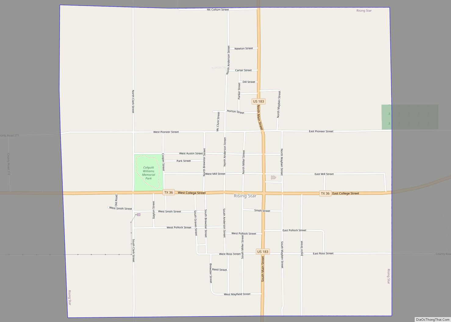
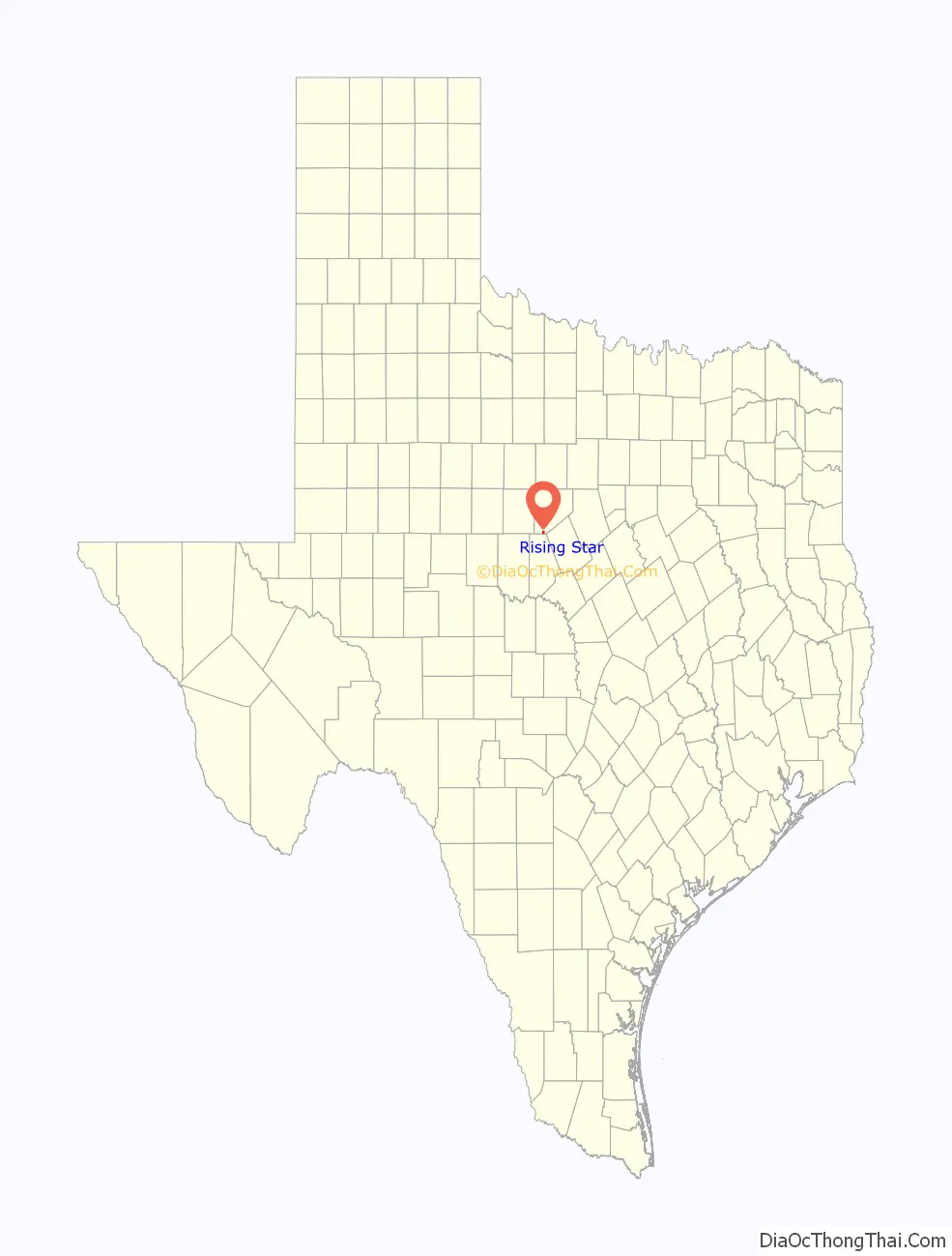
Online Interactive Map
Click on ![]() to view map in "full screen" mode.
to view map in "full screen" mode.
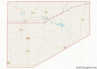
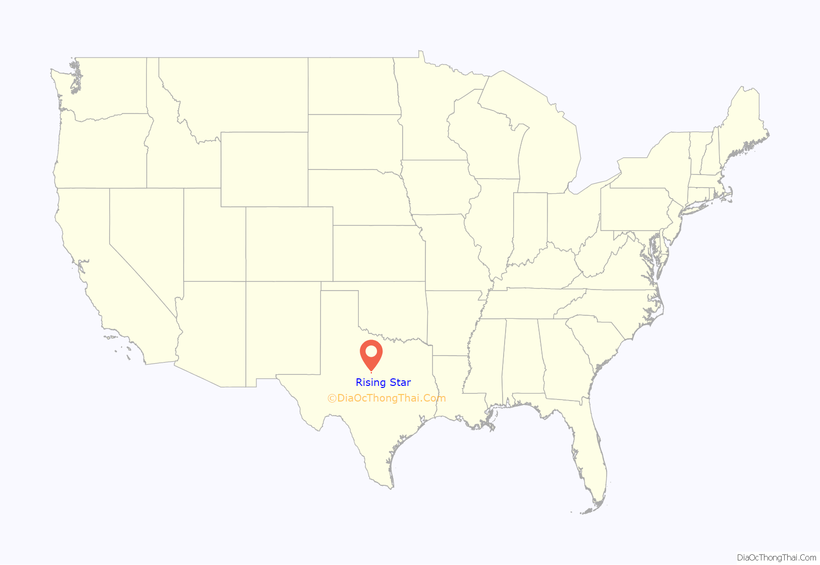
Rising Star location map. Where is Rising Star town?
History
The first settlers arrived in the area that is now Rising Star on January 10, 1875. The original seven families were the families of William “Allie” Wylie Smith, G. A., Andrew “Big Andy” Smith, Andrew “Little Andy” Agnew, William “Billy” Agnew, Fletcher Fields, and D. M. (Dave) McKinley. The seven families were all related to each other through the Agnew line.
Large amounts of land were found to be available for purchase in the area, because the state of Texas kept all unappropriated and vacant land after joining the Union 30 years prior. This land belonged to the state, which sold it to finance the construction of the public school system and state universities. The state gave a portion of its land to railroad companies to sell. This encouraged and helped railroad lines to be developed throughout Texas. Because of this, almost all of the land in Eastland County was either school land or railroad land. Settlers could buy railroad land for $3.00 per acre and school land for as low as $1.00 per acre with no down payment and about 20–40 years to pay off the land. Most of these East Texas families purchased land from the railroad companies.
Other families soon began to move into the area and purchase land. Some of the families that settled later were the Anderson, Irby, Roach, Cox, Hull, Leach, Haynes, Wynn, Mayfield, and Swindle families.
No mail routes existed initially in this newly settled frontier, but by about 1880, the community became a stop on a mail route between Cisco and Brownwood. Prior to the establishment of this mail route, the families received mail from Sipe Springs. In 1881, the town sent a petition to the U.S. government asking for a new post office in the area. The community leaders were required to suggest a name for the post office and decided upon the name Star, which was then sent for approval to the Postal Service. The Postal Service sent word back that a post office under the name Star was already located in Texas (in Mills County). The citizens called a meeting to select another name, and after many long hours of deliberation, Little Andy Agnew proposed, “Since we are a rising young community, why don’t we just call ourselves Rising Star.” The name was agreed to and accepted by the Postal Service. From 1910 through 1911, a spur of the Texas Central line (Katy Railroad) was constructed to the west 40 miles from De Leon to Cross Plains through Rising Star. The Katy abandoned the spur in the 1940s.
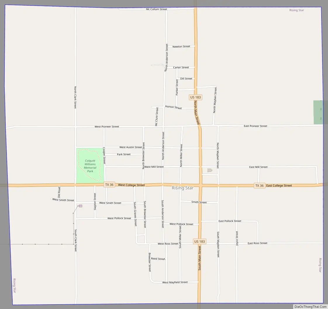
Rising Star Road Map
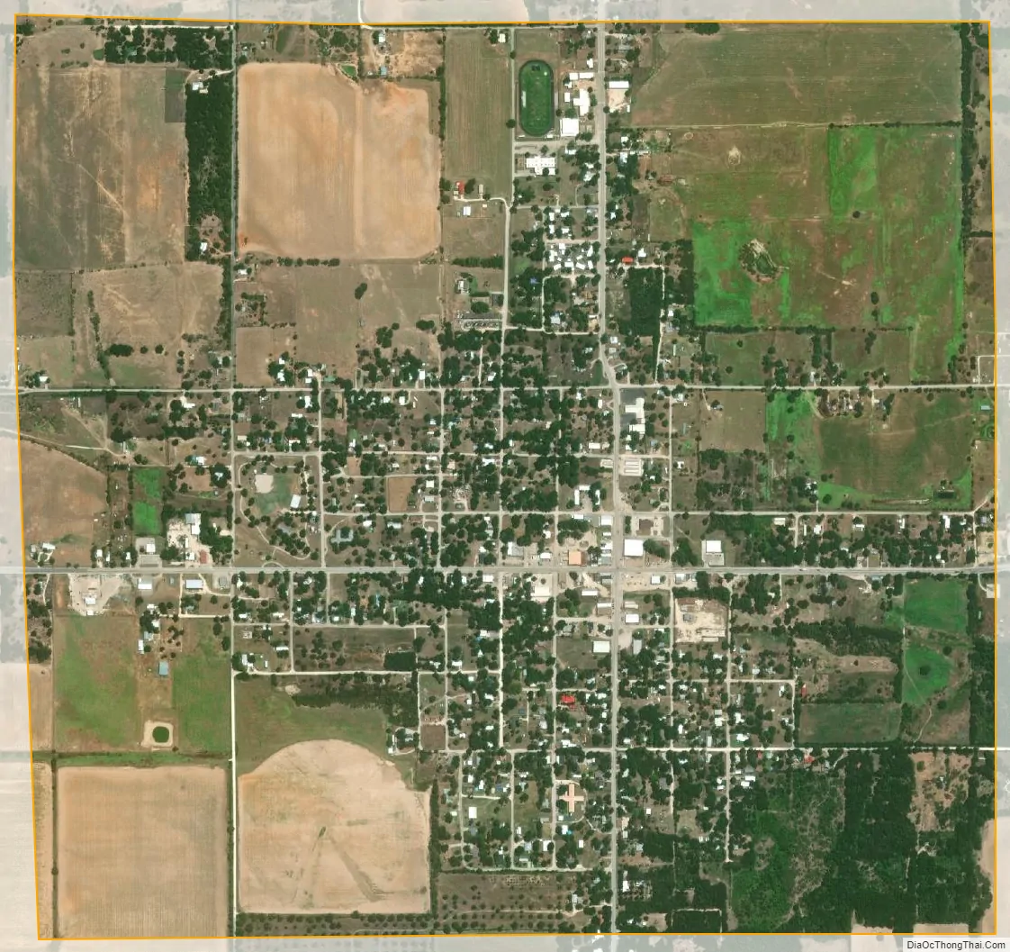
Rising Star city Satellite Map
Geography
Rising Star is located in southwestern Eastland County at 32°5′47″N 98°57′58″W / 32.09639°N 98.96611°W / 32.09639; -98.96611 (32.096260, –98.966074). U.S. Route 183 passes through the town, leading north 20 miles (32 km) to Cisco and south 28 miles (45 km) to Brownwood. Texas State Highway 36 crosses US-183 in the center of town, leading southeast 26 miles (42 km) to Comanche and west 12 miles (19 km) to Cross Plains. Eastland, the county seat, is 30 miles (48 km) to the north and east via US-183 and Interstate 20.
According to the United States Census Bureau, the town of Rising Star has an area of 1.7 square miles (4.5 km), all of it land.
Climate
The climate in this area is characterized by hot, humid summers and generally mild to cool winters. According to the Köppen climate classification system, Rising Star has a humid subtropical climate, Cfa on climate maps.
See also
Map of Texas State and its subdivision:- Anderson
- Andrews
- Angelina
- Aransas
- Archer
- Armstrong
- Atascosa
- Austin
- Bailey
- Bandera
- Bastrop
- Baylor
- Bee
- Bell
- Bexar
- Blanco
- Borden
- Bosque
- Bowie
- Brazoria
- Brazos
- Brewster
- Briscoe
- Brooks
- Brown
- Burleson
- Burnet
- Caldwell
- Calhoun
- Callahan
- Cameron
- Camp
- Carson
- Cass
- Castro
- Chambers
- Cherokee
- Childress
- Clay
- Cochran
- Coke
- Coleman
- Collin
- Collingsworth
- Colorado
- Comal
- Comanche
- Concho
- Cooke
- Coryell
- Cottle
- Crane
- Crockett
- Crosby
- Culberson
- Dallam
- Dallas
- Dawson
- Deaf Smith
- Delta
- Denton
- Dewitt
- Dickens
- Dimmit
- Donley
- Duval
- Eastland
- Ector
- Edwards
- El Paso
- Ellis
- Erath
- Falls
- Fannin
- Fayette
- Fisher
- Floyd
- Foard
- Fort Bend
- Franklin
- Freestone
- Frio
- Gaines
- Galveston
- Garza
- Gillespie
- Glasscock
- Goliad
- Gonzales
- Gray
- Grayson
- Gregg
- Grimes
- Guadalupe
- Hale
- Hall
- Hamilton
- Hansford
- Hardeman
- Hardin
- Harris
- Harrison
- Hartley
- Haskell
- Hays
- Hemphill
- Henderson
- Hidalgo
- Hill
- Hockley
- Hood
- Hopkins
- Houston
- Howard
- Hudspeth
- Hunt
- Hutchinson
- Irion
- Jack
- Jackson
- Jasper
- Jeff Davis
- Jefferson
- Jim Hogg
- Jim Wells
- Johnson
- Jones
- Karnes
- Kaufman
- Kendall
- Kenedy
- Kent
- Kerr
- Kimble
- King
- Kinney
- Kleberg
- Knox
- La Salle
- Lamar
- Lamb
- Lampasas
- Lavaca
- Lee
- Leon
- Liberty
- Limestone
- Lipscomb
- Live Oak
- Llano
- Loving
- Lubbock
- Lynn
- Madison
- Marion
- Martin
- Mason
- Matagorda
- Maverick
- McCulloch
- McLennan
- McMullen
- Medina
- Menard
- Midland
- Milam
- Mills
- Mitchell
- Montague
- Montgomery
- Moore
- Morris
- Motley
- Nacogdoches
- Navarro
- Newton
- Nolan
- Nueces
- Ochiltree
- Oldham
- Orange
- Palo Pinto
- Panola
- Parker
- Parmer
- Pecos
- Polk
- Potter
- Presidio
- Rains
- Randall
- Reagan
- Real
- Red River
- Reeves
- Refugio
- Roberts
- Robertson
- Rockwall
- Runnels
- Rusk
- Sabine
- San Augustine
- San Jacinto
- San Patricio
- San Saba
- Schleicher
- Scurry
- Shackelford
- Shelby
- Sherman
- Smith
- Somervell
- Starr
- Stephens
- Sterling
- Stonewall
- Sutton
- Swisher
- Tarrant
- Taylor
- Terrell
- Terry
- Throckmorton
- Titus
- Tom Green
- Travis
- Trinity
- Tyler
- Upshur
- Upton
- Uvalde
- Val Verde
- Van Zandt
- Victoria
- Walker
- Waller
- Ward
- Washington
- Webb
- Wharton
- Wheeler
- Wichita
- Wilbarger
- Willacy
- Williamson
- Wilson
- Winkler
- Wise
- Wood
- Yoakum
- Young
- Zapata
- Zavala
- Alabama
- Alaska
- Arizona
- Arkansas
- California
- Colorado
- Connecticut
- Delaware
- District of Columbia
- Florida
- Georgia
- Hawaii
- Idaho
- Illinois
- Indiana
- Iowa
- Kansas
- Kentucky
- Louisiana
- Maine
- Maryland
- Massachusetts
- Michigan
- Minnesota
- Mississippi
- Missouri
- Montana
- Nebraska
- Nevada
- New Hampshire
- New Jersey
- New Mexico
- New York
- North Carolina
- North Dakota
- Ohio
- Oklahoma
- Oregon
- Pennsylvania
- Rhode Island
- South Carolina
- South Dakota
- Tennessee
- Texas
- Utah
- Vermont
- Virginia
- Washington
- West Virginia
- Wisconsin
- Wyoming