Cisco is a city in Eastland County, Texas. The population was 3,899 at the time of the 2010 census.
| Name: | Cisco city |
|---|---|
| LSAD Code: | 25 |
| LSAD Description: | city (suffix) |
| State: | Texas |
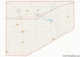
| County: | Eastland County |
| Elevation: | 1,634 ft (498 m) |
| Total Area: | 4.96 sq mi (12.84 km²) |
| Land Area: | 4.96 sq mi (12.83 km²) |
| Water Area: | 0.00 sq mi (0.01 km²) |
| Total Population: | 3,899 |
| Population Density: | 763.67/sq mi (294.87/km²) |
| ZIP code: | 76437 |
| Area code: | 254 |
| FIPS code: | 4815004 |
| GNISfeature ID: | 1332853 |
| Website: | www.cityofcisco.com |
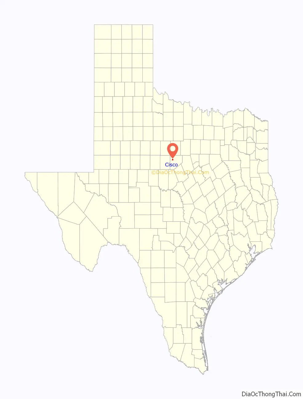
Online Interactive Map
Click on ![]() to view map in "full screen" mode.
to view map in "full screen" mode.
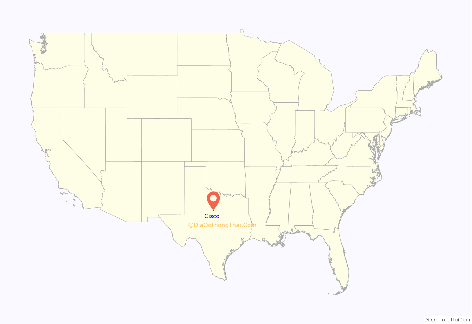
Cisco location map. Where is Cisco city?
History
Cisco, at the intersection of U.S. Highway 183 and Interstate 20 in northwestern Eastland County, traces its history back to 1878 or 1879, when Rev. C. G. Stevens arrived in the area, established a post office and a church, and called the frontier settlement “Red Gap”. About six families were already living nearby, and W. T. Caldwell was running a store a half mile to the west. In 1881, the Houston and Texas Central Railway crossed the Texas and Pacific, which had come through the year before, at a point near Red Gap, and the settlement’s inhabitants moved their town to the crossing. The date the rails crossed, May 17, 1881, is considered by some to be Cisco’s “birthday.” Three years later, the town was officially recognized and a new post office granted; the town’s name was changed to “Cisco” for John J. Cisco, a New York financier largely responsible for the building of the Houston and Texas Central.
Railroads continued to influence the development of Cisco as the Texas and Pacific acquired lots in the town and sold them to immigrants attracted by brochures touting the town as the “Gate City of the West”. Once settlers arrived, agricultural agents employed by the railroad advised them what and when to plant and on occasion provided the seed.
During the 1880s, a Mrs. Haws built and managed the first hotel, and Mrs. J. D. Alexander brought the first “millinery and fancy goods” to town. Following a practice common at the time, religious groups in Cisco met together for prayer meetings in the schoolhouse until they could build separate churches. By 1892, Cisco was a growing community with two newspapers, a bank, and an economy based on trade, ranching, fruit farming, and the limestone, coal, and iron ore available nearby. A broom factory and roller corn and flour mills were among the town’s 56 businesses.
On April 28, 1893, an F4 tornado struck the center of the business district of Cisco, killing 28 people and destroying or severely damaging every building in town. The city hall, every church and school, and an estimated 500 homes were destroyed.
Conrad Hilton started the Hilton Hotel chain with a single hotel bought in Cisco. Hilton came to Cisco to buy a bank, but the bank cost too much, so he purchased the Mobley Hotel in 1919. The hotel is now a local museum and community center.
During the 1920s, Cisco, like nearby Ranger, Eastland, and Desdemona, was a petroleum boomtown. Although Cisco played a relatively minor role in the Eastland County oil boom of 1919–21, its population grew rapidly at the time, with some estimates as high as 15,000; in the wake of the boom, Cisco adopted a city charter and built a new railroad station that cost $25,000, a value of $310,597.88 in 2015.
In 1925, the first annual meeting of the West Texas Historical Association was held in Cisco. The association, formed in 1924, was then based at Hardin–Simmons University in Abilene, but moved in 1998 to Texas Tech University in Lubbock.
The Santa Claus Bank Robbery occurred in Cisco on December 23, 1927, when Marshall Ratliff and his gang attempted to rob the First National Bank. As of August 2009, the bank site is occupied by an auto parts store, with a Texas Historical Commission sign commemorating the event.
On May 9, 2015, an area just south of the city was hit by a large tornado, destroying several homes, killing one person, and critically injuring one more.
Largest concrete swimming pool in the world
Cisco in its early days was plagued with inadequate water supply. In the 1920s, the Williamson Dam was built north of town, resulting in the formation of Lake Cisco. The dam was named after James Milton Williamson, long-time mayor and survivor of the 1893 tornado. At its base was built what was billed as the largest concrete swimming pool in the world. The complex boasted a two-story building with a skating rink upstairs, a zoo, an amusement park with rides, and a park. Bob Wills was only one of the celebrities to entertain there. For decades, it was a major attraction for folks from miles around. The hollow dam was at one time open to the public, but this is no longer the case. The pool closed in the 1970s and the vacant skating rink burned a few years later.
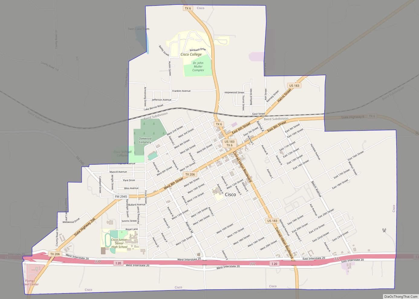
Cisco Road Map

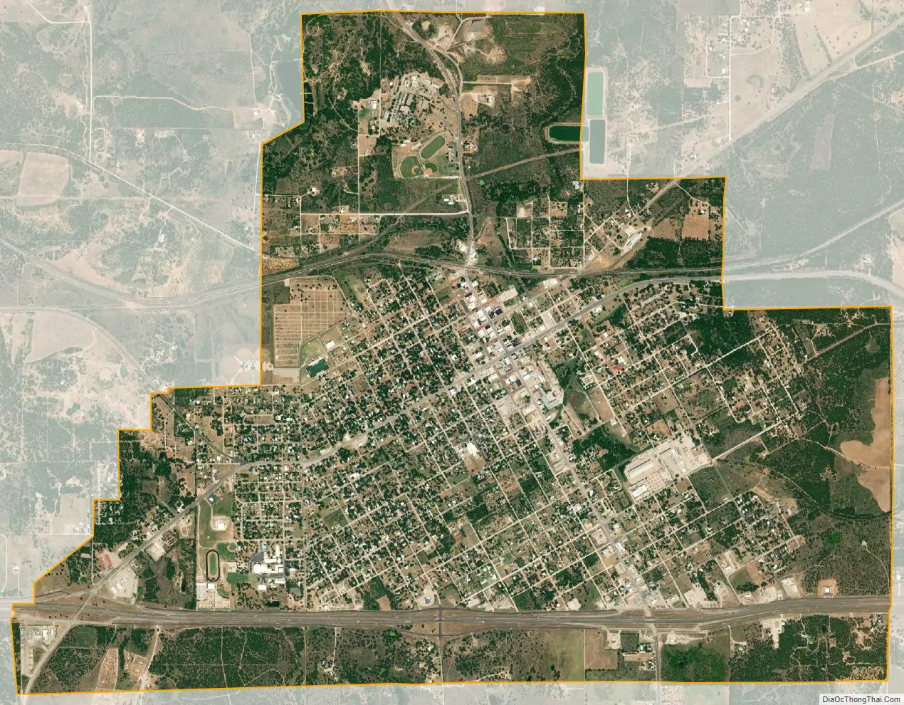
Cisco city Satellite Map
Geography
Cisco is located in northwestern Eastland County at 32°23′5″N 98°58′53″W / 32.38472°N 98.98139°W / 32.38472; -98.98139 (32.384762, –98.981265). Interstate 20 passes through the south side of the city, leading west 45 miles (72 km) to Abilene and east 105 miles (169 km) to Fort Worth. Access to Cisco is from Exits 330 and 332. U.S. Route 183 passes through the center of Cisco, leading north 28 miles (45 km) to Breckenridge and south 49 miles (79 km) to Brownwood. Texas State Highway 6 also passes through the center of town, leading east 10 miles (16 km) to Eastland, the county seat, and northwest 33 miles (53 km) to Albany. Texas State Highway 206 leaves Cisco to the southwest, leading 22 miles (35 km) to Cross Plains.
According to the United States Census Bureau, the city has a total area of 4.9 square miles (12.8 km), of which 2.216 acres (8,966 m), or 0.07%, is covered by water.
See also
Map of Texas State and its subdivision:- Anderson
- Andrews
- Angelina
- Aransas
- Archer
- Armstrong
- Atascosa
- Austin
- Bailey
- Bandera
- Bastrop
- Baylor
- Bee
- Bell
- Bexar
- Blanco
- Borden
- Bosque
- Bowie
- Brazoria
- Brazos
- Brewster
- Briscoe
- Brooks
- Brown
- Burleson
- Burnet
- Caldwell
- Calhoun
- Callahan
- Cameron
- Camp
- Carson
- Cass
- Castro
- Chambers
- Cherokee
- Childress
- Clay
- Cochran
- Coke
- Coleman
- Collin
- Collingsworth
- Colorado
- Comal
- Comanche
- Concho
- Cooke
- Coryell
- Cottle
- Crane
- Crockett
- Crosby
- Culberson
- Dallam
- Dallas
- Dawson
- Deaf Smith
- Delta
- Denton
- Dewitt
- Dickens
- Dimmit
- Donley
- Duval
- Eastland
- Ector
- Edwards
- El Paso
- Ellis
- Erath
- Falls
- Fannin
- Fayette
- Fisher
- Floyd
- Foard
- Fort Bend
- Franklin
- Freestone
- Frio
- Gaines
- Galveston
- Garza
- Gillespie
- Glasscock
- Goliad
- Gonzales
- Gray
- Grayson
- Gregg
- Grimes
- Guadalupe
- Hale
- Hall
- Hamilton
- Hansford
- Hardeman
- Hardin
- Harris
- Harrison
- Hartley
- Haskell
- Hays
- Hemphill
- Henderson
- Hidalgo
- Hill
- Hockley
- Hood
- Hopkins
- Houston
- Howard
- Hudspeth
- Hunt
- Hutchinson
- Irion
- Jack
- Jackson
- Jasper
- Jeff Davis
- Jefferson
- Jim Hogg
- Jim Wells
- Johnson
- Jones
- Karnes
- Kaufman
- Kendall
- Kenedy
- Kent
- Kerr
- Kimble
- King
- Kinney
- Kleberg
- Knox
- La Salle
- Lamar
- Lamb
- Lampasas
- Lavaca
- Lee
- Leon
- Liberty
- Limestone
- Lipscomb
- Live Oak
- Llano
- Loving
- Lubbock
- Lynn
- Madison
- Marion
- Martin
- Mason
- Matagorda
- Maverick
- McCulloch
- McLennan
- McMullen
- Medina
- Menard
- Midland
- Milam
- Mills
- Mitchell
- Montague
- Montgomery
- Moore
- Morris
- Motley
- Nacogdoches
- Navarro
- Newton
- Nolan
- Nueces
- Ochiltree
- Oldham
- Orange
- Palo Pinto
- Panola
- Parker
- Parmer
- Pecos
- Polk
- Potter
- Presidio
- Rains
- Randall
- Reagan
- Real
- Red River
- Reeves
- Refugio
- Roberts
- Robertson
- Rockwall
- Runnels
- Rusk
- Sabine
- San Augustine
- San Jacinto
- San Patricio
- San Saba
- Schleicher
- Scurry
- Shackelford
- Shelby
- Sherman
- Smith
- Somervell
- Starr
- Stephens
- Sterling
- Stonewall
- Sutton
- Swisher
- Tarrant
- Taylor
- Terrell
- Terry
- Throckmorton
- Titus
- Tom Green
- Travis
- Trinity
- Tyler
- Upshur
- Upton
- Uvalde
- Val Verde
- Van Zandt
- Victoria
- Walker
- Waller
- Ward
- Washington
- Webb
- Wharton
- Wheeler
- Wichita
- Wilbarger
- Willacy
- Williamson
- Wilson
- Winkler
- Wise
- Wood
- Yoakum
- Young
- Zapata
- Zavala
- Alabama
- Alaska
- Arizona
- Arkansas
- California
- Colorado
- Connecticut
- Delaware
- District of Columbia
- Florida
- Georgia
- Hawaii
- Idaho
- Illinois
- Indiana
- Iowa
- Kansas
- Kentucky
- Louisiana
- Maine
- Maryland
- Massachusetts
- Michigan
- Minnesota
- Mississippi
- Missouri
- Montana
- Nebraska
- Nevada
- New Hampshire
- New Jersey
- New Mexico
- New York
- North Carolina
- North Dakota
- Ohio
- Oklahoma
- Oregon
- Pennsylvania
- Rhode Island
- South Carolina
- South Dakota
- Tennessee
- Texas
- Utah
- Vermont
- Virginia
- Washington
- West Virginia
- Wisconsin
- Wyoming