Sanderson is a census-designated place (CDP) in and the county seat of Terrell County, Texas, United States. The population was 837 at the 2010 census. Sanderson was created in 1882 as a part of neighboring Pecos County. It became the seat of Terrell County in 1905.
| Name: | Sanderson CDP |
|---|---|
| LSAD Code: | 57 |
| LSAD Description: | CDP (suffix) |
| State: | Texas |
| County: | Terrell County |
| Elevation: | 2,789 ft (850 m) |
| Total Area: | 4.2 sq mi (10.8 km²) |
| Land Area: | 4.2 sq mi (10.8 km²) |
| Water Area: | 0.0 sq mi (0.0 km²) |
| Total Population: | 837 |
| Population Density: | 200/sq mi (78/km²) |
| ZIP code: | 79848 |
| Area code: | 432 |
| FIPS code: | 4865084 |
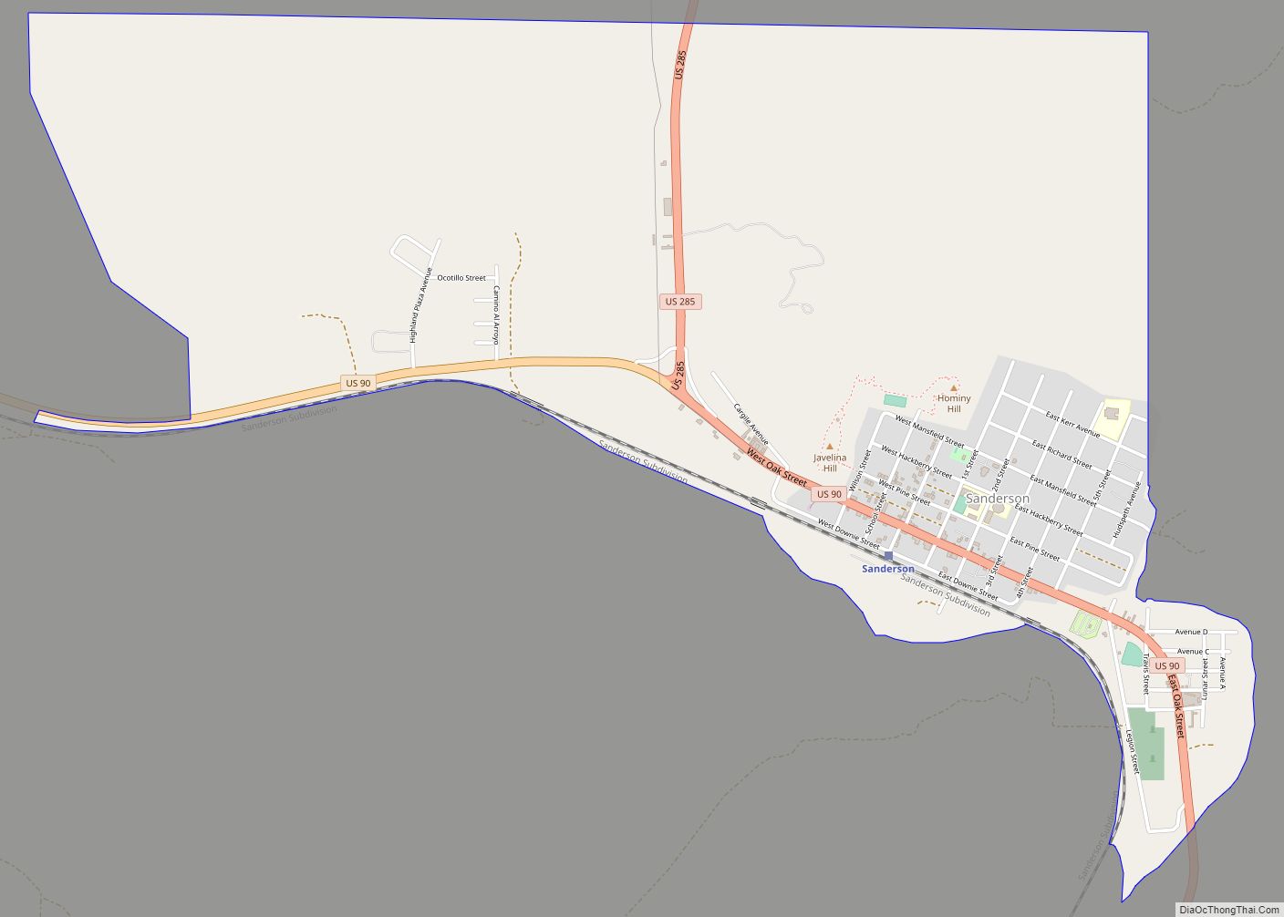
Online Interactive Map
Click on ![]() to view map in "full screen" mode.
to view map in "full screen" mode.
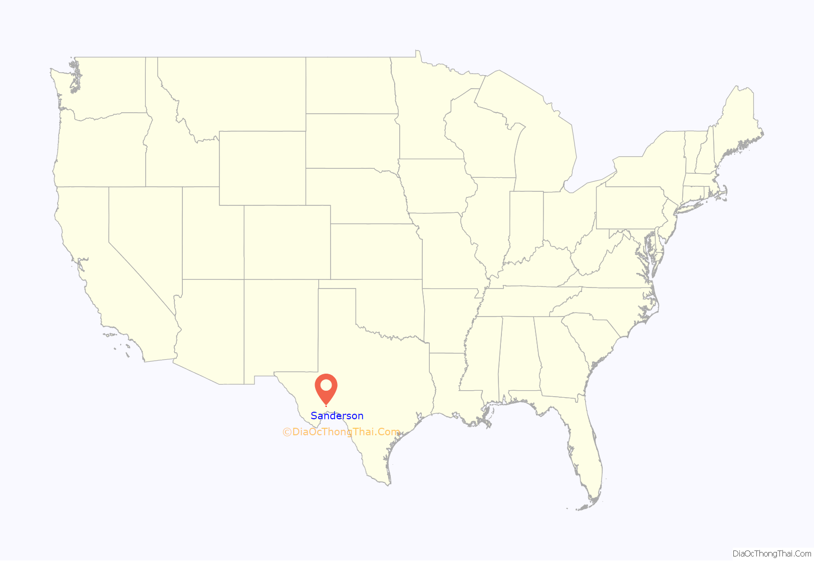
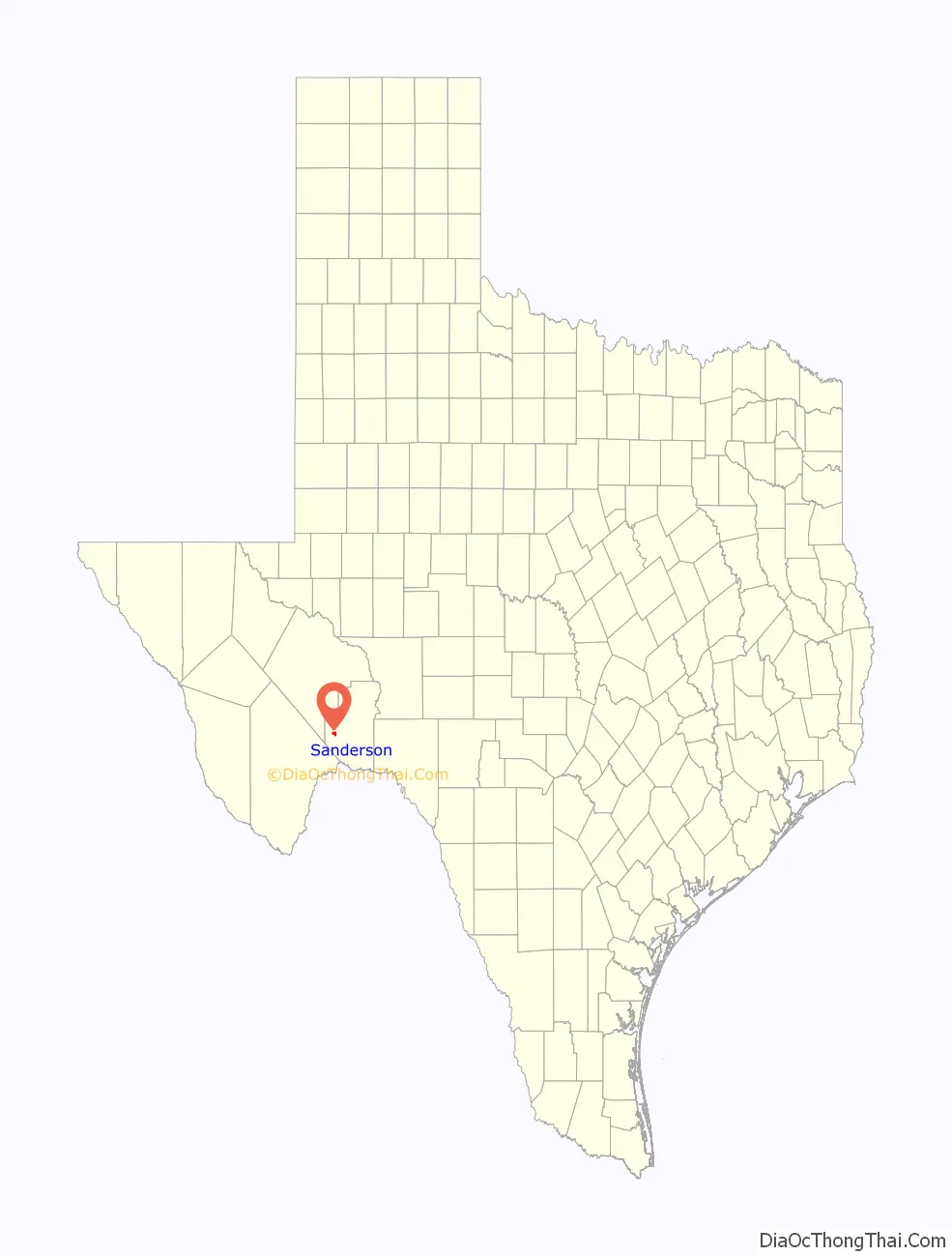
Sanderson location map. Where is Sanderson CDP?
History
Sanderson was founded in 1882. It was a division point for the Southern Pacific Railroad, where refueling and crew changes on its main transcontinental route took place. Mohair and wool production on surrounding ranches formed a significant part of the economy. The community entered in an economic decline when the operations involving sheep and goats decreased.
A devastating flood in June, 1965 killed 26 people and washed away homes and businesses near the usually dry Sanderson Creek. Since then, many flood-control dams have been erected across the arroyos upstream from the town.
An illustrated tour brochure guides visitors past 50 historic sites, including several notable buildings remaining from the town’s more prosperous era. The 1906 Courthouse was built to designs by Henry Phelps, but the still-graceful building was much modified in 1932, in 1950, and again in 1983. Facing the courthouse square is the little-changed 1931 Art Deco-style Sanderson High School, designed by Ralph W. Cameron, one of San Antonio’s leading architects of the period. A handsome Deco frieze above the entranceway illustrates TRUTH CULTURE PROGRESS SUCCESS. Nearby is a Classical Revival structure built as a Masonic Lodge, but used for many years now as a private residence. Kerrs Mercantile on U.S. Route 90 was the leading retailer in these parts for decades; now under new ownership, the establishment is called the Z bar trading company known for hardware, household goods and gift items.
After regulations changed in 1995, the Southern Pacific ended the practice of changing train crews (and overnighting them) in Sanderson. By 2013, the community had lost most of the businesses it had during its peak, and the population was half of what it was at its peak.
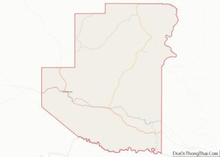
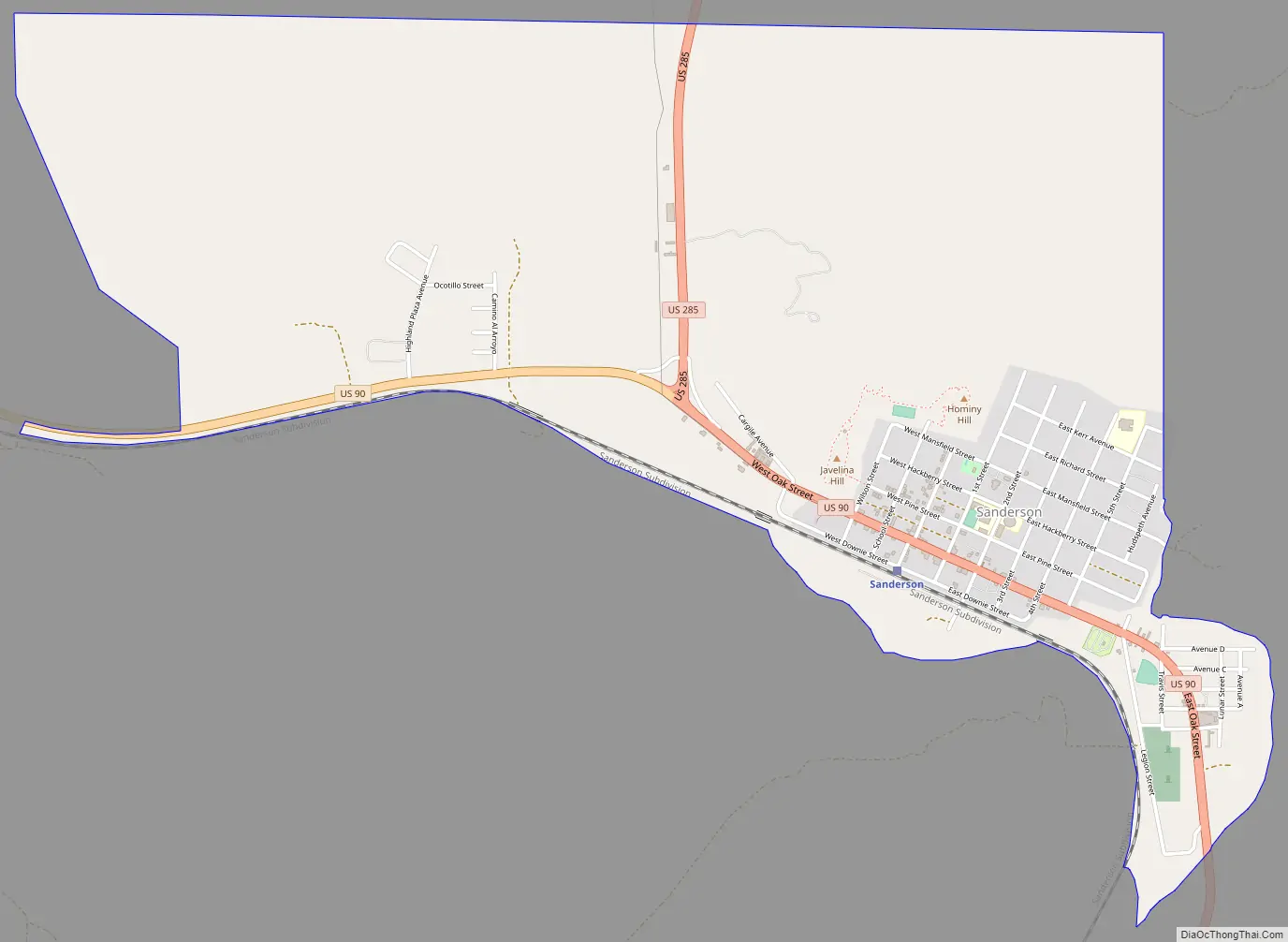
Sanderson Road Map
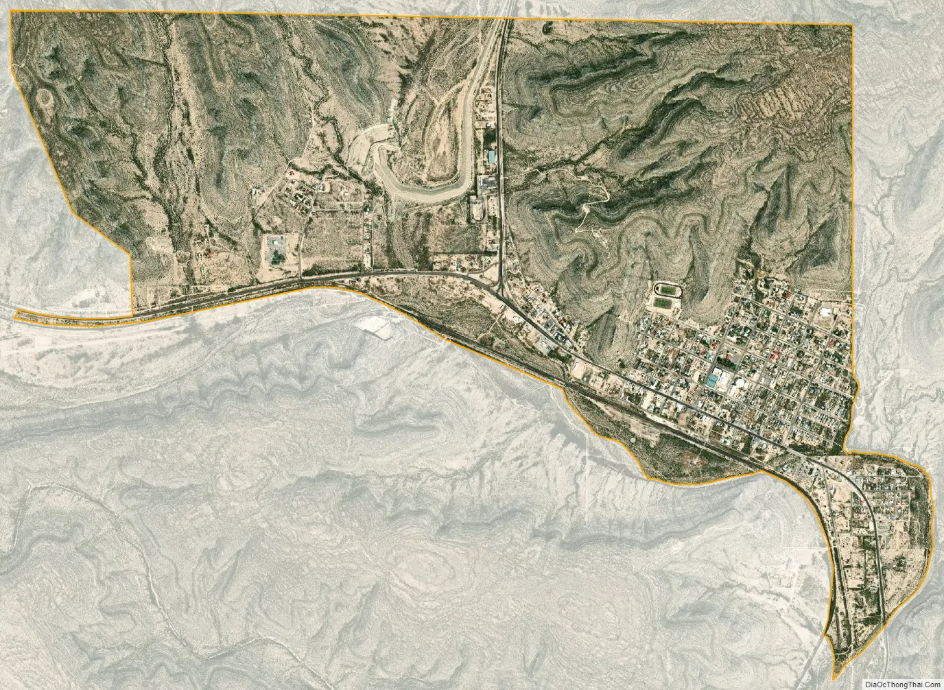
Sanderson city Satellite Map
Geography
According to the United States Census Bureau, the CDP has a total area of 4.2 square miles (10.9 km), all of it land.
Sanderson is located on U.S. Route 90, 120 miles (190 km) west of Del Rio.
Climate
Sanderson has a hot semiarid climate (Köppen BSh) bordering both on a cool semiarid climate (BSk) and a hot desert climate (BWh). Winters feature mild, sunny days and cold or freezing nights, while summers are hot with occasional thunderstorms providing the only significant source of precipitation apart from occasional remnant hurricanes moving inland from the Gulf of Mexico.
See also
Map of Texas State and its subdivision:- Anderson
- Andrews
- Angelina
- Aransas
- Archer
- Armstrong
- Atascosa
- Austin
- Bailey
- Bandera
- Bastrop
- Baylor
- Bee
- Bell
- Bexar
- Blanco
- Borden
- Bosque
- Bowie
- Brazoria
- Brazos
- Brewster
- Briscoe
- Brooks
- Brown
- Burleson
- Burnet
- Caldwell
- Calhoun
- Callahan
- Cameron
- Camp
- Carson
- Cass
- Castro
- Chambers
- Cherokee
- Childress
- Clay
- Cochran
- Coke
- Coleman
- Collin
- Collingsworth
- Colorado
- Comal
- Comanche
- Concho
- Cooke
- Coryell
- Cottle
- Crane
- Crockett
- Crosby
- Culberson
- Dallam
- Dallas
- Dawson
- Deaf Smith
- Delta
- Denton
- Dewitt
- Dickens
- Dimmit
- Donley
- Duval
- Eastland
- Ector
- Edwards
- El Paso
- Ellis
- Erath
- Falls
- Fannin
- Fayette
- Fisher
- Floyd
- Foard
- Fort Bend
- Franklin
- Freestone
- Frio
- Gaines
- Galveston
- Garza
- Gillespie
- Glasscock
- Goliad
- Gonzales
- Gray
- Grayson
- Gregg
- Grimes
- Guadalupe
- Hale
- Hall
- Hamilton
- Hansford
- Hardeman
- Hardin
- Harris
- Harrison
- Hartley
- Haskell
- Hays
- Hemphill
- Henderson
- Hidalgo
- Hill
- Hockley
- Hood
- Hopkins
- Houston
- Howard
- Hudspeth
- Hunt
- Hutchinson
- Irion
- Jack
- Jackson
- Jasper
- Jeff Davis
- Jefferson
- Jim Hogg
- Jim Wells
- Johnson
- Jones
- Karnes
- Kaufman
- Kendall
- Kenedy
- Kent
- Kerr
- Kimble
- King
- Kinney
- Kleberg
- Knox
- La Salle
- Lamar
- Lamb
- Lampasas
- Lavaca
- Lee
- Leon
- Liberty
- Limestone
- Lipscomb
- Live Oak
- Llano
- Loving
- Lubbock
- Lynn
- Madison
- Marion
- Martin
- Mason
- Matagorda
- Maverick
- McCulloch
- McLennan
- McMullen
- Medina
- Menard
- Midland
- Milam
- Mills
- Mitchell
- Montague
- Montgomery
- Moore
- Morris
- Motley
- Nacogdoches
- Navarro
- Newton
- Nolan
- Nueces
- Ochiltree
- Oldham
- Orange
- Palo Pinto
- Panola
- Parker
- Parmer
- Pecos
- Polk
- Potter
- Presidio
- Rains
- Randall
- Reagan
- Real
- Red River
- Reeves
- Refugio
- Roberts
- Robertson
- Rockwall
- Runnels
- Rusk
- Sabine
- San Augustine
- San Jacinto
- San Patricio
- San Saba
- Schleicher
- Scurry
- Shackelford
- Shelby
- Sherman
- Smith
- Somervell
- Starr
- Stephens
- Sterling
- Stonewall
- Sutton
- Swisher
- Tarrant
- Taylor
- Terrell
- Terry
- Throckmorton
- Titus
- Tom Green
- Travis
- Trinity
- Tyler
- Upshur
- Upton
- Uvalde
- Val Verde
- Van Zandt
- Victoria
- Walker
- Waller
- Ward
- Washington
- Webb
- Wharton
- Wheeler
- Wichita
- Wilbarger
- Willacy
- Williamson
- Wilson
- Winkler
- Wise
- Wood
- Yoakum
- Young
- Zapata
- Zavala
- Alabama
- Alaska
- Arizona
- Arkansas
- California
- Colorado
- Connecticut
- Delaware
- District of Columbia
- Florida
- Georgia
- Hawaii
- Idaho
- Illinois
- Indiana
- Iowa
- Kansas
- Kentucky
- Louisiana
- Maine
- Maryland
- Massachusetts
- Michigan
- Minnesota
- Mississippi
- Missouri
- Montana
- Nebraska
- Nevada
- New Hampshire
- New Jersey
- New Mexico
- New York
- North Carolina
- North Dakota
- Ohio
- Oklahoma
- Oregon
- Pennsylvania
- Rhode Island
- South Carolina
- South Dakota
- Tennessee
- Texas
- Utah
- Vermont
- Virginia
- Washington
- West Virginia
- Wisconsin
- Wyoming