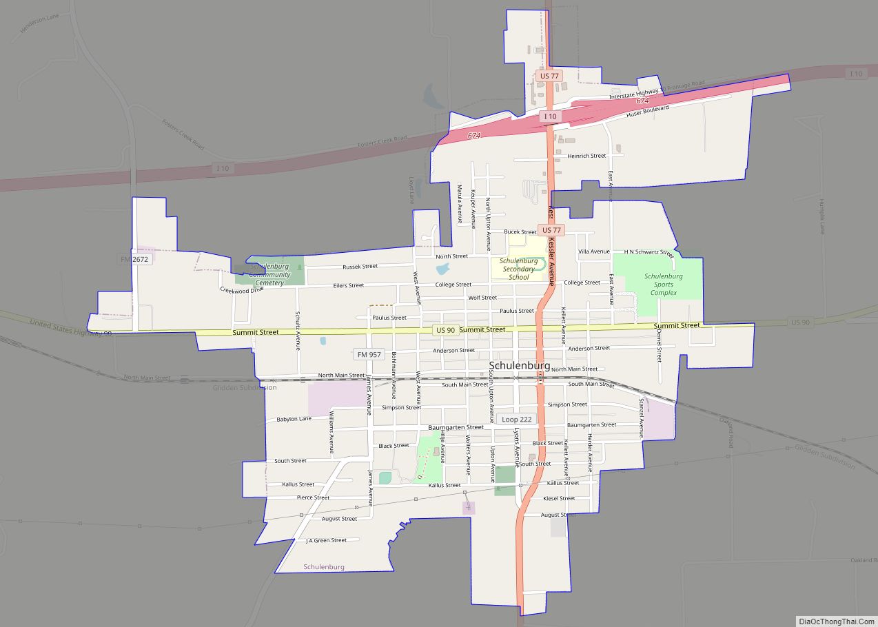
Schulenburg is a city in Fayette County, Texas, United States. The population was 2,633 at the 2020 census. Known for its German culture, Schulenburg is home of the Texas Polka Music Museum. It is in a rural, agricultural area settled by German and Czech emigrants in the 1800s.
| Name: | Schulenburg city |
|---|---|
| LSAD Code: | 25 |
| LSAD Description: | city (suffix) |
| State: | Texas |
| County: | Fayette County |
| Incorporated: | May 24, 1875 |
| Elevation: | 367 ft (112 m) |
| Total Area: | 2.61 sq mi (6.77 km²) |
| Land Area: | 2.61 sq mi (6.77 km²) |
| Water Area: | 0.00 sq mi (0.00 km²) |
| Total Population: | 2,633 |
| Population Density: | 1,114.38/sq mi (430.29/km²) |
| ZIP code: | 78956 |
| Area code: | 979 |
| FIPS code: | 4866188 |
| GNISfeature ID: | 1346794 |
| Website: | schulenburgtx.org |
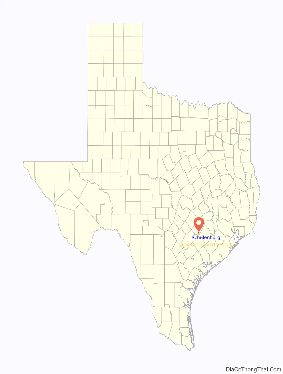
Online Interactive Map
Click on ![]() to view map in "full screen" mode.
to view map in "full screen" mode.
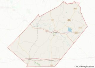
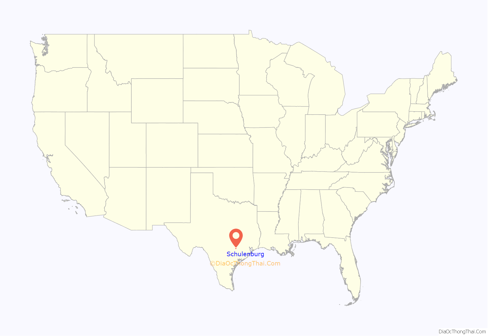
Schulenburg location map. Where is Schulenburg city?
History
In 1831, the Mexican government granted 4,428 acres (1,792 ha) of land to Kesiah Crier. Crier’s family and the James Lyons family were the first European-American settlers in the area. The town of Schulenburg developed from two nearby communities: Lyons, founded in 1842, and High Hill, settled in 1842 and later named in 1858.
In 1873, the Galveston, Harris and San Antonio Railroad bought land in the area. They built a depot on the portion formerly owned by Louis Schulenburg, and named it after him. The first train arrived on New Year’s Eve of 1873, and the town was formally incorporated on May 24, 1875.
Many of the early settlers to Schulenburg and the surrounding area were immigrants of German, Austrian and Czech descent, who came after the Revolutions of 1848 in Europe. The area still shows evidence of their cultures. For instance, local bakeries are noted for their kolaches, a Czech pastry.
Jewish immigrants also made Schulenburg their home, and many of them became merchants. Initially from Germany in the mid-19th century, they were later joined by immigrants from eastern Europe.
The town is the home of Stanzel Flying Models, makers of wire-controlled and free-flight model airplanes for nearly 70 years. Schulenburg is also home to Shaller Go-Karts manufacturing, for use in many tracks around the country.
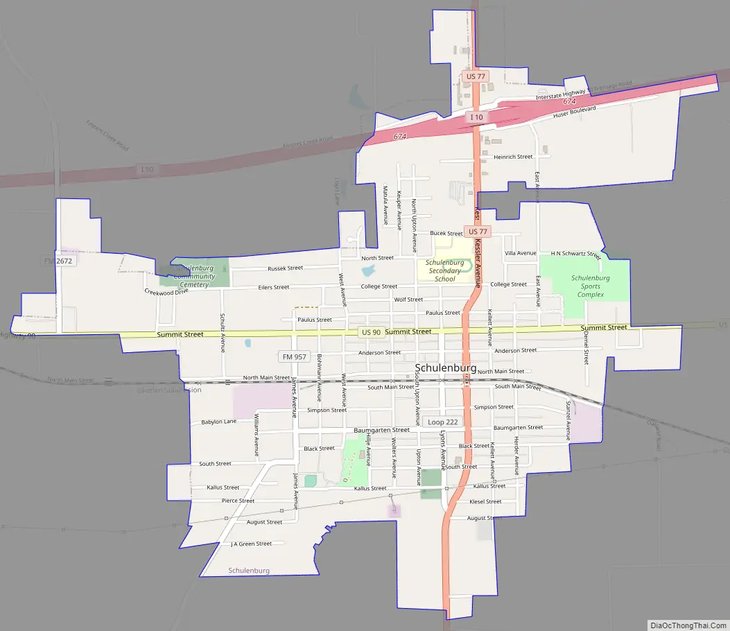
Schulenburg Road Map
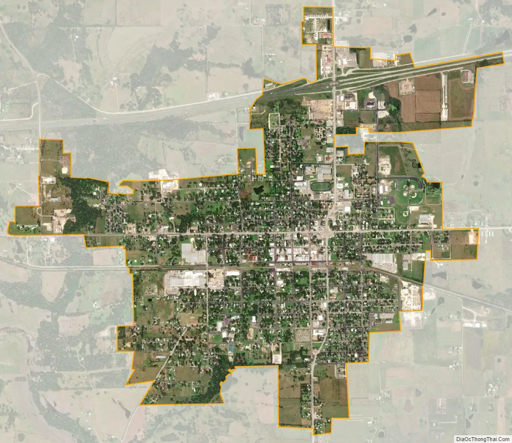
Schulenburg city Satellite Map
Geography
Schulenburg is located in southern Fayette County at 29°40′49″N 96°54′26″W / 29.68028°N 96.90722°W / 29.68028; -96.90722 (29.680320, –96.907138), on high ground 2 miles (3 km) east of the Navidad River. It is about 95 miles west of Houston, Texas.
According to the United States Census Bureau, Schulenburg has a total area of 2.5 square miles (6.5 km), all of it land.
See also
Map of Texas State and its subdivision:- Anderson
- Andrews
- Angelina
- Aransas
- Archer
- Armstrong
- Atascosa
- Austin
- Bailey
- Bandera
- Bastrop
- Baylor
- Bee
- Bell
- Bexar
- Blanco
- Borden
- Bosque
- Bowie
- Brazoria
- Brazos
- Brewster
- Briscoe
- Brooks
- Brown
- Burleson
- Burnet
- Caldwell
- Calhoun
- Callahan
- Cameron
- Camp
- Carson
- Cass
- Castro
- Chambers
- Cherokee
- Childress
- Clay
- Cochran
- Coke
- Coleman
- Collin
- Collingsworth
- Colorado
- Comal
- Comanche
- Concho
- Cooke
- Coryell
- Cottle
- Crane
- Crockett
- Crosby
- Culberson
- Dallam
- Dallas
- Dawson
- Deaf Smith
- Delta
- Denton
- Dewitt
- Dickens
- Dimmit
- Donley
- Duval
- Eastland
- Ector
- Edwards
- El Paso
- Ellis
- Erath
- Falls
- Fannin
- Fayette
- Fisher
- Floyd
- Foard
- Fort Bend
- Franklin
- Freestone
- Frio
- Gaines
- Galveston
- Garza
- Gillespie
- Glasscock
- Goliad
- Gonzales
- Gray
- Grayson
- Gregg
- Grimes
- Guadalupe
- Hale
- Hall
- Hamilton
- Hansford
- Hardeman
- Hardin
- Harris
- Harrison
- Hartley
- Haskell
- Hays
- Hemphill
- Henderson
- Hidalgo
- Hill
- Hockley
- Hood
- Hopkins
- Houston
- Howard
- Hudspeth
- Hunt
- Hutchinson
- Irion
- Jack
- Jackson
- Jasper
- Jeff Davis
- Jefferson
- Jim Hogg
- Jim Wells
- Johnson
- Jones
- Karnes
- Kaufman
- Kendall
- Kenedy
- Kent
- Kerr
- Kimble
- King
- Kinney
- Kleberg
- Knox
- La Salle
- Lamar
- Lamb
- Lampasas
- Lavaca
- Lee
- Leon
- Liberty
- Limestone
- Lipscomb
- Live Oak
- Llano
- Loving
- Lubbock
- Lynn
- Madison
- Marion
- Martin
- Mason
- Matagorda
- Maverick
- McCulloch
- McLennan
- McMullen
- Medina
- Menard
- Midland
- Milam
- Mills
- Mitchell
- Montague
- Montgomery
- Moore
- Morris
- Motley
- Nacogdoches
- Navarro
- Newton
- Nolan
- Nueces
- Ochiltree
- Oldham
- Orange
- Palo Pinto
- Panola
- Parker
- Parmer
- Pecos
- Polk
- Potter
- Presidio
- Rains
- Randall
- Reagan
- Real
- Red River
- Reeves
- Refugio
- Roberts
- Robertson
- Rockwall
- Runnels
- Rusk
- Sabine
- San Augustine
- San Jacinto
- San Patricio
- San Saba
- Schleicher
- Scurry
- Shackelford
- Shelby
- Sherman
- Smith
- Somervell
- Starr
- Stephens
- Sterling
- Stonewall
- Sutton
- Swisher
- Tarrant
- Taylor
- Terrell
- Terry
- Throckmorton
- Titus
- Tom Green
- Travis
- Trinity
- Tyler
- Upshur
- Upton
- Uvalde
- Val Verde
- Van Zandt
- Victoria
- Walker
- Waller
- Ward
- Washington
- Webb
- Wharton
- Wheeler
- Wichita
- Wilbarger
- Willacy
- Williamson
- Wilson
- Winkler
- Wise
- Wood
- Yoakum
- Young
- Zapata
- Zavala
- Alabama
- Alaska
- Arizona
- Arkansas
- California
- Colorado
- Connecticut
- Delaware
- District of Columbia
- Florida
- Georgia
- Hawaii
- Idaho
- Illinois
- Indiana
- Iowa
- Kansas
- Kentucky
- Louisiana
- Maine
- Maryland
- Massachusetts
- Michigan
- Minnesota
- Mississippi
- Missouri
- Montana
- Nebraska
- Nevada
- New Hampshire
- New Jersey
- New Mexico
- New York
- North Carolina
- North Dakota
- Ohio
- Oklahoma
- Oregon
- Pennsylvania
- Rhode Island
- South Carolina
- South Dakota
- Tennessee
- Texas
- Utah
- Vermont
- Virginia
- Washington
- West Virginia
- Wisconsin
- Wyoming