Somerset is a city located in Bexar County, Texas, United States. It is located less than 20 miles south of Downtown San Antonio and is part of the San Antonio–New Braunfels metropolitan area. The population was 1,756 at the 2020 census.
| Name: | Somerset city |
|---|---|
| LSAD Code: | 25 |
| LSAD Description: | city (suffix) |
| State: | Texas |
| County: | Bexar County |
| Elevation: | 646 ft (197 m) |
| Total Area: | 2.00 sq mi (5.19 km²) |
| Land Area: | 2.00 sq mi (5.17 km²) |
| Water Area: | 0.01 sq mi (0.02 km²) |
| Total Population: | 1,756 |
| Population Density: | 983.48/sq mi (379.80/km²) |
| ZIP code: | 78069 |
| Area code: | 830 |
| FIPS code: | 4868708 |
| GNISfeature ID: | 1368603 |
| Website: | cityofsomerset.org |
Online Interactive Map
Click on ![]() to view map in "full screen" mode.
to view map in "full screen" mode.
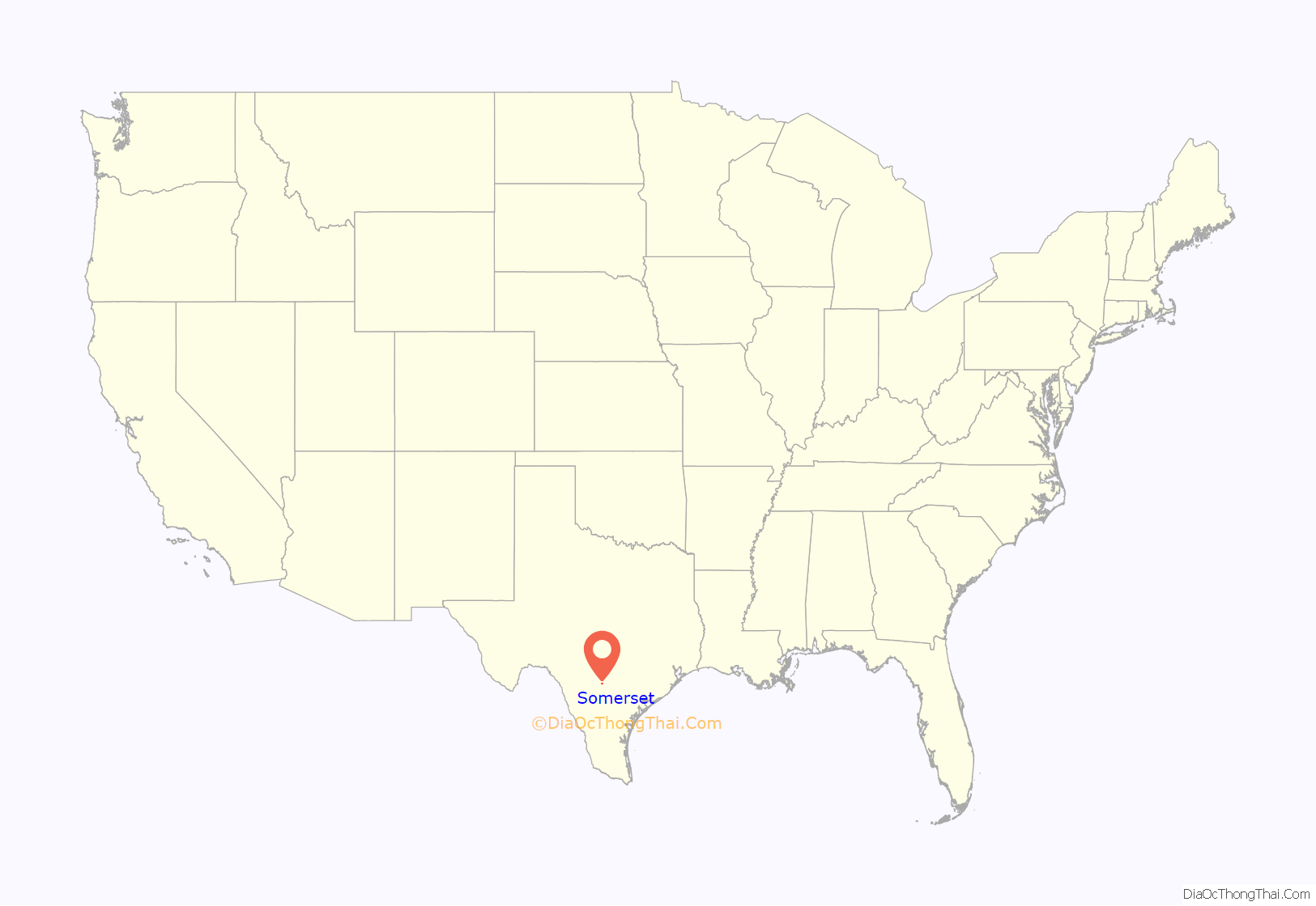
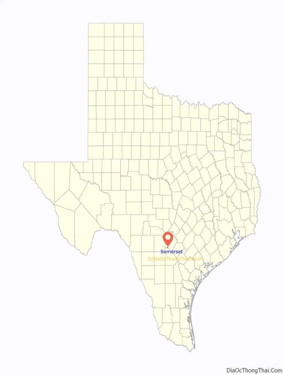
Somerset location map. Where is Somerset city?
History
English speaking European settlers had already arrived in the area by the early 1800s. Somerset was named for an organized settlement that had been begun in 1848, in what is now Atascosa County, by a group of Baptist families from Somerset, Kentucky. The present site was named Somerset when the First Townsite Company was formed on the Artesian Belt Railroad right-of-way on May 25, 1909, by A. M. Pyron, Carl Kurz, and Jonas A. Kerr.
In 1913, while drilling for artesian water, Kurz discovered oil and an economic boom followed. The Somerset oilfield extended from Somerset to below Pleasanton and was the largest known shallow field in the world at that time. Two oil refineries in the field and a pipeline into San Antonio handled the high-gravity crude.
The town grew rapidly from fifty residents in 1925 to 700 in 1928; it was served by a state bank, a ten-room hotel, and several machine and blacksmith shops. A post office opened there in 1920. A nearby lignite coal mine also added to the booming economy of the area.
During the 1920s farmers turned from cotton to dryland fruit and vegetable farming. In 1931, the Somerset Fruit Growers Exchange building was dedicated, and between truck farming, oil, and coal, the town prospered until the mid-1930s, when diminishing oil returns and the Great Depression caused a decline. In 1931 the town reported twenty businesses; by 1958 there were only eight.
In 1920, the Somerset Independent School District was formed from at least five other school districts: Wildman, Senior, Bexar, Old Rock (Old Somerset area), and Oak Island. The Somerset Police Department was created in 1972 followed by the city being incorporated in 1973. Somerset has a mayor-council form of city government.
Somerset Road Map
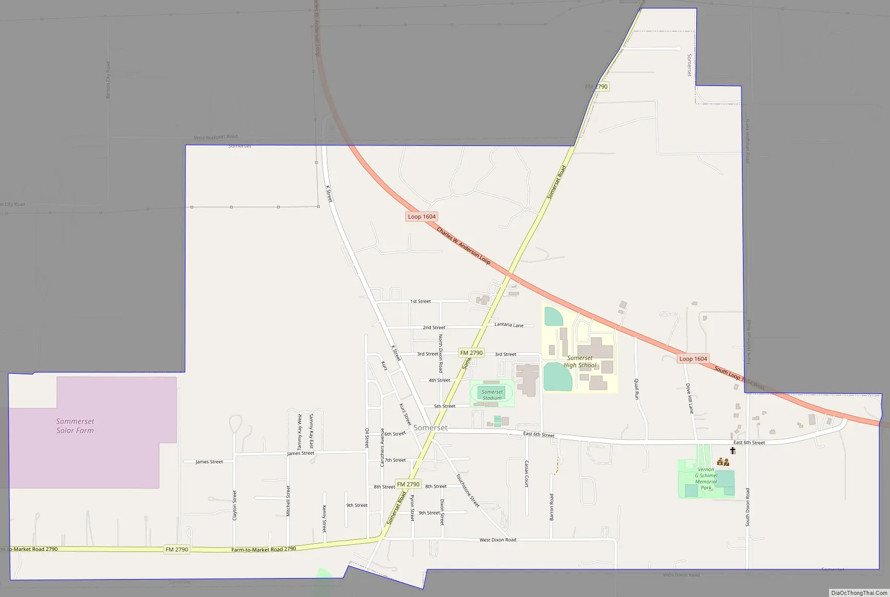
Somerset city Satellite Map

Geography
According to the United States Census Bureau, Somerset has a total area of 2.0 square miles (5.2 km), all of it land.
See also
Map of Texas State and its subdivision:- Anderson
- Andrews
- Angelina
- Aransas
- Archer
- Armstrong
- Atascosa
- Austin
- Bailey
- Bandera
- Bastrop
- Baylor
- Bee
- Bell
- Bexar
- Blanco
- Borden
- Bosque
- Bowie
- Brazoria
- Brazos
- Brewster
- Briscoe
- Brooks
- Brown
- Burleson
- Burnet
- Caldwell
- Calhoun
- Callahan
- Cameron
- Camp
- Carson
- Cass
- Castro
- Chambers
- Cherokee
- Childress
- Clay
- Cochran
- Coke
- Coleman
- Collin
- Collingsworth
- Colorado
- Comal
- Comanche
- Concho
- Cooke
- Coryell
- Cottle
- Crane
- Crockett
- Crosby
- Culberson
- Dallam
- Dallas
- Dawson
- Deaf Smith
- Delta
- Denton
- Dewitt
- Dickens
- Dimmit
- Donley
- Duval
- Eastland
- Ector
- Edwards
- El Paso
- Ellis
- Erath
- Falls
- Fannin
- Fayette
- Fisher
- Floyd
- Foard
- Fort Bend
- Franklin
- Freestone
- Frio
- Gaines
- Galveston
- Garza
- Gillespie
- Glasscock
- Goliad
- Gonzales
- Gray
- Grayson
- Gregg
- Grimes
- Guadalupe
- Hale
- Hall
- Hamilton
- Hansford
- Hardeman
- Hardin
- Harris
- Harrison
- Hartley
- Haskell
- Hays
- Hemphill
- Henderson
- Hidalgo
- Hill
- Hockley
- Hood
- Hopkins
- Houston
- Howard
- Hudspeth
- Hunt
- Hutchinson
- Irion
- Jack
- Jackson
- Jasper
- Jeff Davis
- Jefferson
- Jim Hogg
- Jim Wells
- Johnson
- Jones
- Karnes
- Kaufman
- Kendall
- Kenedy
- Kent
- Kerr
- Kimble
- King
- Kinney
- Kleberg
- Knox
- La Salle
- Lamar
- Lamb
- Lampasas
- Lavaca
- Lee
- Leon
- Liberty
- Limestone
- Lipscomb
- Live Oak
- Llano
- Loving
- Lubbock
- Lynn
- Madison
- Marion
- Martin
- Mason
- Matagorda
- Maverick
- McCulloch
- McLennan
- McMullen
- Medina
- Menard
- Midland
- Milam
- Mills
- Mitchell
- Montague
- Montgomery
- Moore
- Morris
- Motley
- Nacogdoches
- Navarro
- Newton
- Nolan
- Nueces
- Ochiltree
- Oldham
- Orange
- Palo Pinto
- Panola
- Parker
- Parmer
- Pecos
- Polk
- Potter
- Presidio
- Rains
- Randall
- Reagan
- Real
- Red River
- Reeves
- Refugio
- Roberts
- Robertson
- Rockwall
- Runnels
- Rusk
- Sabine
- San Augustine
- San Jacinto
- San Patricio
- San Saba
- Schleicher
- Scurry
- Shackelford
- Shelby
- Sherman
- Smith
- Somervell
- Starr
- Stephens
- Sterling
- Stonewall
- Sutton
- Swisher
- Tarrant
- Taylor
- Terrell
- Terry
- Throckmorton
- Titus
- Tom Green
- Travis
- Trinity
- Tyler
- Upshur
- Upton
- Uvalde
- Val Verde
- Van Zandt
- Victoria
- Walker
- Waller
- Ward
- Washington
- Webb
- Wharton
- Wheeler
- Wichita
- Wilbarger
- Willacy
- Williamson
- Wilson
- Winkler
- Wise
- Wood
- Yoakum
- Young
- Zapata
- Zavala
- Alabama
- Alaska
- Arizona
- Arkansas
- California
- Colorado
- Connecticut
- Delaware
- District of Columbia
- Florida
- Georgia
- Hawaii
- Idaho
- Illinois
- Indiana
- Iowa
- Kansas
- Kentucky
- Louisiana
- Maine
- Maryland
- Massachusetts
- Michigan
- Minnesota
- Mississippi
- Missouri
- Montana
- Nebraska
- Nevada
- New Hampshire
- New Jersey
- New Mexico
- New York
- North Carolina
- North Dakota
- Ohio
- Oklahoma
- Oregon
- Pennsylvania
- Rhode Island
- South Carolina
- South Dakota
- Tennessee
- Texas
- Utah
- Vermont
- Virginia
- Washington
- West Virginia
- Wisconsin
- Wyoming