Sweetwater is a municipality in and the seat of Nolan County, Texas, United States. It is 123 miles southeast of Lubbock and 40 miles west of Abilene, Texas. Its population was 10,906 at the 2010 census.
| Name: | Sweetwater city |
|---|---|
| LSAD Code: | 25 |
| LSAD Description: | city (suffix) |
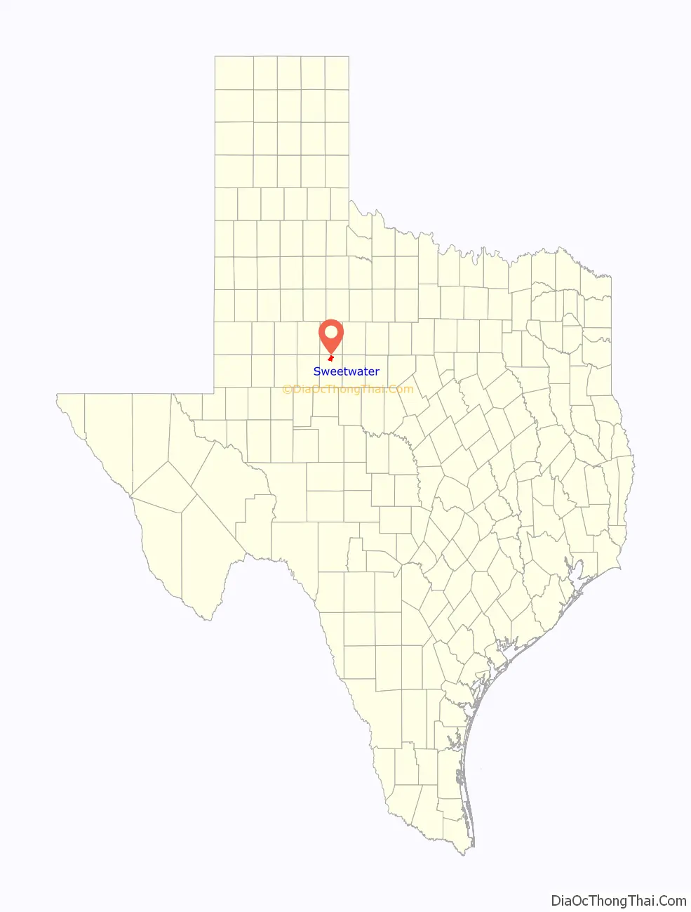
| State: | Texas |
| County: | Nolan County |
| Elevation: | 2,169 ft (661 m) |
| Total Area: | 11.07 sq mi (28.68 km²) |
| Land Area: | 11.07 sq mi (28.68 km²) |
| Water Area: | 0.00 sq mi (0.00 km²) |
| Total Population: | 10,906 |
| Population Density: | 945.37/sq mi (365.01/km²) |
| ZIP code: | 79556 |
| Area code: | 325 |
| FIPS code: | 4871540 |
Online Interactive Map
Click on ![]() to view map in "full screen" mode.
to view map in "full screen" mode.
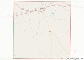
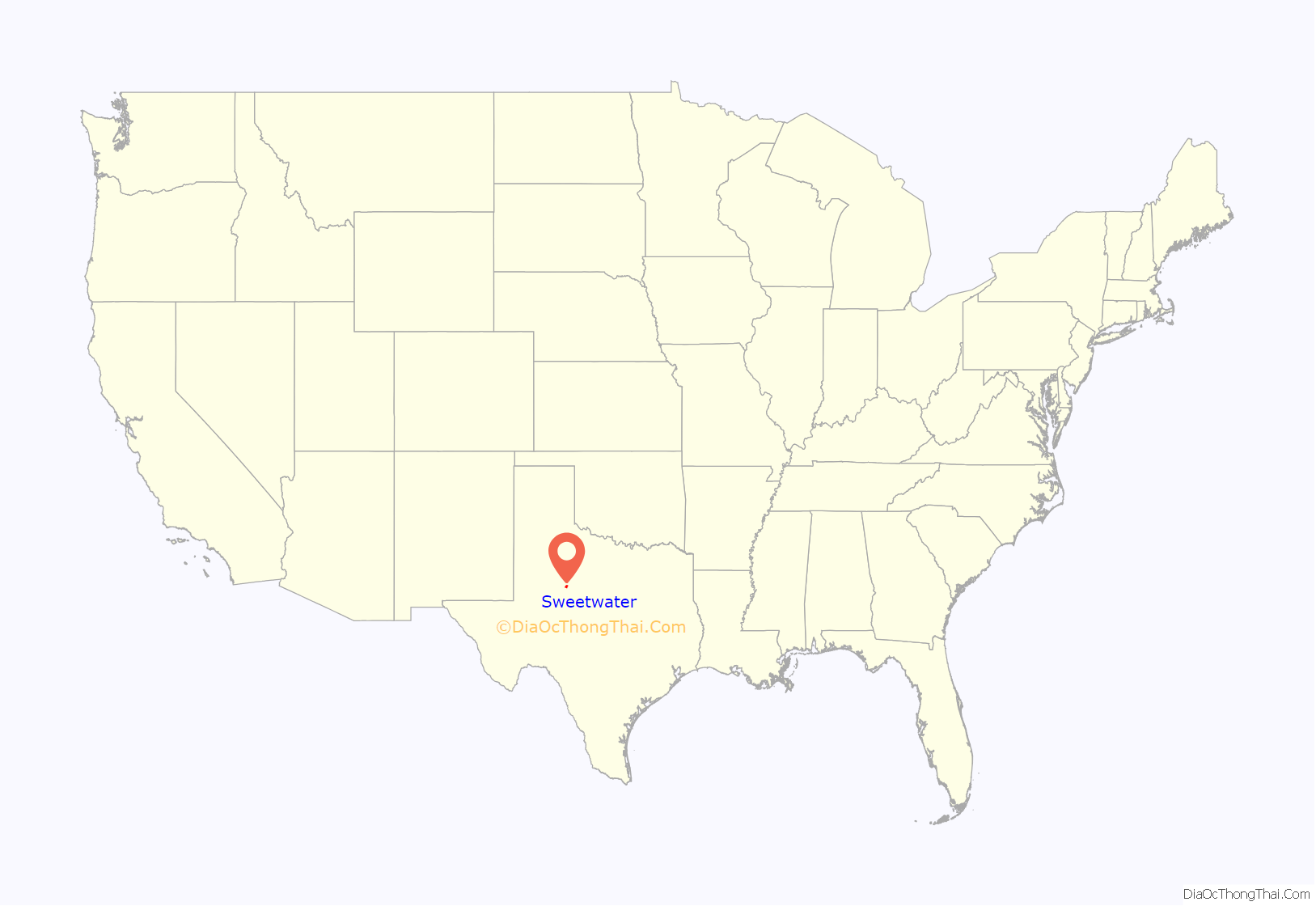
Sweetwater location map. Where is Sweetwater city?
History
The town’s name “Sweetwater” is the English translation of the Kiowa language word “Mobeetie”.
Sweetwater received a U.S. post office in 1879. The Texas and Pacific Railway started service in 1881, with the first train arriving on March 12 of that year, beginning Sweetwater’s long history as a railroad town. To encourage the railroads, Sweetwater increased its water supply by building a small town lake called City Lake in 1898 (now called Newman Park), then three larger lakes were constructed thereafter. Construction began on the Kansas City, Mexico and Orient Railway in 1903. By 1912 the Santa Fe Railway was serving Sweetwater via its new Coleman Cutoff and completing a connection with the T&P nearby at “Tecific” junction. Businesses and homes were built along the rail lines. Texas and Pacific Railway passenger service was discontinued in 1969.
Gulf Refinery operated from 1929 to 1954, and at one time the town was a large telegraph center. The International Harvester Company operated a factory on W. Third Street in Sweetwater from 1920 to 1950. Gypsum plants, apparel manufacturers, cement plants, cotton compresses, a cottonseed oil mill, and packing companies were among the nearly 250 businesses operating there from the 1970s. Many still operate today. Sweetwater remains a production hub for such commodities as cotton, oil, and cattle. The population of Sweetwater has remained steady between 11,000 and 13,000 since 1940.
At Sweetwater during World War II, one class of British RAF pilots was trained before the airfield was converted for training American women pilots. The Women Airforce Service Pilots (WASPs) were trained under the direction of famed aviator Jacqueline Cochran at Sweetwater’s Avenger Field. These WASPs were the first women to fly American military aircraft. The military airstrip was closed at the end of the war.
Pilots flying over Sweetwater can still land at Avenger Field – the Sweetwater Airport (SWW). The National WASP WWII Museum is located at Avenger Field. The WASP women were not recognized for having served in the armed forces until 1977, after U.S. Senator Barry M. Goldwater of Arizona and Colonel Bruce Arnold, late son of General Hap Arnold, gained their official recognition as military veterans. In 1970, the field was developed for Texas State Technical College in Sweetwater.
Sweetwater also has a Pioneer Museum, with display rooms depicting the lives of early settlers. It has extensive photograph files, farm and ranch exhibits, Indian artifacts, and WASP exhibits.
The local newspaper, Sweetwater Reporter, was founded in 1911. The newspaper, first established in 1881, was called the Sweetwater Advance. It was later published as the Nolan County Review, and became the Daily Reporter in 1911. An historic, early 20th-century, stage theater has been renovated and is in full use. The Municipal Auditorium, where Elvis Presley performed twice in 1955, continues to feature live acts. Sweetwater’s Rolling Plains Memorial Hospital was founded in 1976.
Sports include access to a large public swimming pool and an 18-hole golf course (opened 1958). Public fishing and recreational facilities are located at Lake Sweetwater.
First Baptist Church had one of the earliest congregations in Sweetwater, and it continues to thrive.
Parts of the south side of Sweetwater were devastated by an estimated EF3 tornado that swept through town early in the morning of April 19, 1986.
Sweetwater is the center of the leading wind power generation region of the Western Hemisphere. It is sometimes called the “Wind Turbine Capital of Texas”. The largest wind farm in Texas is Roscoe Wind Farm. In 2009 about 1,330 direct wind-related jobs were created in Nolan County alone, where the industry generated almost $18,000,000 in annual landowner royalties and over $12,000,000 in annual local school taxes (2007).
Special events include the world’s largest rattlesnake round-up, held annually since 1958 by the Sweetwater Jaycees on the second weekend in March. It is held along with a gun and coin show hosted by the Sweetwater Rifle and Pistol Club, which was founded in the 1940s.
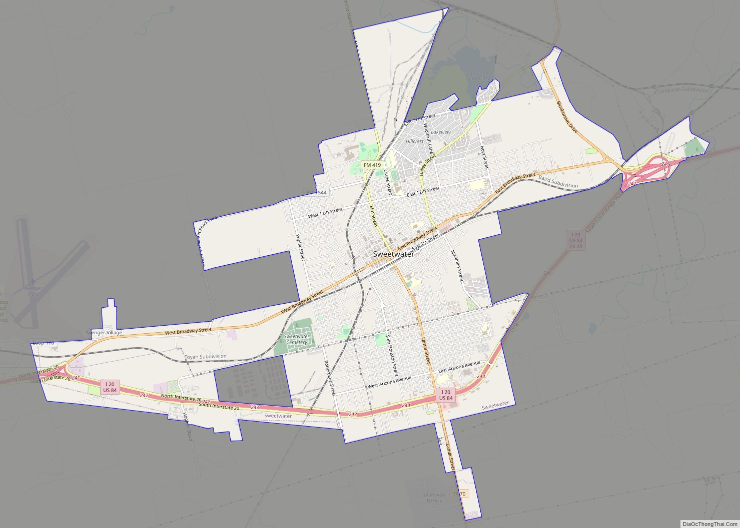
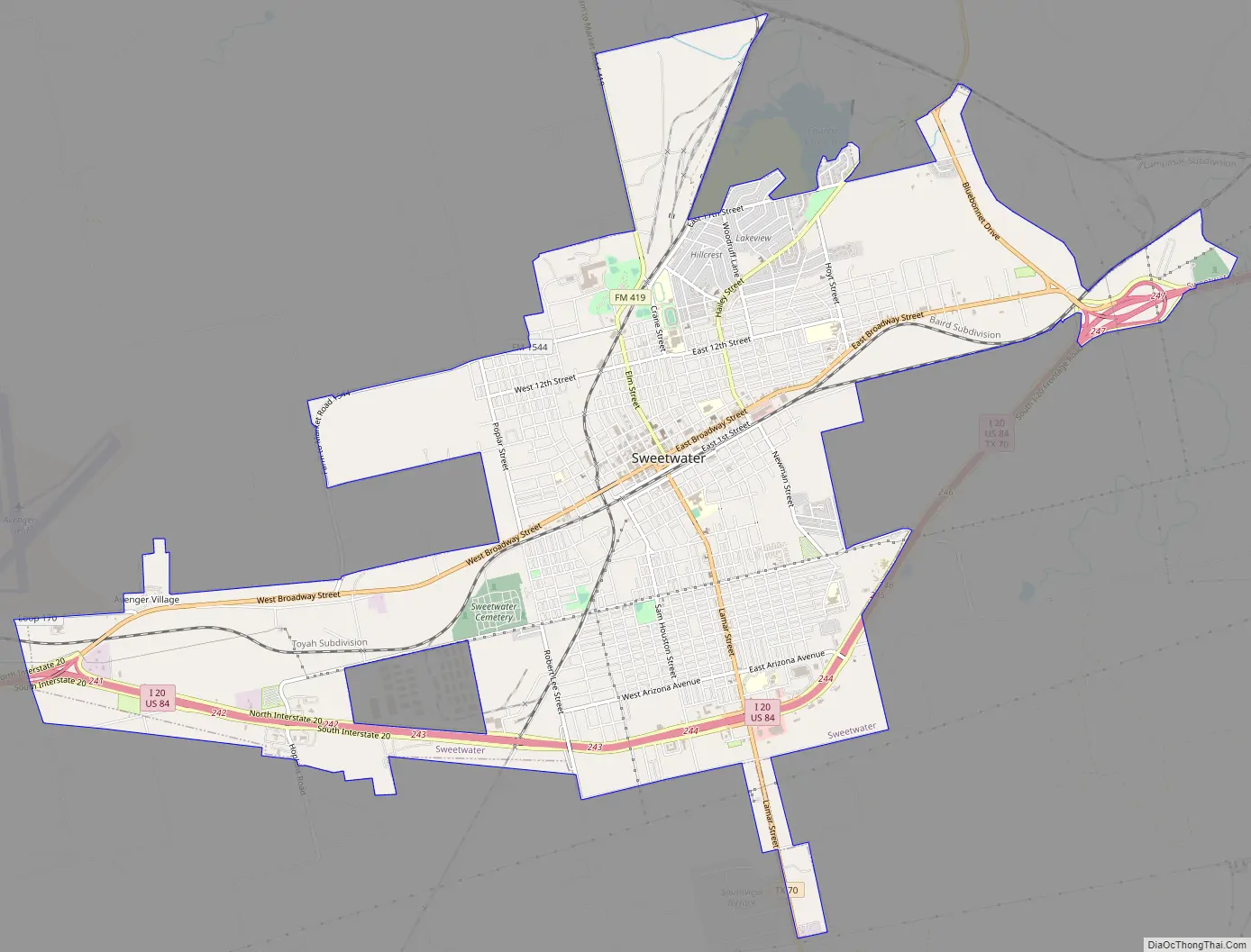
Sweetwater Road Map
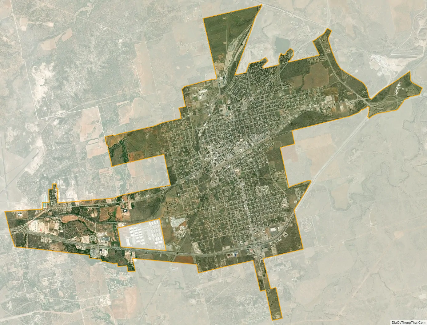
Sweetwater city Satellite Map
Geography
Sweetwater is located at 32°28′5″N 100°24′26″W / 32.46806°N 100.40722°W / 32.46806; -100.40722 (32.468147, –100.407125).
According to the United States Census Bureau, in 2020, the city had a total land area of 11.07 sq mi (28.7 km), all of it land.
Sweetwater is the center of the Western Hemisphere’s leading wind power generation region and West Texas has more than 4,000 MW of operational wind energy. Nolan County alone would currently rank as the eighth-largest “nation” in terms of wind energy generation – with more than 1,500 MW installed.
Climate
Climate type occurs primarily on the periphery of the true deserts in low-latitude semiarid steppe regions. The Köppen climate classification subtype for this climate is BSk (tropical and subtropical steppe climate).
See also
Map of Texas State and its subdivision:- Anderson
- Andrews
- Angelina
- Aransas
- Archer
- Armstrong
- Atascosa
- Austin
- Bailey
- Bandera
- Bastrop
- Baylor
- Bee
- Bell
- Bexar
- Blanco
- Borden
- Bosque
- Bowie
- Brazoria
- Brazos
- Brewster
- Briscoe
- Brooks
- Brown
- Burleson
- Burnet
- Caldwell
- Calhoun
- Callahan
- Cameron
- Camp
- Carson
- Cass
- Castro
- Chambers
- Cherokee
- Childress
- Clay
- Cochran
- Coke
- Coleman
- Collin
- Collingsworth
- Colorado
- Comal
- Comanche
- Concho
- Cooke
- Coryell
- Cottle
- Crane
- Crockett
- Crosby
- Culberson
- Dallam
- Dallas
- Dawson
- Deaf Smith
- Delta
- Denton
- Dewitt
- Dickens
- Dimmit
- Donley
- Duval
- Eastland
- Ector
- Edwards
- El Paso
- Ellis
- Erath
- Falls
- Fannin
- Fayette
- Fisher
- Floyd
- Foard
- Fort Bend
- Franklin
- Freestone
- Frio
- Gaines
- Galveston
- Garza
- Gillespie
- Glasscock
- Goliad
- Gonzales
- Gray
- Grayson
- Gregg
- Grimes
- Guadalupe
- Hale
- Hall
- Hamilton
- Hansford
- Hardeman
- Hardin
- Harris
- Harrison
- Hartley
- Haskell
- Hays
- Hemphill
- Henderson
- Hidalgo
- Hill
- Hockley
- Hood
- Hopkins
- Houston
- Howard
- Hudspeth
- Hunt
- Hutchinson
- Irion
- Jack
- Jackson
- Jasper
- Jeff Davis
- Jefferson
- Jim Hogg
- Jim Wells
- Johnson
- Jones
- Karnes
- Kaufman
- Kendall
- Kenedy
- Kent
- Kerr
- Kimble
- King
- Kinney
- Kleberg
- Knox
- La Salle
- Lamar
- Lamb
- Lampasas
- Lavaca
- Lee
- Leon
- Liberty
- Limestone
- Lipscomb
- Live Oak
- Llano
- Loving
- Lubbock
- Lynn
- Madison
- Marion
- Martin
- Mason
- Matagorda
- Maverick
- McCulloch
- McLennan
- McMullen
- Medina
- Menard
- Midland
- Milam
- Mills
- Mitchell
- Montague
- Montgomery
- Moore
- Morris
- Motley
- Nacogdoches
- Navarro
- Newton
- Nolan
- Nueces
- Ochiltree
- Oldham
- Orange
- Palo Pinto
- Panola
- Parker
- Parmer
- Pecos
- Polk
- Potter
- Presidio
- Rains
- Randall
- Reagan
- Real
- Red River
- Reeves
- Refugio
- Roberts
- Robertson
- Rockwall
- Runnels
- Rusk
- Sabine
- San Augustine
- San Jacinto
- San Patricio
- San Saba
- Schleicher
- Scurry
- Shackelford
- Shelby
- Sherman
- Smith
- Somervell
- Starr
- Stephens
- Sterling
- Stonewall
- Sutton
- Swisher
- Tarrant
- Taylor
- Terrell
- Terry
- Throckmorton
- Titus
- Tom Green
- Travis
- Trinity
- Tyler
- Upshur
- Upton
- Uvalde
- Val Verde
- Van Zandt
- Victoria
- Walker
- Waller
- Ward
- Washington
- Webb
- Wharton
- Wheeler
- Wichita
- Wilbarger
- Willacy
- Williamson
- Wilson
- Winkler
- Wise
- Wood
- Yoakum
- Young
- Zapata
- Zavala
- Alabama
- Alaska
- Arizona
- Arkansas
- California
- Colorado
- Connecticut
- Delaware
- District of Columbia
- Florida
- Georgia
- Hawaii
- Idaho
- Illinois
- Indiana
- Iowa
- Kansas
- Kentucky
- Louisiana
- Maine
- Maryland
- Massachusetts
- Michigan
- Minnesota
- Mississippi
- Missouri
- Montana
- Nebraska
- Nevada
- New Hampshire
- New Jersey
- New Mexico
- New York
- North Carolina
- North Dakota
- Ohio
- Oklahoma
- Oregon
- Pennsylvania
- Rhode Island
- South Carolina
- South Dakota
- Tennessee
- Texas
- Utah
- Vermont
- Virginia
- Washington
- West Virginia
- Wisconsin
- Wyoming