Trophy Club is a suburb of the Dallas–Fort Worth metroplex in the U.S. state of Texas. When established in the 1970s, it was one of the earliest premier planned communities in Texas, built around the only golf course designed by Ben Hogan. It is located west of the DFW Airport and south of the western edge of Grapevine Lake, spanning the county line separating Denton and Tarrant along State Highway 114. The population was 13,688 in 2020.
| Name: | Trophy Club town |
|---|---|
| LSAD Code: | 43 |
| LSAD Description: | town (suffix) |
| State: | Texas |
| County: | Denton County, Tarrant County |
| Elevation: | 607 ft (185 m) |
| Total Area: | 4.01 sq mi (10.40 km²) |
| Land Area: | 3.98 sq mi (10.32 km²) |
| Water Area: | 0.03 sq mi (0.08 km²) |
| Total Population: | 13,688 |
| Population Density: | 3,126.04/sq mi (1,206.98/km²) |
| ZIP code: | 76262 |
| Area code: | 817, 682 |
| FIPS code: | 4873710 |
| GNISfeature ID: | 1388551 |
Online Interactive Map
Click on ![]() to view map in "full screen" mode.
to view map in "full screen" mode.
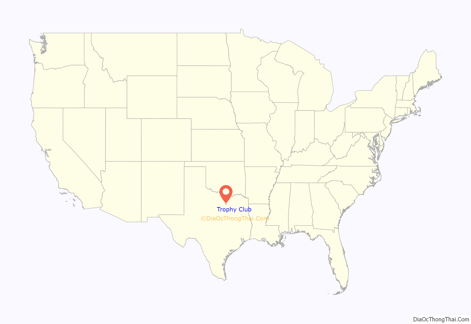
Trophy Club location map. Where is Trophy Club town?
History
Trophy Club’s history dates back to 1847 when Charles and Matilda Medlin and twenty other families left the state of Missouri to settle in the then-thriving Elizabethtown, Texas. The Medlin’s were part of the Peters Colony, a group of settlers in the 19th century that settled in various areas in Texas in hopes to acquire land grants. The families in Elizabethtown remained there until the Elizabeth Creek flooded, causing the families to relocate to higher ground. That area is now present-day Trophy Club.
The Medlins made a lasting impact on the development of the town, and a cemetery was constructed in honor of the Medlins’ daughter, Mittie Ann Medlin. The middle school in Trophy Club was also named after the Medlins.
The cemetery also provides information on the existence of the settlers that were in the area at the time.
Long after the time of the Medlins, citizens of DFW began talk about restoring the town. Eventually, the community was developed in 1973 by developers Johnson and Loggins, who created the community as a housing development surrounding the country club. The town was named for the original plan that the country club would house the trophy collections of golf legend Ben Hogan, who designed its golf course. Originally part of Westlake, the town was incorporated in 1985. The first Mayor of Trophy Club was James “Jim” P. Carter, who served as Mayor from 1985 until 1999.
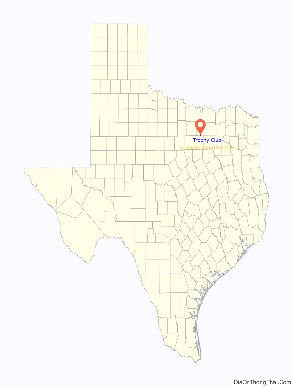
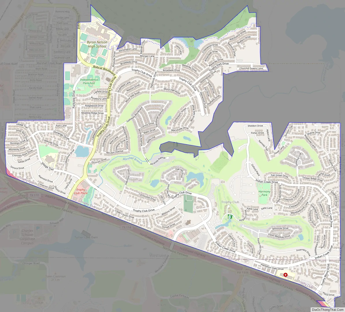
Trophy Club Road Map
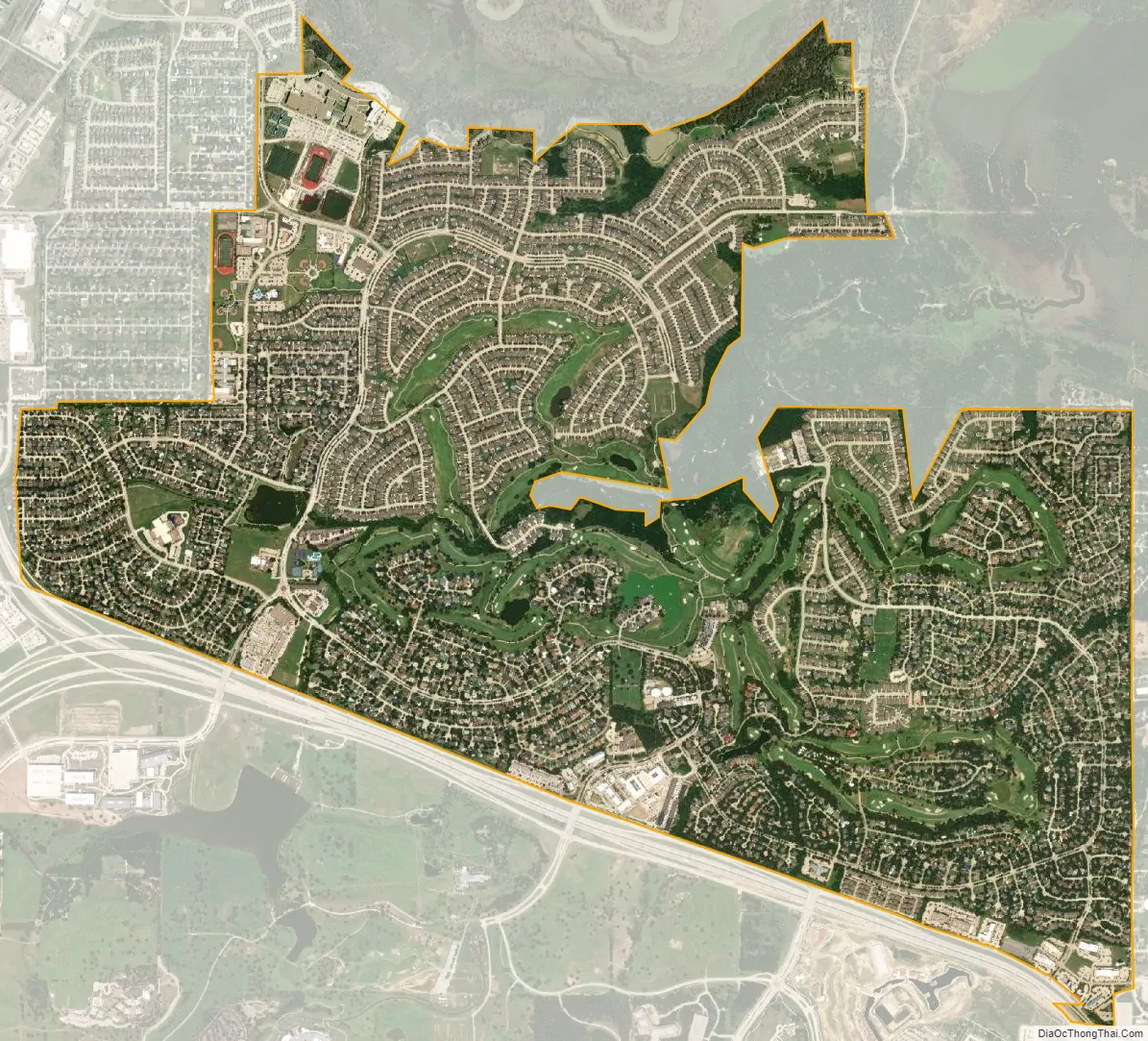
Trophy Club city Satellite Map
Geography
Trophy Club is located at 33°0′2″N 97°11′35″W / 33.00056°N 97.19306°W / 33.00056; -97.19306 (33.000507, −97.193181). The town is located on the southwestern edge of Grapevine Lake. According to the United States Census Bureau, the town has a total area of 4.1 square miles (10.5 km), of which 75% is land and 25% water.
Climate
Trophy Club, like the rest of the Dallas–Fort Worth area, has a humid subtropical climate, with hot, humid summers and generally mild to cool winters.
See also
Map of Texas State and its subdivision:- Anderson
- Andrews
- Angelina
- Aransas
- Archer
- Armstrong
- Atascosa
- Austin
- Bailey
- Bandera
- Bastrop
- Baylor
- Bee
- Bell
- Bexar
- Blanco
- Borden
- Bosque
- Bowie
- Brazoria
- Brazos
- Brewster
- Briscoe
- Brooks
- Brown
- Burleson
- Burnet
- Caldwell
- Calhoun
- Callahan
- Cameron
- Camp
- Carson
- Cass
- Castro
- Chambers
- Cherokee
- Childress
- Clay
- Cochran
- Coke
- Coleman
- Collin
- Collingsworth
- Colorado
- Comal
- Comanche
- Concho
- Cooke
- Coryell
- Cottle
- Crane
- Crockett
- Crosby
- Culberson
- Dallam
- Dallas
- Dawson
- Deaf Smith
- Delta
- Denton
- Dewitt
- Dickens
- Dimmit
- Donley
- Duval
- Eastland
- Ector
- Edwards
- El Paso
- Ellis
- Erath
- Falls
- Fannin
- Fayette
- Fisher
- Floyd
- Foard
- Fort Bend
- Franklin
- Freestone
- Frio
- Gaines
- Galveston
- Garza
- Gillespie
- Glasscock
- Goliad
- Gonzales
- Gray
- Grayson
- Gregg
- Grimes
- Guadalupe
- Hale
- Hall
- Hamilton
- Hansford
- Hardeman
- Hardin
- Harris
- Harrison
- Hartley
- Haskell
- Hays
- Hemphill
- Henderson
- Hidalgo
- Hill
- Hockley
- Hood
- Hopkins
- Houston
- Howard
- Hudspeth
- Hunt
- Hutchinson
- Irion
- Jack
- Jackson
- Jasper
- Jeff Davis
- Jefferson
- Jim Hogg
- Jim Wells
- Johnson
- Jones
- Karnes
- Kaufman
- Kendall
- Kenedy
- Kent
- Kerr
- Kimble
- King
- Kinney
- Kleberg
- Knox
- La Salle
- Lamar
- Lamb
- Lampasas
- Lavaca
- Lee
- Leon
- Liberty
- Limestone
- Lipscomb
- Live Oak
- Llano
- Loving
- Lubbock
- Lynn
- Madison
- Marion
- Martin
- Mason
- Matagorda
- Maverick
- McCulloch
- McLennan
- McMullen
- Medina
- Menard
- Midland
- Milam
- Mills
- Mitchell
- Montague
- Montgomery
- Moore
- Morris
- Motley
- Nacogdoches
- Navarro
- Newton
- Nolan
- Nueces
- Ochiltree
- Oldham
- Orange
- Palo Pinto
- Panola
- Parker
- Parmer
- Pecos
- Polk
- Potter
- Presidio
- Rains
- Randall
- Reagan
- Real
- Red River
- Reeves
- Refugio
- Roberts
- Robertson
- Rockwall
- Runnels
- Rusk
- Sabine
- San Augustine
- San Jacinto
- San Patricio
- San Saba
- Schleicher
- Scurry
- Shackelford
- Shelby
- Sherman
- Smith
- Somervell
- Starr
- Stephens
- Sterling
- Stonewall
- Sutton
- Swisher
- Tarrant
- Taylor
- Terrell
- Terry
- Throckmorton
- Titus
- Tom Green
- Travis
- Trinity
- Tyler
- Upshur
- Upton
- Uvalde
- Val Verde
- Van Zandt
- Victoria
- Walker
- Waller
- Ward
- Washington
- Webb
- Wharton
- Wheeler
- Wichita
- Wilbarger
- Willacy
- Williamson
- Wilson
- Winkler
- Wise
- Wood
- Yoakum
- Young
- Zapata
- Zavala
- Alabama
- Alaska
- Arizona
- Arkansas
- California
- Colorado
- Connecticut
- Delaware
- District of Columbia
- Florida
- Georgia
- Hawaii
- Idaho
- Illinois
- Indiana
- Iowa
- Kansas
- Kentucky
- Louisiana
- Maine
- Maryland
- Massachusetts
- Michigan
- Minnesota
- Mississippi
- Missouri
- Montana
- Nebraska
- Nevada
- New Hampshire
- New Jersey
- New Mexico
- New York
- North Carolina
- North Dakota
- Ohio
- Oklahoma
- Oregon
- Pennsylvania
- Rhode Island
- South Carolina
- South Dakota
- Tennessee
- Texas
- Utah
- Vermont
- Virginia
- Washington
- West Virginia
- Wisconsin
- Wyoming


