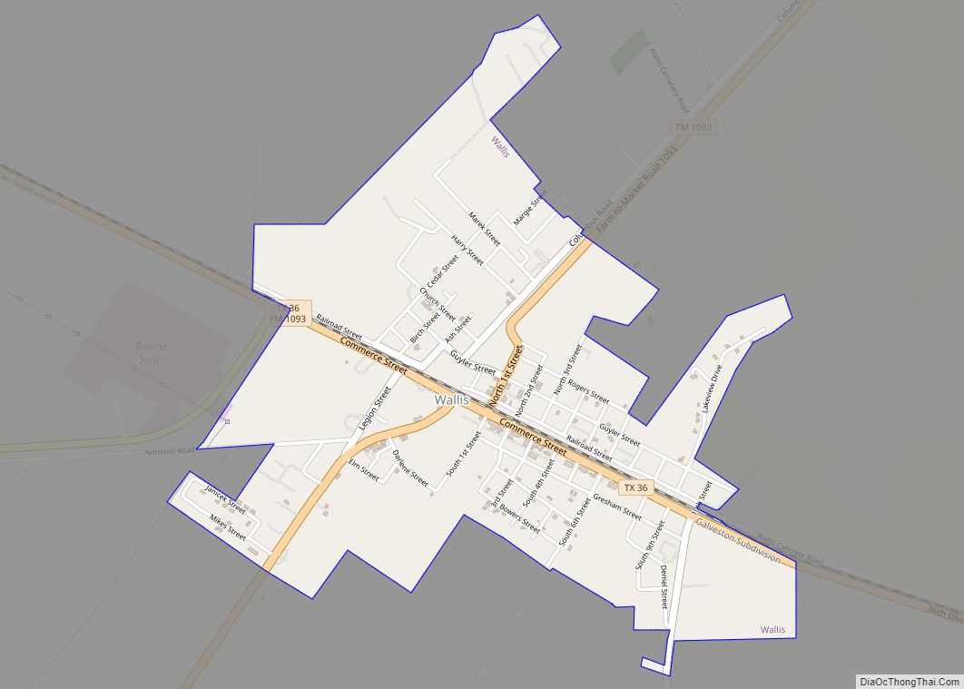
Wallis is a city in far southeastern Austin County, Texas, United States. The city is located along State Highway 36 (SH 36) and the BNSF Railway between Rosenberg and Sealy. The city’s population was 1,292 at the 2020 census.
| Name: | Wallis city |
|---|---|
| LSAD Code: | 25 |
| LSAD Description: | city (suffix) |
| State: | Texas |
| County: | Austin County |
| Elevation: | 128 ft (39 m) |
| Total Area: | 1.51 sq mi (3.91 km²) |
| Land Area: | 1.50 sq mi (3.87 km²) |
| Water Area: | 0.01 sq mi (0.04 km²) |
| Total Population: | 1,292 |
| Population Density: | 871.57/sq mi (336.42/km²) |
| ZIP code: | 77485 |
| Area code: | 979 |
| FIPS code: | 4876240 |
| GNISfeature ID: | 1376626 |
| Website: | www.wallistexas.org |
Online Interactive Map
Click on ![]() to view map in "full screen" mode.
to view map in "full screen" mode.
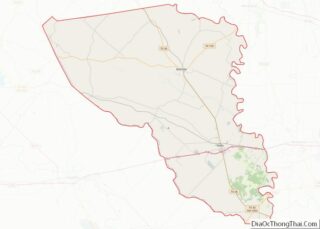
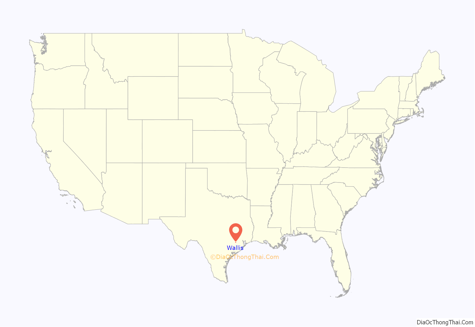
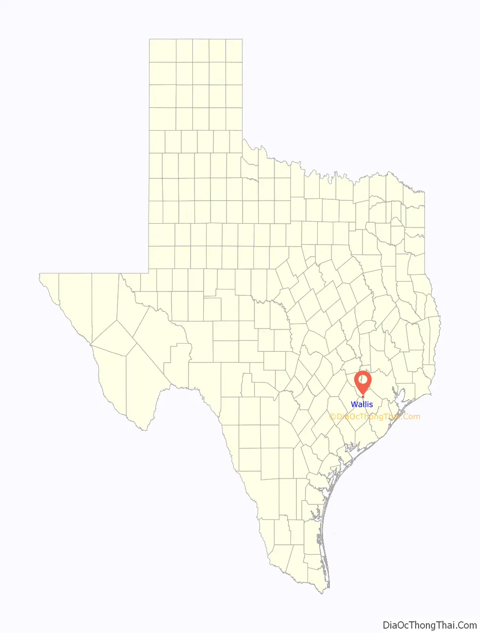
Wallis location map. Where is Wallis city?
History
In 1830 the first Anglo-Americans made their homes in the area between the Brazos and San Bernard rivers. When the settlement got a post office in 1873, its name was Bovine Bend. Sometime after 1880, the Gulf, Colorado and Santa Fe Railway was constructed through the community from Galveston to Brenham. At that time, the town was renamed Wallis Station after J. E. Wallis, the director of the railroad. In 1887 the San Antonio and Aransas Pass Railway, being built east toward Houston, reached Wallis. Starting in about 1890, Czech immigrants began moving into the area. By 1904 there were 631 souls living in Wallis. In 1911, the town dropped “Station” from its name to become Wallis. Seven years later its school had 100 students. Between 1925 and 1943 the population grew from 800 to 900. By the latter year the town boasted 39 businesses. After declining to 690 in 1949, the number of inhabitants increased to 1,075 by 1966. A decade later, the city claimed to have a bank, library, and a newspaper, as well as two schools and eight churches. In 1991 there were 1,411 people and 15 commercial establishments. The population declined to 1,311 in 2000 and to 1,252 in 2010. In 2013 the BNSF Railway still operated along the one-time Gulf, Colorado and Santa Fe Railway right-of-way, while the east–west railroad line no longer existed.
Guardian Angel Catholic Church on Demel Street
Historical marker at Guardian Angel Catholic Church
Guardian Angel Cemetery on FM 1952 south of Wallis
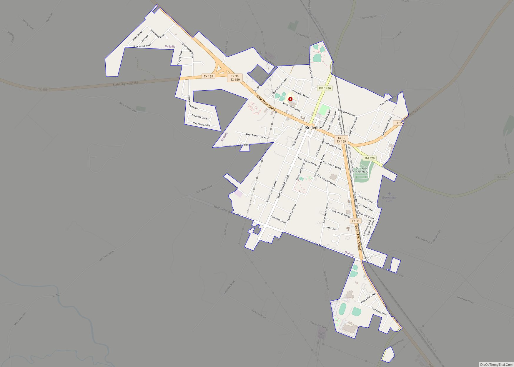
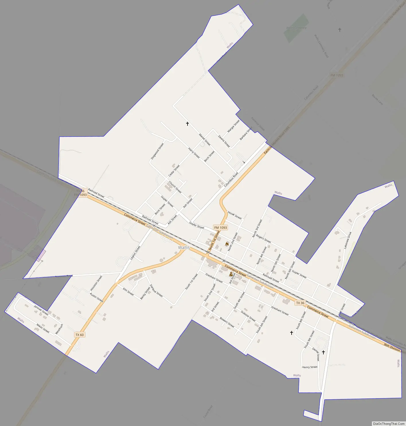
Wallis Road Map
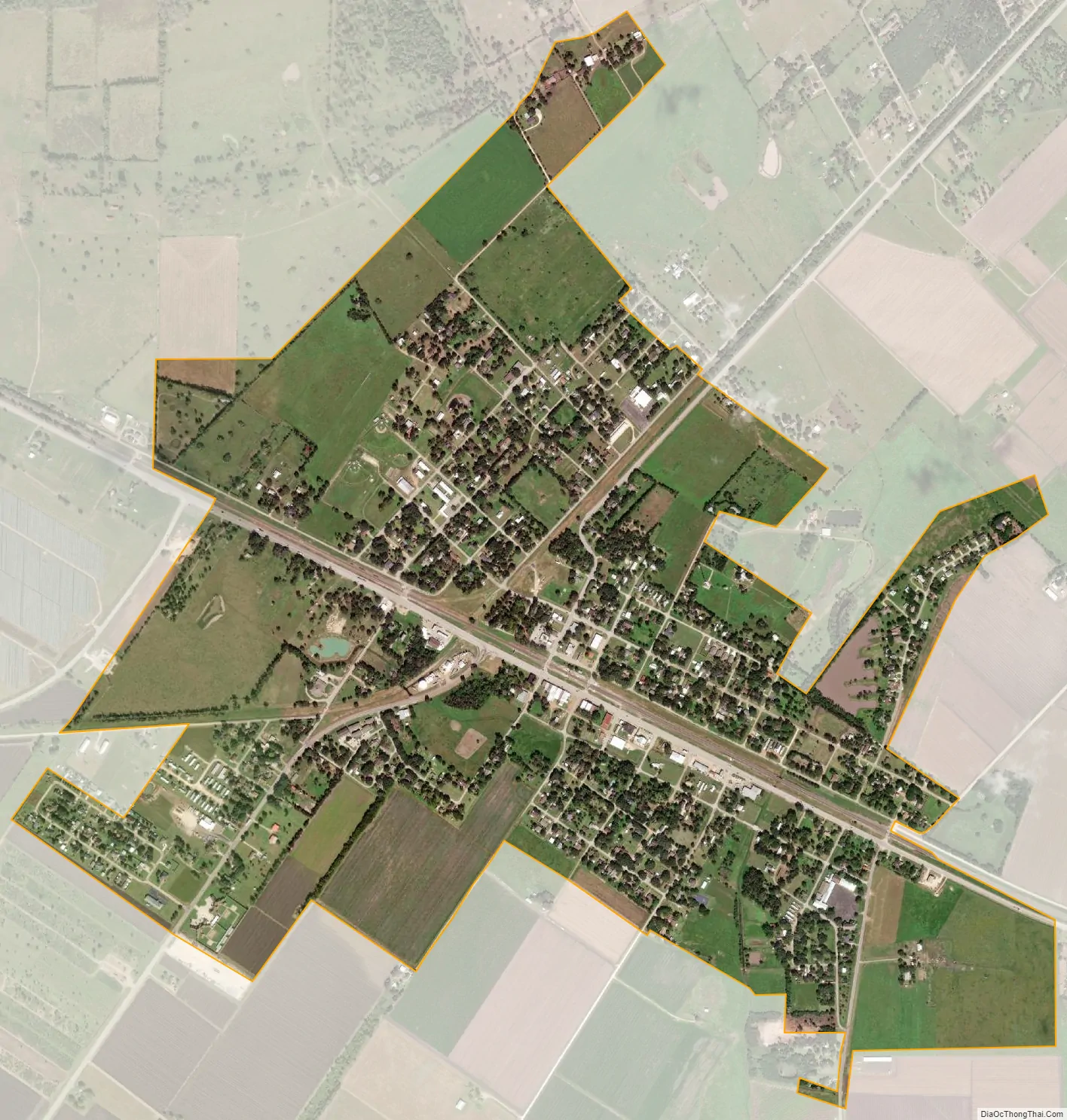
Wallis city Satellite Map
Geography
Wallis is located at 29°37′50″N 96°3′46″W / 29.63056°N 96.06278°W / 29.63056; -96.06278 (29.630649, –96.062751). SH 36 heads northwest from Wallis to Sealy in Austin County and east-southeast from Wallis to Rosenberg in Fort Bend County. The BNSF Railway runs parallel with SH 36 on the north side of the highway. State Highway 60 starts in the west part of Wallis and goes south to East Bernard. Farm to Market Road 1093 continues northeast to Simonton in Fort Bend County and west-southwest to Eagle Lake in Colorado County. Farm to Market Road 1952 begins in the east part of Wallis and goes south and east to Tavener in Fort Bend County.
According to the United States Census Bureau, the city has a total area of 1.5 square miles (3.9 km), of which 0.015 square miles (0.04 km), or 0.92%, is water.
See also
Map of Texas State and its subdivision:- Anderson
- Andrews
- Angelina
- Aransas
- Archer
- Armstrong
- Atascosa
- Austin
- Bailey
- Bandera
- Bastrop
- Baylor
- Bee
- Bell
- Bexar
- Blanco
- Borden
- Bosque
- Bowie
- Brazoria
- Brazos
- Brewster
- Briscoe
- Brooks
- Brown
- Burleson
- Burnet
- Caldwell
- Calhoun
- Callahan
- Cameron
- Camp
- Carson
- Cass
- Castro
- Chambers
- Cherokee
- Childress
- Clay
- Cochran
- Coke
- Coleman
- Collin
- Collingsworth
- Colorado
- Comal
- Comanche
- Concho
- Cooke
- Coryell
- Cottle
- Crane
- Crockett
- Crosby
- Culberson
- Dallam
- Dallas
- Dawson
- Deaf Smith
- Delta
- Denton
- Dewitt
- Dickens
- Dimmit
- Donley
- Duval
- Eastland
- Ector
- Edwards
- El Paso
- Ellis
- Erath
- Falls
- Fannin
- Fayette
- Fisher
- Floyd
- Foard
- Fort Bend
- Franklin
- Freestone
- Frio
- Gaines
- Galveston
- Garza
- Gillespie
- Glasscock
- Goliad
- Gonzales
- Gray
- Grayson
- Gregg
- Grimes
- Guadalupe
- Hale
- Hall
- Hamilton
- Hansford
- Hardeman
- Hardin
- Harris
- Harrison
- Hartley
- Haskell
- Hays
- Hemphill
- Henderson
- Hidalgo
- Hill
- Hockley
- Hood
- Hopkins
- Houston
- Howard
- Hudspeth
- Hunt
- Hutchinson
- Irion
- Jack
- Jackson
- Jasper
- Jeff Davis
- Jefferson
- Jim Hogg
- Jim Wells
- Johnson
- Jones
- Karnes
- Kaufman
- Kendall
- Kenedy
- Kent
- Kerr
- Kimble
- King
- Kinney
- Kleberg
- Knox
- La Salle
- Lamar
- Lamb
- Lampasas
- Lavaca
- Lee
- Leon
- Liberty
- Limestone
- Lipscomb
- Live Oak
- Llano
- Loving
- Lubbock
- Lynn
- Madison
- Marion
- Martin
- Mason
- Matagorda
- Maverick
- McCulloch
- McLennan
- McMullen
- Medina
- Menard
- Midland
- Milam
- Mills
- Mitchell
- Montague
- Montgomery
- Moore
- Morris
- Motley
- Nacogdoches
- Navarro
- Newton
- Nolan
- Nueces
- Ochiltree
- Oldham
- Orange
- Palo Pinto
- Panola
- Parker
- Parmer
- Pecos
- Polk
- Potter
- Presidio
- Rains
- Randall
- Reagan
- Real
- Red River
- Reeves
- Refugio
- Roberts
- Robertson
- Rockwall
- Runnels
- Rusk
- Sabine
- San Augustine
- San Jacinto
- San Patricio
- San Saba
- Schleicher
- Scurry
- Shackelford
- Shelby
- Sherman
- Smith
- Somervell
- Starr
- Stephens
- Sterling
- Stonewall
- Sutton
- Swisher
- Tarrant
- Taylor
- Terrell
- Terry
- Throckmorton
- Titus
- Tom Green
- Travis
- Trinity
- Tyler
- Upshur
- Upton
- Uvalde
- Val Verde
- Van Zandt
- Victoria
- Walker
- Waller
- Ward
- Washington
- Webb
- Wharton
- Wheeler
- Wichita
- Wilbarger
- Willacy
- Williamson
- Wilson
- Winkler
- Wise
- Wood
- Yoakum
- Young
- Zapata
- Zavala
- Alabama
- Alaska
- Arizona
- Arkansas
- California
- Colorado
- Connecticut
- Delaware
- District of Columbia
- Florida
- Georgia
- Hawaii
- Idaho
- Illinois
- Indiana
- Iowa
- Kansas
- Kentucky
- Louisiana
- Maine
- Maryland
- Massachusetts
- Michigan
- Minnesota
- Mississippi
- Missouri
- Montana
- Nebraska
- Nevada
- New Hampshire
- New Jersey
- New Mexico
- New York
- North Carolina
- North Dakota
- Ohio
- Oklahoma
- Oregon
- Pennsylvania
- Rhode Island
- South Carolina
- South Dakota
- Tennessee
- Texas
- Utah
- Vermont
- Virginia
- Washington
- West Virginia
- Wisconsin
- Wyoming