Wells is a town in Cherokee County, Texas, United States. The population was 790 at the 2010 census, and 853 at the 2020 U.S. census.
| Name: | Wells town |
|---|---|
| LSAD Code: | 43 |
| LSAD Description: | town (suffix) |
| State: | Texas |
| County: | Cherokee County |
| Elevation: | 325 ft (99 m) |
| Total Area: | 1.92 sq mi (4.96 km²) |
| Land Area: | 1.92 sq mi (4.96 km²) |
| Water Area: | 0.00 sq mi (0.00 km²) |
| Total Population: | 853 |
| Population Density: | 413.58/sq mi (159.67/km²) |
| ZIP code: | 75976 |
| Area code: | 936 |
| FIPS code: | 4877176 |
| GNISfeature ID: | 1371031 |
Online Interactive Map
Click on ![]() to view map in "full screen" mode.
to view map in "full screen" mode.
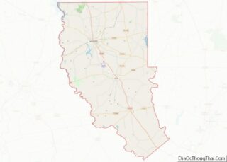
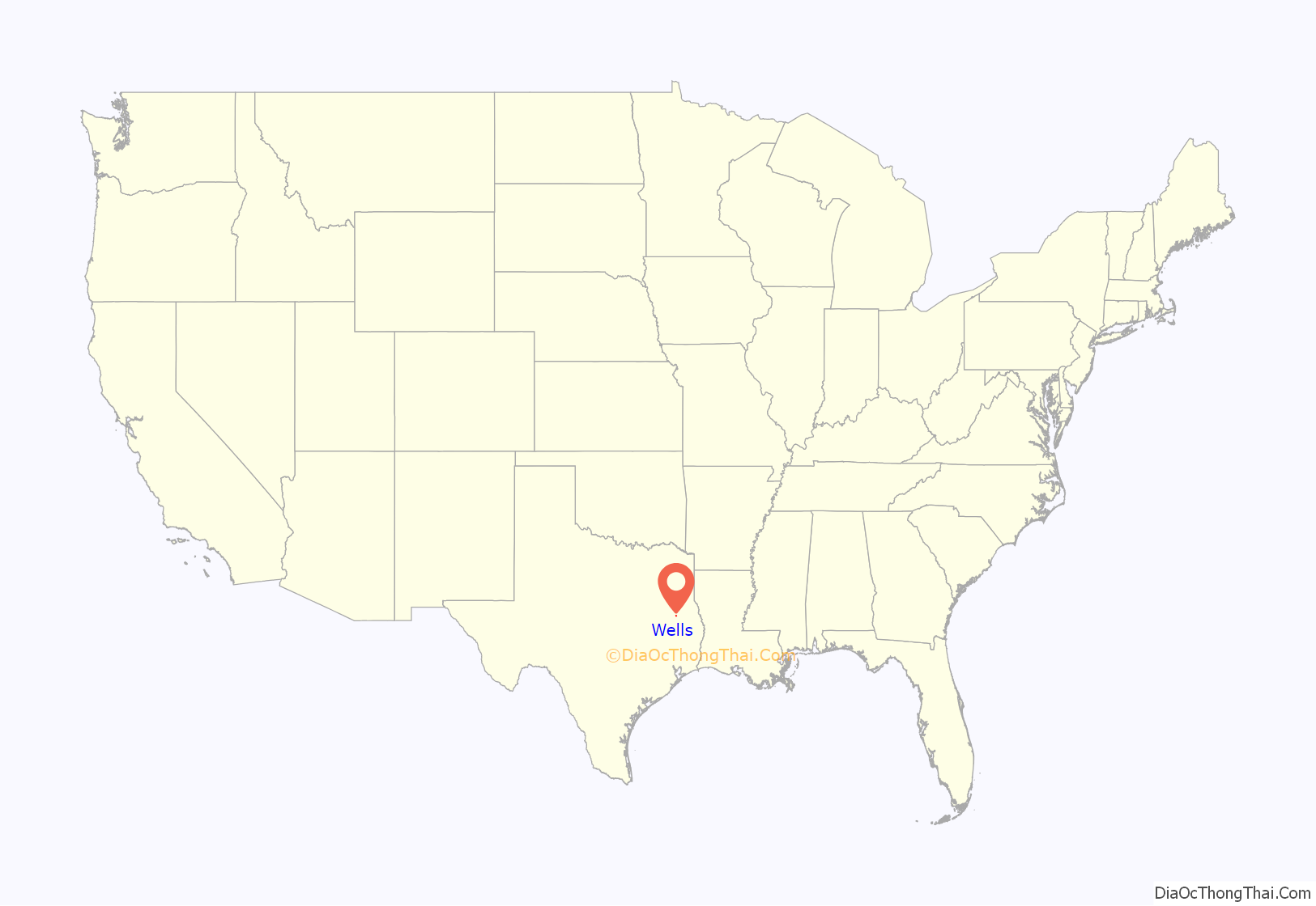
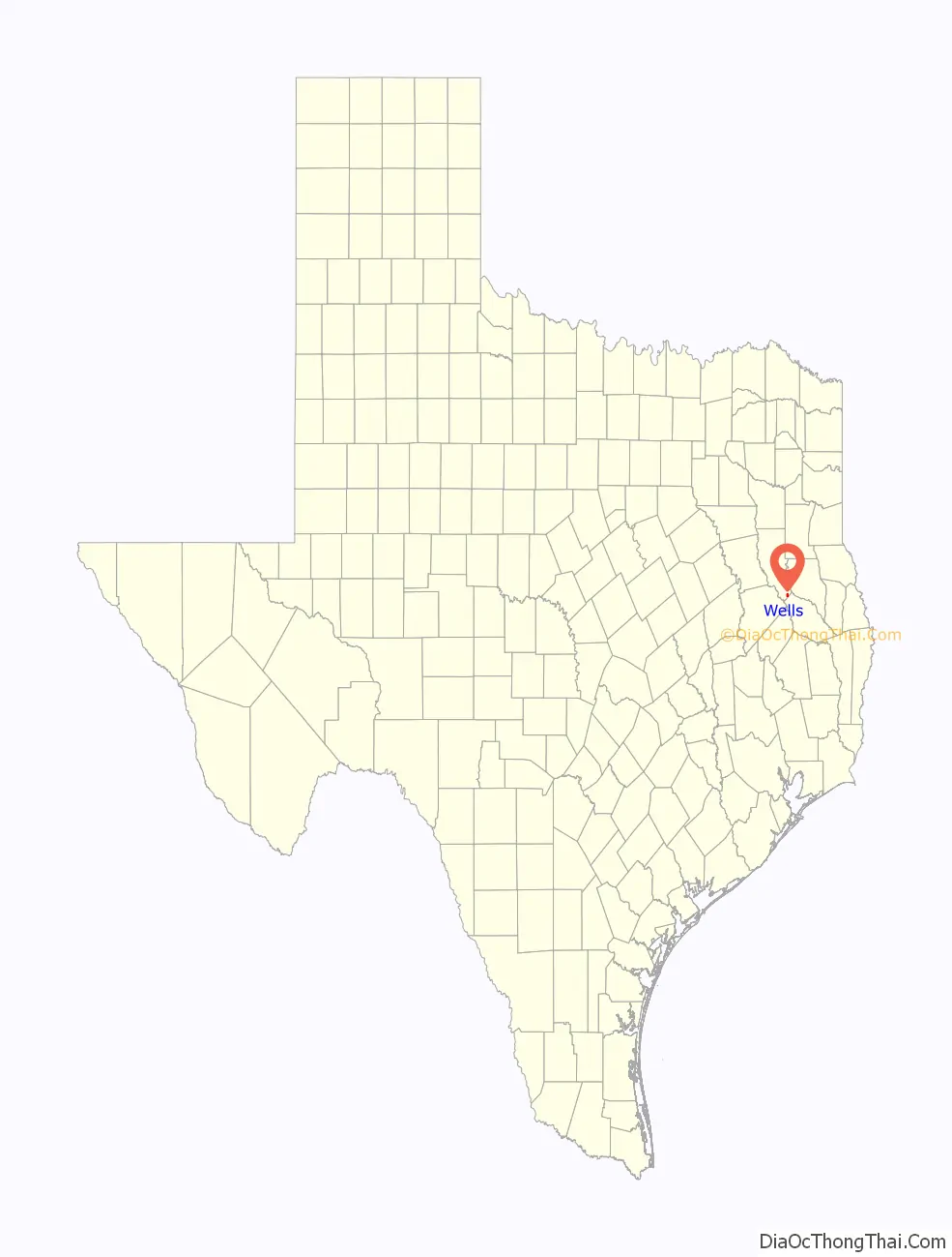
Wells location map. Where is Wells town?
History
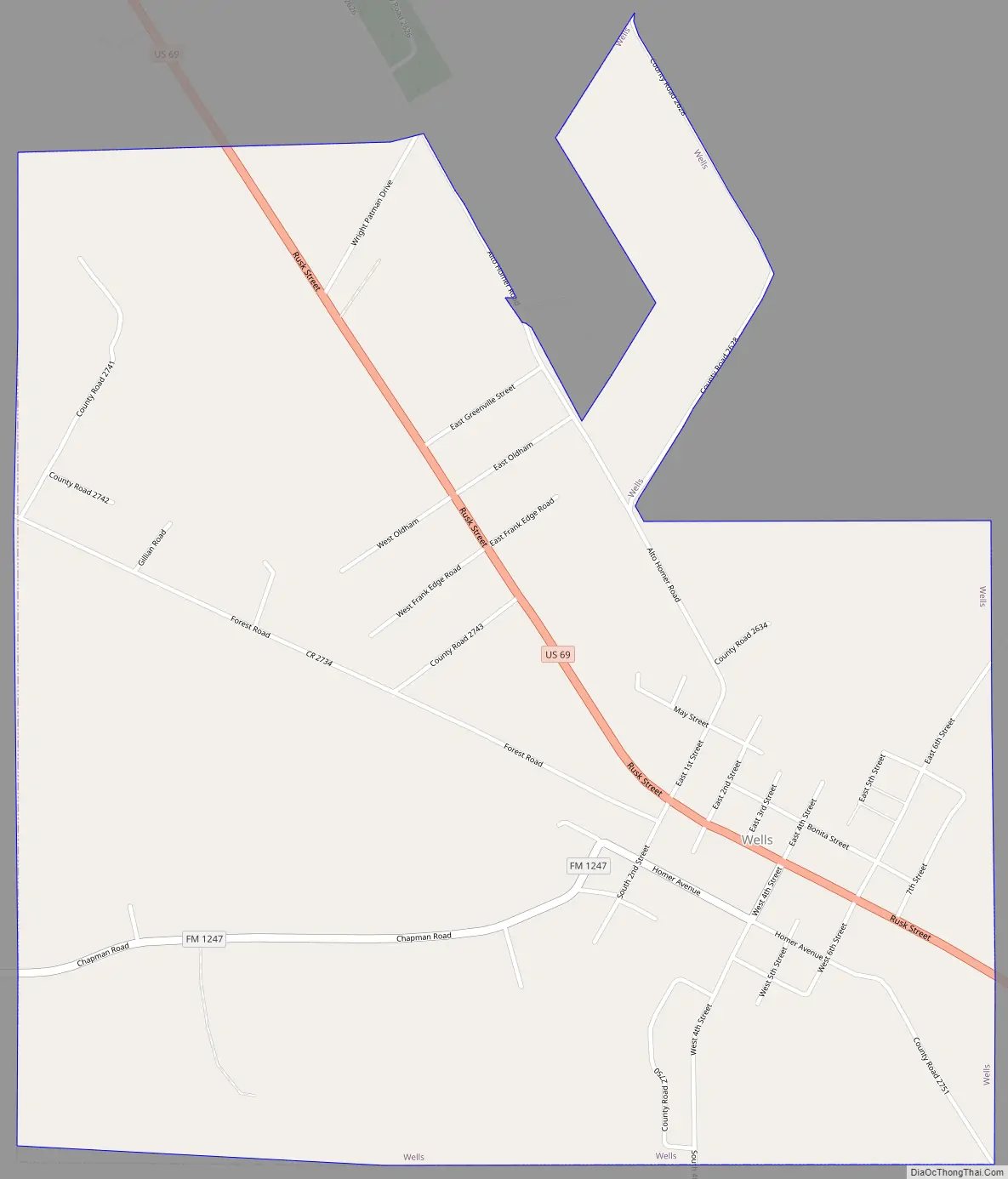
Wells is at the junction of U.S. Highway 69 and Farm Road 1247, twenty-three miles south of Rusk in extreme southern Cherokee County. It was established in 1885 as a stop on the newly constructed Kansas and Gulf Short Line Railroad and was named for Maj. E. H. Wells, a civil engineer for the railroad. A post office opened in 1886, and by 1890 the town had a sawmill, a hotel, a Methodist church, three general stores, and a population of fifty. Shortly after the railroad was completed, the state penitentiary established a satellite camp just outside the town to produce charcoal for the state-run iron works at Rusk. The presence of the prison camp discouraged many potential settlers, and the town’s population remained small until after 1900, when the charcoal camp was closed. During the 1910s, however, the town boomed; the First State Bank of Wells opened in 1913, and the following year the population reached 300. During the 1920s the community incorporated, and in 1936 Wells reported 475 residents and twenty businesses. The population continued to grow after World War II, rising to 761 by 1990. Over the same period, however, the number of businesses has gradually declined, falling from twenty-six in 1952 to seven in 1990. Farming, cattle ranching, and lumber are the principal industries.
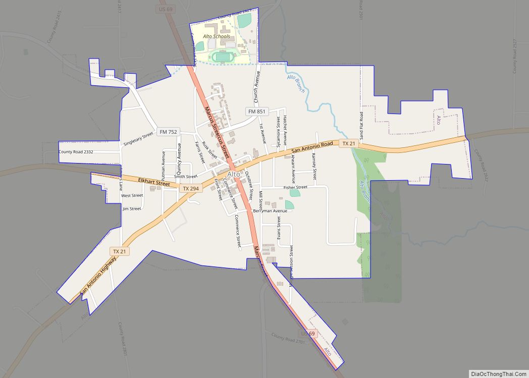
Wells Road Map
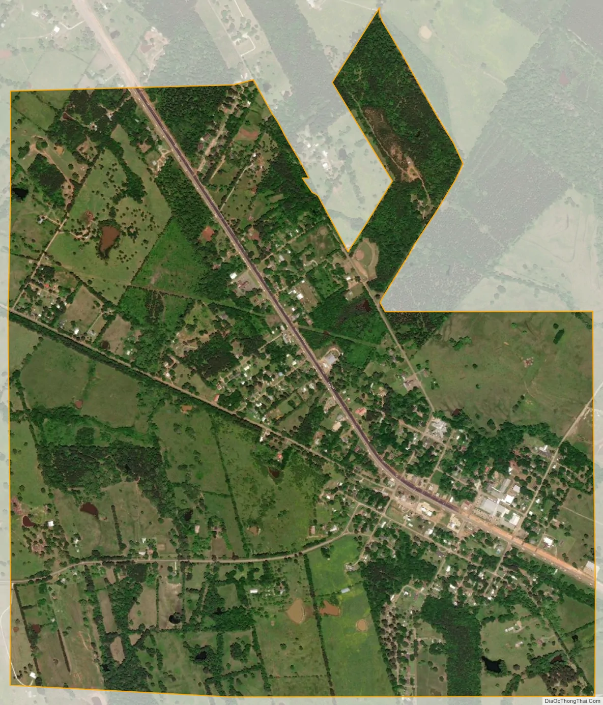
Wells city Satellite Map
Geography
Wells is located at 31°29′25″N 94°56′27″W / 31.49028°N 94.94083°W / 31.49028; -94.94083 (31.490395, –94.940950).
Wells is in the southernmost tip of Cherokee County in East Texas approximately 65 miles (105 km) south of Tyler and 17 miles (27 km) north of Lufkin on U.S. 69. Nacogdoches is 20 miles (32 km) Northeast, Dallas is 165.84 miles (266.89 km) to the north and west while Houston is 137.51 miles (221.30 km) to the south and west.
According to the United States Census Bureau, the town has a total area of 2.0 square miles (5.2 km), all of it land.
See also
Map of Texas State and its subdivision:- Anderson
- Andrews
- Angelina
- Aransas
- Archer
- Armstrong
- Atascosa
- Austin
- Bailey
- Bandera
- Bastrop
- Baylor
- Bee
- Bell
- Bexar
- Blanco
- Borden
- Bosque
- Bowie
- Brazoria
- Brazos
- Brewster
- Briscoe
- Brooks
- Brown
- Burleson
- Burnet
- Caldwell
- Calhoun
- Callahan
- Cameron
- Camp
- Carson
- Cass
- Castro
- Chambers
- Cherokee
- Childress
- Clay
- Cochran
- Coke
- Coleman
- Collin
- Collingsworth
- Colorado
- Comal
- Comanche
- Concho
- Cooke
- Coryell
- Cottle
- Crane
- Crockett
- Crosby
- Culberson
- Dallam
- Dallas
- Dawson
- Deaf Smith
- Delta
- Denton
- Dewitt
- Dickens
- Dimmit
- Donley
- Duval
- Eastland
- Ector
- Edwards
- El Paso
- Ellis
- Erath
- Falls
- Fannin
- Fayette
- Fisher
- Floyd
- Foard
- Fort Bend
- Franklin
- Freestone
- Frio
- Gaines
- Galveston
- Garza
- Gillespie
- Glasscock
- Goliad
- Gonzales
- Gray
- Grayson
- Gregg
- Grimes
- Guadalupe
- Hale
- Hall
- Hamilton
- Hansford
- Hardeman
- Hardin
- Harris
- Harrison
- Hartley
- Haskell
- Hays
- Hemphill
- Henderson
- Hidalgo
- Hill
- Hockley
- Hood
- Hopkins
- Houston
- Howard
- Hudspeth
- Hunt
- Hutchinson
- Irion
- Jack
- Jackson
- Jasper
- Jeff Davis
- Jefferson
- Jim Hogg
- Jim Wells
- Johnson
- Jones
- Karnes
- Kaufman
- Kendall
- Kenedy
- Kent
- Kerr
- Kimble
- King
- Kinney
- Kleberg
- Knox
- La Salle
- Lamar
- Lamb
- Lampasas
- Lavaca
- Lee
- Leon
- Liberty
- Limestone
- Lipscomb
- Live Oak
- Llano
- Loving
- Lubbock
- Lynn
- Madison
- Marion
- Martin
- Mason
- Matagorda
- Maverick
- McCulloch
- McLennan
- McMullen
- Medina
- Menard
- Midland
- Milam
- Mills
- Mitchell
- Montague
- Montgomery
- Moore
- Morris
- Motley
- Nacogdoches
- Navarro
- Newton
- Nolan
- Nueces
- Ochiltree
- Oldham
- Orange
- Palo Pinto
- Panola
- Parker
- Parmer
- Pecos
- Polk
- Potter
- Presidio
- Rains
- Randall
- Reagan
- Real
- Red River
- Reeves
- Refugio
- Roberts
- Robertson
- Rockwall
- Runnels
- Rusk
- Sabine
- San Augustine
- San Jacinto
- San Patricio
- San Saba
- Schleicher
- Scurry
- Shackelford
- Shelby
- Sherman
- Smith
- Somervell
- Starr
- Stephens
- Sterling
- Stonewall
- Sutton
- Swisher
- Tarrant
- Taylor
- Terrell
- Terry
- Throckmorton
- Titus
- Tom Green
- Travis
- Trinity
- Tyler
- Upshur
- Upton
- Uvalde
- Val Verde
- Van Zandt
- Victoria
- Walker
- Waller
- Ward
- Washington
- Webb
- Wharton
- Wheeler
- Wichita
- Wilbarger
- Willacy
- Williamson
- Wilson
- Winkler
- Wise
- Wood
- Yoakum
- Young
- Zapata
- Zavala
- Alabama
- Alaska
- Arizona
- Arkansas
- California
- Colorado
- Connecticut
- Delaware
- District of Columbia
- Florida
- Georgia
- Hawaii
- Idaho
- Illinois
- Indiana
- Iowa
- Kansas
- Kentucky
- Louisiana
- Maine
- Maryland
- Massachusetts
- Michigan
- Minnesota
- Mississippi
- Missouri
- Montana
- Nebraska
- Nevada
- New Hampshire
- New Jersey
- New Mexico
- New York
- North Carolina
- North Dakota
- Ohio
- Oklahoma
- Oregon
- Pennsylvania
- Rhode Island
- South Carolina
- South Dakota
- Tennessee
- Texas
- Utah
- Vermont
- Virginia
- Washington
- West Virginia
- Wisconsin
- Wyoming