Wilson is a small rural city in the northeastern quadrant of Lynn County, Texas, United States. As of the 2010 census, the population was 489.
| Name: | Wilson city |
|---|---|
| LSAD Code: | 25 |
| LSAD Description: | city (suffix) |
| State: | Texas |
| County: | Lynn County |
| Elevation: | 3,120 ft (950 m) |
| Total Area: | 0.65 sq mi (1.67 km²) |
| Land Area: | 0.64 sq mi (1.67 km²) |
| Total Population: | 489 |
| Population Density: | 758.6/sq mi (292.89/km²) |
| ZIP code: | 79381 |
| Area code: | 806 |
| FIPS code: | 4879612 |
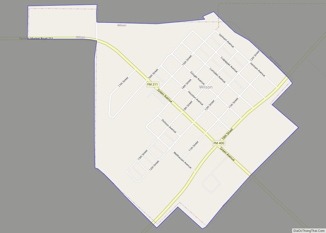
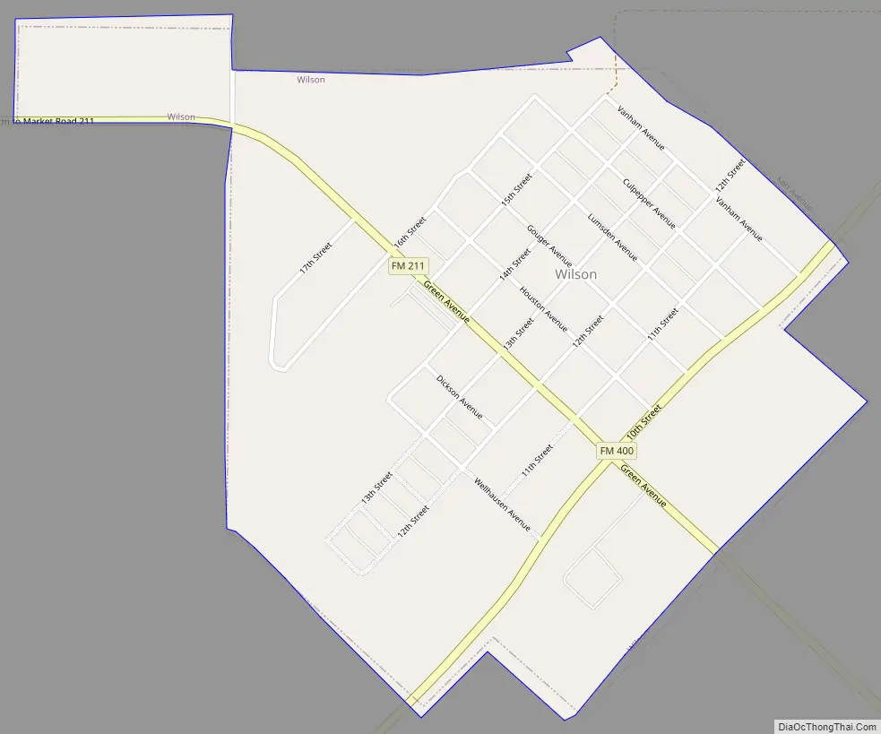
Online Interactive Map
Click on ![]() to view map in "full screen" mode.
to view map in "full screen" mode.
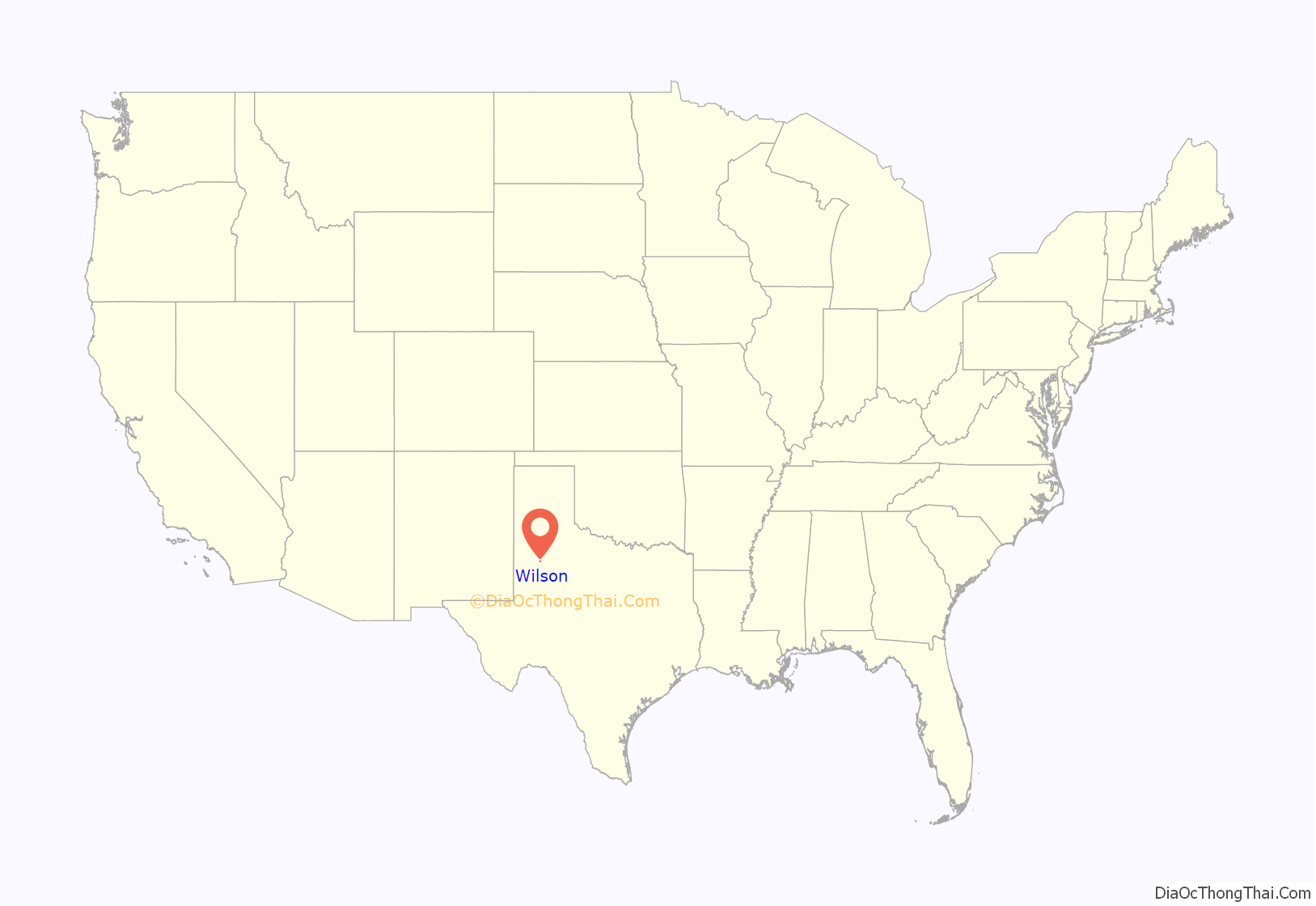
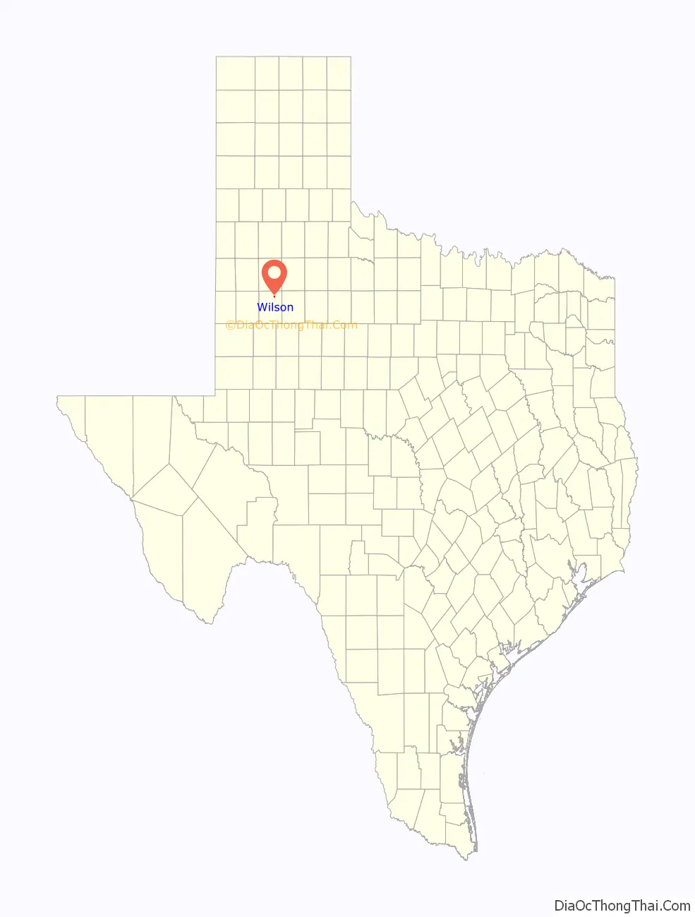
Wilson location map. Where is Wilson city?
History
The town of Wilson was established in 1912 by William Dickson Green of Shiner, Texas, and Lonnie Lumsden. Early settlers included German and Polish emigrant farmers who acquired property on former Wilson County School lands located in Lynn County, hence the city’s name.
Wilson was founded in anticipation that the Panhandle and Santa Fe Railway would lay tracks through the area. The Panhandle and Santa Fe Railway Company was one of the two major operating subsidiaries of the Atchison, Topeka and Santa Fe Railway Company (Santa Fe) in Texas, with lines crossing the Texas Panhandle and South Plains regions, as well as a line across the Trans-Pecos to Presidio. A branch line between Slaton Junction and Lamesa was constructed in 1911, and this line would pass directly through Wilson.
In 1917, William Green built the “Green Building” that housed a mercantile store that quickly became the center of activity in this small town. The couple most involved in operating the store were Mr. and Mrs. J.T. Williams, who managed the store from 1916 to 1936, when Mr. Williams died. Mrs. Williams continued to manage the store for another few years until the early 1940s. In 1963, the citizens of Wilson celebrated the renovation of the Green Building, and today, the refurbished building serves as the city hall and historical museum, and continues to be a community gathering spot.
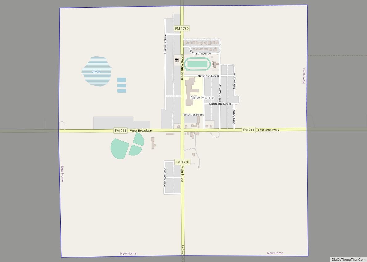
Wilson Road Map
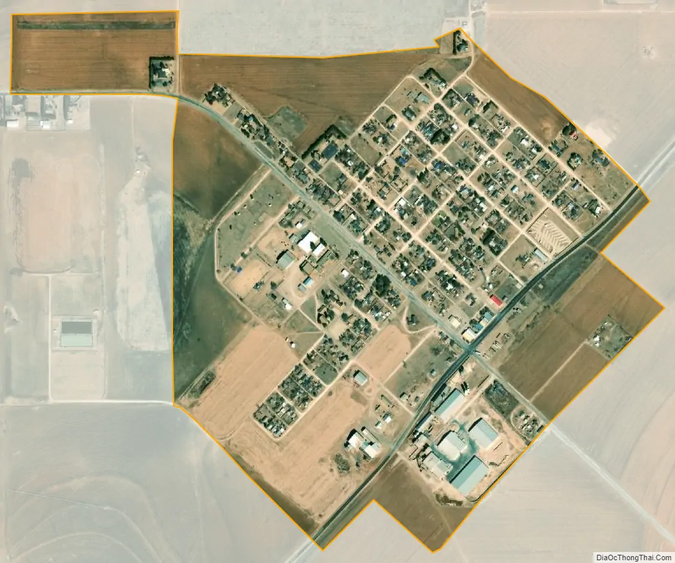
Wilson city Satellite Map
Geography
Wilson rests upon the level High Plains of the Llano Estacado in West Texas. It is situated at the intersection of Farm to Market Road 400 and Farm to Market Road 211. Farm to Market Road 400 runs parallel to the tracks of the former Panhandle and Santa Fe Railway. This branch line was abandoned in 1999 and Wilson no longer has access to rail transport.
It is located at 33°19′01″N 101°43′27″W / 33.31694°N 101.72417°W / 33.31694; -101.72417 (33.3170352, –101.7240454). It is 11 miles (18 km) northeast of Tahoka, the Lynn county seat.
According to the United States Census Bureau, the city has a total area of 0.6 square miles (1.6 km), all of it land.
See also
Map of Texas State and its subdivision:- Anderson
- Andrews
- Angelina
- Aransas
- Archer
- Armstrong
- Atascosa
- Austin
- Bailey
- Bandera
- Bastrop
- Baylor
- Bee
- Bell
- Bexar
- Blanco
- Borden
- Bosque
- Bowie
- Brazoria
- Brazos
- Brewster
- Briscoe
- Brooks
- Brown
- Burleson
- Burnet
- Caldwell
- Calhoun
- Callahan
- Cameron
- Camp
- Carson
- Cass
- Castro
- Chambers
- Cherokee
- Childress
- Clay
- Cochran
- Coke
- Coleman
- Collin
- Collingsworth
- Colorado
- Comal
- Comanche
- Concho
- Cooke
- Coryell
- Cottle
- Crane
- Crockett
- Crosby
- Culberson
- Dallam
- Dallas
- Dawson
- Deaf Smith
- Delta
- Denton
- Dewitt
- Dickens
- Dimmit
- Donley
- Duval
- Eastland
- Ector
- Edwards
- El Paso
- Ellis
- Erath
- Falls
- Fannin
- Fayette
- Fisher
- Floyd
- Foard
- Fort Bend
- Franklin
- Freestone
- Frio
- Gaines
- Galveston
- Garza
- Gillespie
- Glasscock
- Goliad
- Gonzales
- Gray
- Grayson
- Gregg
- Grimes
- Guadalupe
- Hale
- Hall
- Hamilton
- Hansford
- Hardeman
- Hardin
- Harris
- Harrison
- Hartley
- Haskell
- Hays
- Hemphill
- Henderson
- Hidalgo
- Hill
- Hockley
- Hood
- Hopkins
- Houston
- Howard
- Hudspeth
- Hunt
- Hutchinson
- Irion
- Jack
- Jackson
- Jasper
- Jeff Davis
- Jefferson
- Jim Hogg
- Jim Wells
- Johnson
- Jones
- Karnes
- Kaufman
- Kendall
- Kenedy
- Kent
- Kerr
- Kimble
- King
- Kinney
- Kleberg
- Knox
- La Salle
- Lamar
- Lamb
- Lampasas
- Lavaca
- Lee
- Leon
- Liberty
- Limestone
- Lipscomb
- Live Oak
- Llano
- Loving
- Lubbock
- Lynn
- Madison
- Marion
- Martin
- Mason
- Matagorda
- Maverick
- McCulloch
- McLennan
- McMullen
- Medina
- Menard
- Midland
- Milam
- Mills
- Mitchell
- Montague
- Montgomery
- Moore
- Morris
- Motley
- Nacogdoches
- Navarro
- Newton
- Nolan
- Nueces
- Ochiltree
- Oldham
- Orange
- Palo Pinto
- Panola
- Parker
- Parmer
- Pecos
- Polk
- Potter
- Presidio
- Rains
- Randall
- Reagan
- Real
- Red River
- Reeves
- Refugio
- Roberts
- Robertson
- Rockwall
- Runnels
- Rusk
- Sabine
- San Augustine
- San Jacinto
- San Patricio
- San Saba
- Schleicher
- Scurry
- Shackelford
- Shelby
- Sherman
- Smith
- Somervell
- Starr
- Stephens
- Sterling
- Stonewall
- Sutton
- Swisher
- Tarrant
- Taylor
- Terrell
- Terry
- Throckmorton
- Titus
- Tom Green
- Travis
- Trinity
- Tyler
- Upshur
- Upton
- Uvalde
- Val Verde
- Van Zandt
- Victoria
- Walker
- Waller
- Ward
- Washington
- Webb
- Wharton
- Wheeler
- Wichita
- Wilbarger
- Willacy
- Williamson
- Wilson
- Winkler
- Wise
- Wood
- Yoakum
- Young
- Zapata
- Zavala
- Alabama
- Alaska
- Arizona
- Arkansas
- California
- Colorado
- Connecticut
- Delaware
- District of Columbia
- Florida
- Georgia
- Hawaii
- Idaho
- Illinois
- Indiana
- Iowa
- Kansas
- Kentucky
- Louisiana
- Maine
- Maryland
- Massachusetts
- Michigan
- Minnesota
- Mississippi
- Missouri
- Montana
- Nebraska
- Nevada
- New Hampshire
- New Jersey
- New Mexico
- New York
- North Carolina
- North Dakota
- Ohio
- Oklahoma
- Oregon
- Pennsylvania
- Rhode Island
- South Carolina
- South Dakota
- Tennessee
- Texas
- Utah
- Vermont
- Virginia
- Washington
- West Virginia
- Wisconsin
- Wyoming