Wylie is a city and northeastern suburb of Dallas, that was once solely located in Collin County, but now extends into neighboring Dallas and Rockwall counties in the U.S. state of Texas. It is located on State Route 78 about 24 miles (39 km) northeast of central Dallas and centrally located between nearby Lavon Lake and Lake Ray Hubbard.
| Name: | Wylie city |
|---|---|
| LSAD Code: | 25 |
| LSAD Description: | city (suffix) |
| State: | Texas |
| County: | Collin County, Dallas County, Rockwall County |
| Elevation: | 558 ft (170 m) |
| Total Area: | 37.29 sq mi (96.57 km²) |
| Land Area: | 22.06 sq mi (57.13 km²) |
| Water Area: | 15.23 sq mi (39.45 km²) |
| Total Population: | 57,526 |
| Population Density: | 2,405.90/sq mi (928.95/km²) |
| ZIP code: | 75098 |
| Area code: | 214, 469, 945, 972 |
| FIPS code: | 4880356 |
| GNISfeature ID: | 1350621 |
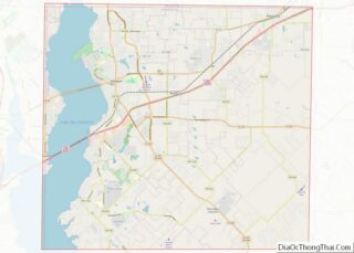
Online Interactive Map
Click on ![]() to view map in "full screen" mode.
to view map in "full screen" mode.
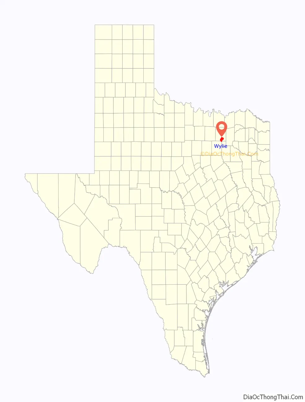
Wylie location map. Where is Wylie city?

History
Originally called Nickelville, reportedly after the name of the first store, it was organized in the early 1870s. The Gulf, Colorado and Santa Fe Railway laid tracks a half mile north of the original townsite in 1886. The businesses of Nickelville moved to take advantage of the railroad within the following year, and the City of Wylie was incorporated in 1887 along the right-of-way. It was named for Lt. Colonel William D. Wylie, a right-of-way agent for the railroad and Civil War veteran.
That same year, Wylie had given itself its name, established a post office branch, and incorporated, choosing an alderman form of government. Two years later, the St. Louis Southwestern Railway reached the town. The two railroads and the rich agricultural region of the Blackland Prairies contributed to the town’s growth. In 1890, Wylie had a population of 400 and the first one-room school house was built. By 1900, it had grown to 773. In the next decade, the population tripled. Before 1920, the community had over 35 businesses, including two banks, a school, and a weekly newspaper.
Unlike many rural Texas communities, Wylie grew during the Great Depression years, reaching 914 residents by 1940. In part, this was a result of increased dairy farming to meet the demands of nearby Dallas. Following World War II, the population increase continued.
Onions were the town’s cash crop in the 1930s and 1940s. “Wide Awake Wylie” became the city’s nickname in the late 1940s and 1950s, a result of late night get-togethers of its citizens and businesses that stayed open until midnight on some evenings.
Designed to provide water for towns in four counties, the construction of the Lavon Dam and Reservoir 5 miles (8 km) north of town, and the selection of Wylie to house the offices of the North Texas Municipal Water District, pushed the population to 1,804 in 1960.
In the 1990s, Wylie had two disasters. On May 9, 1993 (Mother’s Day), a tornado ravaged downtown Wylie. In December 1998, two fires destroyed and damaged several businesses. After that, the downtown area was renovated, while preserving the many century-old buildings that remained standing. On April 11, 2016, a hail storm struck Wylie that produced softball-sized hailstones and damaged an estimated 80% of homes in the city, causing over $240 million in damage.
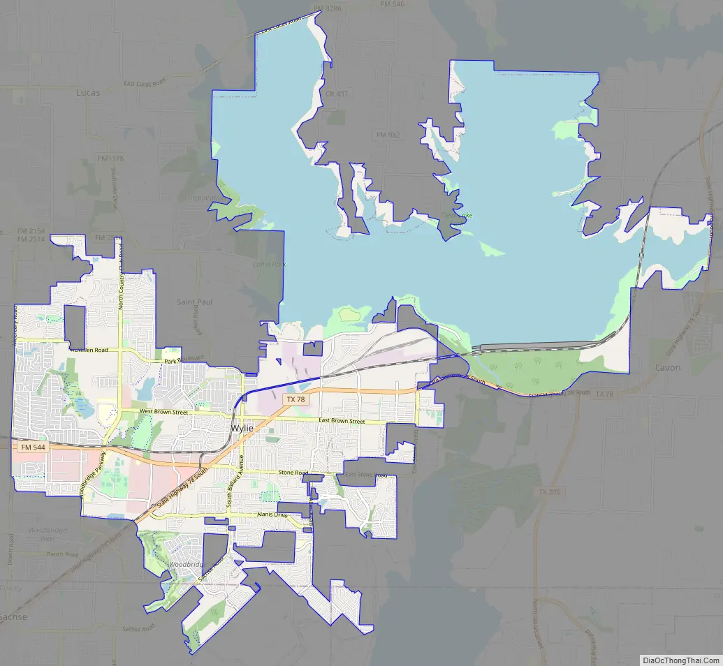
Wylie Road Map
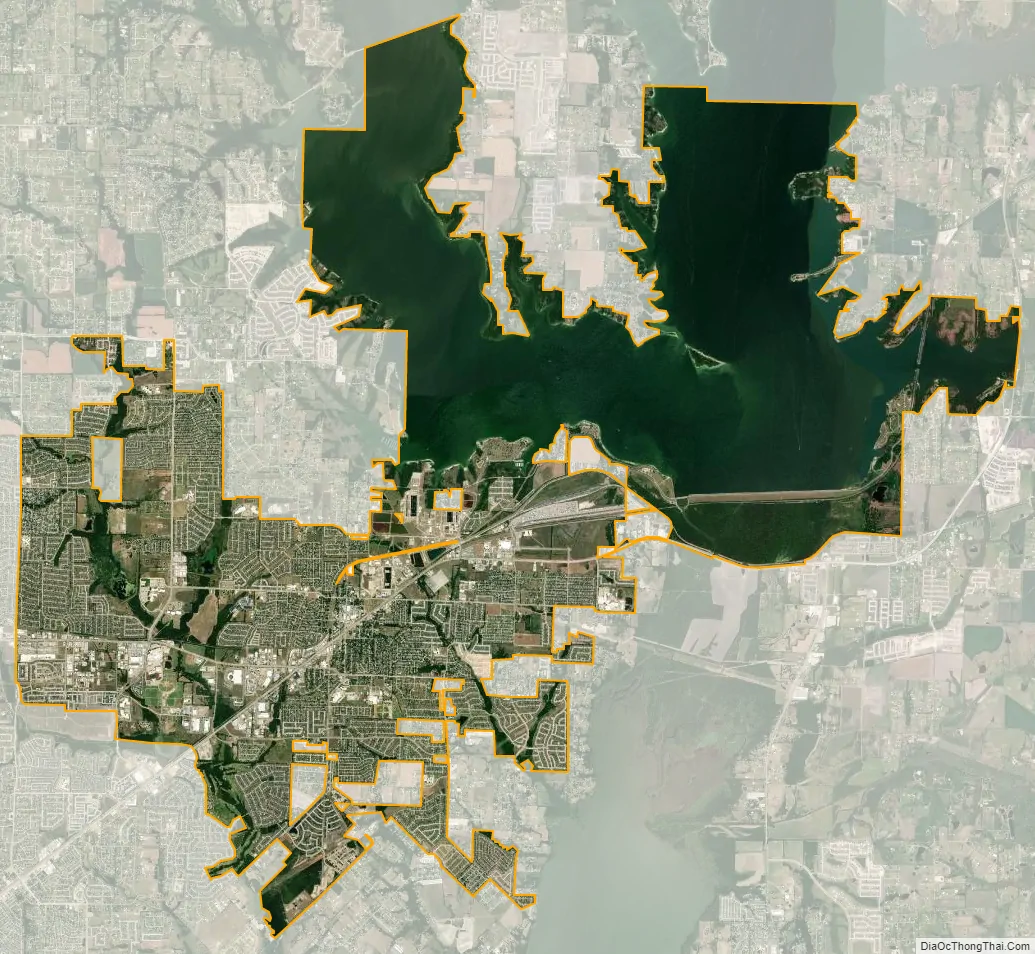
Wylie city Satellite Map
Geography
According to the United States Census Bureau, the city has a total area of 35.317 square miles, of which 21.037 square miles are land and 14.280 square miles, or 40.43%, are covered by water. Wylie is part of the subtropical region, with hot, dry summers and cold, mild, rainy winters.
See also
Map of Texas State and its subdivision:- Anderson
- Andrews
- Angelina
- Aransas
- Archer
- Armstrong
- Atascosa
- Austin
- Bailey
- Bandera
- Bastrop
- Baylor
- Bee
- Bell
- Bexar
- Blanco
- Borden
- Bosque
- Bowie
- Brazoria
- Brazos
- Brewster
- Briscoe
- Brooks
- Brown
- Burleson
- Burnet
- Caldwell
- Calhoun
- Callahan
- Cameron
- Camp
- Carson
- Cass
- Castro
- Chambers
- Cherokee
- Childress
- Clay
- Cochran
- Coke
- Coleman
- Collin
- Collingsworth
- Colorado
- Comal
- Comanche
- Concho
- Cooke
- Coryell
- Cottle
- Crane
- Crockett
- Crosby
- Culberson
- Dallam
- Dallas
- Dawson
- Deaf Smith
- Delta
- Denton
- Dewitt
- Dickens
- Dimmit
- Donley
- Duval
- Eastland
- Ector
- Edwards
- El Paso
- Ellis
- Erath
- Falls
- Fannin
- Fayette
- Fisher
- Floyd
- Foard
- Fort Bend
- Franklin
- Freestone
- Frio
- Gaines
- Galveston
- Garza
- Gillespie
- Glasscock
- Goliad
- Gonzales
- Gray
- Grayson
- Gregg
- Grimes
- Guadalupe
- Hale
- Hall
- Hamilton
- Hansford
- Hardeman
- Hardin
- Harris
- Harrison
- Hartley
- Haskell
- Hays
- Hemphill
- Henderson
- Hidalgo
- Hill
- Hockley
- Hood
- Hopkins
- Houston
- Howard
- Hudspeth
- Hunt
- Hutchinson
- Irion
- Jack
- Jackson
- Jasper
- Jeff Davis
- Jefferson
- Jim Hogg
- Jim Wells
- Johnson
- Jones
- Karnes
- Kaufman
- Kendall
- Kenedy
- Kent
- Kerr
- Kimble
- King
- Kinney
- Kleberg
- Knox
- La Salle
- Lamar
- Lamb
- Lampasas
- Lavaca
- Lee
- Leon
- Liberty
- Limestone
- Lipscomb
- Live Oak
- Llano
- Loving
- Lubbock
- Lynn
- Madison
- Marion
- Martin
- Mason
- Matagorda
- Maverick
- McCulloch
- McLennan
- McMullen
- Medina
- Menard
- Midland
- Milam
- Mills
- Mitchell
- Montague
- Montgomery
- Moore
- Morris
- Motley
- Nacogdoches
- Navarro
- Newton
- Nolan
- Nueces
- Ochiltree
- Oldham
- Orange
- Palo Pinto
- Panola
- Parker
- Parmer
- Pecos
- Polk
- Potter
- Presidio
- Rains
- Randall
- Reagan
- Real
- Red River
- Reeves
- Refugio
- Roberts
- Robertson
- Rockwall
- Runnels
- Rusk
- Sabine
- San Augustine
- San Jacinto
- San Patricio
- San Saba
- Schleicher
- Scurry
- Shackelford
- Shelby
- Sherman
- Smith
- Somervell
- Starr
- Stephens
- Sterling
- Stonewall
- Sutton
- Swisher
- Tarrant
- Taylor
- Terrell
- Terry
- Throckmorton
- Titus
- Tom Green
- Travis
- Trinity
- Tyler
- Upshur
- Upton
- Uvalde
- Val Verde
- Van Zandt
- Victoria
- Walker
- Waller
- Ward
- Washington
- Webb
- Wharton
- Wheeler
- Wichita
- Wilbarger
- Willacy
- Williamson
- Wilson
- Winkler
- Wise
- Wood
- Yoakum
- Young
- Zapata
- Zavala
- Alabama
- Alaska
- Arizona
- Arkansas
- California
- Colorado
- Connecticut
- Delaware
- District of Columbia
- Florida
- Georgia
- Hawaii
- Idaho
- Illinois
- Indiana
- Iowa
- Kansas
- Kentucky
- Louisiana
- Maine
- Maryland
- Massachusetts
- Michigan
- Minnesota
- Mississippi
- Missouri
- Montana
- Nebraska
- Nevada
- New Hampshire
- New Jersey
- New Mexico
- New York
- North Carolina
- North Dakota
- Ohio
- Oklahoma
- Oregon
- Pennsylvania
- Rhode Island
- South Carolina
- South Dakota
- Tennessee
- Texas
- Utah
- Vermont
- Virginia
- Washington
- West Virginia
- Wisconsin
- Wyoming