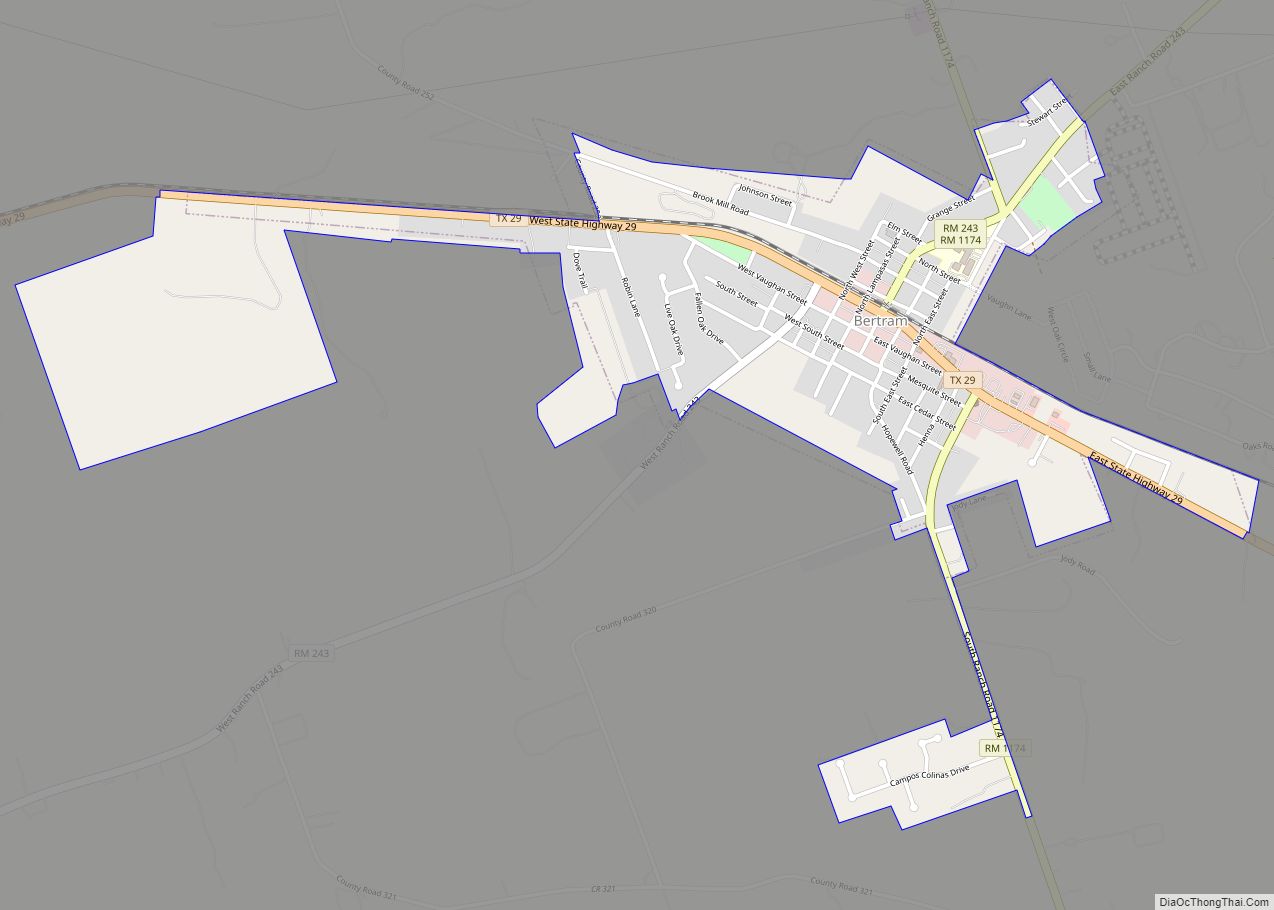
Burnet (/ˈbɜːrnɪt/ BUR-nit) is a city in and the county seat of Burnet County, Texas, United States. Its population was 6,436 at the 2020 census.
Both the city and the county were named for David Gouverneur Burnet, the first (provisional) president of the Republic of Texas. He also served as vice president during the administration of Mirabeau B. Lamar.
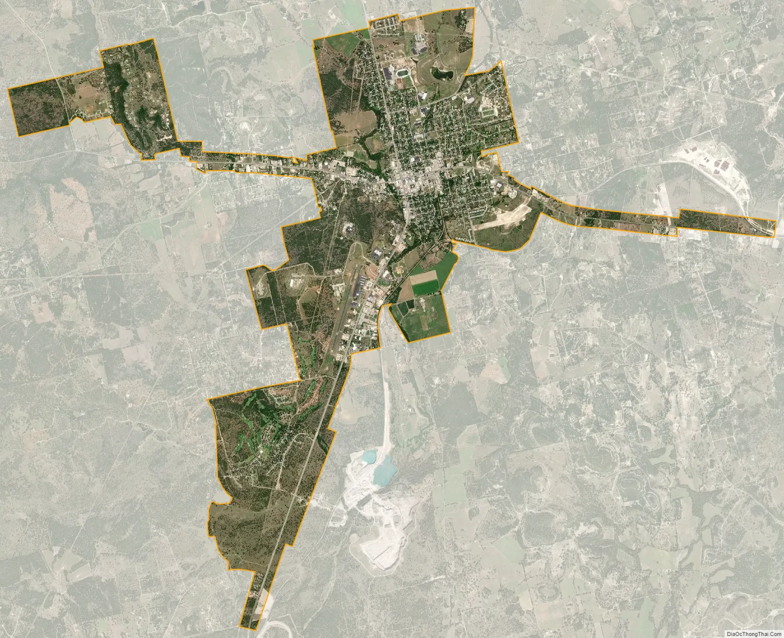
| Name: | Burnet city |
|---|---|
| LSAD Code: | 25 |
| LSAD Description: | city (suffix) |
| State: | Texas |
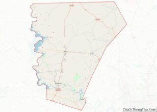
| County: | Burnet County |
| Elevation: | 1,286 ft (392 m) |
| Total Area: | 10.40 sq mi (26.94 km²) |
| Land Area: | 10.37 sq mi (26.85 km²) |
| Water Area: | 0.03 sq mi (0.09 km²) |
| Total Population: | 6,436 |
| Population Density: | 617.86/sq mi (238.56/km²) |
| ZIP code: | 78611 |
| FIPS code: | 4811464 |
| GNISfeature ID: | 1353341 |
| Website: | www.cityofburnet.com |
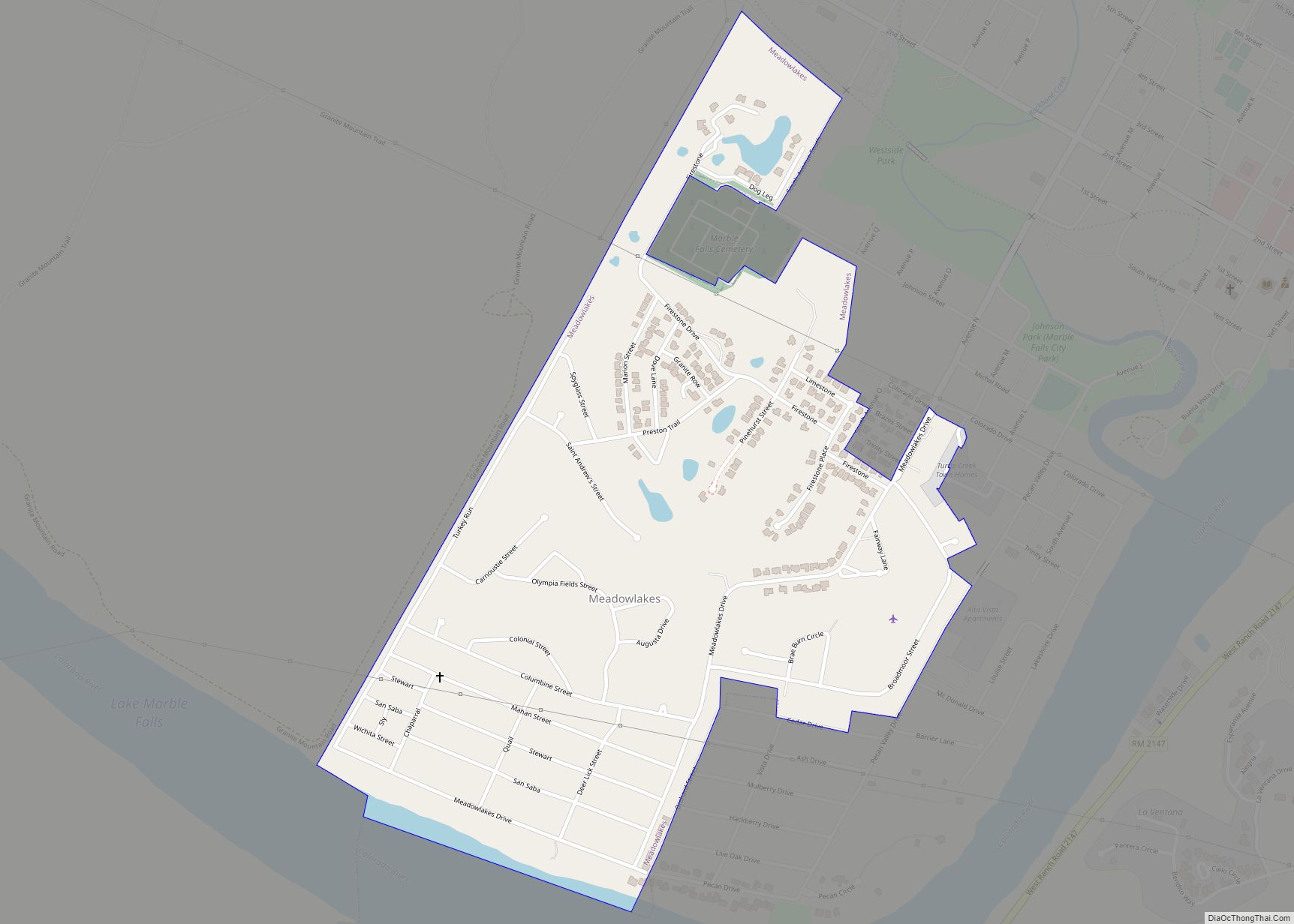
Online Interactive Map
Click on ![]() to view map in "full screen" mode.
to view map in "full screen" mode.
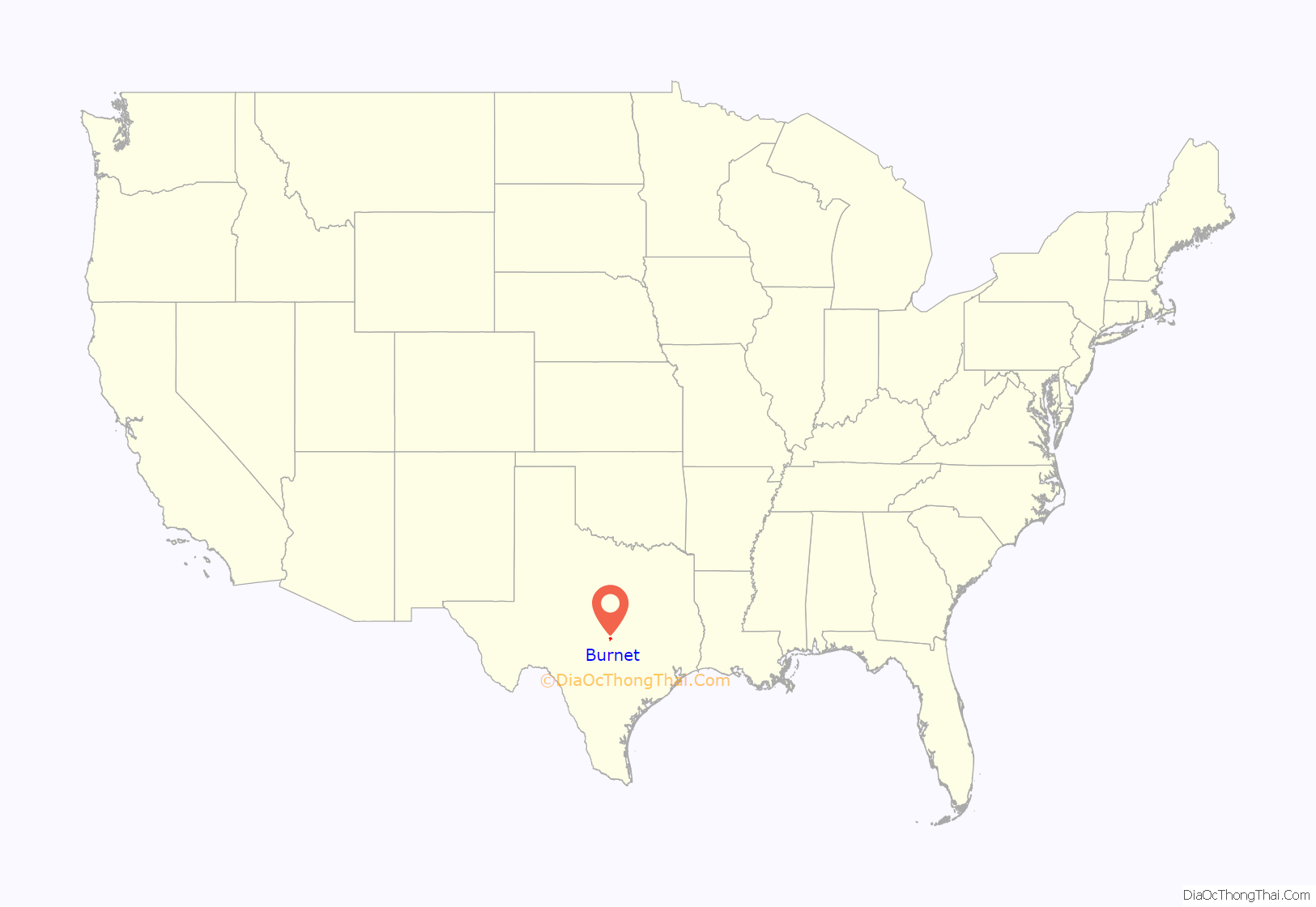
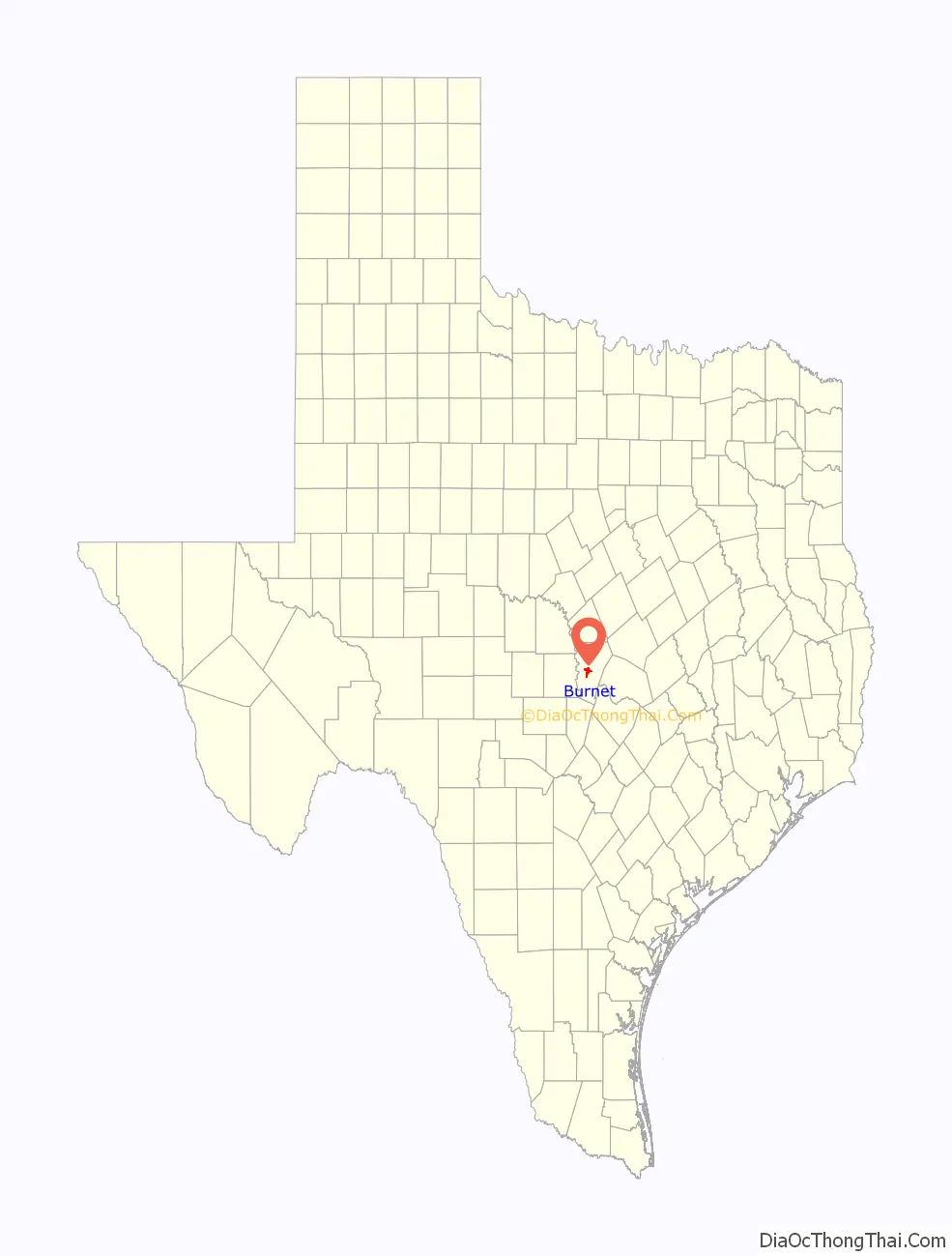
Burnet location map. Where is Burnet city?
History
In December 1847, a company of the Texas Ranger Division commanded by Henry E. McCulloch established a station at the site of present-day Burnet for the protection of frontier settlers from Indian raids. In March 1849, the station was chosen as a federal fort and named Fort Croghan.
A town was founded next to Fort Croghan in 1852, when Burnet County was established. The town was originally named Hamilton after John Hamilton, who owned a league and labor of land nearby. In August 1852, a post office was established in Hamilton and named Burnet Courthouse. In 1857, 35 residents of the town petitioned the state legislature to change the name of the town to Burnet since another town in Texas was named Hamilton; the name was changed in 1858. Major growth occurred with the arrival of the Austin and Northwestern Railroad in April 1882, when Burnet became the railhead for the area to the west. After the railroad was extended to Llano in 1892, Burnet declined as a supply point and became a farming and livestock center. The City of Burnet was incorporated in 1933.
The Burnet Bulletin newspaper has served the community since 1873 and is the official paper of record for the city and Burnet County.
Burnet Road Map
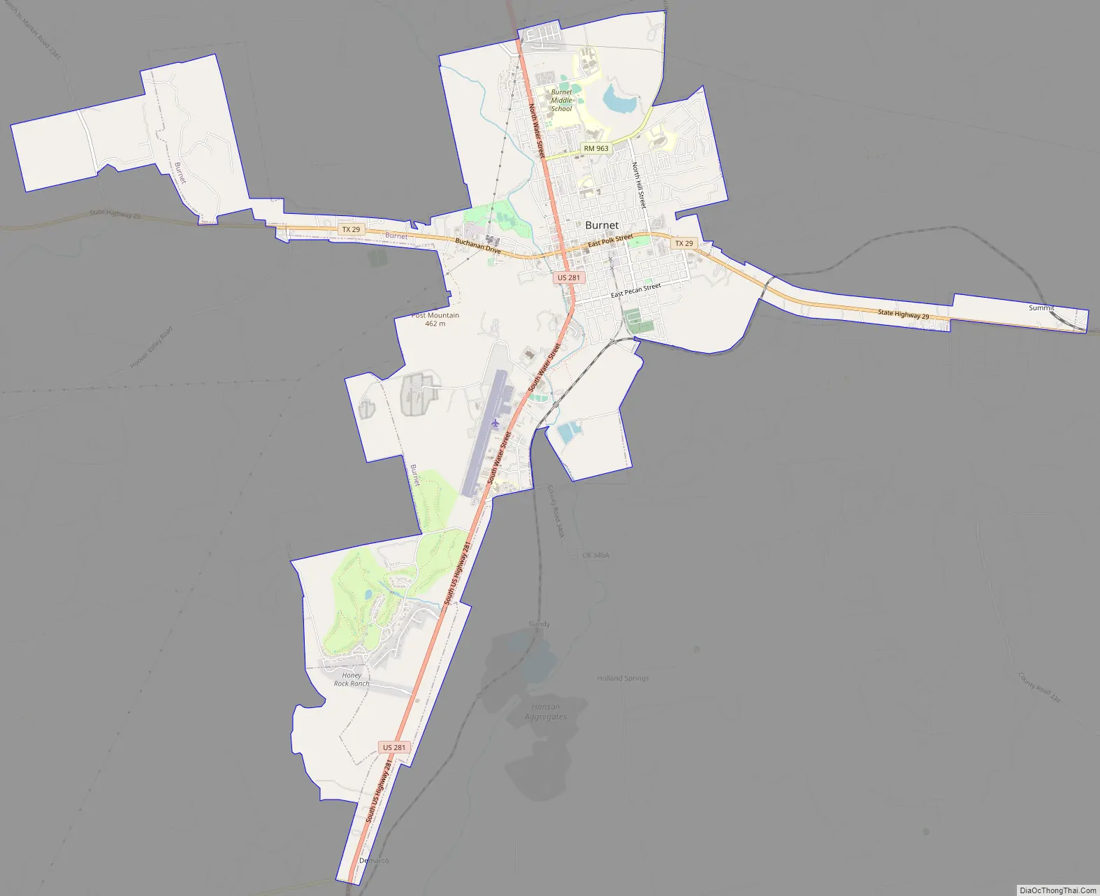
Burnet city Satellite Map
Geography
Burnet is located one mile west of the divide between the Brazos and Colorado River watersheds near the center of Burnet County. It is 54 miles (87 km) northwest of the state capital, Austin—roughly a 60- to 90-minute drive via U.S. Highway 183 and State Highway 29. It is 36 miles (58 km) west of Georgetown and Interstate Highway 35 via State Highway 29, and 100 miles (160 km) north of San Antonio on U.S. Highway 281.
According to the United States Census Bureau, Burnet has a total area of 10.2 square miles (26.3 km), of which 0.04 square miles (0.1 km), or 0.32%, is covered by water.
See also
Map of Texas State and its subdivision:- Anderson
- Andrews
- Angelina
- Aransas
- Archer
- Armstrong
- Atascosa
- Austin
- Bailey
- Bandera
- Bastrop
- Baylor
- Bee
- Bell
- Bexar
- Blanco
- Borden
- Bosque
- Bowie
- Brazoria
- Brazos
- Brewster
- Briscoe
- Brooks
- Brown
- Burleson
- Burnet
- Caldwell
- Calhoun
- Callahan
- Cameron
- Camp
- Carson
- Cass
- Castro
- Chambers
- Cherokee
- Childress
- Clay
- Cochran
- Coke
- Coleman
- Collin
- Collingsworth
- Colorado
- Comal
- Comanche
- Concho
- Cooke
- Coryell
- Cottle
- Crane
- Crockett
- Crosby
- Culberson
- Dallam
- Dallas
- Dawson
- Deaf Smith
- Delta
- Denton
- Dewitt
- Dickens
- Dimmit
- Donley
- Duval
- Eastland
- Ector
- Edwards
- El Paso
- Ellis
- Erath
- Falls
- Fannin
- Fayette
- Fisher
- Floyd
- Foard
- Fort Bend
- Franklin
- Freestone
- Frio
- Gaines
- Galveston
- Garza
- Gillespie
- Glasscock
- Goliad
- Gonzales
- Gray
- Grayson
- Gregg
- Grimes
- Guadalupe
- Hale
- Hall
- Hamilton
- Hansford
- Hardeman
- Hardin
- Harris
- Harrison
- Hartley
- Haskell
- Hays
- Hemphill
- Henderson
- Hidalgo
- Hill
- Hockley
- Hood
- Hopkins
- Houston
- Howard
- Hudspeth
- Hunt
- Hutchinson
- Irion
- Jack
- Jackson
- Jasper
- Jeff Davis
- Jefferson
- Jim Hogg
- Jim Wells
- Johnson
- Jones
- Karnes
- Kaufman
- Kendall
- Kenedy
- Kent
- Kerr
- Kimble
- King
- Kinney
- Kleberg
- Knox
- La Salle
- Lamar
- Lamb
- Lampasas
- Lavaca
- Lee
- Leon
- Liberty
- Limestone
- Lipscomb
- Live Oak
- Llano
- Loving
- Lubbock
- Lynn
- Madison
- Marion
- Martin
- Mason
- Matagorda
- Maverick
- McCulloch
- McLennan
- McMullen
- Medina
- Menard
- Midland
- Milam
- Mills
- Mitchell
- Montague
- Montgomery
- Moore
- Morris
- Motley
- Nacogdoches
- Navarro
- Newton
- Nolan
- Nueces
- Ochiltree
- Oldham
- Orange
- Palo Pinto
- Panola
- Parker
- Parmer
- Pecos
- Polk
- Potter
- Presidio
- Rains
- Randall
- Reagan
- Real
- Red River
- Reeves
- Refugio
- Roberts
- Robertson
- Rockwall
- Runnels
- Rusk
- Sabine
- San Augustine
- San Jacinto
- San Patricio
- San Saba
- Schleicher
- Scurry
- Shackelford
- Shelby
- Sherman
- Smith
- Somervell
- Starr
- Stephens
- Sterling
- Stonewall
- Sutton
- Swisher
- Tarrant
- Taylor
- Terrell
- Terry
- Throckmorton
- Titus
- Tom Green
- Travis
- Trinity
- Tyler
- Upshur
- Upton
- Uvalde
- Val Verde
- Van Zandt
- Victoria
- Walker
- Waller
- Ward
- Washington
- Webb
- Wharton
- Wheeler
- Wichita
- Wilbarger
- Willacy
- Williamson
- Wilson
- Winkler
- Wise
- Wood
- Yoakum
- Young
- Zapata
- Zavala
- Alabama
- Alaska
- Arizona
- Arkansas
- California
- Colorado
- Connecticut
- Delaware
- District of Columbia
- Florida
- Georgia
- Hawaii
- Idaho
- Illinois
- Indiana
- Iowa
- Kansas
- Kentucky
- Louisiana
- Maine
- Maryland
- Massachusetts
- Michigan
- Minnesota
- Mississippi
- Missouri
- Montana
- Nebraska
- Nevada
- New Hampshire
- New Jersey
- New Mexico
- New York
- North Carolina
- North Dakota
- Ohio
- Oklahoma
- Oregon
- Pennsylvania
- Rhode Island
- South Carolina
- South Dakota
- Tennessee
- Texas
- Utah
- Vermont
- Virginia
- Washington
- West Virginia
- Wisconsin
- Wyoming