Marble Falls is a city in Burnet County, Texas, United States. As of the 2020 United States Census, the city population was 7,033. Lake Marble Falls is part of the Highland Lakes on the Colorado River, the largest chain of lakes in Texas. Marble Falls was founded by Adam Rankin Johnson in 1887, a former Indian fighter and Confederate general.
| Name: | Marble Falls city |
|---|---|
| LSAD Code: | 25 |
| LSAD Description: | city (suffix) |
| State: | Texas |
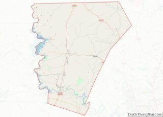
| County: | Burnet County |
| Elevation: | 823 ft (251 m) |
| Total Area: | 15.16 sq mi (39.26 km²) |
| Land Area: | 14.51 sq mi (37.59 km²) |
| Water Area: | 0.65 sq mi (1.67 km²) |
| Total Population: | 6,077 |
| Population Density: | 484.94/sq mi (187.24/km²) |
| ZIP code: | 78654, 78657 |
| Area code: | 830 |
| FIPS code: | 4846584 |
| GNISfeature ID: | 1362162 |
| Website: | ci.marble-falls.tx.us |
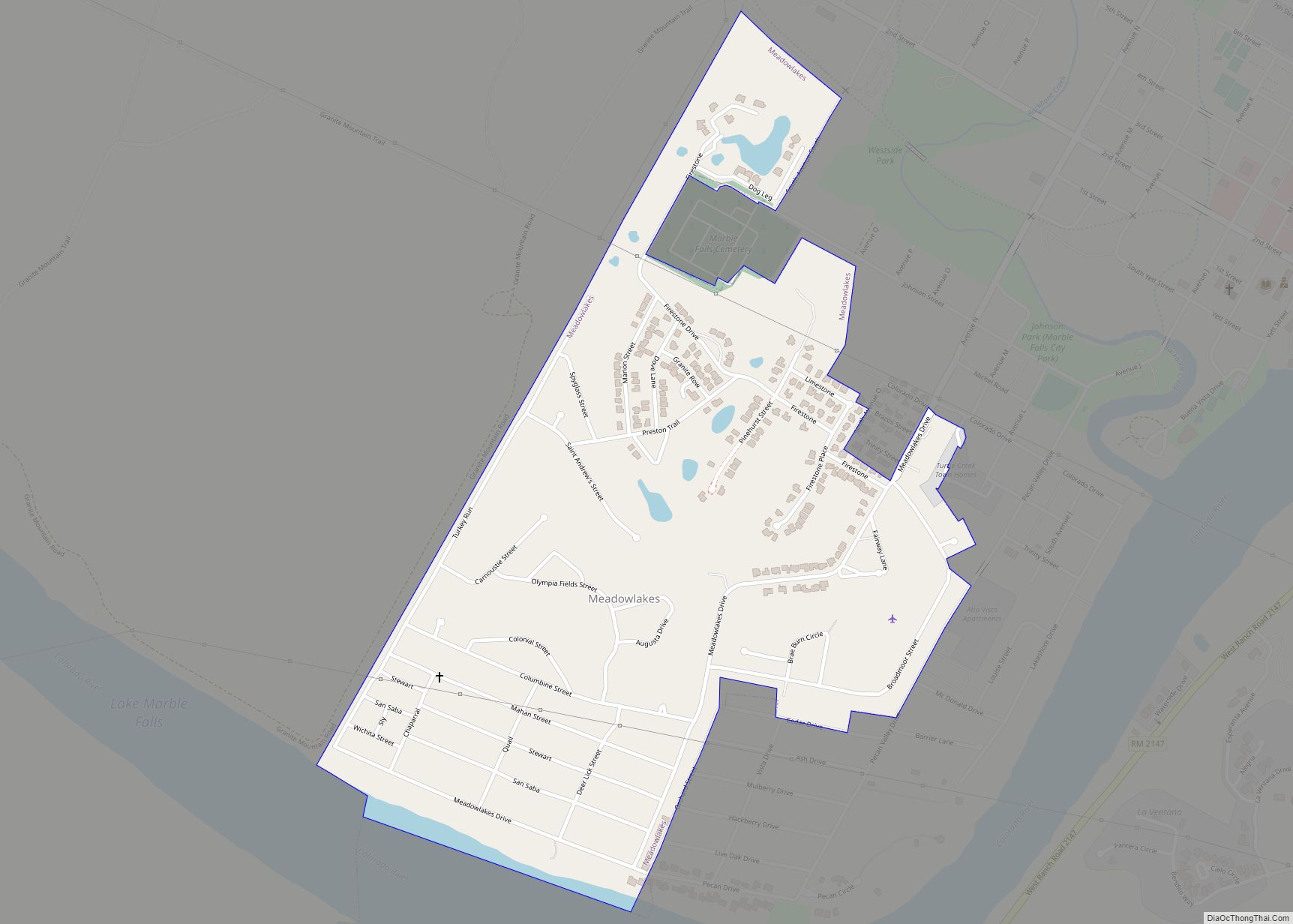
Online Interactive Map
Click on ![]() to view map in "full screen" mode.
to view map in "full screen" mode.
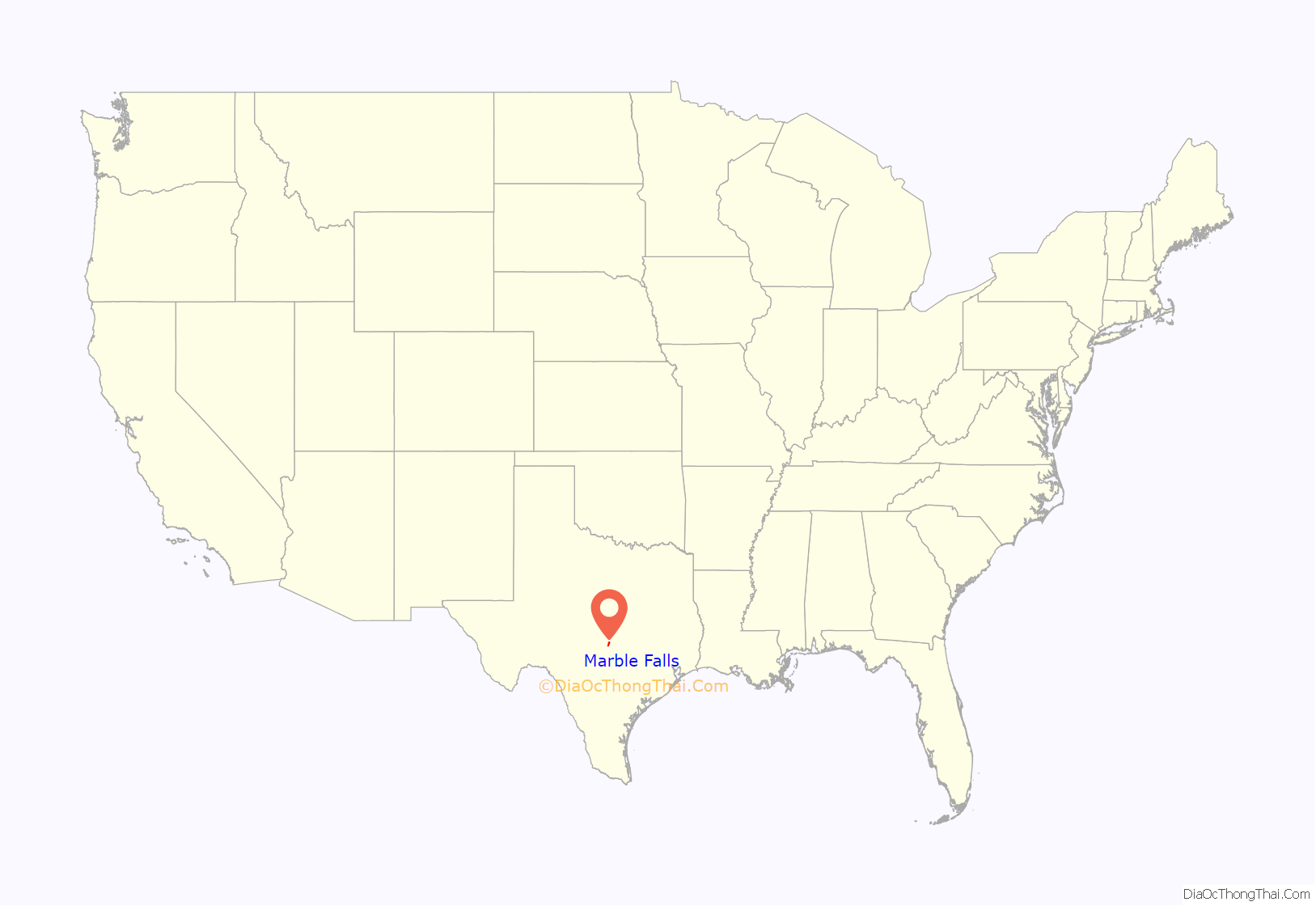
Marble Falls location map. Where is Marble Falls city?
History
Marble Falls was founded in 1887 by Adam Rankin “Stovepipe” Johnson, a former Indian fighter and Confederate general. Johnson had visited the natural marble falls during his pre-war days as a Burnet County surveyor, and wanted to build an industrial city powered by the Colorado River. Johnson facilitated the construction of a railroad to nearby Granite Mountain in 1884, and helped plat the Marble Falls townsite. The sale of lots began in 1887, and Johnson built a home, a college, and a factory near the falls.
The town grew to a population of 1,800 within ten years.
In 1917, Marble Falls elected Ophelia Crosby “Birdie” Harwood as the first woman mayor in Texas, three years before women were allowed to vote.
When the Max Starcke Dam was completed in 1951, the marble falls which had given the town its name were submerged under the new Lake Marble Falls. The town’s economy declined through the drought of the 1950s, and prospered as a tourism and retirement location, beginning in the 1970s. Beginning in the 1980s, Marble Falls has grown into the retail and entertainment center for the Highland Lakes area.
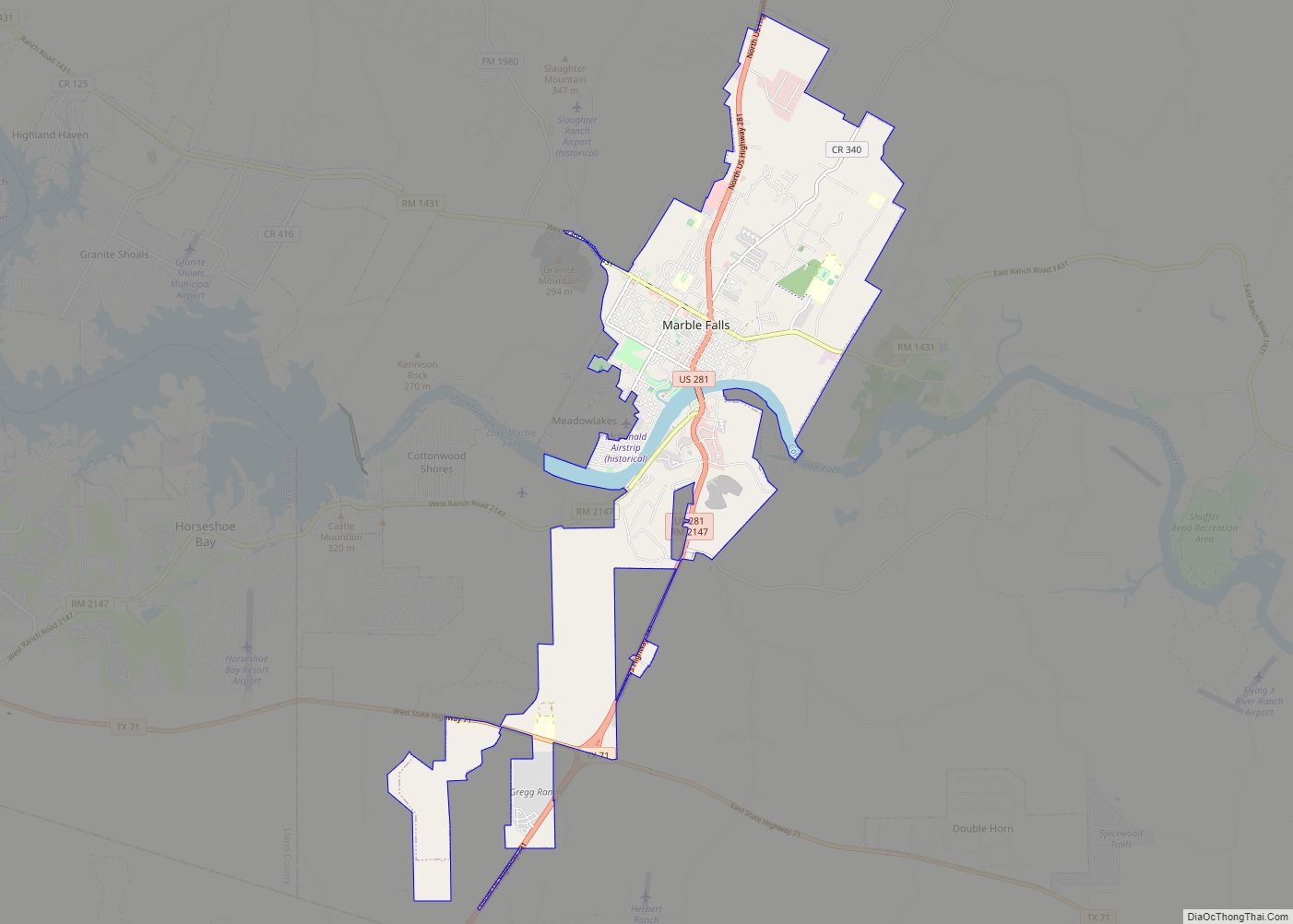
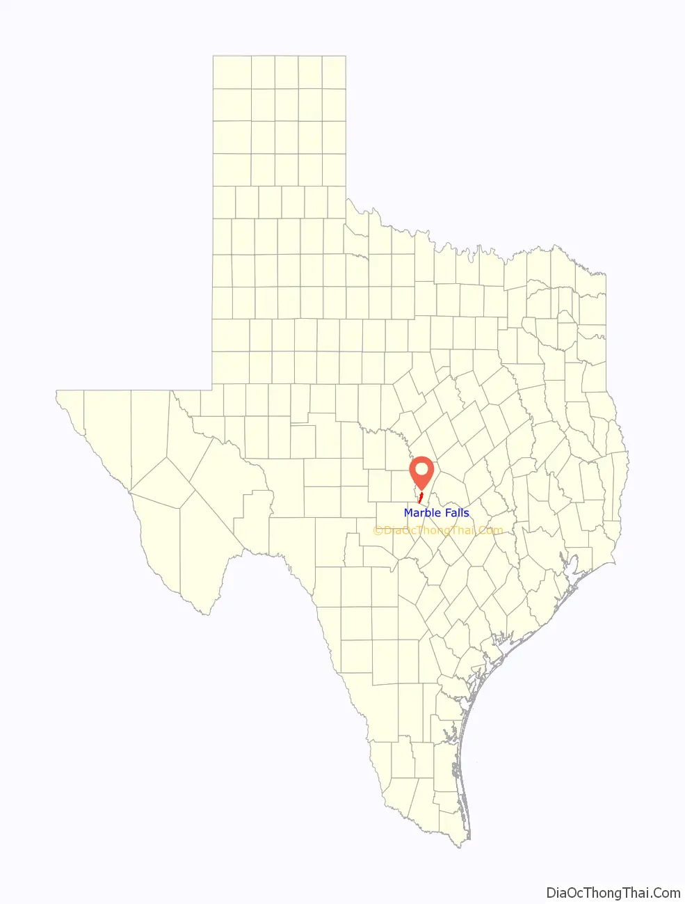
Marble Falls Road Map
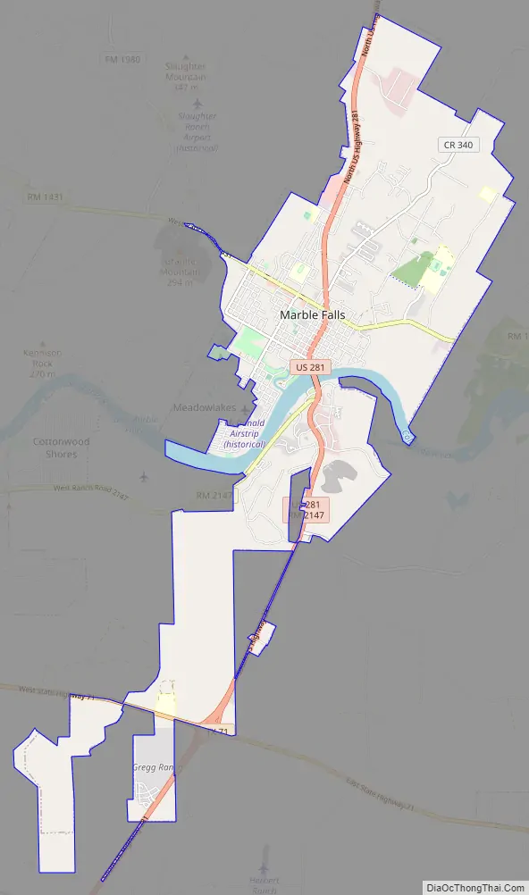
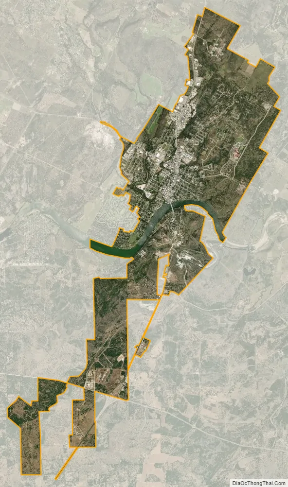
Marble Falls city Satellite Map
Geography
Marble Falls is located on the banks of Lake Marble Falls. According to the Handbook of Texas website, the former falls were flooded by the lake, which was created by a shelf of limestone running diagonally across the Colorado River from northeast to southwest. The upper layer of limestone, brownish on the exterior but a deep blue inside, was so hard and cherty it was mistaken for marble. The falls were actually three distinct formations at the head of a canyon 1.25 miles (2.01 km) long, with a drop of some 50 feet (15 m) through the limestone strata. The natural lake and waterfall were covered when the Colorado River was dammed with the completion of Max Starcke Dam in 1951. A photo of the falls as they once existed can be seen at the website for the Wallace Guest House, a local bed and breakfast. Lake Marble Falls sits between Lake Lyndon B. Johnson to the north and Lake Travis to the south. The falls for which the city is named are now underwater but are revealed every few years when the lake is lowered.
Equally noteworthy is the huge igneous batholith called Granite Mountain looming on the town’s western edge that secured Marble Falls’ place in Texas history. The famed pink granite was used for the construction of the Texas State Capitol and other state government office buildings, and can also be found in the Galveston Seawall and Austin–Bergstrom International Airport.
According to the United States Census Bureau, the city has a total area of 12.2 square miles (31.6 km), of which 11.6 square miles (30.0 km) is land and 0.62 square miles (1.6 km), or 5.21%, is water.
See also
Map of Texas State and its subdivision:- Anderson
- Andrews
- Angelina
- Aransas
- Archer
- Armstrong
- Atascosa
- Austin
- Bailey
- Bandera
- Bastrop
- Baylor
- Bee
- Bell
- Bexar
- Blanco
- Borden
- Bosque
- Bowie
- Brazoria
- Brazos
- Brewster
- Briscoe
- Brooks
- Brown
- Burleson
- Burnet
- Caldwell
- Calhoun
- Callahan
- Cameron
- Camp
- Carson
- Cass
- Castro
- Chambers
- Cherokee
- Childress
- Clay
- Cochran
- Coke
- Coleman
- Collin
- Collingsworth
- Colorado
- Comal
- Comanche
- Concho
- Cooke
- Coryell
- Cottle
- Crane
- Crockett
- Crosby
- Culberson
- Dallam
- Dallas
- Dawson
- Deaf Smith
- Delta
- Denton
- Dewitt
- Dickens
- Dimmit
- Donley
- Duval
- Eastland
- Ector
- Edwards
- El Paso
- Ellis
- Erath
- Falls
- Fannin
- Fayette
- Fisher
- Floyd
- Foard
- Fort Bend
- Franklin
- Freestone
- Frio
- Gaines
- Galveston
- Garza
- Gillespie
- Glasscock
- Goliad
- Gonzales
- Gray
- Grayson
- Gregg
- Grimes
- Guadalupe
- Hale
- Hall
- Hamilton
- Hansford
- Hardeman
- Hardin
- Harris
- Harrison
- Hartley
- Haskell
- Hays
- Hemphill
- Henderson
- Hidalgo
- Hill
- Hockley
- Hood
- Hopkins
- Houston
- Howard
- Hudspeth
- Hunt
- Hutchinson
- Irion
- Jack
- Jackson
- Jasper
- Jeff Davis
- Jefferson
- Jim Hogg
- Jim Wells
- Johnson
- Jones
- Karnes
- Kaufman
- Kendall
- Kenedy
- Kent
- Kerr
- Kimble
- King
- Kinney
- Kleberg
- Knox
- La Salle
- Lamar
- Lamb
- Lampasas
- Lavaca
- Lee
- Leon
- Liberty
- Limestone
- Lipscomb
- Live Oak
- Llano
- Loving
- Lubbock
- Lynn
- Madison
- Marion
- Martin
- Mason
- Matagorda
- Maverick
- McCulloch
- McLennan
- McMullen
- Medina
- Menard
- Midland
- Milam
- Mills
- Mitchell
- Montague
- Montgomery
- Moore
- Morris
- Motley
- Nacogdoches
- Navarro
- Newton
- Nolan
- Nueces
- Ochiltree
- Oldham
- Orange
- Palo Pinto
- Panola
- Parker
- Parmer
- Pecos
- Polk
- Potter
- Presidio
- Rains
- Randall
- Reagan
- Real
- Red River
- Reeves
- Refugio
- Roberts
- Robertson
- Rockwall
- Runnels
- Rusk
- Sabine
- San Augustine
- San Jacinto
- San Patricio
- San Saba
- Schleicher
- Scurry
- Shackelford
- Shelby
- Sherman
- Smith
- Somervell
- Starr
- Stephens
- Sterling
- Stonewall
- Sutton
- Swisher
- Tarrant
- Taylor
- Terrell
- Terry
- Throckmorton
- Titus
- Tom Green
- Travis
- Trinity
- Tyler
- Upshur
- Upton
- Uvalde
- Val Verde
- Van Zandt
- Victoria
- Walker
- Waller
- Ward
- Washington
- Webb
- Wharton
- Wheeler
- Wichita
- Wilbarger
- Willacy
- Williamson
- Wilson
- Winkler
- Wise
- Wood
- Yoakum
- Young
- Zapata
- Zavala
- Alabama
- Alaska
- Arizona
- Arkansas
- California
- Colorado
- Connecticut
- Delaware
- District of Columbia
- Florida
- Georgia
- Hawaii
- Idaho
- Illinois
- Indiana
- Iowa
- Kansas
- Kentucky
- Louisiana
- Maine
- Maryland
- Massachusetts
- Michigan
- Minnesota
- Mississippi
- Missouri
- Montana
- Nebraska
- Nevada
- New Hampshire
- New Jersey
- New Mexico
- New York
- North Carolina
- North Dakota
- Ohio
- Oklahoma
- Oregon
- Pennsylvania
- Rhode Island
- South Carolina
- South Dakota
- Tennessee
- Texas
- Utah
- Vermont
- Virginia
- Washington
- West Virginia
- Wisconsin
- Wyoming