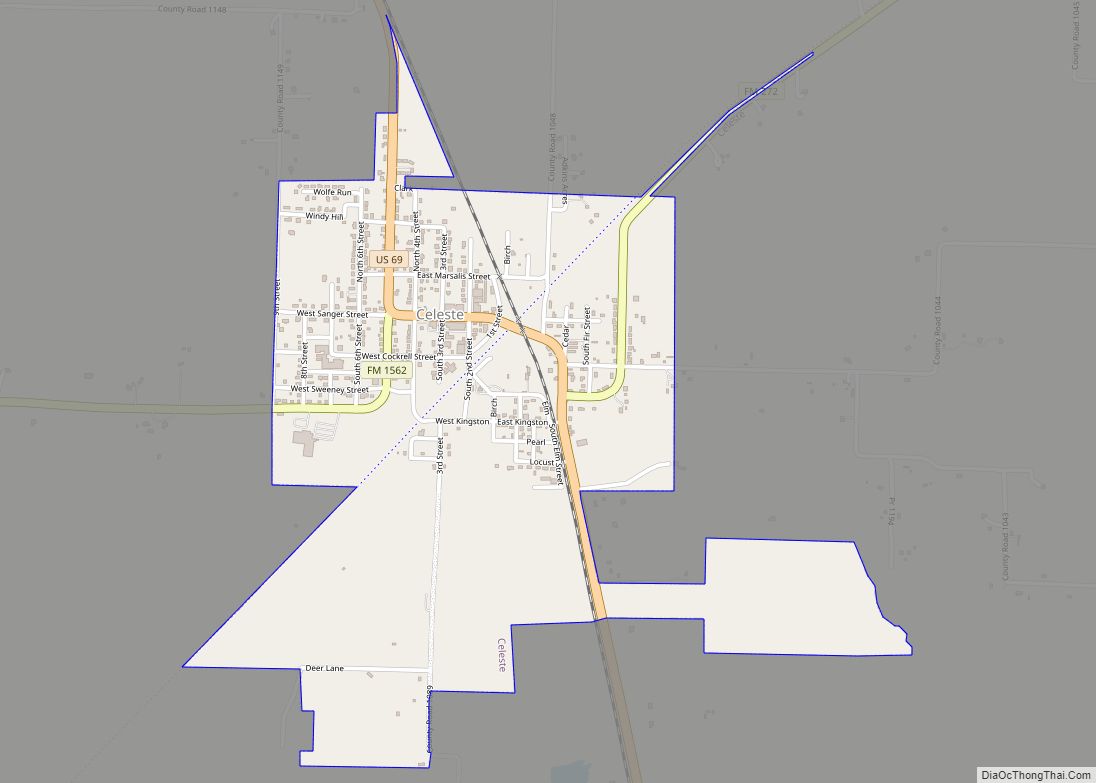
Celeste (Light Blue, in Spanish) is a city in Hunt County, in the U.S. state of Texas. The population was 814 at the 2010 census.
| Name: | Celeste city |
|---|---|
| LSAD Code: | 25 |
| LSAD Description: | city (suffix) |
| State: | Texas |
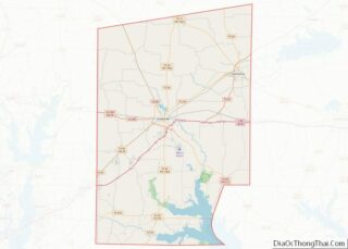
| County: | Hunt County |
| Elevation: | 669 ft (204 m) |
| Total Area: | 1.34 sq mi (3.48 km²) |
| Land Area: | 1.34 sq mi (3.48 km²) |
| Water Area: | 0.00 sq mi (0.00 km²) |
| Total Population: | 814 |
| Population Density: | 674.85/sq mi (260.59/km²) |
| ZIP code: | 75423 |
| Area code: | 903 |
| FIPS code: | 4813672 |
| GNISfeature ID: | 1354174 |
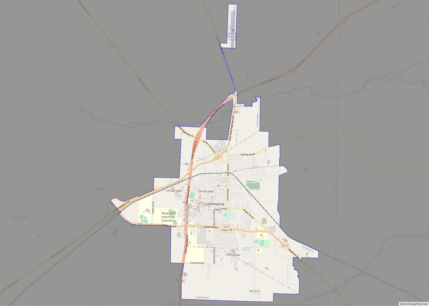
Online Interactive Map
Click on ![]() to view map in "full screen" mode.
to view map in "full screen" mode.
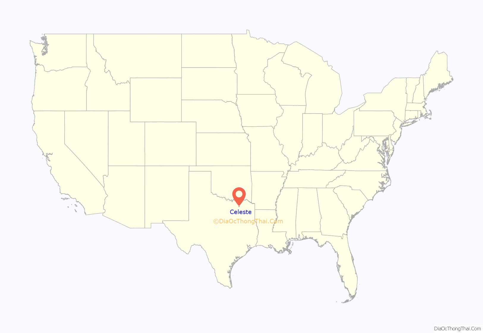
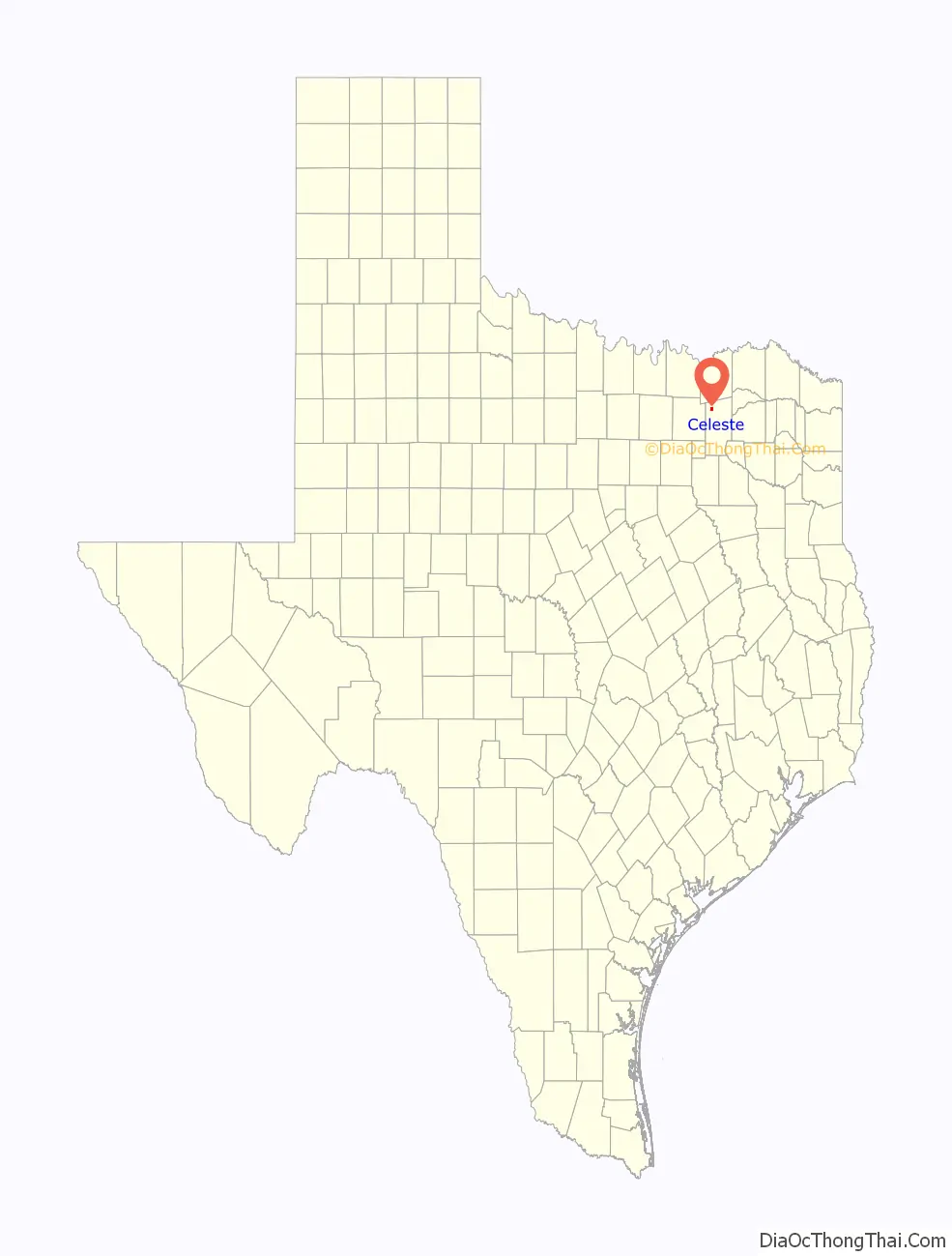
Celeste location map. Where is Celeste city?
History
Like many towns in Hunt County, Celeste was a product of railroad development. The townsite was platted in 1886 by the Gulf, Colorado and Santa Fe Railway 3 miles (5 km) north of Kingston, on open prairie already crossed by the Missouri, Kansas and Texas line. This location was chosen in order to ensure that Kingston, whose elected officials had refused to offer incentives to attract the Gulf, Colorado and Santa Fe to build through their community, would be bypassed by the line as it put down tracks from Paris through Farmersville to Dallas.
Celeste was named for the wife of a Santa Fe official. The two rail lines stimulated rapid growth. A post office opened in Celeste in 1886, and a number of merchants moved their businesses from Kingston to Celeste. By 1888 three churches were holding services in the settlement. The population by the mid-1890s stood at 600, and the community maintained three gristmills and cotton gins, a bank, a weekly newspaper, and a graded public school. Celeste was incorporated in 1900, and its population increased from 671 that year to 850 on the eve of World War I.
By 1914 the community had two banks, three cotton gins, a water works, an ice factory, and a weekly newspaper, as well as some thirty-five other businesses. It reported a population of 1,022 by 1926. Its high school and two elementary schools registered 500 students. Some fifty business establishments, including two banks and a newspaper, were in operation. After the 1920s, however, the population of Celeste fell from 803 in 1933 to 518 in the mid-1960s; businesses correspondingly declined, from thirty to sixteen. After the 1960s the town revived; in 1976 its population was 745. In 1982 the community, where World War II hero Audie Murphy once lived, had a bank, four churches, ten stores, and a school that enrolled 300 students. The population was 733 in 1990 and 817 in 2010.
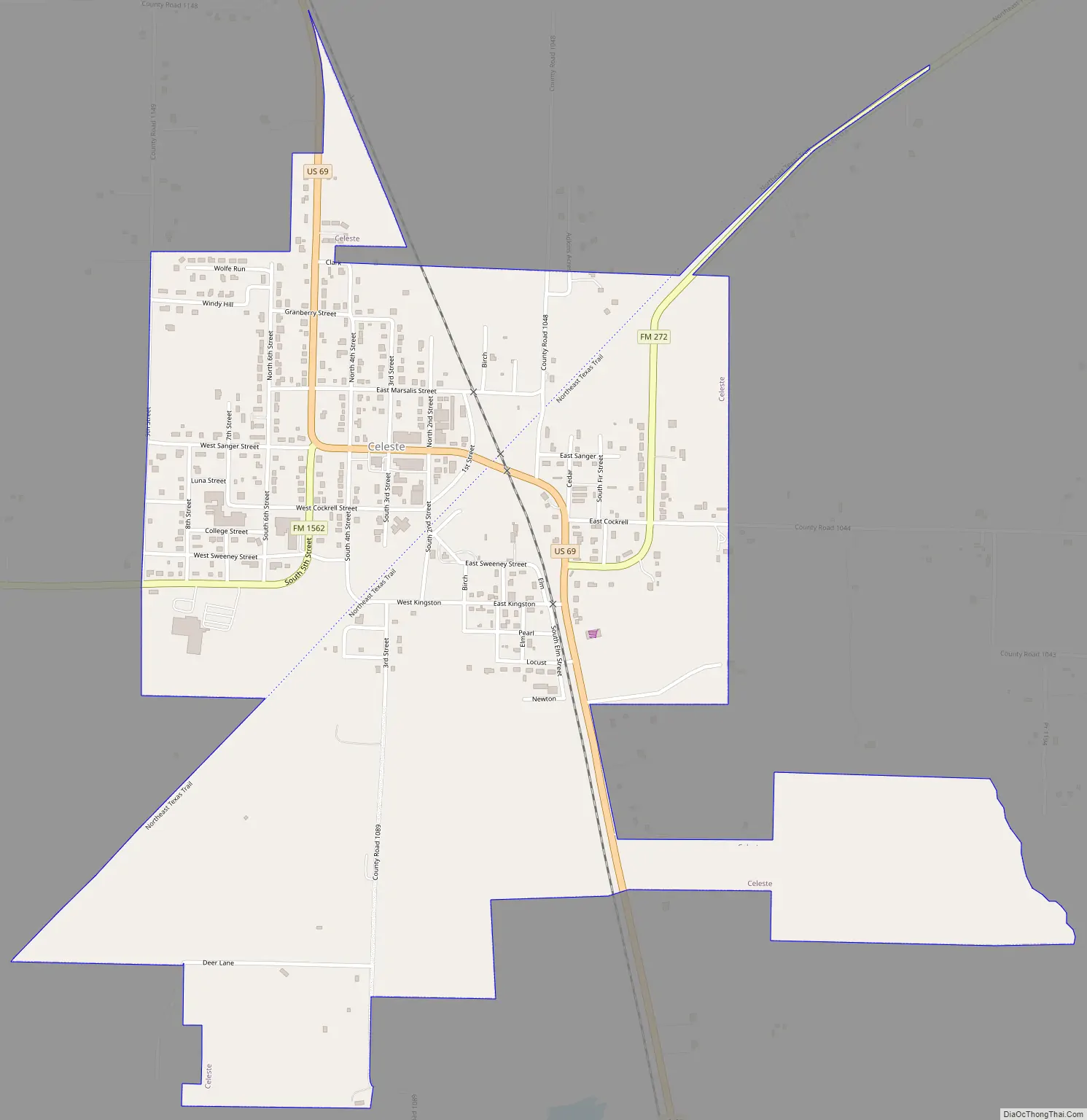
Celeste Road Map
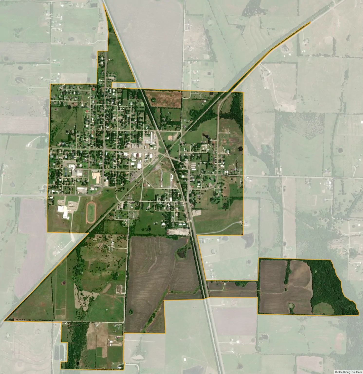
Celeste city Satellite Map
Geography
Celeste is in northwestern Hunt County along U.S. Route 69, which leads northwest 40 miles (64 km) to Denison and southeast 12 miles (19 km) to Greenville the Hunt county seat. According to the United States Census Bureau, Celeste has a total area of 1.1 square miles (2.9 km), all of it land.
See also
Map of Texas State and its subdivision:- Anderson
- Andrews
- Angelina
- Aransas
- Archer
- Armstrong
- Atascosa
- Austin
- Bailey
- Bandera
- Bastrop
- Baylor
- Bee
- Bell
- Bexar
- Blanco
- Borden
- Bosque
- Bowie
- Brazoria
- Brazos
- Brewster
- Briscoe
- Brooks
- Brown
- Burleson
- Burnet
- Caldwell
- Calhoun
- Callahan
- Cameron
- Camp
- Carson
- Cass
- Castro
- Chambers
- Cherokee
- Childress
- Clay
- Cochran
- Coke
- Coleman
- Collin
- Collingsworth
- Colorado
- Comal
- Comanche
- Concho
- Cooke
- Coryell
- Cottle
- Crane
- Crockett
- Crosby
- Culberson
- Dallam
- Dallas
- Dawson
- Deaf Smith
- Delta
- Denton
- Dewitt
- Dickens
- Dimmit
- Donley
- Duval
- Eastland
- Ector
- Edwards
- El Paso
- Ellis
- Erath
- Falls
- Fannin
- Fayette
- Fisher
- Floyd
- Foard
- Fort Bend
- Franklin
- Freestone
- Frio
- Gaines
- Galveston
- Garza
- Gillespie
- Glasscock
- Goliad
- Gonzales
- Gray
- Grayson
- Gregg
- Grimes
- Guadalupe
- Hale
- Hall
- Hamilton
- Hansford
- Hardeman
- Hardin
- Harris
- Harrison
- Hartley
- Haskell
- Hays
- Hemphill
- Henderson
- Hidalgo
- Hill
- Hockley
- Hood
- Hopkins
- Houston
- Howard
- Hudspeth
- Hunt
- Hutchinson
- Irion
- Jack
- Jackson
- Jasper
- Jeff Davis
- Jefferson
- Jim Hogg
- Jim Wells
- Johnson
- Jones
- Karnes
- Kaufman
- Kendall
- Kenedy
- Kent
- Kerr
- Kimble
- King
- Kinney
- Kleberg
- Knox
- La Salle
- Lamar
- Lamb
- Lampasas
- Lavaca
- Lee
- Leon
- Liberty
- Limestone
- Lipscomb
- Live Oak
- Llano
- Loving
- Lubbock
- Lynn
- Madison
- Marion
- Martin
- Mason
- Matagorda
- Maverick
- McCulloch
- McLennan
- McMullen
- Medina
- Menard
- Midland
- Milam
- Mills
- Mitchell
- Montague
- Montgomery
- Moore
- Morris
- Motley
- Nacogdoches
- Navarro
- Newton
- Nolan
- Nueces
- Ochiltree
- Oldham
- Orange
- Palo Pinto
- Panola
- Parker
- Parmer
- Pecos
- Polk
- Potter
- Presidio
- Rains
- Randall
- Reagan
- Real
- Red River
- Reeves
- Refugio
- Roberts
- Robertson
- Rockwall
- Runnels
- Rusk
- Sabine
- San Augustine
- San Jacinto
- San Patricio
- San Saba
- Schleicher
- Scurry
- Shackelford
- Shelby
- Sherman
- Smith
- Somervell
- Starr
- Stephens
- Sterling
- Stonewall
- Sutton
- Swisher
- Tarrant
- Taylor
- Terrell
- Terry
- Throckmorton
- Titus
- Tom Green
- Travis
- Trinity
- Tyler
- Upshur
- Upton
- Uvalde
- Val Verde
- Van Zandt
- Victoria
- Walker
- Waller
- Ward
- Washington
- Webb
- Wharton
- Wheeler
- Wichita
- Wilbarger
- Willacy
- Williamson
- Wilson
- Winkler
- Wise
- Wood
- Yoakum
- Young
- Zapata
- Zavala
- Alabama
- Alaska
- Arizona
- Arkansas
- California
- Colorado
- Connecticut
- Delaware
- District of Columbia
- Florida
- Georgia
- Hawaii
- Idaho
- Illinois
- Indiana
- Iowa
- Kansas
- Kentucky
- Louisiana
- Maine
- Maryland
- Massachusetts
- Michigan
- Minnesota
- Mississippi
- Missouri
- Montana
- Nebraska
- Nevada
- New Hampshire
- New Jersey
- New Mexico
- New York
- North Carolina
- North Dakota
- Ohio
- Oklahoma
- Oregon
- Pennsylvania
- Rhode Island
- South Carolina
- South Dakota
- Tennessee
- Texas
- Utah
- Vermont
- Virginia
- Washington
- West Virginia
- Wisconsin
- Wyoming