Cotulla (/kəˈtjuːlə/ kə-TEW-lə) is a city in and the county seat of La Salle County, Texas, United States. Its population was 3,718 as of the 2020 census.
| Name: | Cotulla city |
|---|---|
| LSAD Code: | 25 |
| LSAD Description: | city (suffix) |
| State: | Texas |
| County: | La Salle County |
| Elevation: | 440 ft (130 m) |
| Total Area: | 2.01 sq mi (5.21 km²) |
| Land Area: | 2.01 sq mi (5.21 km²) |
| Water Area: | 0.00 sq mi (0.00 km²) |
| Total Population: | 3,718 |
| Population Density: | 1,800/sq mi (710/km²) |
| ZIP code: | 78001, 78014 |
| Area code: | 830 |
| FIPS code: | 4817216 |
| GNISfeature ID: | 2410247 |
Online Interactive Map
Click on ![]() to view map in "full screen" mode.
to view map in "full screen" mode.
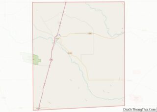
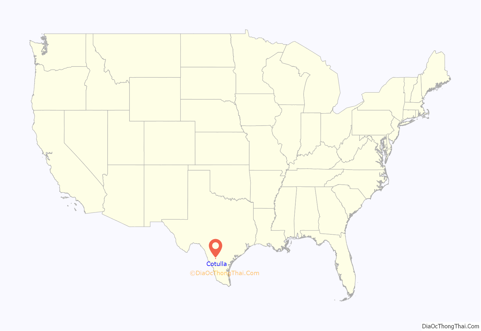
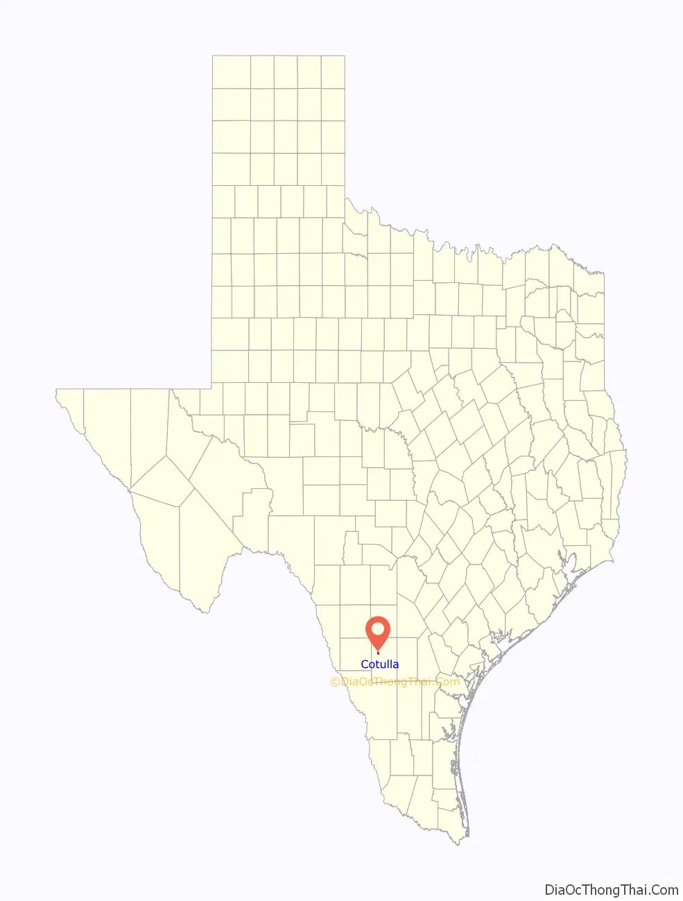
Cotulla location map. Where is Cotulla city?
History
Immigrant Joseph Cotulla, who was reared in Silesia, then a part of Prussia, migrated to the United States in the 1850s. He joined the Union Army in Brownsville, Texas. He lived in Atascosa County, but arrived in La Salle County in 1868 to establish what became a large ranching operation. After learning that the International-Great Northern Railroad intended to lay tracks in La Salle County, he worked to establish the town that bears his name.
In 1881, Cotulla donated 120 acres of his land to the railroad, and in 1882, a depot was constructed there. In 1883, the town was granted a post office. The same year, Cotulla became the county seat by special election.
Joseph Cotulla’s great-grandson, William Lawrence Cotulla (born around 1936), a former storekeeper in Cotulla, is a rancher in La Salle, Dimmit, and Webb Counties. In a 2013 interview with the Laredo Morning Times, William Cotulla noted the community of his birth has changed completely in less than 80 years, having gone through several phases, beginning with emphasis on farming, then ranching, thereafter hunting leases, and now petroleum and natural gas through the Eagle Ford Shale boom. With declining gasoline prices, though, the Eagle Ford boom took a sharp downturn by the fall of 2015.
In 1973, two railroad locomotives collided in Cotulla, and three people were killed as a result. In 2008, the area around Cotulla burned in a huge grass fire.
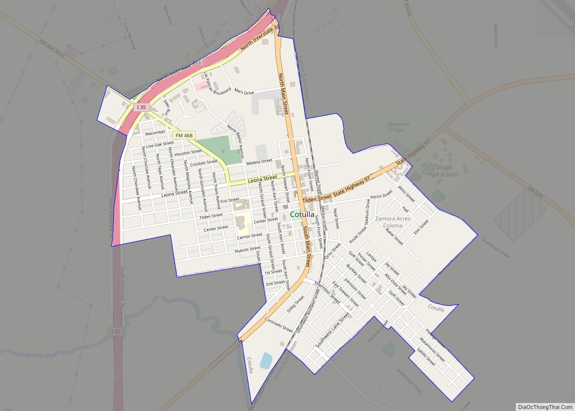
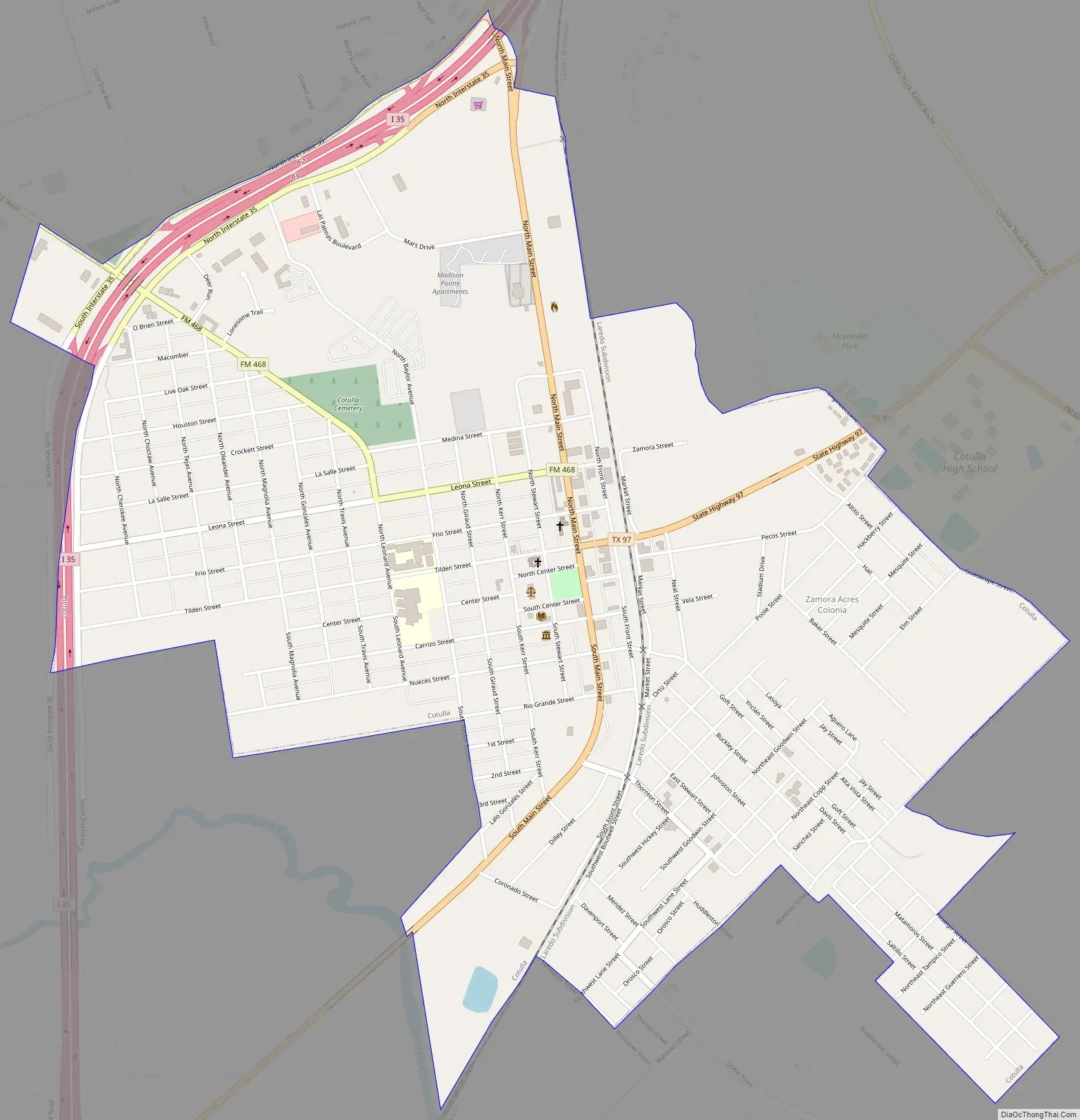
Cotulla Road Map
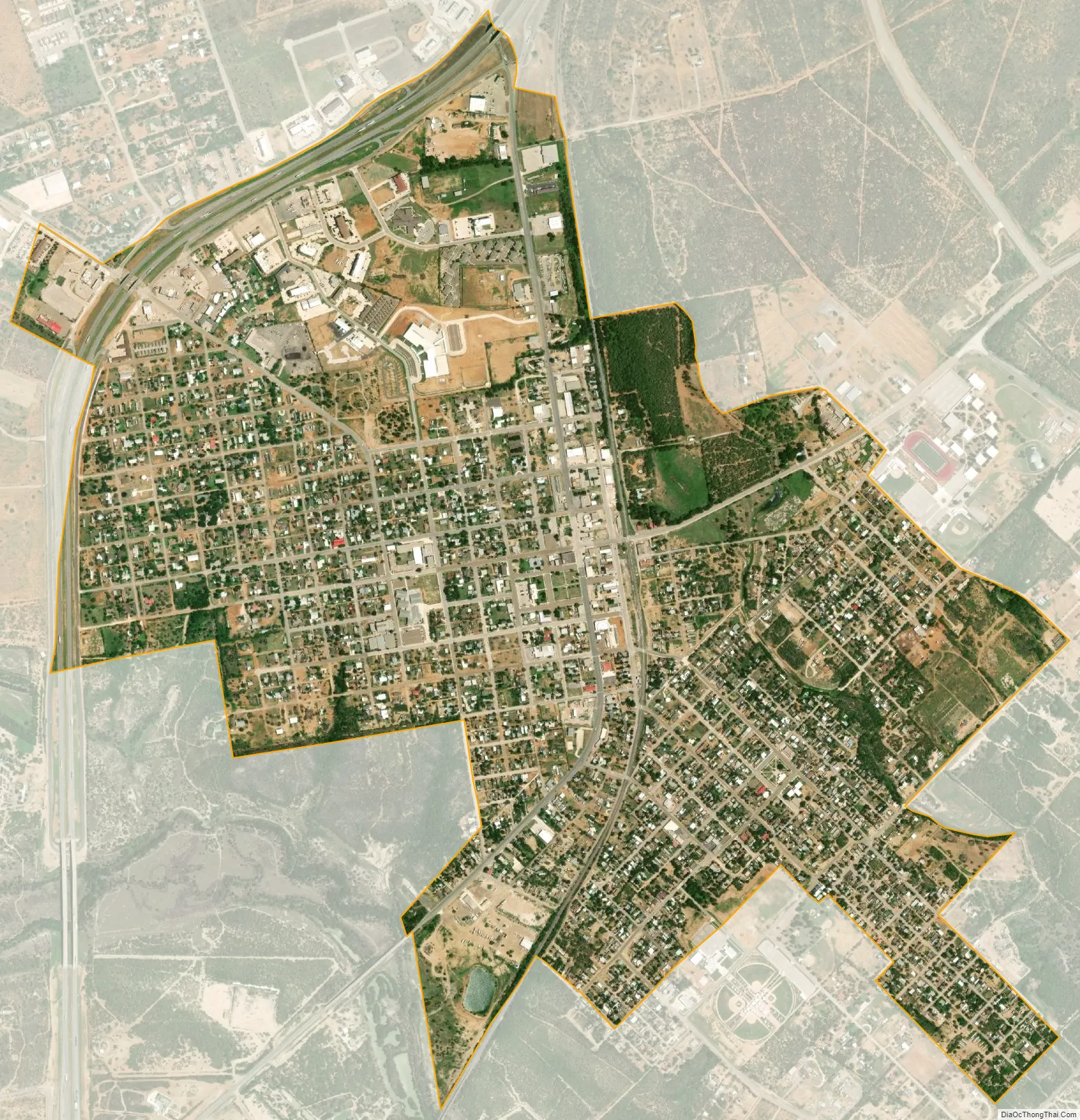
Cotulla city Satellite Map
Geography
Cotulla is located at 28°26′3″N 99°14′11″W / 28.43417°N 99.23639°W / 28.43417; -99.23639 (28.434144, –99.236343). This is 81 mi (147 km) southwest of San Antonio.
According to the United States Census Bureau, the city has a total area of 2.0 square miles (5.2 km), all of it land. The Nueces River flows through southern Cotulla in a southeastward direction to the Gulf of Mexico near Corpus Christi.
See also
Map of Texas State and its subdivision:- Anderson
- Andrews
- Angelina
- Aransas
- Archer
- Armstrong
- Atascosa
- Austin
- Bailey
- Bandera
- Bastrop
- Baylor
- Bee
- Bell
- Bexar
- Blanco
- Borden
- Bosque
- Bowie
- Brazoria
- Brazos
- Brewster
- Briscoe
- Brooks
- Brown
- Burleson
- Burnet
- Caldwell
- Calhoun
- Callahan
- Cameron
- Camp
- Carson
- Cass
- Castro
- Chambers
- Cherokee
- Childress
- Clay
- Cochran
- Coke
- Coleman
- Collin
- Collingsworth
- Colorado
- Comal
- Comanche
- Concho
- Cooke
- Coryell
- Cottle
- Crane
- Crockett
- Crosby
- Culberson
- Dallam
- Dallas
- Dawson
- Deaf Smith
- Delta
- Denton
- Dewitt
- Dickens
- Dimmit
- Donley
- Duval
- Eastland
- Ector
- Edwards
- El Paso
- Ellis
- Erath
- Falls
- Fannin
- Fayette
- Fisher
- Floyd
- Foard
- Fort Bend
- Franklin
- Freestone
- Frio
- Gaines
- Galveston
- Garza
- Gillespie
- Glasscock
- Goliad
- Gonzales
- Gray
- Grayson
- Gregg
- Grimes
- Guadalupe
- Hale
- Hall
- Hamilton
- Hansford
- Hardeman
- Hardin
- Harris
- Harrison
- Hartley
- Haskell
- Hays
- Hemphill
- Henderson
- Hidalgo
- Hill
- Hockley
- Hood
- Hopkins
- Houston
- Howard
- Hudspeth
- Hunt
- Hutchinson
- Irion
- Jack
- Jackson
- Jasper
- Jeff Davis
- Jefferson
- Jim Hogg
- Jim Wells
- Johnson
- Jones
- Karnes
- Kaufman
- Kendall
- Kenedy
- Kent
- Kerr
- Kimble
- King
- Kinney
- Kleberg
- Knox
- La Salle
- Lamar
- Lamb
- Lampasas
- Lavaca
- Lee
- Leon
- Liberty
- Limestone
- Lipscomb
- Live Oak
- Llano
- Loving
- Lubbock
- Lynn
- Madison
- Marion
- Martin
- Mason
- Matagorda
- Maverick
- McCulloch
- McLennan
- McMullen
- Medina
- Menard
- Midland
- Milam
- Mills
- Mitchell
- Montague
- Montgomery
- Moore
- Morris
- Motley
- Nacogdoches
- Navarro
- Newton
- Nolan
- Nueces
- Ochiltree
- Oldham
- Orange
- Palo Pinto
- Panola
- Parker
- Parmer
- Pecos
- Polk
- Potter
- Presidio
- Rains
- Randall
- Reagan
- Real
- Red River
- Reeves
- Refugio
- Roberts
- Robertson
- Rockwall
- Runnels
- Rusk
- Sabine
- San Augustine
- San Jacinto
- San Patricio
- San Saba
- Schleicher
- Scurry
- Shackelford
- Shelby
- Sherman
- Smith
- Somervell
- Starr
- Stephens
- Sterling
- Stonewall
- Sutton
- Swisher
- Tarrant
- Taylor
- Terrell
- Terry
- Throckmorton
- Titus
- Tom Green
- Travis
- Trinity
- Tyler
- Upshur
- Upton
- Uvalde
- Val Verde
- Van Zandt
- Victoria
- Walker
- Waller
- Ward
- Washington
- Webb
- Wharton
- Wheeler
- Wichita
- Wilbarger
- Willacy
- Williamson
- Wilson
- Winkler
- Wise
- Wood
- Yoakum
- Young
- Zapata
- Zavala
- Alabama
- Alaska
- Arizona
- Arkansas
- California
- Colorado
- Connecticut
- Delaware
- District of Columbia
- Florida
- Georgia
- Hawaii
- Idaho
- Illinois
- Indiana
- Iowa
- Kansas
- Kentucky
- Louisiana
- Maine
- Maryland
- Massachusetts
- Michigan
- Minnesota
- Mississippi
- Missouri
- Montana
- Nebraska
- Nevada
- New Hampshire
- New Jersey
- New Mexico
- New York
- North Carolina
- North Dakota
- Ohio
- Oklahoma
- Oregon
- Pennsylvania
- Rhode Island
- South Carolina
- South Dakota
- Tennessee
- Texas
- Utah
- Vermont
- Virginia
- Washington
- West Virginia
- Wisconsin
- Wyoming