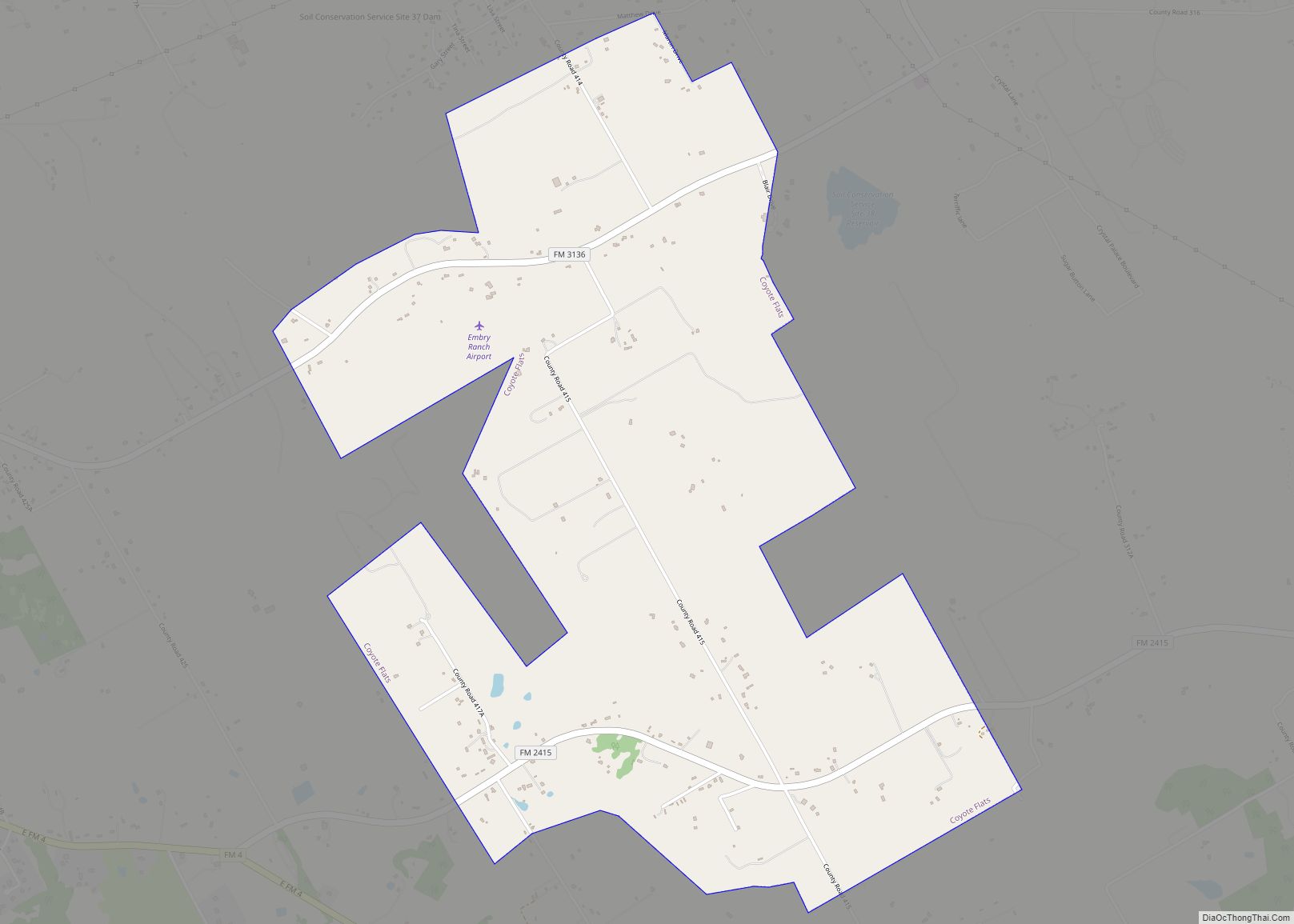
Coyote Flats is a city in Johnson County in the U.S. state of Texas. As of the 2010 census, before the community was incorporated, the population was 312.
| Name: | Coyote Flats city |
|---|---|
| LSAD Code: | 25 |
| LSAD Description: | city (suffix) |
| State: | Texas |
| County: | Johnson County |
| Elevation: | 860 ft (260 m) |
| Total Area: | 3.36 sq mi (8.71 km²) |
| Land Area: | 3.33 sq mi (8.62 km²) |
| Water Area: | 0.04 sq mi (0.09 km²) |
| Total Population: | 312 |
| Population Density: | 109.04/sq mi (42.10/km²) |
| ZIP code: | 76031 (Cleburne) |
| FIPS code: | 4817429 |
| GNISfeature ID: | 2663677 |
Online Interactive Map
Click on ![]() to view map in "full screen" mode.
to view map in "full screen" mode.
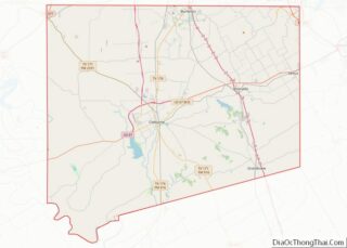
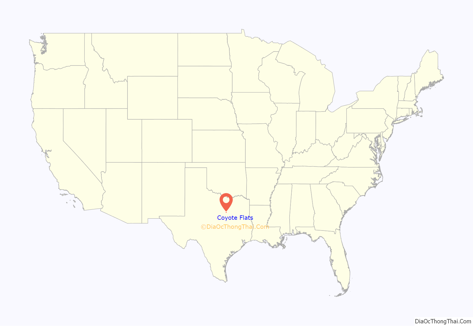
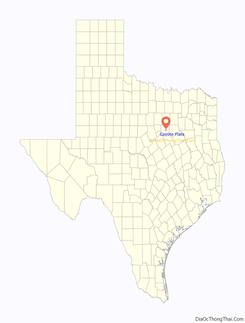
Coyote Flats location map. Where is Coyote Flats city?
History
In 2009, the city of Keene wanted to annex seven parcels of land to its south, but was met with strong opposition from the parcels’ residents. Judge John Neill of the 18th District Court subsequently blocked the annexation of three of the seven parcels on the grounds that they were outside of Keene’s extraterritorial jurisdiction. On March 10, 2010, 25 residents petitioned a specially called meeting of the Johnson County Commissioners Court to become incorporated as a municipality. The name “Coyote Flats” was submitted at the meeting.
An election to incorporate the City of Coyote Flats was held on May 8, 2010. The measure was approved by a vote of 76 to 11. John Barnett was sworn in as mayor on August 11.
Mayor John Barnett presented Jim McHale and Theo Embry with plaques of appreciation, recognizing their dedicated work to help establish the city of Coyote Flats in spring and summer 2010.
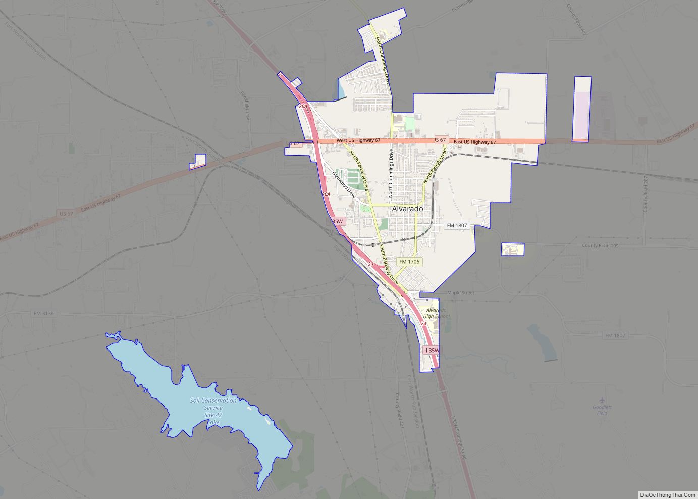
Coyote Flats Road Map
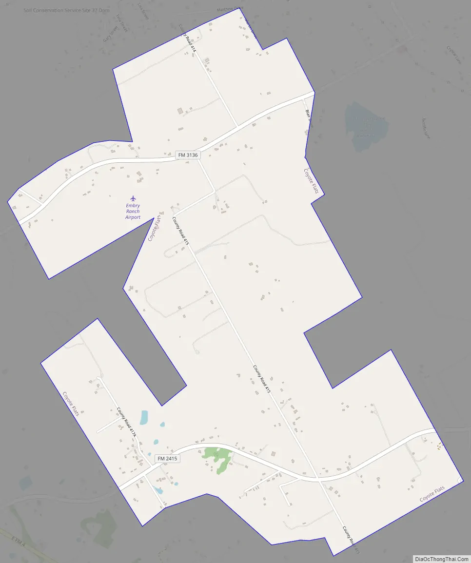
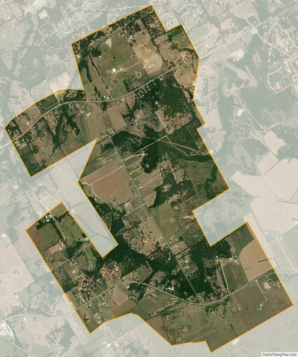
Coyote Flats city Satellite Map
Geography
Coyote Flats is located at 32°21′20″N 97°17′32″W / 32.35556°N 97.29222°W / 32.35556; -97.29222 (32.355614, –97.292037). It is 6 miles (10 km) east of Cleburne, 4 miles (6 km) south of Keene, and 7 miles (11 km) southwest of Alvarado. Downtown Fort Worth is 30 miles (48 km) to the north.
According to the United States Census Bureau, Coyote Flats has a total land area of 3.329 square miles (8.618 km) and a total water area of 0.035 square miles (0.091 km).
See also
Map of Texas State and its subdivision:- Anderson
- Andrews
- Angelina
- Aransas
- Archer
- Armstrong
- Atascosa
- Austin
- Bailey
- Bandera
- Bastrop
- Baylor
- Bee
- Bell
- Bexar
- Blanco
- Borden
- Bosque
- Bowie
- Brazoria
- Brazos
- Brewster
- Briscoe
- Brooks
- Brown
- Burleson
- Burnet
- Caldwell
- Calhoun
- Callahan
- Cameron
- Camp
- Carson
- Cass
- Castro
- Chambers
- Cherokee
- Childress
- Clay
- Cochran
- Coke
- Coleman
- Collin
- Collingsworth
- Colorado
- Comal
- Comanche
- Concho
- Cooke
- Coryell
- Cottle
- Crane
- Crockett
- Crosby
- Culberson
- Dallam
- Dallas
- Dawson
- Deaf Smith
- Delta
- Denton
- Dewitt
- Dickens
- Dimmit
- Donley
- Duval
- Eastland
- Ector
- Edwards
- El Paso
- Ellis
- Erath
- Falls
- Fannin
- Fayette
- Fisher
- Floyd
- Foard
- Fort Bend
- Franklin
- Freestone
- Frio
- Gaines
- Galveston
- Garza
- Gillespie
- Glasscock
- Goliad
- Gonzales
- Gray
- Grayson
- Gregg
- Grimes
- Guadalupe
- Hale
- Hall
- Hamilton
- Hansford
- Hardeman
- Hardin
- Harris
- Harrison
- Hartley
- Haskell
- Hays
- Hemphill
- Henderson
- Hidalgo
- Hill
- Hockley
- Hood
- Hopkins
- Houston
- Howard
- Hudspeth
- Hunt
- Hutchinson
- Irion
- Jack
- Jackson
- Jasper
- Jeff Davis
- Jefferson
- Jim Hogg
- Jim Wells
- Johnson
- Jones
- Karnes
- Kaufman
- Kendall
- Kenedy
- Kent
- Kerr
- Kimble
- King
- Kinney
- Kleberg
- Knox
- La Salle
- Lamar
- Lamb
- Lampasas
- Lavaca
- Lee
- Leon
- Liberty
- Limestone
- Lipscomb
- Live Oak
- Llano
- Loving
- Lubbock
- Lynn
- Madison
- Marion
- Martin
- Mason
- Matagorda
- Maverick
- McCulloch
- McLennan
- McMullen
- Medina
- Menard
- Midland
- Milam
- Mills
- Mitchell
- Montague
- Montgomery
- Moore
- Morris
- Motley
- Nacogdoches
- Navarro
- Newton
- Nolan
- Nueces
- Ochiltree
- Oldham
- Orange
- Palo Pinto
- Panola
- Parker
- Parmer
- Pecos
- Polk
- Potter
- Presidio
- Rains
- Randall
- Reagan
- Real
- Red River
- Reeves
- Refugio
- Roberts
- Robertson
- Rockwall
- Runnels
- Rusk
- Sabine
- San Augustine
- San Jacinto
- San Patricio
- San Saba
- Schleicher
- Scurry
- Shackelford
- Shelby
- Sherman
- Smith
- Somervell
- Starr
- Stephens
- Sterling
- Stonewall
- Sutton
- Swisher
- Tarrant
- Taylor
- Terrell
- Terry
- Throckmorton
- Titus
- Tom Green
- Travis
- Trinity
- Tyler
- Upshur
- Upton
- Uvalde
- Val Verde
- Van Zandt
- Victoria
- Walker
- Waller
- Ward
- Washington
- Webb
- Wharton
- Wheeler
- Wichita
- Wilbarger
- Willacy
- Williamson
- Wilson
- Winkler
- Wise
- Wood
- Yoakum
- Young
- Zapata
- Zavala
- Alabama
- Alaska
- Arizona
- Arkansas
- California
- Colorado
- Connecticut
- Delaware
- District of Columbia
- Florida
- Georgia
- Hawaii
- Idaho
- Illinois
- Indiana
- Iowa
- Kansas
- Kentucky
- Louisiana
- Maine
- Maryland
- Massachusetts
- Michigan
- Minnesota
- Mississippi
- Missouri
- Montana
- Nebraska
- Nevada
- New Hampshire
- New Jersey
- New Mexico
- New York
- North Carolina
- North Dakota
- Ohio
- Oklahoma
- Oregon
- Pennsylvania
- Rhode Island
- South Carolina
- South Dakota
- Tennessee
- Texas
- Utah
- Vermont
- Virginia
- Washington
- West Virginia
- Wisconsin
- Wyoming