Burleson (/ˈbɜːrlɪsən/ BUR-li-sən) is a city in Johnson and Tarrant counties in the U.S. state of Texas. It is a suburb of Fort Worth. As of the 2010 census it had a population of 36,690, and in 2019 it had an estimated population of 48,225.
| Name: | Burleson city |
|---|---|
| LSAD Code: | 25 |
| LSAD Description: | city (suffix) |
| State: | Texas |
| County: | Johnson County, Tarrant County |
| Elevation: | 712 ft (217 m) |
| Total Area: | 28.32 sq mi (73.36 km²) |
| Land Area: | 28.26 sq mi (73.18 km²) |
| Water Area: | 0.07 sq mi (0.17 km²) |
| Total Population: | 36,690 |
| Population Density: | 1,706.66/sq mi (658.95/km²) |
| Area code: | 817 |
| FIPS code: | 4811428 |
| GNISfeature ID: | 1331683 |
| Website: | www.burlesontx.com |
Online Interactive Map
Click on ![]() to view map in "full screen" mode.
to view map in "full screen" mode.
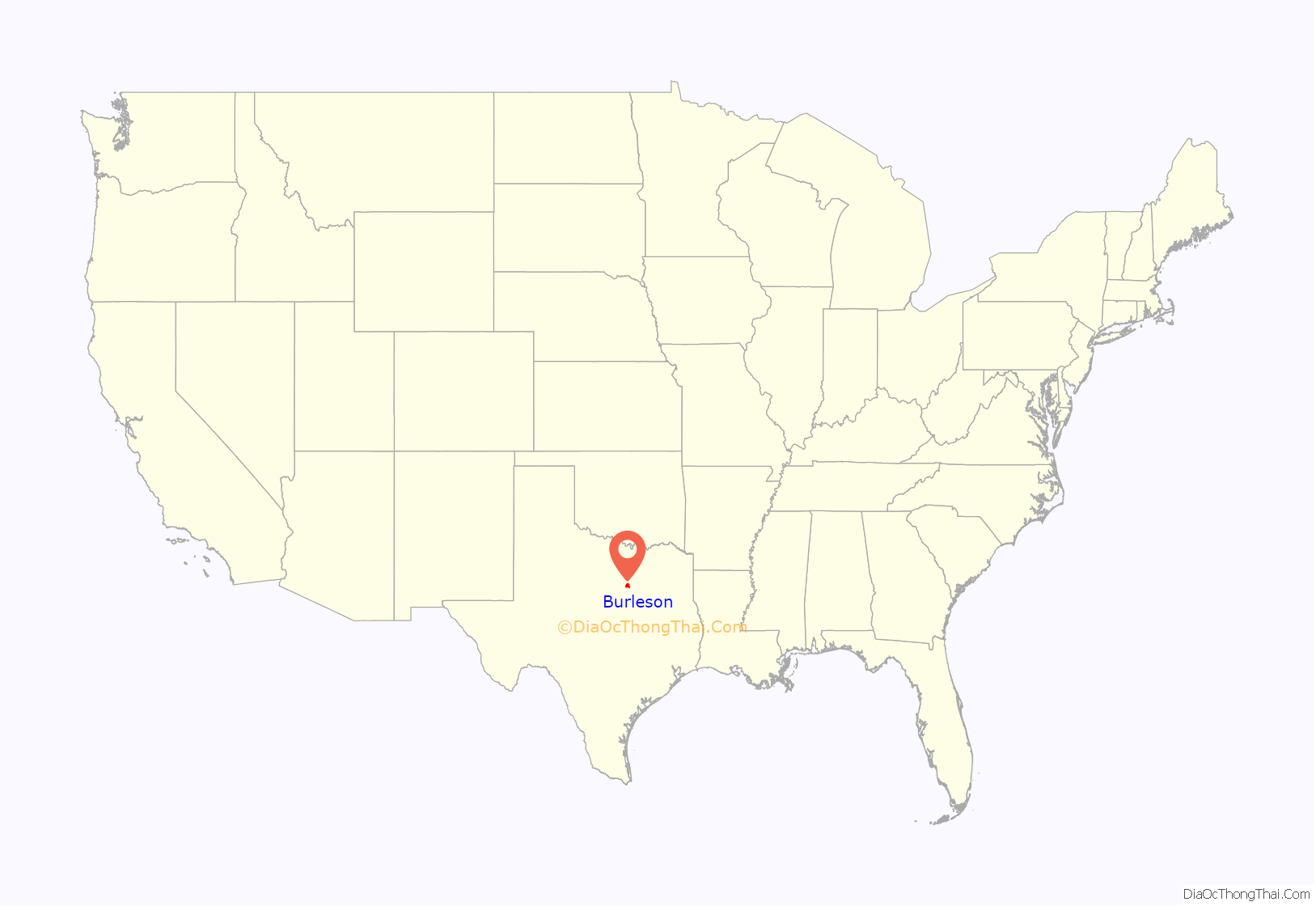
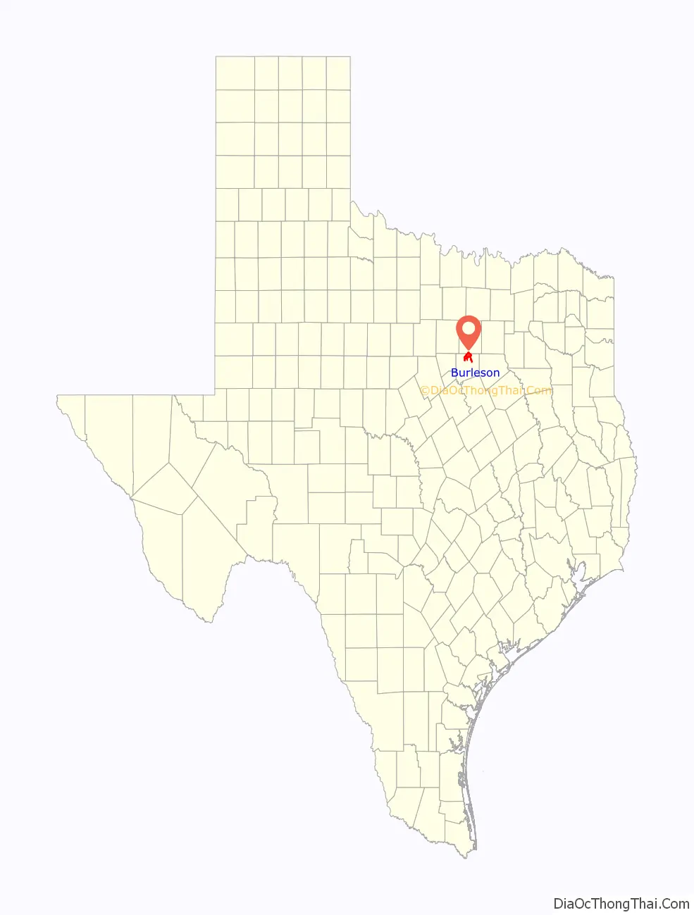
Burleson location map. Where is Burleson city?
History
The Missouri–Kansas–Texas Railroad, known as “the Katy”, extended its service from Denison to Waco. In 1880 the segment from Fort Worth to Alvarado was being laid out, and a midway depot was needed. Grenville M. Dodge, representing the railroad, purchased land for the depot and a town surrounding it from Rev. Henry C. Renfro at the site of what is now called “Old Town” Burleson. As part of the agreement, Renfro named the town “Burleson”, in honor of his teacher Rufus Columbus Burleson, the president of Baylor University. The first lot was sold on October 10, 1880, the date now considered the city’s “founding day”.
The Burleson Post Office opened in 1882, inside a retail establishment, as was common for small towns at the time. On February 20, 1895, a fire burned down most of the business district, along with several houses. One of the Katy workers, J. C. Jones, had stayed in Burleson and opened a water works for the town, drilling a deep well that provided dozens of hydrants for the residents, but they were not sufficient to extinguish the fire. By the end of the 1800s, Burleson was a bustling rural town, with farms all around, schools, a grocery store, cotton gins and grist mills, a general store, a druggist, a bank, and a jeweler. In 1899, a group of nine women formed a society for cultural advancement and called it the Eumathian Club. The women acquired books, loaned them, and held readings, discussions, and music recitals.
In 1909 the Texas Legislature passed a bill forming the Burleson Independent School District. Construction began in 1912 of the Northern Texas Traction Company interurban line between Fort Worth and Cleburne, with Burleson as a stop along the way. The first day of service was September 1, 1912, with 1,200 passengers on the ten passenger runs that day. Two freight runs per day were made as well. The interurban line provided for the first time two very important things to Burleson: easy access to Fort Worth and Cleburne, and electricity. The interurban station was operated out of a drugstore, whose proprietor became ticket master, and who served travelers pastries and soda from the soda fountain. The old drugstore/station still exists, as the Burleson Heritage Museum at the Burleson Visitor’s Center, as do two of the interurban cars.
That year, a petition was sent to a Johnson County judge proposing to incorporate the “Town of Burleson”, including a survey of the town limits that included most of the original town as set out by Grenville Dodge. An election was held, the petition passed, and the county judge ordered it so. On May 21, 1912, Burleson was incorporated.
The 1920 census showed the population of Burleson to be 241. In 1930 the population was 591. Due to the increasing popularity of automobiles, combined with the Great Depression, the interurban line closed in 1931. In 1940 the population decreased to 573, as people had left Burleson during the depression to find jobs wherever they could. In 1950 the population was 791, and grew to 2,345 in 1960, perhaps partly due to the opening of Interstate 35 through the town that year. By 1970 the population was 7,713, by 1980 11,734. In 1990 the population of Burleson was 16,113. In 2000 the population had grown to 20,976, and in 2010 there were 36,690 people in Burleson.
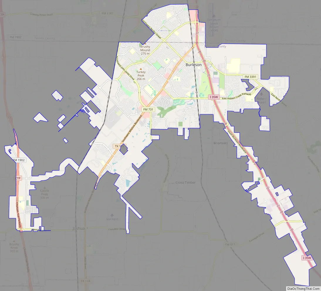
Burleson Road Map
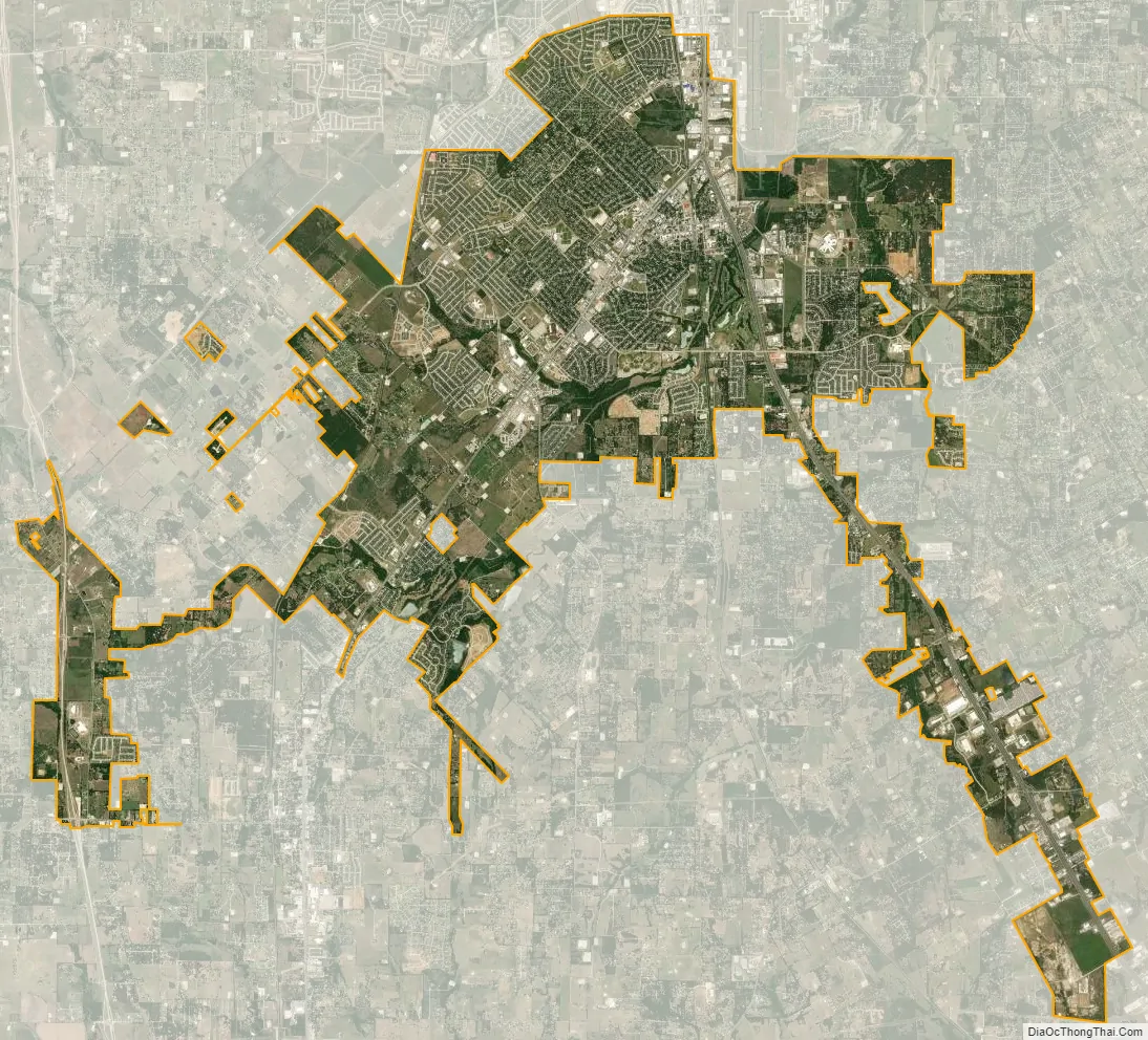
Burleson city Satellite Map
Geography
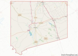
Most of Burleson is in northern Johnson County, with a small portion extending north into Tarrant County. The city is bordered to the north by the cities of Crowley and Fort Worth, and to the southwest by the city of Joshua. The Burleson city limits extend southeast from the city center 8 miles (13 km) in a narrow corridor toward Alvarado along Interstate 35W. I-35W leads north 15 miles (24 km) to the center of Fort Worth and south 40 miles (64 km) to Hillsboro. Texas State Highway 174 begins at I-35W in the northern part of Burleson and runs southwest 15 miles (24 km) to Cleburne, the Johnson county seat.
As of 2010, Burleson had a total area of 26.07 square miles (67.52 km), of which 26.01 square miles (67.36 km) were land and 0.07 square miles (0.17 km), or 0.25%, were water. Village Creek, a tributary of the Trinity River, flows to the northeast through the city. Most of Burleson lies between 700 and 800 feet (210 and 240 m) in elevation.
Climate
The climate is characterized by hot, humid summers and generally mild to cool winters. According to the Köppen Climate Classification system, Burleson has a humid subtropical climate, abbreviated “Cfa” on climate maps.
July and August are typically the hottest months, with highs averaging around 95 °F (35 °C) and lows around 72 °F (22 °C). December and January are the coldest months, with highs averaging 56 °F (13 °C) and lows around 34 °F (1 °C). Average annual rainfall is 37 inches (940 mm) per year.
See also
Map of Texas State and its subdivision:- Anderson
- Andrews
- Angelina
- Aransas
- Archer
- Armstrong
- Atascosa
- Austin
- Bailey
- Bandera
- Bastrop
- Baylor
- Bee
- Bell
- Bexar
- Blanco
- Borden
- Bosque
- Bowie
- Brazoria
- Brazos
- Brewster
- Briscoe
- Brooks
- Brown
- Burleson
- Burnet
- Caldwell
- Calhoun
- Callahan
- Cameron
- Camp
- Carson
- Cass
- Castro
- Chambers
- Cherokee
- Childress
- Clay
- Cochran
- Coke
- Coleman
- Collin
- Collingsworth
- Colorado
- Comal
- Comanche
- Concho
- Cooke
- Coryell
- Cottle
- Crane
- Crockett
- Crosby
- Culberson
- Dallam
- Dallas
- Dawson
- Deaf Smith
- Delta
- Denton
- Dewitt
- Dickens
- Dimmit
- Donley
- Duval
- Eastland
- Ector
- Edwards
- El Paso
- Ellis
- Erath
- Falls
- Fannin
- Fayette
- Fisher
- Floyd
- Foard
- Fort Bend
- Franklin
- Freestone
- Frio
- Gaines
- Galveston
- Garza
- Gillespie
- Glasscock
- Goliad
- Gonzales
- Gray
- Grayson
- Gregg
- Grimes
- Guadalupe
- Hale
- Hall
- Hamilton
- Hansford
- Hardeman
- Hardin
- Harris
- Harrison
- Hartley
- Haskell
- Hays
- Hemphill
- Henderson
- Hidalgo
- Hill
- Hockley
- Hood
- Hopkins
- Houston
- Howard
- Hudspeth
- Hunt
- Hutchinson
- Irion
- Jack
- Jackson
- Jasper
- Jeff Davis
- Jefferson
- Jim Hogg
- Jim Wells
- Johnson
- Jones
- Karnes
- Kaufman
- Kendall
- Kenedy
- Kent
- Kerr
- Kimble
- King
- Kinney
- Kleberg
- Knox
- La Salle
- Lamar
- Lamb
- Lampasas
- Lavaca
- Lee
- Leon
- Liberty
- Limestone
- Lipscomb
- Live Oak
- Llano
- Loving
- Lubbock
- Lynn
- Madison
- Marion
- Martin
- Mason
- Matagorda
- Maverick
- McCulloch
- McLennan
- McMullen
- Medina
- Menard
- Midland
- Milam
- Mills
- Mitchell
- Montague
- Montgomery
- Moore
- Morris
- Motley
- Nacogdoches
- Navarro
- Newton
- Nolan
- Nueces
- Ochiltree
- Oldham
- Orange
- Palo Pinto
- Panola
- Parker
- Parmer
- Pecos
- Polk
- Potter
- Presidio
- Rains
- Randall
- Reagan
- Real
- Red River
- Reeves
- Refugio
- Roberts
- Robertson
- Rockwall
- Runnels
- Rusk
- Sabine
- San Augustine
- San Jacinto
- San Patricio
- San Saba
- Schleicher
- Scurry
- Shackelford
- Shelby
- Sherman
- Smith
- Somervell
- Starr
- Stephens
- Sterling
- Stonewall
- Sutton
- Swisher
- Tarrant
- Taylor
- Terrell
- Terry
- Throckmorton
- Titus
- Tom Green
- Travis
- Trinity
- Tyler
- Upshur
- Upton
- Uvalde
- Val Verde
- Van Zandt
- Victoria
- Walker
- Waller
- Ward
- Washington
- Webb
- Wharton
- Wheeler
- Wichita
- Wilbarger
- Willacy
- Williamson
- Wilson
- Winkler
- Wise
- Wood
- Yoakum
- Young
- Zapata
- Zavala
- Alabama
- Alaska
- Arizona
- Arkansas
- California
- Colorado
- Connecticut
- Delaware
- District of Columbia
- Florida
- Georgia
- Hawaii
- Idaho
- Illinois
- Indiana
- Iowa
- Kansas
- Kentucky
- Louisiana
- Maine
- Maryland
- Massachusetts
- Michigan
- Minnesota
- Mississippi
- Missouri
- Montana
- Nebraska
- Nevada
- New Hampshire
- New Jersey
- New Mexico
- New York
- North Carolina
- North Dakota
- Ohio
- Oklahoma
- Oregon
- Pennsylvania
- Rhode Island
- South Carolina
- South Dakota
- Tennessee
- Texas
- Utah
- Vermont
- Virginia
- Washington
- West Virginia
- Wisconsin
- Wyoming