Cleburne (/ˈkliːbɜːrn/ KLEE-burn) is a city in and the county seat of Johnson County, Texas, United States. As of the 2010 census, its population was 29,337. The city is named in honor of Patrick Cleburne, a Confederate general. Lake Pat Cleburne, the reservoir that provides water to the city and surrounding area, is also named after him.
| Name: | Cleburne city |
|---|---|
| LSAD Code: | 25 |
| LSAD Description: | city (suffix) |
| State: | Texas |
| County: | Johnson County |
| Elevation: | 764 ft (233 m) |
| Total Area: | 38.60 sq mi (99.97 km²) |
| Land Area: | 35.70 sq mi (92.46 km²) |
| Water Area: | 2.90 sq mi (7.52 km²) |
| Total Population: | 29,337 |
| Population Density: | 876.66/sq mi (338.48/km²) |
| ZIP code: | 76031, 76033 |
| Area code: | 817 |
| FIPS code: | 4815364 |
| GNISfeature ID: | 1332964 |
| Website: | www.cleburne.net |
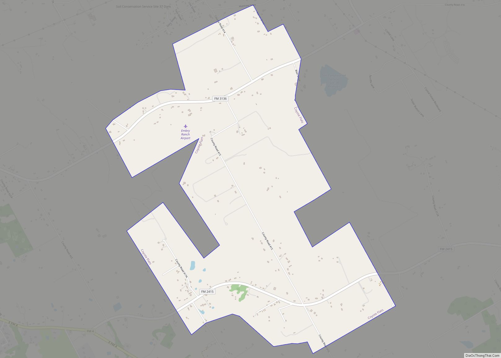
Online Interactive Map
Click on ![]() to view map in "full screen" mode.
to view map in "full screen" mode.
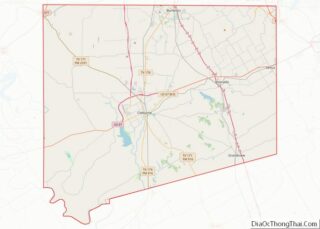
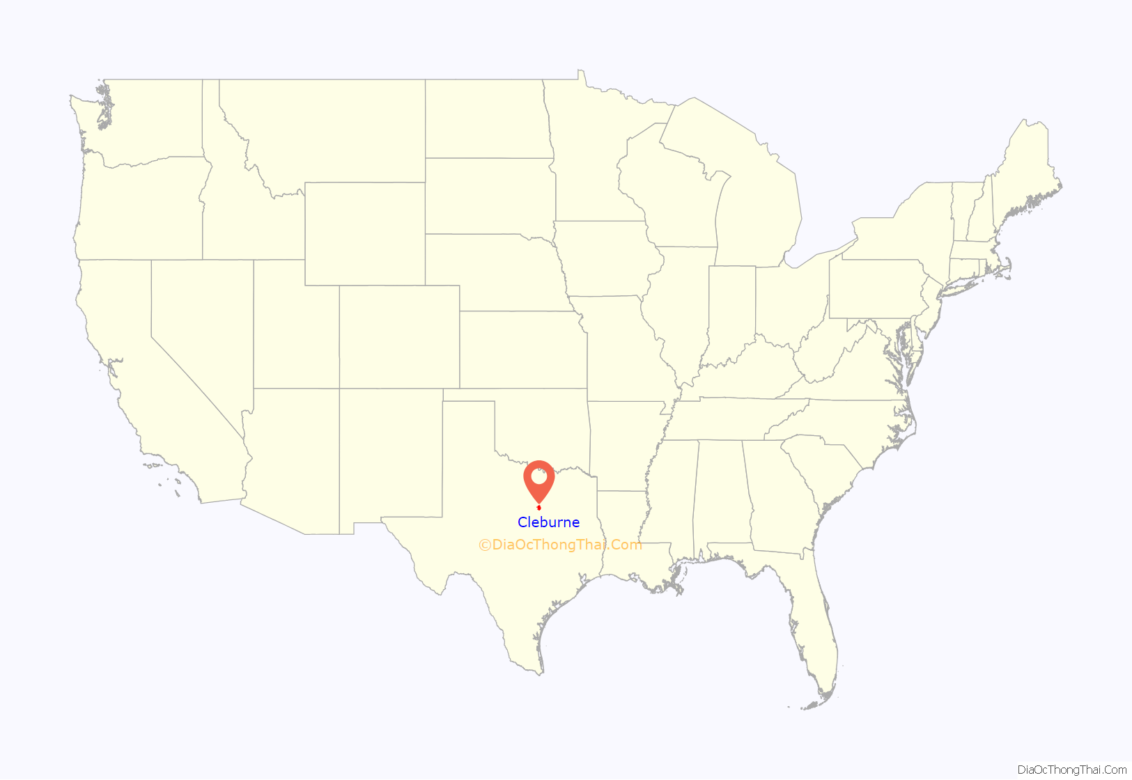
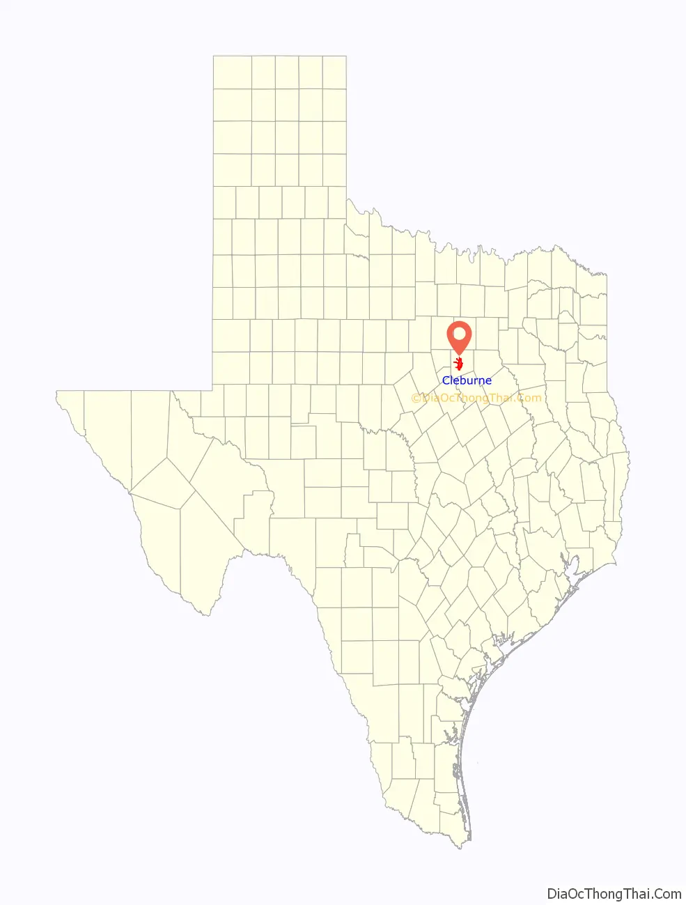
Cleburne location map. Where is Cleburne city?
History
Cleburne is Johnson County’s third county seat (the first being Wardville, now under Lake Pat Cleburne). It was formerly known as Camp Henderson, a temporary Civil War outpost from which Johnson County soldiers would depart for war (most of them served under General Cleburne). The city was formally incorporated in 1871.
Cleburne was near the earliest road in the county. The location featured water from West Buffalo Creek, making it a stop for cattlemen from the Chisholm Trail.
In August 1886, the Texas Farmers’ Alliance met at Lee’s Academy and adopted a 17-point political resolution, commonly known as the Cleburne Demands, which was the first major document of the agrarian revolt occurring at the end of the late 19th century.
In 1900, Cleburne was the site of the founding convention of the Texas State Federation of Labor.
Cleburne was primarily an agricultural center and county seat until the Santa Fe Railroad opened a major facility there in 1898. During this time, the population boomed, as it became a sizable city for the area with over 12,000 residents by 1920. The Chicago, Texas and Mexican Central Railway connected Cleburne to Dallas in 1882. Two other railroads had terminals in Cleburne. The Dallas, Cleburne, and Southwestern Railway completed a route to Egan in 1902, and the Trinity and Brazos Valley, nicknamed the Boll Weevil, operated from Cleburne from 1904 to 1924.
Cleburne was the site of a prisoner-of-war camp for German soldiers during World War 2. The POWs worked as laborers on local farms.
In 1985, the city was the petitioner in the U.S. Supreme Court case City of Cleburne v. Cleburne Living Center, Inc. after being sued over a special-use permit.
Cleburne is on the fringe of the Dallas–Fort Worth metroplex. Growth in the area can be primarily attributed to suburbanization. It is the second-most populous city in Johnson County (slightly less populous than Burleson).
Tornado
On May 15, 2013, Cleburne was hit by a powerful tornado that cut a mile-wide path through part of the city and damaged about 600 homes and two schools. The National Weather Service rated it EF-3, which has winds between 136 and 165 miles per hour (219 and 266 km/h). No deaths or severe injuries were reported.
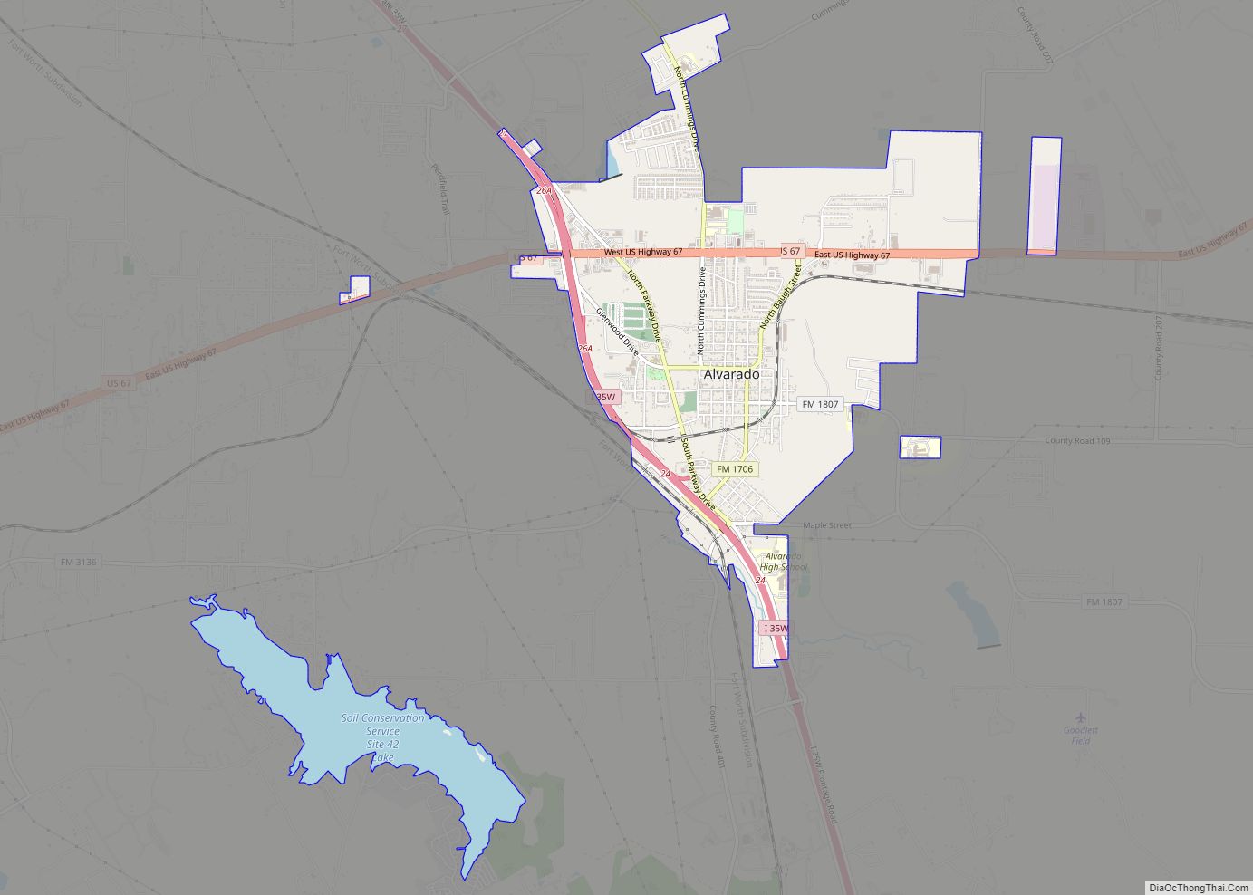
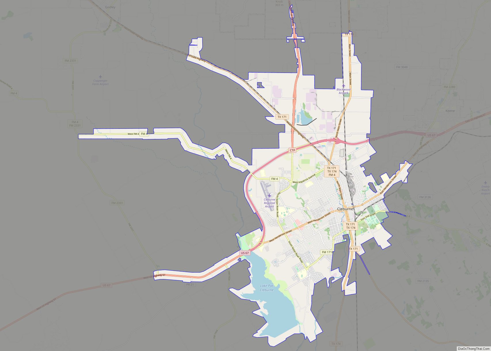
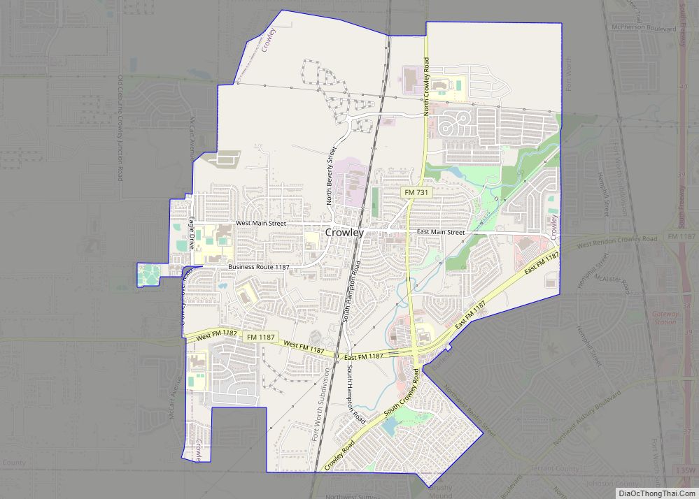
Cleburne Road Map
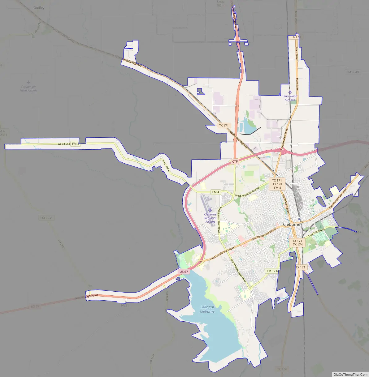
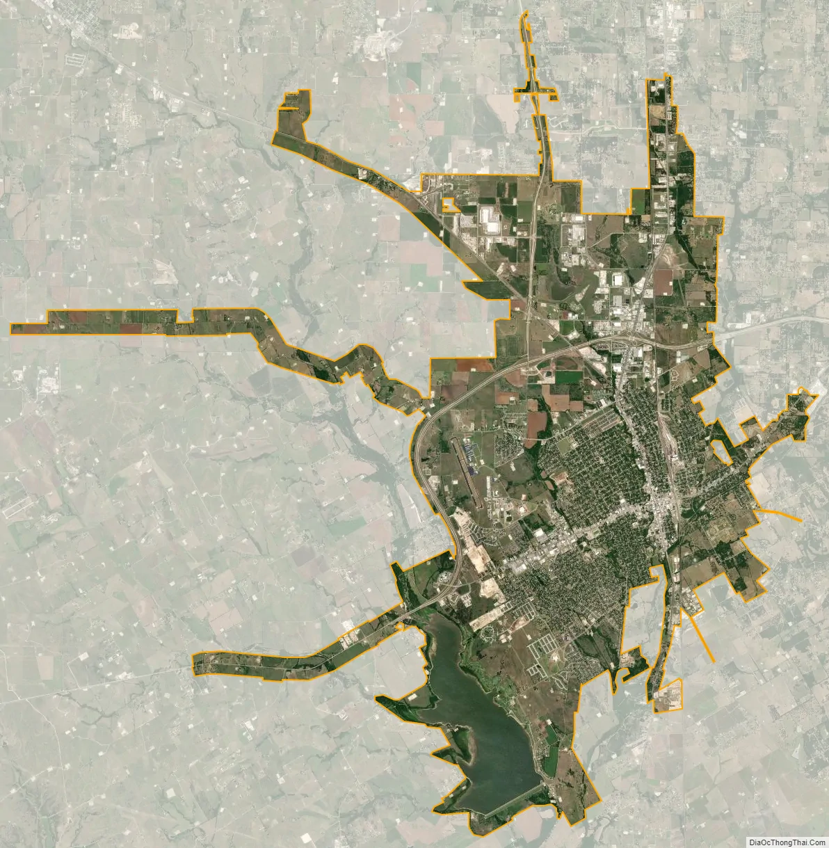
Cleburne city Satellite Map
Geography
Cleburne is west of the center of Johnson County, 30 miles (48 km) south of the center of Fort Worth. It is bordered to the north by Joshua and to the east by Keene. U.S. Route 67 runs through the north side of the city on a freeway bypass; the highway leads east 12 miles (19 km) to Alvarado and west 53 miles (85 km) to Stephenville. State Highways 171 and 174 run through the center of Cleburne on Main Street. Highway 171 leads northwest 19 miles (31 km) to Cresson and southeast 29 miles (47 km) to Hillsboro, while Highway 174 leads north 15 miles (24 km) to Burleson and southwest 38 miles (61 km) to Meridian.
According to the United States Census Bureau, Cleburne has a total area of 32.5 square miles (84.1 km), of which 29.6 square miles (76.6 km) are land and 2.9 square miles (7.4 km), or 8.86%, are covered by water. East and West Buffalo Creek run through the center of Cleburne, flowing south to the Nolan River and part of the Brazos River watershed.
See also
Map of Texas State and its subdivision:- Anderson
- Andrews
- Angelina
- Aransas
- Archer
- Armstrong
- Atascosa
- Austin
- Bailey
- Bandera
- Bastrop
- Baylor
- Bee
- Bell
- Bexar
- Blanco
- Borden
- Bosque
- Bowie
- Brazoria
- Brazos
- Brewster
- Briscoe
- Brooks
- Brown
- Burleson
- Burnet
- Caldwell
- Calhoun
- Callahan
- Cameron
- Camp
- Carson
- Cass
- Castro
- Chambers
- Cherokee
- Childress
- Clay
- Cochran
- Coke
- Coleman
- Collin
- Collingsworth
- Colorado
- Comal
- Comanche
- Concho
- Cooke
- Coryell
- Cottle
- Crane
- Crockett
- Crosby
- Culberson
- Dallam
- Dallas
- Dawson
- Deaf Smith
- Delta
- Denton
- Dewitt
- Dickens
- Dimmit
- Donley
- Duval
- Eastland
- Ector
- Edwards
- El Paso
- Ellis
- Erath
- Falls
- Fannin
- Fayette
- Fisher
- Floyd
- Foard
- Fort Bend
- Franklin
- Freestone
- Frio
- Gaines
- Galveston
- Garza
- Gillespie
- Glasscock
- Goliad
- Gonzales
- Gray
- Grayson
- Gregg
- Grimes
- Guadalupe
- Hale
- Hall
- Hamilton
- Hansford
- Hardeman
- Hardin
- Harris
- Harrison
- Hartley
- Haskell
- Hays
- Hemphill
- Henderson
- Hidalgo
- Hill
- Hockley
- Hood
- Hopkins
- Houston
- Howard
- Hudspeth
- Hunt
- Hutchinson
- Irion
- Jack
- Jackson
- Jasper
- Jeff Davis
- Jefferson
- Jim Hogg
- Jim Wells
- Johnson
- Jones
- Karnes
- Kaufman
- Kendall
- Kenedy
- Kent
- Kerr
- Kimble
- King
- Kinney
- Kleberg
- Knox
- La Salle
- Lamar
- Lamb
- Lampasas
- Lavaca
- Lee
- Leon
- Liberty
- Limestone
- Lipscomb
- Live Oak
- Llano
- Loving
- Lubbock
- Lynn
- Madison
- Marion
- Martin
- Mason
- Matagorda
- Maverick
- McCulloch
- McLennan
- McMullen
- Medina
- Menard
- Midland
- Milam
- Mills
- Mitchell
- Montague
- Montgomery
- Moore
- Morris
- Motley
- Nacogdoches
- Navarro
- Newton
- Nolan
- Nueces
- Ochiltree
- Oldham
- Orange
- Palo Pinto
- Panola
- Parker
- Parmer
- Pecos
- Polk
- Potter
- Presidio
- Rains
- Randall
- Reagan
- Real
- Red River
- Reeves
- Refugio
- Roberts
- Robertson
- Rockwall
- Runnels
- Rusk
- Sabine
- San Augustine
- San Jacinto
- San Patricio
- San Saba
- Schleicher
- Scurry
- Shackelford
- Shelby
- Sherman
- Smith
- Somervell
- Starr
- Stephens
- Sterling
- Stonewall
- Sutton
- Swisher
- Tarrant
- Taylor
- Terrell
- Terry
- Throckmorton
- Titus
- Tom Green
- Travis
- Trinity
- Tyler
- Upshur
- Upton
- Uvalde
- Val Verde
- Van Zandt
- Victoria
- Walker
- Waller
- Ward
- Washington
- Webb
- Wharton
- Wheeler
- Wichita
- Wilbarger
- Willacy
- Williamson
- Wilson
- Winkler
- Wise
- Wood
- Yoakum
- Young
- Zapata
- Zavala
- Alabama
- Alaska
- Arizona
- Arkansas
- California
- Colorado
- Connecticut
- Delaware
- District of Columbia
- Florida
- Georgia
- Hawaii
- Idaho
- Illinois
- Indiana
- Iowa
- Kansas
- Kentucky
- Louisiana
- Maine
- Maryland
- Massachusetts
- Michigan
- Minnesota
- Mississippi
- Missouri
- Montana
- Nebraska
- Nevada
- New Hampshire
- New Jersey
- New Mexico
- New York
- North Carolina
- North Dakota
- Ohio
- Oklahoma
- Oregon
- Pennsylvania
- Rhode Island
- South Carolina
- South Dakota
- Tennessee
- Texas
- Utah
- Vermont
- Virginia
- Washington
- West Virginia
- Wisconsin
- Wyoming