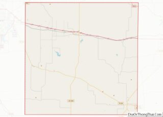
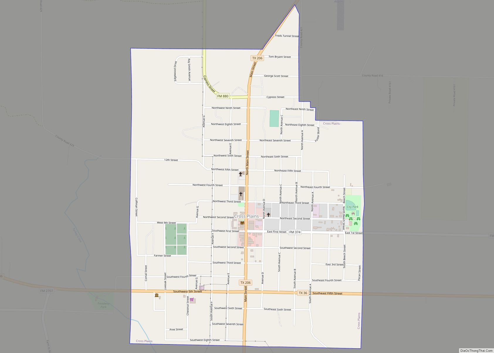
Cross Plains is a town in Callahan County, Texas, United States. The population was 982 at the 2010 census. It is part of the Abilene, Texas Metropolitan Statistical Area.
| Name: | Cross Plains town |
|---|---|
| LSAD Code: | 43 |
| LSAD Description: | town (suffix) |
| State: | Texas |
| County: | Callahan County |
| Elevation: | 1,736 ft (529 m) |
| Total Area: | 1.20 sq mi (3.11 km²) |
| Land Area: | 1.20 sq mi (3.11 km²) |
| Water Area: | 0.00 sq mi (0.00 km²) |
| Total Population: | 982 |
| Population Density: | 821.67/sq mi (317.24/km²) |
| ZIP code: | 76443 |
| Area code: | 254 |
| FIPS code: | 4817816 |
| GNISfeature ID: | 2412390 |
| Website: | www.crossplains.org |
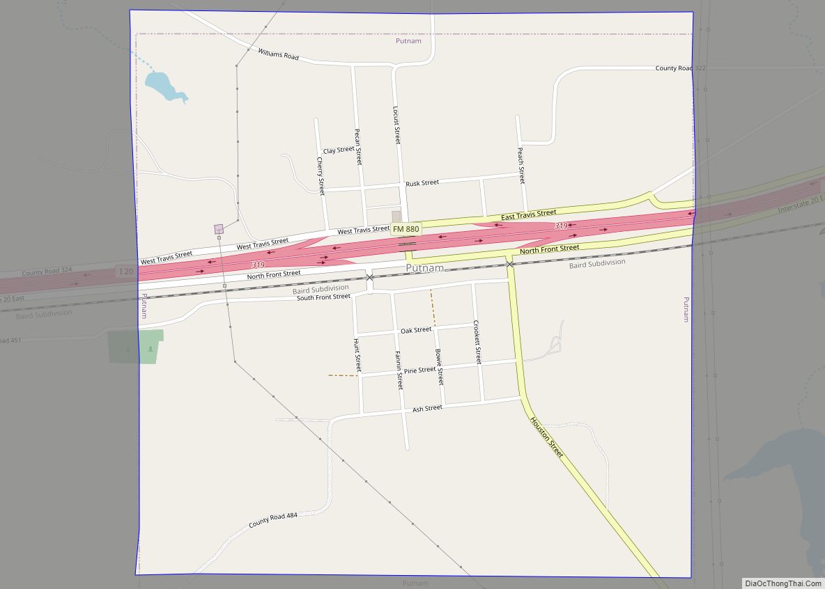
Online Interactive Map
Click on ![]() to view map in "full screen" mode.
to view map in "full screen" mode.
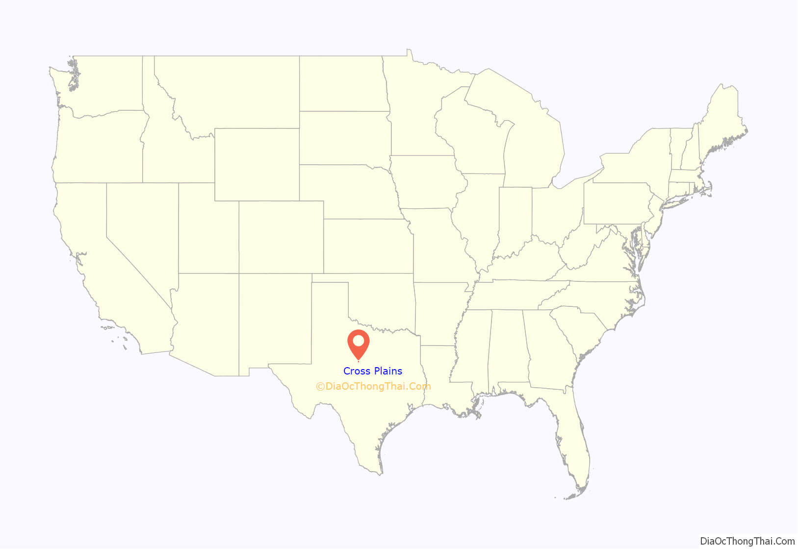
Cross Plains location map. Where is Cross Plains town?
History
Cross Plains was once named “Turkey Creek”, after the stream that now crosses the town’s Treadaway Park. In its early years, Cross Plains had the basic necessities like a store, a cotton gin and gristmill, but little else. Hugh Henry McDermett and J.C. McDermett, early settlers here, petitioned the federal government to establish a post office in Cross Plains. In 1878, the government granted the post office, named “Cross Plains” for the crossings of stagecoach and military roads prior to the Civil War. East and West Caddo Peaks, located 5 miles (8 km) west, were used as landmarks by early Indians, soldiers, and government surveying crews.
The town had one newspaper in 1902 (The Herald), but it soon went out of business. The second paper, The Cross Plains Review, started in 1909 and continues to publish a weekly newspaper every Wednesday. The town moved from the west banks of Turkey Creek to its present site in January 1911, to be closer to the railroad. On January 12, 1911, a train full of prospective land buyers arrived in Cross Plains. Before the day was out, $75,000.00 worth of land had been purchased. Cross Plains was the last stop on the Texas Central Katy Railroad spur from De Leon and Rising Star. The Katy abandoned the spur in the 1940s. An oil boom in 1925 increased the population, and by 1940 it was over 1,200. It has remained hovering around the 1,000 mark for the last 50 years.
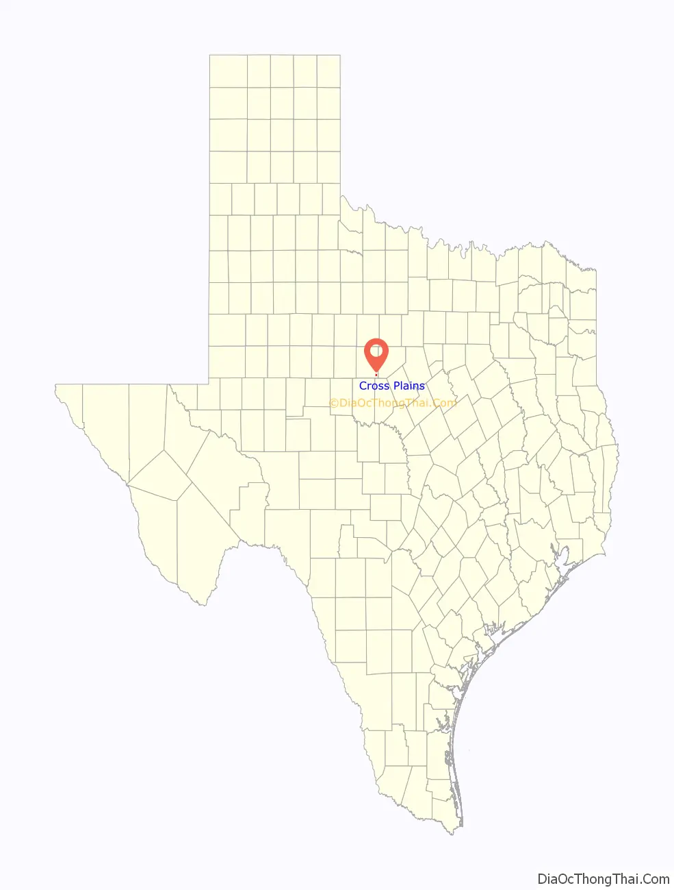
Cross Plains Road Map
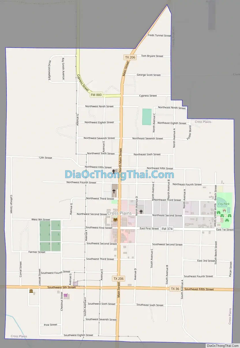
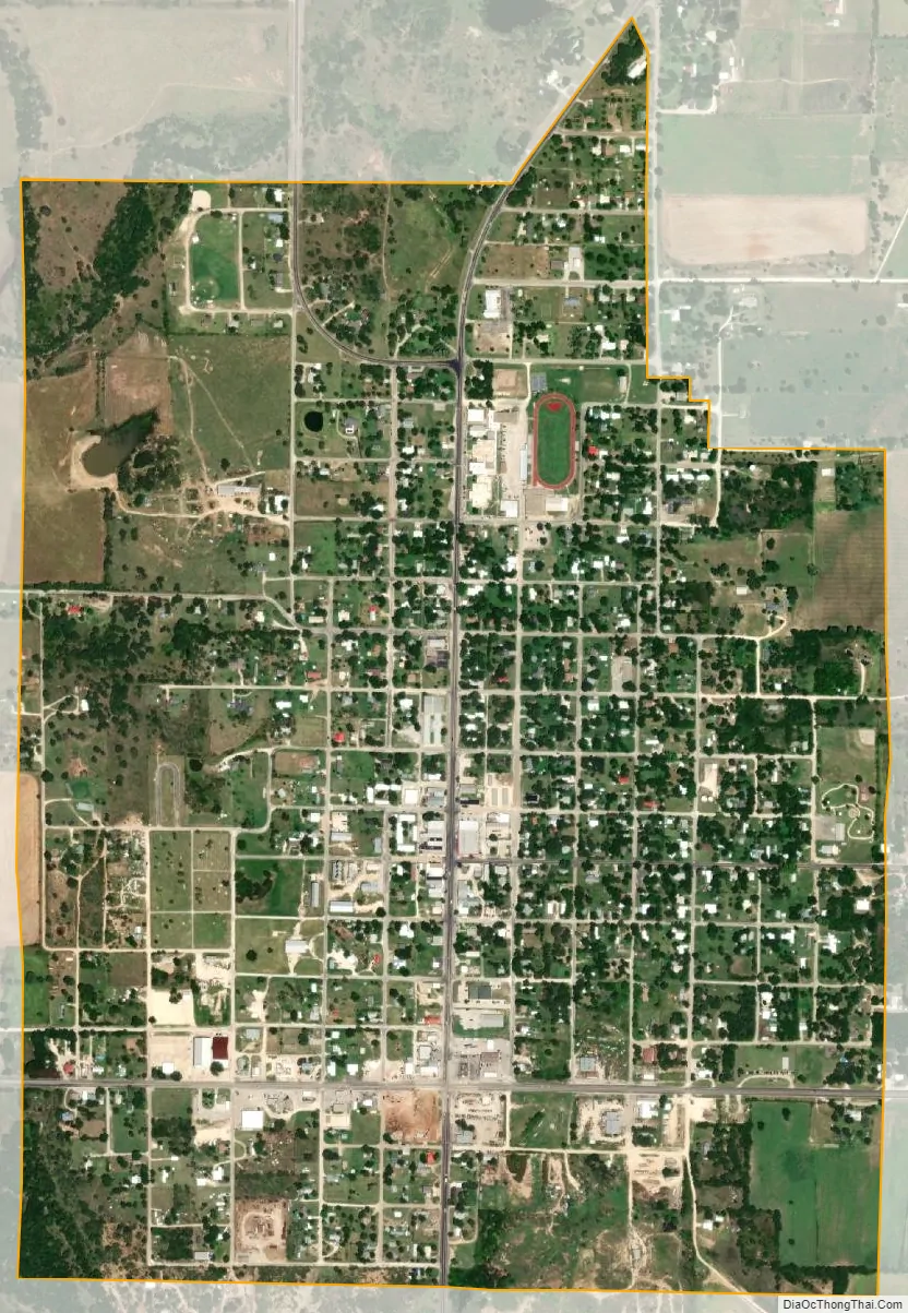
Cross Plains city Satellite Map
Geography
Cross Plains is located in southeastern Callahan County at 32°7′35″N 99°9′53″W / 32.12639°N 99.16472°W / 32.12639; -99.16472 (32.126467, –99.164677). State highways 36 and 206 cross in the southern part of town, with Highway 36 leading northwest 45 miles (72 km) to Abilene and southeast 39 miles (63 km) to Comanche, while Highway 206 leads northeast 23 miles (37 km) to Cisco and southwest 27 miles (43 km) to Coleman.
According to the United States Census Bureau, Cross Plains has a total area of 1.2 square miles (3.1 km), all of it land.
See also
Map of Texas State and its subdivision:- Anderson
- Andrews
- Angelina
- Aransas
- Archer
- Armstrong
- Atascosa
- Austin
- Bailey
- Bandera
- Bastrop
- Baylor
- Bee
- Bell
- Bexar
- Blanco
- Borden
- Bosque
- Bowie
- Brazoria
- Brazos
- Brewster
- Briscoe
- Brooks
- Brown
- Burleson
- Burnet
- Caldwell
- Calhoun
- Callahan
- Cameron
- Camp
- Carson
- Cass
- Castro
- Chambers
- Cherokee
- Childress
- Clay
- Cochran
- Coke
- Coleman
- Collin
- Collingsworth
- Colorado
- Comal
- Comanche
- Concho
- Cooke
- Coryell
- Cottle
- Crane
- Crockett
- Crosby
- Culberson
- Dallam
- Dallas
- Dawson
- Deaf Smith
- Delta
- Denton
- Dewitt
- Dickens
- Dimmit
- Donley
- Duval
- Eastland
- Ector
- Edwards
- El Paso
- Ellis
- Erath
- Falls
- Fannin
- Fayette
- Fisher
- Floyd
- Foard
- Fort Bend
- Franklin
- Freestone
- Frio
- Gaines
- Galveston
- Garza
- Gillespie
- Glasscock
- Goliad
- Gonzales
- Gray
- Grayson
- Gregg
- Grimes
- Guadalupe
- Hale
- Hall
- Hamilton
- Hansford
- Hardeman
- Hardin
- Harris
- Harrison
- Hartley
- Haskell
- Hays
- Hemphill
- Henderson
- Hidalgo
- Hill
- Hockley
- Hood
- Hopkins
- Houston
- Howard
- Hudspeth
- Hunt
- Hutchinson
- Irion
- Jack
- Jackson
- Jasper
- Jeff Davis
- Jefferson
- Jim Hogg
- Jim Wells
- Johnson
- Jones
- Karnes
- Kaufman
- Kendall
- Kenedy
- Kent
- Kerr
- Kimble
- King
- Kinney
- Kleberg
- Knox
- La Salle
- Lamar
- Lamb
- Lampasas
- Lavaca
- Lee
- Leon
- Liberty
- Limestone
- Lipscomb
- Live Oak
- Llano
- Loving
- Lubbock
- Lynn
- Madison
- Marion
- Martin
- Mason
- Matagorda
- Maverick
- McCulloch
- McLennan
- McMullen
- Medina
- Menard
- Midland
- Milam
- Mills
- Mitchell
- Montague
- Montgomery
- Moore
- Morris
- Motley
- Nacogdoches
- Navarro
- Newton
- Nolan
- Nueces
- Ochiltree
- Oldham
- Orange
- Palo Pinto
- Panola
- Parker
- Parmer
- Pecos
- Polk
- Potter
- Presidio
- Rains
- Randall
- Reagan
- Real
- Red River
- Reeves
- Refugio
- Roberts
- Robertson
- Rockwall
- Runnels
- Rusk
- Sabine
- San Augustine
- San Jacinto
- San Patricio
- San Saba
- Schleicher
- Scurry
- Shackelford
- Shelby
- Sherman
- Smith
- Somervell
- Starr
- Stephens
- Sterling
- Stonewall
- Sutton
- Swisher
- Tarrant
- Taylor
- Terrell
- Terry
- Throckmorton
- Titus
- Tom Green
- Travis
- Trinity
- Tyler
- Upshur
- Upton
- Uvalde
- Val Verde
- Van Zandt
- Victoria
- Walker
- Waller
- Ward
- Washington
- Webb
- Wharton
- Wheeler
- Wichita
- Wilbarger
- Willacy
- Williamson
- Wilson
- Winkler
- Wise
- Wood
- Yoakum
- Young
- Zapata
- Zavala
- Alabama
- Alaska
- Arizona
- Arkansas
- California
- Colorado
- Connecticut
- Delaware
- District of Columbia
- Florida
- Georgia
- Hawaii
- Idaho
- Illinois
- Indiana
- Iowa
- Kansas
- Kentucky
- Louisiana
- Maine
- Maryland
- Massachusetts
- Michigan
- Minnesota
- Mississippi
- Missouri
- Montana
- Nebraska
- Nevada
- New Hampshire
- New Jersey
- New Mexico
- New York
- North Carolina
- North Dakota
- Ohio
- Oklahoma
- Oregon
- Pennsylvania
- Rhode Island
- South Carolina
- South Dakota
- Tennessee
- Texas
- Utah
- Vermont
- Virginia
- Washington
- West Virginia
- Wisconsin
- Wyoming