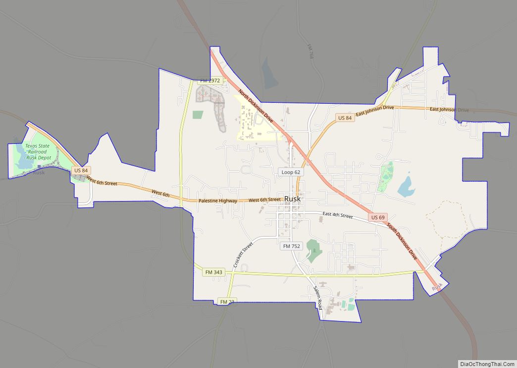
Cuney is a town located in northwest Cherokee County, Texas, United States. With a population of 116 at the 2020 U.S. census, Cuney was the only “wet” town in Cherokee County from the mid-1980s until 2009, when voters in Rusk came out in favor of beer/wine sales. After that result, voters in Jacksonville and Frankston have since voted in favor of beer/wine sales, and Rusk voters returned to the polls to vote in favor of liquor sales.
| Name: | Cuney town |
|---|---|
| LSAD Code: | 43 |
| LSAD Description: | town (suffix) |
| State: | Texas |
| County: | Cherokee County |
| Elevation: | 374 ft (114 m) |
| Total Area: | 1.64 sq mi (4.26 km²) |
| Land Area: | 1.64 sq mi (4.26 km²) |
| Water Area: | 0.00 sq mi (0.00 km²) |
| Total Population: | 116 |
| Population Density: | 71/sq mi (27/km²) |
| ZIP code: | 75759 |
| Area code: | 430, 903 |
| FIPS code: | 4818152 |
| GNISfeature ID: | 1333813 |
Online Interactive Map
Click on ![]() to view map in "full screen" mode.
to view map in "full screen" mode.
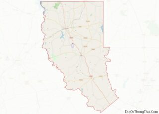
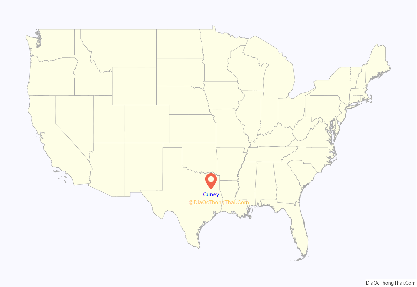
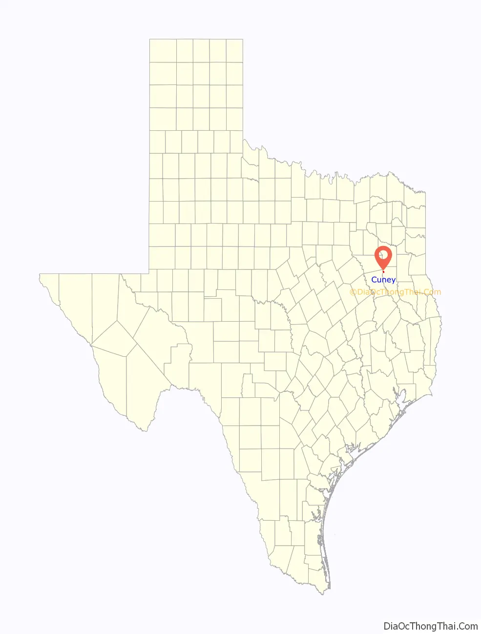
Cuney location map. Where is Cuney town?
History
The site was first settled by freed slaves just after the American Civil War. The settlement was initially known as Andy, after Andrew “Andy” Bragg, one of the area’s first black homeowners. He arrived in 1870. A community did not develop until 1902, when the site became a flag stop on the Texas and New Orleans Railroad, which became part of the Southern Pacific system in 1961.
Around 1914, Palestine cashier H.L. Price and several local investors formed a company and platted a town site. They named the town Cuney, after Price’s son, Cuney Price, who in turn had been named for Norris Wright Cuney, a prominent black politician and head of the state’s Republican Party. A post office was established in 1917 and a number of businesses were operating in the community by the early 1920s. With the paving of State Highway 40 in 1929, which would eventually become U.S. Highway 175, most of the businesses moved a mile north of the railroad to take advantage of the increased traffic. The population was estimated at 100 in 1929, but declined to only 25 by the mid-1930s.
A number of businesses closed after World War II as agricultural prices decreased and residents moved to other cities with greater employment opportunities. Cuney had a population of 75 in the early 1950s. From that period, the community steadily grew, and Cuney was incorporated in November 1983. In the 1990 census, the town had 170 residents. That number had fallen to 145 by 2000.
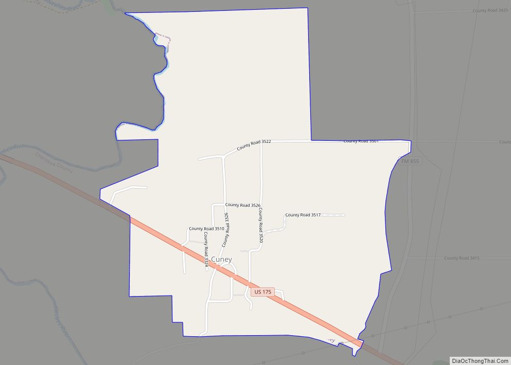
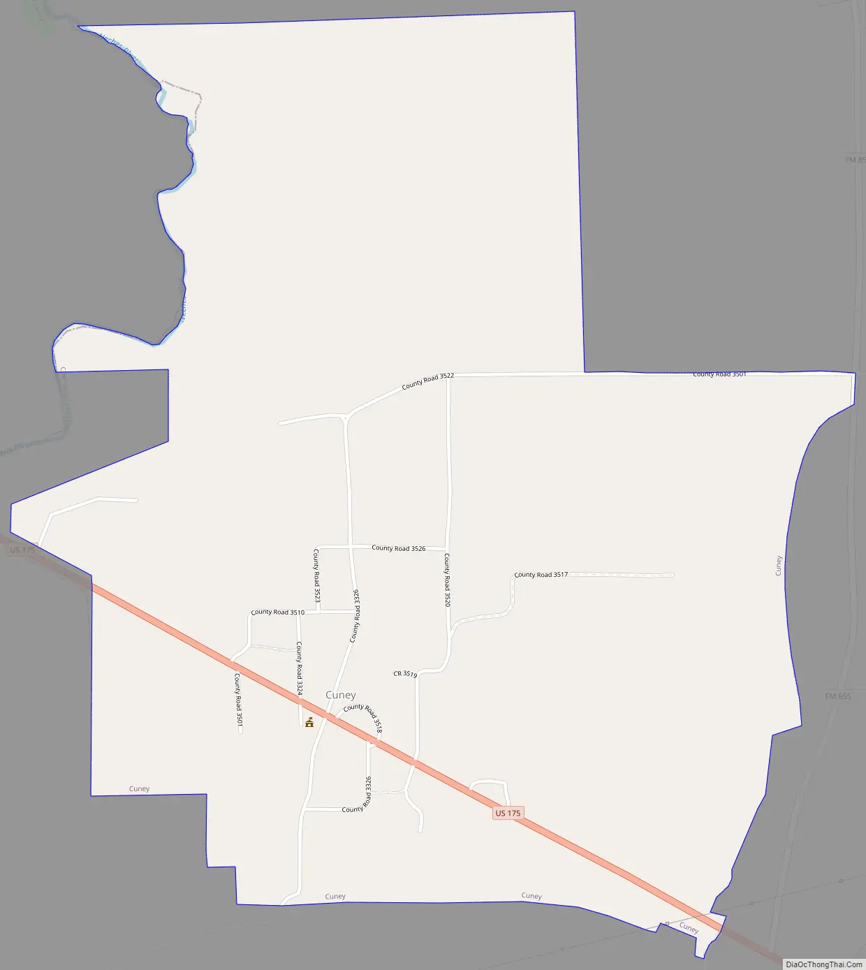
Cuney Road Map
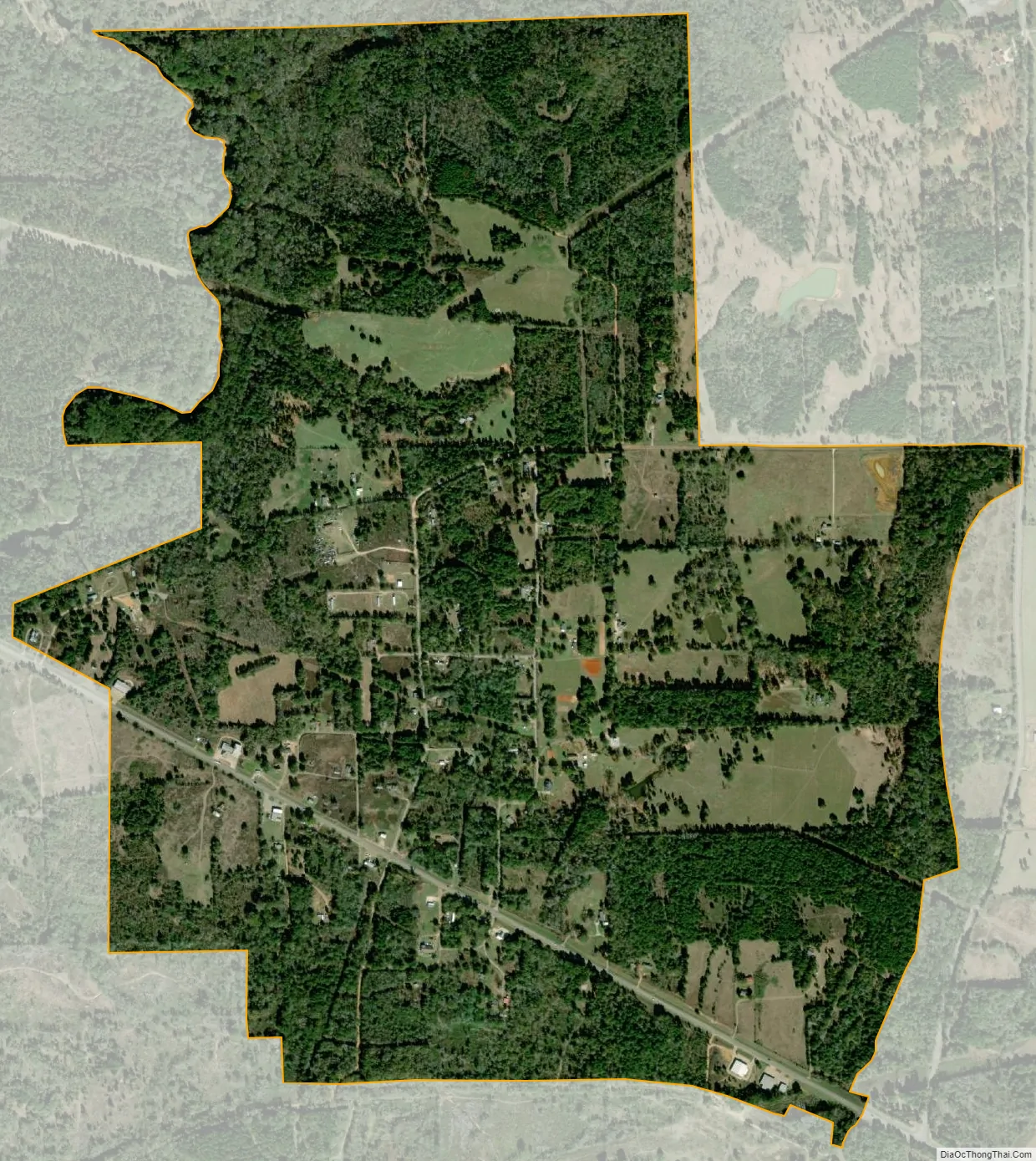
Cuney city Satellite Map
Geography
Cuney is located at 32°2′3″N 95°25′4″W / 32.03417°N 95.41778°W / 32.03417; -95.41778 (32.034127, –95.417769). It is situated just west of the junction of U.S. Highway 175 and FM 855 in northwestern Cherokee County, about 10 miles (16 km) northwest of Jacksonville, 24 miles (39 km) northwest of Rusk, and 28 miles (45 km) southeast of Athens.
According to the United States Census Bureau, the town has a total area of 1.64 square miles (4.26 km), all of it land. The Neches River forms the northwest border of the town and the Cherokee/Anderson County line.
See also
Map of Texas State and its subdivision:- Anderson
- Andrews
- Angelina
- Aransas
- Archer
- Armstrong
- Atascosa
- Austin
- Bailey
- Bandera
- Bastrop
- Baylor
- Bee
- Bell
- Bexar
- Blanco
- Borden
- Bosque
- Bowie
- Brazoria
- Brazos
- Brewster
- Briscoe
- Brooks
- Brown
- Burleson
- Burnet
- Caldwell
- Calhoun
- Callahan
- Cameron
- Camp
- Carson
- Cass
- Castro
- Chambers
- Cherokee
- Childress
- Clay
- Cochran
- Coke
- Coleman
- Collin
- Collingsworth
- Colorado
- Comal
- Comanche
- Concho
- Cooke
- Coryell
- Cottle
- Crane
- Crockett
- Crosby
- Culberson
- Dallam
- Dallas
- Dawson
- Deaf Smith
- Delta
- Denton
- Dewitt
- Dickens
- Dimmit
- Donley
- Duval
- Eastland
- Ector
- Edwards
- El Paso
- Ellis
- Erath
- Falls
- Fannin
- Fayette
- Fisher
- Floyd
- Foard
- Fort Bend
- Franklin
- Freestone
- Frio
- Gaines
- Galveston
- Garza
- Gillespie
- Glasscock
- Goliad
- Gonzales
- Gray
- Grayson
- Gregg
- Grimes
- Guadalupe
- Hale
- Hall
- Hamilton
- Hansford
- Hardeman
- Hardin
- Harris
- Harrison
- Hartley
- Haskell
- Hays
- Hemphill
- Henderson
- Hidalgo
- Hill
- Hockley
- Hood
- Hopkins
- Houston
- Howard
- Hudspeth
- Hunt
- Hutchinson
- Irion
- Jack
- Jackson
- Jasper
- Jeff Davis
- Jefferson
- Jim Hogg
- Jim Wells
- Johnson
- Jones
- Karnes
- Kaufman
- Kendall
- Kenedy
- Kent
- Kerr
- Kimble
- King
- Kinney
- Kleberg
- Knox
- La Salle
- Lamar
- Lamb
- Lampasas
- Lavaca
- Lee
- Leon
- Liberty
- Limestone
- Lipscomb
- Live Oak
- Llano
- Loving
- Lubbock
- Lynn
- Madison
- Marion
- Martin
- Mason
- Matagorda
- Maverick
- McCulloch
- McLennan
- McMullen
- Medina
- Menard
- Midland
- Milam
- Mills
- Mitchell
- Montague
- Montgomery
- Moore
- Morris
- Motley
- Nacogdoches
- Navarro
- Newton
- Nolan
- Nueces
- Ochiltree
- Oldham
- Orange
- Palo Pinto
- Panola
- Parker
- Parmer
- Pecos
- Polk
- Potter
- Presidio
- Rains
- Randall
- Reagan
- Real
- Red River
- Reeves
- Refugio
- Roberts
- Robertson
- Rockwall
- Runnels
- Rusk
- Sabine
- San Augustine
- San Jacinto
- San Patricio
- San Saba
- Schleicher
- Scurry
- Shackelford
- Shelby
- Sherman
- Smith
- Somervell
- Starr
- Stephens
- Sterling
- Stonewall
- Sutton
- Swisher
- Tarrant
- Taylor
- Terrell
- Terry
- Throckmorton
- Titus
- Tom Green
- Travis
- Trinity
- Tyler
- Upshur
- Upton
- Uvalde
- Val Verde
- Van Zandt
- Victoria
- Walker
- Waller
- Ward
- Washington
- Webb
- Wharton
- Wheeler
- Wichita
- Wilbarger
- Willacy
- Williamson
- Wilson
- Winkler
- Wise
- Wood
- Yoakum
- Young
- Zapata
- Zavala
- Alabama
- Alaska
- Arizona
- Arkansas
- California
- Colorado
- Connecticut
- Delaware
- District of Columbia
- Florida
- Georgia
- Hawaii
- Idaho
- Illinois
- Indiana
- Iowa
- Kansas
- Kentucky
- Louisiana
- Maine
- Maryland
- Massachusetts
- Michigan
- Minnesota
- Mississippi
- Missouri
- Montana
- Nebraska
- Nevada
- New Hampshire
- New Jersey
- New Mexico
- New York
- North Carolina
- North Dakota
- Ohio
- Oklahoma
- Oregon
- Pennsylvania
- Rhode Island
- South Carolina
- South Dakota
- Tennessee
- Texas
- Utah
- Vermont
- Virginia
- Washington
- West Virginia
- Wisconsin
- Wyoming