Decatur is the county seat of Wise County, Texas, United States. Its population was 6,538 in 2020.
| Name: | Decatur city |
|---|---|
| LSAD Code: | 25 |
| LSAD Description: | city (suffix) |
| State: | Texas |
| County: | Wise County |
| Elevation: | 1,102 ft (336 m) |
| Total Area: | 8.78 sq mi (22.75 km²) |
| Land Area: | 8.78 sq mi (22.75 km²) |
| Water Area: | 0.00 sq mi (0.00 km²) |
| Total Population: | 6,538 |
| Population Density: | 740/sq mi (290/km²) |
| ZIP code: | 76234 |
| Area code: | 940 |
| FIPS code: | 4819528 |
| GNISfeature ID: | 1373362 |
| Website: | http://www.decaturtx.org/ |
Online Interactive Map
Click on ![]() to view map in "full screen" mode.
to view map in "full screen" mode.
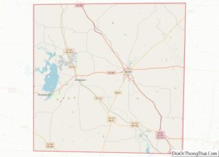
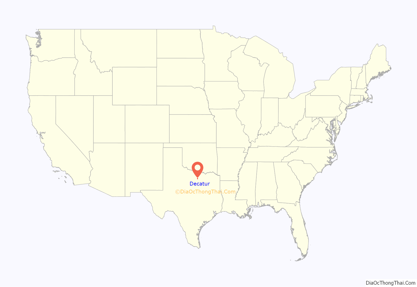
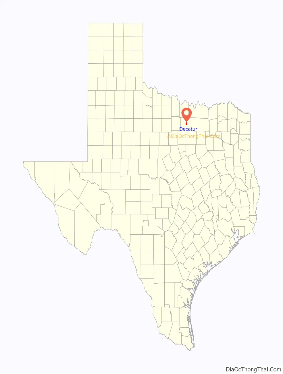
Decatur location map. Where is Decatur city?
History
Wise County was established in 1856, and Taylorsville (in honor of Zachary Taylor) was made the county seat.
Absalom Bishop, an early settler and member of the Texas Legislature, opposed naming the town after a Whig Party member, and in 1858, arranged to have the name changed to Decatur, in honor of naval hero Stephen Decatur.
In 1857, a post office was opened, and the first school was established in 1857. In the early 1860s, a courthouse was erected.
Civil War
Early settlers to northern Texas came from a variety of eastern states, with about half coming from the “Deep South”. Most of the rest came from the Upper South, and a number sympathized with the Unionist side at the outset of the Civil War. Cooke County and others voted against secession in this part of the state. Violence against Unionists by Confederate troops and militia was common, especially after the Confederate legislature passed an unpopular conscription law.
In October 1862, several Unionist sympathizers from Decatur were arrested by Confederate troops and taken to nearby Gainesville, the Cooke County seat, for trial on charges of treason and insurrection. About 150–200 suspects were arrested by Confederate troops. A “Citizens Court” was pulled together by local colonels, although it had no standing in state law. It quickly convicted seven men, who were executed by hanging. Mob pressure against the court arose, and it turned over 14 suspects, who were lynched – executed by hanging without any judicial process. Nineteen men who had been acquitted were returned to the court, and a new jury convicted them without any new evidence, sentencing them to death. They were also hanged. Another two men were shot trying to escape. In all, 42 men were killed in Gainesville in these actions.
North Texas was in chaos, with dissenting citizens at risk from military forces. A few weeks later, more suspected Unionist supporters were hanged without trial in several North Texas communities. Five were lynched in Decatur, under the supervision of Confederate Capt. John Hale. The Great Hanging at Gainesville is believed to have been the largest single incident of vigilante violence in U.S. history.
After the Civil War
By the late 1860s, several stores and a hotel had been established. In 1882, the Fort Worth and Denver Railway reached the town, and Decatur was added to the Butterfield Overland mail route.
In 1881, the Wise County Old Settlers Reunion held their first meeting. This has become an annual tradition in Decatur, and the reunion continues to take place during the last full week of July.
Decatur Baptist College (now Dallas Baptist University) was established in Decatur in 1898. It was the first two-year institution of higher education in Texas. In 1965, the college moved to Dallas to be in a larger population center. The former Administration Building then housed the Wise County Heritage Museum. The building was destroyed in a fire in 2023. It is one of five sites in Decatur listed on the National Register of Historic Places.
The Wise County Courthouse was designed by James Riely Gordon, the master architect of Texas courthouses. Completed in 1896, the building is an example of Gordon’s Signature Plan. He used corner entrances (making for short halls) to draw in the breeze, which was pulled up through a central atrium like a chimney, providing excellent air circulation. The exterior is Texas red granite (like the Capitol) with terra cotta ornamentation. The almost pyramidal mass refers to 1,000-year-old churches in the south of France. The building has been praised, with its “sister” courthouse in Waxahachie, as “the zenith of Gordon’s Richardsonian Romanesque work”. It is listed on the National Register of Historic Places.
In 1962, Eddie Wayne Hill, lead guitarist for Tommy & the Tom Toms, and drummer Joel Colbert, were killed when their convertible collided head-on with a gravel truck on State Highway 114 south of Decatur. Country singer Charley Pride was more fortunate, surviving a mid-air crash with another plane over Decatur in 1980, though two people died in the crash.
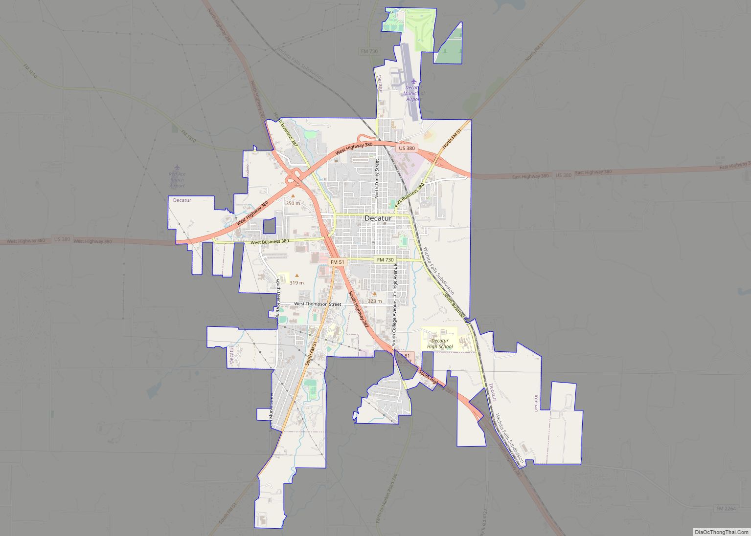
Decatur Road Map
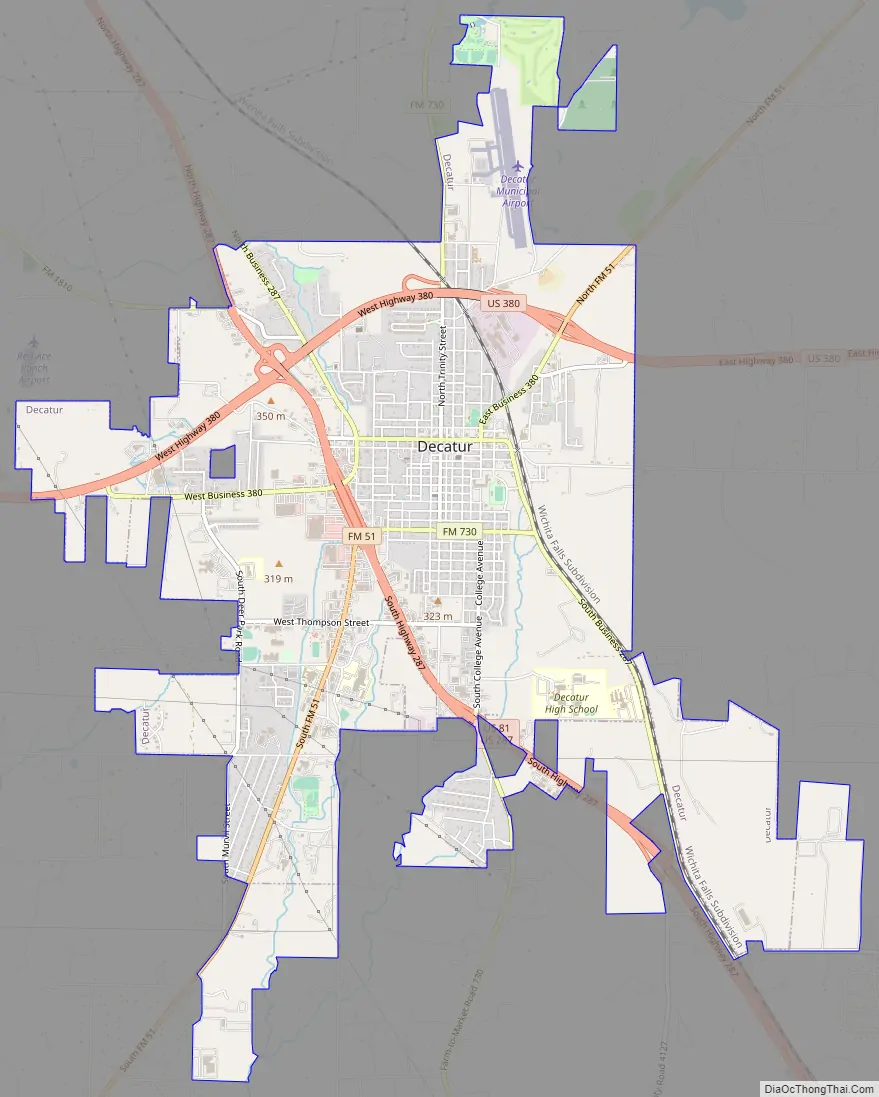
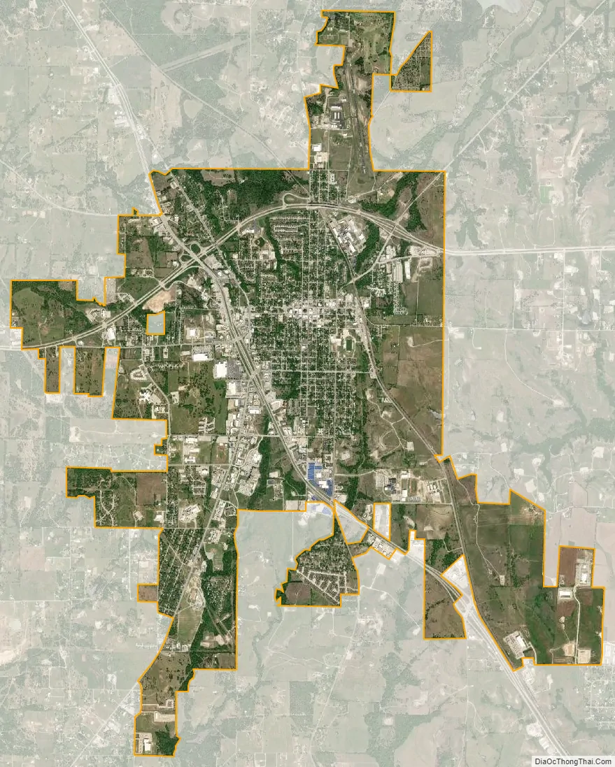
Decatur city Satellite Map
Geography
According to the United States Census Bureau, the city has a total area of 8.5 square miles (22 km), all land. The highest point of elevation in the county is the courthouse site. As with ancient hill towns in Europe, the frontier settlement was developed on high ground for defensive purposes, so European settlers could see and ward off attacks or raids, in this case by Native Americans.
Climate
The climate in this area is characterized by hot, humid summers and generally mild to cool winters. According to the Köppen climate classification, Decatur has a humid subtropical climate, Cfa on climate maps.
See also
Map of Texas State and its subdivision:- Anderson
- Andrews
- Angelina
- Aransas
- Archer
- Armstrong
- Atascosa
- Austin
- Bailey
- Bandera
- Bastrop
- Baylor
- Bee
- Bell
- Bexar
- Blanco
- Borden
- Bosque
- Bowie
- Brazoria
- Brazos
- Brewster
- Briscoe
- Brooks
- Brown
- Burleson
- Burnet
- Caldwell
- Calhoun
- Callahan
- Cameron
- Camp
- Carson
- Cass
- Castro
- Chambers
- Cherokee
- Childress
- Clay
- Cochran
- Coke
- Coleman
- Collin
- Collingsworth
- Colorado
- Comal
- Comanche
- Concho
- Cooke
- Coryell
- Cottle
- Crane
- Crockett
- Crosby
- Culberson
- Dallam
- Dallas
- Dawson
- Deaf Smith
- Delta
- Denton
- Dewitt
- Dickens
- Dimmit
- Donley
- Duval
- Eastland
- Ector
- Edwards
- El Paso
- Ellis
- Erath
- Falls
- Fannin
- Fayette
- Fisher
- Floyd
- Foard
- Fort Bend
- Franklin
- Freestone
- Frio
- Gaines
- Galveston
- Garza
- Gillespie
- Glasscock
- Goliad
- Gonzales
- Gray
- Grayson
- Gregg
- Grimes
- Guadalupe
- Hale
- Hall
- Hamilton
- Hansford
- Hardeman
- Hardin
- Harris
- Harrison
- Hartley
- Haskell
- Hays
- Hemphill
- Henderson
- Hidalgo
- Hill
- Hockley
- Hood
- Hopkins
- Houston
- Howard
- Hudspeth
- Hunt
- Hutchinson
- Irion
- Jack
- Jackson
- Jasper
- Jeff Davis
- Jefferson
- Jim Hogg
- Jim Wells
- Johnson
- Jones
- Karnes
- Kaufman
- Kendall
- Kenedy
- Kent
- Kerr
- Kimble
- King
- Kinney
- Kleberg
- Knox
- La Salle
- Lamar
- Lamb
- Lampasas
- Lavaca
- Lee
- Leon
- Liberty
- Limestone
- Lipscomb
- Live Oak
- Llano
- Loving
- Lubbock
- Lynn
- Madison
- Marion
- Martin
- Mason
- Matagorda
- Maverick
- McCulloch
- McLennan
- McMullen
- Medina
- Menard
- Midland
- Milam
- Mills
- Mitchell
- Montague
- Montgomery
- Moore
- Morris
- Motley
- Nacogdoches
- Navarro
- Newton
- Nolan
- Nueces
- Ochiltree
- Oldham
- Orange
- Palo Pinto
- Panola
- Parker
- Parmer
- Pecos
- Polk
- Potter
- Presidio
- Rains
- Randall
- Reagan
- Real
- Red River
- Reeves
- Refugio
- Roberts
- Robertson
- Rockwall
- Runnels
- Rusk
- Sabine
- San Augustine
- San Jacinto
- San Patricio
- San Saba
- Schleicher
- Scurry
- Shackelford
- Shelby
- Sherman
- Smith
- Somervell
- Starr
- Stephens
- Sterling
- Stonewall
- Sutton
- Swisher
- Tarrant
- Taylor
- Terrell
- Terry
- Throckmorton
- Titus
- Tom Green
- Travis
- Trinity
- Tyler
- Upshur
- Upton
- Uvalde
- Val Verde
- Van Zandt
- Victoria
- Walker
- Waller
- Ward
- Washington
- Webb
- Wharton
- Wheeler
- Wichita
- Wilbarger
- Willacy
- Williamson
- Wilson
- Winkler
- Wise
- Wood
- Yoakum
- Young
- Zapata
- Zavala
- Alabama
- Alaska
- Arizona
- Arkansas
- California
- Colorado
- Connecticut
- Delaware
- District of Columbia
- Florida
- Georgia
- Hawaii
- Idaho
- Illinois
- Indiana
- Iowa
- Kansas
- Kentucky
- Louisiana
- Maine
- Maryland
- Massachusetts
- Michigan
- Minnesota
- Mississippi
- Missouri
- Montana
- Nebraska
- Nevada
- New Hampshire
- New Jersey
- New Mexico
- New York
- North Carolina
- North Dakota
- Ohio
- Oklahoma
- Oregon
- Pennsylvania
- Rhode Island
- South Carolina
- South Dakota
- Tennessee
- Texas
- Utah
- Vermont
- Virginia
- Washington
- West Virginia
- Wisconsin
- Wyoming