Gainesville is a city in and the county seat of Cooke County, Texas, United States. Its population was 16,002 at the 2010 census. It is part of the Texoma region and is an important Agri-business center.
| Name: | Gainesville city |
|---|---|
| LSAD Code: | 25 |
| LSAD Description: | city (suffix) |
| State: | Texas |
| County: | Cooke County |
| Elevation: | 751 ft (229 m) |
| Total Area: | 19.33 sq mi (50.07 km²) |
| Land Area: | 19.30 sq mi (50.00 km²) |
| Water Area: | 0.03 sq mi (0.07 km²) |
| Total Population: | 16,002 |
| Population Density: | 874.79/sq mi (337.75/km²) |
| ZIP code: | 76240-76241 |
| Area code: | 940 |
| FIPS code: | 4827984 |
| GNISfeature ID: | 1373791 |
| Website: | www.gainesville.tx.us |
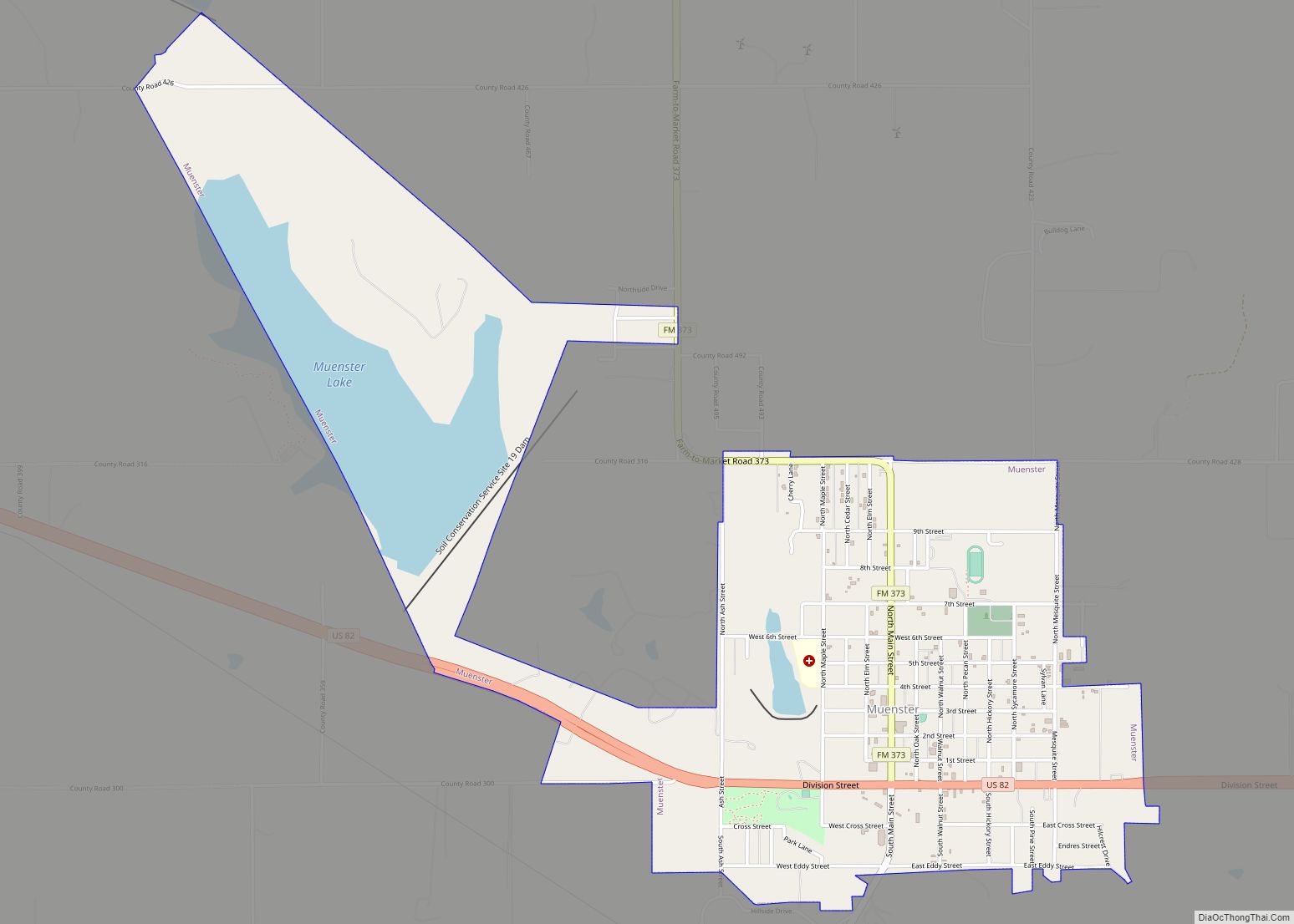
Online Interactive Map
Click on ![]() to view map in "full screen" mode.
to view map in "full screen" mode.
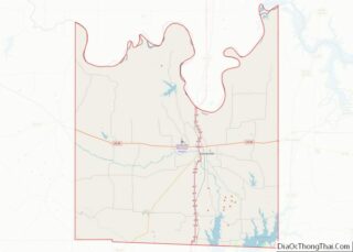
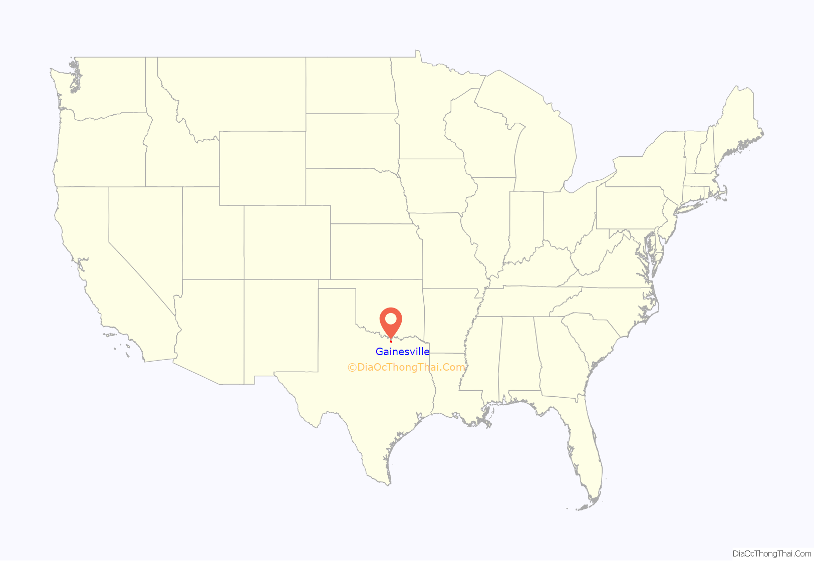
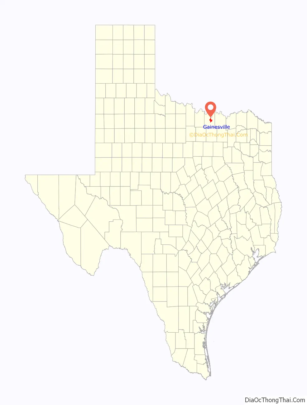
Gainesville location map. Where is Gainesville city?
History
Founded in 1850, the city of Gainesville was established on a 40-acre (16 ha) tract of land donated by Mary E. Clark. City residents called their new community “Liberty”, which proved short-lived, as a Liberty, Texas, already existed. One of the original settlers of Cooke County, Colonel William Fitzhugh, suggested that the town be named after General Edmund Pendleton Gaines. Gaines, a United States general under whom Fitzhugh had served, had been sympathetic with the Texas Revolution.
The first hint of prosperity arrived with the Butterfield Overland Mail stagecoach in September 1858, bringing freight, passengers, and mail. In 1860, Cooke County voted against secession. In 1862, during the Civil War, the Great Hanging at Gainesville, a controversial trial and lynching of 40 suspected Union loyalists, brought the new town to the attention of the state and came close to ripping the county apart. In the decade after the Civil War, Gainesville had its first period of extended growth, catalyzed by the expansion of the cattle industry in Texas. Gainesville, only 7 miles (11 km) from the Oklahoma border, became a supply point for cowboys driving herds north to Kansas. The merchants of Gainesville reaped considerable benefits from the passing cattle drives.
Within 20 years, its population increased from a few hundred to more than 2,000. Gainesville was incorporated on February 17, 1873, and by 1890 was established as a commercial and shipping point for area ranchers and farmers. In the late 1870s, two factors drastically altered the historic landscape of North-central Texas. The first of these was barbed wire. In 1875, Henry B. Sanborn, a regional sales agent for Joseph Glidden’s Bar Fence Company of DeKalb, Illinois, traveled to Texas. That autumn, he chose Gainesville as one of his initial distribution points for the newly invented barbed wire, which his employer had patented the previous year. On his first visit to Gainesville, he sold 10 reels of the wire to the Cleaves and Fletcher hardware store—the first spools of barbed wire ever sold in Texas.
World War II had an enormous impact on Cooke County. Camp Howze, an army infantry training camp, was established on some of the best farmland in the county. The construction of the camp helped bring Cooke County out of the Great Depression by providing jobs. The county population doubled and the area boomed.
Since then, tourism has brought renewed prosperity to the area. The return of Amtrak on June 14, 1999, brought Gainesville back full circle to one of the original sources of its growth and success. In the early 1990s, Gainesville had 600 businesses and a population of 14,587. In 2000, the population was 15,538, with the population after the 2010 Census being just over 16,000 people.
Courthouse
Gainesville is home to a courthouse with an octagonal rotunda topped by stained glass, erected in 1910. “The 1912 Cooke County Courthouse was designed by the Dallas firm of Lang & Witchell. The courthouse was designed in the Beaux Arts style with some Prairie Style features and influences from famed Chicago architect Louis Sullivan. The courthouse in the center of Gainesville features black and white marbled interiors and a tall central atrium capped by a stained glass skylight under the tower.” The courthouse is undergoing a major renovation project, resulting in the move of many county offices to surrounding buildings.
Camp Howze, World War II
Gainesville was once home to Camp Howze, one of the largest infantry replacement training centers during World War II. Only a few remnants of the camp still exist, but are now located on private property.
Railroad
Railroads across Texas changed the nature and reach of commerce when they built through and to areas. When the first railroad arrived in Gainesville, it improved the city’s economics. For the first time, reliable, timely transportation meant goods and people could go vast distances. Gainesville was connected to the outside world in a whole new way with the coming of the railroads. For example, when the GC&SF arrived in 1887, goods could directly travel to or from Gainesville, directly to Chicago and Galveston, on the same railroad. Both were major transportation hubs during that age, and still are today.
Original companies and dates of arrival in Gainesville:
- The Denison and Pacific Railway (1879) (now a part of UP via the MKT) – route: Denison, TX to Gainesville via Whitesboro, TX
- Gainesville, Henrietta and Western Railway (1886) (now a part of UP via the MKT) – route: Gainesville to Wichita Falls, TX
- Gulf Colorado & Santa Fe Railway (1887) (now a part of BNSF) – route: Fort Worth to Oklahoma City
These turned into major railroads:
- Missouri–Kansas–Texas Railroad (MKT) is now the Union Pacific, but the lines owned in Gainesville were abandoned long before the UP bought the MKT in 1988. The MKT through town was abandoned around 1969 after having providing service for 90 years.
- Atchison, Topeka and Santa Fe Railway (ATSF) is now the BNSF Railway.
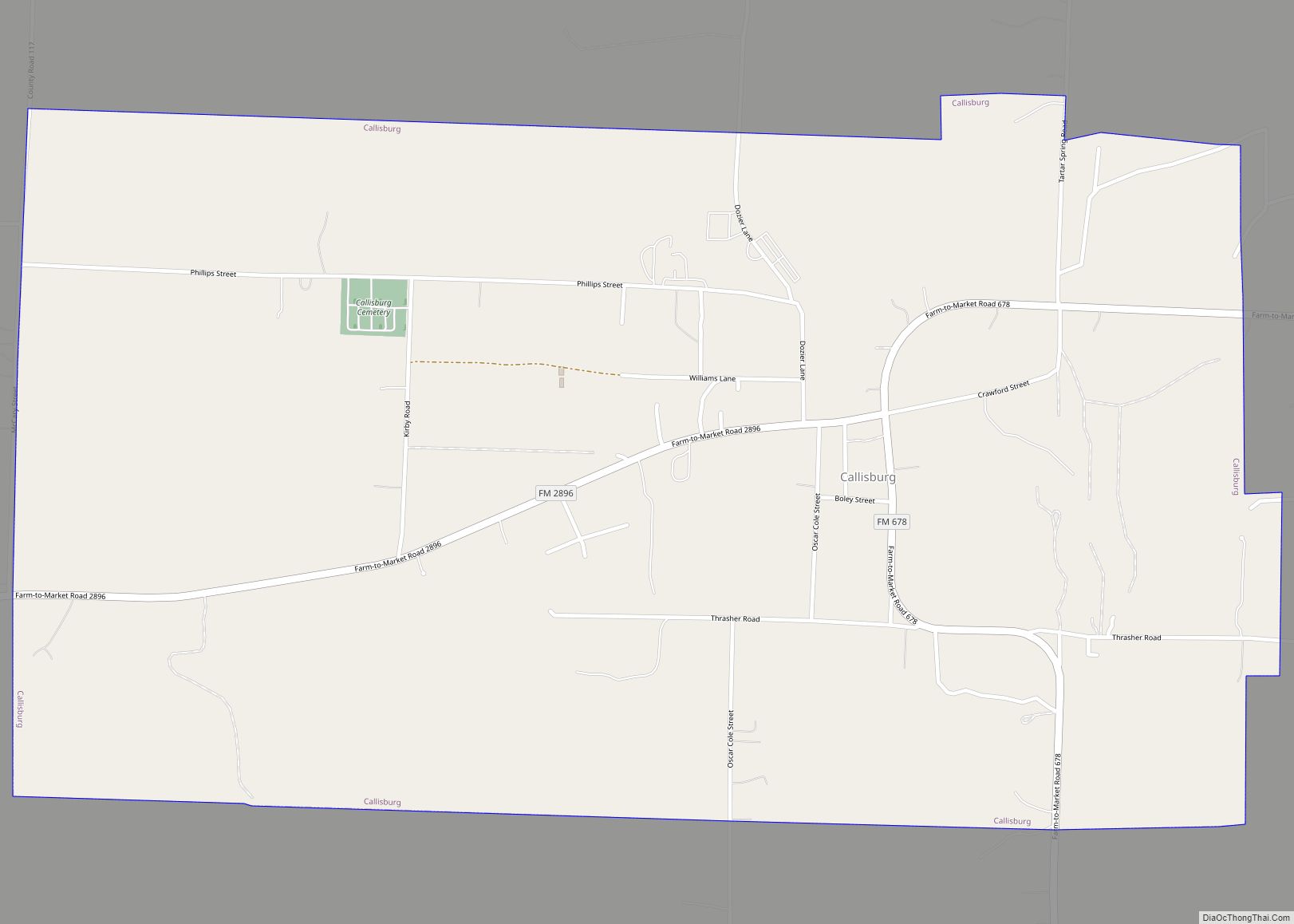
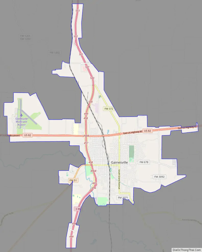
Gainesville Road Map
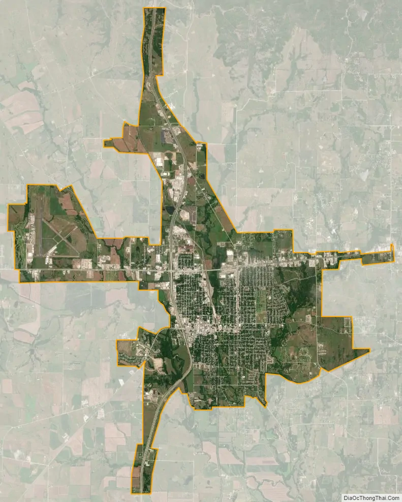
Gainesville city Satellite Map
Geography
Gainesville is located slightly east of the center of Cooke County at 33°37′49″N 97°8′25″W / 33.63028°N 97.14028°W / 33.63028; -97.14028 (33.630360, –97.140323). According to the United States Census Bureau, the city has a total area of 19.0 square miles (49.3 km), of which 0.04 square miles (0.1 km), or 0.15%, is covered by water.
The town is located at the interchange of two major thoroughfares: U.S. Route 82 going east/west passing over Interstate 35 (north/south). It is an exurb of the Dallas-Fort Worth metroplex, 71 miles (114 km) north of the center of Dallas and 65 miles (105 km) north of the center of Fort Worth. It is also a part of the Texoma region. Nearby towns and cities include:
- North: Thackerville, Oklahoma
- South: Valley View
- East: Whitesboro
- West: Lindsay
See also
Map of Texas State and its subdivision:- Anderson
- Andrews
- Angelina
- Aransas
- Archer
- Armstrong
- Atascosa
- Austin
- Bailey
- Bandera
- Bastrop
- Baylor
- Bee
- Bell
- Bexar
- Blanco
- Borden
- Bosque
- Bowie
- Brazoria
- Brazos
- Brewster
- Briscoe
- Brooks
- Brown
- Burleson
- Burnet
- Caldwell
- Calhoun
- Callahan
- Cameron
- Camp
- Carson
- Cass
- Castro
- Chambers
- Cherokee
- Childress
- Clay
- Cochran
- Coke
- Coleman
- Collin
- Collingsworth
- Colorado
- Comal
- Comanche
- Concho
- Cooke
- Coryell
- Cottle
- Crane
- Crockett
- Crosby
- Culberson
- Dallam
- Dallas
- Dawson
- Deaf Smith
- Delta
- Denton
- Dewitt
- Dickens
- Dimmit
- Donley
- Duval
- Eastland
- Ector
- Edwards
- El Paso
- Ellis
- Erath
- Falls
- Fannin
- Fayette
- Fisher
- Floyd
- Foard
- Fort Bend
- Franklin
- Freestone
- Frio
- Gaines
- Galveston
- Garza
- Gillespie
- Glasscock
- Goliad
- Gonzales
- Gray
- Grayson
- Gregg
- Grimes
- Guadalupe
- Hale
- Hall
- Hamilton
- Hansford
- Hardeman
- Hardin
- Harris
- Harrison
- Hartley
- Haskell
- Hays
- Hemphill
- Henderson
- Hidalgo
- Hill
- Hockley
- Hood
- Hopkins
- Houston
- Howard
- Hudspeth
- Hunt
- Hutchinson
- Irion
- Jack
- Jackson
- Jasper
- Jeff Davis
- Jefferson
- Jim Hogg
- Jim Wells
- Johnson
- Jones
- Karnes
- Kaufman
- Kendall
- Kenedy
- Kent
- Kerr
- Kimble
- King
- Kinney
- Kleberg
- Knox
- La Salle
- Lamar
- Lamb
- Lampasas
- Lavaca
- Lee
- Leon
- Liberty
- Limestone
- Lipscomb
- Live Oak
- Llano
- Loving
- Lubbock
- Lynn
- Madison
- Marion
- Martin
- Mason
- Matagorda
- Maverick
- McCulloch
- McLennan
- McMullen
- Medina
- Menard
- Midland
- Milam
- Mills
- Mitchell
- Montague
- Montgomery
- Moore
- Morris
- Motley
- Nacogdoches
- Navarro
- Newton
- Nolan
- Nueces
- Ochiltree
- Oldham
- Orange
- Palo Pinto
- Panola
- Parker
- Parmer
- Pecos
- Polk
- Potter
- Presidio
- Rains
- Randall
- Reagan
- Real
- Red River
- Reeves
- Refugio
- Roberts
- Robertson
- Rockwall
- Runnels
- Rusk
- Sabine
- San Augustine
- San Jacinto
- San Patricio
- San Saba
- Schleicher
- Scurry
- Shackelford
- Shelby
- Sherman
- Smith
- Somervell
- Starr
- Stephens
- Sterling
- Stonewall
- Sutton
- Swisher
- Tarrant
- Taylor
- Terrell
- Terry
- Throckmorton
- Titus
- Tom Green
- Travis
- Trinity
- Tyler
- Upshur
- Upton
- Uvalde
- Val Verde
- Van Zandt
- Victoria
- Walker
- Waller
- Ward
- Washington
- Webb
- Wharton
- Wheeler
- Wichita
- Wilbarger
- Willacy
- Williamson
- Wilson
- Winkler
- Wise
- Wood
- Yoakum
- Young
- Zapata
- Zavala
- Alabama
- Alaska
- Arizona
- Arkansas
- California
- Colorado
- Connecticut
- Delaware
- District of Columbia
- Florida
- Georgia
- Hawaii
- Idaho
- Illinois
- Indiana
- Iowa
- Kansas
- Kentucky
- Louisiana
- Maine
- Maryland
- Massachusetts
- Michigan
- Minnesota
- Mississippi
- Missouri
- Montana
- Nebraska
- Nevada
- New Hampshire
- New Jersey
- New Mexico
- New York
- North Carolina
- North Dakota
- Ohio
- Oklahoma
- Oregon
- Pennsylvania
- Rhode Island
- South Carolina
- South Dakota
- Tennessee
- Texas
- Utah
- Vermont
- Virginia
- Washington
- West Virginia
- Wisconsin
- Wyoming