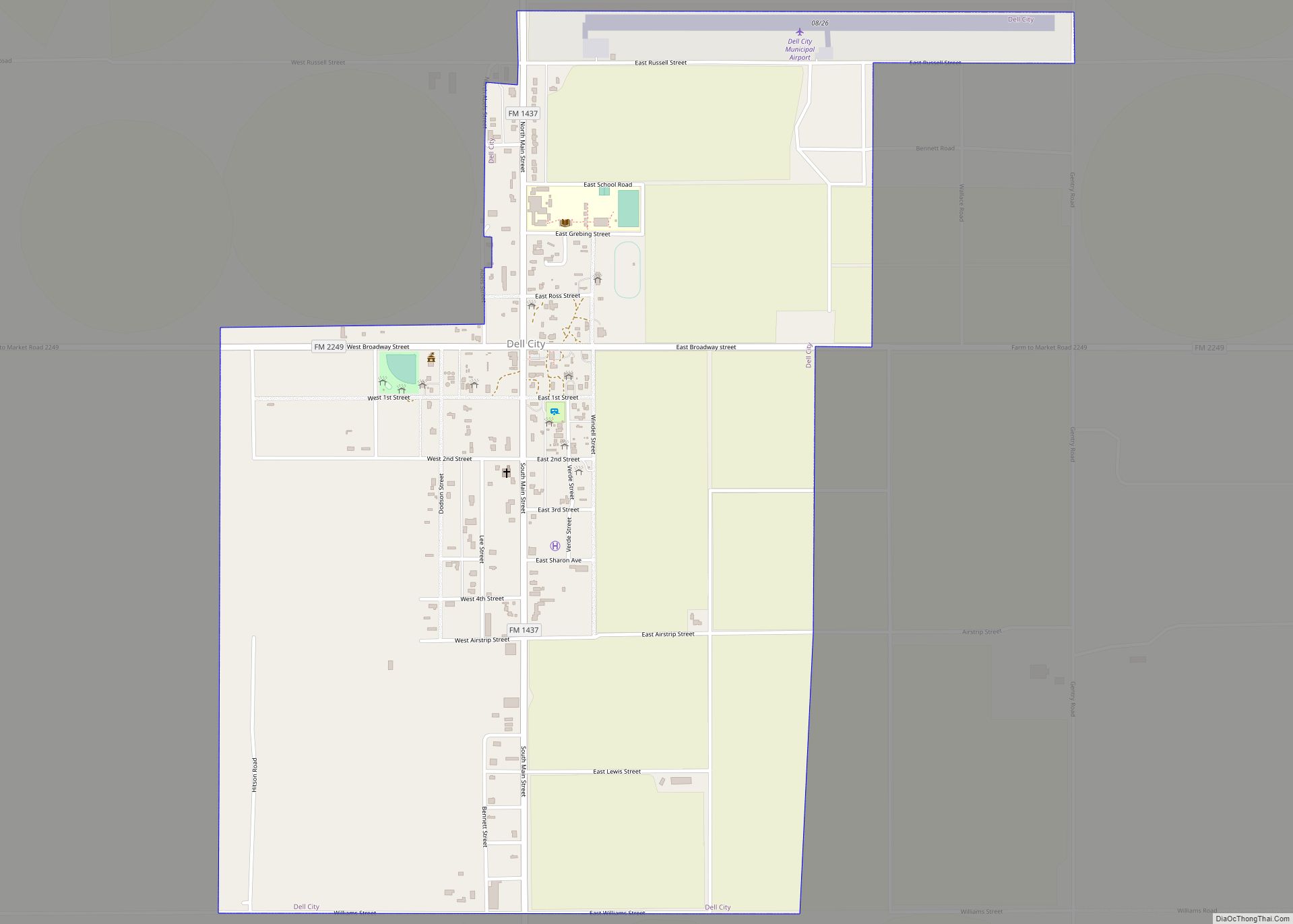
Dell City is a city in Hudspeth County, Texas. The population was 365 at the time of the 2010 census, down from 413 at the time of the 2000 census. It is near the former location of Paulville, a failed Ron Paul-inspired Libertarian cooperative and planned community.
It was incorporated in 1948, shortly after the discovery of an underground water supply by oil prospectors, which attracted farmers to the area. Its name is a reference to the nursery rhyme “The Farmer in the Dell.”
| Name: | Dell City city |
|---|---|
| LSAD Code: | 25 |
| LSAD Description: | city (suffix) |
| State: | Texas |
| County: | Hudspeth County |
| Elevation: | 3,701 ft (1,128 m) |
| Total Area: | 1.67 sq mi (4.32 km²) |
| Land Area: | 1.67 sq mi (4.32 km²) |
| Water Area: | 0.00 sq mi (0.00 km²) |
| Total Population: | 365 |
| Population Density: | 315.54/sq mi (121.85/km²) |
| ZIP code: | 79837 |
| Area code: | 915 |
| FIPS code: | 4819708 |
| GNISfeature ID: | 1355897 |
| Website: | www.dellcity.com |
Online Interactive Map
Click on ![]() to view map in "full screen" mode.
to view map in "full screen" mode.
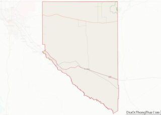
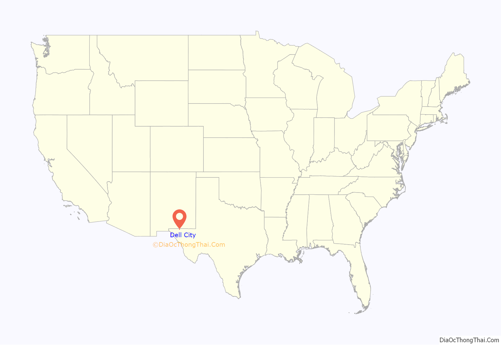
Dell City location map. Where is Dell City city?
History
Dell City was established in 1948, as an aquifer had been found in the area. Settlers came from other areas of Texas and New Mexico. It developed into being a farming town. The community had about 500 people in the 1950s.
In 2012, Jeanne Catsoulis of The New York Times described Dell City as “a borderline ghost town”. In 2014, there were 336 people, according to the United States Census Bureau, with 50 being the average age. In 2016, Jessica Onsurez wrote that residents in the town, which had a decline in the number of businesses, are divided over whether the town is “dying”, in her words, or whether it will rebound. Residents rejected proposals to establish a prison and a manufacturing plant.
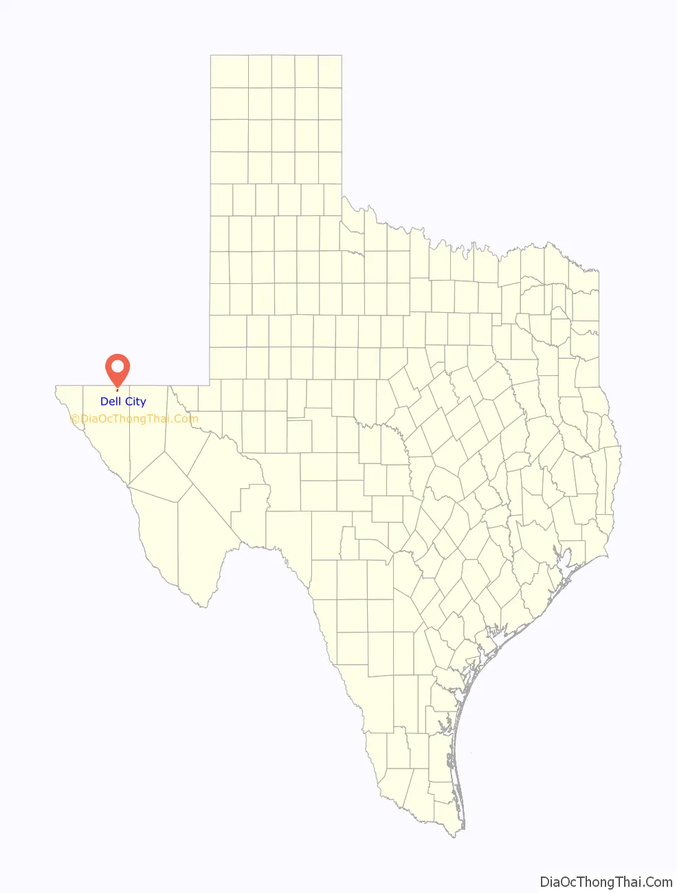
Dell City Road Map
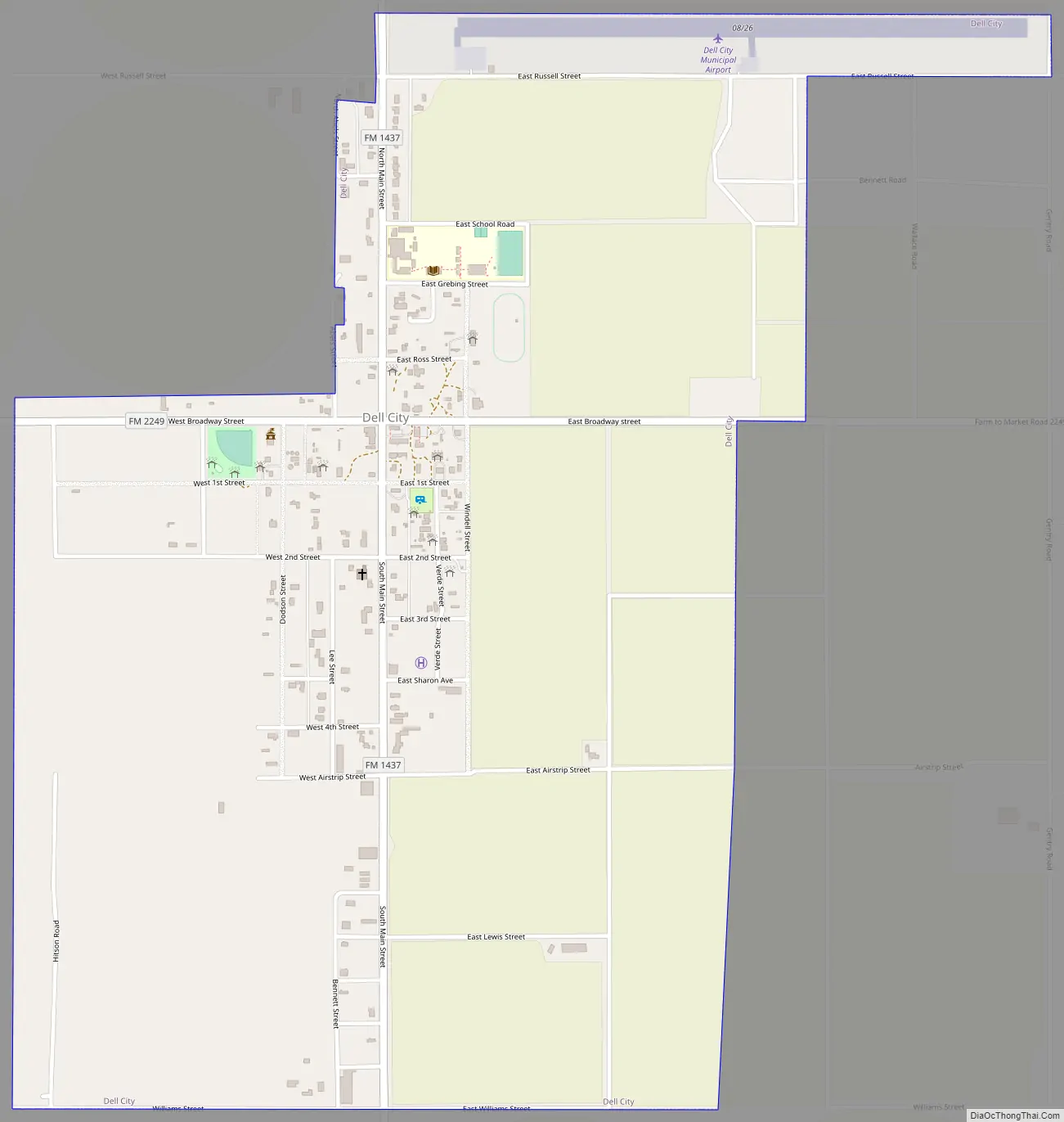
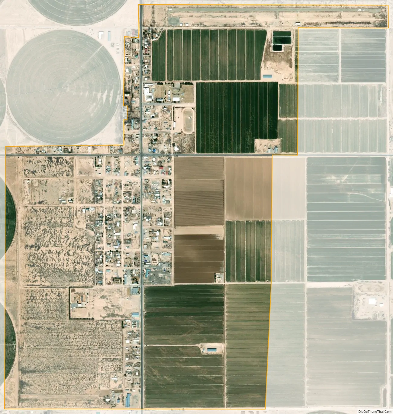
Dell City city Satellite Map
Geography
Dell City is located in northeastern Hudspeth County at 31°56′7″N 105°12′1″W / 31.93528°N 105.20028°W / 31.93528; -105.20028 (31.935324, –105.200298), in West Texas. It is 13 miles (21 km) north of U.S. Routes 62 and 180, and 4 miles (6 km) south of the New Mexico state line. The Guadalupe Mountains are visible to the east.
According to the United States Census Bureau, the city has a total area of 1.7 square miles (4.3 km), all of it land.
It is about 90 miles (140 km) from El Paso, which is west of Dell City. Carlsbad, New Mexico, to the northeast, is 90 miles (140 km) away.
It is about 20 miles (32 km) west of the Guadalupe Mountains National Park. Texas Highways states that it is about 45 minutes travel time away.
See also
Map of Texas State and its subdivision:- Anderson
- Andrews
- Angelina
- Aransas
- Archer
- Armstrong
- Atascosa
- Austin
- Bailey
- Bandera
- Bastrop
- Baylor
- Bee
- Bell
- Bexar
- Blanco
- Borden
- Bosque
- Bowie
- Brazoria
- Brazos
- Brewster
- Briscoe
- Brooks
- Brown
- Burleson
- Burnet
- Caldwell
- Calhoun
- Callahan
- Cameron
- Camp
- Carson
- Cass
- Castro
- Chambers
- Cherokee
- Childress
- Clay
- Cochran
- Coke
- Coleman
- Collin
- Collingsworth
- Colorado
- Comal
- Comanche
- Concho
- Cooke
- Coryell
- Cottle
- Crane
- Crockett
- Crosby
- Culberson
- Dallam
- Dallas
- Dawson
- Deaf Smith
- Delta
- Denton
- Dewitt
- Dickens
- Dimmit
- Donley
- Duval
- Eastland
- Ector
- Edwards
- El Paso
- Ellis
- Erath
- Falls
- Fannin
- Fayette
- Fisher
- Floyd
- Foard
- Fort Bend
- Franklin
- Freestone
- Frio
- Gaines
- Galveston
- Garza
- Gillespie
- Glasscock
- Goliad
- Gonzales
- Gray
- Grayson
- Gregg
- Grimes
- Guadalupe
- Hale
- Hall
- Hamilton
- Hansford
- Hardeman
- Hardin
- Harris
- Harrison
- Hartley
- Haskell
- Hays
- Hemphill
- Henderson
- Hidalgo
- Hill
- Hockley
- Hood
- Hopkins
- Houston
- Howard
- Hudspeth
- Hunt
- Hutchinson
- Irion
- Jack
- Jackson
- Jasper
- Jeff Davis
- Jefferson
- Jim Hogg
- Jim Wells
- Johnson
- Jones
- Karnes
- Kaufman
- Kendall
- Kenedy
- Kent
- Kerr
- Kimble
- King
- Kinney
- Kleberg
- Knox
- La Salle
- Lamar
- Lamb
- Lampasas
- Lavaca
- Lee
- Leon
- Liberty
- Limestone
- Lipscomb
- Live Oak
- Llano
- Loving
- Lubbock
- Lynn
- Madison
- Marion
- Martin
- Mason
- Matagorda
- Maverick
- McCulloch
- McLennan
- McMullen
- Medina
- Menard
- Midland
- Milam
- Mills
- Mitchell
- Montague
- Montgomery
- Moore
- Morris
- Motley
- Nacogdoches
- Navarro
- Newton
- Nolan
- Nueces
- Ochiltree
- Oldham
- Orange
- Palo Pinto
- Panola
- Parker
- Parmer
- Pecos
- Polk
- Potter
- Presidio
- Rains
- Randall
- Reagan
- Real
- Red River
- Reeves
- Refugio
- Roberts
- Robertson
- Rockwall
- Runnels
- Rusk
- Sabine
- San Augustine
- San Jacinto
- San Patricio
- San Saba
- Schleicher
- Scurry
- Shackelford
- Shelby
- Sherman
- Smith
- Somervell
- Starr
- Stephens
- Sterling
- Stonewall
- Sutton
- Swisher
- Tarrant
- Taylor
- Terrell
- Terry
- Throckmorton
- Titus
- Tom Green
- Travis
- Trinity
- Tyler
- Upshur
- Upton
- Uvalde
- Val Verde
- Van Zandt
- Victoria
- Walker
- Waller
- Ward
- Washington
- Webb
- Wharton
- Wheeler
- Wichita
- Wilbarger
- Willacy
- Williamson
- Wilson
- Winkler
- Wise
- Wood
- Yoakum
- Young
- Zapata
- Zavala
- Alabama
- Alaska
- Arizona
- Arkansas
- California
- Colorado
- Connecticut
- Delaware
- District of Columbia
- Florida
- Georgia
- Hawaii
- Idaho
- Illinois
- Indiana
- Iowa
- Kansas
- Kentucky
- Louisiana
- Maine
- Maryland
- Massachusetts
- Michigan
- Minnesota
- Mississippi
- Missouri
- Montana
- Nebraska
- Nevada
- New Hampshire
- New Jersey
- New Mexico
- New York
- North Carolina
- North Dakota
- Ohio
- Oklahoma
- Oregon
- Pennsylvania
- Rhode Island
- South Carolina
- South Dakota
- Tennessee
- Texas
- Utah
- Vermont
- Virginia
- Washington
- West Virginia
- Wisconsin
- Wyoming