Dickinson is a city in Galveston County, Texas, within Houston–The Woodlands–Sugar Land metropolitan area. The population was 20,847 at the 2020 census.
| Name: | Dickinson city |
|---|---|
| LSAD Code: | 25 |
| LSAD Description: | city (suffix) |
| State: | Texas |
| County: | Galveston County |
| Incorporated: | 1977 |
| Elevation: | 10 ft (3 m) |
| Total Area: | 10.33 sq mi (26.75 km²) |
| Land Area: | 9.89 sq mi (25.63 km²) |
| Water Area: | 0.42 sq mi (1.12 km²) |
| Total Population: | 20,847 |
| Population Density: | 2,135.32/sq mi (824.46/km²) |
| ZIP code: | 77539 |
| Area code: | 281 |
| FIPS code: | 4820344 |
| GNISfeature ID: | 1334345 |
| Website: | ci.dickinson.tx.us |
Online Interactive Map
Click on ![]() to view map in "full screen" mode.
to view map in "full screen" mode.
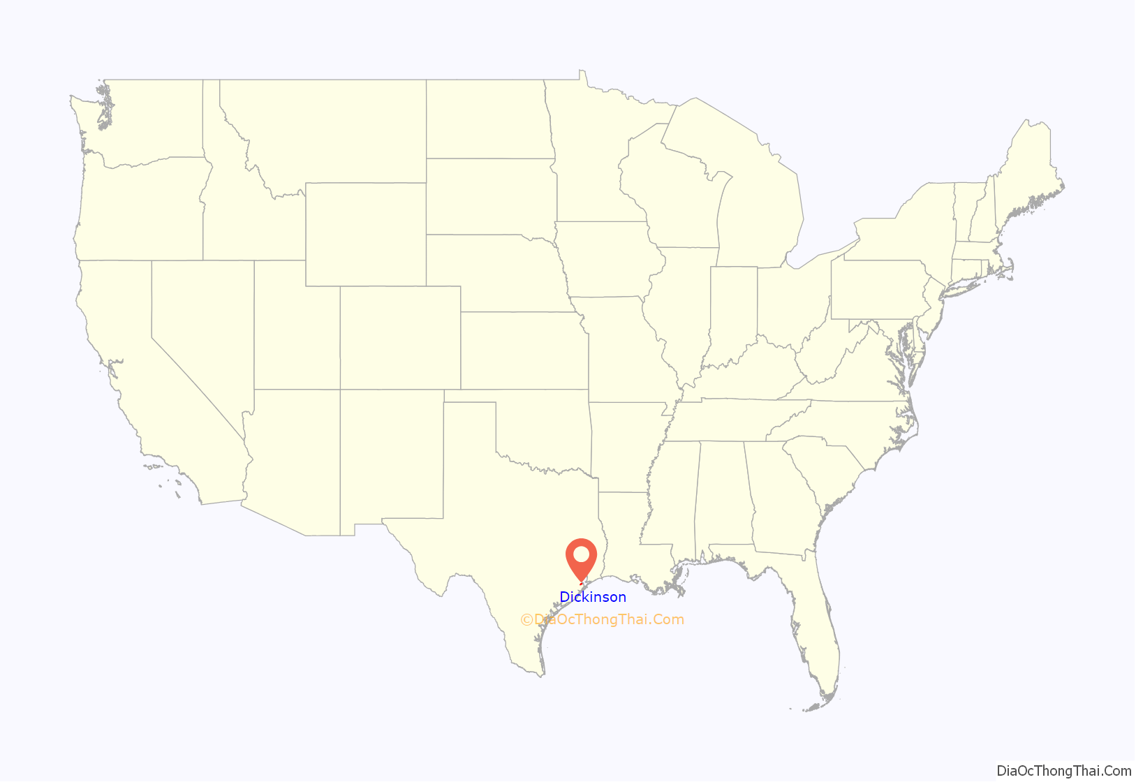
Dickinson location map. Where is Dickinson city?
History
Dickinson is located on a tract of land granted to John Dickinson in 1824, and named after him. A settlement had been established in this area on Dickinson Bayou before 1850. The Galveston, Houston, and Henderson Railroad was built directly through Dickinson. This line was used in the American Civil War to successfully retake Galveston.
The Dickinson Land and Improvement Association was organized in the 1890s by Fred M. Nichols and eight other businessmen. It marketed to potential farmers with claims of the soil’s suitability for food crops, and to socialites with the creation of the Dickinson Picnic Grounds and other attractions. By 1911, the Galveston–Houston Electric Railway had three stops in Dickinson, and the Oleander Country Club was a popular destination for prominent Galvestonians.
In 1905, Italian ambassador Baron Mayor des Planches convinced about 150 Italians from crowded eastern cities to move to Dickinson. They joined the dozens relocated there after flooding in Bryan forced them to seek new homes.
During the 1920s, Dickinson became a significant tourist destination resulting from investment by the Maceo crime syndicate which ran Galveston during this time. The syndicate created gambling venues in the city such as the Silver Moon casino.
The City of Dickinson constructed a new multimillion-dollar city hall and library complex which was dedicated June 30, 2009. The complex is located at 4403 Highway 3.
In May 2009 the city began hosting a crawfish festival, called the Red, White and Bayou crawfish festival. The city decided in 2018 not to continue with the festival. In August of 2022 the city resumed the festival.
In August 2017, Dickinson was devastated by Hurricane Harvey. Ninety percent of the city was flooded during the storm and 50% was destroyed by flooding.
In January of 2021, Dickinson made national news by the Mayoral election run-off ending in a tie (1,010 votes to 1010 votes), Mayor Sean Skipworth was selected by drawing a name out of a hat.
In August of 2021, Dickinson made national news again when Council Member Position 1, H. Scott Apley died of the COVID-19 virus after making many anti-mask and anti-vaccine social media posts. Johnnie Simpson Jr., a United Methodist Pastor, won the seat after earning 49% of the vote in a four-way special election, and 60.3% of the vote in a runoff.
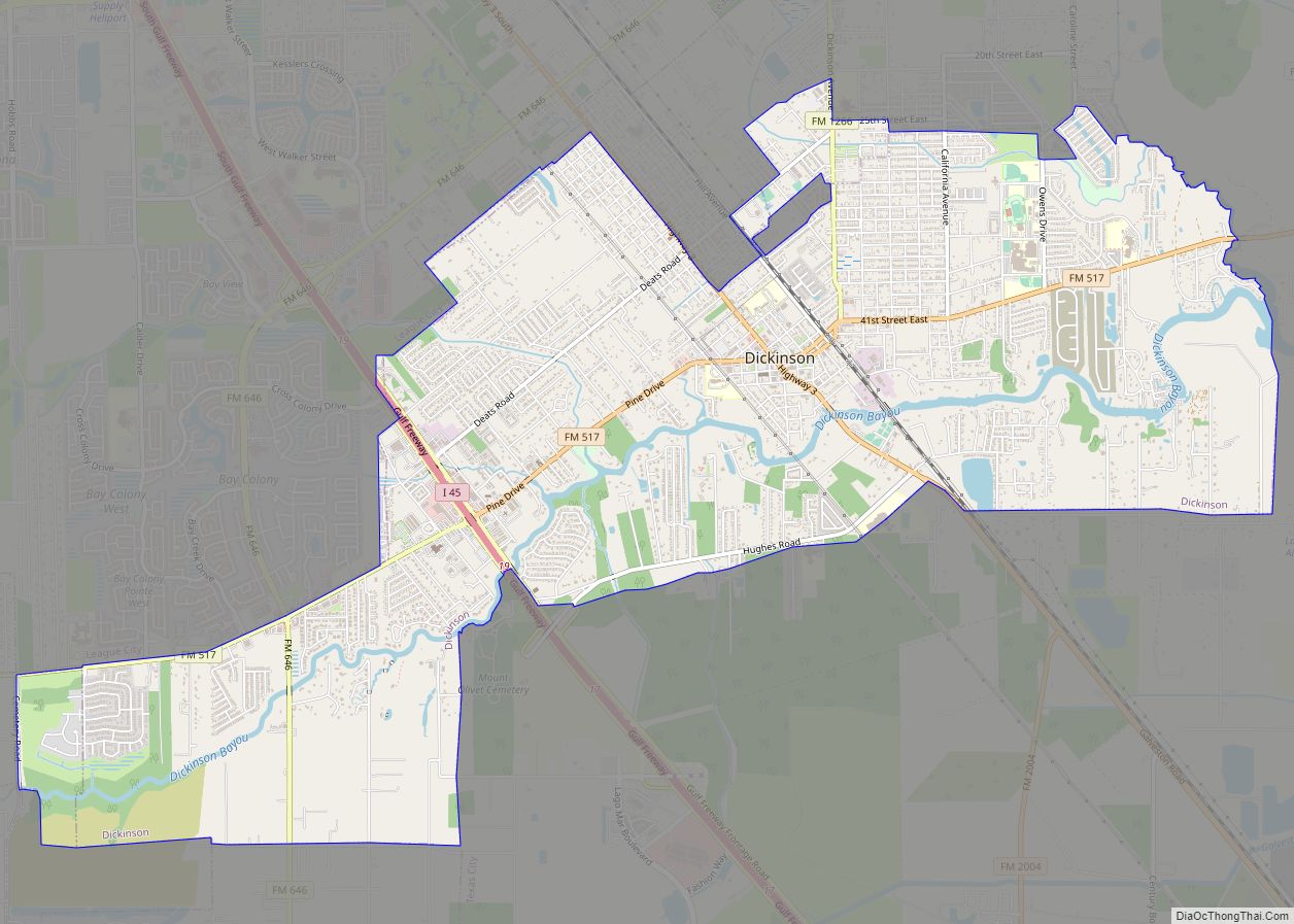
Dickinson Road Map
Dickinson city Satellite Map
Geography
Dickinson is located at 29°27′38″N 95°03′14″W / 29.460467°N 95.053856°W / 29.460467; -95.053856 (29.460467, –95.053856). This is about 28 miles (45 km) southeast of Houston and 19 miles (31 km) northwest of Galveston.
According to the United States Census Bureau, the city has a total area of 10.3 square miles (26.6 km), of which 9.9 square miles (25.6 km) is land and 0.42 square miles (1.1 km), or 3.95%, is water.
See also
Map of Texas State and its subdivision:- Anderson
- Andrews
- Angelina
- Aransas
- Archer
- Armstrong
- Atascosa
- Austin
- Bailey
- Bandera
- Bastrop
- Baylor
- Bee
- Bell
- Bexar
- Blanco
- Borden
- Bosque
- Bowie
- Brazoria
- Brazos
- Brewster
- Briscoe
- Brooks
- Brown
- Burleson
- Burnet
- Caldwell
- Calhoun
- Callahan
- Cameron
- Camp
- Carson
- Cass
- Castro
- Chambers
- Cherokee
- Childress
- Clay
- Cochran
- Coke
- Coleman
- Collin
- Collingsworth
- Colorado
- Comal
- Comanche
- Concho
- Cooke
- Coryell
- Cottle
- Crane
- Crockett
- Crosby
- Culberson
- Dallam
- Dallas
- Dawson
- Deaf Smith
- Delta
- Denton
- Dewitt
- Dickens
- Dimmit
- Donley
- Duval
- Eastland
- Ector
- Edwards
- El Paso
- Ellis
- Erath
- Falls
- Fannin
- Fayette
- Fisher
- Floyd
- Foard
- Fort Bend
- Franklin
- Freestone
- Frio
- Gaines
- Galveston
- Garza
- Gillespie
- Glasscock
- Goliad
- Gonzales
- Gray
- Grayson
- Gregg
- Grimes
- Guadalupe
- Hale
- Hall
- Hamilton
- Hansford
- Hardeman
- Hardin
- Harris
- Harrison
- Hartley
- Haskell
- Hays
- Hemphill
- Henderson
- Hidalgo
- Hill
- Hockley
- Hood
- Hopkins
- Houston
- Howard
- Hudspeth
- Hunt
- Hutchinson
- Irion
- Jack
- Jackson
- Jasper
- Jeff Davis
- Jefferson
- Jim Hogg
- Jim Wells
- Johnson
- Jones
- Karnes
- Kaufman
- Kendall
- Kenedy
- Kent
- Kerr
- Kimble
- King
- Kinney
- Kleberg
- Knox
- La Salle
- Lamar
- Lamb
- Lampasas
- Lavaca
- Lee
- Leon
- Liberty
- Limestone
- Lipscomb
- Live Oak
- Llano
- Loving
- Lubbock
- Lynn
- Madison
- Marion
- Martin
- Mason
- Matagorda
- Maverick
- McCulloch
- McLennan
- McMullen
- Medina
- Menard
- Midland
- Milam
- Mills
- Mitchell
- Montague
- Montgomery
- Moore
- Morris
- Motley
- Nacogdoches
- Navarro
- Newton
- Nolan
- Nueces
- Ochiltree
- Oldham
- Orange
- Palo Pinto
- Panola
- Parker
- Parmer
- Pecos
- Polk
- Potter
- Presidio
- Rains
- Randall
- Reagan
- Real
- Red River
- Reeves
- Refugio
- Roberts
- Robertson
- Rockwall
- Runnels
- Rusk
- Sabine
- San Augustine
- San Jacinto
- San Patricio
- San Saba
- Schleicher
- Scurry
- Shackelford
- Shelby
- Sherman
- Smith
- Somervell
- Starr
- Stephens
- Sterling
- Stonewall
- Sutton
- Swisher
- Tarrant
- Taylor
- Terrell
- Terry
- Throckmorton
- Titus
- Tom Green
- Travis
- Trinity
- Tyler
- Upshur
- Upton
- Uvalde
- Val Verde
- Van Zandt
- Victoria
- Walker
- Waller
- Ward
- Washington
- Webb
- Wharton
- Wheeler
- Wichita
- Wilbarger
- Willacy
- Williamson
- Wilson
- Winkler
- Wise
- Wood
- Yoakum
- Young
- Zapata
- Zavala
- Alabama
- Alaska
- Arizona
- Arkansas
- California
- Colorado
- Connecticut
- Delaware
- District of Columbia
- Florida
- Georgia
- Hawaii
- Idaho
- Illinois
- Indiana
- Iowa
- Kansas
- Kentucky
- Louisiana
- Maine
- Maryland
- Massachusetts
- Michigan
- Minnesota
- Mississippi
- Missouri
- Montana
- Nebraska
- Nevada
- New Hampshire
- New Jersey
- New Mexico
- New York
- North Carolina
- North Dakota
- Ohio
- Oklahoma
- Oregon
- Pennsylvania
- Rhode Island
- South Carolina
- South Dakota
- Tennessee
- Texas
- Utah
- Vermont
- Virginia
- Washington
- West Virginia
- Wisconsin
- Wyoming
