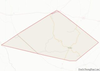
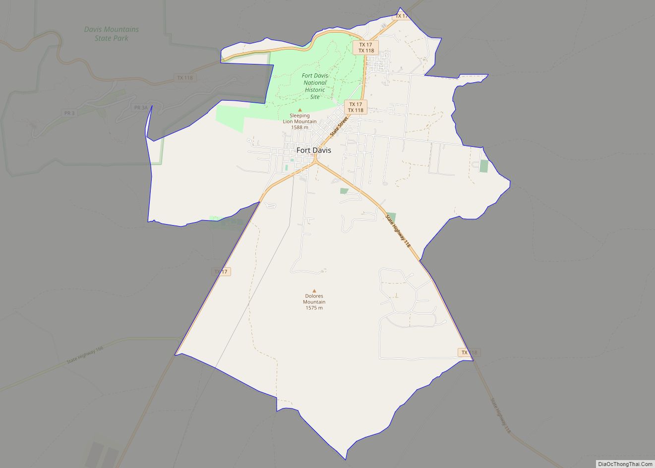
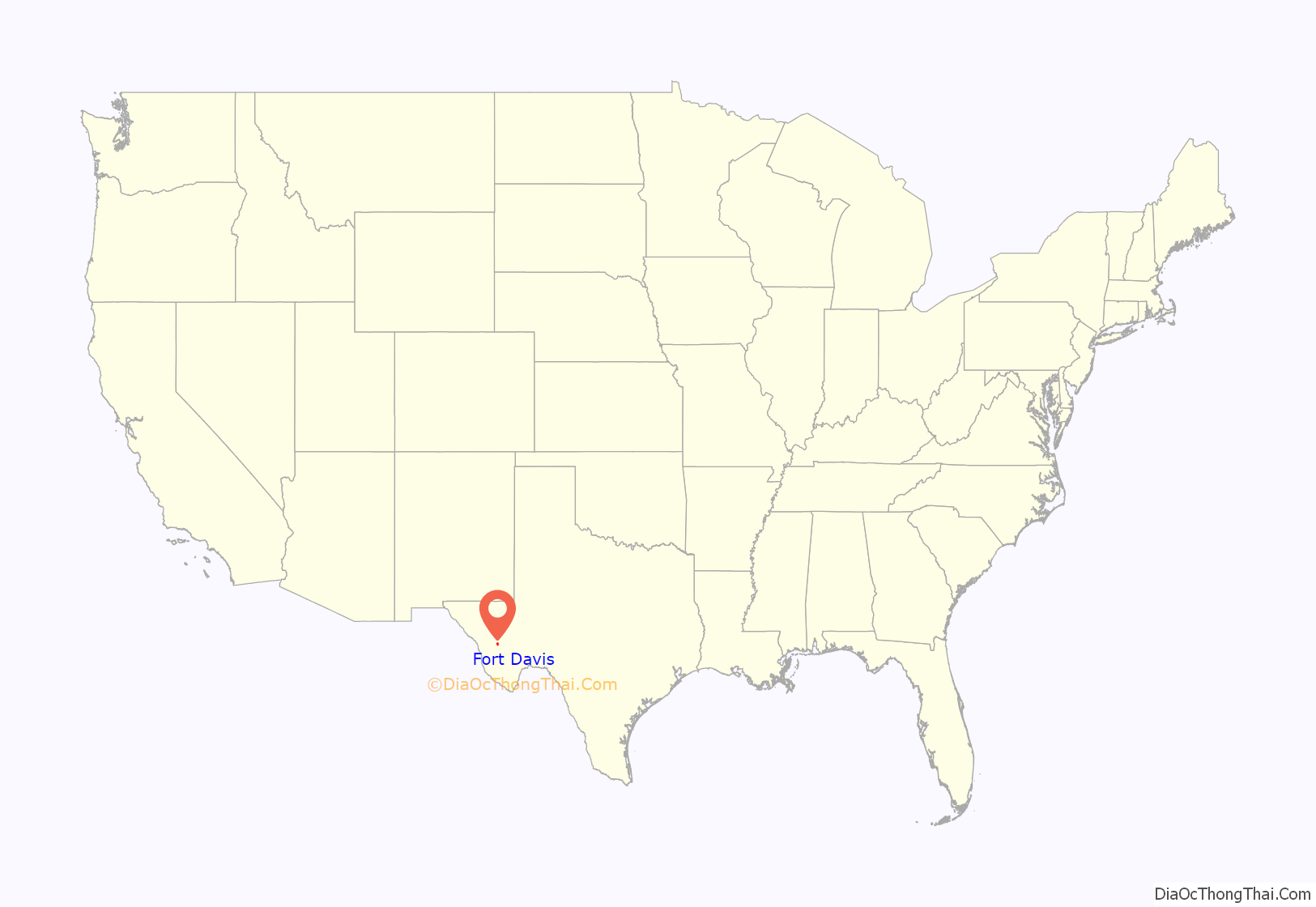
Fort Davis is an unincorporated community and census-designated place (CDP) in Jeff Davis County, Texas, United States. The population was 1,201 at the 2010 census, up from 1,050 at the 2000 census. It is the county seat of Jeff Davis County.
| Name: | Fort Davis CDP |
|---|---|
| LSAD Code: | 57 |
| LSAD Description: | CDP (suffix) |
| State: | Texas |
| County: | Jeff Davis County |
| Elevation: | 4,892 ft (1,491 m) |
| Total Area: | 10.1 sq mi (26.1 km²) |
| Land Area: | 10.1 sq mi (26.1 km²) |
| Water Area: | 0.0 sq mi (0.0 km²) |
| Total Population: | 1,201 |
| Population Density: | 119/sq mi (46.0/km²) |
| ZIP code: | 79734 |
| Area code: | 432 |
| FIPS code: | 4826688 |
| GNISfeature ID: | 1357584 |
Online Interactive Map
Click on ![]() to view map in "full screen" mode.
to view map in "full screen" mode.
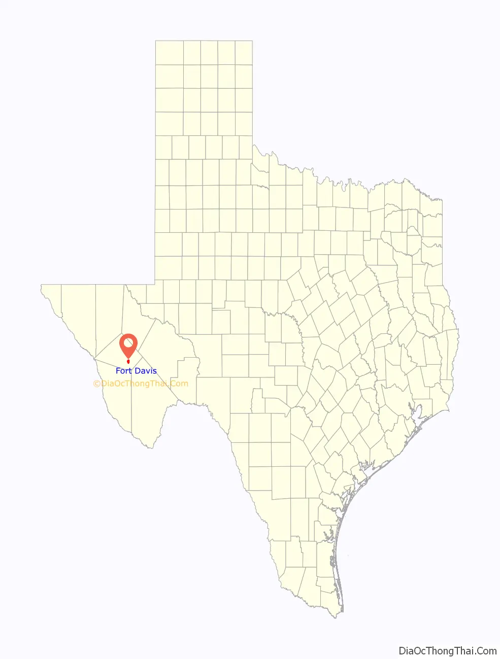
Fort Davis location map. Where is Fort Davis CDP?
History
It was the site of Fort Davis, established in 1854 on the San Antonio–El Paso Road through west Texas and named after Jefferson Davis, who was then the Secretary of War under President Franklin Pierce. It was reestablished in 1867 following the civil war.
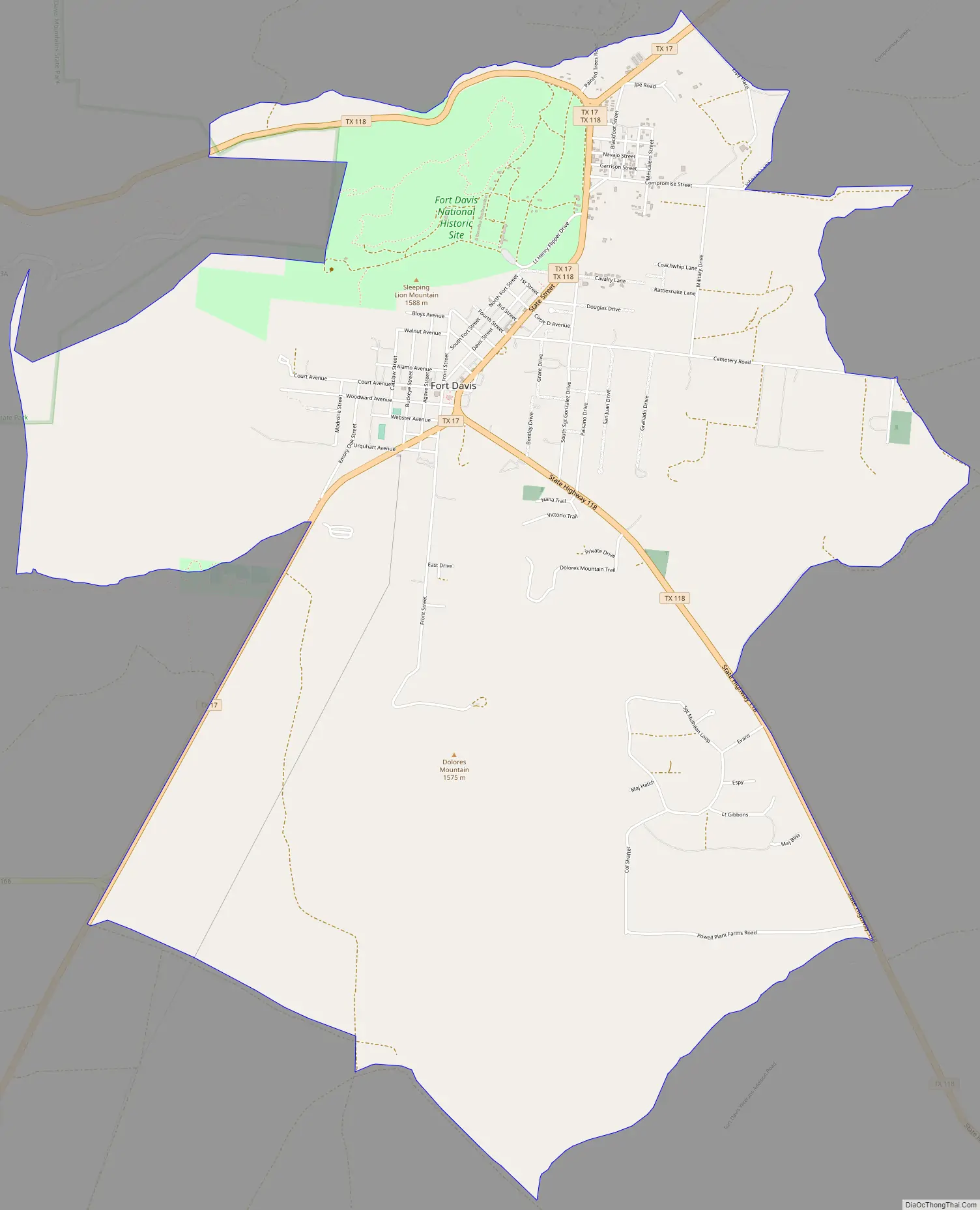
Fort Davis Road Map
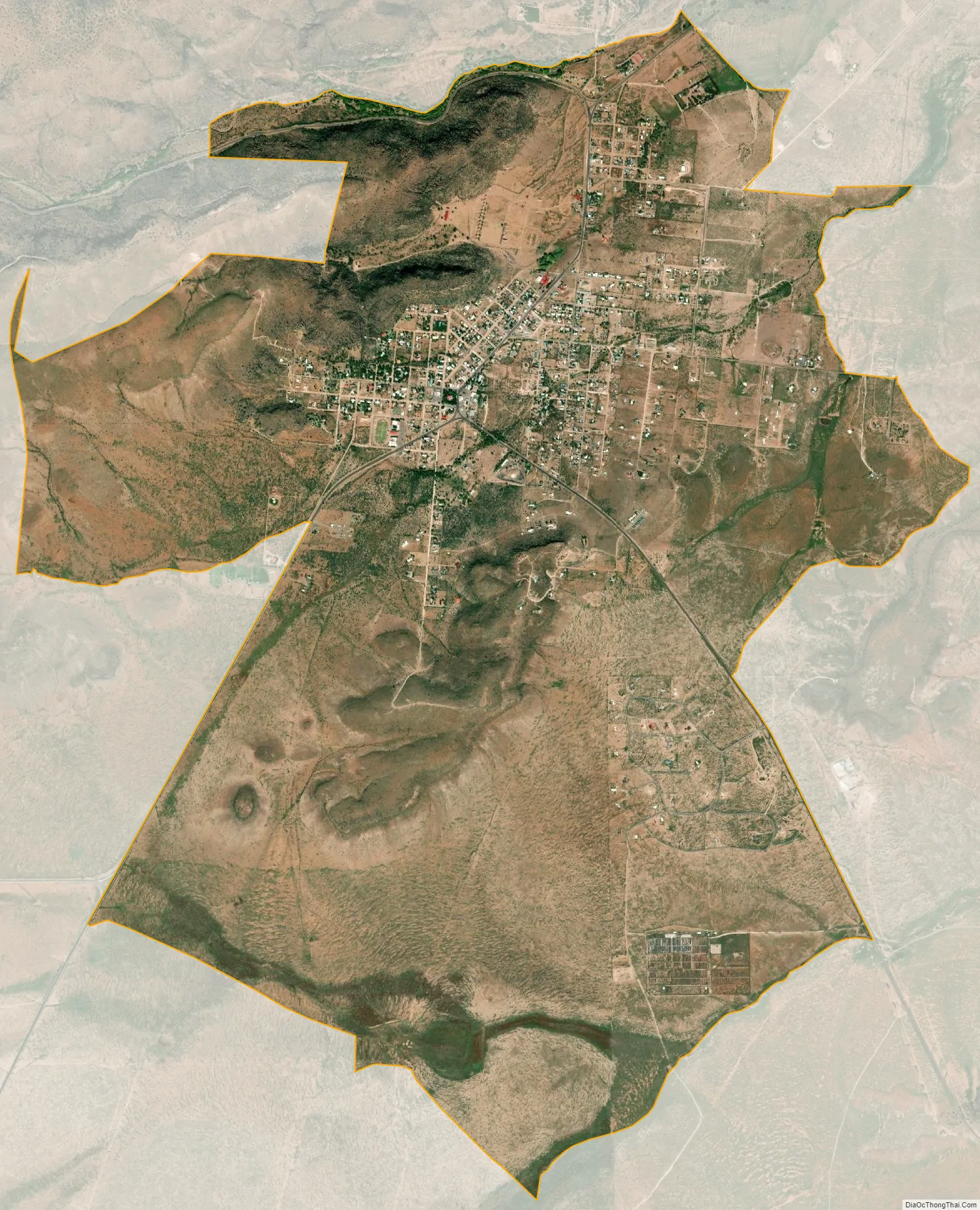
Fort Davis city Satellite Map
Geography
Fort Davis is located in southeastern Jeff Davis County at the southeast foot of the Davis Mountains. Texas State Highway 17 (State Street) passes through the center of town, leading northeast 38 miles (61 km) to Interstate 10 at Balmorhea and southwest 21 miles (34 km) to Marfa. Texas State Highway 118 joins Highway 17 through the center of Fort Davis, but leads northwest through the Davis Mountains 52 miles (84 km) to I-10 and southeast 23 miles (37 km) to Alpine.
According to the United States Census Bureau, the CDP has a total area of 10.1 square miles (26.1 km), all land.
Fort Davis has the highest elevation above sea level of any county seat in Texas; the elevation is 4,900 feet (1,500 m).
Climate
Fort Davis experiences a semi-arid climate (Köppen BSk) with cool, dry winters and hot, wet summers. There is a large degree of diurnal temperature variation due to the high elevation of the area.
Khbcewilucbhjhshdsjhcej uj
See also
Map of Texas State and its subdivision:- Anderson
- Andrews
- Angelina
- Aransas
- Archer
- Armstrong
- Atascosa
- Austin
- Bailey
- Bandera
- Bastrop
- Baylor
- Bee
- Bell
- Bexar
- Blanco
- Borden
- Bosque
- Bowie
- Brazoria
- Brazos
- Brewster
- Briscoe
- Brooks
- Brown
- Burleson
- Burnet
- Caldwell
- Calhoun
- Callahan
- Cameron
- Camp
- Carson
- Cass
- Castro
- Chambers
- Cherokee
- Childress
- Clay
- Cochran
- Coke
- Coleman
- Collin
- Collingsworth
- Colorado
- Comal
- Comanche
- Concho
- Cooke
- Coryell
- Cottle
- Crane
- Crockett
- Crosby
- Culberson
- Dallam
- Dallas
- Dawson
- Deaf Smith
- Delta
- Denton
- Dewitt
- Dickens
- Dimmit
- Donley
- Duval
- Eastland
- Ector
- Edwards
- El Paso
- Ellis
- Erath
- Falls
- Fannin
- Fayette
- Fisher
- Floyd
- Foard
- Fort Bend
- Franklin
- Freestone
- Frio
- Gaines
- Galveston
- Garza
- Gillespie
- Glasscock
- Goliad
- Gonzales
- Gray
- Grayson
- Gregg
- Grimes
- Guadalupe
- Hale
- Hall
- Hamilton
- Hansford
- Hardeman
- Hardin
- Harris
- Harrison
- Hartley
- Haskell
- Hays
- Hemphill
- Henderson
- Hidalgo
- Hill
- Hockley
- Hood
- Hopkins
- Houston
- Howard
- Hudspeth
- Hunt
- Hutchinson
- Irion
- Jack
- Jackson
- Jasper
- Jeff Davis
- Jefferson
- Jim Hogg
- Jim Wells
- Johnson
- Jones
- Karnes
- Kaufman
- Kendall
- Kenedy
- Kent
- Kerr
- Kimble
- King
- Kinney
- Kleberg
- Knox
- La Salle
- Lamar
- Lamb
- Lampasas
- Lavaca
- Lee
- Leon
- Liberty
- Limestone
- Lipscomb
- Live Oak
- Llano
- Loving
- Lubbock
- Lynn
- Madison
- Marion
- Martin
- Mason
- Matagorda
- Maverick
- McCulloch
- McLennan
- McMullen
- Medina
- Menard
- Midland
- Milam
- Mills
- Mitchell
- Montague
- Montgomery
- Moore
- Morris
- Motley
- Nacogdoches
- Navarro
- Newton
- Nolan
- Nueces
- Ochiltree
- Oldham
- Orange
- Palo Pinto
- Panola
- Parker
- Parmer
- Pecos
- Polk
- Potter
- Presidio
- Rains
- Randall
- Reagan
- Real
- Red River
- Reeves
- Refugio
- Roberts
- Robertson
- Rockwall
- Runnels
- Rusk
- Sabine
- San Augustine
- San Jacinto
- San Patricio
- San Saba
- Schleicher
- Scurry
- Shackelford
- Shelby
- Sherman
- Smith
- Somervell
- Starr
- Stephens
- Sterling
- Stonewall
- Sutton
- Swisher
- Tarrant
- Taylor
- Terrell
- Terry
- Throckmorton
- Titus
- Tom Green
- Travis
- Trinity
- Tyler
- Upshur
- Upton
- Uvalde
- Val Verde
- Van Zandt
- Victoria
- Walker
- Waller
- Ward
- Washington
- Webb
- Wharton
- Wheeler
- Wichita
- Wilbarger
- Willacy
- Williamson
- Wilson
- Winkler
- Wise
- Wood
- Yoakum
- Young
- Zapata
- Zavala
- Alabama
- Alaska
- Arizona
- Arkansas
- California
- Colorado
- Connecticut
- Delaware
- District of Columbia
- Florida
- Georgia
- Hawaii
- Idaho
- Illinois
- Indiana
- Iowa
- Kansas
- Kentucky
- Louisiana
- Maine
- Maryland
- Massachusetts
- Michigan
- Minnesota
- Mississippi
- Missouri
- Montana
- Nebraska
- Nevada
- New Hampshire
- New Jersey
- New Mexico
- New York
- North Carolina
- North Dakota
- Ohio
- Oklahoma
- Oregon
- Pennsylvania
- Rhode Island
- South Carolina
- South Dakota
- Tennessee
- Texas
- Utah
- Vermont
- Virginia
- Washington
- West Virginia
- Wisconsin
- Wyoming