Fulton is a town in Aransas County, Texas, United States. As of the 2010 census, this South Texas coastal fishing community had a population of 1,358. The town is named for George Ware Fulton, a land developer in the area.
| Name: | Fulton town |
|---|---|
| LSAD Code: | 43 |
| LSAD Description: | town (suffix) |
| State: | Texas |
| County: | Aransas County |
| Elevation: | 10 ft (3 m) |
| Total Area: | 2.46 sq mi (6.36 km²) |
| Land Area: | 1.41 sq mi (3.64 km²) |
| Water Area: | 1.05 sq mi (2.72 km²) |
| Total Population: | 1,358 |
| Population Density: | 1,057.61/sq mi (408.39/km²) |
| ZIP code: | 78358 |
| Area code: | 361 |
| FIPS code: | 4827888 |
| GNISfeature ID: | 1336302 |
| Website: | www.fultontexas.org |
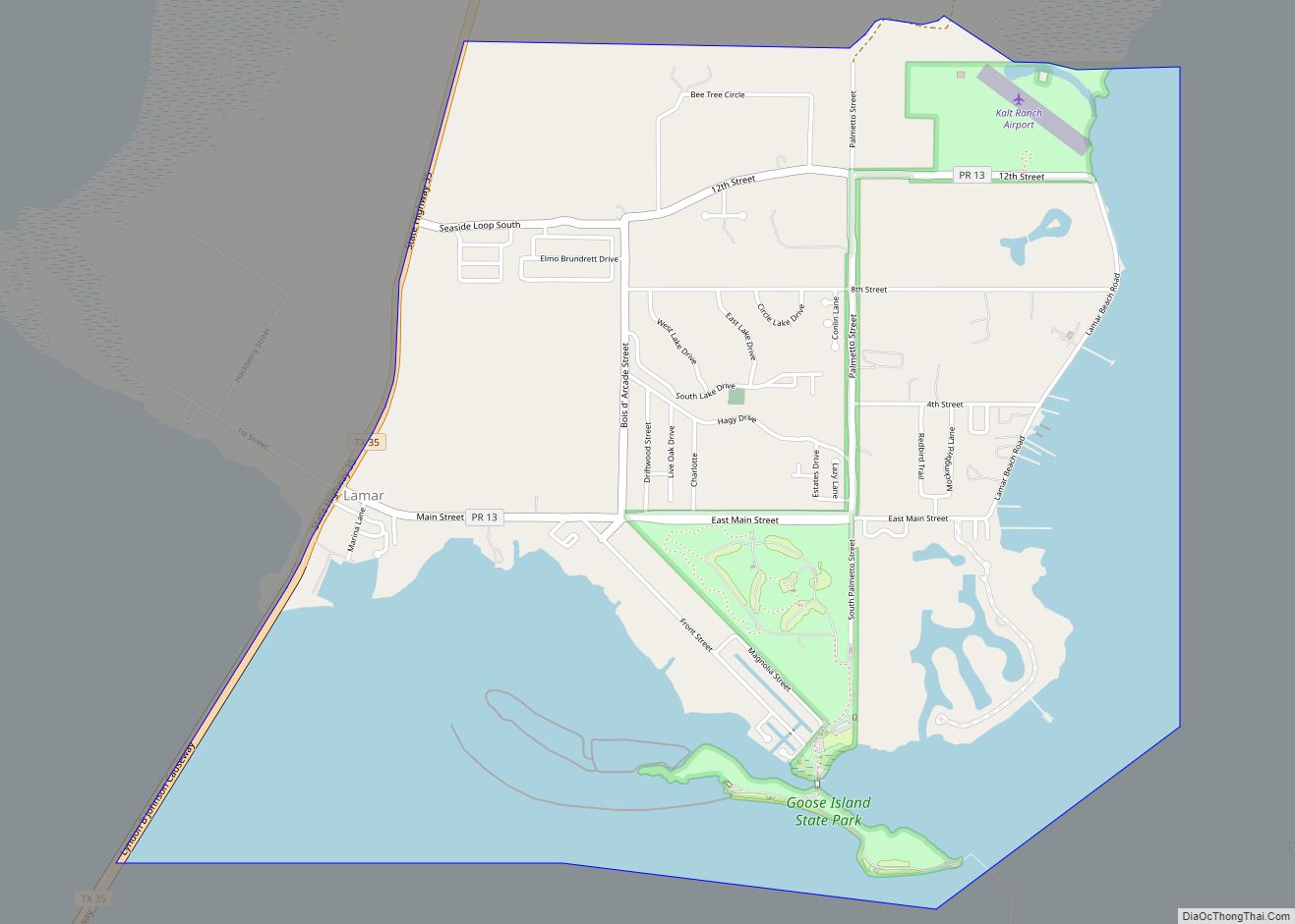
Online Interactive Map
Click on ![]() to view map in "full screen" mode.
to view map in "full screen" mode.
Fulton location map. Where is Fulton town?


History
Fulton was founded in 1866, and named by George Ware Fulton, Sr., whose wife Harriet Smith Fulton inherited 11,000 acres (4,500 ha) on the northern end of the Live Oak Peninsula, including the area where Mr. Fulton created the town he named for himself. Fulton had been a teacher in Indiana and decided to come to Texas by flatboat with 60 other men during the war for independence between Texas and Mexico. After the long trip to Texas, George Fulton found that the war was over but he joined the Army of the Republic of Texas for a few months. He worked for Henry Smith, the first Governor of Texas, and married Smith’s daughter, Harriet. They raised a family and moved around the country as George found jobs supervising railroads and building bridges. When Harriet inherited 48,000 acres of the Texas coast, they moved back to live on the Live Oak Peninsula.
After ten years, the Fultons built a large house, now known as the Fulton Mansion, just south of the town. The Fulton’s owned thousands of cattle wandering on their extensive lands, and formed a cattle company with others. Mr. Fulton built slaughterhouses and patented a chilled slaughterhouse, the first in the world. The town quickly became the site for many slaughterhouses as cattle from south Texas were driven to Fulton. The cattle slaughterhouses lasted until the 1880s when railroads reached the area and provided ways to ship live cattle to population centers such as Chicago.
In 1930, some evidence of a prehistoric settlement was found in the Fulton area, possibly Karankawan.
On August 25, 2017, Hurricane Harvey made landfall near Fulton at category 4 intensity.
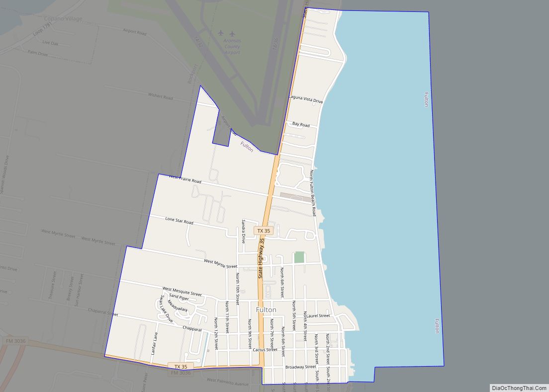
Fulton Road Map

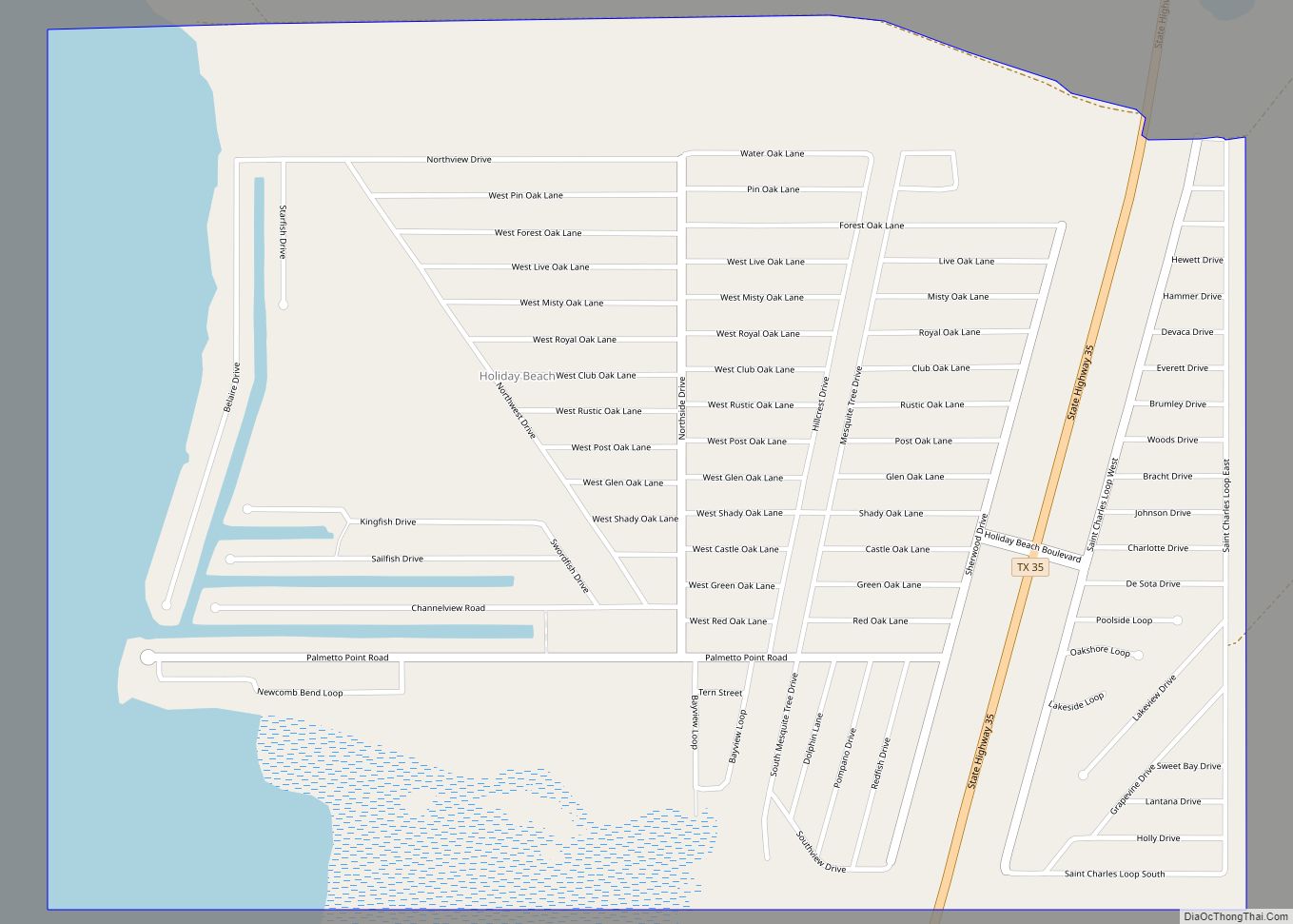
Fulton city Satellite Map

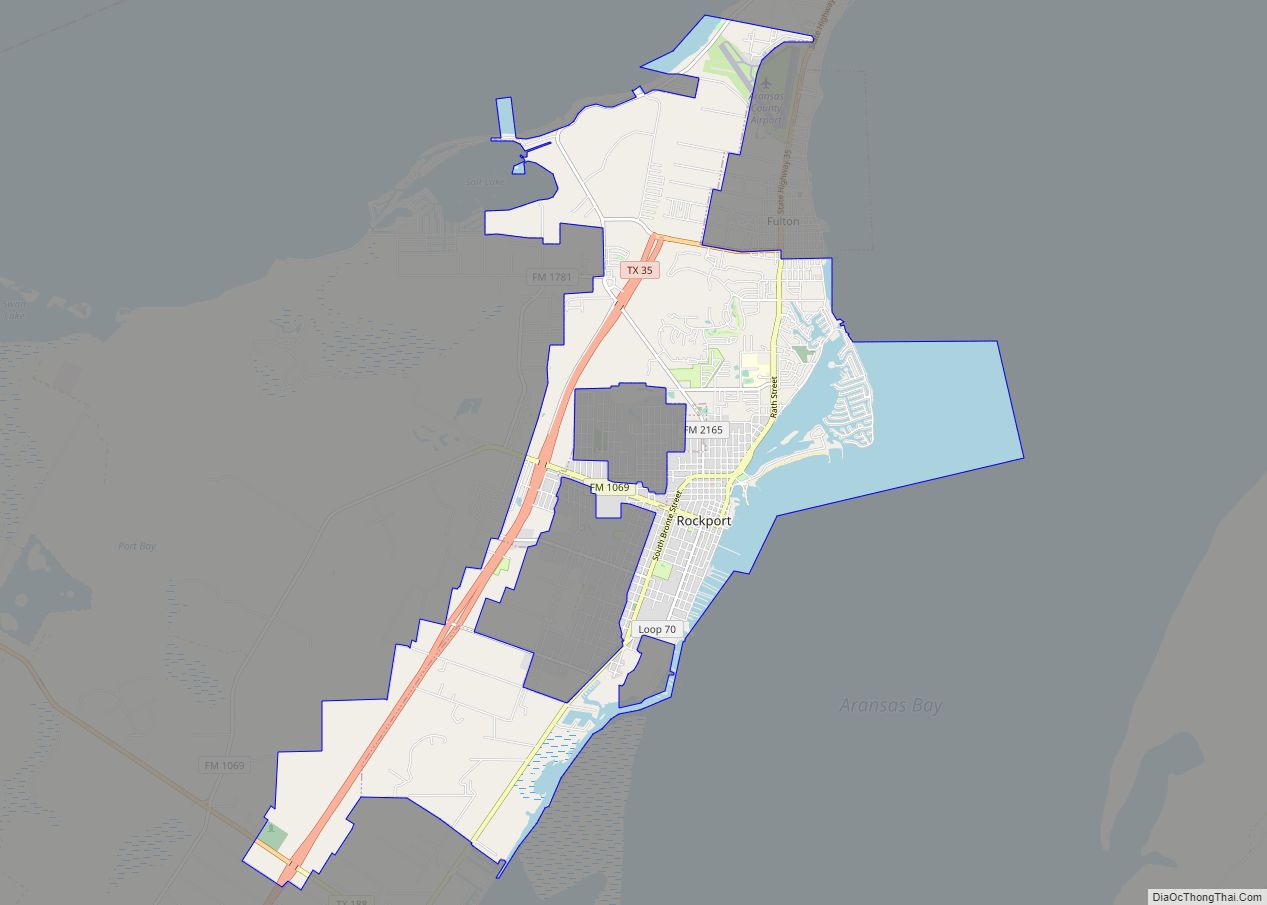
Geography
Fulton is located on the western shore of Aransas Bay. It is bordered to the south by the city of Rockport, the county seat. Texas State Highway 35 passes through the center of the town, leading north across the inlet of Copano Bay. Corpus Christi is 32 miles (51 km) to the southwest, and Port Lavaca is 49 miles (79 km) to the northeast.
According to the United States Census Bureau, the town has a total area of 2.5 square miles (6.4 km), of which 1.4 square miles (3.6 km) is land and 1.0 square mile (2.7 km), or 42.77%, is water.
Climate
The climate in this area is characterized by hot, humid summers and generally mild to cool winters. According to the Köppen Climate Classification system, Fulton has a humid subtropical climate, abbreviated “Cfa” on climate maps.
See also
Map of Texas State and its subdivision:- Anderson
- Andrews
- Angelina
- Aransas
- Archer
- Armstrong
- Atascosa
- Austin
- Bailey
- Bandera
- Bastrop
- Baylor
- Bee
- Bell
- Bexar
- Blanco
- Borden
- Bosque
- Bowie
- Brazoria
- Brazos
- Brewster
- Briscoe
- Brooks
- Brown
- Burleson
- Burnet
- Caldwell
- Calhoun
- Callahan
- Cameron
- Camp
- Carson
- Cass
- Castro
- Chambers
- Cherokee
- Childress
- Clay
- Cochran
- Coke
- Coleman
- Collin
- Collingsworth
- Colorado
- Comal
- Comanche
- Concho
- Cooke
- Coryell
- Cottle
- Crane
- Crockett
- Crosby
- Culberson
- Dallam
- Dallas
- Dawson
- Deaf Smith
- Delta
- Denton
- Dewitt
- Dickens
- Dimmit
- Donley
- Duval
- Eastland
- Ector
- Edwards
- El Paso
- Ellis
- Erath
- Falls
- Fannin
- Fayette
- Fisher
- Floyd
- Foard
- Fort Bend
- Franklin
- Freestone
- Frio
- Gaines
- Galveston
- Garza
- Gillespie
- Glasscock
- Goliad
- Gonzales
- Gray
- Grayson
- Gregg
- Grimes
- Guadalupe
- Hale
- Hall
- Hamilton
- Hansford
- Hardeman
- Hardin
- Harris
- Harrison
- Hartley
- Haskell
- Hays
- Hemphill
- Henderson
- Hidalgo
- Hill
- Hockley
- Hood
- Hopkins
- Houston
- Howard
- Hudspeth
- Hunt
- Hutchinson
- Irion
- Jack
- Jackson
- Jasper
- Jeff Davis
- Jefferson
- Jim Hogg
- Jim Wells
- Johnson
- Jones
- Karnes
- Kaufman
- Kendall
- Kenedy
- Kent
- Kerr
- Kimble
- King
- Kinney
- Kleberg
- Knox
- La Salle
- Lamar
- Lamb
- Lampasas
- Lavaca
- Lee
- Leon
- Liberty
- Limestone
- Lipscomb
- Live Oak
- Llano
- Loving
- Lubbock
- Lynn
- Madison
- Marion
- Martin
- Mason
- Matagorda
- Maverick
- McCulloch
- McLennan
- McMullen
- Medina
- Menard
- Midland
- Milam
- Mills
- Mitchell
- Montague
- Montgomery
- Moore
- Morris
- Motley
- Nacogdoches
- Navarro
- Newton
- Nolan
- Nueces
- Ochiltree
- Oldham
- Orange
- Palo Pinto
- Panola
- Parker
- Parmer
- Pecos
- Polk
- Potter
- Presidio
- Rains
- Randall
- Reagan
- Real
- Red River
- Reeves
- Refugio
- Roberts
- Robertson
- Rockwall
- Runnels
- Rusk
- Sabine
- San Augustine
- San Jacinto
- San Patricio
- San Saba
- Schleicher
- Scurry
- Shackelford
- Shelby
- Sherman
- Smith
- Somervell
- Starr
- Stephens
- Sterling
- Stonewall
- Sutton
- Swisher
- Tarrant
- Taylor
- Terrell
- Terry
- Throckmorton
- Titus
- Tom Green
- Travis
- Trinity
- Tyler
- Upshur
- Upton
- Uvalde
- Val Verde
- Van Zandt
- Victoria
- Walker
- Waller
- Ward
- Washington
- Webb
- Wharton
- Wheeler
- Wichita
- Wilbarger
- Willacy
- Williamson
- Wilson
- Winkler
- Wise
- Wood
- Yoakum
- Young
- Zapata
- Zavala
- Alabama
- Alaska
- Arizona
- Arkansas
- California
- Colorado
- Connecticut
- Delaware
- District of Columbia
- Florida
- Georgia
- Hawaii
- Idaho
- Illinois
- Indiana
- Iowa
- Kansas
- Kentucky
- Louisiana
- Maine
- Maryland
- Massachusetts
- Michigan
- Minnesota
- Mississippi
- Missouri
- Montana
- Nebraska
- Nevada
- New Hampshire
- New Jersey
- New Mexico
- New York
- North Carolina
- North Dakota
- Ohio
- Oklahoma
- Oregon
- Pennsylvania
- Rhode Island
- South Carolina
- South Dakota
- Tennessee
- Texas
- Utah
- Vermont
- Virginia
- Washington
- West Virginia
- Wisconsin
- Wyoming