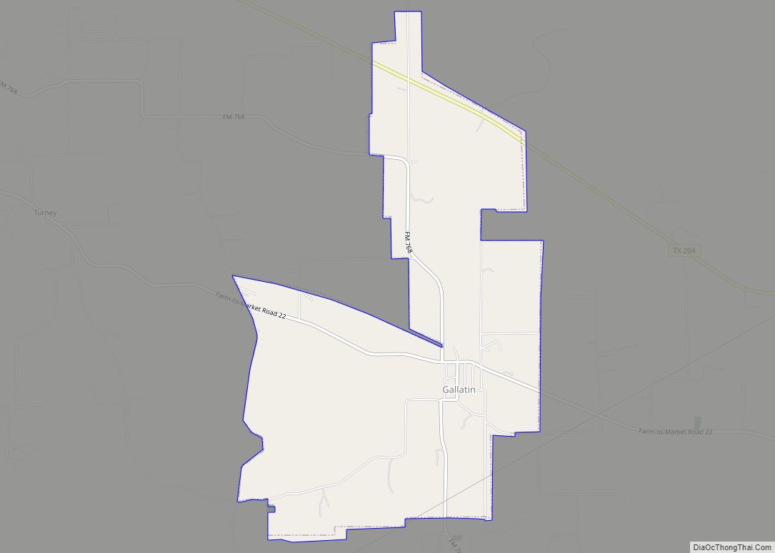
Gallatin is a city in Cherokee County, Texas, in the United States, with a 2020 U.S. census-tabulated population of 321.
| Name: | Gallatin city |
|---|---|
| LSAD Code: | 25 |
| LSAD Description: | city (suffix) |
| State: | Texas |
| County: | Cherokee County |
| Elevation: | 404 ft (123 m) |
| Total Area: | 4.60 sq mi (11.92 km²) |
| Land Area: | 4.60 sq mi (11.92 km²) |
| Water Area: | 0.00 sq mi (0.00 km²) |
| Total Population: | 321 |
| Population Density: | 94.27/sq mi (36.40/km²) |
| ZIP code: | 75764 |
| Area code: | 903 430 |
| FIPS code: | 4828008 |
| GNISfeature ID: | 1336348 |
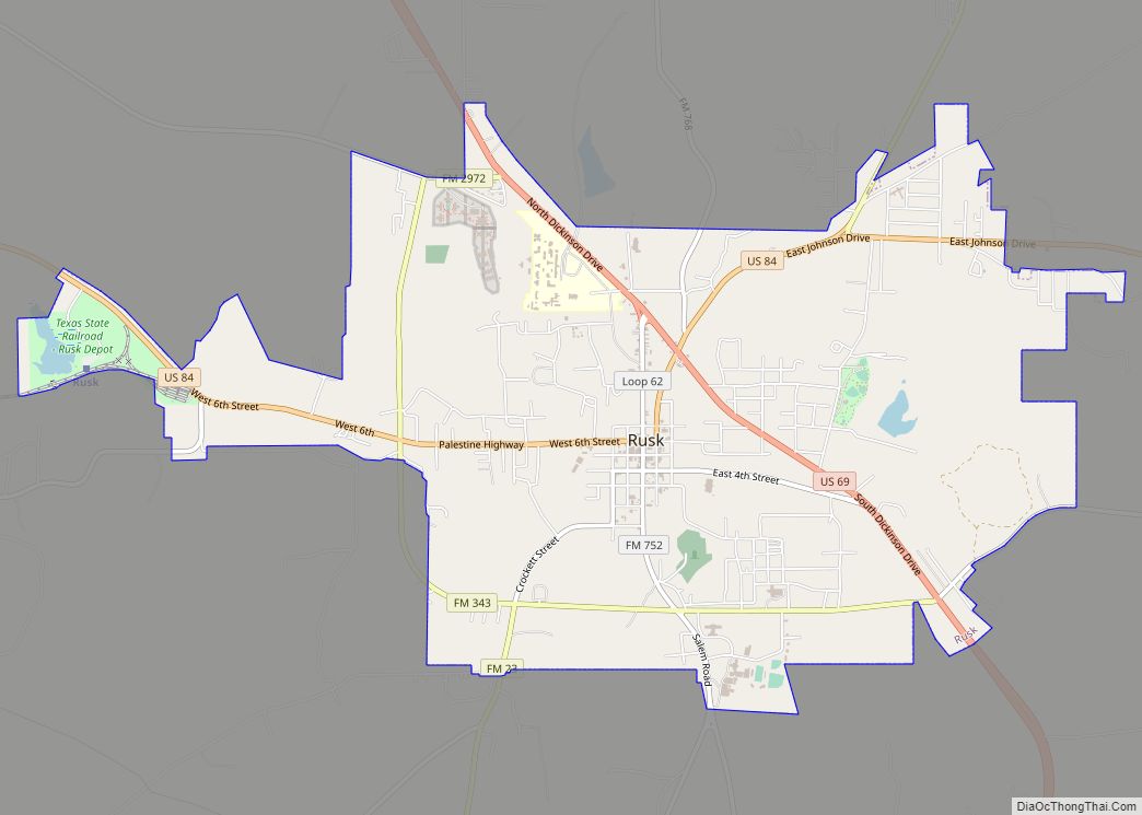
Online Interactive Map
Click on ![]() to view map in "full screen" mode.
to view map in "full screen" mode.
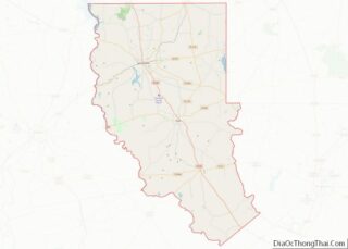
Gallatin location map. Where is Gallatin city?


History
The area was first settled in the late 1840s, but a community did not develop until 1902, when the Texas and New Orleans Railroad (T&NO) was built through the area. John W. Chandler and his sister, Sophronia, who owned the surrounding land, asked Rusk attorney C. H. Martin to survey a townsite. Chandler named the new town Gallatin, after his hometown of Gallatin, Tennessee (which in turn had been named for Albert Gallatin). The new community, located in a large truck-farming area, quickly developed into a market for tomatoes and other produce. The construction in 1907 of a branch line of the T&NO between Gallatin and Rusk further enhanced the town as a shipping center.
By 1914 Gallatin had a population of 350, several churches, two general stores, a drugstore, a school, and a cotton gin. In 1916, virtually the entire business district was destroyed by fire, but the town was quickly rebuilt, and as late as the mid-1930s it reported 500 residents and five businesses.
After World War II, the community steadily declined. Its school was consolidated with the Rusk schools in the 1950s, and many of the town’s businesses closed. The population fell to 350 by the early 1950s, and in 1990 only 171 residents and two stores were reported there. Nevertheless, Gallatin was incorporated in the early 1980s. In 1991, it had an estimated population of 382 and three businesses. In 2000, the population was 378 with four businesses.
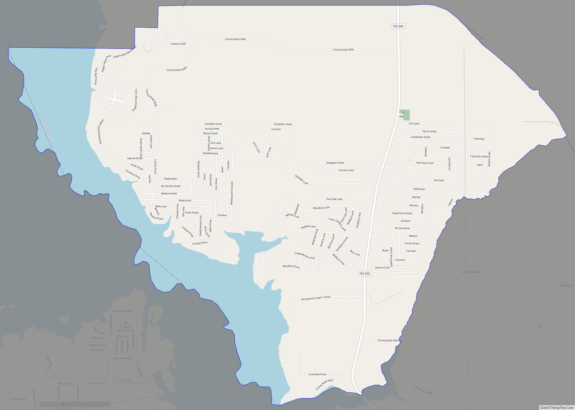
Gallatin Road Map

Gallatin city Satellite Map

Geography
Gallatin is located at 31°54′12″N 95°9′2″W / 31.90333°N 95.15056°W / 31.90333; -95.15056 (31.903316, −95.150520).
According to the United States Census Bureau, the city has a total area of 4.6 square miles (12 km), all of it land.
See also
Map of Texas State and its subdivision:- Anderson
- Andrews
- Angelina
- Aransas
- Archer
- Armstrong
- Atascosa
- Austin
- Bailey
- Bandera
- Bastrop
- Baylor
- Bee
- Bell
- Bexar
- Blanco
- Borden
- Bosque
- Bowie
- Brazoria
- Brazos
- Brewster
- Briscoe
- Brooks
- Brown
- Burleson
- Burnet
- Caldwell
- Calhoun
- Callahan
- Cameron
- Camp
- Carson
- Cass
- Castro
- Chambers
- Cherokee
- Childress
- Clay
- Cochran
- Coke
- Coleman
- Collin
- Collingsworth
- Colorado
- Comal
- Comanche
- Concho
- Cooke
- Coryell
- Cottle
- Crane
- Crockett
- Crosby
- Culberson
- Dallam
- Dallas
- Dawson
- Deaf Smith
- Delta
- Denton
- Dewitt
- Dickens
- Dimmit
- Donley
- Duval
- Eastland
- Ector
- Edwards
- El Paso
- Ellis
- Erath
- Falls
- Fannin
- Fayette
- Fisher
- Floyd
- Foard
- Fort Bend
- Franklin
- Freestone
- Frio
- Gaines
- Galveston
- Garza
- Gillespie
- Glasscock
- Goliad
- Gonzales
- Gray
- Grayson
- Gregg
- Grimes
- Guadalupe
- Hale
- Hall
- Hamilton
- Hansford
- Hardeman
- Hardin
- Harris
- Harrison
- Hartley
- Haskell
- Hays
- Hemphill
- Henderson
- Hidalgo
- Hill
- Hockley
- Hood
- Hopkins
- Houston
- Howard
- Hudspeth
- Hunt
- Hutchinson
- Irion
- Jack
- Jackson
- Jasper
- Jeff Davis
- Jefferson
- Jim Hogg
- Jim Wells
- Johnson
- Jones
- Karnes
- Kaufman
- Kendall
- Kenedy
- Kent
- Kerr
- Kimble
- King
- Kinney
- Kleberg
- Knox
- La Salle
- Lamar
- Lamb
- Lampasas
- Lavaca
- Lee
- Leon
- Liberty
- Limestone
- Lipscomb
- Live Oak
- Llano
- Loving
- Lubbock
- Lynn
- Madison
- Marion
- Martin
- Mason
- Matagorda
- Maverick
- McCulloch
- McLennan
- McMullen
- Medina
- Menard
- Midland
- Milam
- Mills
- Mitchell
- Montague
- Montgomery
- Moore
- Morris
- Motley
- Nacogdoches
- Navarro
- Newton
- Nolan
- Nueces
- Ochiltree
- Oldham
- Orange
- Palo Pinto
- Panola
- Parker
- Parmer
- Pecos
- Polk
- Potter
- Presidio
- Rains
- Randall
- Reagan
- Real
- Red River
- Reeves
- Refugio
- Roberts
- Robertson
- Rockwall
- Runnels
- Rusk
- Sabine
- San Augustine
- San Jacinto
- San Patricio
- San Saba
- Schleicher
- Scurry
- Shackelford
- Shelby
- Sherman
- Smith
- Somervell
- Starr
- Stephens
- Sterling
- Stonewall
- Sutton
- Swisher
- Tarrant
- Taylor
- Terrell
- Terry
- Throckmorton
- Titus
- Tom Green
- Travis
- Trinity
- Tyler
- Upshur
- Upton
- Uvalde
- Val Verde
- Van Zandt
- Victoria
- Walker
- Waller
- Ward
- Washington
- Webb
- Wharton
- Wheeler
- Wichita
- Wilbarger
- Willacy
- Williamson
- Wilson
- Winkler
- Wise
- Wood
- Yoakum
- Young
- Zapata
- Zavala
- Alabama
- Alaska
- Arizona
- Arkansas
- California
- Colorado
- Connecticut
- Delaware
- District of Columbia
- Florida
- Georgia
- Hawaii
- Idaho
- Illinois
- Indiana
- Iowa
- Kansas
- Kentucky
- Louisiana
- Maine
- Maryland
- Massachusetts
- Michigan
- Minnesota
- Mississippi
- Missouri
- Montana
- Nebraska
- Nevada
- New Hampshire
- New Jersey
- New Mexico
- New York
- North Carolina
- North Dakota
- Ohio
- Oklahoma
- Oregon
- Pennsylvania
- Rhode Island
- South Carolina
- South Dakota
- Tennessee
- Texas
- Utah
- Vermont
- Virginia
- Washington
- West Virginia
- Wisconsin
- Wyoming