Garland is a city in the U.S. state of Texas. It is located northeast of Dallas and is a part of the Dallas–Fort Worth metroplex. It is located within Dallas County except for small portions located in Collin and Rockwall Counties. At the 2010 census, the city had a population of 226,876. In 2019, the population rose to 239,928, making it the 93rd-most populous city in the United States of America and the 12th-most populous city in Texas; by 2020, it had a population of 246,018. Garland is the third largest city in Dallas County by population and has access to downtown Dallas via public transportation including two Dart Blue Line stations and buses.
| Name: | Garland city |
|---|---|
| LSAD Code: | 25 |
| LSAD Description: | city (suffix) |
| State: | Texas |
| County: | Collin County, Dallas County, Rockwall County |
| Incorporated: | 1891 |
| Elevation: | 551 ft (168 m) |
| Total Area: | 57.25 sq mi (148.29 km²) |
| Land Area: | 57.13 sq mi (147.97 km²) |
| Water Area: | 0.12 sq mi (0.31 km²) |
| Total Population: | 226,876 |
| Population Density: | 4,199.54/sq mi (1,621.44/km²) |
| ZIP code: | 75040-75049 |
| Area code: | 214, 469, 945, 972 |
| FIPS code: | 4829000 |
| GNISfeature ID: | 1388185 |
| Website: | garlandtx.gov |
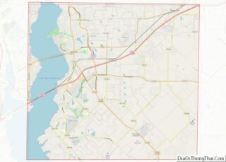
Online Interactive Map
Click on ![]() to view map in "full screen" mode.
to view map in "full screen" mode.
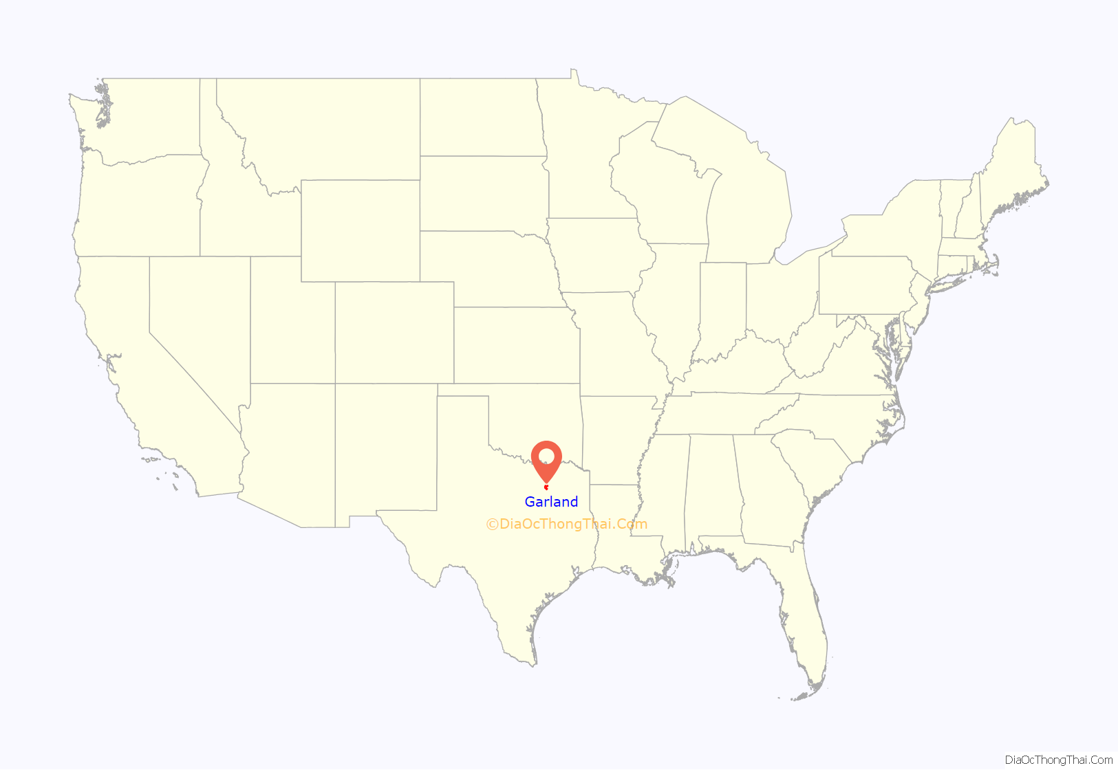
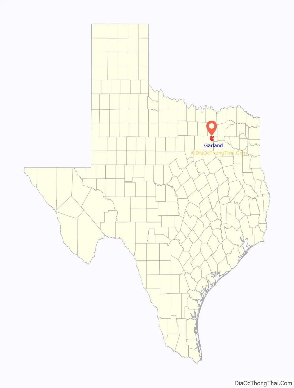
Garland location map. Where is Garland city?
History
Immigrants began arriving in the Peters colony area around 1850, but a community was not created until 1874. Two communities sprang up in the area: Embree, named for physician K. H. Embree, and Duck Creek, named for the local creek of the same name. A rivalry between the two towns ensued as the area began to grow around the Santa Fe Railroad depot.
Eventually, to settle a dispute regarding which town should have the local post office, Dallas County Judge Thomas A. Nash asked visiting Congressman Joe Abbott to move the post office between the two towns. The move was completed in 1887. The new location was named Garland after U.S. Attorney General Augustus Hill Garland.
Soon after, the towns of Embree and Duck Creek were combined, and the three areas combined to form the city of Garland, which was incorporated in 1891. By 1904, the town had a population of 819 people.
In 1920, local businessmen financed a new electrical generator plant (sold by Fairbanks-Morse) for the town. This later led to the formation of Garland Power and Light, the municipal electric provider that still powers the city today.
On May 9, 1927, a devastating F4 tornado struck the town and killed 15 people, including the former mayor, S. E. Nicholson.
Businesses began to move back into the area in the late 1930s. The Craddock food company and later the Byer-Rolnick hat factory (now owned by Resistol) moved into the area. In 1937, KRLD, a major Dallas radio station, built its radio antenna tower in Garland, and it is operational to this day.
During World War II, several aircraft plants were operated in the area, and the Kraft Foods company purchased a vacant one after the war for its own use. By 1950, the population of Garland exceeded 10,000 people. From 1950 to 1954, though, the Dallas/Garland area suffered from a serious and extended drought, so to supplement the water provided by wells, Garland began using the water from the nearby Lake Lavon.
The suburban population boom that the whole country experienced after World War II also reached Garland by 1960, when the population nearly quadrupled from the 1950 figure to about 38,500. By 1970, the population had doubled to about 81,500. By 1980, the population reached 138,850. Charles R. Matthews served as mayor in the 1980s; he was later a member of the elected Texas Railroad Commission.
In the 2000s, Garland added several notable developments, mostly in the northern portion of the city. Hawaiian Falls waterpark opened in 2003. (Garland formerly had a Wet ‘n Wild waterpark, which closed in 1993). The Garland Independent School District’s Curtis Culwell Center (formerly called the Special Events Center), an arena and conference facility, opened in 2005. Later that year, Firewheel Town Center, a Main Street-style outdoor mall, owned by Simon Property Group, opened in October 2005.
It has over 100 business and includes an AMC theater. In 2009, the city, in conjunction with developer Trammell Crow Company, finished a public/private partnership to develop the old parking lot (the land between 5th Street, 6th Street, and on the north side of Austin Street) into a new mixed-use, transit-oriented development named 5th Street Crossing. Cater-corner to both City Hall and the downtown DART Rail station, the project consists of 189 residential apartment units, 11,000 square feet (1,000 m) of flex retail, and six live-work units.
The southeast side of Garland suffered a major blow on the night of December 26, 2015, after a large EF4 tornado struck the area, moving north from Sunnyvale. At least eight fatalities were confirmed in the city from this event.
Garland Road Map
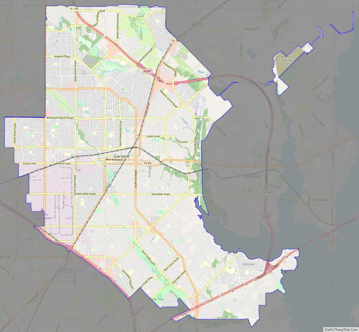
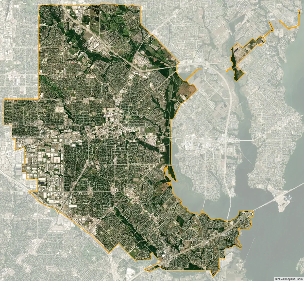
Garland city Satellite Map
Geography
Garland is located at 32°54′26″N 96°38′7″W / 32.90722°N 96.63528°W / 32.90722; -96.63528 (32.907325, –96.635197). According to the United States Census Bureau, the city has a total area of 57.1 sq mi (147.9 km), all land.
Neighborhoods and historical communities
- Buckingham North
- Duck Creek
- Centerville
- Club Hill
- Eastern Hills
- Embree
- Firewheel
- Oaks
- Rose Hill
- Spring Park
- Travis College Hill Addition
- Valley Creek*
- The 5
- Oakridge
- Brentwood Place
- Brentwood Village
Climate
Garland is part of the humid subtropical region. The average warmest month is July, with the highest recorded temperature being 111 °F (44 °C) in 2000. Typically, the coolest month is January, when the lowest recorded temperature was −3 °F (−19 °C) in 1989. The maximum average precipitation occurs in May.
See also
Map of Texas State and its subdivision:- Anderson
- Andrews
- Angelina
- Aransas
- Archer
- Armstrong
- Atascosa
- Austin
- Bailey
- Bandera
- Bastrop
- Baylor
- Bee
- Bell
- Bexar
- Blanco
- Borden
- Bosque
- Bowie
- Brazoria
- Brazos
- Brewster
- Briscoe
- Brooks
- Brown
- Burleson
- Burnet
- Caldwell
- Calhoun
- Callahan
- Cameron
- Camp
- Carson
- Cass
- Castro
- Chambers
- Cherokee
- Childress
- Clay
- Cochran
- Coke
- Coleman
- Collin
- Collingsworth
- Colorado
- Comal
- Comanche
- Concho
- Cooke
- Coryell
- Cottle
- Crane
- Crockett
- Crosby
- Culberson
- Dallam
- Dallas
- Dawson
- Deaf Smith
- Delta
- Denton
- Dewitt
- Dickens
- Dimmit
- Donley
- Duval
- Eastland
- Ector
- Edwards
- El Paso
- Ellis
- Erath
- Falls
- Fannin
- Fayette
- Fisher
- Floyd
- Foard
- Fort Bend
- Franklin
- Freestone
- Frio
- Gaines
- Galveston
- Garza
- Gillespie
- Glasscock
- Goliad
- Gonzales
- Gray
- Grayson
- Gregg
- Grimes
- Guadalupe
- Hale
- Hall
- Hamilton
- Hansford
- Hardeman
- Hardin
- Harris
- Harrison
- Hartley
- Haskell
- Hays
- Hemphill
- Henderson
- Hidalgo
- Hill
- Hockley
- Hood
- Hopkins
- Houston
- Howard
- Hudspeth
- Hunt
- Hutchinson
- Irion
- Jack
- Jackson
- Jasper
- Jeff Davis
- Jefferson
- Jim Hogg
- Jim Wells
- Johnson
- Jones
- Karnes
- Kaufman
- Kendall
- Kenedy
- Kent
- Kerr
- Kimble
- King
- Kinney
- Kleberg
- Knox
- La Salle
- Lamar
- Lamb
- Lampasas
- Lavaca
- Lee
- Leon
- Liberty
- Limestone
- Lipscomb
- Live Oak
- Llano
- Loving
- Lubbock
- Lynn
- Madison
- Marion
- Martin
- Mason
- Matagorda
- Maverick
- McCulloch
- McLennan
- McMullen
- Medina
- Menard
- Midland
- Milam
- Mills
- Mitchell
- Montague
- Montgomery
- Moore
- Morris
- Motley
- Nacogdoches
- Navarro
- Newton
- Nolan
- Nueces
- Ochiltree
- Oldham
- Orange
- Palo Pinto
- Panola
- Parker
- Parmer
- Pecos
- Polk
- Potter
- Presidio
- Rains
- Randall
- Reagan
- Real
- Red River
- Reeves
- Refugio
- Roberts
- Robertson
- Rockwall
- Runnels
- Rusk
- Sabine
- San Augustine
- San Jacinto
- San Patricio
- San Saba
- Schleicher
- Scurry
- Shackelford
- Shelby
- Sherman
- Smith
- Somervell
- Starr
- Stephens
- Sterling
- Stonewall
- Sutton
- Swisher
- Tarrant
- Taylor
- Terrell
- Terry
- Throckmorton
- Titus
- Tom Green
- Travis
- Trinity
- Tyler
- Upshur
- Upton
- Uvalde
- Val Verde
- Van Zandt
- Victoria
- Walker
- Waller
- Ward
- Washington
- Webb
- Wharton
- Wheeler
- Wichita
- Wilbarger
- Willacy
- Williamson
- Wilson
- Winkler
- Wise
- Wood
- Yoakum
- Young
- Zapata
- Zavala
- Alabama
- Alaska
- Arizona
- Arkansas
- California
- Colorado
- Connecticut
- Delaware
- District of Columbia
- Florida
- Georgia
- Hawaii
- Idaho
- Illinois
- Indiana
- Iowa
- Kansas
- Kentucky
- Louisiana
- Maine
- Maryland
- Massachusetts
- Michigan
- Minnesota
- Mississippi
- Missouri
- Montana
- Nebraska
- Nevada
- New Hampshire
- New Jersey
- New Mexico
- New York
- North Carolina
- North Dakota
- Ohio
- Oklahoma
- Oregon
- Pennsylvania
- Rhode Island
- South Carolina
- South Dakota
- Tennessee
- Texas
- Utah
- Vermont
- Virginia
- Washington
- West Virginia
- Wisconsin
- Wyoming