George West is a city in Live Oak County, Texas, United States, and named for cattle rancher George Washington West. The population was 2,445 at the 2010 census. It is the county seat of Live Oak County. George West was named the “storytelling capital of Texas” in 2005 by the Texas Senate; and it hosts the George West Storyfest, a festival that features storytelling, cowboy poetry, and music. Numerous ranches surround George West.
The Texas author and folklorist J. Frank Dobie was born in Live Oak County near George West in 1888. Former State Senator Cyndi Taylor Krier, also the administrative judge of Bexar County, was reared near George West in the unincorporated community of Dinero.
| Name: | George West city |
|---|---|
| LSAD Code: | 25 |
| LSAD Description: | city (suffix) |
| State: | Texas |
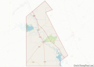
| County: | Live Oak County |
| Elevation: | 157 ft (48 m) |
| Total Area: | 1.94 sq mi (5.02 km²) |
| Land Area: | 1.94 sq mi (5.02 km²) |
| Water Area: | 0.00 sq mi (0.00 km²) |
| Total Population: | 2,445 |
| Population Density: | 1,321.98/sq mi (510.40/km²) |
| ZIP code: | 78022 |
| Area code: | 361 |
| FIPS code: | 4829348 |
| GNISfeature ID: | 1336484 |
| Website: | cityofgw.org |
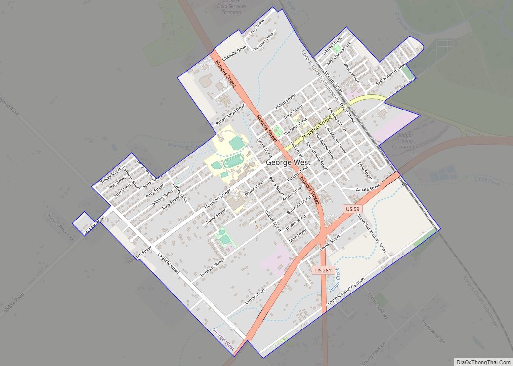
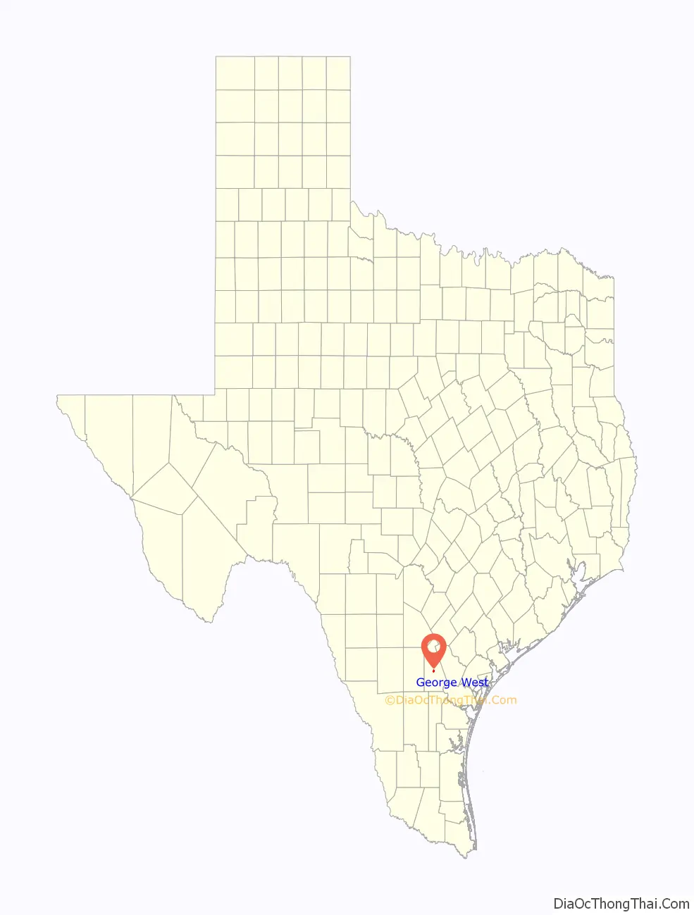
Online Interactive Map
Click on ![]() to view map in "full screen" mode.
to view map in "full screen" mode.
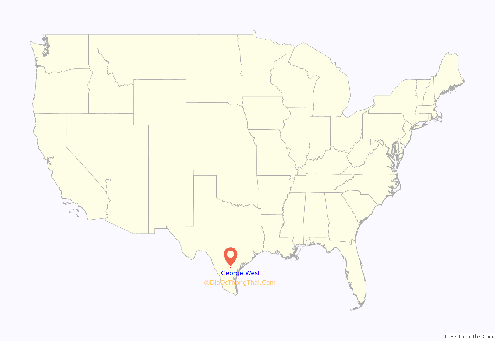
George West location map. Where is George West city?
History
George West was a land venture and ranching enterprise of George Washington West and Kittie West. Originally from Shannonville Tennessee, West began to build his town in 1913, after ranching from 1880 to 1912 in the area between Pleasanton and Corpus Christi. He sold his cattle holdings and began to colonize some 75,000 acres (300 km).
West offered the San Antonio, Uvalde and Gulf Railroad $100,000 and a free easement through his land to build to George West. West had made his fortune on cattle drives but knew that the future rested with the transport of the animals on a train. He purchased some 120,000 acres in Live Oak County and held 26,000 cattle. A drought had caused such losses that he sold half of his acreage. Other ranchers tried to sell property at that time, and prices dropped to low levels.
In 1918, West offered $75,000 to build a new courthouse if the county seat was moved from Oakville, which was not on a railroad route, and if voters approved the plan. The courthouse actually cost $120,000 and was built to West’s specifications. He also built schools, roads, and water and electricity plants.
George West was incorporated in 1946, and the government changed to home rule in 1980.
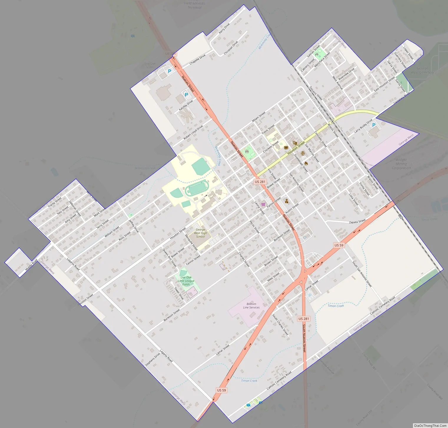
George West Road Map
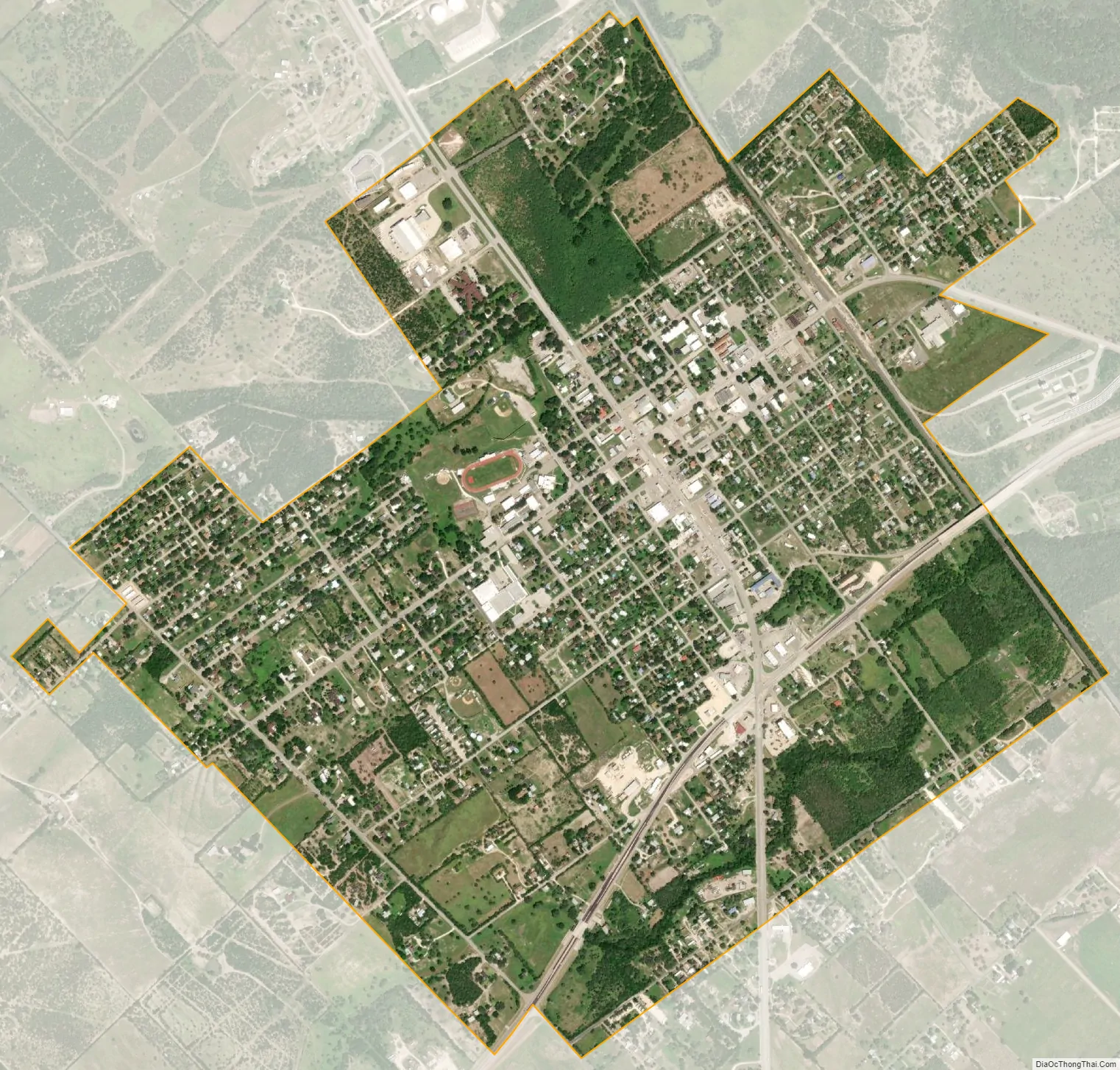
George West city Satellite Map
Geography
George West is located at 28°19′52″N 98°07′01″W / 28.331147°N 98.117013°W / 28.331147; -98.117013 (28.331147, –98.117013). This is 65.7 miles (105.7 km) northwest of Corpus Christi and miles (127 km) 85.6 miles south of San Antonio.
According to the United States Census Bureau, the city has a total area of 12 square miles (31 km), all of it land.
See also
Map of Texas State and its subdivision:- Anderson
- Andrews
- Angelina
- Aransas
- Archer
- Armstrong
- Atascosa
- Austin
- Bailey
- Bandera
- Bastrop
- Baylor
- Bee
- Bell
- Bexar
- Blanco
- Borden
- Bosque
- Bowie
- Brazoria
- Brazos
- Brewster
- Briscoe
- Brooks
- Brown
- Burleson
- Burnet
- Caldwell
- Calhoun
- Callahan
- Cameron
- Camp
- Carson
- Cass
- Castro
- Chambers
- Cherokee
- Childress
- Clay
- Cochran
- Coke
- Coleman
- Collin
- Collingsworth
- Colorado
- Comal
- Comanche
- Concho
- Cooke
- Coryell
- Cottle
- Crane
- Crockett
- Crosby
- Culberson
- Dallam
- Dallas
- Dawson
- Deaf Smith
- Delta
- Denton
- Dewitt
- Dickens
- Dimmit
- Donley
- Duval
- Eastland
- Ector
- Edwards
- El Paso
- Ellis
- Erath
- Falls
- Fannin
- Fayette
- Fisher
- Floyd
- Foard
- Fort Bend
- Franklin
- Freestone
- Frio
- Gaines
- Galveston
- Garza
- Gillespie
- Glasscock
- Goliad
- Gonzales
- Gray
- Grayson
- Gregg
- Grimes
- Guadalupe
- Hale
- Hall
- Hamilton
- Hansford
- Hardeman
- Hardin
- Harris
- Harrison
- Hartley
- Haskell
- Hays
- Hemphill
- Henderson
- Hidalgo
- Hill
- Hockley
- Hood
- Hopkins
- Houston
- Howard
- Hudspeth
- Hunt
- Hutchinson
- Irion
- Jack
- Jackson
- Jasper
- Jeff Davis
- Jefferson
- Jim Hogg
- Jim Wells
- Johnson
- Jones
- Karnes
- Kaufman
- Kendall
- Kenedy
- Kent
- Kerr
- Kimble
- King
- Kinney
- Kleberg
- Knox
- La Salle
- Lamar
- Lamb
- Lampasas
- Lavaca
- Lee
- Leon
- Liberty
- Limestone
- Lipscomb
- Live Oak
- Llano
- Loving
- Lubbock
- Lynn
- Madison
- Marion
- Martin
- Mason
- Matagorda
- Maverick
- McCulloch
- McLennan
- McMullen
- Medina
- Menard
- Midland
- Milam
- Mills
- Mitchell
- Montague
- Montgomery
- Moore
- Morris
- Motley
- Nacogdoches
- Navarro
- Newton
- Nolan
- Nueces
- Ochiltree
- Oldham
- Orange
- Palo Pinto
- Panola
- Parker
- Parmer
- Pecos
- Polk
- Potter
- Presidio
- Rains
- Randall
- Reagan
- Real
- Red River
- Reeves
- Refugio
- Roberts
- Robertson
- Rockwall
- Runnels
- Rusk
- Sabine
- San Augustine
- San Jacinto
- San Patricio
- San Saba
- Schleicher
- Scurry
- Shackelford
- Shelby
- Sherman
- Smith
- Somervell
- Starr
- Stephens
- Sterling
- Stonewall
- Sutton
- Swisher
- Tarrant
- Taylor
- Terrell
- Terry
- Throckmorton
- Titus
- Tom Green
- Travis
- Trinity
- Tyler
- Upshur
- Upton
- Uvalde
- Val Verde
- Van Zandt
- Victoria
- Walker
- Waller
- Ward
- Washington
- Webb
- Wharton
- Wheeler
- Wichita
- Wilbarger
- Willacy
- Williamson
- Wilson
- Winkler
- Wise
- Wood
- Yoakum
- Young
- Zapata
- Zavala
- Alabama
- Alaska
- Arizona
- Arkansas
- California
- Colorado
- Connecticut
- Delaware
- District of Columbia
- Florida
- Georgia
- Hawaii
- Idaho
- Illinois
- Indiana
- Iowa
- Kansas
- Kentucky
- Louisiana
- Maine
- Maryland
- Massachusetts
- Michigan
- Minnesota
- Mississippi
- Missouri
- Montana
- Nebraska
- Nevada
- New Hampshire
- New Jersey
- New Mexico
- New York
- North Carolina
- North Dakota
- Ohio
- Oklahoma
- Oregon
- Pennsylvania
- Rhode Island
- South Carolina
- South Dakota
- Tennessee
- Texas
- Utah
- Vermont
- Virginia
- Washington
- West Virginia
- Wisconsin
- Wyoming