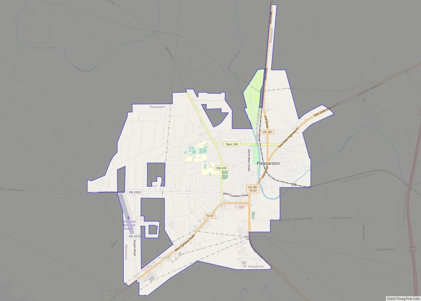
Pleasanton is a city in Atascosa County, Texas, United States. The population was 8,934 at the 2010 census. Pleasanton’s official motto is “The City of Live Oaks and Friendly Folks.” It is part of the San Antonio-New Braunfels Metropolitan Statistical Area.
| Name: | Pleasanton city |
|---|---|
| LSAD Code: | 25 |
| LSAD Description: | city (suffix) |
| State: | Texas |
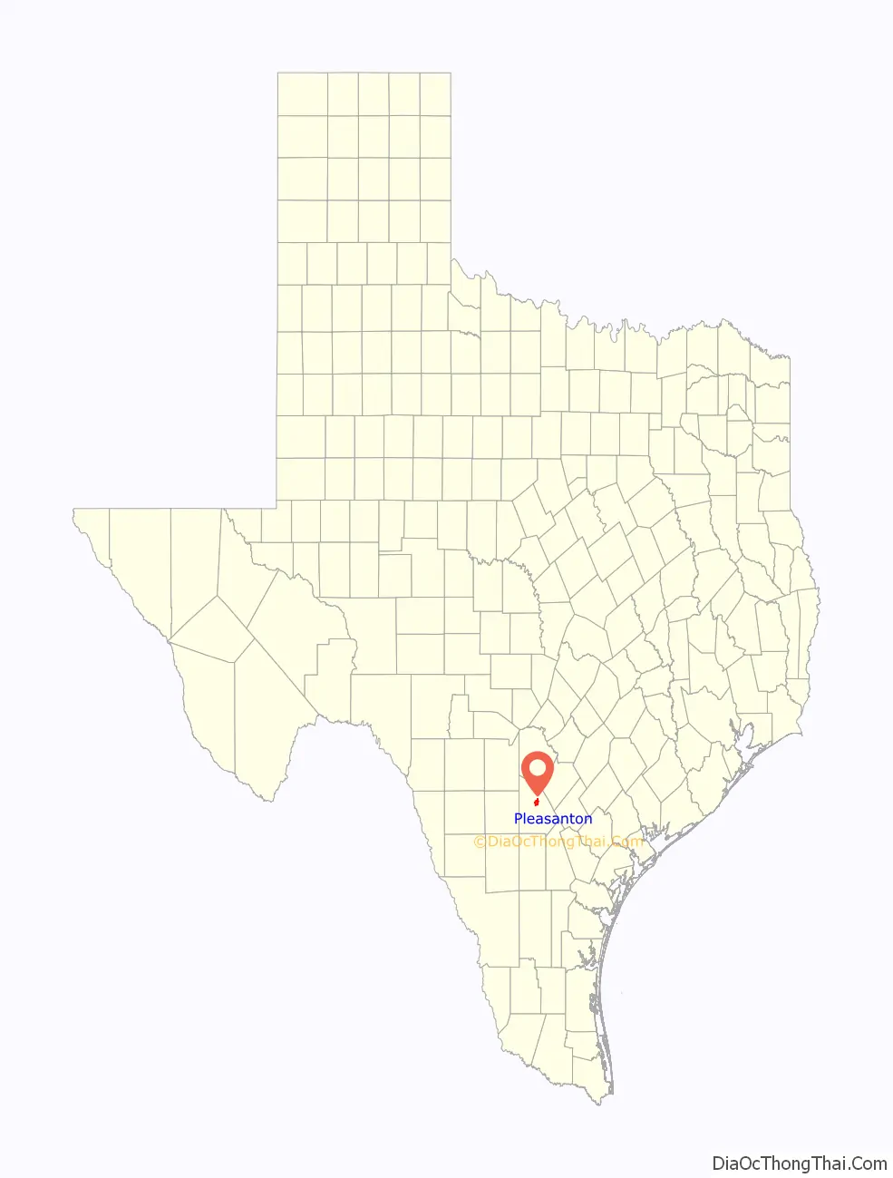
| County: | Atascosa County |
| Elevation: | 361 ft (110 m) |
| Total Area: | 8.96 sq mi (23.20 km²) |
| Land Area: | 8.96 sq mi (23.20 km²) |
| Water Area: | 0.00 sq mi (0.00 km²) |
| Total Population: | 8,934 |
| Population Density: | 1,211.63/sq mi (467.81/km²) |
| ZIP code: | 78064 |
| Area code: | 830 |
| FIPS code: | 4858280 |
| GNISfeature ID: | 1375500 |
| Website: | www.pleasantontx.org |
Online Interactive Map
Click on ![]() to view map in "full screen" mode.
to view map in "full screen" mode.
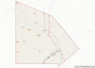
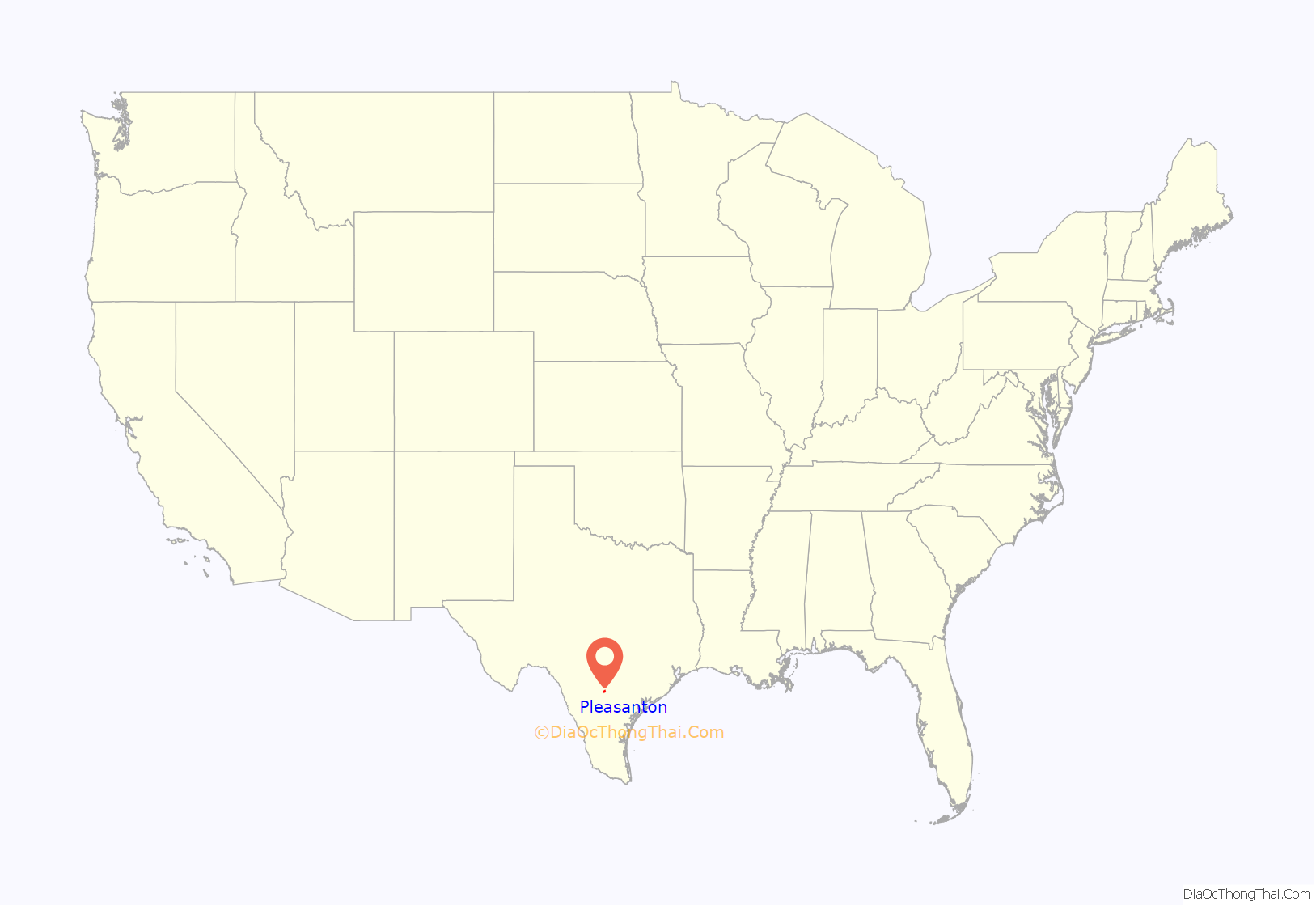
Pleasanton location map. Where is Pleasanton city?
History
Pleasanton was established in 1858 when conflicts with the Native Americans caused the settlers to move the location of the county seat from Amphion. The settlers chose the current townsite because of its location at the mouth of Bonita Creek. John Bowen (died 1867), San Antonio’s first Anglo-American postmaster, founded and named the town of Pleasanton after his good friend and fellow early Texas Settler John Pleasants.
At one time Pleasanton had two newspapers, the Pleasanton Picayune, which became the Pleasanton Express in 1909, and the Pleasanton Reporter. The county seat was relocated from Pleasanton to Jourdanton in 1910. Pleasanton was incorporated in 1917.
In November 1957, the citizens of Pleasanton voted overwhelmingly to desegregate the public schools. This came some two months after the crisis at Little Rock Central High School in Arkansas. Some three dozen African American pupils were then integrated into the Pleasanton school.
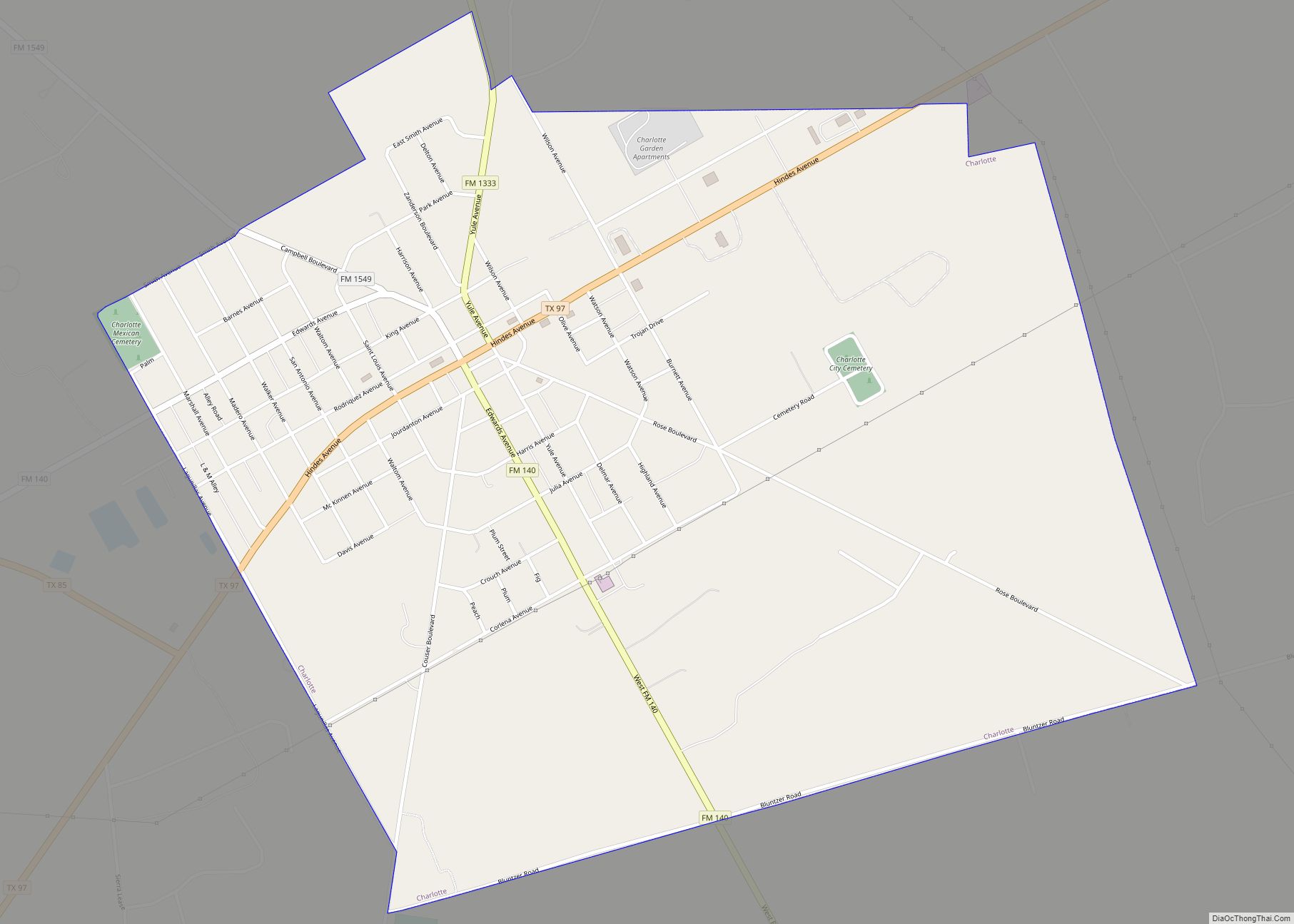
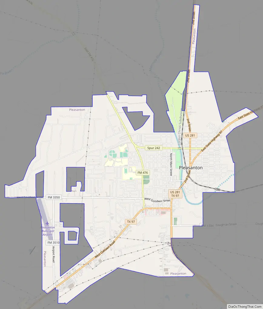
Pleasanton Road Map
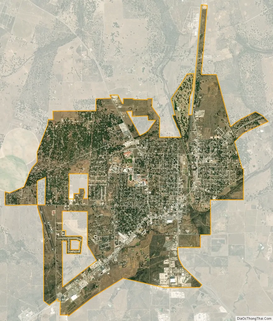
Pleasanton city Satellite Map
Geography
Pleasanton is located at 28°58′1″N 98°29′6″W / 28.96694°N 98.48500°W / 28.96694; -98.48500 (28.966953, –98.484937), about 35 miles (56 km) south of downtown San Antonio, 110 miles (180 km) south-southwest of Austin and 110 miles (180 km) north by north-northwest of Corpus Christi.
According to the United States Census Bureau, the city has a total area of 8.5 square miles (22 km), all land.
The average annual temperature of Pleasanton is 70 °F (21 °C). The mean temperature on January 1 is 50 °F (10 °C) and on June 1 is 78 °F (26 °C). Average annual precipitation is 26.1 inches (660 mm).
Most soils of Pleasanton are quite sandy at the surface but have a clay-rich subsoil that holds moisture. They belong to the Alfisol soil order. Common soil series in town are Nusil, Poth and Rhymes.
See also
Map of Texas State and its subdivision:- Anderson
- Andrews
- Angelina
- Aransas
- Archer
- Armstrong
- Atascosa
- Austin
- Bailey
- Bandera
- Bastrop
- Baylor
- Bee
- Bell
- Bexar
- Blanco
- Borden
- Bosque
- Bowie
- Brazoria
- Brazos
- Brewster
- Briscoe
- Brooks
- Brown
- Burleson
- Burnet
- Caldwell
- Calhoun
- Callahan
- Cameron
- Camp
- Carson
- Cass
- Castro
- Chambers
- Cherokee
- Childress
- Clay
- Cochran
- Coke
- Coleman
- Collin
- Collingsworth
- Colorado
- Comal
- Comanche
- Concho
- Cooke
- Coryell
- Cottle
- Crane
- Crockett
- Crosby
- Culberson
- Dallam
- Dallas
- Dawson
- Deaf Smith
- Delta
- Denton
- Dewitt
- Dickens
- Dimmit
- Donley
- Duval
- Eastland
- Ector
- Edwards
- El Paso
- Ellis
- Erath
- Falls
- Fannin
- Fayette
- Fisher
- Floyd
- Foard
- Fort Bend
- Franklin
- Freestone
- Frio
- Gaines
- Galveston
- Garza
- Gillespie
- Glasscock
- Goliad
- Gonzales
- Gray
- Grayson
- Gregg
- Grimes
- Guadalupe
- Hale
- Hall
- Hamilton
- Hansford
- Hardeman
- Hardin
- Harris
- Harrison
- Hartley
- Haskell
- Hays
- Hemphill
- Henderson
- Hidalgo
- Hill
- Hockley
- Hood
- Hopkins
- Houston
- Howard
- Hudspeth
- Hunt
- Hutchinson
- Irion
- Jack
- Jackson
- Jasper
- Jeff Davis
- Jefferson
- Jim Hogg
- Jim Wells
- Johnson
- Jones
- Karnes
- Kaufman
- Kendall
- Kenedy
- Kent
- Kerr
- Kimble
- King
- Kinney
- Kleberg
- Knox
- La Salle
- Lamar
- Lamb
- Lampasas
- Lavaca
- Lee
- Leon
- Liberty
- Limestone
- Lipscomb
- Live Oak
- Llano
- Loving
- Lubbock
- Lynn
- Madison
- Marion
- Martin
- Mason
- Matagorda
- Maverick
- McCulloch
- McLennan
- McMullen
- Medina
- Menard
- Midland
- Milam
- Mills
- Mitchell
- Montague
- Montgomery
- Moore
- Morris
- Motley
- Nacogdoches
- Navarro
- Newton
- Nolan
- Nueces
- Ochiltree
- Oldham
- Orange
- Palo Pinto
- Panola
- Parker
- Parmer
- Pecos
- Polk
- Potter
- Presidio
- Rains
- Randall
- Reagan
- Real
- Red River
- Reeves
- Refugio
- Roberts
- Robertson
- Rockwall
- Runnels
- Rusk
- Sabine
- San Augustine
- San Jacinto
- San Patricio
- San Saba
- Schleicher
- Scurry
- Shackelford
- Shelby
- Sherman
- Smith
- Somervell
- Starr
- Stephens
- Sterling
- Stonewall
- Sutton
- Swisher
- Tarrant
- Taylor
- Terrell
- Terry
- Throckmorton
- Titus
- Tom Green
- Travis
- Trinity
- Tyler
- Upshur
- Upton
- Uvalde
- Val Verde
- Van Zandt
- Victoria
- Walker
- Waller
- Ward
- Washington
- Webb
- Wharton
- Wheeler
- Wichita
- Wilbarger
- Willacy
- Williamson
- Wilson
- Winkler
- Wise
- Wood
- Yoakum
- Young
- Zapata
- Zavala
- Alabama
- Alaska
- Arizona
- Arkansas
- California
- Colorado
- Connecticut
- Delaware
- District of Columbia
- Florida
- Georgia
- Hawaii
- Idaho
- Illinois
- Indiana
- Iowa
- Kansas
- Kentucky
- Louisiana
- Maine
- Maryland
- Massachusetts
- Michigan
- Minnesota
- Mississippi
- Missouri
- Montana
- Nebraska
- Nevada
- New Hampshire
- New Jersey
- New Mexico
- New York
- North Carolina
- North Dakota
- Ohio
- Oklahoma
- Oregon
- Pennsylvania
- Rhode Island
- South Carolina
- South Dakota
- Tennessee
- Texas
- Utah
- Vermont
- Virginia
- Washington
- West Virginia
- Wisconsin
- Wyoming