Godley is a city in northwestern Johnson County, Texas, United States, in the Dallas–Fort Worth metroplex. It is on Texas State Highway 171, Farm Roads 2331 and 917, and the tracks of the Atchison, Topeka and Santa Fe Railway northwest of Cleburne. The population was 1,009 in 2010, up from 879 in 2000.
| Name: | Godley city |
|---|---|
| LSAD Code: | 25 |
| LSAD Description: | city (suffix) |
| State: | Texas |
| County: | Johnson County |
| Elevation: | 928 ft (283 m) |
| Total Area: | 2.20 sq mi (5.69 km²) |
| Land Area: | 2.18 sq mi (5.65 km²) |
| Water Area: | 0.01 sq mi (0.04 km²) |
| Total Population: | 1,009 |
| Population Density: | 629.24/sq mi (242.93/km²) |
| ZIP code: | 76044 |
| Area code: | 817 |
| FIPS code: | 4829972 |
| GNISfeature ID: | 1336634 |
| Website: | godleytx.gov |
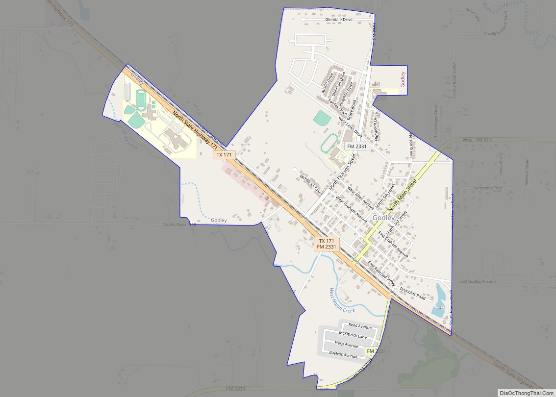
Online Interactive Map
Click on ![]() to view map in "full screen" mode.
to view map in "full screen" mode.
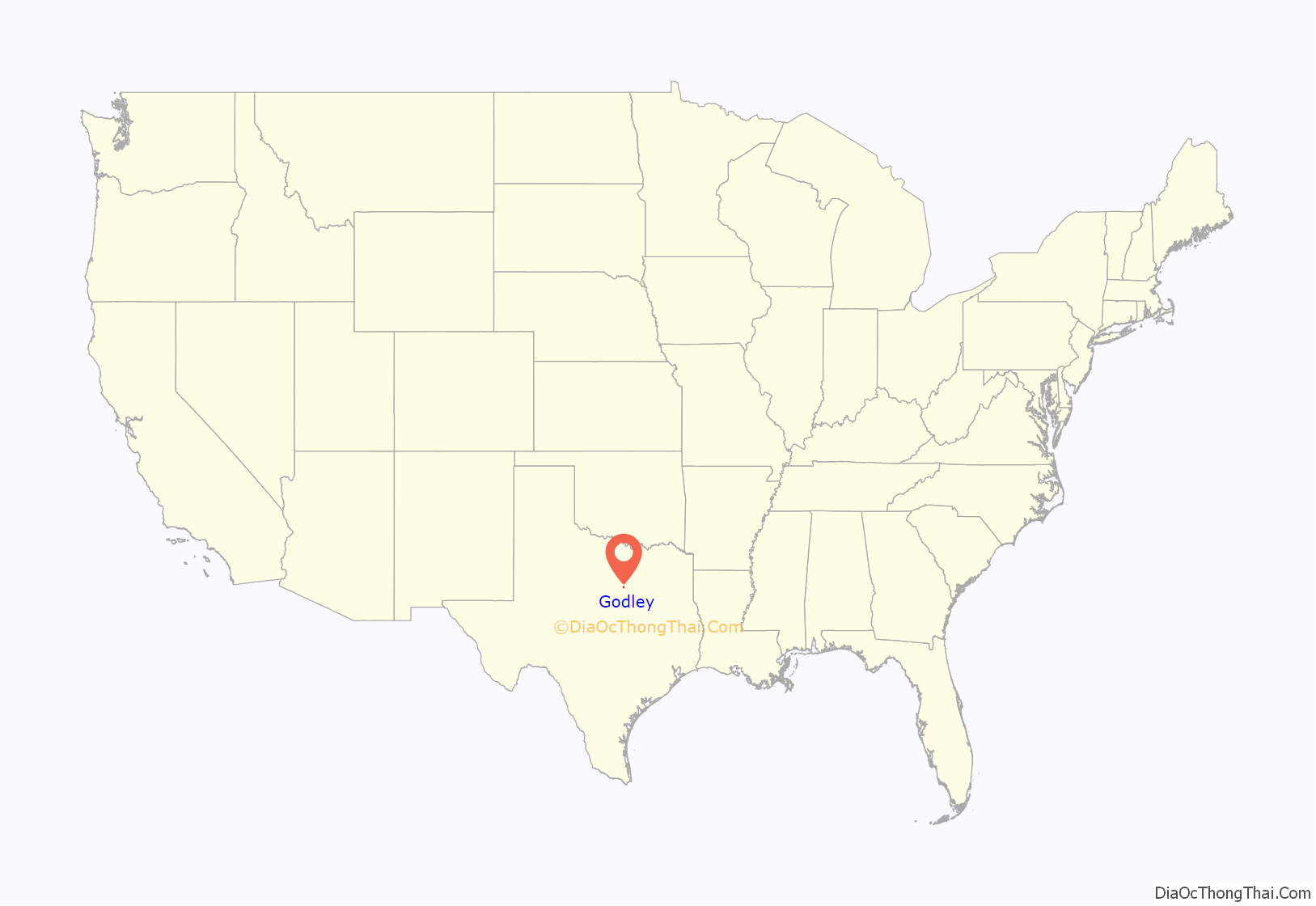
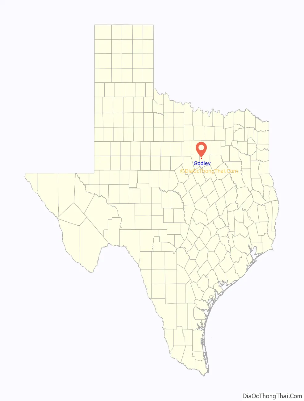
Godley location map. Where is Godley city?
History
Godley was established in 1886 and named for R. B. Godley, a Cleburne lumber merchant who donated an 8-acre (3.2 ha) tract for a townsite and 20 acres (8.1 ha) of land as a right-of-way to the Gulf, Colorado and Santa Fe Railway. A station was constructed in 1886. By 1888, when the post office opened, Godley had a gristmill, three cotton gins, and two dairy-processing plants. Four years later it had two general stores. By the mid-1920s the population was 613. In 1930 it was 378, and twenty-two rated businesses operated locally. In the 1940s the town had a population of 317 and twenty businesses. By 1956 it had a population of 424 and sixteen businesses, and by 1990 it had 569 people and twelve businesses.
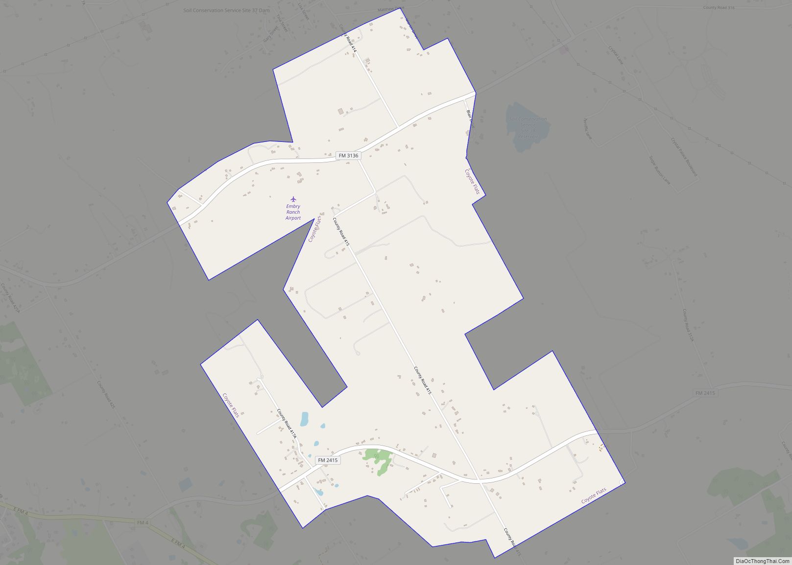
Godley Road Map

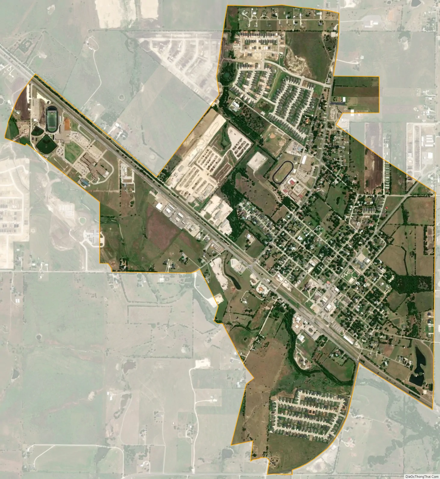
Godley city Satellite Map
Geography
Godley is located at 32°26′54″N 97°31′46″W / 32.44833°N 97.52944°W / 32.44833; -97.52944 (32.448427, –97.529520). Via Highway 171 it is 11 miles (18 km) northwest of Cleburne, the Johnson county seat, and 8 miles (13 km) southeast of Cresson. It is 30 miles (48 km) southwest of downtown Fort Worth.
According to the United States Census Bureau, Godley has a total area of 1.7 square miles (4.3 km), of which 0.01 square miles (0.02 km), or 0.39%, are water. It lies near the headwaters of the Nolan River watershed, a tributary of the Brazos River.
See also
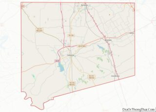
Map of Texas State and its subdivision:- Anderson
- Andrews
- Angelina
- Aransas
- Archer
- Armstrong
- Atascosa
- Austin
- Bailey
- Bandera
- Bastrop
- Baylor
- Bee
- Bell
- Bexar
- Blanco
- Borden
- Bosque
- Bowie
- Brazoria
- Brazos
- Brewster
- Briscoe
- Brooks
- Brown
- Burleson
- Burnet
- Caldwell
- Calhoun
- Callahan
- Cameron
- Camp
- Carson
- Cass
- Castro
- Chambers
- Cherokee
- Childress
- Clay
- Cochran
- Coke
- Coleman
- Collin
- Collingsworth
- Colorado
- Comal
- Comanche
- Concho
- Cooke
- Coryell
- Cottle
- Crane
- Crockett
- Crosby
- Culberson
- Dallam
- Dallas
- Dawson
- Deaf Smith
- Delta
- Denton
- Dewitt
- Dickens
- Dimmit
- Donley
- Duval
- Eastland
- Ector
- Edwards
- El Paso
- Ellis
- Erath
- Falls
- Fannin
- Fayette
- Fisher
- Floyd
- Foard
- Fort Bend
- Franklin
- Freestone
- Frio
- Gaines
- Galveston
- Garza
- Gillespie
- Glasscock
- Goliad
- Gonzales
- Gray
- Grayson
- Gregg
- Grimes
- Guadalupe
- Hale
- Hall
- Hamilton
- Hansford
- Hardeman
- Hardin
- Harris
- Harrison
- Hartley
- Haskell
- Hays
- Hemphill
- Henderson
- Hidalgo
- Hill
- Hockley
- Hood
- Hopkins
- Houston
- Howard
- Hudspeth
- Hunt
- Hutchinson
- Irion
- Jack
- Jackson
- Jasper
- Jeff Davis
- Jefferson
- Jim Hogg
- Jim Wells
- Johnson
- Jones
- Karnes
- Kaufman
- Kendall
- Kenedy
- Kent
- Kerr
- Kimble
- King
- Kinney
- Kleberg
- Knox
- La Salle
- Lamar
- Lamb
- Lampasas
- Lavaca
- Lee
- Leon
- Liberty
- Limestone
- Lipscomb
- Live Oak
- Llano
- Loving
- Lubbock
- Lynn
- Madison
- Marion
- Martin
- Mason
- Matagorda
- Maverick
- McCulloch
- McLennan
- McMullen
- Medina
- Menard
- Midland
- Milam
- Mills
- Mitchell
- Montague
- Montgomery
- Moore
- Morris
- Motley
- Nacogdoches
- Navarro
- Newton
- Nolan
- Nueces
- Ochiltree
- Oldham
- Orange
- Palo Pinto
- Panola
- Parker
- Parmer
- Pecos
- Polk
- Potter
- Presidio
- Rains
- Randall
- Reagan
- Real
- Red River
- Reeves
- Refugio
- Roberts
- Robertson
- Rockwall
- Runnels
- Rusk
- Sabine
- San Augustine
- San Jacinto
- San Patricio
- San Saba
- Schleicher
- Scurry
- Shackelford
- Shelby
- Sherman
- Smith
- Somervell
- Starr
- Stephens
- Sterling
- Stonewall
- Sutton
- Swisher
- Tarrant
- Taylor
- Terrell
- Terry
- Throckmorton
- Titus
- Tom Green
- Travis
- Trinity
- Tyler
- Upshur
- Upton
- Uvalde
- Val Verde
- Van Zandt
- Victoria
- Walker
- Waller
- Ward
- Washington
- Webb
- Wharton
- Wheeler
- Wichita
- Wilbarger
- Willacy
- Williamson
- Wilson
- Winkler
- Wise
- Wood
- Yoakum
- Young
- Zapata
- Zavala
- Alabama
- Alaska
- Arizona
- Arkansas
- California
- Colorado
- Connecticut
- Delaware
- District of Columbia
- Florida
- Georgia
- Hawaii
- Idaho
- Illinois
- Indiana
- Iowa
- Kansas
- Kentucky
- Louisiana
- Maine
- Maryland
- Massachusetts
- Michigan
- Minnesota
- Mississippi
- Missouri
- Montana
- Nebraska
- Nevada
- New Hampshire
- New Jersey
- New Mexico
- New York
- North Carolina
- North Dakota
- Ohio
- Oklahoma
- Oregon
- Pennsylvania
- Rhode Island
- South Carolina
- South Dakota
- Tennessee
- Texas
- Utah
- Vermont
- Virginia
- Washington
- West Virginia
- Wisconsin
- Wyoming