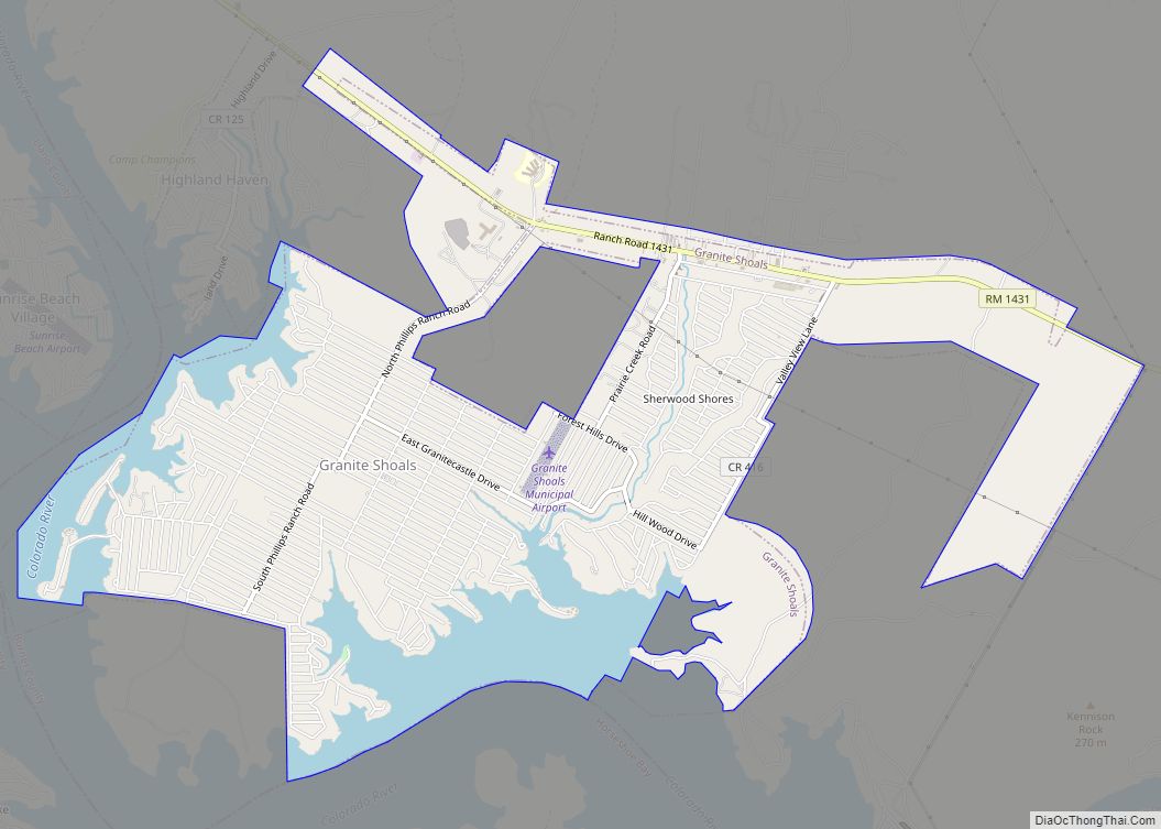
Granite Shoals is a city in Burnet County, Texas, United States. The 2010 census population was 4,910.
| Name: | Granite Shoals city |
|---|---|
| LSAD Code: | 25 |
| LSAD Description: | city (suffix) |
| State: | Texas |
| County: | Burnet County |
| Incorporated: | 1966 |
| Elevation: | 879 ft (268 m) |
| Total Area: | 6.91 sq mi (17.90 km²) |
| Land Area: | 5.77 sq mi (14.95 km²) |
| Water Area: | 1.14 sq mi (2.95 km²) |
| Total Population: | 4,910 |
| Population Density: | 881.17/sq mi (340.23/km²) |
| ZIP code: | 78654 |
| Area code: | 830 |
| FIPS code: | 4830584 |
| GNISfeature ID: | 1388555 |
| Website: | www.graniteshoals.org |
Online Interactive Map
Click on ![]() to view map in "full screen" mode.
to view map in "full screen" mode.
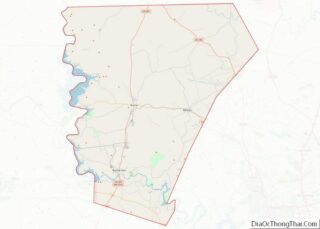
Granite Shoals location map. Where is Granite Shoals city?


History
Granite Shoals was incorporated as a city by a vote of area residents in 1966. The original city comprised various sections of the Sherwood Shores subdivision, which was at the time the largest platted subdivision in the state of Texas. The Sherwood Shores subdivisions were created from the Phillips, Naumann and Ebeling ranches in 1962. In November 2005, residents voted to adopt a home rule charter to govern the city. In 2006, the city hired its first city manager.
The major industry in Granite Shoals is granite mining, and the city is popular with lake enthusiasts with its 18 city parks, 14 of which are located on Lake Lyndon B. Johnson. The city’s municipal complex is home to the Andy Roddick Foundation International Tennis Center, a planned center of 18 adult courts and at least two QuickStart courts for kids. The QuickStart courts became operational in 2010, and fundraising events are in place for the remainder of the center. In 2011, the city received a grant to fund the Leonel Manzano Hike, Bike and Run Trails at its municipal complex, which will have 2-mile and 1/2-mile trails. Leonel Manzano grew up in Granite Shoals. The city is undergoing strong growth with the opening of a new bank and several new stores.
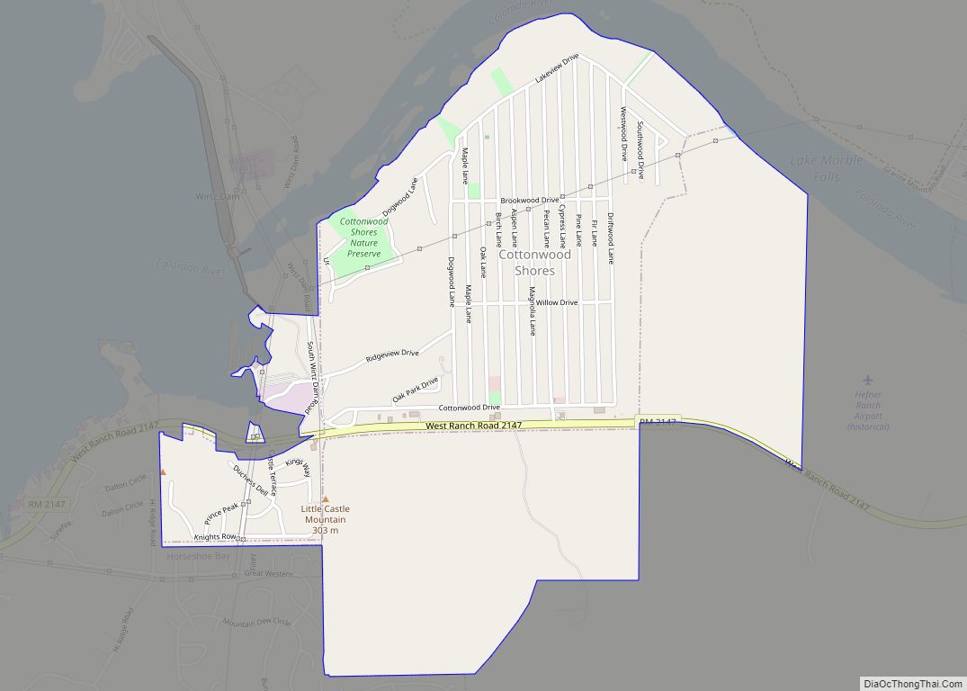
Granite Shoals Road Map

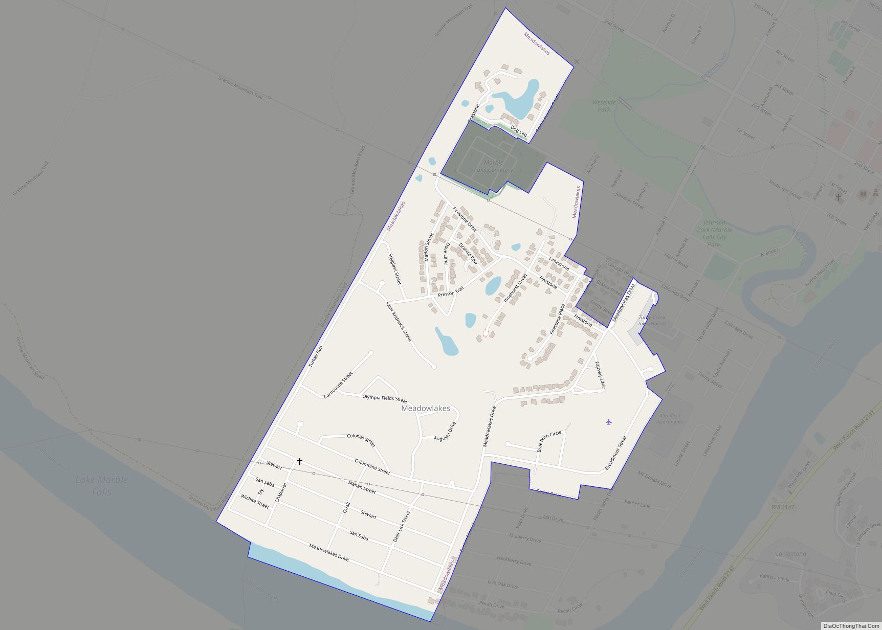
Granite Shoals city Satellite Map

Geography
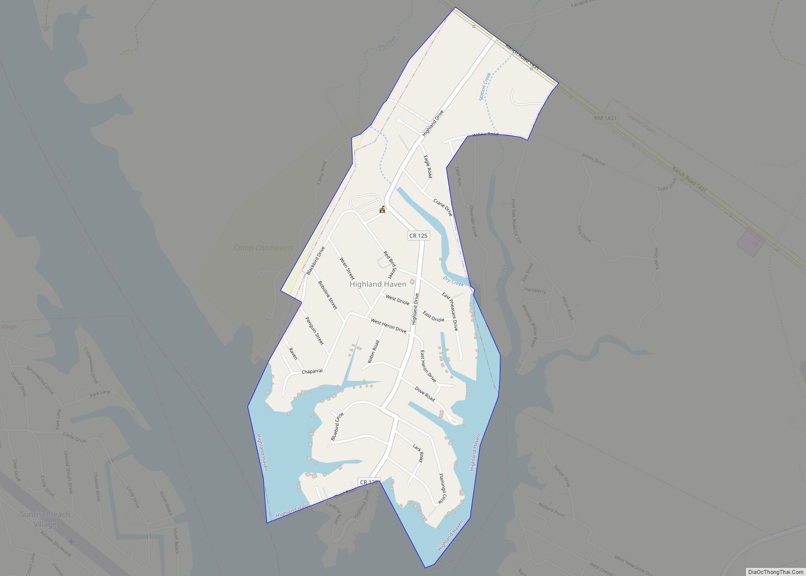
Granite Shoals is located in southwestern Burnet County at 30°35′13″N 98°22′54″W / 30.587032°N 98.381693°W / 30.587032; -98.381693. This is 7 miles (11 km) west of Marble Falls and 56 miles (90 km) northwest of downtown Austin, on a bend on the east shore of Lake Lyndon B. Johnson.
According to the United States Census Bureau, the city has a total area of 5.7 square miles (14.7 km), of which 4.5 square miles (11.7 km) is land and 1.2 square miles (3.0 km), or 20.25%, is water.
See also
Map of Texas State and its subdivision:- Anderson
- Andrews
- Angelina
- Aransas
- Archer
- Armstrong
- Atascosa
- Austin
- Bailey
- Bandera
- Bastrop
- Baylor
- Bee
- Bell
- Bexar
- Blanco
- Borden
- Bosque
- Bowie
- Brazoria
- Brazos
- Brewster
- Briscoe
- Brooks
- Brown
- Burleson
- Burnet
- Caldwell
- Calhoun
- Callahan
- Cameron
- Camp
- Carson
- Cass
- Castro
- Chambers
- Cherokee
- Childress
- Clay
- Cochran
- Coke
- Coleman
- Collin
- Collingsworth
- Colorado
- Comal
- Comanche
- Concho
- Cooke
- Coryell
- Cottle
- Crane
- Crockett
- Crosby
- Culberson
- Dallam
- Dallas
- Dawson
- Deaf Smith
- Delta
- Denton
- Dewitt
- Dickens
- Dimmit
- Donley
- Duval
- Eastland
- Ector
- Edwards
- El Paso
- Ellis
- Erath
- Falls
- Fannin
- Fayette
- Fisher
- Floyd
- Foard
- Fort Bend
- Franklin
- Freestone
- Frio
- Gaines
- Galveston
- Garza
- Gillespie
- Glasscock
- Goliad
- Gonzales
- Gray
- Grayson
- Gregg
- Grimes
- Guadalupe
- Hale
- Hall
- Hamilton
- Hansford
- Hardeman
- Hardin
- Harris
- Harrison
- Hartley
- Haskell
- Hays
- Hemphill
- Henderson
- Hidalgo
- Hill
- Hockley
- Hood
- Hopkins
- Houston
- Howard
- Hudspeth
- Hunt
- Hutchinson
- Irion
- Jack
- Jackson
- Jasper
- Jeff Davis
- Jefferson
- Jim Hogg
- Jim Wells
- Johnson
- Jones
- Karnes
- Kaufman
- Kendall
- Kenedy
- Kent
- Kerr
- Kimble
- King
- Kinney
- Kleberg
- Knox
- La Salle
- Lamar
- Lamb
- Lampasas
- Lavaca
- Lee
- Leon
- Liberty
- Limestone
- Lipscomb
- Live Oak
- Llano
- Loving
- Lubbock
- Lynn
- Madison
- Marion
- Martin
- Mason
- Matagorda
- Maverick
- McCulloch
- McLennan
- McMullen
- Medina
- Menard
- Midland
- Milam
- Mills
- Mitchell
- Montague
- Montgomery
- Moore
- Morris
- Motley
- Nacogdoches
- Navarro
- Newton
- Nolan
- Nueces
- Ochiltree
- Oldham
- Orange
- Palo Pinto
- Panola
- Parker
- Parmer
- Pecos
- Polk
- Potter
- Presidio
- Rains
- Randall
- Reagan
- Real
- Red River
- Reeves
- Refugio
- Roberts
- Robertson
- Rockwall
- Runnels
- Rusk
- Sabine
- San Augustine
- San Jacinto
- San Patricio
- San Saba
- Schleicher
- Scurry
- Shackelford
- Shelby
- Sherman
- Smith
- Somervell
- Starr
- Stephens
- Sterling
- Stonewall
- Sutton
- Swisher
- Tarrant
- Taylor
- Terrell
- Terry
- Throckmorton
- Titus
- Tom Green
- Travis
- Trinity
- Tyler
- Upshur
- Upton
- Uvalde
- Val Verde
- Van Zandt
- Victoria
- Walker
- Waller
- Ward
- Washington
- Webb
- Wharton
- Wheeler
- Wichita
- Wilbarger
- Willacy
- Williamson
- Wilson
- Winkler
- Wise
- Wood
- Yoakum
- Young
- Zapata
- Zavala
- Alabama
- Alaska
- Arizona
- Arkansas
- California
- Colorado
- Connecticut
- Delaware
- District of Columbia
- Florida
- Georgia
- Hawaii
- Idaho
- Illinois
- Indiana
- Iowa
- Kansas
- Kentucky
- Louisiana
- Maine
- Maryland
- Massachusetts
- Michigan
- Minnesota
- Mississippi
- Missouri
- Montana
- Nebraska
- Nevada
- New Hampshire
- New Jersey
- New Mexico
- New York
- North Carolina
- North Dakota
- Ohio
- Oklahoma
- Oregon
- Pennsylvania
- Rhode Island
- South Carolina
- South Dakota
- Tennessee
- Texas
- Utah
- Vermont
- Virginia
- Washington
- West Virginia
- Wisconsin
- Wyoming