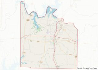
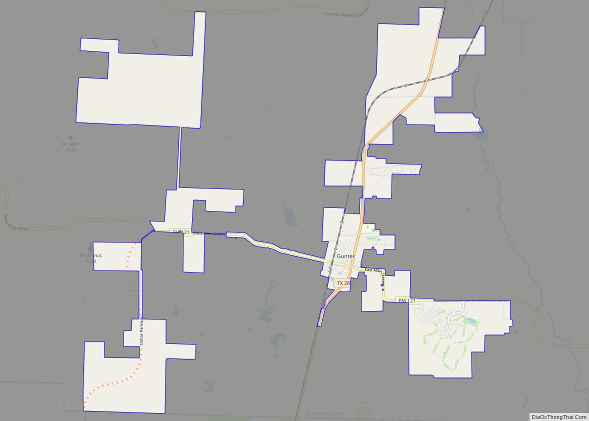
Gunter is a city in the southwestern corner of Grayson County, Texas, United States. The population was 2,060 at the 2020 census, up from 1,498 at the 2010 census. It is part of the Sherman–Denison metropolitan area.
| Name: | Gunter city |
|---|---|
| LSAD Code: | 25 |
| LSAD Description: | city (suffix) |
| State: | Texas |
| County: | Grayson County |
| Elevation: | 705 ft (215 m) |
| Total Area: | 17.70 sq mi (45.85 km²) |
| Land Area: | 17.59 sq mi (45.56 km²) |
| Water Area: | 0.11 sq mi (0.29 km²) |
| Total Population: | 2,060 |
| Population Density: | 95.22/sq mi (36.77/km²) |
| ZIP code: | 75058 |
| Area code: | 903 |
| FIPS code: | 4831616 |
| GNISfeature ID: | 1373952 |
| Website: | ci.gunter.tx.us |
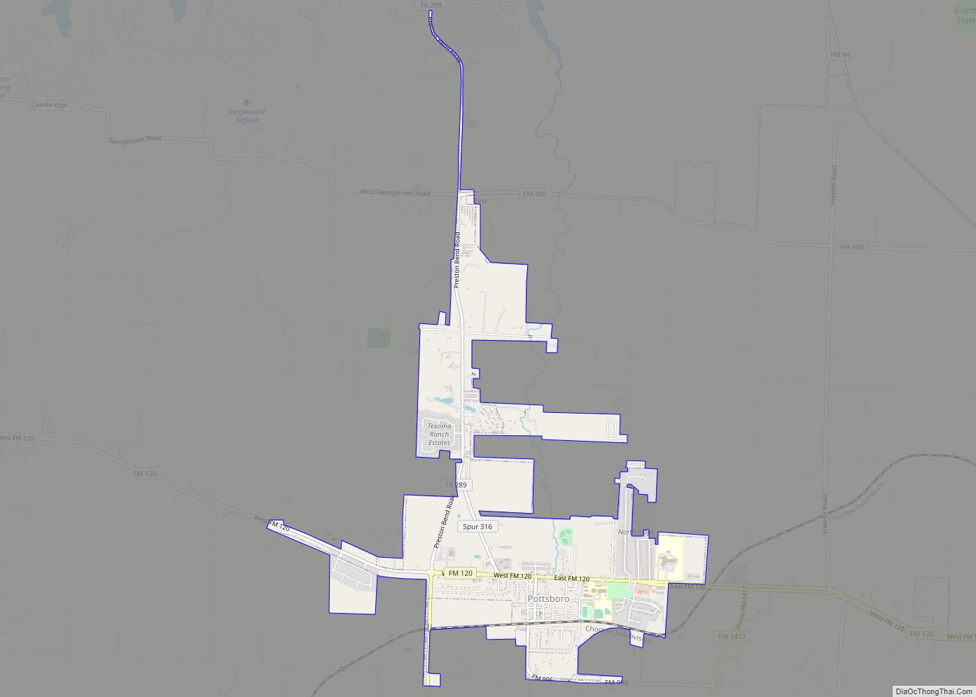
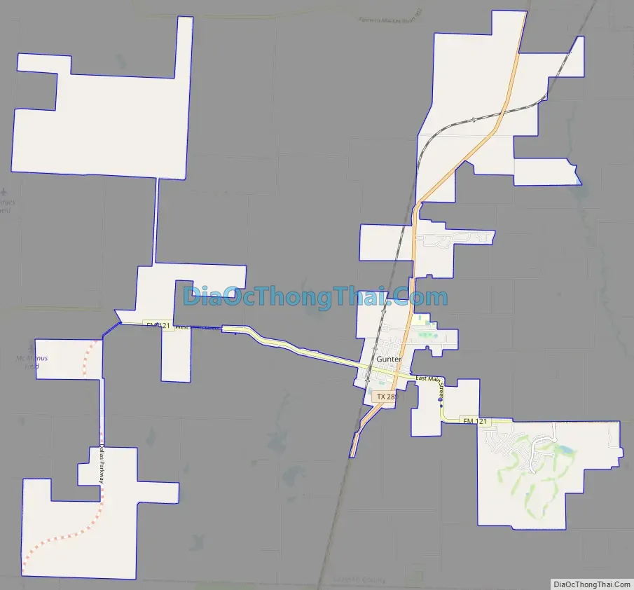
Online Interactive Map
Click on ![]() to view map in "full screen" mode.
to view map in "full screen" mode.
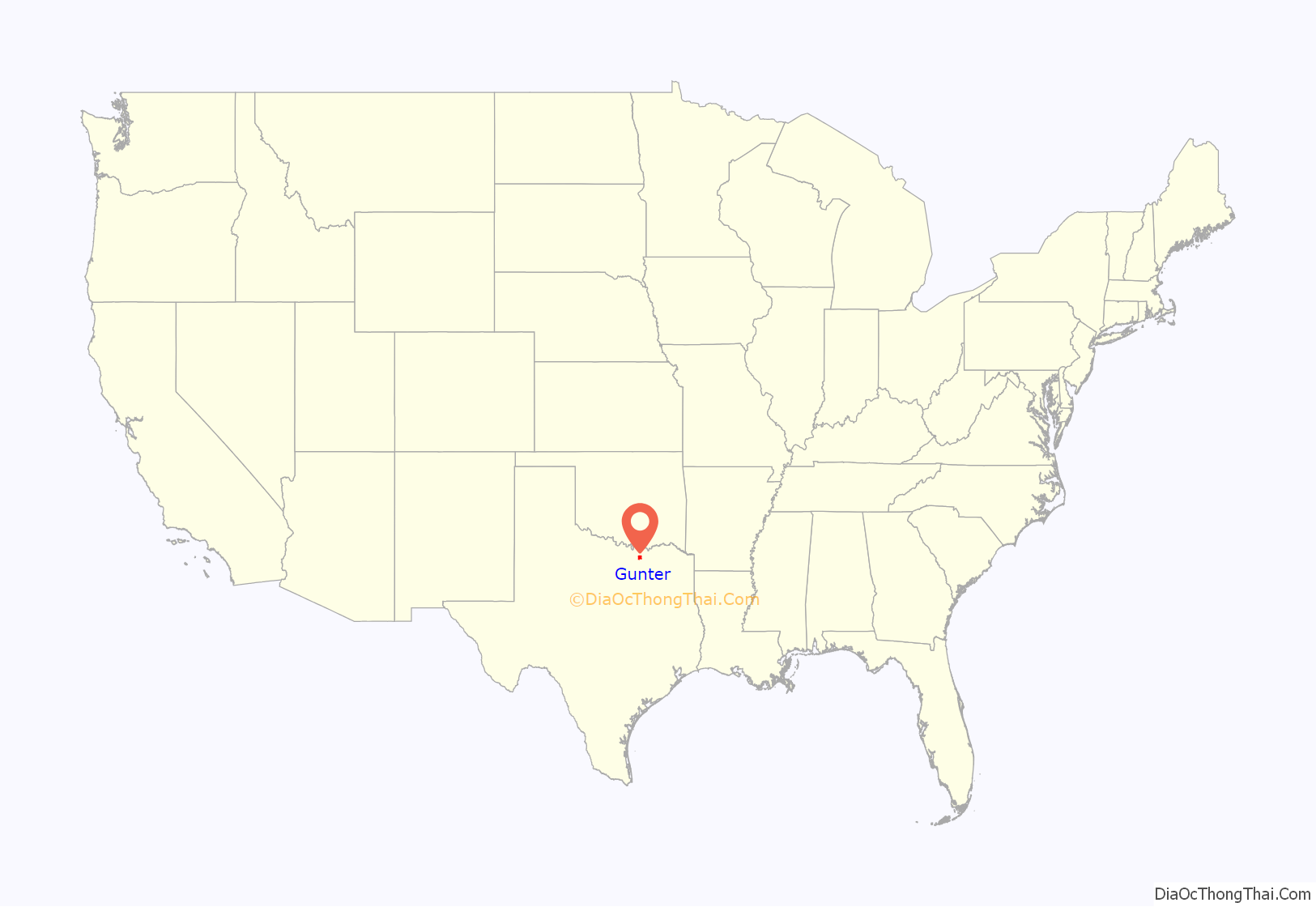
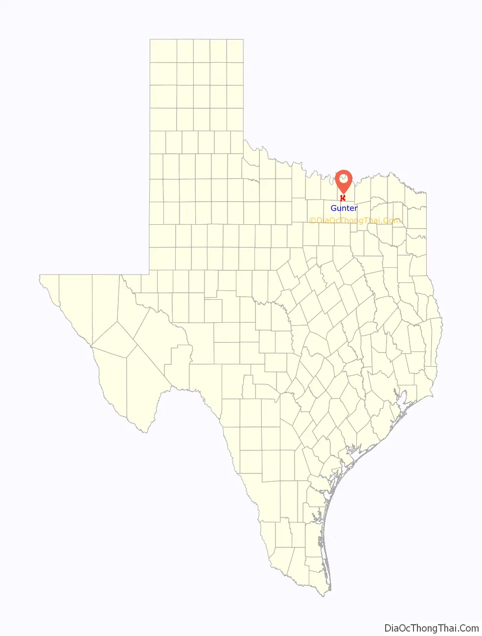
Gunter location map. Where is Gunter city?
History
Gunter was founded in 1902 (other sources report 1901, with a post office as early as 1898) when the family of John (a/k/a Jot) Gunter deeded 328 acres (1.33 km) for the original townsite, near the intersection of current State Highway 289 and Farm to Market Road 121. The first residence was established in 1903 by Albert Earthman, who would later charter the First National Bank in Gunter. A second bank, the First State Bank, would later open.
Gunter steadily grew until 1924, when the First State Bank (having outlasted the First National Bank) closed its doors, leaving many businessmen and farmers in financial ruin. The Great Depression and two devastating fires in 1930 and 1948 further damaged the local economy.
However, Gunter began to grow again in the 1950s, and experienced its greatest growth in the last two decades, growing 37% in population during the 1990s. Gunter has started to experience overflow growth from the northern Metroplex suburbs, due to its location on State Highway 289 approximately 10 miles (16 km) north of Celina, as well as its proximity to the Sherman–Denison metropolitan area and nearby Lake Texoma. Recent developments include the opening of a Sonic Drive-In and a Dollar General. In May 2002, a branch of Ada, Oklahoma-based Landmark Bank opened in Gunter, providing the town its first financial institution in nearly 90 years.
Gunter Road Map
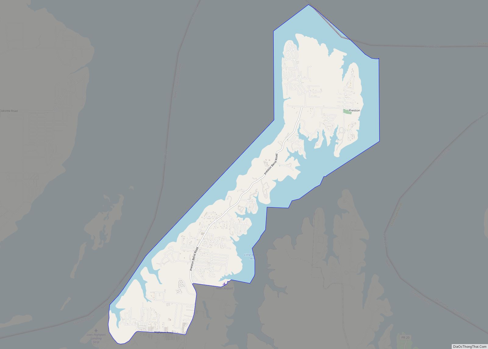
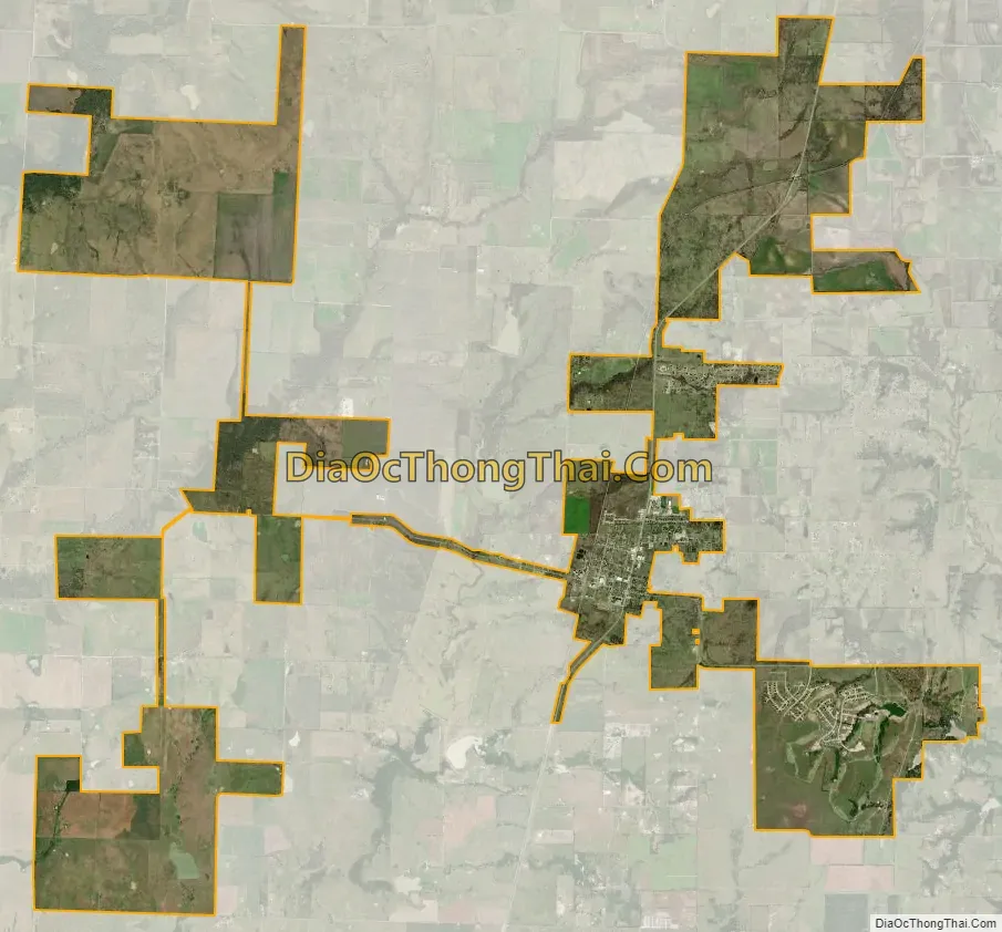
Gunter city Satellite Map
Geography
Gunter is located in southwestern Grayson County at 33°27′5″N 96°44′40″W / 33.45139°N 96.74444°W / 33.45139; -96.74444 (33.451331, –96.744479). State Highway 289 leads north 18 miles (29 km) to Sherman, the county seat, and south 10 miles (16 km) to Celina.
The city’s boundaries expanded dramatically during the decade between 2000 and 2010. According to the United States Census Bureau, the city had a total area of 1.5 square miles (3.9 km), all of it land, in 2000, which had risen to 17.6 square miles (45.7 km) in 2010, of which 17.5 square miles (45.4 km) were land and 0.1 square miles (0.3 km), or 0.63%, were water.
See also
Map of Texas State and its subdivision:- Anderson
- Andrews
- Angelina
- Aransas
- Archer
- Armstrong
- Atascosa
- Austin
- Bailey
- Bandera
- Bastrop
- Baylor
- Bee
- Bell
- Bexar
- Blanco
- Borden
- Bosque
- Bowie
- Brazoria
- Brazos
- Brewster
- Briscoe
- Brooks
- Brown
- Burleson
- Burnet
- Caldwell
- Calhoun
- Callahan
- Cameron
- Camp
- Carson
- Cass
- Castro
- Chambers
- Cherokee
- Childress
- Clay
- Cochran
- Coke
- Coleman
- Collin
- Collingsworth
- Colorado
- Comal
- Comanche
- Concho
- Cooke
- Coryell
- Cottle
- Crane
- Crockett
- Crosby
- Culberson
- Dallam
- Dallas
- Dawson
- Deaf Smith
- Delta
- Denton
- Dewitt
- Dickens
- Dimmit
- Donley
- Duval
- Eastland
- Ector
- Edwards
- El Paso
- Ellis
- Erath
- Falls
- Fannin
- Fayette
- Fisher
- Floyd
- Foard
- Fort Bend
- Franklin
- Freestone
- Frio
- Gaines
- Galveston
- Garza
- Gillespie
- Glasscock
- Goliad
- Gonzales
- Gray
- Grayson
- Gregg
- Grimes
- Guadalupe
- Hale
- Hall
- Hamilton
- Hansford
- Hardeman
- Hardin
- Harris
- Harrison
- Hartley
- Haskell
- Hays
- Hemphill
- Henderson
- Hidalgo
- Hill
- Hockley
- Hood
- Hopkins
- Houston
- Howard
- Hudspeth
- Hunt
- Hutchinson
- Irion
- Jack
- Jackson
- Jasper
- Jeff Davis
- Jefferson
- Jim Hogg
- Jim Wells
- Johnson
- Jones
- Karnes
- Kaufman
- Kendall
- Kenedy
- Kent
- Kerr
- Kimble
- King
- Kinney
- Kleberg
- Knox
- La Salle
- Lamar
- Lamb
- Lampasas
- Lavaca
- Lee
- Leon
- Liberty
- Limestone
- Lipscomb
- Live Oak
- Llano
- Loving
- Lubbock
- Lynn
- Madison
- Marion
- Martin
- Mason
- Matagorda
- Maverick
- McCulloch
- McLennan
- McMullen
- Medina
- Menard
- Midland
- Milam
- Mills
- Mitchell
- Montague
- Montgomery
- Moore
- Morris
- Motley
- Nacogdoches
- Navarro
- Newton
- Nolan
- Nueces
- Ochiltree
- Oldham
- Orange
- Palo Pinto
- Panola
- Parker
- Parmer
- Pecos
- Polk
- Potter
- Presidio
- Rains
- Randall
- Reagan
- Real
- Red River
- Reeves
- Refugio
- Roberts
- Robertson
- Rockwall
- Runnels
- Rusk
- Sabine
- San Augustine
- San Jacinto
- San Patricio
- San Saba
- Schleicher
- Scurry
- Shackelford
- Shelby
- Sherman
- Smith
- Somervell
- Starr
- Stephens
- Sterling
- Stonewall
- Sutton
- Swisher
- Tarrant
- Taylor
- Terrell
- Terry
- Throckmorton
- Titus
- Tom Green
- Travis
- Trinity
- Tyler
- Upshur
- Upton
- Uvalde
- Val Verde
- Van Zandt
- Victoria
- Walker
- Waller
- Ward
- Washington
- Webb
- Wharton
- Wheeler
- Wichita
- Wilbarger
- Willacy
- Williamson
- Wilson
- Winkler
- Wise
- Wood
- Yoakum
- Young
- Zapata
- Zavala
- Alabama
- Alaska
- Arizona
- Arkansas
- California
- Colorado
- Connecticut
- Delaware
- District of Columbia
- Florida
- Georgia
- Hawaii
- Idaho
- Illinois
- Indiana
- Iowa
- Kansas
- Kentucky
- Louisiana
- Maine
- Maryland
- Massachusetts
- Michigan
- Minnesota
- Mississippi
- Missouri
- Montana
- Nebraska
- Nevada
- New Hampshire
- New Jersey
- New Mexico
- New York
- North Carolina
- North Dakota
- Ohio
- Oklahoma
- Oregon
- Pennsylvania
- Rhode Island
- South Carolina
- South Dakota
- Tennessee
- Texas
- Utah
- Vermont
- Virginia
- Washington
- West Virginia
- Wisconsin
- Wyoming