Harlingen (/ˈhɑːrlɪndʒɪn/ HAR-lin-jin) is a city in Cameron County in the central region of the Rio Grande Valley of the southern part of the U.S. state of Texas, about 30 miles (48 km) from the coast of the Gulf of Mexico. The city covers more than 40 square miles (104 km) and is the second-largest city in Cameron County, as well as the fourth-largest in the Rio Grande Valley. As of the 2020 census, the city had a population of 71,892.
Harlingen is a principal city of the Brownsville–Harlingen metropolitan area, which is part of the larger Brownsville–Harlingen–Raymondville combined statistical area, included in the Matamoros–Brownsville metropolitan region.
| Name: | Harlingen city |
|---|---|
| LSAD Code: | 25 |
| LSAD Description: | city (suffix) |
| State: | Texas |
| County: | Cameron County |
| Founded: | 1904 |
| Elevation: | 39 ft (12 m) |
| Land Area: | 40.13 sq mi (103.93 km²) |
| Water Area: | 0.50 sq mi (1.29 km²) |
| Population Density: | 1,800/sq mi (680/km²) |
| ZIP code: | 78550-78553 |
| Area code: | 956 |
| FIPS code: | 4832372 |
| GNISfeature ID: | 1337354 |
| Website: | www.harlingentx.gov |
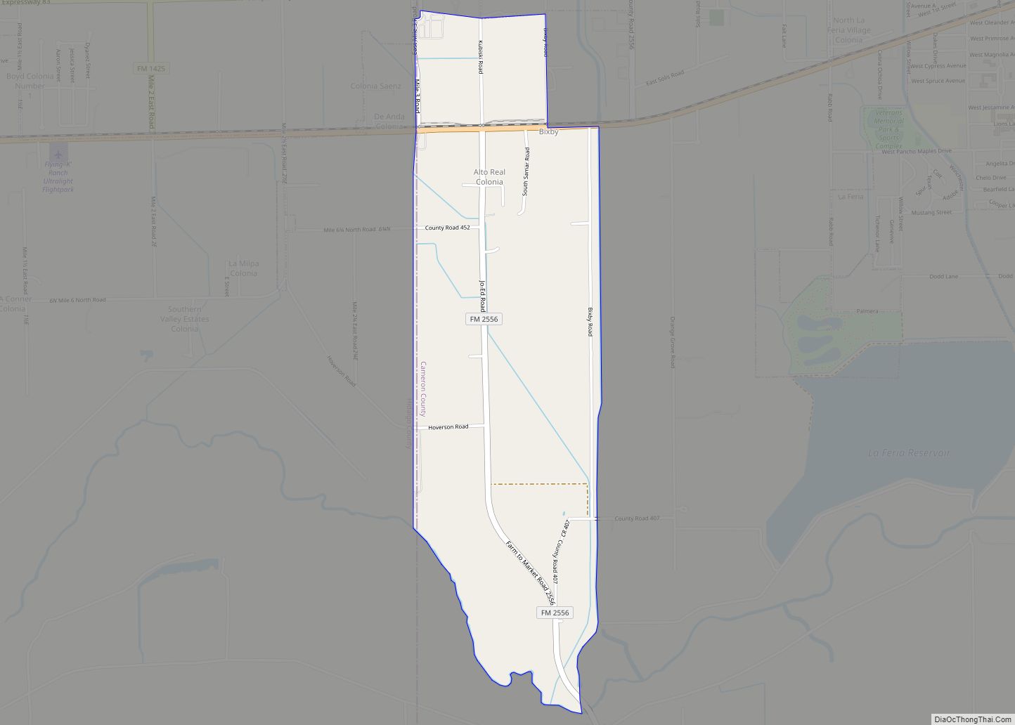
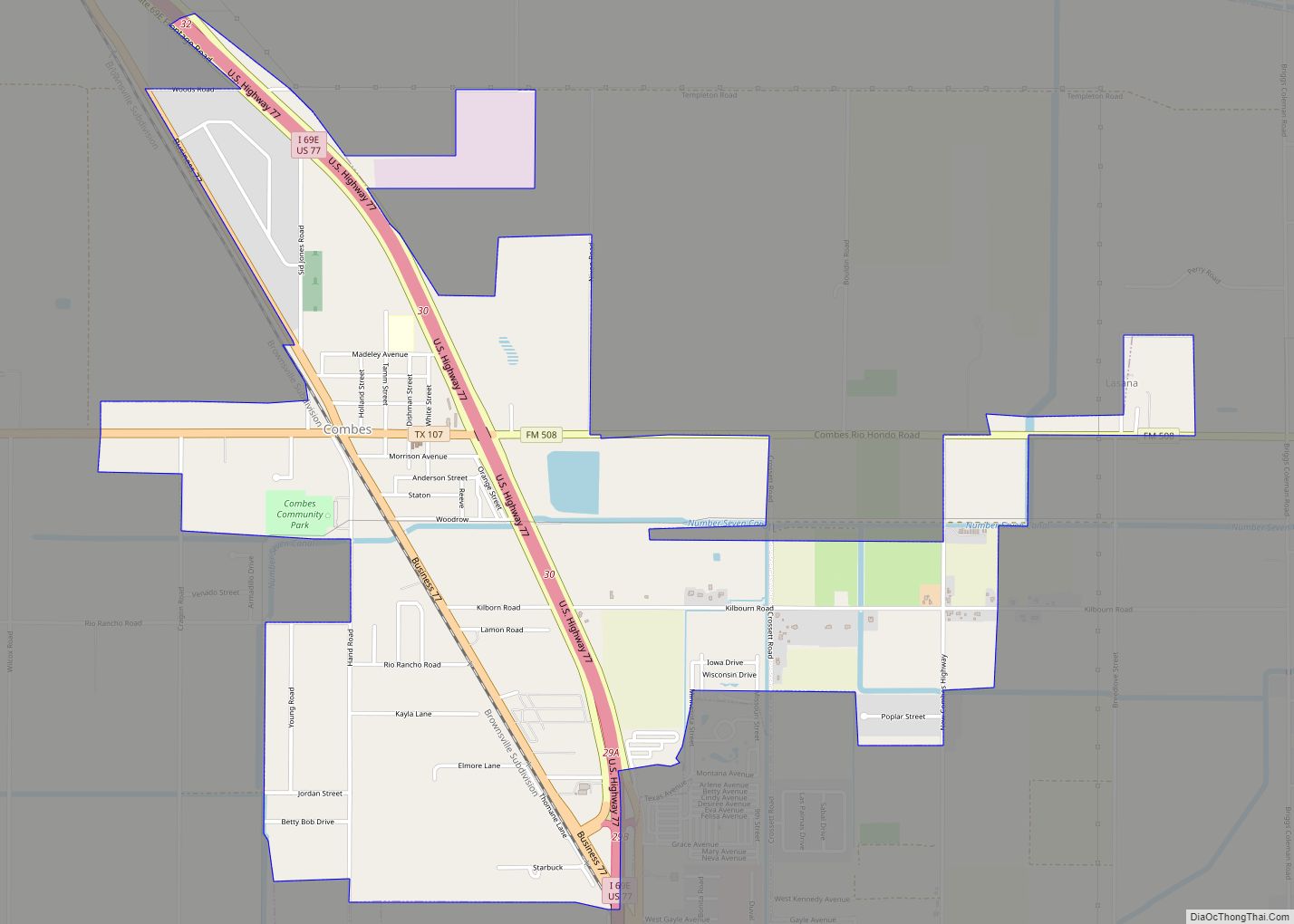
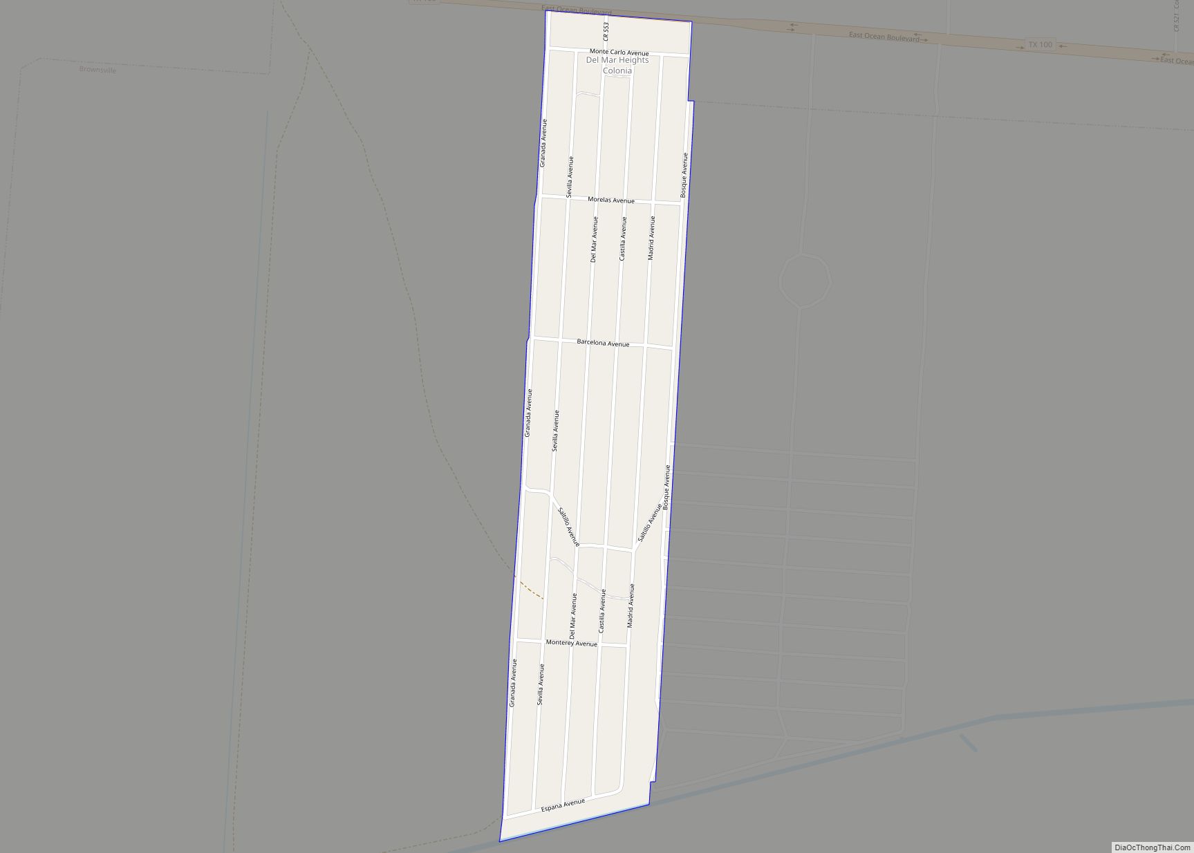
Online Interactive Map
Click on ![]() to view map in "full screen" mode.
to view map in "full screen" mode.
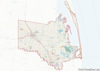
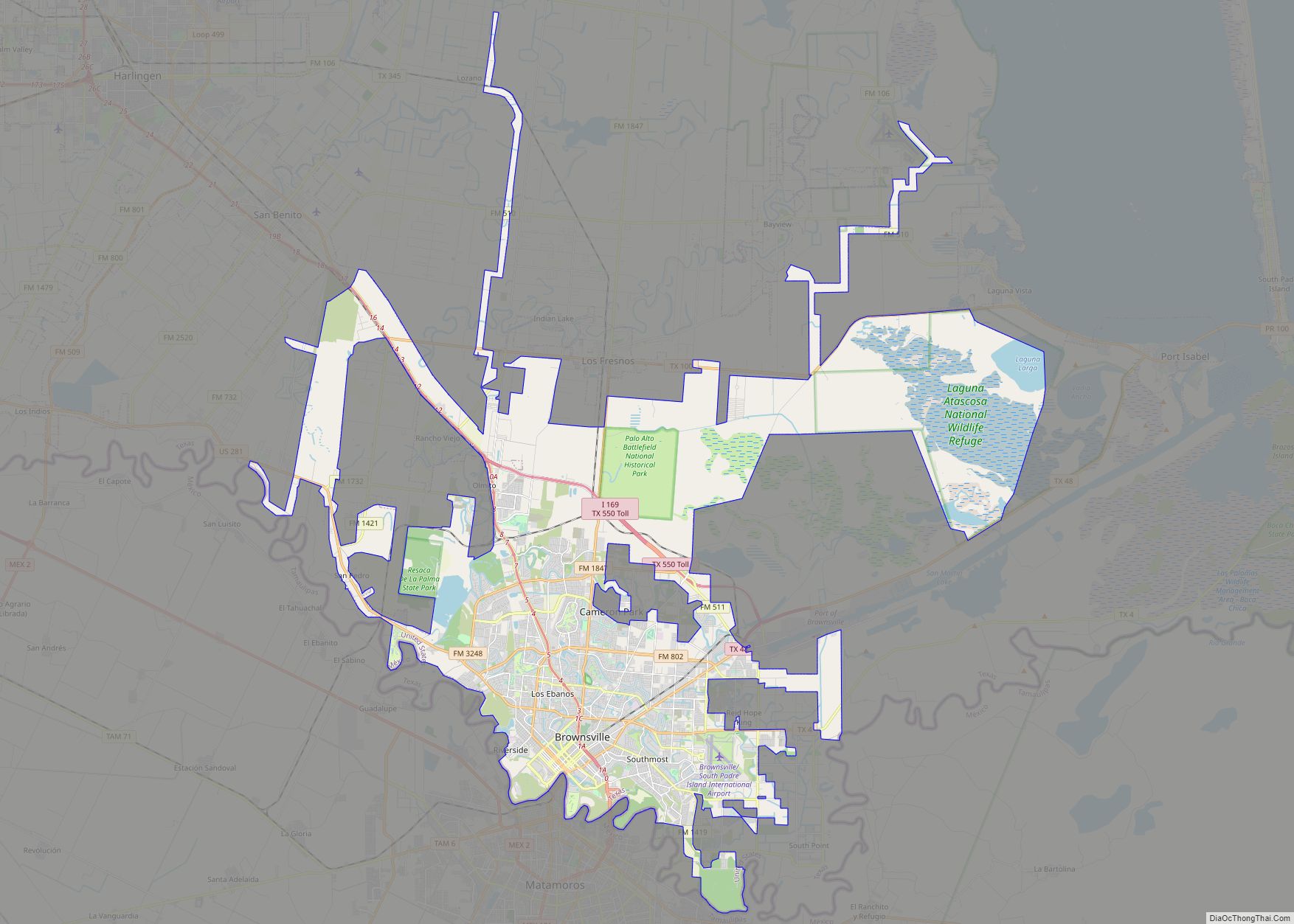
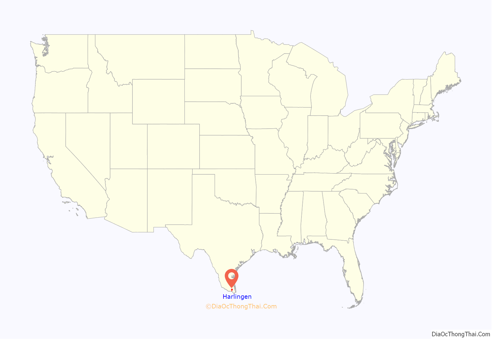
Harlingen location map. Where is Harlingen city?
History
Harlingen’s strategic location at the intersection of U.S. Route 77 and U.S. Route 83, co-designated as Interstate 69 East and Interstate 2, respectively, in northwestern Cameron County, fostered its development as a distribution, shipping, and industrial center. In 1904, Lon C. Hill (a man of Choctaw ancestry) envisioned the Rio Grande as a commercial waterway. He named the town he founded on the north bank after the Frisian city of Harlingen, in the Netherlands. The town’s post office was established that year. The first school opened with 15 pupils in 1905 near the Hill home, the first residence built in Harlingen. Harlingen incorporated on April 15, 1910, when the population totaled 1,126. In 1920, the census listed 1,748. The local economy at first was almost entirely agricultural, with the chief crops vegetables and cotton.
World War II military installations in Harlingen caused a jump in population from 23,000 in 1950 to 41,000 by 1960. Harlingen Army Air Field preceded Harlingen Air Force Base, which closed in 1962. The city’s population fell to 33,603 by 1972, then climbed to 40,824 by 1980. Local enterprise, focused on the purchase and use of the abandoned base and related housing, laid the groundwork for continuing progress through a diversified economy. The estimated population in July 1985 was 49,000, of which about 80% was Hispanic. In the late 1980s, income from tourism ranked second only to citrus fruit production, with grain and cotton next in order. The addition of wholesale and retail trade, light and medium manufacturing, and an array of service industries has broadened the economic base. Large-scale construction for multifaceted retirement communities is a new phase of industrial development.
The City of Harlingen operates a busy industrial airpark where bombers used to land. At Valley International Airport, the Confederate Air Force (now Commemorative Air Force) occupied hangar and apron space until 1991. The first hospital in Harlingen opened in 1923, and consisted of little more than two barracks as wings. The Valley Baptist Hospital was built nearby a few years later, and eventually the older hospital closed. The Valley Baptist Hospital has grown into the Valley Baptist Medical Center. The city’s outstanding network of health-care specialists and facilities parallels the growth of the still-expanding center. Also serving regional health needs are the South Texas State Chest Hospital, the State Hospital for Children, and the Rio Grande State Mental Health and Mental Retardation Center.
Besides public and church-affiliated schools, Harlingen students attend the University Preparatory School, the Marine Military Academy, Texas State Technical College, or Rio Grande Vocational and Rehabilitation classes. Civic and cultural development in Harlingen has kept pace with the growth of the community. Fraternal orders and civic organizations operating in the community include Rotary, Kiwanis, Lions, Optimist, 20–30, VFW, American Legion, and the Lower Valley Cotillion Club; a woman’s building is maintained as a center for the activities of the many woman’s clubs active in the city. Development and appreciation of the fine arts are encouraged by organizations such as the Rio Grande Valley Art League, the Art Forum, and the Rio Grande Valley Civic Association, which stages its winter concert series at the 2,300-seat Harlingen Municipal Auditorium. Each March, Harlingen is the site of the Rio Grande Valley International Music Festival. The city has two newspapers—the Harlingen Press, a weekly paper established in 1951, and the Valley Morning Star, a daily established in 1911. In 1990, the population was 48,735. In 1992, the city was named an All-America City, cited especially for its volunteer spirit and self-help programs. In 2000, the community had 57,564 inhabitants and 2,549 businesses.
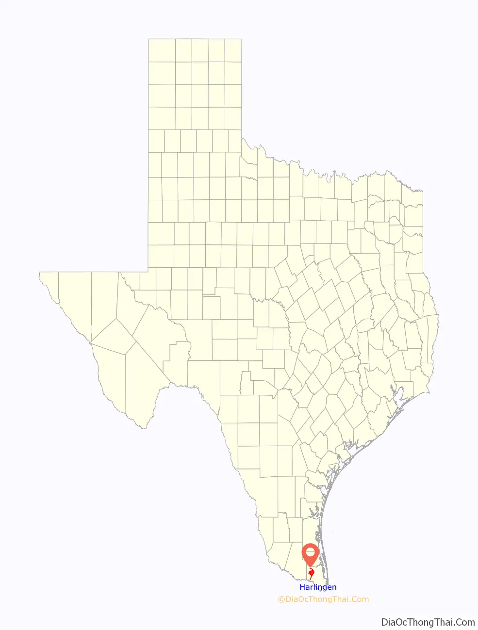
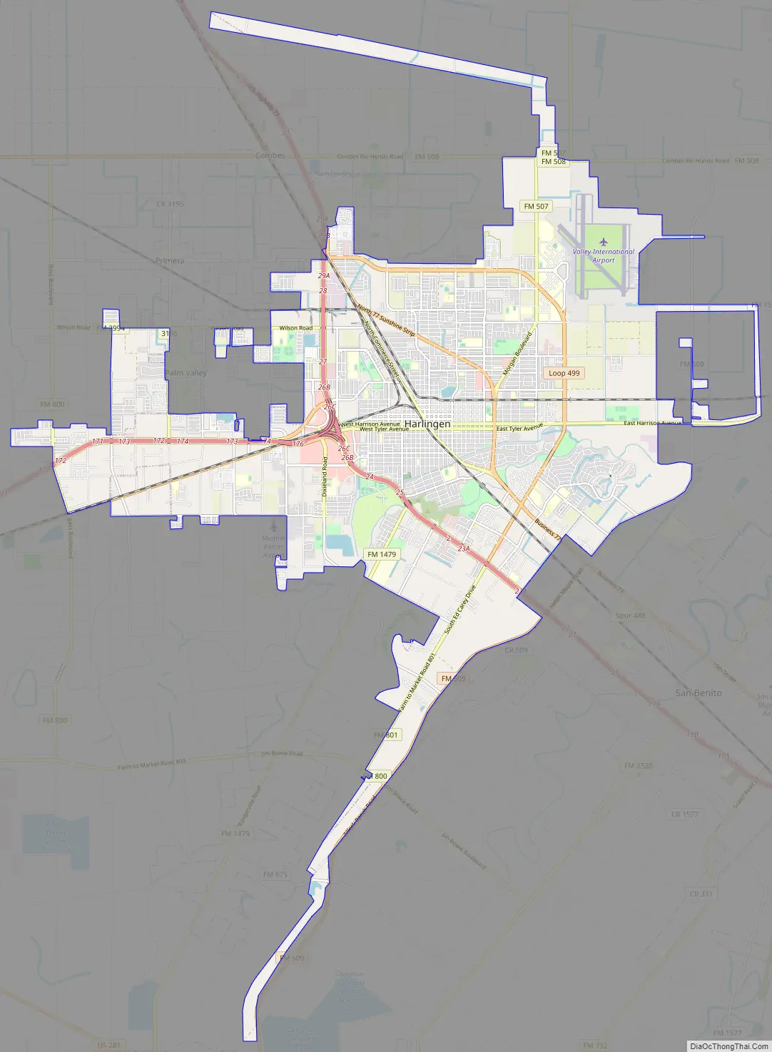
Harlingen Road Map
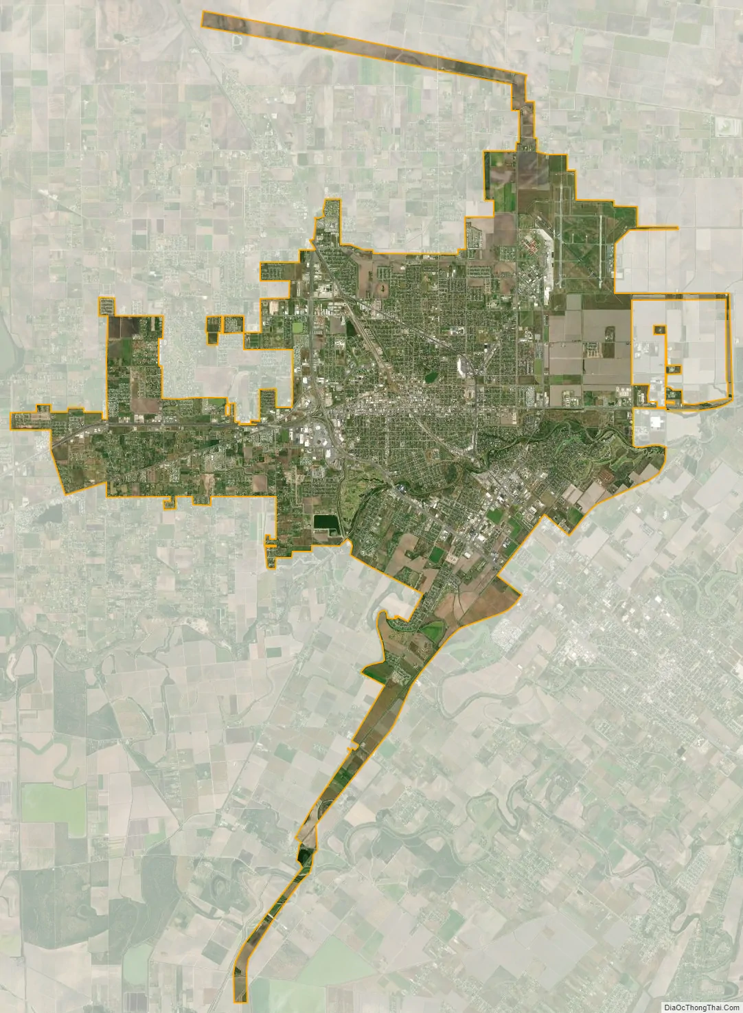
Harlingen city Satellite Map
Geography
According to the United States Census Bureau, the city has a total area of 40.3 square miles (104.4 km), of which 39.8 square miles (103.1 km) is land and 0.5 square miles (1.3 km), or 1.22%, is covered by water.
Soils in Harlingen range in texture from fine sandy loam to clay. They are neutral to moderately alkaline with pH of 7.2 to 8.5 (most commonly around 8.2), and are moderately well drained or well drained in most cases, with small areas of poorly drained, saline clays.
Climate
Harlingen has a humid subtropical climate (Köppen Cfa). Summers are long, and very humid with hot days and warm nights. Winters are very dry with warm days and cool nights. Precipitation peaks during September with 5.76 inches (146 mm) of precipitation falling.
See also
Map of Texas State and its subdivision:- Anderson
- Andrews
- Angelina
- Aransas
- Archer
- Armstrong
- Atascosa
- Austin
- Bailey
- Bandera
- Bastrop
- Baylor
- Bee
- Bell
- Bexar
- Blanco
- Borden
- Bosque
- Bowie
- Brazoria
- Brazos
- Brewster
- Briscoe
- Brooks
- Brown
- Burleson
- Burnet
- Caldwell
- Calhoun
- Callahan
- Cameron
- Camp
- Carson
- Cass
- Castro
- Chambers
- Cherokee
- Childress
- Clay
- Cochran
- Coke
- Coleman
- Collin
- Collingsworth
- Colorado
- Comal
- Comanche
- Concho
- Cooke
- Coryell
- Cottle
- Crane
- Crockett
- Crosby
- Culberson
- Dallam
- Dallas
- Dawson
- Deaf Smith
- Delta
- Denton
- Dewitt
- Dickens
- Dimmit
- Donley
- Duval
- Eastland
- Ector
- Edwards
- El Paso
- Ellis
- Erath
- Falls
- Fannin
- Fayette
- Fisher
- Floyd
- Foard
- Fort Bend
- Franklin
- Freestone
- Frio
- Gaines
- Galveston
- Garza
- Gillespie
- Glasscock
- Goliad
- Gonzales
- Gray
- Grayson
- Gregg
- Grimes
- Guadalupe
- Hale
- Hall
- Hamilton
- Hansford
- Hardeman
- Hardin
- Harris
- Harrison
- Hartley
- Haskell
- Hays
- Hemphill
- Henderson
- Hidalgo
- Hill
- Hockley
- Hood
- Hopkins
- Houston
- Howard
- Hudspeth
- Hunt
- Hutchinson
- Irion
- Jack
- Jackson
- Jasper
- Jeff Davis
- Jefferson
- Jim Hogg
- Jim Wells
- Johnson
- Jones
- Karnes
- Kaufman
- Kendall
- Kenedy
- Kent
- Kerr
- Kimble
- King
- Kinney
- Kleberg
- Knox
- La Salle
- Lamar
- Lamb
- Lampasas
- Lavaca
- Lee
- Leon
- Liberty
- Limestone
- Lipscomb
- Live Oak
- Llano
- Loving
- Lubbock
- Lynn
- Madison
- Marion
- Martin
- Mason
- Matagorda
- Maverick
- McCulloch
- McLennan
- McMullen
- Medina
- Menard
- Midland
- Milam
- Mills
- Mitchell
- Montague
- Montgomery
- Moore
- Morris
- Motley
- Nacogdoches
- Navarro
- Newton
- Nolan
- Nueces
- Ochiltree
- Oldham
- Orange
- Palo Pinto
- Panola
- Parker
- Parmer
- Pecos
- Polk
- Potter
- Presidio
- Rains
- Randall
- Reagan
- Real
- Red River
- Reeves
- Refugio
- Roberts
- Robertson
- Rockwall
- Runnels
- Rusk
- Sabine
- San Augustine
- San Jacinto
- San Patricio
- San Saba
- Schleicher
- Scurry
- Shackelford
- Shelby
- Sherman
- Smith
- Somervell
- Starr
- Stephens
- Sterling
- Stonewall
- Sutton
- Swisher
- Tarrant
- Taylor
- Terrell
- Terry
- Throckmorton
- Titus
- Tom Green
- Travis
- Trinity
- Tyler
- Upshur
- Upton
- Uvalde
- Val Verde
- Van Zandt
- Victoria
- Walker
- Waller
- Ward
- Washington
- Webb
- Wharton
- Wheeler
- Wichita
- Wilbarger
- Willacy
- Williamson
- Wilson
- Winkler
- Wise
- Wood
- Yoakum
- Young
- Zapata
- Zavala
- Alabama
- Alaska
- Arizona
- Arkansas
- California
- Colorado
- Connecticut
- Delaware
- District of Columbia
- Florida
- Georgia
- Hawaii
- Idaho
- Illinois
- Indiana
- Iowa
- Kansas
- Kentucky
- Louisiana
- Maine
- Maryland
- Massachusetts
- Michigan
- Minnesota
- Mississippi
- Missouri
- Montana
- Nebraska
- Nevada
- New Hampshire
- New Jersey
- New Mexico
- New York
- North Carolina
- North Dakota
- Ohio
- Oklahoma
- Oregon
- Pennsylvania
- Rhode Island
- South Carolina
- South Dakota
- Tennessee
- Texas
- Utah
- Vermont
- Virginia
- Washington
- West Virginia
- Wisconsin
- Wyoming