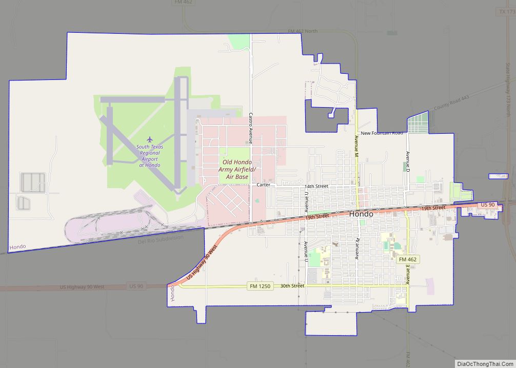
Hondo is a city in and the county seat of Medina County, Texas, United States. According to the 2010 Census, the population was 8,803. It is part of the San Antonio Metropolitan Statistical Area.
| Name: | Hondo city |
|---|---|
| LSAD Code: | 25 |
| LSAD Description: | city (suffix) |
| State: | Texas |
| County: | Medina County |
| Elevation: | 892 ft (272 m) |
| Total Area: | 10.08 sq mi (26.10 km²) |
| Land Area: | 10.05 sq mi (26.03 km²) |
| Water Area: | 0.03 sq mi (0.07 km²) |
| Total Population: | 8,803 |
| Population Density: | 939.09/sq mi (362.57/km²) |
| ZIP code: | 78861 |
| Area code: | 830 |
| FIPS code: | 4834676 |
| GNISfeature ID: | 1359487 |
| Website: | cityofhondo.com |
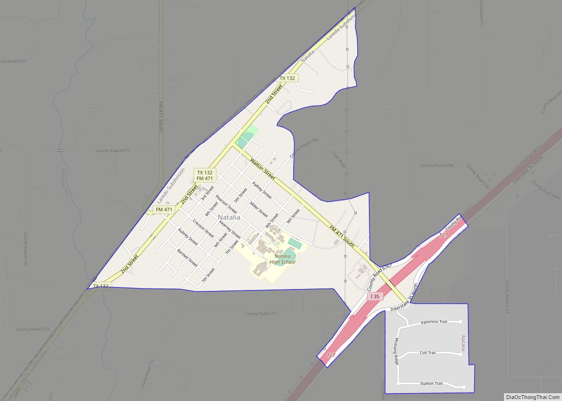
Online Interactive Map
Click on ![]() to view map in "full screen" mode.
to view map in "full screen" mode.
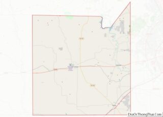
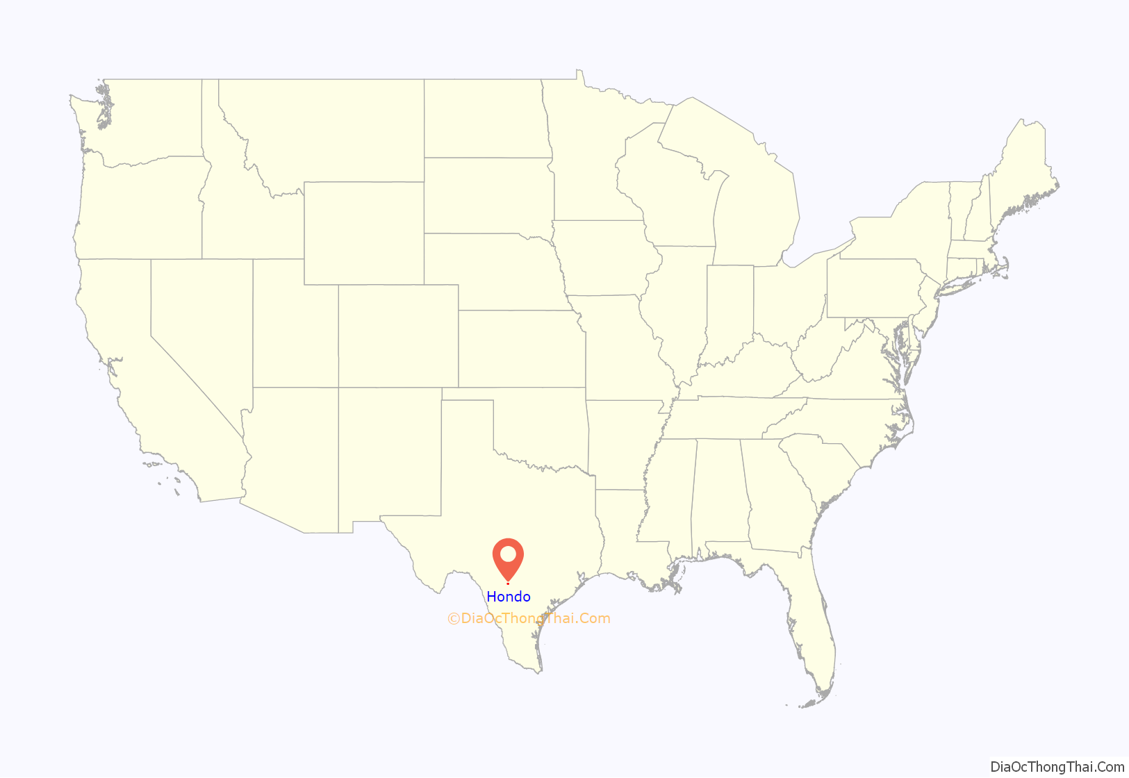
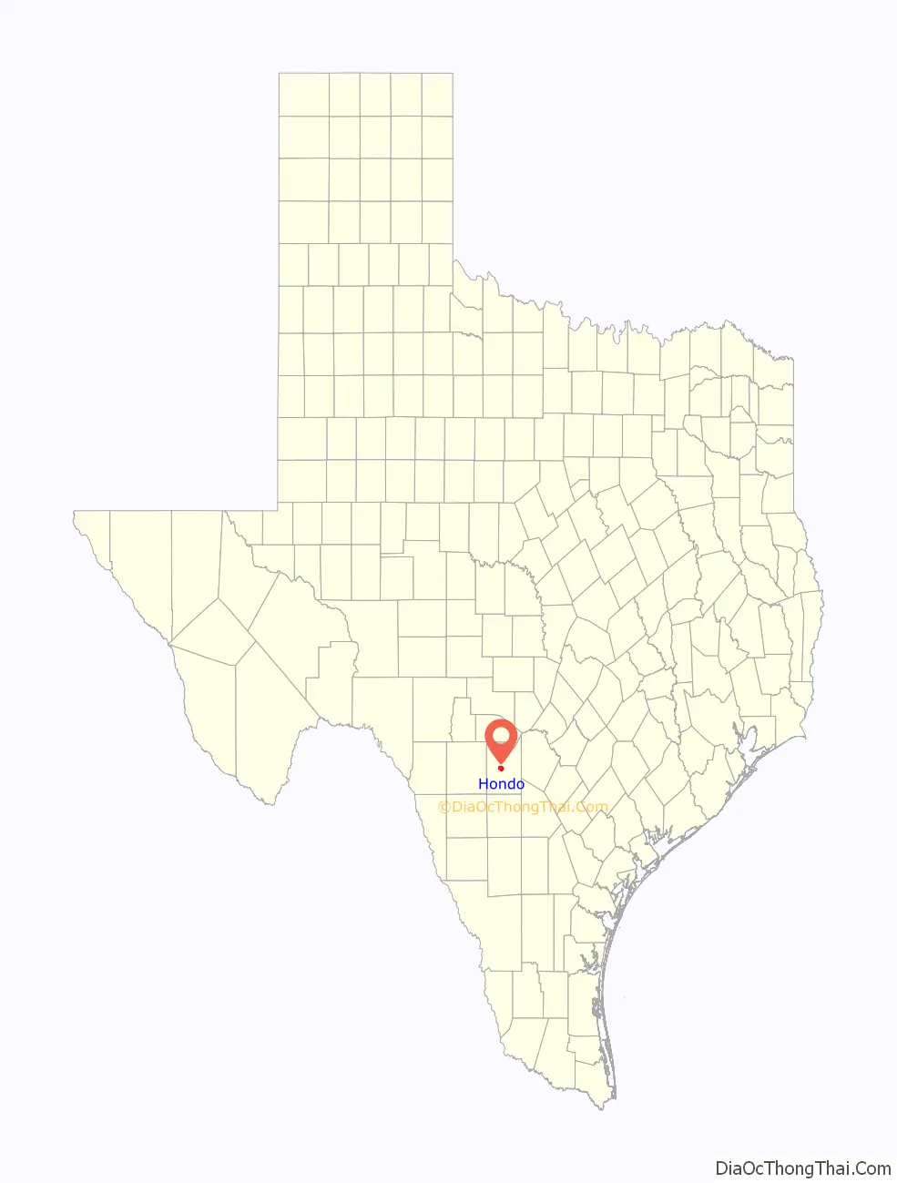
Hondo location map. Where is Hondo city?
History
Original inhabitants of the area, now Medina County, were the Coahuiltecan people. Non-indigenous settlers to the area came from Alsace-Lorraine, Germany, Belgium and Mexico. Many family-owned businesses, farms, and ranches are still owned by descendants of the non-indigenous families.
The first Spaniard to explore the area was Cabeza de Vaca in the early 1530s, some 40 years after Columbus arrived in the New World.
The city of Hondo was first settled in 1881 and incorporated in 1942.
Hondo was the scene of two bank robberies in the early 1920s. The crooks were the famed Newton Gang, the most successful outlaws in U.S. history. Both bank heists occurred the same night.
In 1930, the local Hondo Lions Club erected the now somewhat famous sign reading “This is God’s Country, Don’t Drive Thru It Like Hell” at the city limits with the intention of slowing down those speeding while traveling through town. Later, in the 1940s the sign was changed to “This is God’s Country, Please Don’t Drive Through It Like Hell” to satisfy those in the town who were displeased with the tone of the old sign. [1] The sign has been in news and print in many magazines, including on the cover of National Geographic, and in the music video of Little Texas’ song “God Blessed Texas.”
The U.S. Army built an air field in the town in 1942 to train new pilots; at one time the largest air navigation school in the world, Hondo Army Air Field trained over 14,000 navigators for service during World War II before closing in 1946.
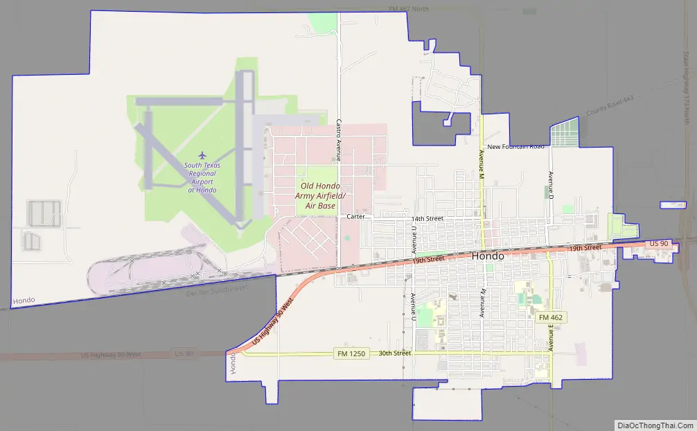
Hondo Road Map
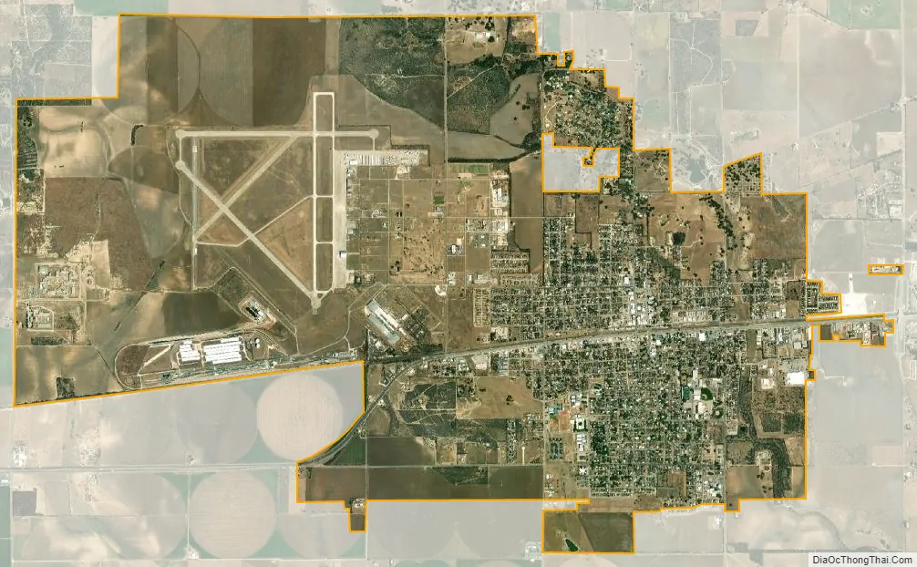
Hondo city Satellite Map
Geography
Hondo is located approximately 40 miles (64 km) west of Downtown San Antonio.
According to the United States Census Bureau, the city has a total area of 9.6 square miles (25 km), of which, 9.6 square miles (25 km) of it is land and 0.04 square miles (0.10 km) of it (0.21%) is covered with water. Hondo was mentioned in Season 2 Episode 13 of The Night Shift and described as “a two stoplight town down I-90”.
Climate
The climate in this area is characterized by hot, humid summers and generally mild to cool winters. According to the Köppen Climate Classification system, Hondo has a humid subtropical climate, abbreviated “Cfa” on climate maps.
See also
Map of Texas State and its subdivision:- Anderson
- Andrews
- Angelina
- Aransas
- Archer
- Armstrong
- Atascosa
- Austin
- Bailey
- Bandera
- Bastrop
- Baylor
- Bee
- Bell
- Bexar
- Blanco
- Borden
- Bosque
- Bowie
- Brazoria
- Brazos
- Brewster
- Briscoe
- Brooks
- Brown
- Burleson
- Burnet
- Caldwell
- Calhoun
- Callahan
- Cameron
- Camp
- Carson
- Cass
- Castro
- Chambers
- Cherokee
- Childress
- Clay
- Cochran
- Coke
- Coleman
- Collin
- Collingsworth
- Colorado
- Comal
- Comanche
- Concho
- Cooke
- Coryell
- Cottle
- Crane
- Crockett
- Crosby
- Culberson
- Dallam
- Dallas
- Dawson
- Deaf Smith
- Delta
- Denton
- Dewitt
- Dickens
- Dimmit
- Donley
- Duval
- Eastland
- Ector
- Edwards
- El Paso
- Ellis
- Erath
- Falls
- Fannin
- Fayette
- Fisher
- Floyd
- Foard
- Fort Bend
- Franklin
- Freestone
- Frio
- Gaines
- Galveston
- Garza
- Gillespie
- Glasscock
- Goliad
- Gonzales
- Gray
- Grayson
- Gregg
- Grimes
- Guadalupe
- Hale
- Hall
- Hamilton
- Hansford
- Hardeman
- Hardin
- Harris
- Harrison
- Hartley
- Haskell
- Hays
- Hemphill
- Henderson
- Hidalgo
- Hill
- Hockley
- Hood
- Hopkins
- Houston
- Howard
- Hudspeth
- Hunt
- Hutchinson
- Irion
- Jack
- Jackson
- Jasper
- Jeff Davis
- Jefferson
- Jim Hogg
- Jim Wells
- Johnson
- Jones
- Karnes
- Kaufman
- Kendall
- Kenedy
- Kent
- Kerr
- Kimble
- King
- Kinney
- Kleberg
- Knox
- La Salle
- Lamar
- Lamb
- Lampasas
- Lavaca
- Lee
- Leon
- Liberty
- Limestone
- Lipscomb
- Live Oak
- Llano
- Loving
- Lubbock
- Lynn
- Madison
- Marion
- Martin
- Mason
- Matagorda
- Maverick
- McCulloch
- McLennan
- McMullen
- Medina
- Menard
- Midland
- Milam
- Mills
- Mitchell
- Montague
- Montgomery
- Moore
- Morris
- Motley
- Nacogdoches
- Navarro
- Newton
- Nolan
- Nueces
- Ochiltree
- Oldham
- Orange
- Palo Pinto
- Panola
- Parker
- Parmer
- Pecos
- Polk
- Potter
- Presidio
- Rains
- Randall
- Reagan
- Real
- Red River
- Reeves
- Refugio
- Roberts
- Robertson
- Rockwall
- Runnels
- Rusk
- Sabine
- San Augustine
- San Jacinto
- San Patricio
- San Saba
- Schleicher
- Scurry
- Shackelford
- Shelby
- Sherman
- Smith
- Somervell
- Starr
- Stephens
- Sterling
- Stonewall
- Sutton
- Swisher
- Tarrant
- Taylor
- Terrell
- Terry
- Throckmorton
- Titus
- Tom Green
- Travis
- Trinity
- Tyler
- Upshur
- Upton
- Uvalde
- Val Verde
- Van Zandt
- Victoria
- Walker
- Waller
- Ward
- Washington
- Webb
- Wharton
- Wheeler
- Wichita
- Wilbarger
- Willacy
- Williamson
- Wilson
- Winkler
- Wise
- Wood
- Yoakum
- Young
- Zapata
- Zavala
- Alabama
- Alaska
- Arizona
- Arkansas
- California
- Colorado
- Connecticut
- Delaware
- District of Columbia
- Florida
- Georgia
- Hawaii
- Idaho
- Illinois
- Indiana
- Iowa
- Kansas
- Kentucky
- Louisiana
- Maine
- Maryland
- Massachusetts
- Michigan
- Minnesota
- Mississippi
- Missouri
- Montana
- Nebraska
- Nevada
- New Hampshire
- New Jersey
- New Mexico
- New York
- North Carolina
- North Dakota
- Ohio
- Oklahoma
- Oregon
- Pennsylvania
- Rhode Island
- South Carolina
- South Dakota
- Tennessee
- Texas
- Utah
- Vermont
- Virginia
- Washington
- West Virginia
- Wisconsin
- Wyoming