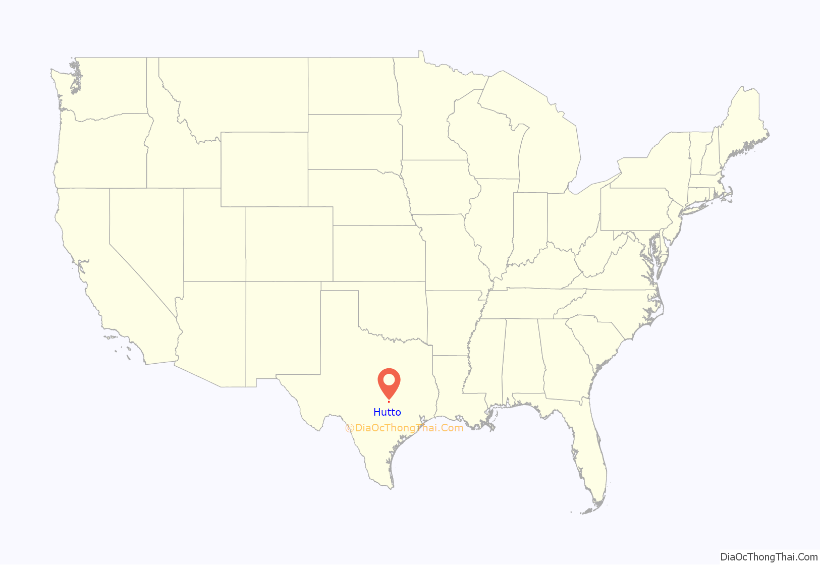
Hutto is a city in Williamson County, Texas, United States. It is part of the Austin–Round Rock metropolitan area. The population was 27,577 at the 2020 census.
| Name: | Hutto city |
|---|---|
| LSAD Code: | 25 |
| LSAD Description: | city (suffix) |
| State: | Texas |
| County: | Williamson County |
| Elevation: | 663 ft (202 m) |
| Total Area: | 12.39 sq mi (32.09 km²) |
| Land Area: | 12.35 sq mi (31.97 km²) |
| Water Area: | 0.05 sq mi (0.12 km²) |
| Total Population: | 27,577 |
| Population Density: | 2,170.9453/sq mi (838.20668/km²) |
| ZIP code: | 78634 |
| Area code: | 512 & 737 |
| FIPS code: | 4835624 |
| GNISfeature ID: | 1359869 |
Online Interactive Map
Click on ![]() to view map in "full screen" mode.
to view map in "full screen" mode.
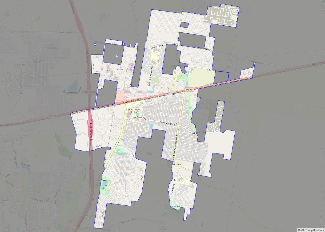
Hutto location map. Where is Hutto city?
History
Hutto was established in 1876 when the International-Great Northern Railroad passed through land owned by James Emory Hutto (1824–1914), for whom the community is named. Railroad officials designated the stop Hutto Station. James Hutto was born in Alabama on June 8, 1824; he came to Texas in 1847 and moved his family to Williamson County in 1855. A slave, Adam Orgain, was actually the first person to live in the immediate Hutto vicinity, having been placed out on the blackland prairie by his owner to watch after the cattle and livestock holdings. In 1876, James Hutto sold 50 acres (200,000 m) to the Texas Land Company of New York for a town site and railroad right of way. Hutto became a wealthy cattleman in Williamson County, but in 1885, he left Hutto for Waco, and entered the hardware business. Other early settlers in the area were the Carpenter, Davis, Evans, Farley, Goodwin, Highsmith, Johnson, Magle, Payne, Saul, Weight, Womack, and Wright families. Other people living in Hutto during the 1890s included the Armstrongs, the Ahlbergs, M. B. Kennedy, the Hugh Kimbro family, William McCutcheon, Green Randolph, J. B. Ross and the Tisdales. Soon, a great many more people, primarily Swedish and German immigrants, came to the area to farm and ranch and begin their new lives in America.
Hutto Road Map
Hutto city Satellite Map
Geography
Hutto is located seven miles (11 km) east of Round Rock and 22 miles (35 km) northeast of Austin.
According to the United States Census Bureau, the city has a total area of 7.75 square miles (20.1 km), all of it land.
See also
Map of Texas State and its subdivision:- Anderson
- Andrews
- Angelina
- Aransas
- Archer
- Armstrong
- Atascosa
- Austin
- Bailey
- Bandera
- Bastrop
- Baylor
- Bee
- Bell
- Bexar
- Blanco
- Borden
- Bosque
- Bowie
- Brazoria
- Brazos
- Brewster
- Briscoe
- Brooks
- Brown
- Burleson
- Burnet
- Caldwell
- Calhoun
- Callahan
- Cameron
- Camp
- Carson
- Cass
- Castro
- Chambers
- Cherokee
- Childress
- Clay
- Cochran
- Coke
- Coleman
- Collin
- Collingsworth
- Colorado
- Comal
- Comanche
- Concho
- Cooke
- Coryell
- Cottle
- Crane
- Crockett
- Crosby
- Culberson
- Dallam
- Dallas
- Dawson
- Deaf Smith
- Delta
- Denton
- Dewitt
- Dickens
- Dimmit
- Donley
- Duval
- Eastland
- Ector
- Edwards
- El Paso
- Ellis
- Erath
- Falls
- Fannin
- Fayette
- Fisher
- Floyd
- Foard
- Fort Bend
- Franklin
- Freestone
- Frio
- Gaines
- Galveston
- Garza
- Gillespie
- Glasscock
- Goliad
- Gonzales
- Gray
- Grayson
- Gregg
- Grimes
- Guadalupe
- Hale
- Hall
- Hamilton
- Hansford
- Hardeman
- Hardin
- Harris
- Harrison
- Hartley
- Haskell
- Hays
- Hemphill
- Henderson
- Hidalgo
- Hill
- Hockley
- Hood
- Hopkins
- Houston
- Howard
- Hudspeth
- Hunt
- Hutchinson
- Irion
- Jack
- Jackson
- Jasper
- Jeff Davis
- Jefferson
- Jim Hogg
- Jim Wells
- Johnson
- Jones
- Karnes
- Kaufman
- Kendall
- Kenedy
- Kent
- Kerr
- Kimble
- King
- Kinney
- Kleberg
- Knox
- La Salle
- Lamar
- Lamb
- Lampasas
- Lavaca
- Lee
- Leon
- Liberty
- Limestone
- Lipscomb
- Live Oak
- Llano
- Loving
- Lubbock
- Lynn
- Madison
- Marion
- Martin
- Mason
- Matagorda
- Maverick
- McCulloch
- McLennan
- McMullen
- Medina
- Menard
- Midland
- Milam
- Mills
- Mitchell
- Montague
- Montgomery
- Moore
- Morris
- Motley
- Nacogdoches
- Navarro
- Newton
- Nolan
- Nueces
- Ochiltree
- Oldham
- Orange
- Palo Pinto
- Panola
- Parker
- Parmer
- Pecos
- Polk
- Potter
- Presidio
- Rains
- Randall
- Reagan
- Real
- Red River
- Reeves
- Refugio
- Roberts
- Robertson
- Rockwall
- Runnels
- Rusk
- Sabine
- San Augustine
- San Jacinto
- San Patricio
- San Saba
- Schleicher
- Scurry
- Shackelford
- Shelby
- Sherman
- Smith
- Somervell
- Starr
- Stephens
- Sterling
- Stonewall
- Sutton
- Swisher
- Tarrant
- Taylor
- Terrell
- Terry
- Throckmorton
- Titus
- Tom Green
- Travis
- Trinity
- Tyler
- Upshur
- Upton
- Uvalde
- Val Verde
- Van Zandt
- Victoria
- Walker
- Waller
- Ward
- Washington
- Webb
- Wharton
- Wheeler
- Wichita
- Wilbarger
- Willacy
- Williamson
- Wilson
- Winkler
- Wise
- Wood
- Yoakum
- Young
- Zapata
- Zavala
- Alabama
- Alaska
- Arizona
- Arkansas
- California
- Colorado
- Connecticut
- Delaware
- District of Columbia
- Florida
- Georgia
- Hawaii
- Idaho
- Illinois
- Indiana
- Iowa
- Kansas
- Kentucky
- Louisiana
- Maine
- Maryland
- Massachusetts
- Michigan
- Minnesota
- Mississippi
- Missouri
- Montana
- Nebraska
- Nevada
- New Hampshire
- New Jersey
- New Mexico
- New York
- North Carolina
- North Dakota
- Ohio
- Oklahoma
- Oregon
- Pennsylvania
- Rhode Island
- South Carolina
- South Dakota
- Tennessee
- Texas
- Utah
- Vermont
- Virginia
- Washington
- West Virginia
- Wisconsin
- Wyoming
