Jasper is a city in and the county seat of Jasper County, Texas, United States. Its population was 6,884 at the 2020 U.S. Census, down from 7,590 at the 2010 U.S. Census. Jasper is situated in the Deep East Texas subregion, about 40 miles (64 km) west of the Texas-Louisiana state line. Jasper (the “Butterfly Capital of Texas”) holds an annual Butterfly Festival the first Saturday in October to celebrate the migration of the monarch butterflies.
| Name: | Jasper city |
|---|---|
| LSAD Code: | 25 |
| LSAD Description: | city (suffix) |
| State: | Texas |
| County: | Jasper County |
| Elevation: | 203 ft (62 m) |
| Total Area: | 10.46 sq mi (27.09 km²) |
| Land Area: | 10.45 sq mi (27.06 km²) |
| Water Area: | 0.01 sq mi (0.03 km²) |
| Total Population: | 6,884 |
| Population Density: | 722.86/sq mi (279.09/km²) |
| ZIP code: | 75951 |
| Area code: | 409 |
| FIPS code: | 4837420 |
| GNISfeature ID: | 1360162 |
| Website: | jaspertx.org |
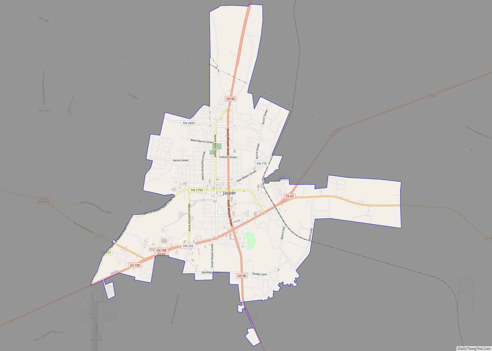
Online Interactive Map
Click on ![]() to view map in "full screen" mode.
to view map in "full screen" mode.
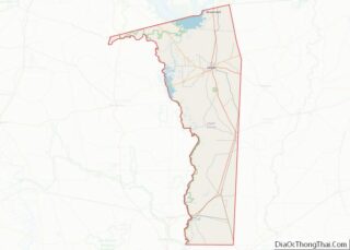
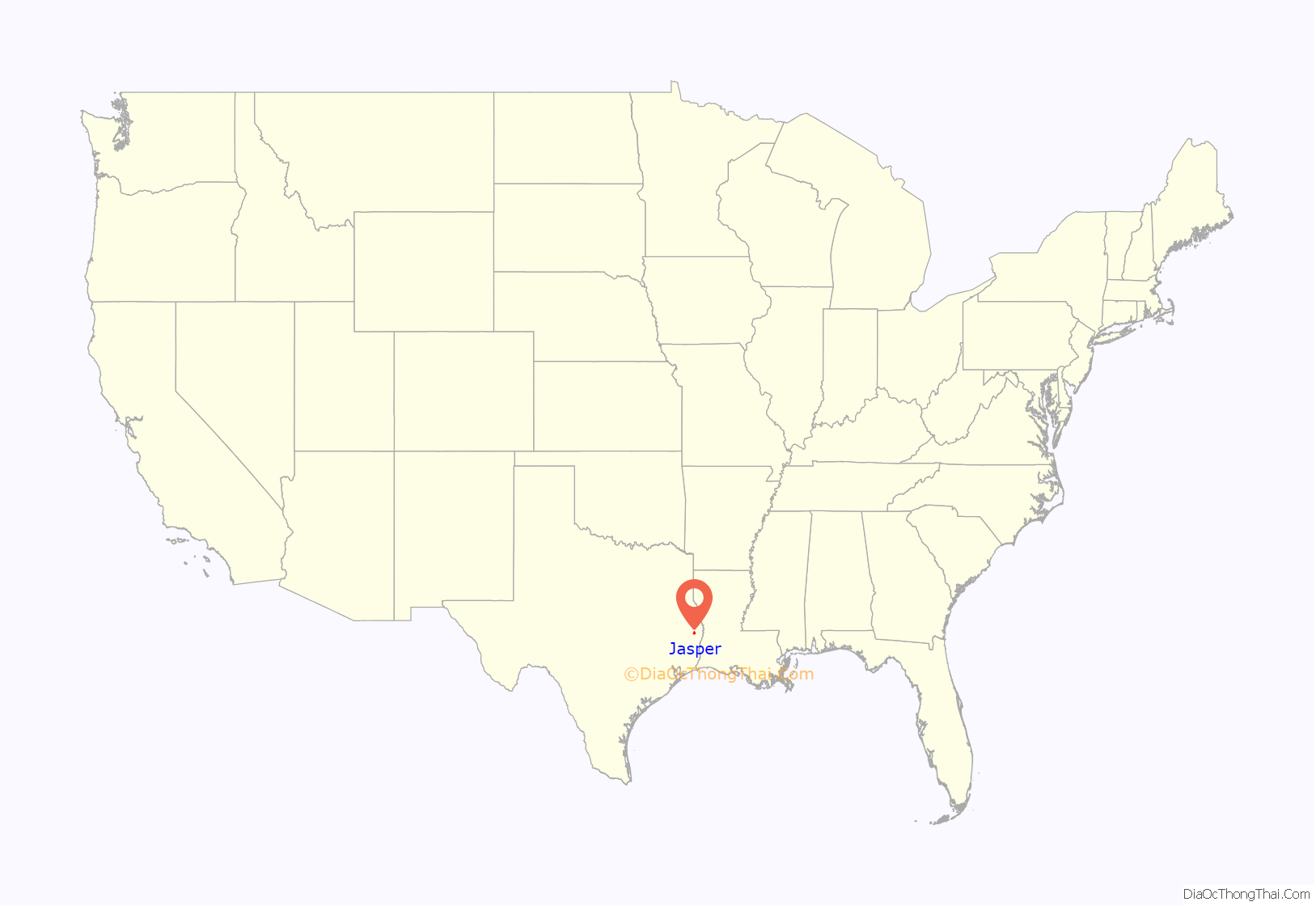
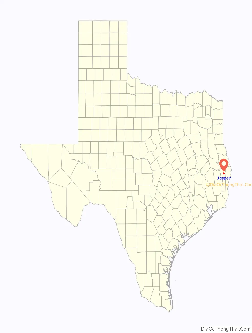
Jasper location map. Where is Jasper city?
History
19th century
The area, which was then part of Mexican Texas, was settled around 1824 by John Bevil. Thirty families occupied the settlement as early as 1830, when it was known as “Snow River”, after John R. Bevil, a hero of the American Revolution.
In 1835, the town was renamed after William Jasper, a soldier from the American Revolution, who was killed attempting to plant the American flag at the storming of Savannah in 1779. Jasper was one of the 23 original counties when the Republic of Texas was created in 1836. Jasper became the county seat in 1844 and became part of the United States with the annexation of Texas in 1845.
During the Civil War, the town housed a Confederate quartermaster depot and served as a major center for Confederate communication, transportation, and supply. Jasper was a Confederate Army headquarters for a nine-county area. Following the war, Union troops led by General George Custer occupied Jasper, camping in the town square.
Educational institutions included the Jasper Male and Female High School, which operated until 1878, when it became the Southeast Texas Male and Female College, and Jasper Collegiate Institute, which operated from 1851 until 1874. The population declined to 360 in 1870, reflecting the hardships of the Civil War, but by 1885 had risen to 1,000.
In 1896, Jasper had a population of 1,200. With the arrival of the Gulf, Colorado and Santa Fe Railway early in the 20th century, Jasper grew into a center for the manufacture of timber products. Lumber from two sawmills, with a daily capacity of 125,000 board feet (295 m³), goods from basket and stave factories, logs, ties, poles, and pulpwood were shipped in 200 cars per month.
20th century
In 1901, the town of Jasper was robbed. The post office safe and the county treasurer’s safe were blown open and robbed. The thieves set a fire, and as the town had no fire department, the entire town was completely destroyed. Damages were estimated at $100,000. What was stolen from the safes was unknown. The thieves escaped.
Jasper served as headquarters for the Lower Neches Valley Authority’s construction program, including Dam “B” at Town Bluff and engineering and surveying for a dam at Magee Bend on the Angelina River. Local farmers raised broiler chickens and beef, and in the 1950s turned to dairying. Jasper also became the headquarters of the Morgan and Lindsey chain of variety stores (otherwise known as dime-stores), which at one time operated 85 outlets in Texas, Arkansas, Louisiana, Mississippi, and Alabama.
In June 1998, the murder of James Byrd Jr. catapulted Jasper into national news and led to the creation of the Matthew Shepard and James Byrd Jr. Hate Crimes Prevention Act. Three men—John William King, Lawrence Russell Brewer, and Shawn Berry—were tried and convicted of capital murder. King and Brewer received the death penalty, while Berry, who was the only suspect who cooperated during the investigation and implicated King and Brewer, was sentenced to life in prison. Brewer was executed on September 21, 2011. King was executed on April 24, 2019.
21st century
In 2000, Jasper had 8,247 residents and around 250 businesses. Jasper was one of the primary locations for the recovery of the Space Shuttle Columbia wreckage in February 2003.
Jasper was greatly affected by Hurricane Rita on September 25, 2005, as it moved inland. The city suffered considerable damage and was left without power or potable water for about three and a half weeks.
The Jasper Arboretum Project began in 2000, and the Outdoor Learning Center was added in 2012 to create 14 acres (5.7 ha) of public gardens, walking trails, a master gardener greenhouse, and a nature classroom.
In 2012, Jasper returned to national attention during a bitterly fought political feud over the hiring and firing of Jasper’s first black police chief, Rodney Pearson. To fire Pearson, two black city council members were recalled in the narrowly divided city. Free of Voting Rights Act preclearance requirements, Jasper is moving to annex largely white suburbs. The feud highlighted Jasper’s persistent struggle with racism throughout its history.
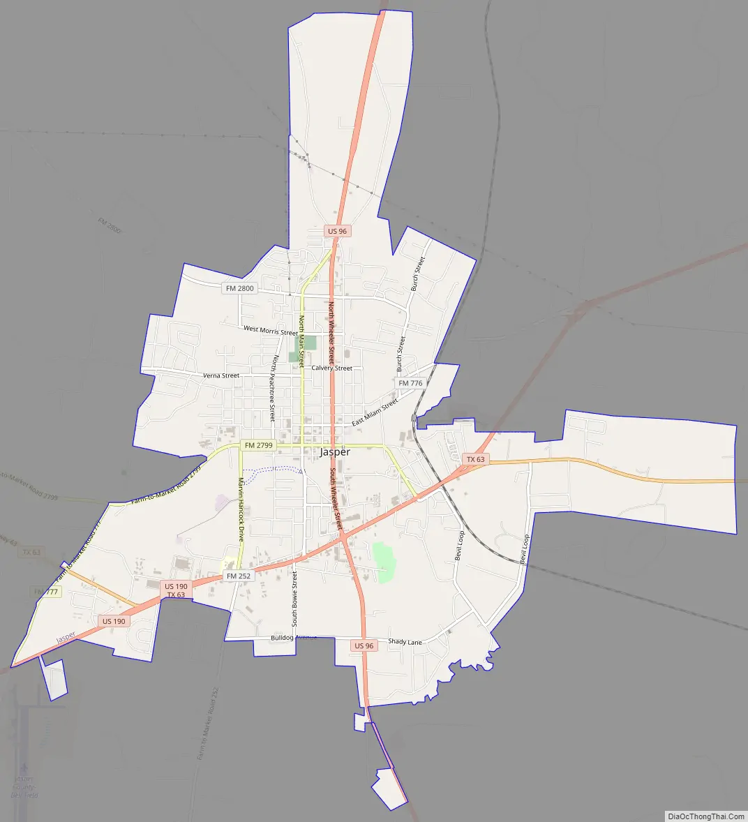
Jasper Road Map
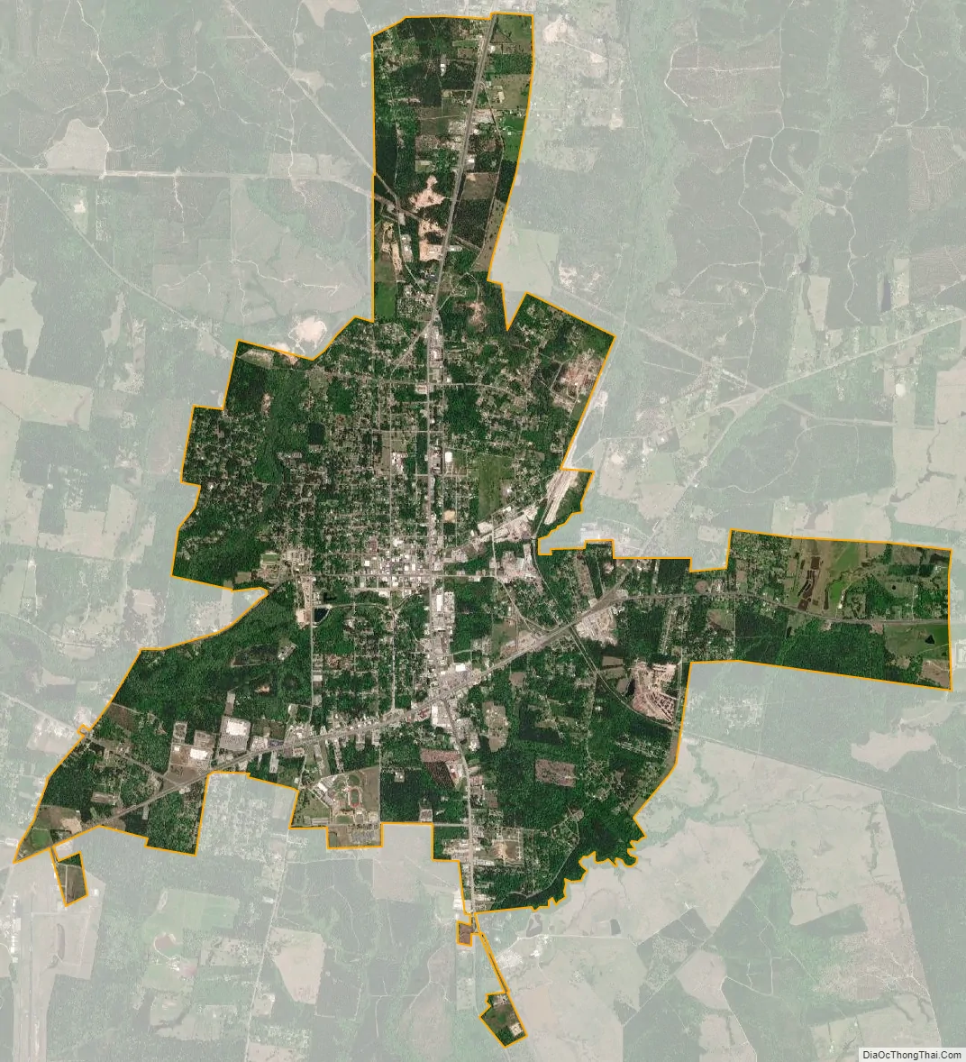
Jasper city Satellite Map
Geography
The city of Jasper is in northern Jasper County, with U.S. Routes 190 and 96 crossing south of the city center. US 190 leads southeast 16 miles (26 km) to Newton and southwest 27 miles (43 km) to Woodville, while US 96 leads north 45 miles (72 km) to San Augustine and south 70 miles (110 km) to Beaumont. Texas State Highway 63 passes through Jasper with US 190, but leads northeast 21 miles (34 km) to Burkeville and northwest 32 miles (51 km) to Zavalla.
According to the United States Census Bureau, Jasper has a total area of 10.5 square miles (27.1 km), of which 0.01 square miles (0.03 km), or 0.11%, are covered by water. Sandy Creek runs passes just south of the city center, flowing west to the Neches River in B. A. Steinhagen Lake.
See also
Map of Texas State and its subdivision:- Anderson
- Andrews
- Angelina
- Aransas
- Archer
- Armstrong
- Atascosa
- Austin
- Bailey
- Bandera
- Bastrop
- Baylor
- Bee
- Bell
- Bexar
- Blanco
- Borden
- Bosque
- Bowie
- Brazoria
- Brazos
- Brewster
- Briscoe
- Brooks
- Brown
- Burleson
- Burnet
- Caldwell
- Calhoun
- Callahan
- Cameron
- Camp
- Carson
- Cass
- Castro
- Chambers
- Cherokee
- Childress
- Clay
- Cochran
- Coke
- Coleman
- Collin
- Collingsworth
- Colorado
- Comal
- Comanche
- Concho
- Cooke
- Coryell
- Cottle
- Crane
- Crockett
- Crosby
- Culberson
- Dallam
- Dallas
- Dawson
- Deaf Smith
- Delta
- Denton
- Dewitt
- Dickens
- Dimmit
- Donley
- Duval
- Eastland
- Ector
- Edwards
- El Paso
- Ellis
- Erath
- Falls
- Fannin
- Fayette
- Fisher
- Floyd
- Foard
- Fort Bend
- Franklin
- Freestone
- Frio
- Gaines
- Galveston
- Garza
- Gillespie
- Glasscock
- Goliad
- Gonzales
- Gray
- Grayson
- Gregg
- Grimes
- Guadalupe
- Hale
- Hall
- Hamilton
- Hansford
- Hardeman
- Hardin
- Harris
- Harrison
- Hartley
- Haskell
- Hays
- Hemphill
- Henderson
- Hidalgo
- Hill
- Hockley
- Hood
- Hopkins
- Houston
- Howard
- Hudspeth
- Hunt
- Hutchinson
- Irion
- Jack
- Jackson
- Jasper
- Jeff Davis
- Jefferson
- Jim Hogg
- Jim Wells
- Johnson
- Jones
- Karnes
- Kaufman
- Kendall
- Kenedy
- Kent
- Kerr
- Kimble
- King
- Kinney
- Kleberg
- Knox
- La Salle
- Lamar
- Lamb
- Lampasas
- Lavaca
- Lee
- Leon
- Liberty
- Limestone
- Lipscomb
- Live Oak
- Llano
- Loving
- Lubbock
- Lynn
- Madison
- Marion
- Martin
- Mason
- Matagorda
- Maverick
- McCulloch
- McLennan
- McMullen
- Medina
- Menard
- Midland
- Milam
- Mills
- Mitchell
- Montague
- Montgomery
- Moore
- Morris
- Motley
- Nacogdoches
- Navarro
- Newton
- Nolan
- Nueces
- Ochiltree
- Oldham
- Orange
- Palo Pinto
- Panola
- Parker
- Parmer
- Pecos
- Polk
- Potter
- Presidio
- Rains
- Randall
- Reagan
- Real
- Red River
- Reeves
- Refugio
- Roberts
- Robertson
- Rockwall
- Runnels
- Rusk
- Sabine
- San Augustine
- San Jacinto
- San Patricio
- San Saba
- Schleicher
- Scurry
- Shackelford
- Shelby
- Sherman
- Smith
- Somervell
- Starr
- Stephens
- Sterling
- Stonewall
- Sutton
- Swisher
- Tarrant
- Taylor
- Terrell
- Terry
- Throckmorton
- Titus
- Tom Green
- Travis
- Trinity
- Tyler
- Upshur
- Upton
- Uvalde
- Val Verde
- Van Zandt
- Victoria
- Walker
- Waller
- Ward
- Washington
- Webb
- Wharton
- Wheeler
- Wichita
- Wilbarger
- Willacy
- Williamson
- Wilson
- Winkler
- Wise
- Wood
- Yoakum
- Young
- Zapata
- Zavala
- Alabama
- Alaska
- Arizona
- Arkansas
- California
- Colorado
- Connecticut
- Delaware
- District of Columbia
- Florida
- Georgia
- Hawaii
- Idaho
- Illinois
- Indiana
- Iowa
- Kansas
- Kentucky
- Louisiana
- Maine
- Maryland
- Massachusetts
- Michigan
- Minnesota
- Mississippi
- Missouri
- Montana
- Nebraska
- Nevada
- New Hampshire
- New Jersey
- New Mexico
- New York
- North Carolina
- North Dakota
- Ohio
- Oklahoma
- Oregon
- Pennsylvania
- Rhode Island
- South Carolina
- South Dakota
- Tennessee
- Texas
- Utah
- Vermont
- Virginia
- Washington
- West Virginia
- Wisconsin
- Wyoming