Leakey (/ˈleɪki/ LAY-kee) is a city in and the county seat of Real County, Texas, United States. The population was 425 at the 2010 census.
The city is named for John H. Leakey (1824–1900), a pioneer from Tennessee. The Alto Frio Baptist Encampment is located to the southeast of the community.
| Name: | Leakey city |
|---|---|
| LSAD Code: | 25 |
| LSAD Description: | city (suffix) |
| State: | Texas |
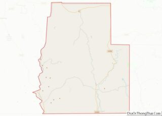
| County: | Real County |
| Elevation: | 1,604 ft (489 m) |
| Total Area: | 0.56 sq mi (1.45 km²) |
| Land Area: | 0.56 sq mi (1.45 km²) |
| Water Area: | 0.00 sq mi (0.00 km²) |
| Total Population: | 425 |
| Population Density: | 780.75/sq mi (301.46/km²) |
| ZIP code: | 78873 |
| Area code: | 830 |
| FIPS code: | 4842004 |
| GNISfeature ID: | 1339757 |
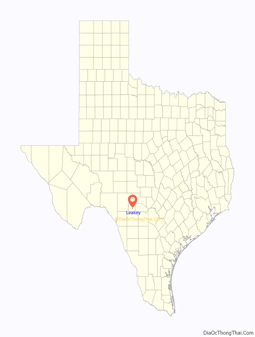
Online Interactive Map
Click on ![]() to view map in "full screen" mode.
to view map in "full screen" mode.
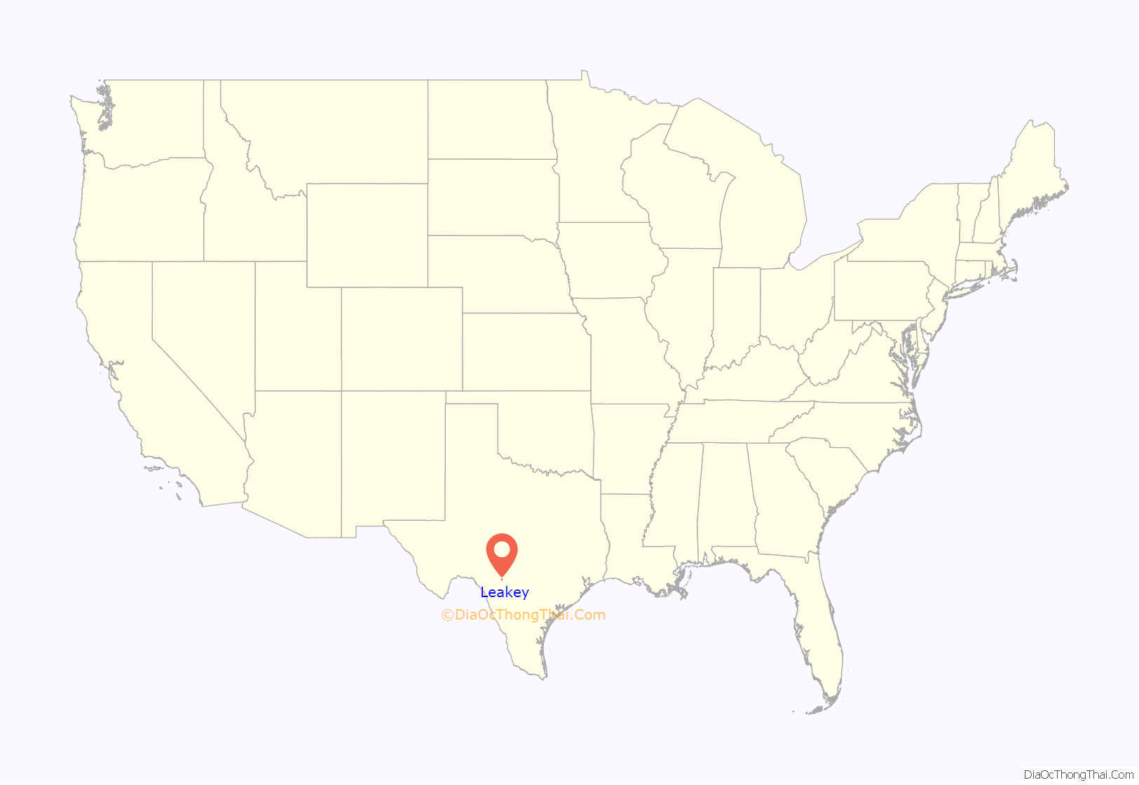
Leakey location map. Where is Leakey city?
History
Archaeological excavations in the Frio Canyon region revealed Paleo-American, Archaic, and Neo-American occupations. Later, several Native American tribes, including Lipan Apache, Comanche, and Tonkawa inhabited or traversed the area.
Anglo-American settlement of the area began in 1856 when John Leakey, his wife Nancy, and a few others settled near a spring along the banks of the Frio River. Shingles and lumber were produced from the abundant cypress and cedar trees. In its first few years, the community was a lonely outpost that was subject to frequent Indian raids, which continued until 1882. Growth accelerated after the Civil War as new families arrived. In 1883, A.G. Vogel moved a post office from the community of Floral to Leakey. That same year, the Texas State Legislature created Edwards County and designated Leakey as the county seat less than a year later. 1883 was also the year that the area’s first school was established on land donated by the Leakeys. A new school building was completed in 1890. In 1891, the Edwards County seat was moved from Leakey to Rocksprings. During the early 1900s, ranching superseded lumber, cotton cultivation, and corn production in importance to the local economy. The raising of Angora goats was a major component of the ranching industry. In 1902, the school in Leakey had a total enrollment of 102 students. The town’s population was estimated to be 318 in 1904.
Real County was created from parts of Edwards, Bandera, and Kerr Counties in the spring of 1913, with Leakey as the county seat. In 1919, Real County Judge Ed Kelly established the Leakey Independent School District. By the mid-1920s, the population had declined to around 120. A larger school building was completed in 1930. Soon after, several nearby schools, including West Frio, Cypress Creek, Rio Frio, Exile, Stanford, Dry Frio, and Harper were consolidated with Leakey schools.
Leakey was formally incorporated on June 11, 1951. The population fluctuated during the latter half of the 20th century. Leakey was home to 450 people in 1960, 393 in 1970, 468 in 1980, and 399 in 1990. By 2000, there were 387 residents living in Leakey, representing a 3.01% decrease in population since the last census was conducted in 1990.
On March 29, 2017, thirteen senior citizens from the First Baptist Church of New Braunfels in Comal County who had completed a retreat at Alto Frio were killed when Jack D. Young, the 20-year-old driver of a pickup, crashed into the church minivan on U.S. Highway 83 inside Uvalde County near the state park. One person survived the crash in critical condition. The accident was one of the deadliest in memory in the Leakey area. Young told a witness, “I’m sorry. I’m sorry” and said that he had been on his cell phone at the time of the accident. Jody Kuchler, a welder from Leakey who saw the accident, said that the driver of the church vehicle moved over to try to avoid Young’s incoming pickup but was blocked by the guard rail.
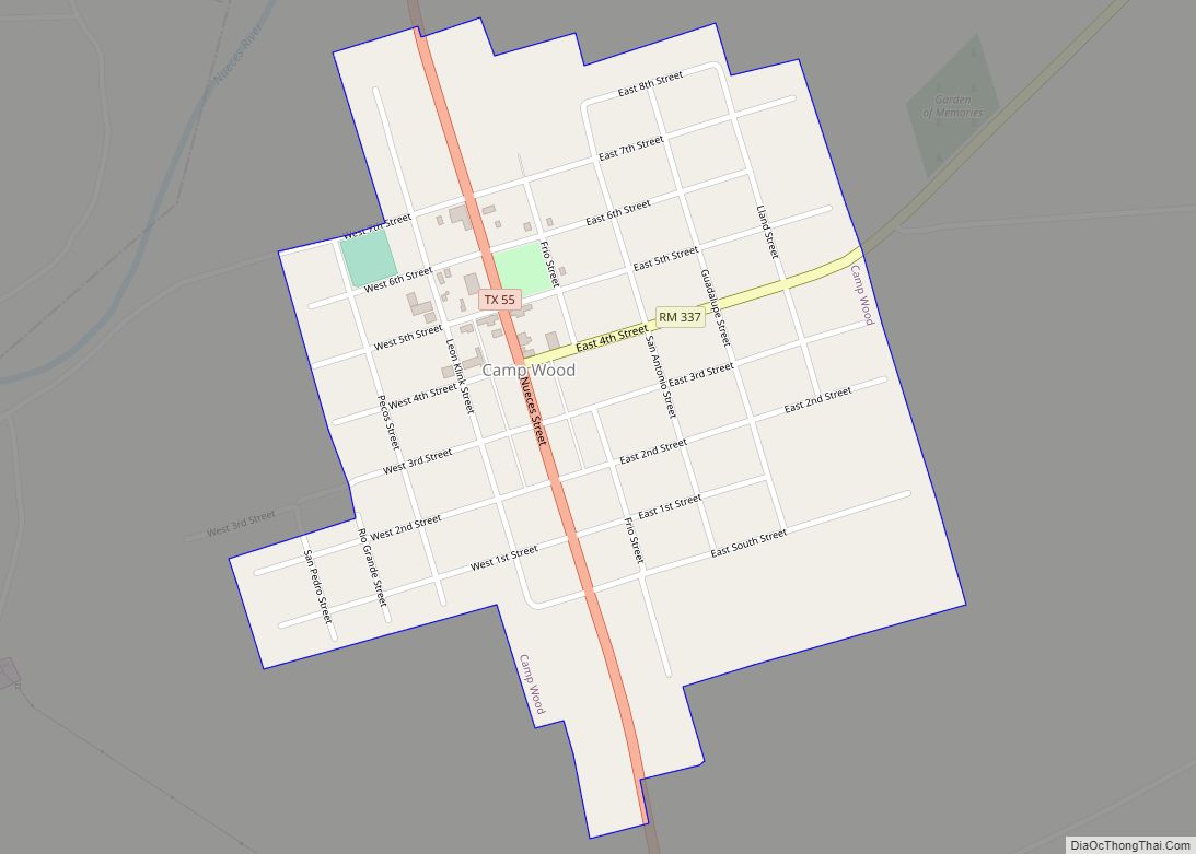
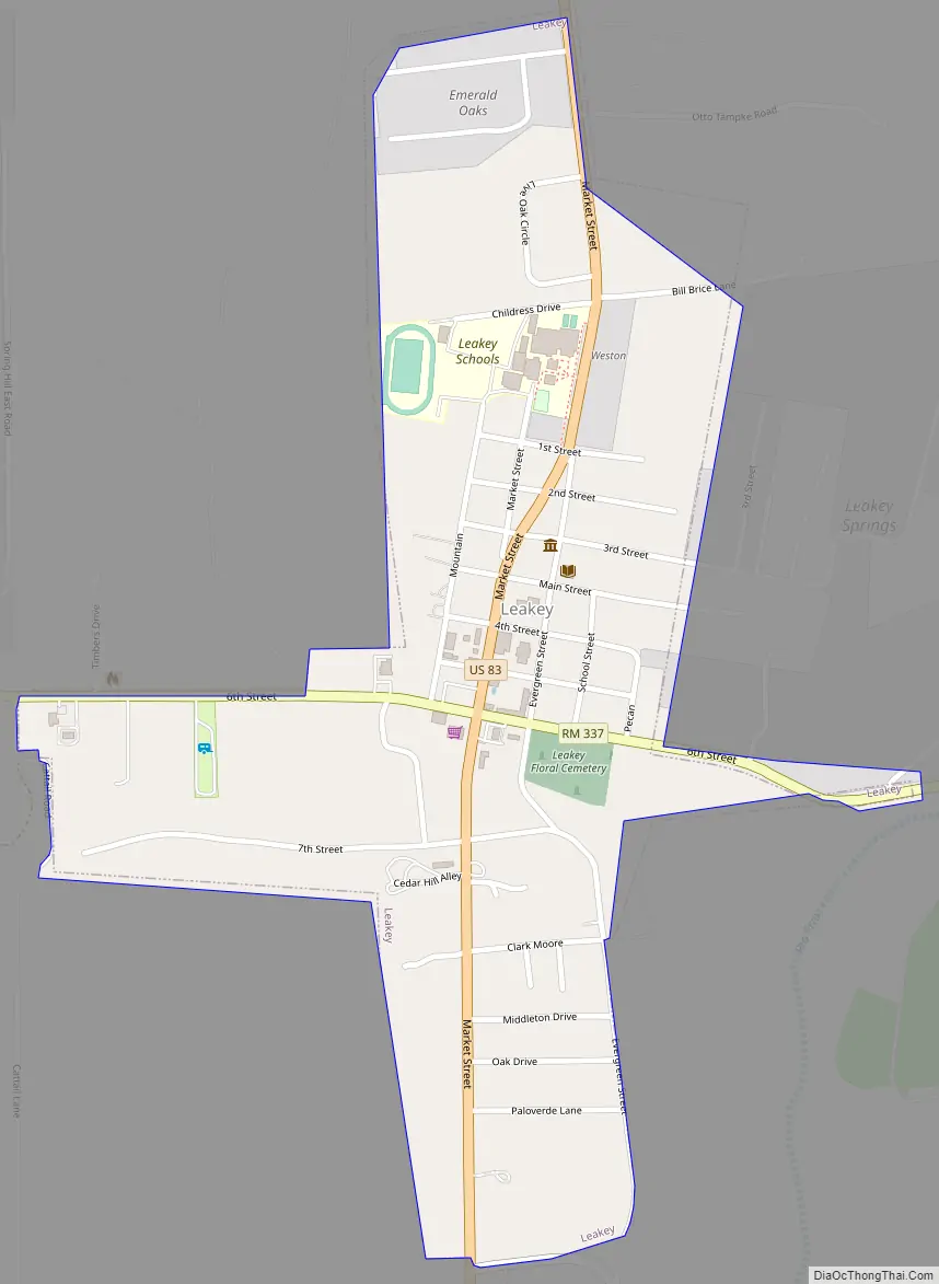
Leakey Road Map
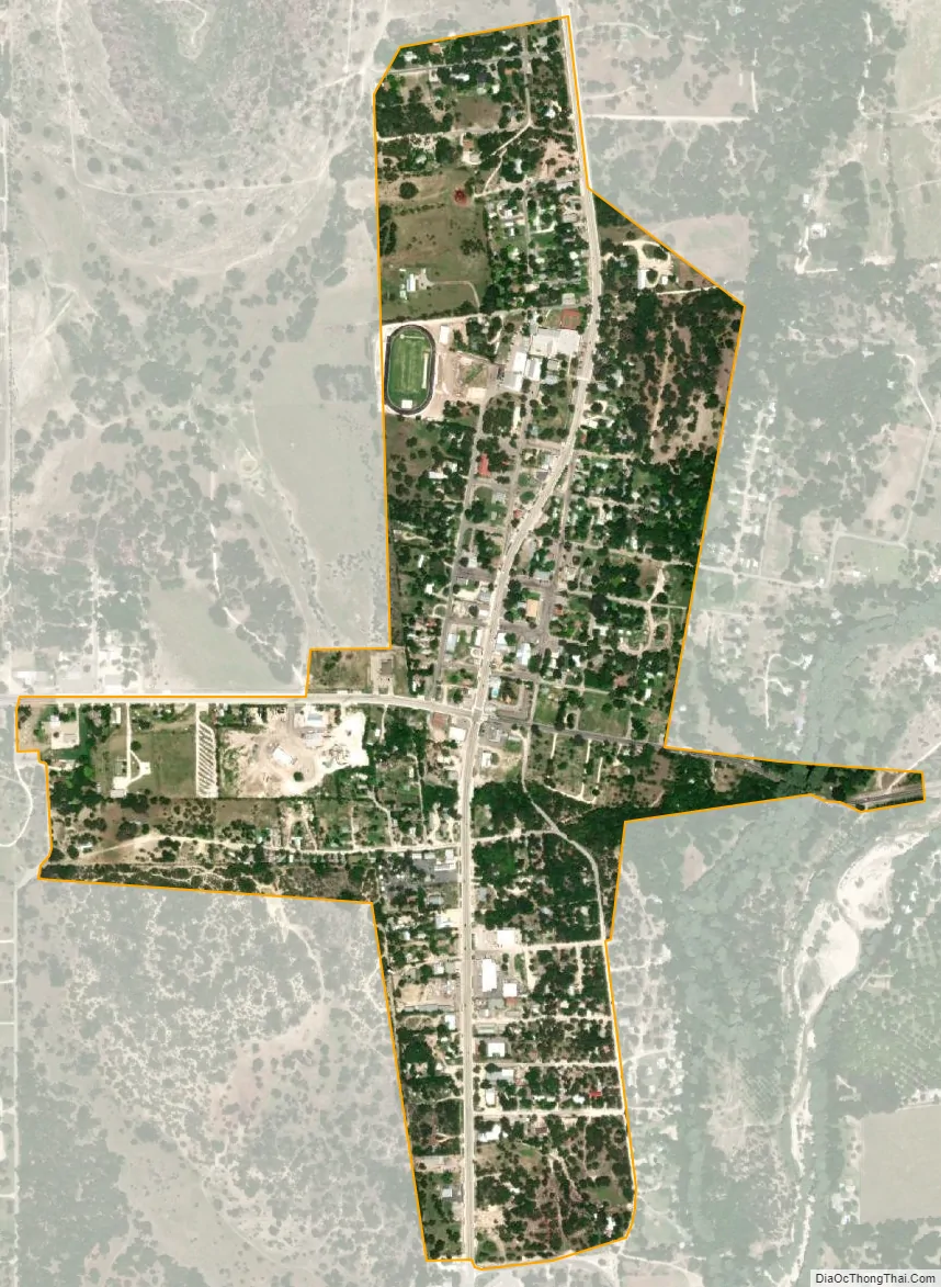
Leakey city Satellite Map
Geography
Leakey is situated at the intersection of U.S. Highway 83, RM 336, RM 337, and FM 1120 in southeastern Real County, approximately 35 miles north of Uvalde and 90 miles northwest of San Antonio.
According to the United States Census Bureau, the city has a total area of 0.6 square miles (1.6 km), all of it land.
It is in close proximity to the Garner State Park, located north of Uvalde.
Climate
The climate in this area is characterized by hot, humid summers and generally mild to cool winters. Leakey has a humid subtropical climate, Cfa on climate maps according to the Köppen climate classification system.
See also
Map of Texas State and its subdivision:- Anderson
- Andrews
- Angelina
- Aransas
- Archer
- Armstrong
- Atascosa
- Austin
- Bailey
- Bandera
- Bastrop
- Baylor
- Bee
- Bell
- Bexar
- Blanco
- Borden
- Bosque
- Bowie
- Brazoria
- Brazos
- Brewster
- Briscoe
- Brooks
- Brown
- Burleson
- Burnet
- Caldwell
- Calhoun
- Callahan
- Cameron
- Camp
- Carson
- Cass
- Castro
- Chambers
- Cherokee
- Childress
- Clay
- Cochran
- Coke
- Coleman
- Collin
- Collingsworth
- Colorado
- Comal
- Comanche
- Concho
- Cooke
- Coryell
- Cottle
- Crane
- Crockett
- Crosby
- Culberson
- Dallam
- Dallas
- Dawson
- Deaf Smith
- Delta
- Denton
- Dewitt
- Dickens
- Dimmit
- Donley
- Duval
- Eastland
- Ector
- Edwards
- El Paso
- Ellis
- Erath
- Falls
- Fannin
- Fayette
- Fisher
- Floyd
- Foard
- Fort Bend
- Franklin
- Freestone
- Frio
- Gaines
- Galveston
- Garza
- Gillespie
- Glasscock
- Goliad
- Gonzales
- Gray
- Grayson
- Gregg
- Grimes
- Guadalupe
- Hale
- Hall
- Hamilton
- Hansford
- Hardeman
- Hardin
- Harris
- Harrison
- Hartley
- Haskell
- Hays
- Hemphill
- Henderson
- Hidalgo
- Hill
- Hockley
- Hood
- Hopkins
- Houston
- Howard
- Hudspeth
- Hunt
- Hutchinson
- Irion
- Jack
- Jackson
- Jasper
- Jeff Davis
- Jefferson
- Jim Hogg
- Jim Wells
- Johnson
- Jones
- Karnes
- Kaufman
- Kendall
- Kenedy
- Kent
- Kerr
- Kimble
- King
- Kinney
- Kleberg
- Knox
- La Salle
- Lamar
- Lamb
- Lampasas
- Lavaca
- Lee
- Leon
- Liberty
- Limestone
- Lipscomb
- Live Oak
- Llano
- Loving
- Lubbock
- Lynn
- Madison
- Marion
- Martin
- Mason
- Matagorda
- Maverick
- McCulloch
- McLennan
- McMullen
- Medina
- Menard
- Midland
- Milam
- Mills
- Mitchell
- Montague
- Montgomery
- Moore
- Morris
- Motley
- Nacogdoches
- Navarro
- Newton
- Nolan
- Nueces
- Ochiltree
- Oldham
- Orange
- Palo Pinto
- Panola
- Parker
- Parmer
- Pecos
- Polk
- Potter
- Presidio
- Rains
- Randall
- Reagan
- Real
- Red River
- Reeves
- Refugio
- Roberts
- Robertson
- Rockwall
- Runnels
- Rusk
- Sabine
- San Augustine
- San Jacinto
- San Patricio
- San Saba
- Schleicher
- Scurry
- Shackelford
- Shelby
- Sherman
- Smith
- Somervell
- Starr
- Stephens
- Sterling
- Stonewall
- Sutton
- Swisher
- Tarrant
- Taylor
- Terrell
- Terry
- Throckmorton
- Titus
- Tom Green
- Travis
- Trinity
- Tyler
- Upshur
- Upton
- Uvalde
- Val Verde
- Van Zandt
- Victoria
- Walker
- Waller
- Ward
- Washington
- Webb
- Wharton
- Wheeler
- Wichita
- Wilbarger
- Willacy
- Williamson
- Wilson
- Winkler
- Wise
- Wood
- Yoakum
- Young
- Zapata
- Zavala
- Alabama
- Alaska
- Arizona
- Arkansas
- California
- Colorado
- Connecticut
- Delaware
- District of Columbia
- Florida
- Georgia
- Hawaii
- Idaho
- Illinois
- Indiana
- Iowa
- Kansas
- Kentucky
- Louisiana
- Maine
- Maryland
- Massachusetts
- Michigan
- Minnesota
- Mississippi
- Missouri
- Montana
- Nebraska
- Nevada
- New Hampshire
- New Jersey
- New Mexico
- New York
- North Carolina
- North Dakota
- Ohio
- Oklahoma
- Oregon
- Pennsylvania
- Rhode Island
- South Carolina
- South Dakota
- Tennessee
- Texas
- Utah
- Vermont
- Virginia
- Washington
- West Virginia
- Wisconsin
- Wyoming